Download Agreement, Release, and Acknowledgement of Risk:
You (the person requesting this file download) fully understand mountain climbing ("Activity") involves risks and dangers of serious bodily injury, including permanent disability, paralysis, and death ("Risks") and you fully accept and assume all such risks and all responsibility for losses, costs, and damages you incur as a result of your participation in this Activity.
You acknowledge that information in the file you have chosen to download may not be accurate and may contain errors. You agree to assume all risks when using this information and agree to release and discharge 14ers.com, 14ers Inc. and the author(s) of such information (collectively, the "Released Parties").
You hereby discharge the Released Parties from all damages, actions, claims and liabilities of any nature, specifically including, but not limited to, damages, actions, claims and liabilities arising from or related to the negligence of the Released Parties. You further agree to indemnify, hold harmless and defend 14ers.com, 14ers Inc. and each of the other Released Parties from and against any loss, damage, liability and expense, including costs and attorney fees, incurred by 14ers.com, 14ers Inc. or any of the other Released Parties as a result of you using information provided on the 14ers.com or 14ers Inc. websites.
You have read this agreement, fully understand its terms and intend it to be a complete and unconditional release of all liability to the greatest extent allowed by law and agree that if any portion of this agreement is held to be invalid the balance, notwithstanding, shall continue in full force and effect.
By clicking "OK" you agree to these terms. If you DO NOT agree, click "Cancel"...
Dallas Peak Time...3am - 12:15pm Distance...9.9 miles Elevation Gain...4387 feet Trailhead...Mill Creek Route...Mill Creek to Stan's Shortcut to South Face
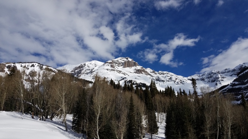
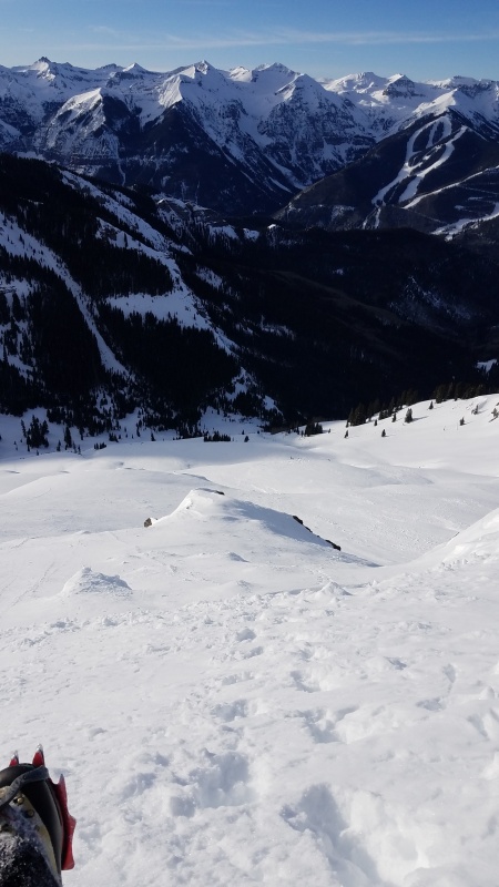
South Side of Dallas from the turnoff of the Deep Creek Trail towards Stan's Shortcut
This would be my fourth attempt at climbing Dallas in winter and as you can probably tell from the title, it was not successful. My first attempt was on March 12th, 2017...turned around about 15 feet vertical and 100 horizontal feet from the summit on the west ridge. My second attempt was on March 9th, 2018...turned around at 12,500' because of a broken crampon. My third attempt was on March 14th, 2018...turned 100 feet from the summit on the east side because I wasn't comfortable soloing the summit tower. This time I was determined to learn from my failures. I climbed the peak in September, near the end of the climbing season. I fixed a rope from the summit, down the east side of the summit tower. My thought was that the west ridge and the north side of the summit tower were both not solo-able for me. My only chance of success would be to have a rope in place so I could belay myself up the dry, harder route up the east side of the tower. I looked at the forecast and avy conditions every day this winter, waiting for a window. I needed perfect conditions and it wasn't close to that all year. The last week it finally stopped snowing and got warm. It was just enough to tempt me to drive out to Telluride and at least give it a look.
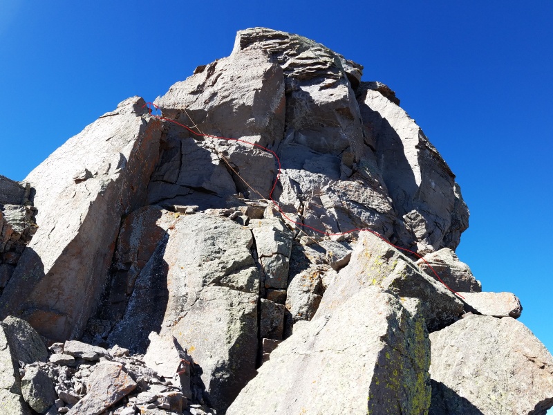
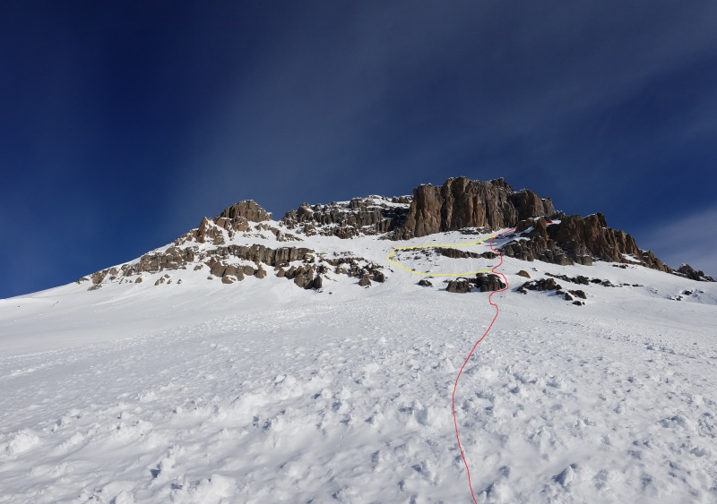
Yellow rope...red line is the way I down-climbed in September and the way I planned to climb up...the hard part is the near vertical section out of sight to the left
The other thing I planned to do was to break trail to Stan's Shortcut the day before. It's not the easiest thing to find in the dark and I have gotten in trouble with this part of the route in the past. I started out at 7:30am on Monday and found the snow conditions to be better than I expected. There was a LOT of it, but it was nice and firm and I had no trouble finding the shortcut.
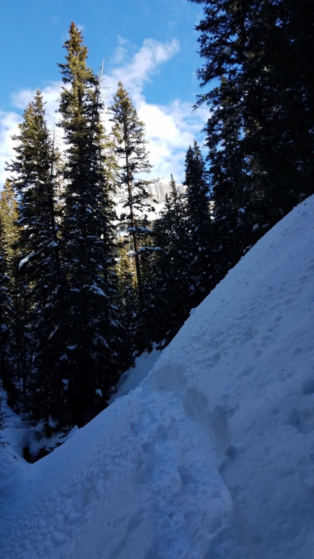
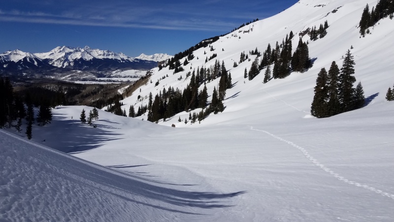
Mill CreekBreaking trail up the right side of Mill CreekLooking back at the crux of the shortcut...climbing up and across this cliff band
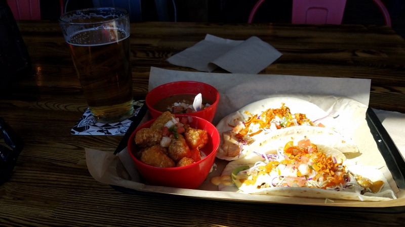
The cliff traverse wasn't doable without an axe and crampons so that's where I turned around. It felt like a successful outing...trail breaking wasn't too bad, I liked what I saw from the snow, getting up to the south face in the dark was going to be easy and the forecast was ideal. I celebrated at Gnar Taco in Ridgway that afternoon.
Gnar...even the refried beans are good
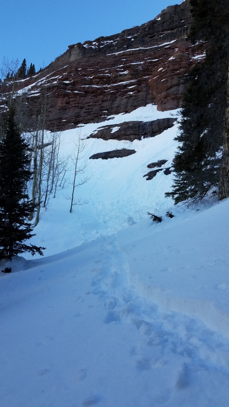
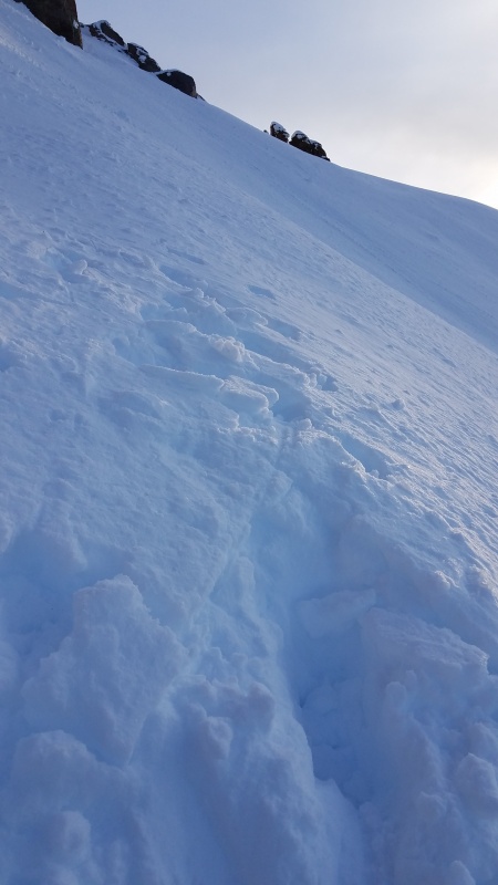
I went to bed early that night, set the alarm for 1:15am and was back at the Mill Creek Trailhead for a 3am start. I didn't sleep much, but I felt good and got geared up at the car. Just as I was about to head out, I went to put on my snowshoes...no showshoes. It took me a few minutes to realize I must have left them outside of my jeep the day before and drove away without them. I looked all over, including peering in the windows of the water treatment facility...gone. Shit! I spent that day beating myself up and figuring out if I should buy snowshoes, rent snowshoes or just go home. I was determined not to waste this opportunity and ended up renting some from a local gear shop in Ouray. That night I slept in the back of the jeep at the trailhead under a full moon on the last night of winter. I was up at 2am and back on the trail at 3am. The moonlight was amazing and I didn't even need my headlamp. I made great time up the shortcut and found myself looking up the south face of Dallas at 4:30am. The snow was perfect and the higher I got, the more I thought this might happen. The whole south face had avy'd or sloughed off during recent storms and the carnage made for great climbing conditions. I used snowshoes till it got too steep, around 12,300', then stashed them and switched to crampons and 2 tools. I took a more direct route up the right side of the face to avoid an annoying left to right traverse. There was a short mixed ice and rock section in the lowest cliff band that was a little tricky. At 7:30am, I got to the first prominent ridge of 2 that separates the south and east face. As soon as I turned the corner, my heart sank. The snow was a totally different consistency and it hadn't slid. I had a bad feeling immediately. As I started to cross it, I sank to my hip and knew it was over. There was no way I was going to cut a line that deep across that slope.
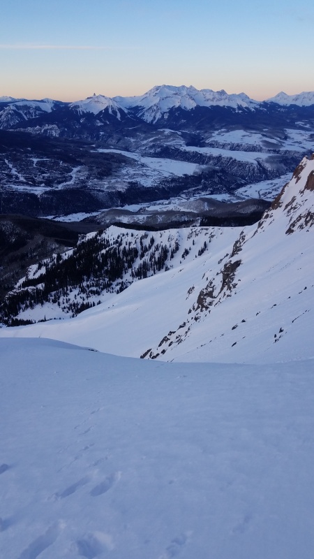
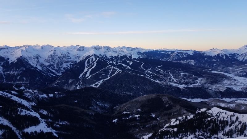
Looking back at the final steps across the south faceFor some reason, it's comforting to look down and see a ski resort across the valleyTurnaround spot at 13,300Waiting for the snow to warm up a little on the way down
Looking back at my route up (red) and down (yellow)
The last time I was in this spot in winter, I was pretty emotional. I called Dani to tell her I didn't summit and then dropped my phone in the snow. I didn't realize for another hour that it was gone. It wasn't a good day. This time, I wasn't that upset. Given the snow conditions and the avy danger this year, I really didn't think I would even get this close. The only thing that bothered me was that my rope was still hanging from the summit. It's not that I care that much about getting the rope back. I just hate leaving stuff behind. I practice and preach LNT principals to my kids all the time. Ben and Brooke love picking up garbage on our hikes and get very angry when they see graffiti. I feel like I've let them down. I'm going to try to get back out there to retrieve it, but I don't know how soon that will be. I'm sorry to anyone that gets up there and sees it. If you do, please remove it for me. If you want to send it back to me, I will gladly pay for the inconvenience. Otherwise, consider it a gift.
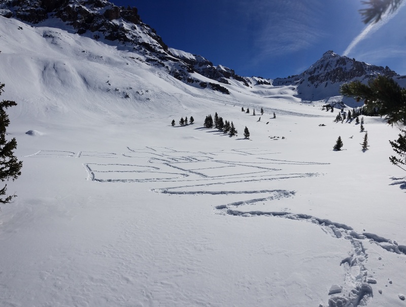
Once I got off the steep stuff, I was able to shed all the anxiety of the climb and appreciate the perfect weather and incredible scenery. I wasn't looking forward to the drive home, so I decided to keep hiking. (nothing wrong with a lake hike Abe) I decided to check out the valley between Gilpin and Emma and I'm glad I did. That is an awesome place. I broke out of the trees and found a huge flat clearing. It looked like a canvas so I decided to write a message to my kids. This was by far the most fun I had all day.
Hiking up Mill CreekView of the east side of Dallas...does anyone know about connecting blue lakes pass to Dallas via this east ridge
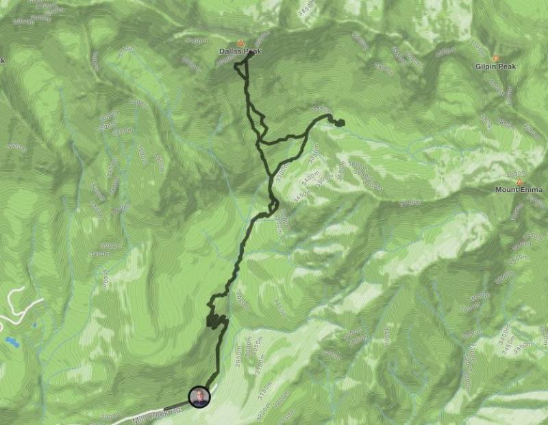
My biggest success of the dayStrava map
After completing my masterpiece, I slowly made my way back to the car. I didn't summit...AGAIN...but that's ok. It was a great day out in the mountains. I'll learn from this. Next time I will fix a rope from the summit to the trailhead. Who's with me?
Thumbnails for uploaded photos (click to open slideshow):
Hey Mike,
Sorry it didn't work out for you. I've had a few peaks like that, Ahab's White Whale, no? Hey, curious and counter-intuitive, but is the standard north face an option? I know, I know, snow and slides, but with heavy consolidated snow it might be an option. There is the cave exit on Dallas that will let you bypass that offwidthy scramble at the summit saddle. I think there's also a funky option described in a post on mountainproject, I suspect it was close to an option Gladbach described to me in a PM. I never tried it but glanced at it last time I was there (admittedly, summer), wraps around the S face on a ledge. Just brainstorming with you.
I know that feeling in the pit of your stomach all to well. Its never a bad decision to turn around and fight another day when you feel that way. Would love to go get this peak someday. Keep at it!
Caution: The information contained in this report may not be accurate and should not be the only resource used in preparation for your climb. Failure to have the necessary experience, physical conditioning, supplies or equipment can result in injury or death. 14ers.com and the author(s) of this report provide no warranties, either express or implied, that the information provided is accurate or reliable. By using the information provided, you agree to indemnify and hold harmless 14ers.com and the report author(s) with respect to any claims and demands against them, including any attorney fees and expenses. Please read the 14ers.com Safety and Disclaimer pages for more information.
Please respect private property: 14ers.com supports the rights of private landowners to determine how and by whom their land will be used. In Colorado, it is your responsibility to determine if land is private and to obtain the appropriate permission before entering the property.

")
")
")
")
")
")
")
")
")
")
")
")
")
")
")


