| Report Type | Full |
| Peak(s) |
Mount Hood - 11,239' |
| Date Posted | 04/30/2019 |
| Date Climbed | 04/22/2019 |
| Author | nyker |
| Mount Hood Trip Report |
|---|
|
Mount Hood (Wy’east) South Side Route Cascades, Oregon According to Native American lore of the Klickitat tribe of present day Oregon and Washington, Wy'east was a son of the Great Chief Tyhee Saghalie.
As a result of a lover's triangle and ensuing aggressive quarrel with his brother Pahto over a woman named Loowit, together they enraged their father with their behavior and caused great destruction to the landscape throwing rocks and spewing fire at one another. As a consequence and punishment, Chief Saghalie turned all three lovers into great mountains, Pahto became Mount Adams, Loowit became Mount St Helens and Wy'east became Mount Hood. (Source: Skamania Historical Society)
Aerial view of Wy'east
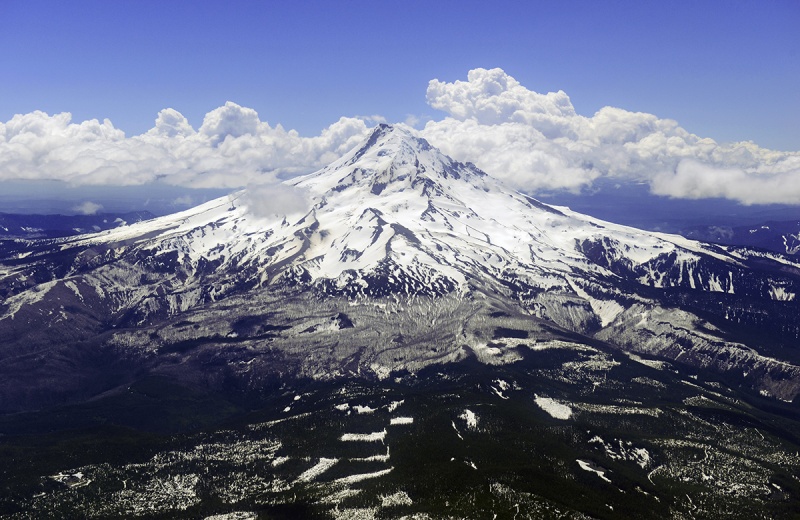
Mount Hood is a magnificent mountain and I’d wanted to climb it for some time. When Mount Saint Helens erupted decades ago, it put the Cascades on my radar screen and that’s when I learned about Mount Hood, another stratovolcano to the south of its more active northern neighbor. Scientists at the time were concerned the Saint Helens eruption would destabilize the area potentially causing eruptions of other nearby volcanoes such as Mount Hood, Oregon’s high point. Coupled with my interest in and background in science, these Cascade volcanoes fascinated me. Mount Hood is also famous for the headlines it’s made in the past due to widely publicized climbing related accidents in 1986 and 2002 among many others. Mount Hood is a mountain to be respected. While I appreciated its stature and geological significance, I didn’t actually have a formal plan to climb it until more recently. First Attempt I finally had a plan to attempt Mount Hood in May 2017. After doing the necessary preparation, flying in and sorting out the then-logistics, I was ready. I did some recon of the area, then an acclimatizing hike up to above the ski area to 9k and explored a bit. One thing I noticed was even on my weekday warm up there were a great variety of people on this mountain. Like its northern neighbor Mount Rainier, Hood is easily accessible, being only 90 minutes from Portland having a paved road to the trailhead and within two hours one can find themselves on a glacier on Mount Hood. This convenience undoubtedly contributes to its popularity and number of people attempting this mountain, purportedly per the Forest Service, estimated to be up to 10,000 per year with some claiming this peak sees the second highest summit attempts after Mount Fuji, which sees upwards of 250,000+ people attempting its summit annually (in a 10 week climbing season nonetheless). I cannot verify either of these figures, but 10,000 seems high for actual successful summits on Hood, but who knows. Bright eyed and bushy tailed, I started out then at 3:00am on the standard South Side Route up the Hogsback and what I thought had been good preparation and positioning for a summit attempt. While I made good time up to the Devil's Kitchen, I was then met by a huge crowd of people in various stages of climbing, hesitating and struggling up the Hogsback and up to the Pearly Gates. The fact that it was close to Memorial Day (mistake #1) and a weekend (mistake #2) was not lost on me. As I would later realize, late May was on the late side for climbing here as well (mistake #3) even in a good snow year. After getting up to and moving over the Hogsback, then traversing directly under and stepping over the then-partially opened bergschrund I found myself at the end of a stagnating conga line of people struggling to make it up to the Pearly Gates and again through the Pearly Gates themselves. Never having been here before, I assumed folks would move through this section without much fanfare and figured I’d just wait rather than try to pass anyone since the terrain and footing was too narrow, steep and precarious to try and safely push past folks. Bad assumption. This was not a good place to wait. At that icy juncture of the bergschrund and the way the route was back then with a sharp 90 degree turn up to the Pearly Gates it was exposed on all sides. I ended up spending 30+ minutes waiting for the crowd to dissipate wasting precious time before the sun rose too high warming the upper route further. I was paying for my three mistakes above. Most of the people above me were not moving much if at all. One person slipped slightly, luckily caught by their anchored partner, another climber was stuck, visibly panicked on the steep ramp up from the bergschrund unsure what to do yelling to a partner who was nowhere to be found and another at the top of that section before the entrance to the Pearly Gates frozen like a deer in the headlights and another guy had just decided to sit down in the middle of the route. Lingering thoughts of the 2002 incident were fresh in my mind where an errant step by a single climber triggered a fatal domino effect of several unarrested falls in this same spot. Small chunks of ice and other debris were raining down on me both triggered from the people above as well as the warming effects of the sun, now getting higher in the sky with the route losing its protective shadow. Two roped teams were also trying to navigate around the melee. What a difference compared to that remote infrequently visited 13er or isolated Adirondack peak in Spring which might not see a climber for a month. I was disappointed in the situation, getting frustrated and increasingly sketched out by the scene, and reluctantly decided to turn around. Below are some shots I took from the Hogsback after I turned around showing the crowds, which were still there another 20 minutes later. 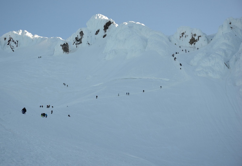 Like ants... 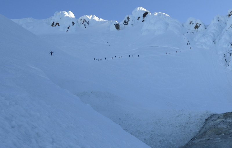 The weight of decisions like this haunts me and continues to gnaw away at me for months. I’ve been thinking about this moment for two years since I turned around wondering if I should have just kept going, waited more, gone up the alternative Old Chute route, etc…and as such Mt. Hood became one of my main mountains on which I had unfinished business. Mountaineering is a learning experience, an exercise in decision making and discovering who you are. The more mountains you experience, the “better” informed you might be next time or at least you hope you will be. Situations are relative also; had I been climbing Mount Elbert and run into 30 people near the summit (or 100 people), it wouldn’t have materially changed the risk profile of the mountain, snow or no snow, nor my decision making. It might have added a certain amount of frustration had I expected solitude, but not much more consequence beyond that and in actuality, 20+ people on a near the summit of a 14er is not uncommon these days. Hood is different. Because of its ease of access and the easy approach, it lulls people into complacency and many hikers come here unprepared for what they find higher up. This is especially true at or above the Hogsback where in recent years has seen several accidents on its slopes in situations I imagined were not too dissimilar from what I experienced. The steep exposed terrain, the elevation gained to get this point tiring some folks out, objective hazards of rock/icefall, the narrow bottlenecks and no-fall zones make this mountain more serious and less forgiving of errors, yours or importantly those of others. In May 2018, I was ready again to give it a go, until two weeks before my expected trip date when I tweaked my knees on a training incident which took six months of rehab to get back to some sort of climbing condition and another few months to feel good about descending a steep snow slope again. Fast forward to this week, April 2019. The strategy would be a little different this time: Logistics would be similar but timing would be earlier. I'd also team up with good friend and skilled climber Lucas, whose partnership would help make this a success. The plan was to go earlier in the season (five weeks earlier than my 2017 attempt), climb during a non-holiday weekday and to get started earlier, all of which should result in fewer people on the route and allow more time to allow for those inevitable unforeseen setbacks that usually occur on any mountain trip. April weather however does have a history of being cooler and more unpredictable in the Cascades than late May, but I was willing to make that trade. It also seemed to be a good snow year, with 489 inches of snow recorded this winter with a current base depth of 149 inches as recorded by Timberline Lodge. Mount Hood climbs harder than many peaks which are higher than its 11,239ft summit. While not a 14er or even a 12er, acclimatizing was still important for my sea level blood so I again arrived to area a few days early, stayed in Government Camp (~4,000ft elevation) and did some warm up hikes to above the ski area on Mount Hood which gets you to 8,500+ft or so and spent some time around the Lodge acclimatizing (~6,000ft). It was a good time to iron out any last minute gear issues as well. I had climbed San Bernardino Peak in California recently so that would definitely help with acclimatizing. As you can see from the photo below it has been a pretty good snow year for a Mount Hood. You'll have snow right out of the parking lot. This is what you call full coverage! 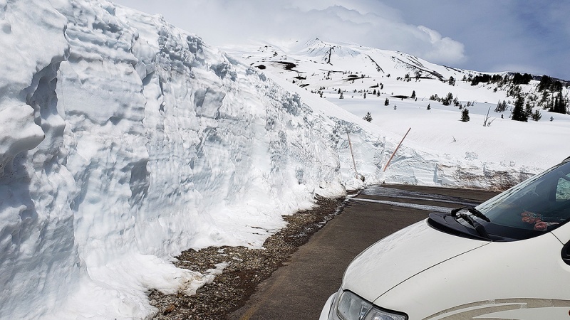 The Climb (Note some of the photos here were taken in daylight or on the way down hence daylight shots of the lower mountain as I didn’t take any photos before sunrise). It was rainy and cloudy for the three days before our early morning start, typical April weather in these parts but was getting me nervous that weather wouldn't cooperate for our day. 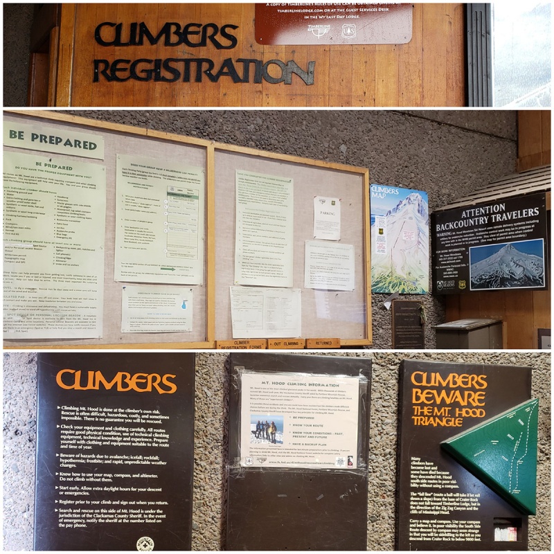
However, as luck would have it, the night before skies cleared and we had a pretty good window for several hours in the morning before clouds rolled in again. It hadn’t snowed much in recent days minimizing unsettled snow and avalanche risk, but due to the sheer amount of snow on the mountain, a potential warmer day could result in a wet slide, so we were mindful of this. Filling out the Climbing permit and getting our blue bags we were off. Snow right out of the lot, lenticular clouds hang over Mount Hood 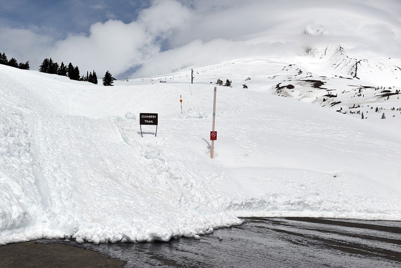 (Taken in daylight the day before) 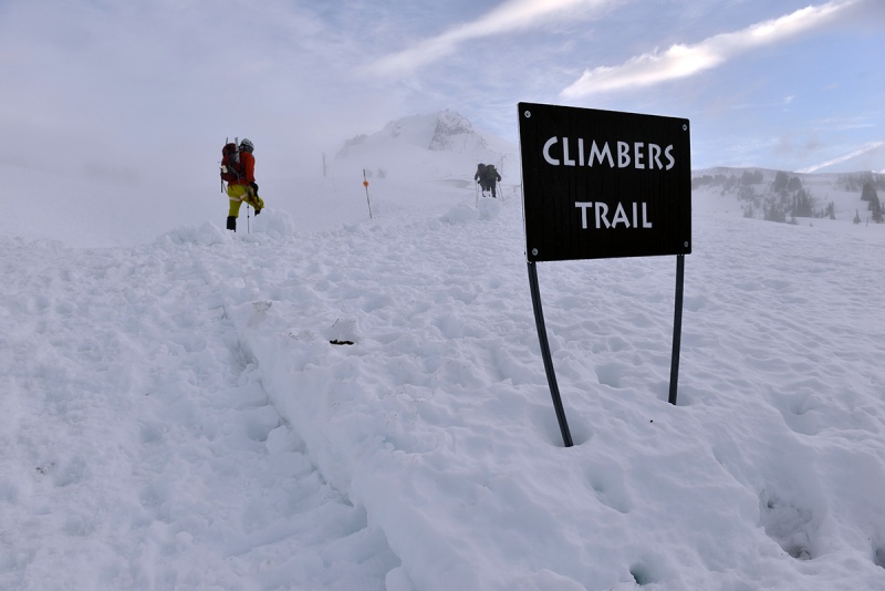 Starting up under a waning gibbous moon the white landscape was illuminated in a pale moonlight such that we almost didn’t need our headlamps. Another dozen climbers were in earshot as we ascended the lower slopes. The sky was not quite black but not quite blue either. The scene was made more surreal with the white Mount Hood massif looming large towering over the marshmallow-white snowy landscape. Daytime image of the lower route. Stay on the groomed snowcat trail until this ends and don’t venture onto the skiing terrain further to climbers left on the ascent. 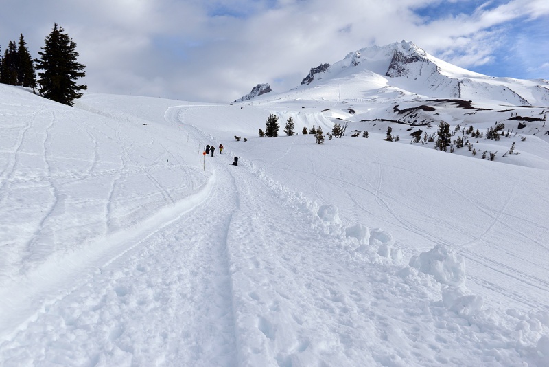
In areas less sheltered by drifts or snow mounds, a mild but persistent wind (10-15 knots) had picked up over the last 12 hours which made things cooler and mandated an extra layer to be put on. The crisp morning air though made for firm dry snow which made crampons bite well as we made our way up the approach from the lower angle slopes to the upper mountain. I left my axe in my pack for the time being as it was pretty mellow slope at the start, but crampons were helpful given harder snowpack and ice patches early in the morning. 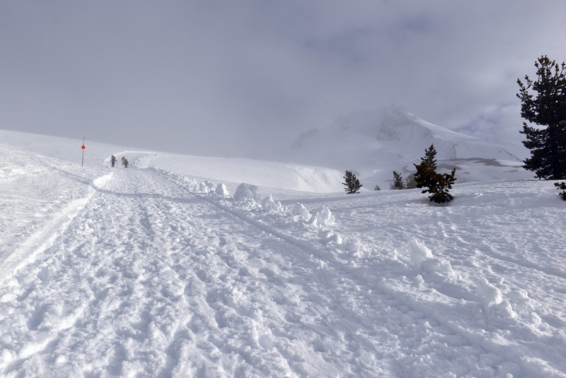 The view coming up 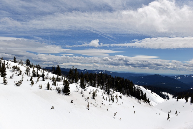 Whiteout conditions come and go... 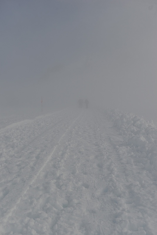 Similar to Rainier, I was on the fence about which boots to wear this time, either my heavier Nepals or older red Trango S EVOs, I opted for the Trangos which I find more comfortable climbing in, hoping that coupled with my warmer socks and gaiters they’d be warm enough and it turned out to be the right choice, guess my feet run warm. The more popular boots on the mountain today were Nepals, Cubes or plastic boots. Be prepared for random whiteouts… 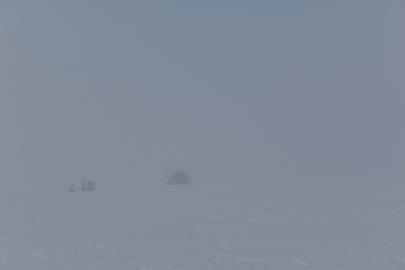 A climb of the South Side route is a tale of two mountains; (1) The section up from the parking lot to Devils Kitchen and then (2) from Devils Kitchen to the summit. At least in the Spring/Winter none of this route would really be considered a hike in the traditional sense. You’ll be on snow 100% of the time on this climb, at least currently. I’ve never been here in summer, but locals were saying me the climb itself is easier in summer, but far more dangerous due to rockfall, icefall and the fact that the bergschrund and other crevasses are opened much wider with more unstable edges. 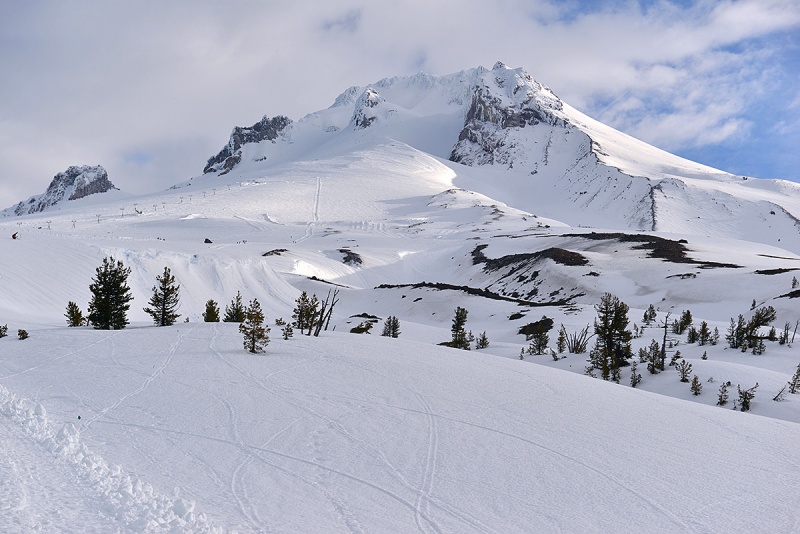 view of the remaining route from about ~8,500ft +/- 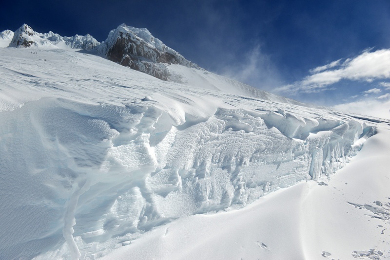 Some skiers climbing up above the end of the ski area 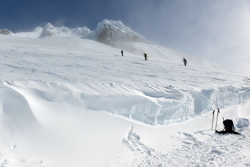 Shots looking down from around the top of the ski field, this will likely also be done in the dark, though I did see several folks starting out to climb, (without skis) after 7:00am from the parking lot on my warmup day. 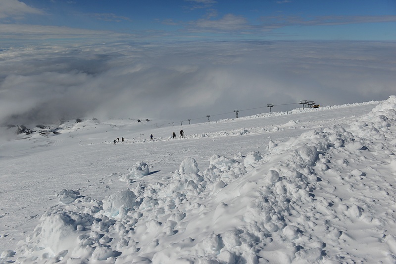
The groomed trail you'll follow from the parking lot to just above where the ski area ends.  The upper mountain getting closer
The part of the route up to the Devils Kitchen is simply a walk up on low and moderate angle snow generally requiring crampons and ideally trekking poles for balance. At this point you probably don't need your axe, although it would not hurt to take it out. Most of the ascent in this section is basic snow movement and crampon technique 101 nothing too steep. The angle steepens as you climb higher approaching the flat spot where the lava dome is forming, i.e. the Devils Kitchen. Lower down it’s probably in the 20 degrees range, then gets up maybe to 30 degrees, possibly a bit steeper depending on your line. The snow was pretty firm and the spike of my axe would probably only stick in an inch or less. 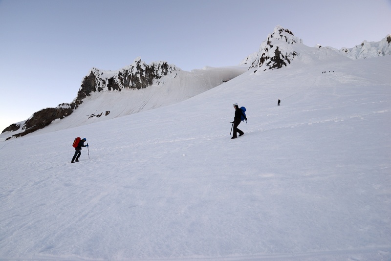
Clouds moved in and out all morning, The Hogsback comes into better view now.
I took this above shot on the way down, when clouds came in the rest of the day You will surely smell the Devils Kitchen before you reach it. Depending on the prevailing wind and where exactly you top out on it, the smell of sulphur dioxide could be faint to sickeningly strong. In the image below, note lone climber on Old Chute Route to the left in the photo
Once you reach the Devils Kitchen it makes sense to take a check of both your own condition and that of the weather, though if you started very early and are fast, you'll likely be here in the dark so the latter might be tough to see. The entire Hogsback can be seen now. To the left in these shots you can see footprints traversing up the side of the Hogsback to the top. Move left around this feature, don't cross on top of it.
We arrived here just before sunrise, as the pyramidal shadow of Mount Hood was cast upon the landscape in a visually stunning moment.
From this point on the consequences of mistakes or something going wrong are more severe. Most teams roped up at this point. As I was preparing for this climb, one of the questions I always wondered was what the Hogsback actually looked like and how it climbed. So, for you aspiring climbers, I have a few shots for you from different angles:
The Hogsback is basically a snow dune formed by the wind, so it can and will change. It's worth mentioning again as others have pointed out and listening to locals comment on the mountain, that the position of and steepness of the Hogsback has changed in recent years and has made the standard Pearly Gates route more technical than it has been in the past with some steeper and sketchier sections. I have seen older photos where the Hogsback was a ramp right up into the upper Pearly Gates and made for an easier summit approach, that’s’ not the case currently.
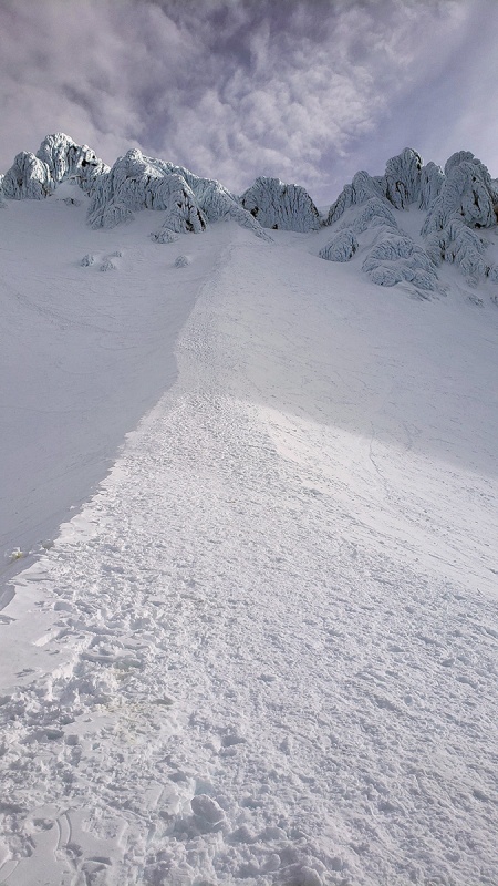 When I was here two years ago the route went up a portion of the Hogsback and then took a 90 degree right turn under the bergschrund, then another 90 degree turn up to the Pearly Gates. On this day we climbed virtually the whole Hogsback and then took a right turn doing a traverse over and above where the bergschrund would normally open. This traverse is fairly exposed on steep snow high above the lava dome of the devils kitchen and is one of the no fall zones. Here is a shot from on top of the lower Hogsback, note smoking fumarole to the right. This is a dormant, not extinct volcano remember…
This is your last spot to take a safe rest break before continuing on the upper mountain where it will be harder to stop in the danger zone up there exposed to multiple hazards not to mention the potential for other climbers above and below you. Below are shots taken from above the Hogsback, as you make that exposed traverse over to the right under the entrance to the Pearly Gates. This begins the crux of the route.
You can see our footprints above and below, which is on the traverse over
You can sort of get a sense of the steepness here
The mountain was not that crowded today, looking down from the under the Pearly Gates we could see maybe 20 people all of whom started within an hour of one another, plus another half dozen that were above us. This is in contrast to at least 50 people around the Hogsback alone back in 2017 and another 50 underneath coming up. The snow/ice was pretty hard at this point and up and worthy noting that a self-arrest would have been hard to initiate should you need to make one due to the hard snow/ice. There were some boot prints to step into though those areas were more like crushed snow and you still needed to kick a good step in on anything steep. Hood has so much ice and snow locked up in the upper mountain, part of what makes this a visually interesting climb, very different from Colorado or the Sierra. I wouldn't want to climb this after Spring time when melting accelerates rock and icefall though. The ice towers and rime covered rock in and around the Gates you’ll be climbing in and under.
Inside the Pearly Gates, right chute. Most people we saw used an anchor or were roped up here. It was early, not crowded and if you have time, there is not much downside to using one here. However, if it was crowded and bottlenecked, a rope anywhere up here would probably only make things worse. I didn’t have an inclinometer and know things always seem steeper than they really are, but I think this section was 55-60 degrees. This is a short section probably about 200 vertical feet, but requires attention and a second short ice tool would have come in handy today. Any fall here likely won’t be stopped.
Exiting the Pearly Gates and just under the summit, where the angle lessens with the final ~150 ft to the summit. Some of this section reminded me of the upper reaches of the Hourglass on Little Bear in Spring snow, though a bit steeper and harder ice/snow. Mount Jefferson appears rearing its head in the distance. Three Sisters behind it.
Topping out near the frozen summit, but this isn’t the true summit yet
Two other climbers topping out on a sub summit, that might be from the Old Chute route
Almost there…
The summit! There was a memorial of sort on the top, which must have been placed there very recently maybe even that morning. Mount Saint Helens is seen in the distance.
The summit ridge had a cornice on the north and eastern sides so we were cautious to stay back from the edge. The summit was a welcome sight! It was a stunning place, covered in white ice and weather hardened snow. From the lofty summit of Mount Hood, you can see Mount Rainier, Mount Saint Helens, Mount Adams, Mount Jefferson and the Three Sisters to the south. A volcano wonderland. Other than taking a few photos, we got off the summit and made our way down pretty quickly. Coming back down the Pearly Gates, it seemed best to face in and front point down. This is where an extra short ice tool would have been handy. There was one party in front of us, so we waited patiently (maybe a little impatiently) for them to get clear of any possible debris before we down-climbed this section. Descending the Hogsback. Climbers down below left are resting near the Devils Kitchen. Note lava dome to the left. Cross your fingers you will be upwind from here as it can smell pretty strong and nauseating.
Once you are back on the lower Hogsback, the stress level drops considerably as you’ll be out of the main danger zones and less exposed to falling rock and ice or higher consequence slips. I was so happy this worked out this time thanks to all the complicated factors that come into play in planning such a trip; a cooperating body, fairly stable weather, good snow and climbing conditions, great partner in Lucas, gear working and a cooperating mountain that let us up today. I’d highly recommend this mountain to climb, but just come prepared with a healthy amount of respect for this peak. One important note with the South Side Route – on the descent, the route proper doesn’t follow the fall line of the mountain and climbers often become disoriented, especially in one of the frequent whiteouts that occur. Many people veer off too far west to the Zig Zag Glacier (descending too far right) or too far east (descending too far left) into the White River Glacier putting them in danger of crevasse risk on the glaciers and getting lost off route on the way back to the parking lot / lodge or higher hut. On your way up, it would make sense to mark waypoints of your track to help on the descent. 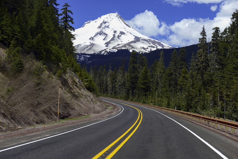
Helpful hints in your trip planning:
Thumbnails for uploaded photos (click to open slideshow): ")
")
")
")
")
")
")
")
")
")
")
")
")
")
")
")
")
")
")
")
")
")
")
")
")
")
")
")
")
")
")
")
")
")
")
")
")
")
")
")
")
")
")
")
")
|
| Comments or Questions | |||||||||||||||
|---|---|---|---|---|---|---|---|---|---|---|---|---|---|---|---|
|
Caution: The information contained in this report may not be accurate and should not be the only resource used in preparation for your climb. Failure to have the necessary experience, physical conditioning, supplies or equipment can result in injury or death. 14ers.com and the author(s) of this report provide no warranties, either express or implied, that the information provided is accurate or reliable. By using the information provided, you agree to indemnify and hold harmless 14ers.com and the report author(s) with respect to any claims and demands against them, including any attorney fees and expenses. Please read the 14ers.com Safety and Disclaimer pages for more information.
Please respect private property: 14ers.com supports the rights of private landowners to determine how and by whom their land will be used. In Colorado, it is your responsibility to determine if land is private and to obtain the appropriate permission before entering the property.


