Download Agreement, Release, and Acknowledgement of Risk:
You (the person requesting this file download) fully understand mountain climbing ("Activity") involves risks and dangers of serious bodily injury, including permanent disability, paralysis, and death ("Risks") and you fully accept and assume all such risks and all responsibility for losses, costs, and damages you incur as a result of your participation in this Activity.
You acknowledge that information in the file you have chosen to download may not be accurate and may contain errors. You agree to assume all risks when using this information and agree to release and discharge 14ers.com, 14ers Inc. and the author(s) of such information (collectively, the "Released Parties").
You hereby discharge the Released Parties from all damages, actions, claims and liabilities of any nature, specifically including, but not limited to, damages, actions, claims and liabilities arising from or related to the negligence of the Released Parties. You further agree to indemnify, hold harmless and defend 14ers.com, 14ers Inc. and each of the other Released Parties from and against any loss, damage, liability and expense, including costs and attorney fees, incurred by 14ers.com, 14ers Inc. or any of the other Released Parties as a result of you using information provided on the 14ers.com or 14ers Inc. websites.
You have read this agreement, fully understand its terms and intend it to be a complete and unconditional release of all liability to the greatest extent allowed by law and agree that if any portion of this agreement is held to be invalid the balance, notwithstanding, shall continue in full force and effect.
By clicking "OK" you agree to these terms. If you DO NOT agree, click "Cancel"...
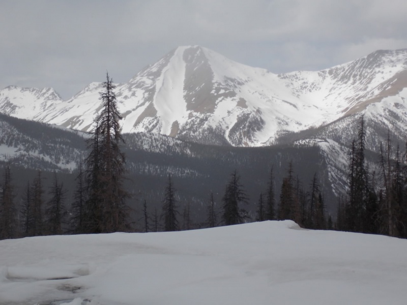
Aetna from Monarch Pass - Had I seen this before the hike, I might have chickened out!
Trailhead: FS230 & US50 - per Bill's Route Description Route: Grand Couloir Length:7.5 miles Vertical: 4100 feet Partners: Solo
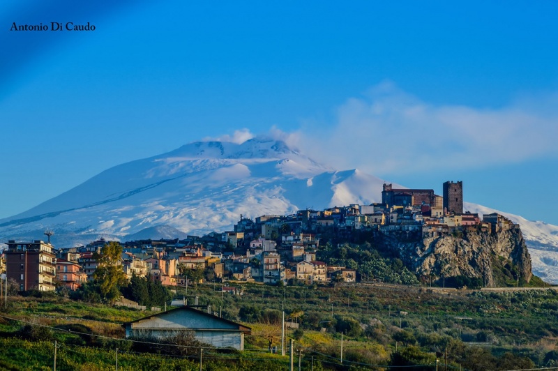
Mount Aetna had been on my list for some time. When I was in the Navy, I was stationed in Sicily in the late 1960's and lived in a little town called Motta Sant'Anastasia and had a wonderful view of Mount Etna - the largest and most active volcano in Italy. What looks like clouds in the following picture is actually smoke from the volcano.
Motta with Etna in the background - photo credit Antonio Di Caudo
This was a tough one for me - tougher than it should have been. I've been an insomniac my entire adult life and normally can force a good night's sleep with a Lunesta tablet but for whatever reason, it just didn't work for me the night before. And I didn't really eat anything after noon the day before either, so I was struggling before I started. It COULDN'T be that I am old and not in the best of shape! No way! That's my story and I'm sticking to it! <smile>
I didn't make the best time on this hike and came close to turning around about 1000 feet shy of the summit when I really started bonking but decided that as close as I was, I just had to tough it out and continue. And in a way, going slower means that I enjoy the views a bit more as I stop to catch my breath. Which happened a lot on this one.
To the hike...
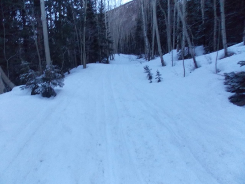
I left the TH about 5:45 and needed my headlamp for probably a half an hour or so. Conditions going up the road were fine in the morning as the snowmobiles had packed the snow plus it was relatively frozen early in the morning. Coming down it was a little slushy but not bad.
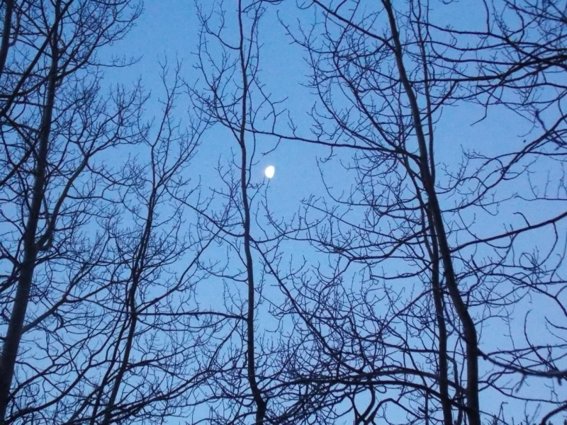
The road up.Waning gibbous moon
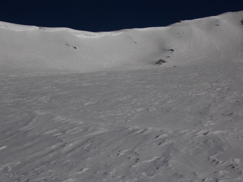
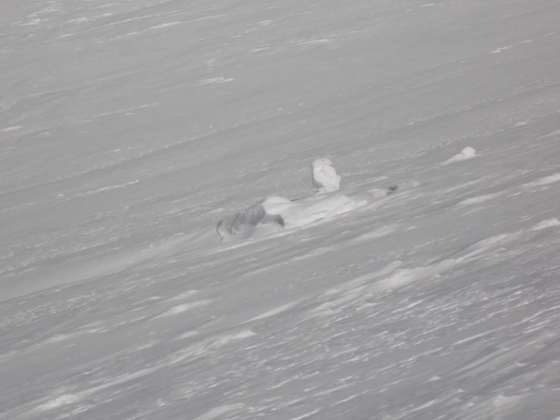
Users bmcqueen and Tornadoman had done this hike a few days prior and advised me of the times it took them (I was a lot slower) and of the evidence of an avalanche I would see along the way. That evidence was very apparent about a half mile before the Boss Lake cutoff.
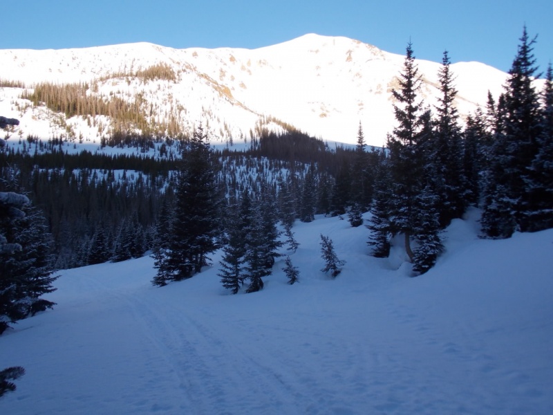
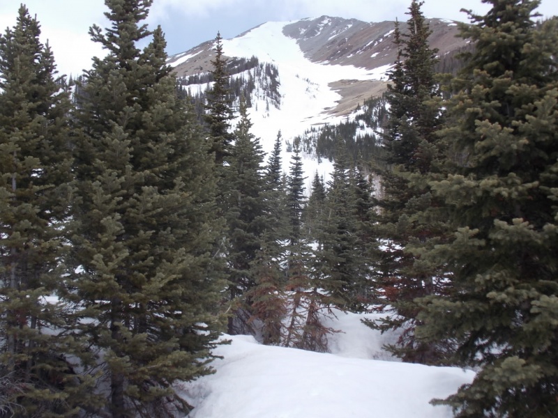
As described in Bill's route description, the trail stays in the trees for a bit and then things start to open up.
Clover Mountain?
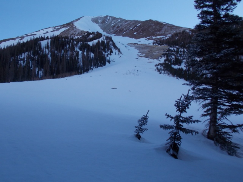
It took me just over 2 hours to make 2.5 miles to the runout. Talk about slow...
Here we go...
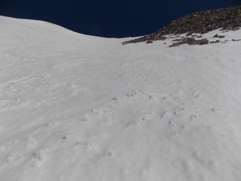
I started out just booting it up, then switched to snowshoes for a while - mainly for traction and then finally crampons the last half of the climb.
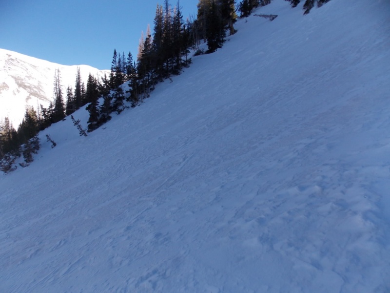
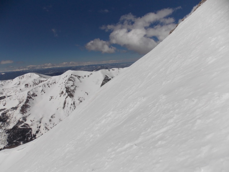
Steepness about 1/3 the way up.And a look back down from about the same spot.
Cornices off to the left of the route about half way up.
And a couple snow rollers resemble a duck or a goose going up. I did manage to pass him!
Steeper near the top.The final push
And a short vid from the same spot.
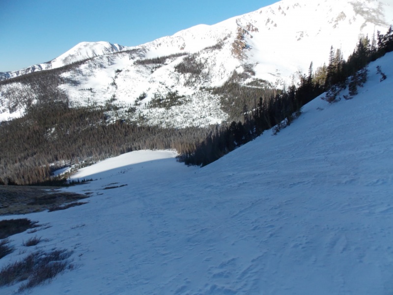
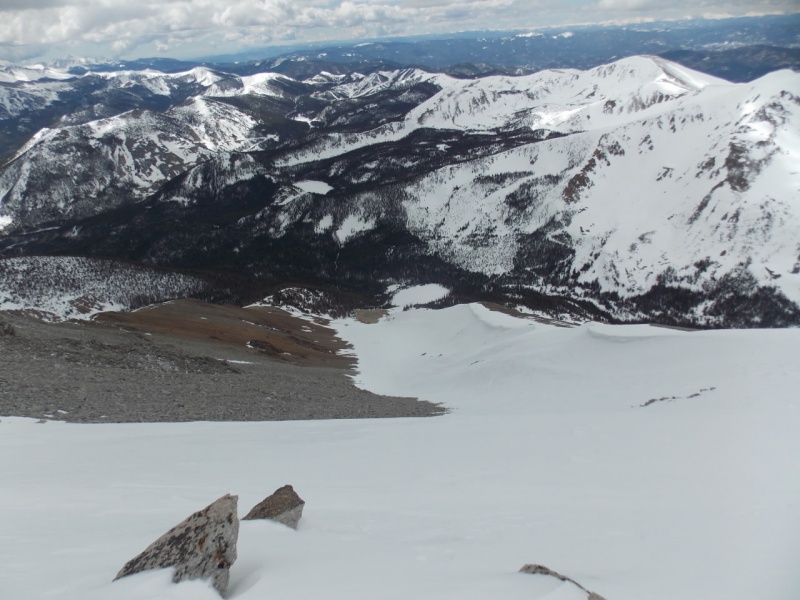
One more look down from the summit ridge - note the white circle in the middle of the photo - that's the runout where I started up.
It took me just over 3 hours to get from the runout to the summit - certainly not a blazing pace, but I made it.
Vid of the final summit ridge with a 360 from the summit.
As always, the views from the summit were stellar.
But now, it's time to go down. It was my intention to glissade all the way down but I was a bit nervous about how the upper couloir would direct me as it looked like I would be heading for the rocks so I ended up walking down a few hundred feet to insure I had a clear and safe path.
Short vid of the walk down of the upper portion of the descent
And then it was glissade time! I ended up stopping several times - to both get some self arrest practice in and to warm my butt some. As there were a lot of ski and board tracks, the ride down was a bit bumpy as you will see...
This was a fun, fun day - as they always are in the Colorado mountains!
One last look.
Thanks for taking the time to read this and please be careful out there.
Thumbnails for uploaded photos (click to open slideshow):
Have always liked the view of Aetna/Taylor from Monarch Pass. Have to be careful not to drive off the road looking at it.
Wow. How recent is that avalanche damage? Was that an obstacle?
Loved the glissade video. A self-described "old guy" goes helter-skelter down the long, steep, south couloir of Aetna, then tells us all to be careful out there.
Ha!.
@David - Thanks! Yeah, the timing was more luck than skill, tho
@Kirsten - I'm sure you won't have any trouble. Thanks for your comments.
@Eddie - You will like those peaks. And yeah - I'm glad I didn't bail. I would've been kicking myself if I had.
@rrk - I think that avy was some time back as all the snow that caused it was melted. No obstacle for foot traffic - and it looked like snow machines weren't having any issue getting by as someone (maybe them?) had sawed some of the limbs to allow passage. It's gonna be a while before 4X4's are gonna get through tho. And I cracked up at your last comment! Thanks for keeping me honest!
Way to persist/persevere despite dubious personal conditions.
My favorite video is the glissade. Great way to move down a mountain quickly!
Looks like you had a great day! :-D
Thanks for the conditions detail & report!
@Doug - I about spit my coffee all over my screen when I read your comment. There are about 1000 things I can think to say but I think I'll just say "Thanks"... I think.... Be well, my friend...
@sunny1 - As always, you are so positive in your comments - not just on my TR's but on the forum, and TR's in general. Thanks!
Aetna is a fun mountain, and it's a treat that you had snow from the runout to the summit. Glad you pushed through to the top and got your glissade and views, too.
Much appreciated, Joseph. You are correct - it is a fun mountain.
Caution: The information contained in this report may not be accurate and should not be the only resource used in preparation for your climb. Failure to have the necessary experience, physical conditioning, supplies or equipment can result in injury or death. 14ers.com and the author(s) of this report provide no warranties, either express or implied, that the information provided is accurate or reliable. By using the information provided, you agree to indemnify and hold harmless 14ers.com and the report author(s) with respect to any claims and demands against them, including any attorney fees and expenses. Please read the 14ers.com Safety and Disclaimer pages for more information.
Please respect private property: 14ers.com supports the rights of private landowners to determine how and by whom their land will be used. In Colorado, it is your responsibility to determine if land is private and to obtain the appropriate permission before entering the property.


")
")
")
")
")
")
")
")
")
")
")
")
")
")
")
")
")
")
")
")
")
")
")
")
")
")


