Download Agreement, Release, and Acknowledgement of Risk:
You (the person requesting this file download) fully understand mountain climbing ("Activity") involves risks and dangers of serious bodily injury, including permanent disability, paralysis, and death ("Risks") and you fully accept and assume all such risks and all responsibility for losses, costs, and damages you incur as a result of your participation in this Activity.
You acknowledge that information in the file you have chosen to download may not be accurate and may contain errors. You agree to assume all risks when using this information and agree to release and discharge 14ers.com, 14ers Inc. and the author(s) of such information (collectively, the "Released Parties").
You hereby discharge the Released Parties from all damages, actions, claims and liabilities of any nature, specifically including, but not limited to, damages, actions, claims and liabilities arising from or related to the negligence of the Released Parties. You further agree to indemnify, hold harmless and defend 14ers.com, 14ers Inc. and each of the other Released Parties from and against any loss, damage, liability and expense, including costs and attorney fees, incurred by 14ers.com, 14ers Inc. or any of the other Released Parties as a result of you using information provided on the 14ers.com or 14ers Inc. websites.
You have read this agreement, fully understand its terms and intend it to be a complete and unconditional release of all liability to the greatest extent allowed by law and agree that if any portion of this agreement is held to be invalid the balance, notwithstanding, shall continue in full force and effect.
By clicking "OK" you agree to these terms. If you DO NOT agree, click "Cancel"...
The Colorado winds were high so I decided to head down to New Mexico this week to do some highpointing. Taos is actually closer to my house than many Colorado peaks, so the 4 hour drive wasn’t too demanding. In fact, it was kind of fun. When I made it past Ft Garland I saw a road sign indicating there were bighorn sheep in the area. To my surprise I immediately encountered a herd of bighorn sheep standing along the side of the road. A few minutes later I saw a sign warning of cows, and wouldn’t you know it? Cows on the road. The same thing happened with the deer and elk warning signs, and a few minutes later, even horses! I hadn’t realized there were wild horses in the San Luis Valley, but yep, there sure are! With all this good luck with animal sightings I kept hoping to see a sign indicating buffalo or elephants or zebras were in the area, but alas, wild horses were about as exotic as it got. Kudos to the group that placed those signs so accurately.
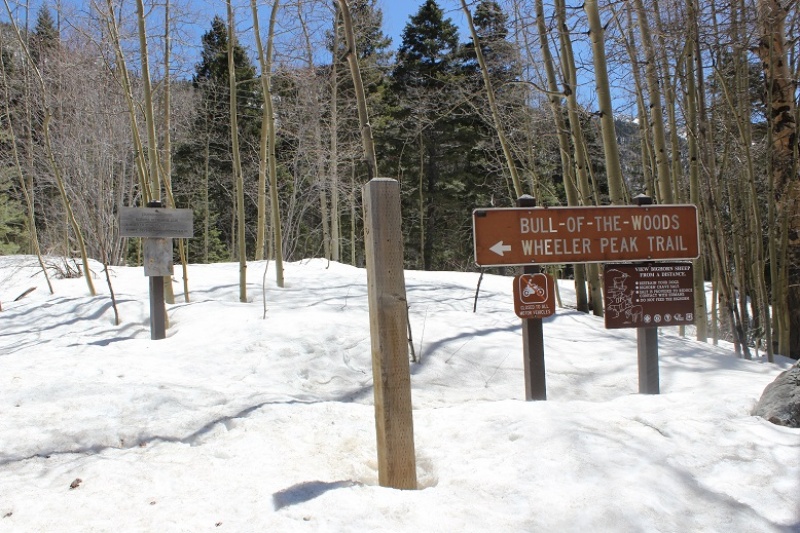
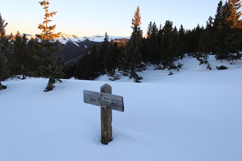
I made it to the trailhead at 4:45am and was on the trail by 5am. Oh, and I did a terrible job parking (without realizing it). I actually made it to the trailhead about half an hour earlier than expected, and only recognized I was there because I saw the “Bull of the Woods trailhead” sign as I was driving by, so I backed up, parked, and was on my way.
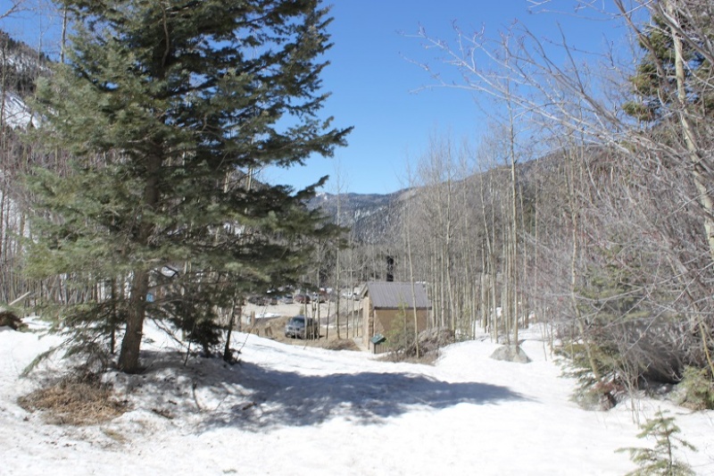
It wasn’t until I was on my way down I saw there was a real parking area directly below where I’d parked. Oops!
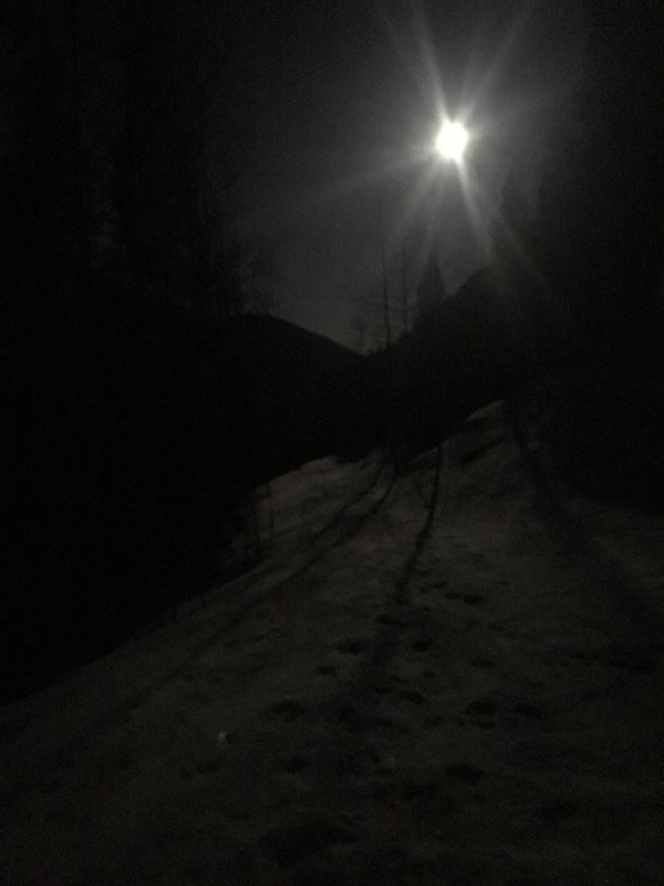
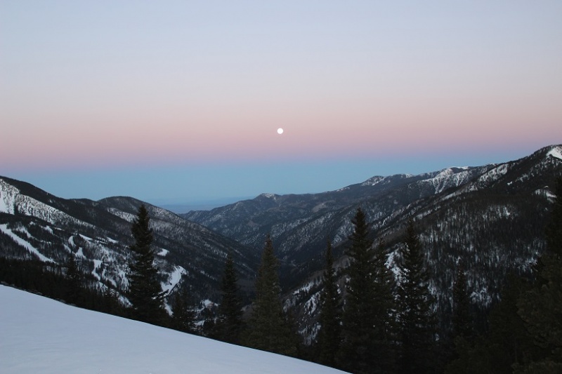
The full moon was absolutely amazing! Unfortunately I wasn’t able to get a good picture, but it was so bright I didn’t need my flashlight. I brought my snowshoes but didn’t put them on until I’d almost made it to treeline. There was quite a bit of snow on the trail (4 feet or so) but the snow was consolidated so I was able to just walk on top of it. There were also tracks to follow.
I could hear a stream to my right, but in the dark I wasn’t able to see the water. There were numerous trails criss-crossing the trail I was on, but as long as I kept hiking in the same direction (northeast) and aimed for the ridge I knew I was on the right track. I stayed on the widest path, or what looked like the widest path.
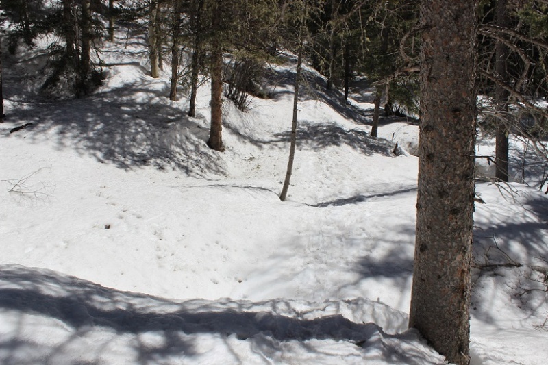
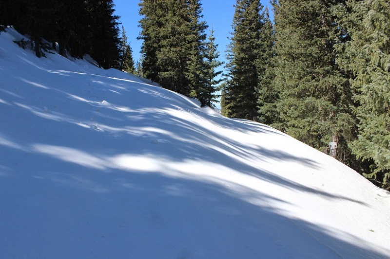
I knew I was supposed to cross the stream at some point, but never saw a bridge. It turns out I crossed the stream without knowing it! Here’s a look at the “stream crossing” from my way back.
Yes, that moon was full!
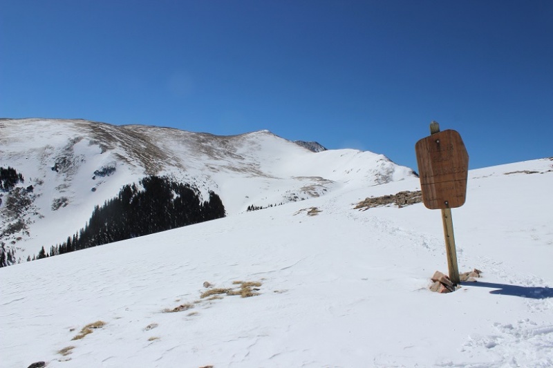
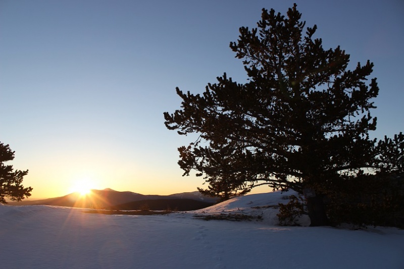
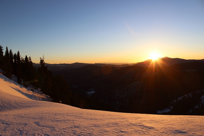
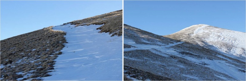
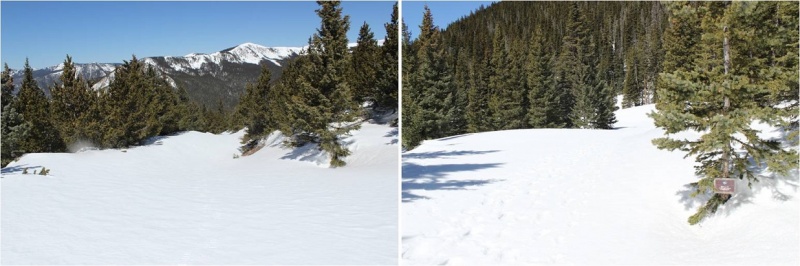
I made it to the Red River Canyon Overlook just as the sun was beginning to rise
At the overlook I turned right and followed the trail to the Bull of the Woods pasture (which didn’t resemble a pasture at all. Maybe it was the snow?)
The footprints stopped, so I was breaking trail from here on out. I got lost a few times trying to stay off private property, but there was so much snow it was impossible to know where the trail was on the mountain. (Hint, go left)
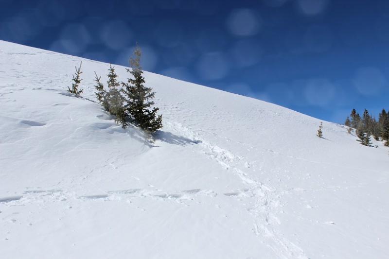
I stopped and put on my snowshoes and followed the ridge, making my own trail.
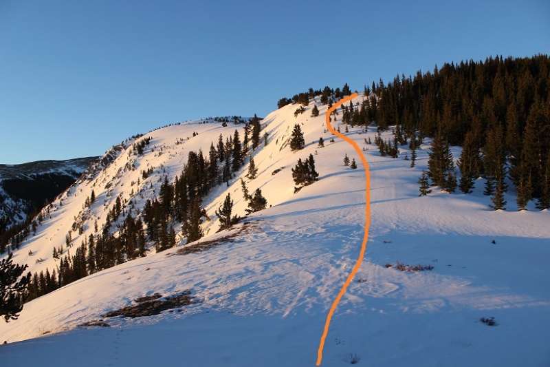
The section after cresting this hill was much steeper than it looks. I had to swing around to the right in order to safely climb through the snow. Here the crampons on my snowshoes came in very helpful.
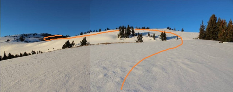
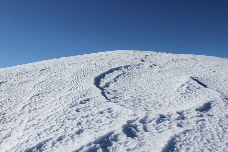
Until the snow just kind of stopped. I knew more snow was coming, so instead of taking off my snowshoes I followed the faint trail of snow around Bull of the Woods Mountain. Here there was either very little snow, or large, steep drifts of 20+ feet. I was glad to have my ice axe.
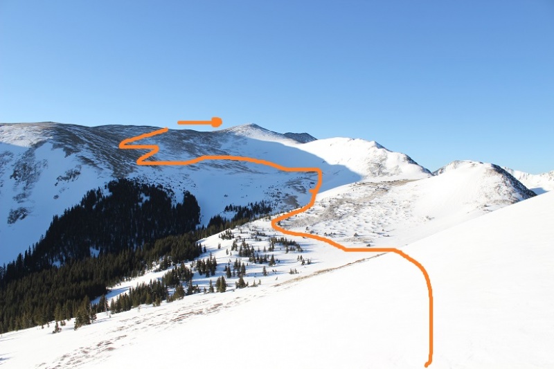
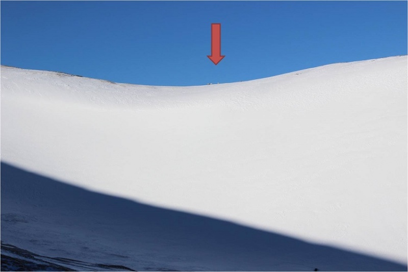
I rounded Frazier Mountain and could smell sheep. I looked all around, but not seeing any figured they must have passed the area recently (but that smell was strong!). I was now presented with the La Cal Basin, which included a 300 foot loss in elevation. This is also where there was quite a bit of snow, which I decided to take advantage of. I needed to cross the basin, avoid those dicey avalanche areas, and then re-ascend the switchbacks on my left.
Crossing into the basin was a bit sketchy
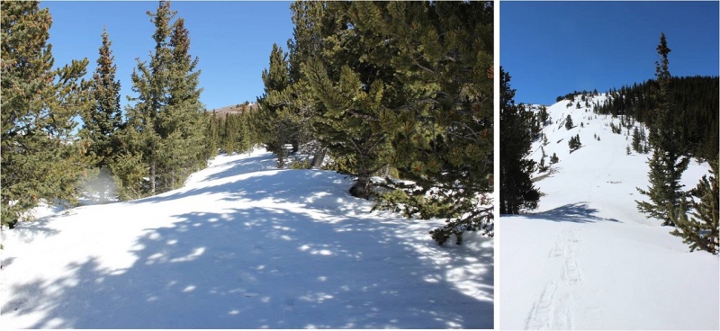
And I was glad to make it to the switchbacks on the other side. Here there wasn’t much snow, so in keeping with my goal of not taking off my snowshoes (just to put them back on again) I stuck to the snow lined trail.
Caption Here
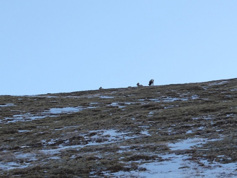
About halfway up the mountainside I saw a few bighorn sheep
And when I looked across the ridge I saw even more!
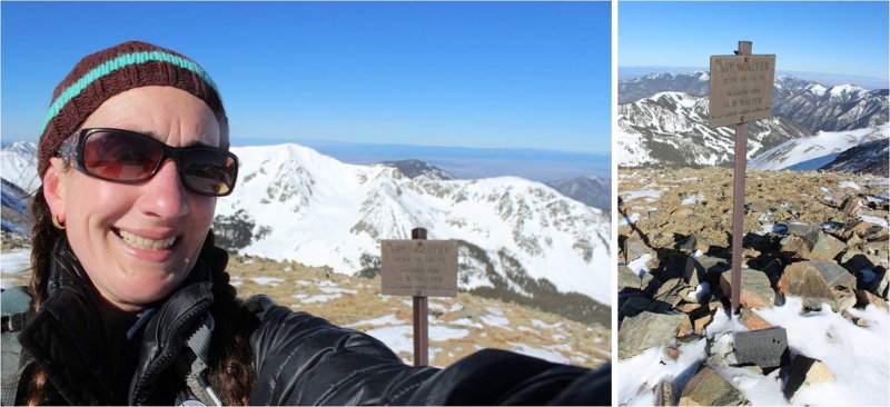
From here I saw what I thought was Wheeler Peak, but it was instead Mt Walter (Wheeler is beyond). I stuck to the snow to make use of my snowshoes
Sticking to the snow looked like this
27
And from the top of this point (13,045) I could see Mt Walter and Wheeler Peak. Sticking to the ridge (and the snow) was the way to go!
I passed Mt Walter and took a few quick photos of the signs and a selfie to prove I was there
From here you can clearly see the summit of Wheeler Peak
Once again, I stuck to the ridge
And summited at 8:45am
Here’s the Summit Video, which I’m excited to say is the first summit video I’ve been able to take all year! I’m so glad it was warm today and sans wind.
Video:
OK, time to turn back. Here’s what the route looks like back from Wheeler Peak… just stick to the ridge
Yep, lots of snow! I was glad to have my ice axe. Snowshoes were a must the entire way back down.
I started crossing the basin again, and unfortunately the sun had warmed up the snow. Snow kept collecting under my snowshoes and I had to keep stopping to kick it off. I made it back to Frazier Hill and saw those sheep I’d smelled earlier (I KNEW they were there somewhere!)
Following the trail in the light of day proved much easier than in the dark, with the added bonus of being able to follow my snowshoe tracks.
Caption Here
39
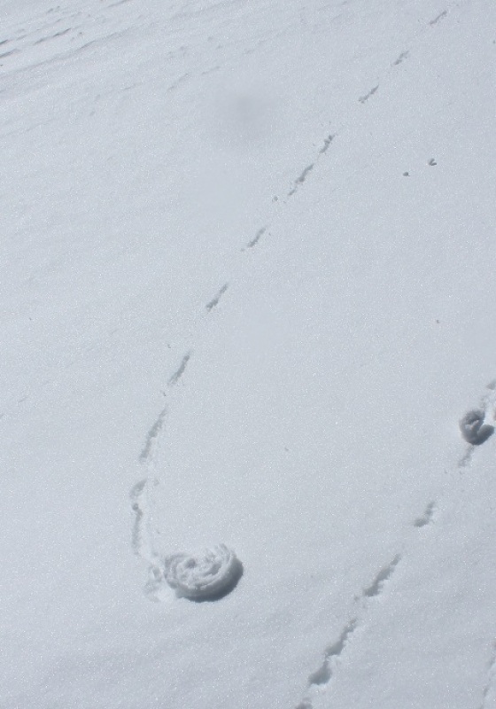
I made it back to Bull of the Woods pasture and once again found footprints. Lots and lots of prints, both human and animal.
The only downside to the warmth of the sun (besides clumps of snow in my snowshoes)? Rollerballs the size of dinner plates
As I followed the trail back to the stream I was actually able to see the stream
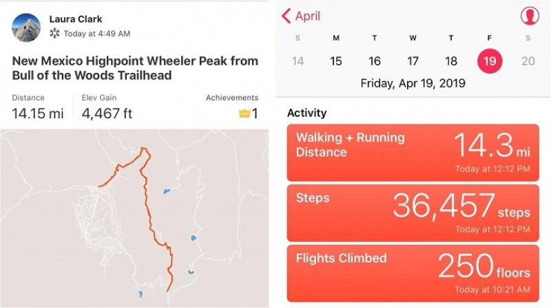
I didn’t see anyone all day until I was about half a mile from the trailhead on my way back down. I talked with a gentlemen about the conditions on the trail. He said he’s hiked these trails for years and was surprised I’d summited today. He was even more surprised when I told him I’d started at 5am. In fact, he didn’t entirely believe me. I made it back to the trailhead at noon, and when I stopped my Strava tracker I was told I’d sent a new app record for completing this hike. Pretty cool! I’d hiked the 14.2 miles of 4467’ in elevation gain in 7 hours.
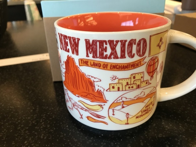
Oh, and the good news? I was finally able to get my New Mexico Starbucks mug in Taos! I’ve been trying for years to get a New Mexico mug to add to my collection, but they’re always out when I visit. Funny, the mug doesn't mention aliens at all…
Also, the ski season in Taos is over, which was a real shame because there was so much snow! And, Taos is beautiful! Majestic even. I had no idea!
Caption Here
Thumbnails for uploaded photos (click to open slideshow):
I hiked this with my twins four years ago. We went in late May, I think, and there was some snow; not as much as you encountered. We didn't cross the basin and stayed on the ridge line.
Beautiful place and plenty of wildlife.
Always good to read your reports; thanks for posting.
Came up from Williams Lake, that day, not much snow in the higher basin past tree line, was able to find the final switchbacks to the summit ridge. Great day to be up there! Had some fun glissadable slopes on the way down. Glad you were able to make it up the longer route!
Caution: The information contained in this report may not be accurate and should not be the only resource used in preparation for your climb. Failure to have the necessary experience, physical conditioning, supplies or equipment can result in injury or death. 14ers.com and the author(s) of this report provide no warranties, either express or implied, that the information provided is accurate or reliable. By using the information provided, you agree to indemnify and hold harmless 14ers.com and the report author(s) with respect to any claims and demands against them, including any attorney fees and expenses. Please read the 14ers.com Safety and Disclaimer pages for more information.
Please respect private property: 14ers.com supports the rights of private landowners to determine how and by whom their land will be used. In Colorado, it is your responsibility to determine if land is private and to obtain the appropriate permission before entering the property.


")
")
")
")
")
")
")
")
")
")
")
")
")
")
")
")
")
")
")
")
")
")
")
")
")
")
")
")
")
")
")
")
")
")
")
")
")
")
")
")
")
")
")
")


