| Report Type | Full |
| Peak(s) |
San Bernardino Peak - 10,649 |
| Date Posted | 04/17/2019 |
| Date Climbed | 04/13/2019 |
| Author | nyker |
| SoCal Delight, San Bernardino Peak |
|---|
|
San Bernardino Peak Trip Report, Spring snow climb Elevation: 10,649ft Roundtrip: ~16 miles Vertical gain +4,967ft I attempted this mountain last December. Back then, I was met with heavy fresh snow from a recent storm and without snowshoes, it made for slow and arduous postholing experience, if not just “undoable” as a daytrip. Given that it was supposed to consist of a long approach with no visible route after 8,500ft or so, was difficult to navigate in fresh untrammeled snow, made tougher by the lower daylight in mid-December so after several hours of two steps up, one step sliding down in thigh/waist deep snow, I turned around. This was my next attempt and I was better prepared this time. San Bernardino Peak is located in the San Gorgonio Wilderness in Southern California, part of the quartet of tall SoCal peaks towering over the desert, the others being San Gorgonio, San Antonio and San Jacinto mountains, the latter being located across Route 10 near Palm Springs. It’s a shapely mountain with nice lines, standing watch over its namesake city and prominently visible from the main highway. 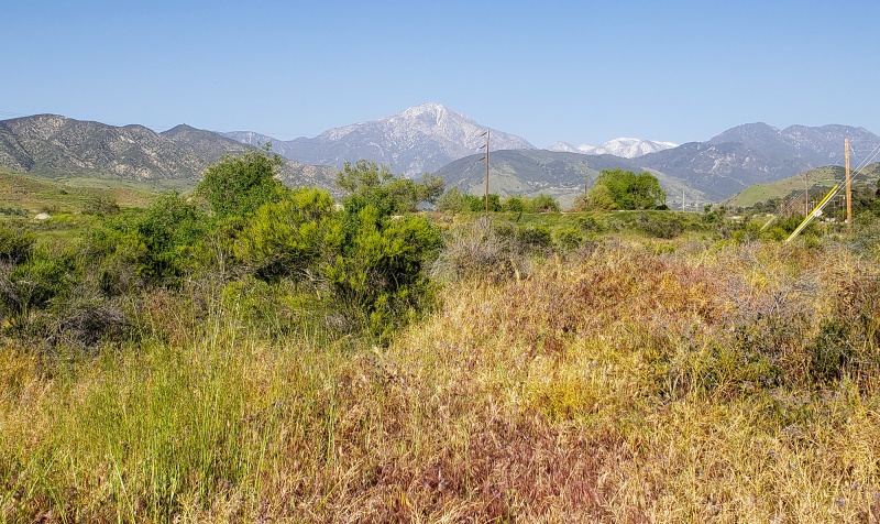
Despite the trailhead being only 90 minutes from greater Los Angeles in a popular hiking area behind a town, I was surprisingly again alone on the route, and aside from some gusty winds, it was a perfect weather day. Morning temperatures were warmer, about 30*F lower down, and high teens to 20*F on the upper reaches of the mountain. A permit (free) is needed that you can get from the Mill Creek Ranger Station/Visitor Center in Mentone. The Climb The main route begins from the Angelus Oaks trailhead, hidden away from the road by an unpaved forest road a mile or so behind a small community on the winding road enroute to Big Bear Mountain, a popular ski resort in season. The trailhead is at an elevation of 5,960ft so some simple math tells you there is some decent vertical gain to be had on this route, roughly + 4,700-5,000ft depending on exact route you follow. The main route from Angelus Oaks starts like many other SoCal peaks on a nice flat trail switching back into an aromatic pine forest. 
Towering pines line the route 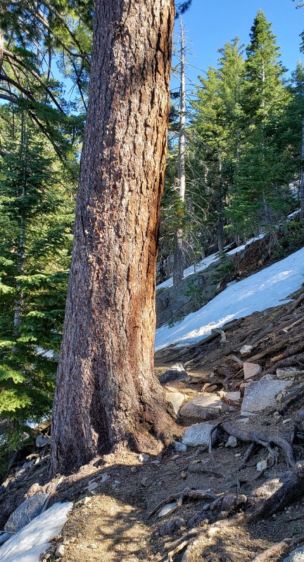 Today, patchy snow started around 7,200ft but didn’t really become consistent until about 8,300ft, after which coverage was 100%, though melting fast lower down given the warm day which reached in 40s pretty quickly, but with the winds, I kept three layers on most of the morning. In the early morning, traction of some sort would help here, in the afternoon it was soft enough for just boots. 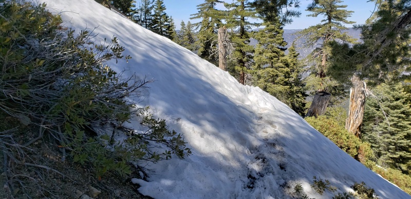 Views of the mountains to the North and verdant valleys below frame early windows on the landscape
After some more hiking through the lower forest on a nice trail, you’ll come to a clearing where surrounding mountains can be seen
You’ll dip back into the forest a bit longer than re-emerge onto subalpine terrain in full snow coverage as you start ascending in earnest. Footprints are mine, pic taken on the descent
The famous Mount Baldy becomes visible to the northwest
Once the snow was fully covering the mountain, no trail or route is visible, so this would be a good place to mark your way with waypoints or keep an eye out for landmarks on your map. 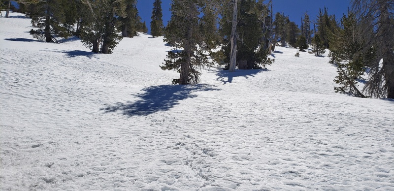 Bluebird all day with Sierra-like skies 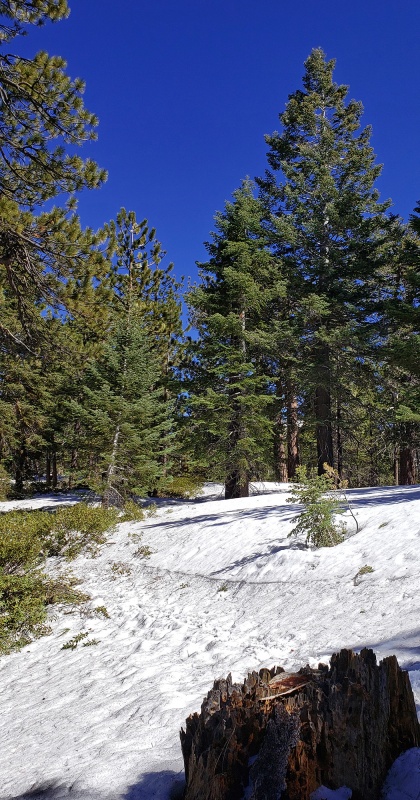 The landscape is beautiful up here. I believe the lake just beginning to be visible is Big Bear Lake. This mountain reminded me of climbing in the Adirondacks in Spring since the peak is covered in deep snow, yet you’re still in a forest, below treeline. 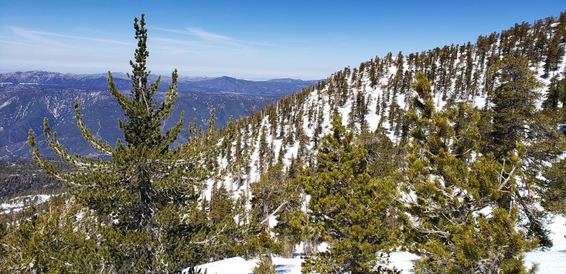
The route to take is to climbers left in the pic below: 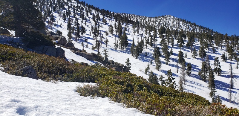 Behold, several footprints appear out of nowhere. There are other trails around this mountain that intersect in a few places. 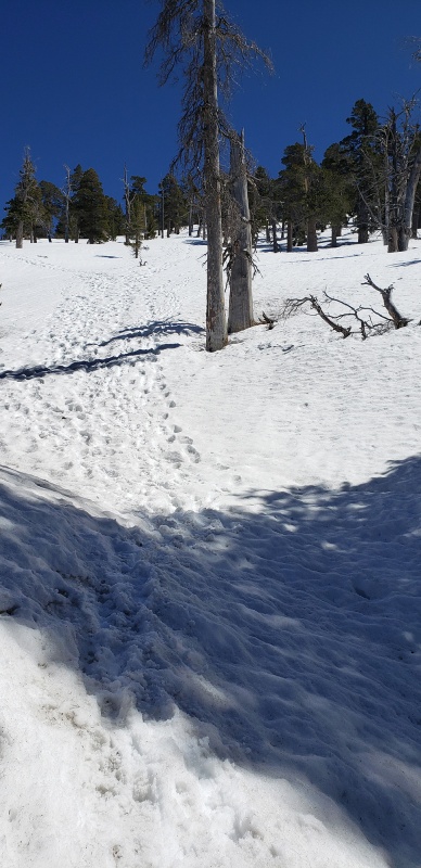 Mount Baldy view again with ancient pine 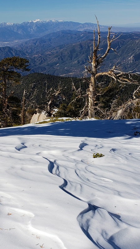
This pic below was the snow scene in December and the spot where I had had enough and turned back on that first attempt. For scale of snow depth, those are 120cm poles covered almost to the handles. 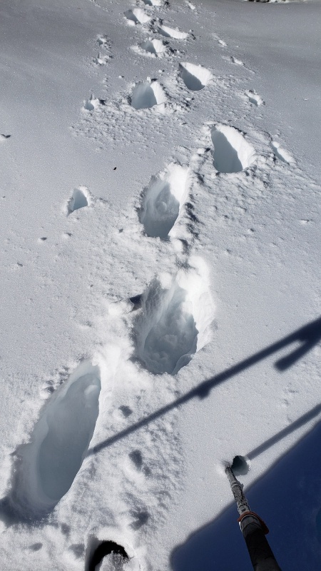
As you climb up the rugged flanks of the mountain, the angle steepens considerably. Was happy to have my axe and crampons here and not just spikes since in the morning before 9:00am this was pretty hard from the melt cycle. Coming back down, when I took this pic, it was much softer. Shallow penitente formations were seen around the mountain 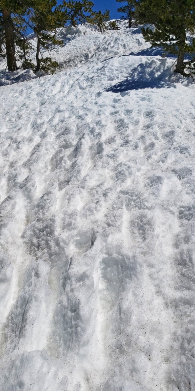 As you climb higher, the forest thins out and the climbing becomes fun and more direct, point-and-shoot climbing to the ridge, no trail or visible route, just deadreackon and go, reach point B and readjust direction. In the morning the snow was perfect for crampons and purchase was great. The term and title "Freedom of the Hills" came to mind... 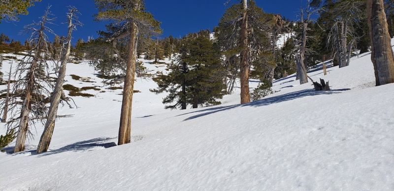 Up up up 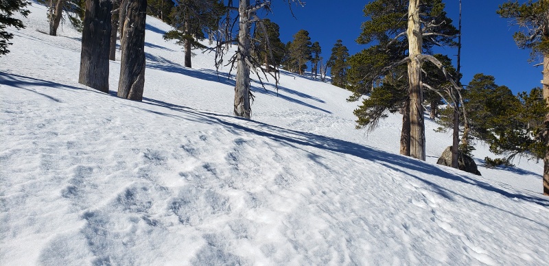 Some clean chutes appear on seemingly virgin snow 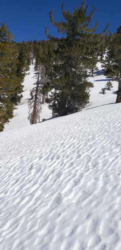 While there are no precipitous cliffs to contend with, there are plenty of spots where you don’t want to slip and fall which would result in a slide of hundreds of yards down the mountain on ice and hard consolidated snow. Given the snow conditions, there was little to no avalanche risk (and hadn’t been for several weeks prior, based on a few conversations I had with the Ranger in recent weeks). I was thinking how fun Whitney would be to do again in snow like this. The final approach to the summit (note there is a small false summit you’ll reach before the summit proper), but this false summit is pretty tame. 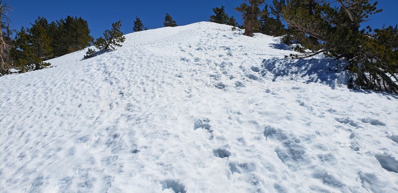
Grand views of San Gorgonio Mountain, also a wonderful climb in itself 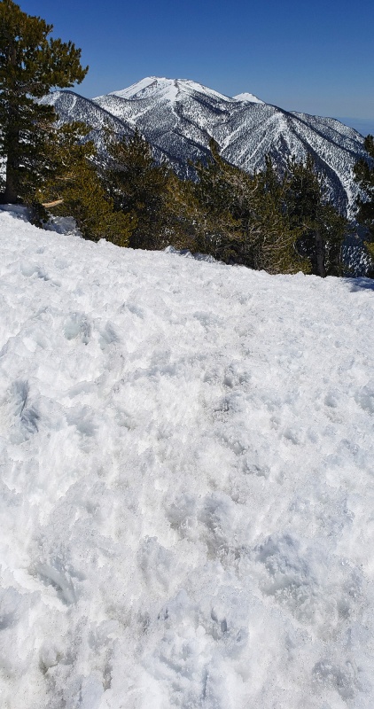 And…Mount San Jacinto across the Valley 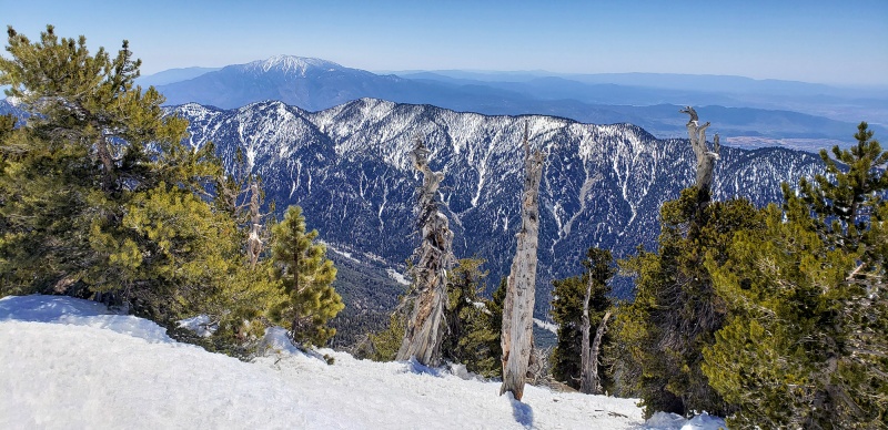 With both peaks from the summit of San Bernardino Peak, taking a rest break 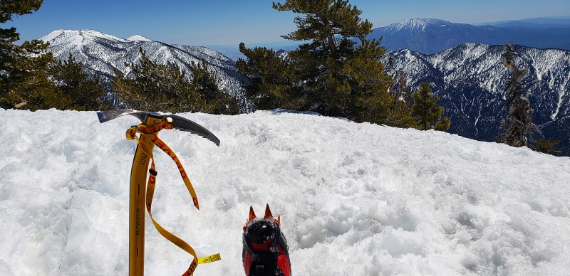
Summit panorama! 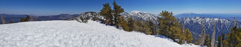 In short, this was a fantastic snow climb with a then solid + 3,000ft snow climb (of a total gain of +5,000ft) with some nice long chutes added in for some great cramponing in a beautiful person-free wilderness area. Later in the day this would not have been too much fun given the quickly softening snow, so if you opt to climb this, and want to do in snow, do it early leaving the trailhead before sunrise for best snow conditions. This report is also the first report ever where I used only my cell phone to take photos, so forgive me if the pics are not up to my normal standards! Notes - Thumbnails for uploaded photos (click to open slideshow): ")
")
")
")
")
")
")
")
")
")
")
")
")
")
")
")
")
")
")
")
")
")
")
")
")
|
| Comments or Questions | ||||||||||||
|---|---|---|---|---|---|---|---|---|---|---|---|---|
|
Caution: The information contained in this report may not be accurate and should not be the only resource used in preparation for your climb. Failure to have the necessary experience, physical conditioning, supplies or equipment can result in injury or death. 14ers.com and the author(s) of this report provide no warranties, either express or implied, that the information provided is accurate or reliable. By using the information provided, you agree to indemnify and hold harmless 14ers.com and the report author(s) with respect to any claims and demands against them, including any attorney fees and expenses. Please read the 14ers.com Safety and Disclaimer pages for more information.
Please respect private property: 14ers.com supports the rights of private landowners to determine how and by whom their land will be used. In Colorado, it is your responsibility to determine if land is private and to obtain the appropriate permission before entering the property.


