| Report Type | Full |
| Peak(s) |
Ogalalla Peak - 13,154 feet |
| Date Posted | 04/15/2019 |
| Modified | 06/09/2019 |
| Date Climbed | 08/15/2002 |
| Author | flyingmagpie |
| Climbing Ogalalla Peak (I) via Ouzel Peak |
|---|
|
Ogalalla Peak is a difficult peak to ascend and descend as a day hike. I’ll explain why in several paragraphs that follow later. Right now I just want to explain why this will be a difficult trip report for me to write. I climbed Ogalalla as a very difficult day hike in August, 2002. “Very difficult” is an understatement. I had built up some endurance and stamina as a distance runner not long before 2002, and I maintained that level of fitness for a long time afterwards through hiking and climbing after I retired. I had the free time. I was living in Estes, and I wanted to spend as much free time as possible in Rocky Mountain National Park. If I found a mountain that excited me, I would repeat it. Most of the 13ers in Rocky I climbed at least twice. The ones that really excited me (Meeker, Chief’s Head, Hague’s, McHenry’s, Alice, for example), I climbed three times, often by variant routes. I even climbed Ogalalla’s closest neighboring 13er to the north, the aptly named Isolation Peak, twice. That is how I spent my time. I didn’t write in my sentence above “I climbed Ogalalla for the first time . . .” because Ogalalla remains the only Rocky 13er I didn’t repeat. I only climbed it one time. It is hard to remember something long ago if you only did it once. Ogalalla is the northernmost 13er in Indian Peaks Wilderness, and also the southernmost 13er in Rocky. The boundary between the Wilderness and the Park splits the summit, as does the Continental Divide. The exact dividing line between Wilderness and Park, and the Great Divide itself is hard to locate exactly on the peak, because it is a gentle, unremarkable, expansive summit. It is remarkable just like Copeland Mountain, however, in that it provides incredible vistas you cannot see from any other place. That makes Ogalalla a very special summit. I believe Ogalalla is the least-climbed 13er in RMNP not because it is a difficult peak to climb technically, but because of the distances and elevation gain involved. There are no technical difficulties on the scrambling route I am about to write, and I will describe as the easiest route to use to accomplish this worthy goal yourselves. Ogalalla is probably over 20 miles round trip from the main Wild Basin trailhead, and well over 5000 feet of gain and loss is involved in the scramble. I climbed Ogalalla as a day hike all right, but it whupped my butt pretty badly in the process, just like my two marathons did. I was one tired puppy when I finally got back to the trailhead. As a day hike, Ogalalla demands a pre-dawn start by headlamp, just like Longs. What it really demands to those who are wise is a one or even two night stay at the closest back country campsite, which is at Upper Ouzel Creek, below Bluebird Lake. Hiking just to Bluebird Lake is a pretty strenuous day hike for most people, about 12 miles round trip, with about 2500 feet of gain and loss. The best scrambling route up Ogalalla involves first climbing a great 12er, Ouzel Peak. Reaching the summit of Ouzel alone involves covering about 8 ½ miles, 17 miles round-trip, and 4600 feet of gain. Once you reach the summit of Ouzel, you can relax over a gentle tundra slope up modest additional gain (maybe a mile and a half and probably less than 1000 feet of additional gain) to the summit of Ogalalla. I can tell you, it is not easy to do all those things, and descend the same route and distance as a day hike. You spend a lot of time up high. To do this climb safely you need to pick a day that you know will be fair and clear all day, with no suddenly developing storms. All of these reasons put together are why I believe Ogalalla is the least-climbed peak in the Park. If you see someone else up there, you can be sure that the other person is a serious mountaineer. When I climbed Ogalalla, I did not encounter another soul past Bluebird Lake. Ogalalla is the opposite of Longs. It nearly always is a lonely summit. Because any good hiker can follow trail signs and maps to Bluebird Lake, I will describe the climb from just below Bluebird. Bluebird Lake is a big beautiful lake in a significant place, like Thunder Lake. But Bluebird is nearly 500 feet higher, at nearly 11,000 feet of elevation, and that last final kick up to the lake is pretty steep. Bluebird Lake is sparsely treed, and surrounded by rocky terrain, while Thunder lies more in a valley surrounded by trees. 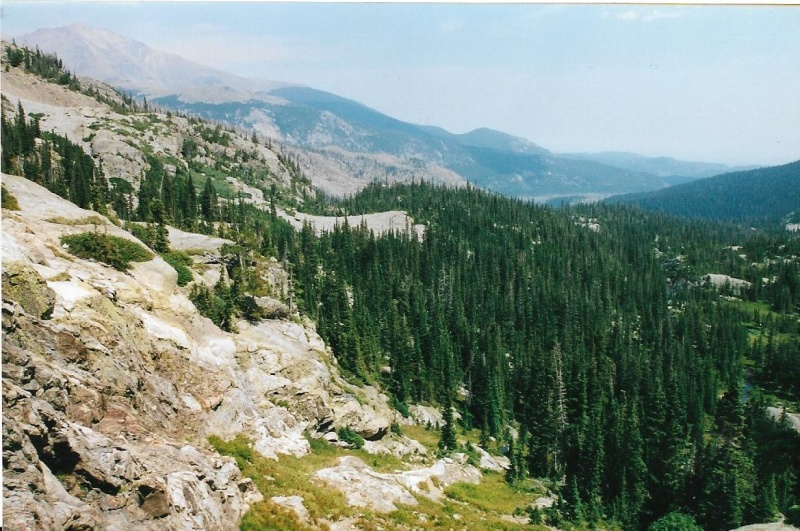
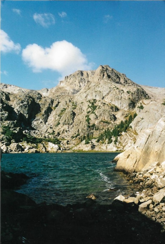
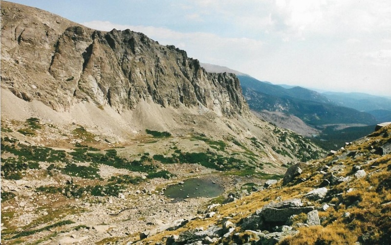
The trail is just below this camera shot looking down-valley. I think I am standing on the trail. Mount Orten and the North Ridge can be seen far away. That must be Meeker further beyond the North Ridge. 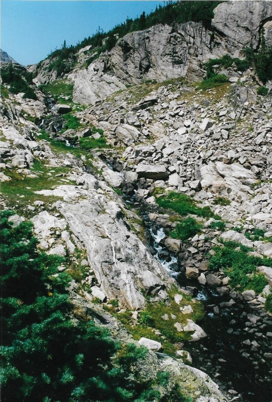
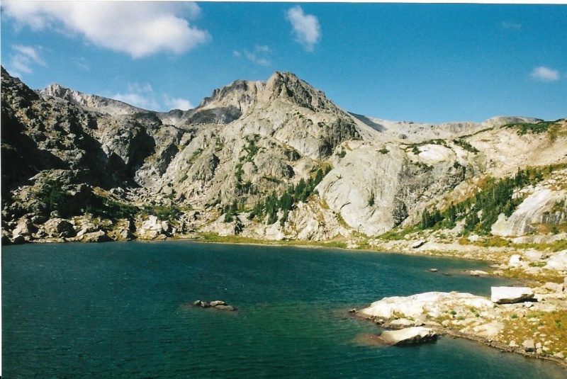
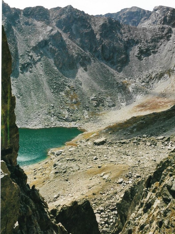
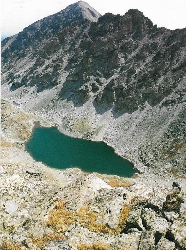
Bluebird used to have a concrete dam. After the Lawn Lake flood caused so much damage and took lives, Park Supervisors thought it would be best to remove all man-made dams raising the level of lakes within the Park artificially, and to return those lakes to their natural levels. Dams fail, as everyone realized after the Lawn Lake flood. Most of the dams removed were earthen dams. Bluebird’s was concrete. Around the outlet to Bluebird, if you look closely, you can still find concrete fragments left behind from tearing out the old concrete dam. Notably, on the shore of Bluebird there is a striking rock formation that reminds me of the yin yang symbol of ancient Chinese Taoism. If you walk around the left-hand, southernmost shore of Bluebird Lake, you can clearly see the yin yang symbol expressed in rock by natural forces. A yin yang symbol formed by nature itself! Wow. And the strangely shaped mountain rising above the yin yang symbol? Why, that is none other than Ouzel Peak, the 12er you must climb first on the scrambler’s route up Ogalalla. To the left of Ouzel rise the slopes of Ogalalla Peak, your destination. 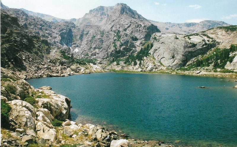
From here you climb up, follow the right shoreline to the inlet, then follow that up a valley. To climb Ouzel, you must cross the outlet to Bluebird, and hike around its righthand, northernmost shoreline to Bluebird’s inlet. There is no bridge across Bluebird’s outlet. For that reason, I don’t think an early-season climb of Ogalalla is a good idea. Snowmelt runoff might make crossing the outlet difficult. Once across the outlet, you hike around the northernmost shoreline to the far side of the lake, and you will find Bluebird’s inlet. You can follow the inlet up a valley that will lead you first to Lark Pond, then to Pipit Lake. Both are above treeline. In Gerry Roach’s great guide to the hikes and climbs in RMNP, I had read that the easiest way to climb Ouzel Peak was by what he calls the Class 2 North Slopes route. I figured once I got above Lark Pond, I could spot the route, and sure enough it is pretty obvious from there. You can reach it the most easily from above Lark Pond. You don’t need to go all the way to Pipit Lake. The route begins up pretty stable rocky slopes. From there, I got onto grassy slopes as soon as I could, because grass holds rock even more stable. Climbing up Ouzel’s north slopes, I got a good look at the south slopes of Mahana Peak above Lark Pond on the other side of the valley. I got a close look at the broad ramp on Mahana that I would use to approach first Isolation Lake, and from there, scramble up a ridge line to the summit of Isolation Peak in September, just a month after this climb. Isolation would be my next Park 13er I told myself, after studying the route I planned to use, just across the valley. 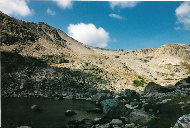
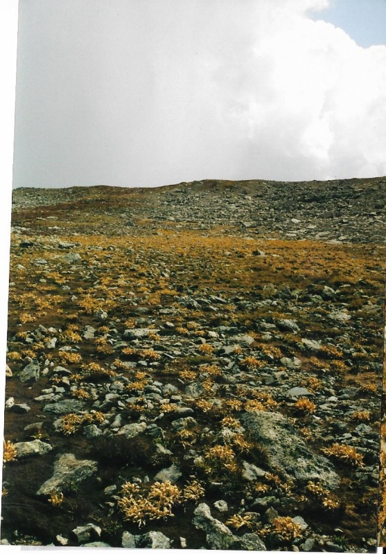
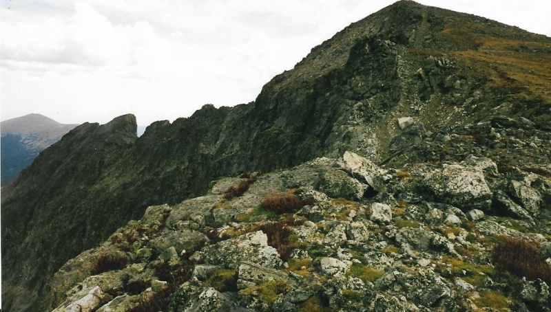
The North Slopes Route up Ouzel Is that grassy slope (yellow grass, Autumn coming on) below the nasty scree slope beyond. See it? Easy slope. Easy start. Easy finish. 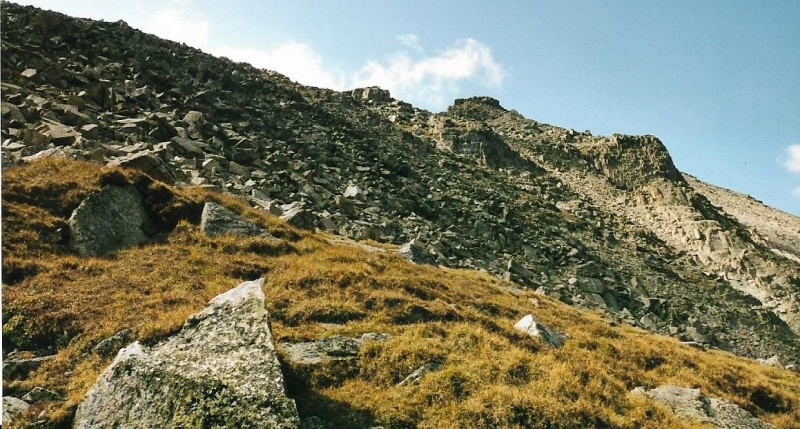
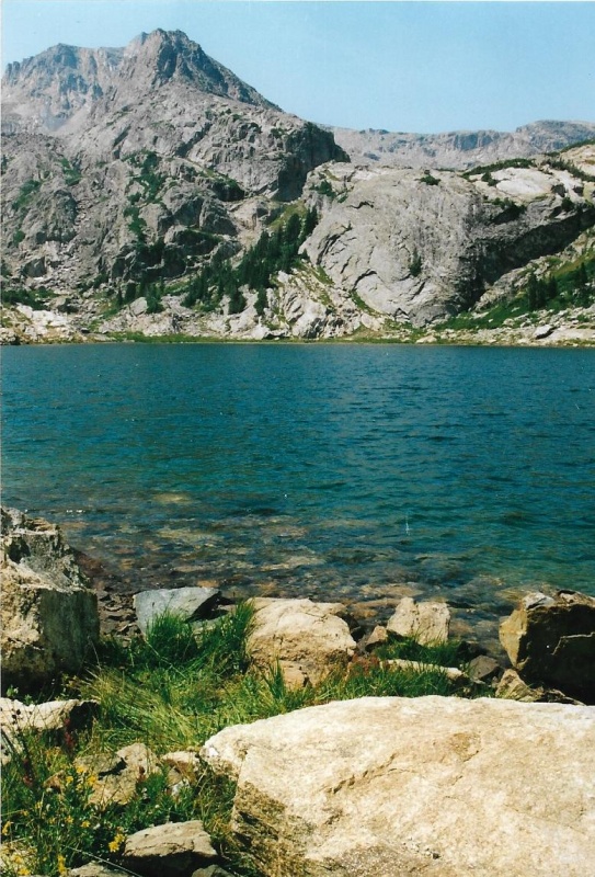
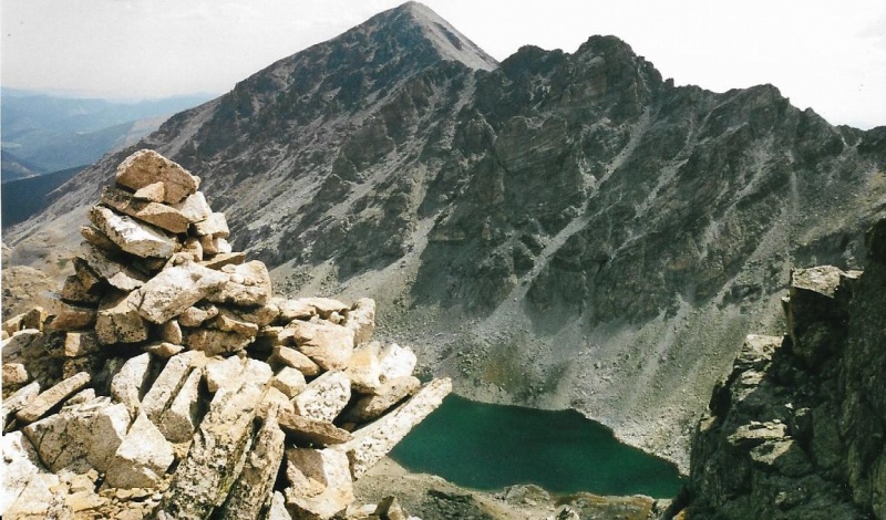
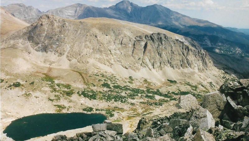
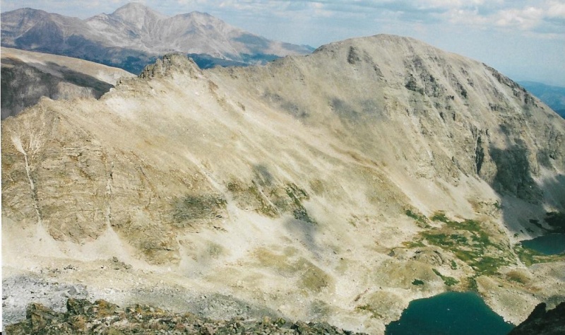
Reaching Ouzel’s summit via the North Slopes route presents no difficulties. Unlike Ogalalla’s summit, Ouzel’s summit is pronounced and definite. The cairn there is pretty unique, and easily recognizable by any climber who has seen it. From Ouzel’s summit, you get a good look at Junco Lake, and above it, Copeland Mountain’s rugged west ridge. Serious technical climbers favor this rugged ridge line as a route by which to reach Ogalalla. Above Junco Lake, you can see the tundra slopes to Ogalalla’s summit. Unfortunately, you must descend from Ouzel’s summit to continue the route to Ogalalla. All the elevation you lose descending from Ouzel, you must regain up the slopes of Ogalalla. Once you have regained all that elevation, you will pass a significant point and ridge line below. That significant point is where Copeland Mountain’s west ridge line (the route technical climbers favor to climb Ogalalla) joins the Continental Divide you are climbing. From here on, the scramblers’ route and the technical climbers’ route have the very same finish! Below the significant point, you are on the northern side of Cony Pass. On the other side of that significant point you are on the southern side of Cony Pass. You are nearing your goal! You do not actually cross Cony Pass. Cony Pass lies below the significant point, and on Copeland’s west ridge itself. As steep as the scree slopes are to Cony Pass, I do not believe Cony Pass is a good route to use to climb Ogalalla Peak. You would take three steps up, then slide two steps back down through that steep loose scree. 
Also, as I followed the ridge line, I got a glance of a slope running down to Junco Lake below. I believed this east-facing slope nearest Ouzel Peak might be doable as an alternate descent route from Ogalalla. I didn’t descend that way on this climb, though. I descended by the same North Slopes route from Ouzel Peak that I had used to ascend. What I did do on my subsequent climb of Isolation, however, in September, was to go out of my way to climb Ouzel again from Isolation. Then I sought out the couloir and eastern slope I had spotted on this Ogalalla climb, and successfully descended to Junco Lake. The slopes did go! Not only did they go, but now, in retrospect, I realize that slope would be a much better way to climb Ogalalla. Why? It would be much shorter in distance from the trailhead, with much less total elevation gain and loss, thasn climbing Ogalalla via Ouzel. For that reason, I will use that alternate descent in a second Ogalalla trip report I will write later. The alternate descent route I used on my second climb of Ouzel is workable also as an ascent route up Ogalalla. Ten miles with over 5000 feet of gain just wore me out so much this, my first and only climb of Ogalalla, that I wasn’t up to trying any new route on the descent. And I had the same distance to hike back, as I lost elevation, gained it again climbing Ouzel, and then lost all the remaining elevation as I hiked all the way back to the trailhead.I was tired, and on this climb I just wanted to stick to my ascent route because I was familiar with it, could descend it sleepwalking, and knew it would would work. 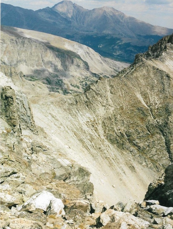
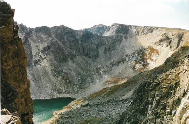
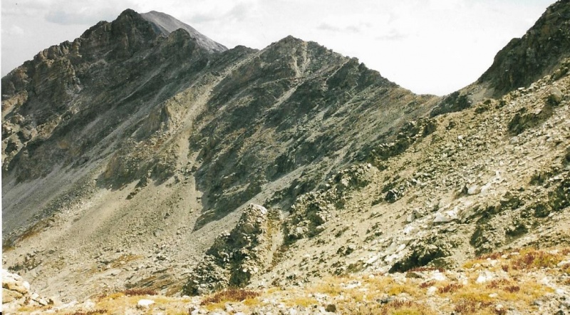
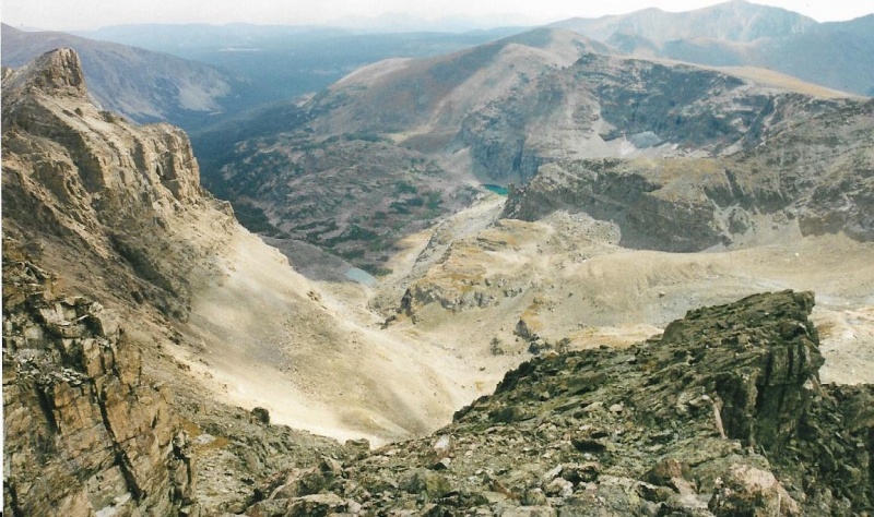
The scree slope leads to Cony Pass. View from the South. 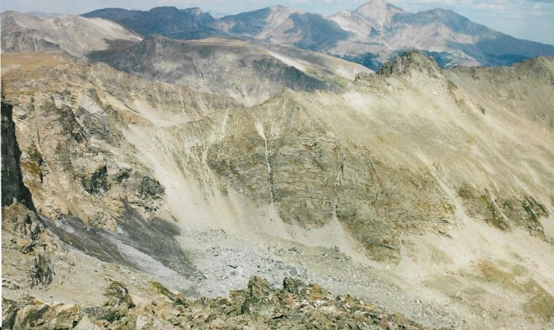
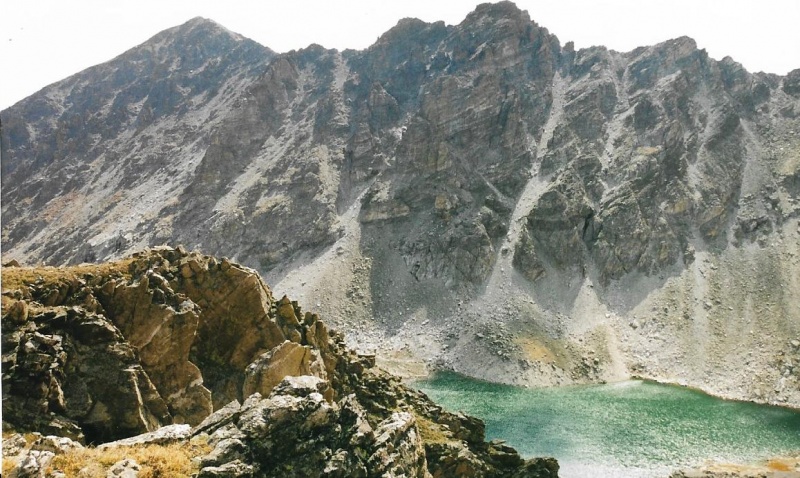
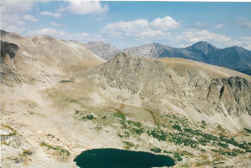
Once you climb high enough up the slopes of Ogalalla, the great views available in all directions become awesomely apparent. 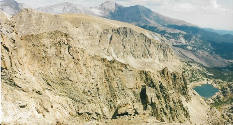
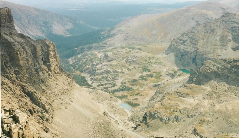
Prior photos were from the edge, looking down. 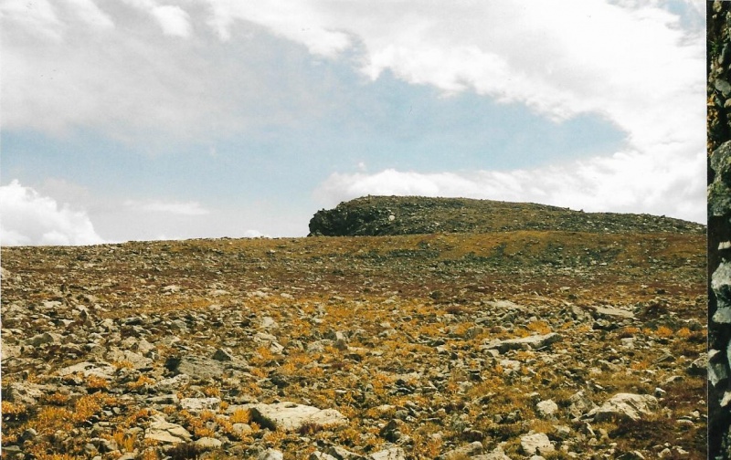
That right border is just to fool the scanner into not cutting off the sky, which it does all too often. 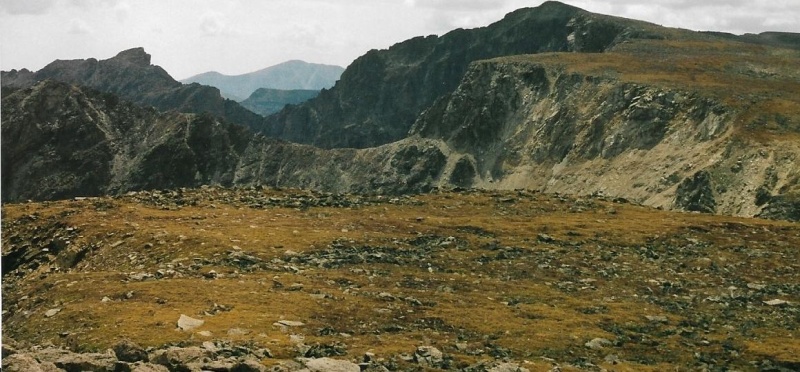
Ogalalla’s summit got closer and closer. Finally I was there! I don’t remember whether I found a cairn, or a register. Usually, I remember to take a picture of a register tube if I find one. I always take a picture too of the summit cairn if I find one. But on Ogalalla’s summit, tired, I didn’t think clearly enough to do either. I was mostly struck by the great views, and particularly the only views of the St. Vrain Glaciers I have ever experienced. That day remains the only day I have seen these great glaciers. Took two photos of them from the summit. 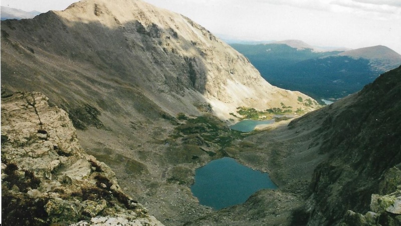
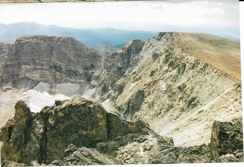
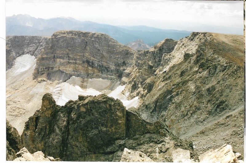
After I had taken two shots of the glaciers, I put my camera back into my pack. I took a long drink of water, and ate an energy bar, both of which I had sorely needed for some time, but was too enthralled by the views to actually stop and do before now. Then I shouldered the pack again, turned around, heaved a big sigh, and headed back down the ridge line toward Ouzel’s summit. It took me a long time to get back down to Ouzel. On Ouzel’s summit, I hadn’t found a register or a tube on my ascent. Just the cairn. So I didn’t bother to look for a register again when I reached the cairn. I just headed down the North Slopes immediately. I knew it would be a long slog down past Lark Pond to Bluebird, and then a long hike back to the Wild Basin Trailhead, the parking lot, finally my truck. Whew! Whew-ee indeed. That was what I exclaimed to myself inside my head when I finally reached the truck. That was some hellacious climb! Then I thought mostly about the long hot bathtub soak I would need when I got home, just to ease the ache and pain in my every tired muscle. Even food wouldn’t be appealing until after that. A few days after my climb, I described the route I had climbed to Ogalalla’s summit to Teresa Gergen. She was so inspired, and wanted Ogalalla’s summit so badly, she repeated my route herself that fall, and successfully climbed both Ouzel and Ogalalla. With her sharp eyes, she looked for a register on Ouzel’s summit longer and harder than I had looked. She did find one of those fruit jar registers. She told me she took out the register inside, and was about to write down her name, but then thought for a moment and wrote down mine for me, and added her own afterwards. Thank you, Teresa! She put the register back in the fruit jar, put the jar back where she had found it, and then began the short descent from Ouzel and subsequent climb to regain the lost elevation up the slopes toward Ogalalla. I don’t remember what she told me about finding up there. I don’t remember whether she told me she found a register tube or cairn. Too long ago! Thumbnails for uploaded photos (click to open slideshow): ")
")
")
")
")
")
")
")
")
")
")
")
")
")
")
")
")
")
")
")
")
")
")
")
")
")
")
")
")
")
")
")
")
|
| Comments or Questions | |||||||||||||||
|---|---|---|---|---|---|---|---|---|---|---|---|---|---|---|---|
|
Caution: The information contained in this report may not be accurate and should not be the only resource used in preparation for your climb. Failure to have the necessary experience, physical conditioning, supplies or equipment can result in injury or death. 14ers.com and the author(s) of this report provide no warranties, either express or implied, that the information provided is accurate or reliable. By using the information provided, you agree to indemnify and hold harmless 14ers.com and the report author(s) with respect to any claims and demands against them, including any attorney fees and expenses. Please read the 14ers.com Safety and Disclaimer pages for more information.
Please respect private property: 14ers.com supports the rights of private landowners to determine how and by whom their land will be used. In Colorado, it is your responsibility to determine if land is private and to obtain the appropriate permission before entering the property.


