Download Agreement, Release, and Acknowledgement of Risk:
You (the person requesting this file download) fully understand mountain climbing ("Activity") involves risks and dangers of serious bodily injury, including permanent disability, paralysis, and death ("Risks") and you fully accept and assume all such risks and all responsibility for losses, costs, and damages you incur as a result of your participation in this Activity.
You acknowledge that information in the file you have chosen to download may not be accurate and may contain errors. You agree to assume all risks when using this information and agree to release and discharge 14ers.com, 14ers Inc. and the author(s) of such information (collectively, the "Released Parties").
You hereby discharge the Released Parties from all damages, actions, claims and liabilities of any nature, specifically including, but not limited to, damages, actions, claims and liabilities arising from or related to the negligence of the Released Parties. You further agree to indemnify, hold harmless and defend 14ers.com, 14ers Inc. and each of the other Released Parties from and against any loss, damage, liability and expense, including costs and attorney fees, incurred by 14ers.com, 14ers Inc. or any of the other Released Parties as a result of you using information provided on the 14ers.com or 14ers Inc. websites.
You have read this agreement, fully understand its terms and intend it to be a complete and unconditional release of all liability to the greatest extent allowed by law and agree that if any portion of this agreement is held to be invalid the balance, notwithstanding, shall continue in full force and effect.
By clicking "OK" you agree to these terms. If you DO NOT agree, click "Cancel"...
I first climbed Mount Alice through Boulder-Grand Pass above Thunder Lake in August, 2002. I so enjoyed this long hike and climb that I repeated it in September, 2002, just to experience again the joy that Mount Alice and Wild Basin itself can provide to any hiker/climber. To top that off, Lynn Prebble and I performed an entire circuit of the mountain in September, 2003. We ascended Alice that time up Hourglass Ridge from Lion Lakes and descended to Thunder Lake via Boulder-Grand Pass. I started and ended all my climbs of Alice from the main Wild Basin trailhead, and by also climbing Alice’s nearest neighbor 12,222 foot Pilot Mountain along the way each time. Gerry Roach labels the Hourglass Ridge climb of Alice one of his “Classic” hikes and climbs. It is that, all right, for sure. If you don’t know who Lynn Prebble is, I will ask you to do a Google search for “‘Lynn Prebble,’ Everest". You will quickly find out. I will ask you to do some other Google searches as you read this trip report. There is a lot to learn here. Keep your Google tab open. My every subsequent climb of Alice just got better than the last one had been. I didn’t believe that could be possible, but it was.
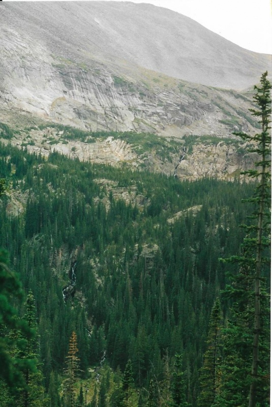
Though it is a peak, “Mount” seems to fit this one just fine. Alice Peak just doesn’t sound right. I don’t know how a peak can express gender, but this one definitely does for me, and she is definitely female. On my September, 2002 climb I definitely fell in love with Alice. You will see why. Autumn, or rather the last warm days of Indian Summer, mark a particularly fine time to climb Alice. The weather is at its most reliable state during Indian Summer. If the morning starts out fair and clear in Indian Summer, it generally will stay that way the rest of the day with no sudden storms. Alice takes a long time and many miles to ascend and descend as a day hike. You spend a lot of time up high, and you don’t want to deal with any sudden storms. You might want to do this one with an overnight or two at the back country camp-site at Thunder Lake. Thunder Lake alone is nearly 7 miles from the Wild Basin trailhead. It is probably over 9 miles total to the summit to the summit of Alice from the trailhead. I believe the total distance from the trailhead to Lion Lakes and up Hourglass Ridge to the summit is just about the same. If you climb in Indian Summer you can also enjoy the added benefit of fall color. There is a shortcut trail that I would advise you to take both ascending and descending, though by taking the shortcut you will miss viewing both Calypso Cascades and Ouzel Falls. Waterfalls are usually at low flow in the fall anyway. You will get a far-away view of Mertensia Falls before you reach Thunder Lake.
Far Away View of Mertensia Falls at Low Flow in Autumn.
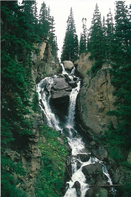
One spring I bushwhacked off the trail with my good SLR Pentax just to get a picture of the top of Mertensia Falls at nearly full flow. I couldn't fit the entire falls into one photo close up. It is just too big. This is the best I could do.
Mertensia Fallsa Close Up in Spring.
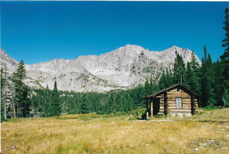
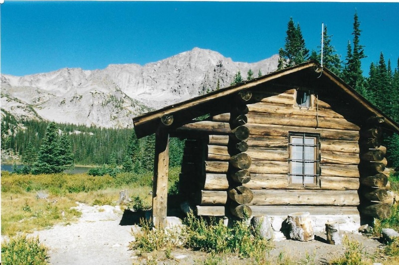
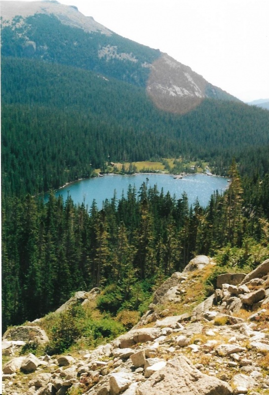
Thunder Lake provides a stunning and beautiful setting for any climb or hike. The Wild Basin Patrol Cabin is at Thunder Lake. I believe this patrol cabin is the most beautiful and historic patrol cabin ever built in the Park, though its design is simple. It is very old, and has historic value. You might want to Google “Thunder Lake Patrol Cabin” to find out why. A particularly notable and historic Park Ranger used to sometimes stay in this patrol cabin. You might want to Google “Jack Moomaw” or “Jack Moomaw RMNP” to find out something about this notable man. Worth doing. That said, I will now go on with my photographs and description about climbing Mount Alice from Thunder Lake.
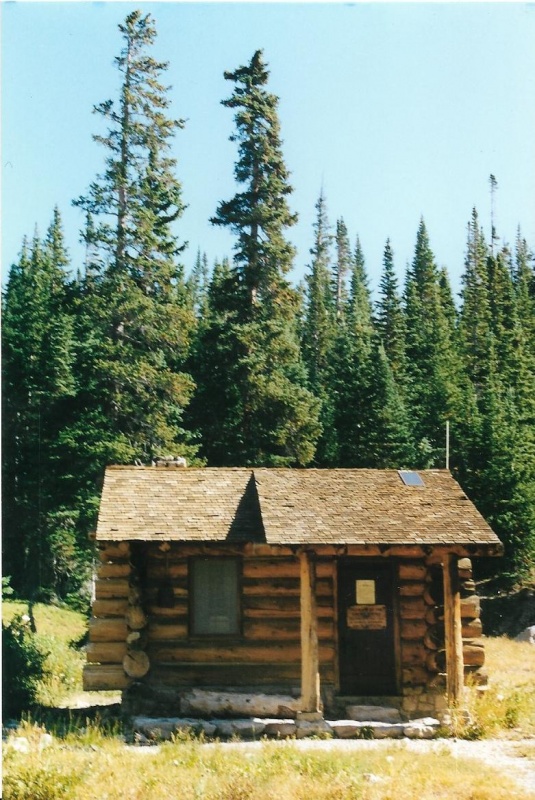
My first 5 photos will be of the Thunder Lake Patrol Cabin.
Thunder Lake and Patrol Cabin. Pilot Mountain and Mount Alice Above.
A Closer View.
Front View.
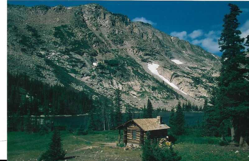
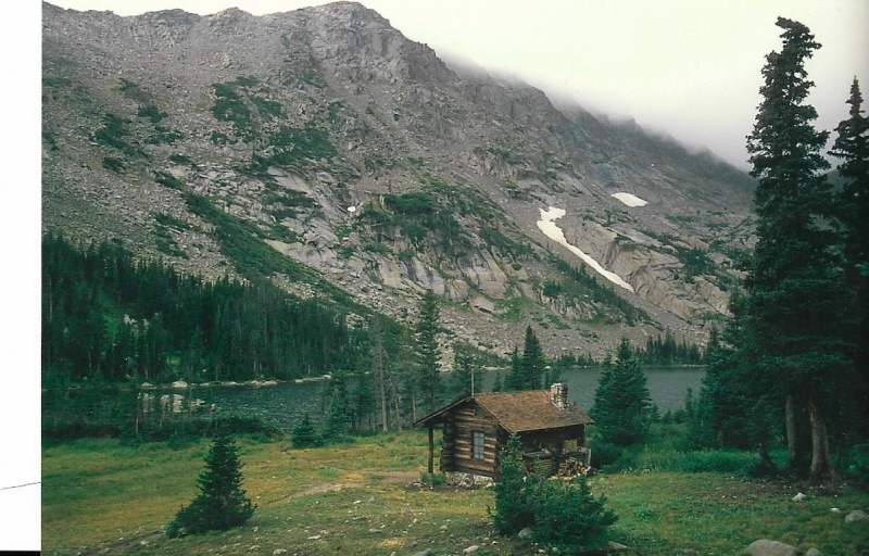
Here are the two best photos I ever took of the lake and patrol cabin with my good 35mm Pentax SLR. Different weather conditions, different lighting. That's Tanima Peak, a 12er, behind.
Thunder Lake Patrol Cabin.
Again.
Then I told you I wanted to refer back to a photo I first showed you in my trip report on climbing Copeland Mountain. I not only got to catch my first glimpses of Isolation and Ogalalla Peaks from Copeland, I also got my first view of the summit of Pilot Mountain from Copeland. The summit of Pilot Mountain is actually the route from Boulder-Grand Pass to the summit of Mount Alice. When you climb Alice from either direction, you are actually walking the Continental Divide! You do that too when you climb either McHenry’s and Chief’s Head from Stone Man Pass! What a trip, huh? In places (like at the three passes themselves) you can stand with one foot on one side of the Divide, and the other foot on the other side. A link is appropriate here to a great song written by the late, great Kate Wolf, and performed here by Nanci Griffith and Emmylou Harris:
If the link doesn't work for you, just do a Google search for "'Across the Great Divide' Nanci Emmylou" and click on the link that comes up. Enjoy!
By the way, beautiful photos will scroll on your computer screen when you listen to this song. Many of these photos were taken of mountains as far away as Alaska. But some photos were also taken as close to home as Rocky Mountain National Park. Noteworthy among these is one that displays the distinctive shape of Taylor Glacier. I believe the elk photo was taken in Rocky. And the montage of photos ends with the end of the song with that great winter view of Chapin, Chiquita, and Ypsilon rolling like waves in some great rocky sea.
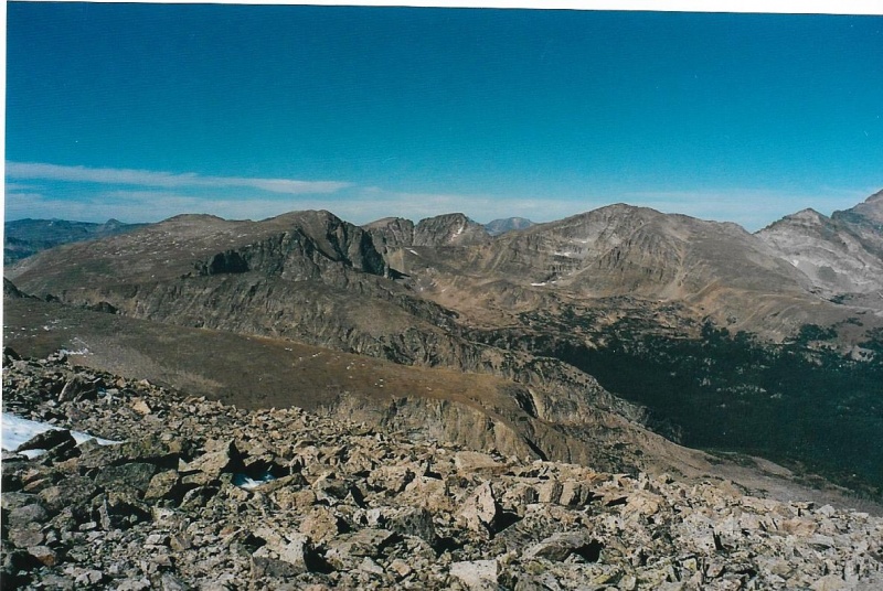
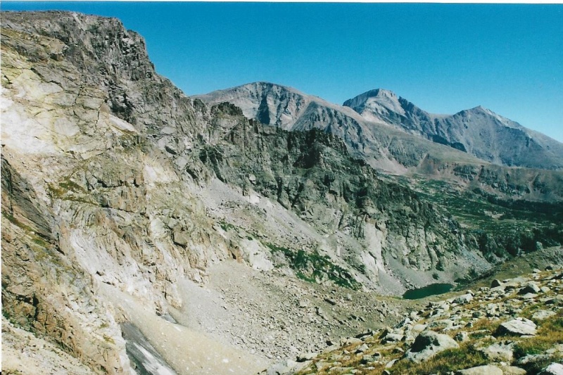
Pilot Mountain"s Summit Is The Crest of the Third Ridge In This Photo. First rocky slope is Copeland below where I stand. Second ridge is, I believe, Tanima's. Alice is above Pilot. McHenry's, with its Notch, farther right. The North Ridge emerges from the left edge of the photo.
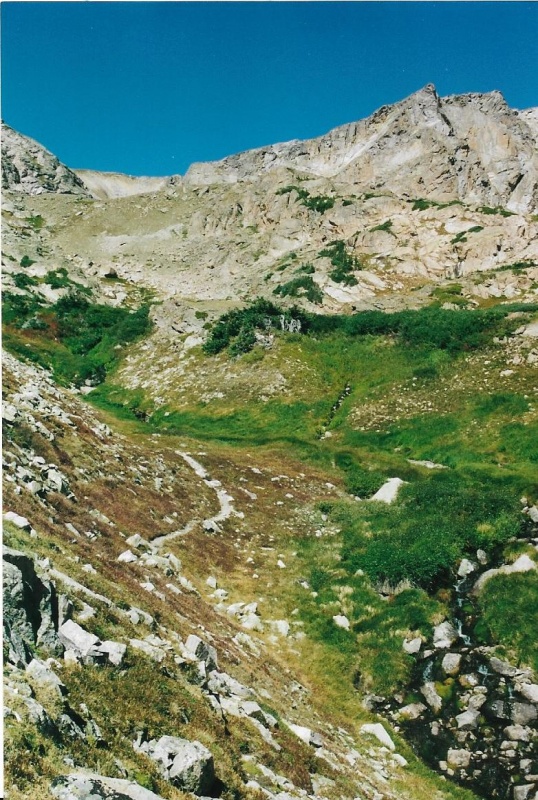
From the Patrol Cabin at Thunder Lake I circled around the lake’s rightmost shoreline, then followed a climber’s trail that broke away from the trail around the lake, ascending up a long slope toward Boulder-Grand Pass. I might have had to do a little bushwhacking to find the climber's trail. Don't really remember. Didn't take any photos down low around the lake.
Looking Back at Thunder Lake.
First View of Boulder-Grand Pass From Just Above the Climber's Trail to It.
Closer To The Pass. On my September Climb, I began to notice the fall colors. Stream is from Boulder-Grand's tarn above.
September Climb.
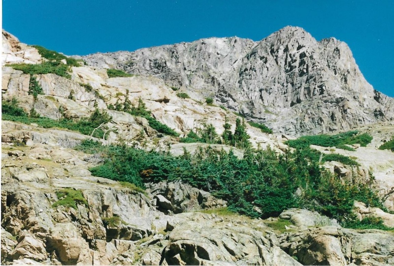
That's Pilot and Alice Above The Rocky Slope Toward The Pass.
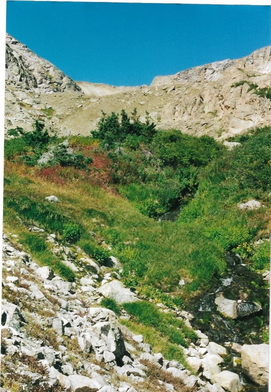
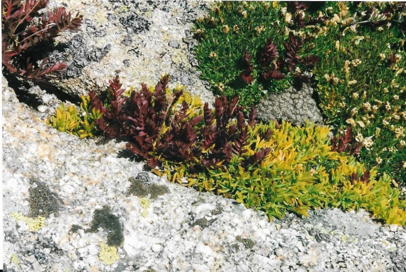
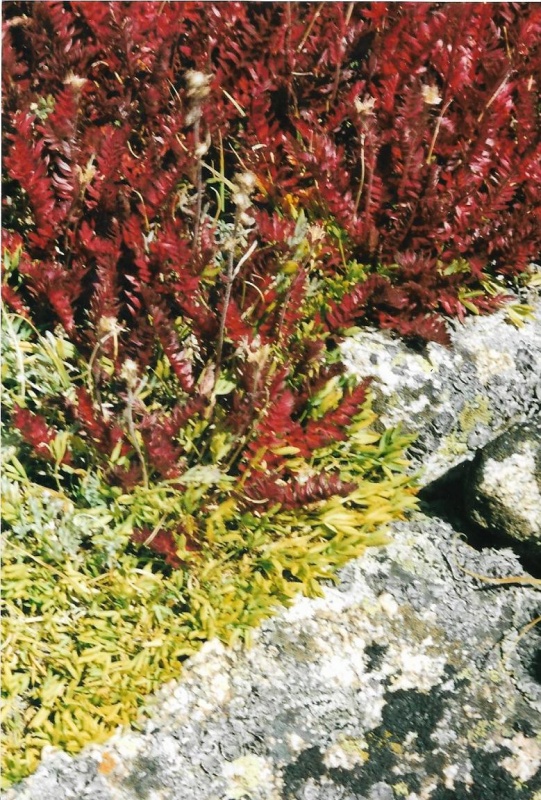
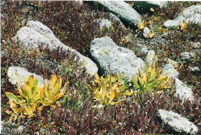
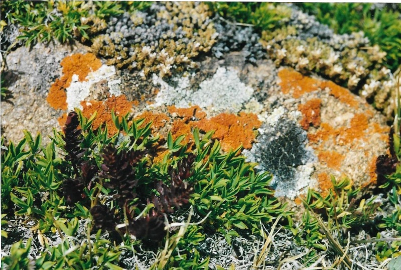
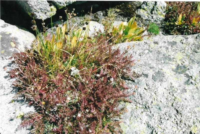
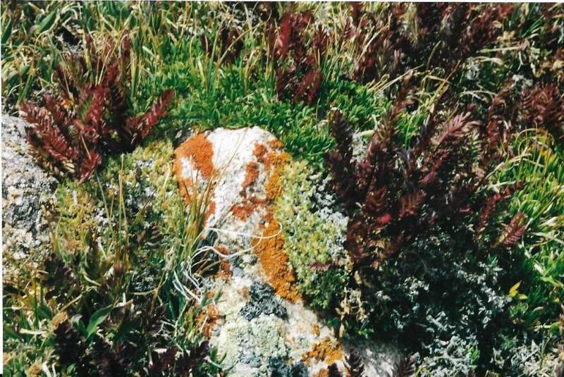
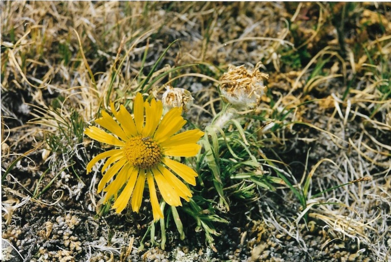
Photos from both my 2002 climbs are inter-mixed in this trip report. On my first climb, I carried my pocket 35mm Pentax IQZoom, on my second climb I carried my good 35mm Pentax SLR. You will notice the difference between the photos from the first and second climbs as a result. On my second climb I found myself hiking amidst a feast of the color displayed by fall foliage. A riot of contrasting colors, really! I couldn’t stop taking photos. It was the striking contrasts between the rocks, the lichen, the reds, the greens, the yellows of the foliage that caught my attention! I share with you a few views of the riot I discovered, and a photo of the last blooming wildflower I found blooming just for me up high in 2002.
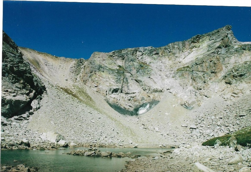
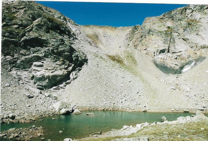
Then I approached at last Boulder-Grand Pass, and it’s tarn below.
First Close View of Boulder-Grand.
Another View.
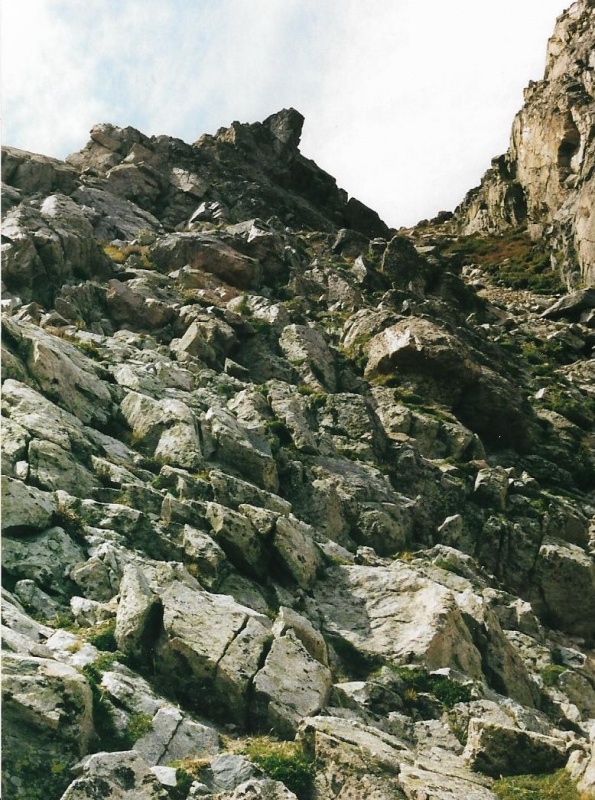
I decided that the most secure footing up the pass was that rocky rib on the right, not the scree. I decided that the rock rib was my ticket to the two peaks.
Climbing the Rock Rib Up Boulder-Grand.
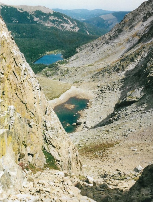
Looking Back Down The Rock Rib. That's the tarn, then Thunder Lake. Mount Orton Beyond that. Ouzel fire burn scar.
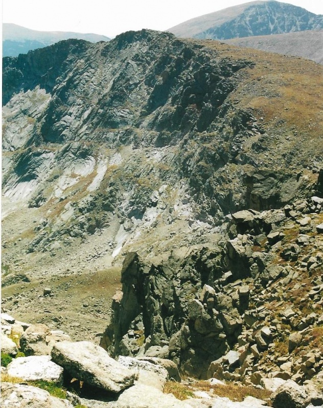
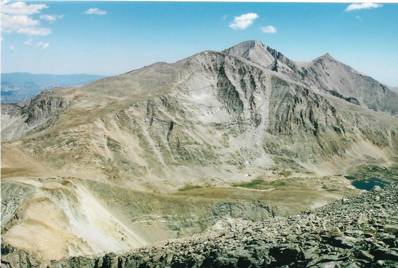
Mount Alice Close By.
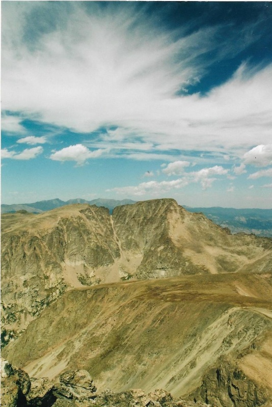
Even Higher. Falcon Lake below. Chief's Head. Longs, Loft, Meeker.
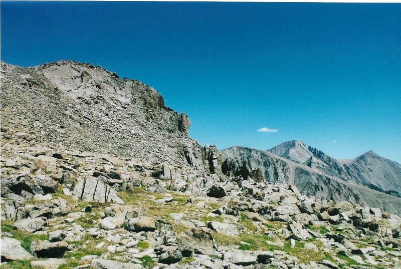
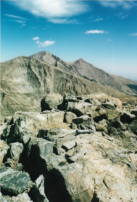
Beyond Boulder-Grand, Summit of Pilot.
Looking Back At Pilot From the Slopes of Alice.
Final Slope Up Alice.
That's Isolation Peak above Alice's Slope.
Nearing the Summit of Alice. You get a look at the ramp leading up to Hourglass Ridge from here. Snowbank Lake below. Chief's Head above Snowbank. Lynn Prebble and I would climb Alice up this ramp and over Hourglass in September of the next year.
Summit Tube and Register.
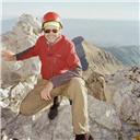
Summit Register Tube. I am alone on the summit. Wearing a hat this time, rrk! Turned around backwards just for style's sake.
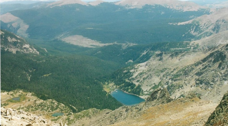
Thunder Lake Below Alice's Summit. Ouzel burn scar a bit farther away.
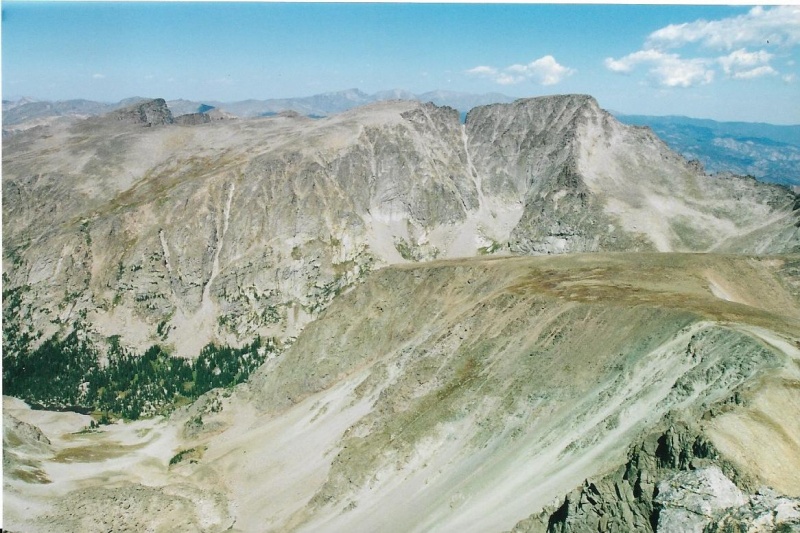
McHenry's Peak, Powell (little bump on the ridge) and Then Taylor.
I will end this trip report with a photo taken with my good SLR of Mchenry’s, the top of Hourglass Ridge (don’t worry, you don’t get cliffed-out at the top as it appears here and in the photo above and before this one), the tundra in full color, and a great drama of clouds and sky taking place above! That’s the Mummy Range in the far distance beyond McHenry's. That speck above center in this photo is not a bit of dirt. It is a hawk cirling high above just to watch me summit! Ha! But it really is a hawk.
Thumbnails for uploaded photos (click to open slideshow):
I see you've posted a TR, I find myself smiling involuntarily. :)
They are that good. Thank you for taking the time & effort to post them.
The RMNP 13ers are special. I've enjoyed all the ones I've done to date.
Mt Alice is on my short list, Jay - wanna join me?
I appreciate the info you've shared!
Cheers!
I'll throw in my vote for Mt. Alice as a great RMNP Wild Basin hike.
I did it once following one of your routes (the loop around
Lion Lakes I/II, Snowbank Lake, hourglass ridge up to Alice,
and down by BGP and Thunder Lake). It was loads of fun to
relive it through your nice narrative and pics.
I do have one quibble (or maybe just need clarification)
about exactly where Pilot Mountain is. My understanding
(based on Lisa Foster's book) is that Pilot is not on the
ridge between Alice and BGP, but rather is a bit east of the
ridge (and is maybe not so easy to get to from the ridge).
Here's what Lisa Foster says about Pilot:
"Thus confusing little peak is not on the Continental Divide
between Boulder-Grand Pass and Mt. Alice, but is the jagged
apex of an arm that runs east from the Continental Divide,
0.6 mile southeast of Mt. Alice. Pilot Mountain goes against
the idea that a summit is the highest point on a particular
feature, and it is not the highpoint on the ridge."
I wish I could post a picture of what I think (perhaps
mistakenly) is Pilot, but the pic is not web accessible and I
apparently can't just upload a photo to this comment.
Maybe let us know what you think?
mathguy:
No doubt you and Lisa are both right! I just didn't know in 2002 and 2003. I assumed the high point was the summit of Pilot. You've got to remember the time-frames here. I don't think 14ers.com existed in 2002-03. Maybe some of the other climbing websites did, then, but I didn't know about them. I was climbing from written guidebooks, mostly Roach's great "Rocky Mountain National Park: Classic Hikes and Climbs." Lisa Foster's great guide to the Park didn't exist then for sure. And the older Park maps (look at them, if you have one) aren't that precise as to where the summit of Pilot actually is. Or maybe I just didn't look at them correctly. I have been wanting to thank you for the kind comments you have made on my past trip reports. Thank you! And I think my best stance here is to admit my ignorance in 2002-03, and to thank you for this valuable correction to my Trip Report, which will definitely help others. So I didn't tag Pilot. Believed I did, using the resources I had. Still don't own a GPS device or a smart phone. My cell phone is a flip phone. Old dogs are not quick to learn new tricks. Thank you for this valuable info. --John
mathguy;
Here's what I truly think. I don't understand how the high point of a mountain cannot be its summit. That is the very definition of "summit." Let me explain the situation here. I climbed the high point of Pilot Mountain three times. That high point is connected to a short easterly ridge to a point some mapmaker evidently decided was Pilot Mountain. My high point is definitely on the ridge between Boulder Grand and Mount Alice, and IS the Continental Divide. The lower easterly point isn't even high enough to be on the Continental Divide. What I believed to be the high point of Pilot Mountain is also connected to a very long northerly ridge line to Mount Alice far away. That high point definitely isn't part of Mount Alice. That high point is much closer to Pilot on the maps than it is to Alice. Why is that prominence below considered to be Pilot's summit, and not a sub-summit of the high point on the short connecting ridge line? You explain that to the mapmaker. Mountaineers know the Continental Divide. It's not a line on a map, it's terrain they can see and climb. Summits are summits. You can see and climb them. A lower point on a short connecting ridge line is not the summit. It is a sub-summit. Mountaineers know that . Evidently those who put names on maps don't. I didn't miss true summit. I climbed it three times, all right. I missed the name on the map. My 1991 edition of the Trails Illustrated map does not have a cross-hatch anywhere on Pilot Mountain. On the 2005 revision of my map taken over by National Geographic, a cross-hatch was added not over the true summit, but over the lower sub-summit bearing the name. By mountaineering standards, I climbed Pilot Mountain, all right.--John
Yep, it makes little sense that the "official" summit of Pilot is where
current topo maps put it. Looking at it on Google Earth I don't even see
a dimple where the official summit is. But so it goes with us humans!
A lot of things get named because they are prominent from below. Lone Eagle would be an excellent example. The Maroon Bells would be another example; from the west they look like one mountain, with 2 bumps on either end. BTW, the official summit of Pilot is a fun scramble.
there's other suspect 'summits' out there - I believe Pilot is actually a point of rock based on pictures and trip reports I've seen, very exposed class 4 scramble. The Lone Eagle comparison is good - I think similar 'summits' in the park are Little Matterhorn and possibly Notchtop Mtn (the pillar across the notch has the tick mark on some maps but is lower). That one depends on who you ask - Gerry Roach has a good paragraph on it, Foster says something a bit different. I've been on some other officially named 'summits' with no prominence and wonder why they're named - barely a bump on a ridge.
Alice is a long haul to a great peak - looks a bit like a smaller Longs Peak from the east and northeast. I believe the summit is actually east of the continental divide - this is odd because everything slopes down and to the west from the summit, but the divide drawn on the map and the Boulder/Grand county line go a bit to the west of the summit, same with Tanima Peak. I also thought Alice's western summit block was a bit higher and had the register tube, but the eastern one feels more 'summity'.
Thank you mathguy, Dave Landers, and cougar, all, for your two bits above. I learned a bit from this exchange. Every true journey is a learning experience, as I wrote in my introduction to this series of TR's, and I think all 3 of us are on true journeys climbing true summits. Dave Roberts wrote a fine book on that, titled of course, "True Summit." I read that book a long time ago. I think its worth my second read, now. I know a lot more now than I did back then. Worth a read for all climbers. If you don't know Roberts, google the name in quotes. "David Roberts,." Add the word "climber" to your search. See what comes up! He's impressive.
Caution: The information contained in this report may not be accurate and should not be the only resource used in preparation for your climb. Failure to have the necessary experience, physical conditioning, supplies or equipment can result in injury or death. 14ers.com and the author(s) of this report provide no warranties, either express or implied, that the information provided is accurate or reliable. By using the information provided, you agree to indemnify and hold harmless 14ers.com and the report author(s) with respect to any claims and demands against them, including any attorney fees and expenses. Please read the 14ers.com Safety and Disclaimer pages for more information.
Please respect private property: 14ers.com supports the rights of private landowners to determine how and by whom their land will be used. In Colorado, it is your responsibility to determine if land is private and to obtain the appropriate permission before entering the property.


")
")
")
")
")
")
")
")
")
")
")
")
")
")
")
")
")
")
")
")
")
")
")
")
")
")
")
")
")
")
")
")
")
")
")
")
")
")