| Report Type | Full |
| Peak(s) |
Capitol Peak - 14,138 feet "K2" - 13,668 feet |
| Date Posted | 03/20/2019 |
| Date Climbed | 08/31/2018 |
| Author | DeTour |
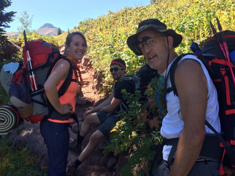
| Additional Members | CharmingCatastrophe, Lucky |
| Not this time: Summer Capitol attempt |
|---|
|
First things first: We didn’t summit Capitol. We turned around right after crossing the knife edge, facing threatening weather. I’mposting a TR anyway, hoping to offer a few tidbits that might be of value to others, including some details on the gullies just past the K2-Daly saddle that I hadn’t found in any other Capitol TR. Over 4,000 words is an absurd amount of detail for a non-summit TR, but hey, it’s been a very cold Chicagoland winter so I’m taking the time if you have the interest. Our group was our usual foursome, including my brother Mark (“Lucky” on 14ers.com), daughter Maryjane, and son-in-law Dennis. We gave ourselves a full day to hike in to Capitol Lake and camp, spending the evening before at a riverside motel in Basalt. A day hike of Capitol is out of the question for us old flatlanders, and besides we’ve grown to appreciate a back-country camp despite the difficulties. We rolled for the trailhead the morning of Aug. 30. My expectations for the hike in were defined by the difficulty of a six-mile trek with heavy pack, and the challenges the peak would present the following day. I viewed the hike as a necessity to reach a special place, not really expecting to enjoy it. I suppose the unappealing “ditch trail” name, and complaints about cows that I had read from other trip reports, helped lower expectations. So it was a very pleasant surprise to find the hike in to be one of the most appealing 14er approaches that I’ve been on. The trailhead-to-peak views available along much of the hike, and a gorgeous day, made for an enchanting trip despite the labor. 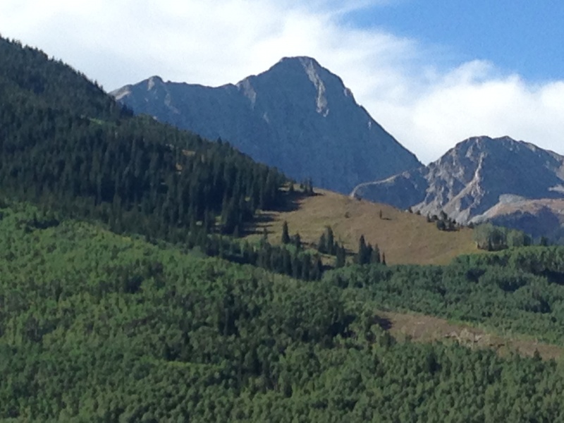
The first mile or so is a utilitarian undertaking, following a generally straight and flat trail through light aspen forest, much of it along the namesake ditch. About a mile in, the trail breaks out of the forest with a sign welcoming you to the Maroon Bells Wilderness Area. 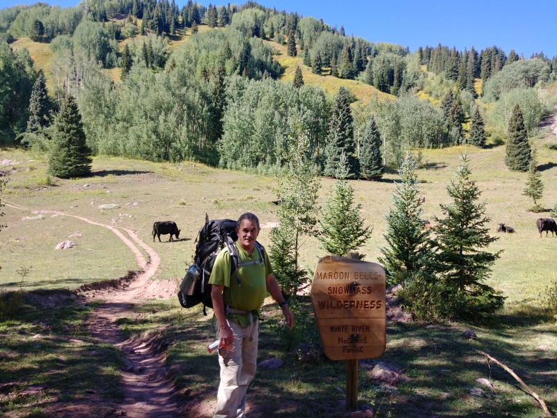
From there, the beauty of the Capitol Creek Valley took over. The trail meanders over gently rolling hills, alternating between aspen stands and picturesque meadows, with minimal 600’ or so of net elevation gain for the first half. As we hiked on a dry trail under brilliant sunshine, a refreshing breeze swept over us intermittently, something that often reminds me of long-passed, and much-loved, ancestors. My parents, both adventurous pioneers of a bygone era, who left successful careers in New York City to build a cabin in a remote end of Michigan's Upper Peninsula in 1951 - and stayed to raise a family. My father-in-law, who possessed a beautiful, childlike wonder of the natural world, and passed it to his daughter, my wife; and ultimately to me as well. His mother, my wife's grandmother, who became a role model to me after my parents passed, living a humble, simple, natural lifestyle to age 106. As we, their sons and granddaughter, hiked this idyllic wilderness valley en route to a majestic mountain, I could almost hear their voices whispering in the wind, "Good ... this is a good thing you're doing."
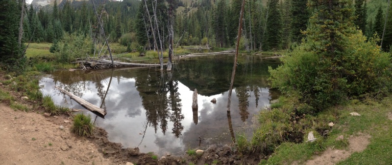
The crossing of Capitol Creek marks the halfway point of the hike. The second half entails a lot more uphill, with about 1600’ of net gain, but it’s spread out pretty well. There were no grueling slopes of the type that you just have to steel your mind to grind up it – and there was only one lonely switchback the entire way to the lake. The scene changed from aspen meadows below the creek to a lot of sub-alpine spruce-pine-fir forest above it, but it was all beautiful. If you're on the fence between camping at Capitol Lake vs. day-hiking Capitol, let me urge you to camp and enjoy the hike in. Yes, you can see the valley on the hike out, but it's more enjoyable coming in, not tired from a summit climb, with the beauty and anticipation of that peak always before you.
I’d read some complaints about the impact of grazing cattle on this hike, both dodging piles on the trail and putting up with the smell, but it wasessentially a non-issue for us, other than one small meadow above the creek crossing that was downright rank. 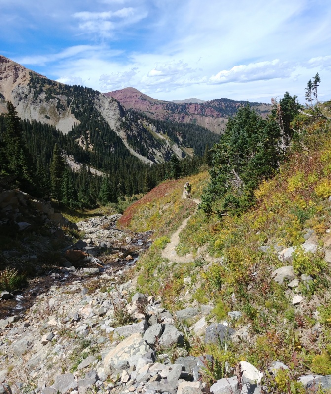
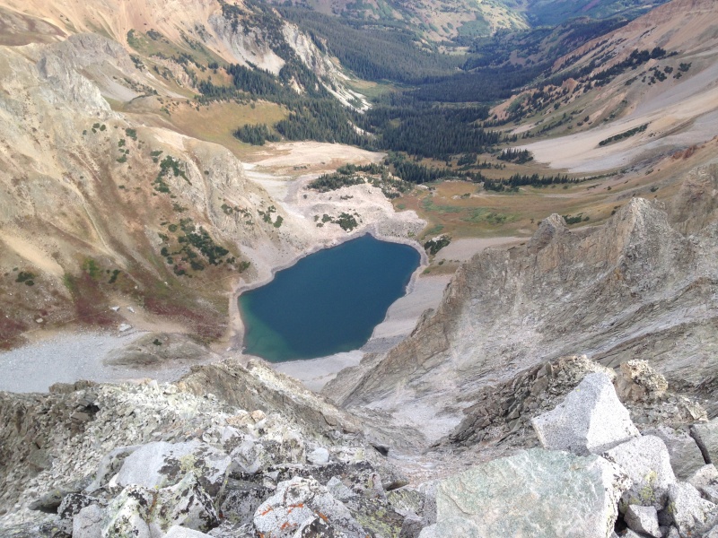
  As we approached the lake, the camping areas came into view. They are located on two knolls, the first at around 11,500’, and a second more prominent knoll closer to the lake, about 100-150’ higher than the first. They both lie a few hundred feet west (climber’s right) of the trail. We found a spot high on the north side of the second knoll suitable for our two tents. One or both of the knolls are visible on the right of the photo above - I believe the second, taller one is directly behind the lower first knoll, so they appear as one in the photo. 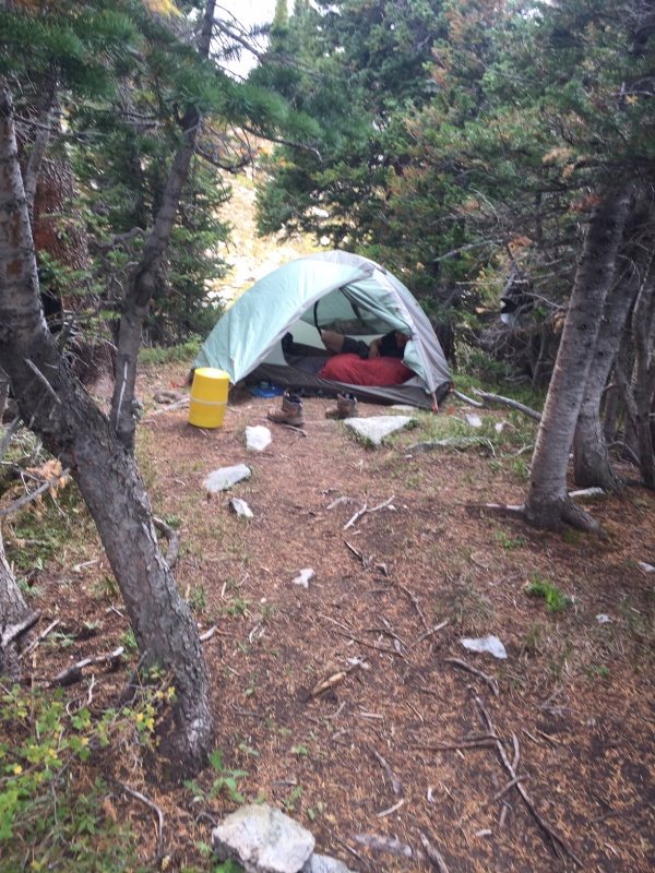
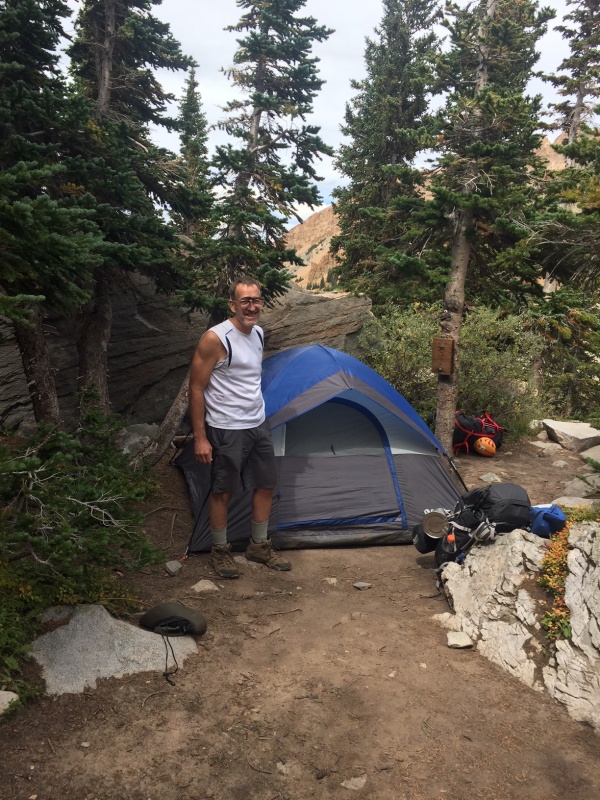
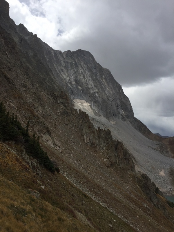
The afternoon was spent resting, filtering water at the lake, and admiring Capitol’s imposing north aspect. The close-up view of K2, the sheer slope below the knife edge, and the substantial ridge beyond that, triggered a gut check as to what we planned to do the next day. Doubts about the wisdom of our undertaking fluttered around me like bats. But ultimately it came down to the same conclusion it had many times in the months leading up to this endeavor: It’s a 14er, yes a hard one, but we’ve done some pretty hard ones, we know how to go about it and have a sound idea of what to expect.
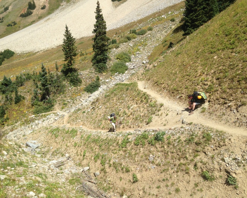
After dinner, as darkness fell, we watched two headlamps slowly inching up the trail toward us from the north. I remarked how challenging it would be to locate the camping knolls in the dark if you weren’t familiar with the area. Not long after that, while the rest of us admired a brilliant streak of Milky Way, Mark walked over to the side of the knoll facing the trail. The headlamps reached the turnoff to the camping knoll and continued upward toward Capitol Lake. He called out to them, “camping up here,” and they immediately turned and headed up our way. It was a father carrying a huge pack, with his son, age around 12-14 we guessed. Dad was enthusiastically grateful for the action, which probably spared them a substantial amount of time wandering around in the dark. And, he had another parent with several more young fellows planning to meet up with them in the hours ahead, so the assistance extended to all of them. Our plan for the summit day was to try to hit the Daly-Capitol saddle around daybreak, to have natural light for negotiating the gullies that we knew lay just beyond that saddle. We were slow getting out of camp (5:15ish), and slow grinding up the 900’ ascent to the saddle, so daylight was upon us by the time we reached the saddle at about 6:15. We paused at a small point just past the saddle ridge that provides an inviting place to catch a rest, shelter from the inevitable saddle wind, and prep for the gullies immediately ahead. 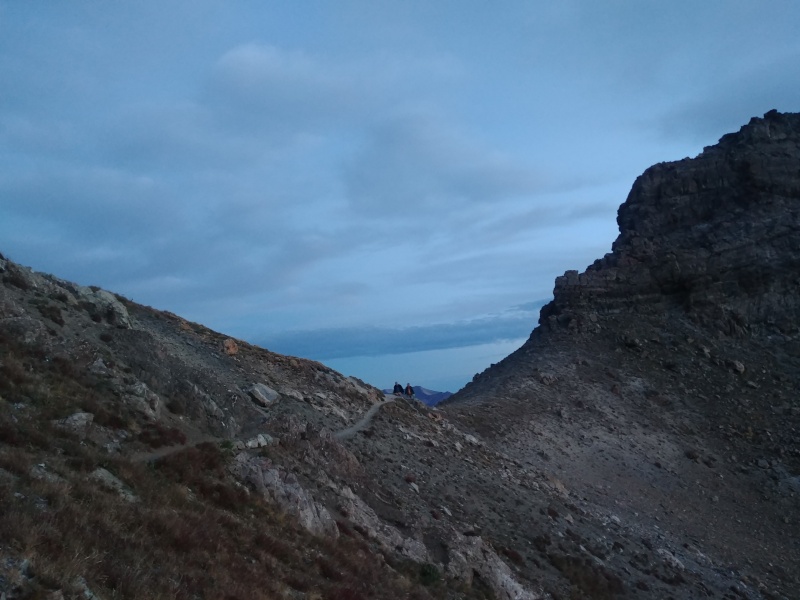
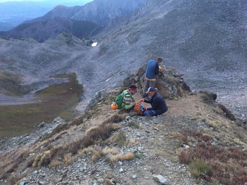
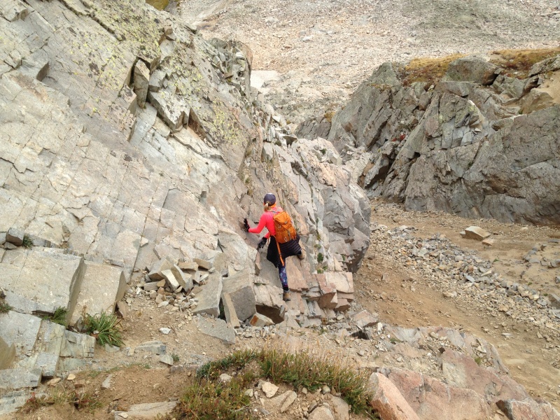
I had tried my best with pre-trip research to figure out what to expect with those gullies on the back side of the K2 ridge, butdetails were always vague. Were there two, or three, or more? Some said stay high, but not too high that you end up on a ledge of the K2 ridge; others “went low” with success. Nowhere did I find much clarity. So I will try to provide some detail here that might help someone’s preparation. What I would call the “first” gully lies immediately past that point. It’s a shallow gully, fairly steep, but that doesn’t matter because the trail just circles around the top of it with minimal up or down. On the other side of that gully you reach another small point, and around that point lies the spot that seems to often cause confusion. 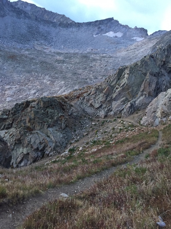
It turns out there are two more gullies here, which merge into one about 100’ down from where the trail reaches them – think of a “Y” shape. I would call these the “second” and “third” gullies. As you approach this area, the trail offers a path across the top of the second gully, onto the rock formation that separates it from the third gully. Mark crossed that spot and peered down into the third gully. No obvious route presented itself from that vantage point in the morning light. He could see there may be a way forward ascending from that point, but it didn’t look inviting. I would read later that it’s possible to follow that ascending trail up a ways here, and follow cairns back down to the trail. But I had also read of someone who didn’t drop back down to the trail, and ended up following a ledge system below the K2 ridge that got sketchy, so going up didn’t seem like the best option. Meanwhile, Maryjane and Dennis were looking down the second gully, where a switchbacking trail down becomes apparent upon inspection. We descended that trail to the point where the two gullies merged, then swung around the rock outcropping and headed back up the third gully. (Some may descend further down the merged gully, but that appeared to us to entail a lot of elevation loss.) 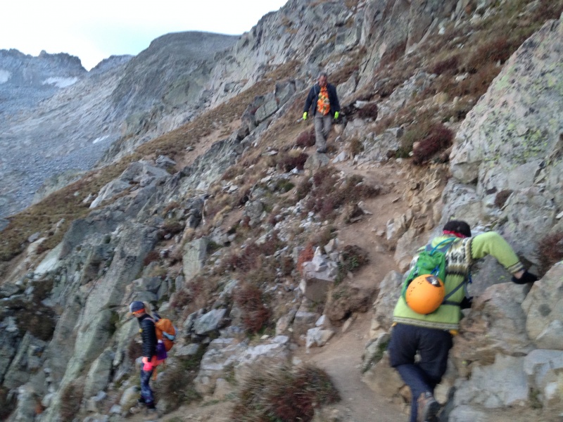
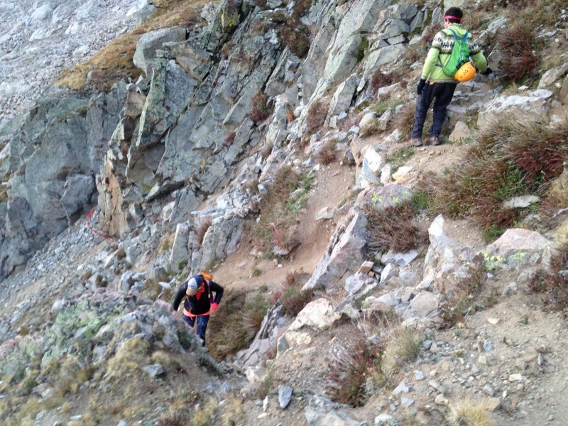
The third gully was comprised of steep loose scree sand mixed with rubble. It’s relatively safe because the soft sand tends to slow anything that might fall in it (rocks or people), but it’s a pain to climb in. My companions ascended the left side of this gully, while I found what I believed to be slightly more solid footing along the right side, making liberal use of handholds in the rock wall to my right. But the cost of my approach was the need to cross over the gully up higher, across looser steep gravelly scree, essentially at the point where it is split again by a fractured rock formation. 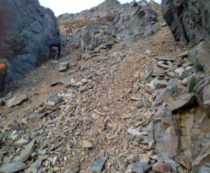
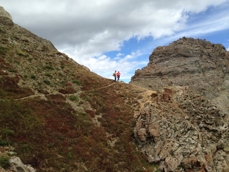
On our return trip we would find a more direct “high route” across these two gullies. I’ll describe that later in this TR. For us, when we exited this third gully onto an obvious trail, we were done with steep gullies. There we saw ahead the gently rolling talus of the basin east of K2. 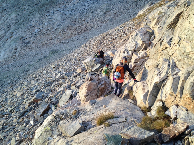
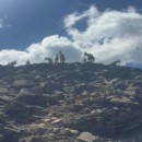
Cairns help establish a trail through the talus. There were other route options further left/east, and therefore lower, than the route we took. And, a faster group that passed us in here opted to stay higher to our right, a sportier route with more class 3-ish scrambling on boulders along the base of the K2-Daly ridge. That group which passed us consisted of one adult with I think three teenage boys. We would learn later in the day that they were the other group who had hooked up with the father-son combo who Mark had helped orient the night before. I dubbed them the “pajama party gang” because one of the boys was wearing cotton house pants, with a bicycle helmet hanging off his backpack. Another was wearing Teva sandals. I had mixed feelings watching these guys breeze past us. On one hand, I thought the apparently casual approach to clothes, gear and footwear was entirely inappropriate for a peak of Capitol’s difficulty and danger. However, I had to admit that these kids were probably safer on the mountain than us, as they breezed quickly and lightly across the rock. We were plodding in comparison. But I have to say, if I were the adult in such a group, I would not be comfortable climbing Capitol with kids equipped like that.
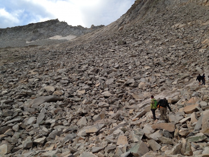
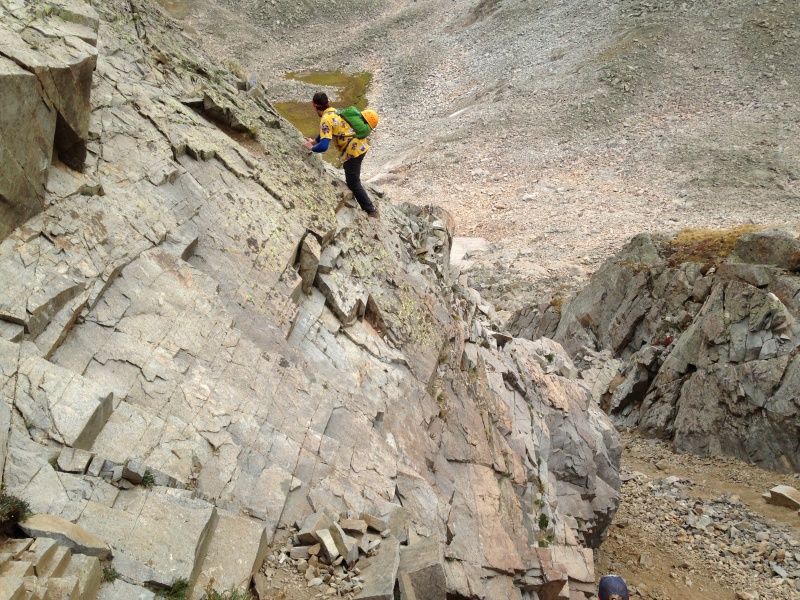
As we proceeded through the talus, we set our sights on some large orange slabs some distance ahead which appeared to offer a welcome break from the talus. When we reached them, we enjoyed pleasant walks along the slabs alternating with short scrambles from one to the next. The main trail appeared to run to our left and below us. We were “cutting the corner” of the turn up toward K2, on terrain that we found preferable. When the summit of K2 came into view, it looked considerably closer than one would expect to see from the standard trail.
For the ascent of K2 we mostly talus-hopped, picking up a faint trail maybe halfway up and possibly losing and re-acquiring it a couple times. It didn’t seem to matter much, as the footing was not bad on the talus and not particularly good on the trail. Gain the ridge of K2 is a significant milestone in the trek, as the view back to the north opens up and the K2 summit beckons a short distance up the ridge. 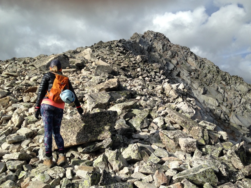
After a short break we headed for the summit of K2. Taking the bypass to the north was never much of a consideration for us. The ascent to the summit is a short, easy class 3 jaunt on vertically stacked boulders right at the ridge and slightly to climber's left. We stayed away from the steep gully to the west side of the peak. 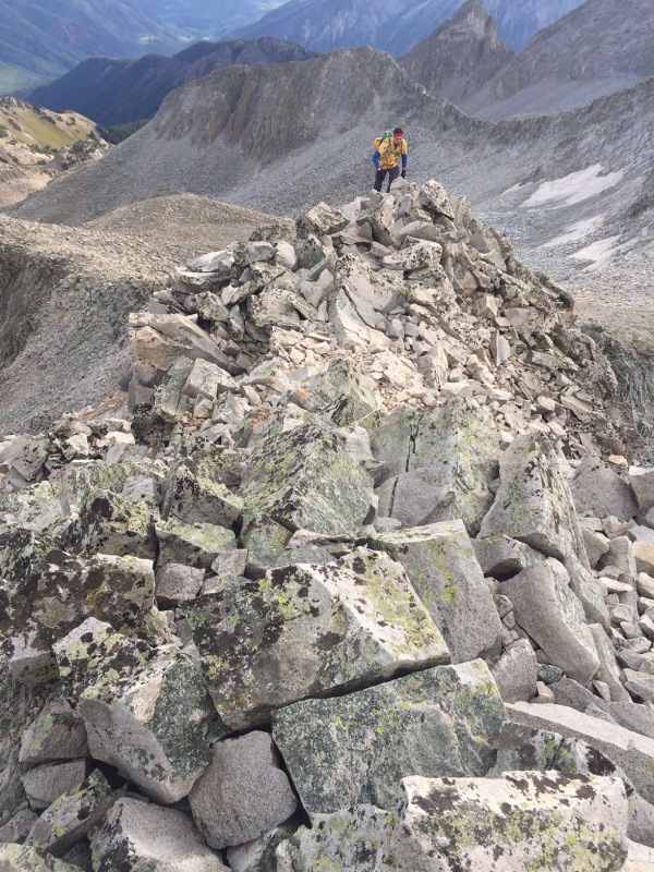
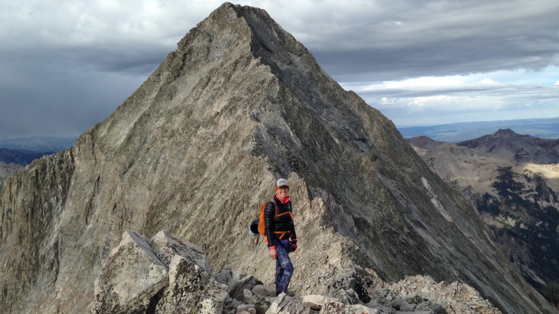
Bill Middlebrook describes this as a good place to examine the weather for a go/no-go call. We had a good forecast and great weather thus far, but there was enough going on south of us to create some concern by this point. Low-hanging clouds spread all along the southern horizon, clearly dropping some form of precipitation. They were some distance away, but how far, what form of precip, and what direction they were moving, was all a bit unclear. We were definitely proceeding, but with frequent glances to our south as we started to descend K2. There’s a lengthy discussion of this descent in a forum thread on 14ers.com. As you stand on the summit looking down, it appears obvious to start descending slabs to the west-northwest. The upper part visible from the summit is easy class 3, and the trail beckons not far below. But that forum thread made it clear that those slabs are not the easiest way down. Rather, a rib running essentially running north from the summit was said to offer easier descending. I started down that rib, but a huge anvil-shaped boulder stood imposingly on it a short distance below the summit. “I think we should stay away from that,” Maryjane suggested. I thought there is probably a perfectly good way around it, but those slabs toward the west looked so inviting. We just headed down the slabs. They turned out to be pretty easy except for the bottom 12’ or so just before you reach the trail below. There, an inside corner where two smooth slabs meet offers little in the way of holds. Mark had passed me descending by this point, as he usually does on difficult terrain, and did some kind of “not recommended” friction-slide move down the joint to the trail. He then turned that class 4-5 spot into class 3 for the rest of us by offering a convenient brace with his arm for us to step on. We were all standing on the trail a few moments later. As we worked the short distance toward the knife edge, a scan of the clouds to our south showed them to be spreading from east to west, and apparently drifting north toward us as well. The forecast for the Labor Day weekend had been generally promising in the days leading up to it, but late in the week at least one source had warned of the chance of moisture moving in from the Gulf of Mexico, spreading southeast to northwest. It looked to me like we were seeing that. What was the chance of it reaching up to us on the wrong side of the knife edge, I wondered – and what did it do to our risk factor if it did reach us? As we negotiated one of the fun little scrambles along the ridge, we encountered some climbers descending after summiting. It was a reminder of how slowly we were progressing. But we kept moving, and minutes later stood at the knife edge. I had long wondered how I would react to the exposure here, if I ever got to this point. As a flatlander, I spend a lot of time researching and reading about others’ experiences, since I only get to actually climb a few peaks a year. I had long since concluded the challenge of the knife edge was likely more mental than physical, but it was still a very real challenge. I was about to find out, along with the rest of our group.
Mark led the way, and as I would have expected, scampered across without hesitation. I followed close behind him, slower, but I was a bit surprised and pleased to find it wasn’t really at all intimidating to me. In fact I would describe it as fun, and not especially difficult. I found decent footing in series of cracks, breaks in the rock, and spots of moderate slope along the south side of the knife edge. I traversed almost the entire stretch, not that long as many have observed, with my feet on the south side and hands, where necessary (not everywhere) on the crest or north side of the knife. I encountered I think two short stretches where I didn’t find good footing on the south side and instead swung my right foot over the crest to crab-walk on all fours a few feet. On the return trip, with a prompt from Mark behind me, I would gain the confidence to negotiate one of those stretches without crab-walking, trusting my boots to adhere to the steep but grippy granite on the south side. Dennis followed me. He can out-climb me seven days a week – just a few days prior he had shown me how to ascend the chimney on North Maroon, and coaxed me through it behind him. But on this airy ridge he struggled. “Howwww do you do this,” he muttered, shifting uncomfortably between different stances. But eventually he gritted his way across. Maryjane followed, very cautiously to my approval, but not visibly intimidated. Soon the four of us stood on the summit side of the knife, with the satisfaction of overcoming one of the two most notorious features of Colorado 14erdom.
Unfortunately this would be as far as we would get. Somewhere during the course of crossing the knife edge, Dennis and Maryjane had pointed out that the southerly clouds had spread to the point where they were now visible north of Capitol’s summit. The fact that they would be upon us soon was pretty apparent. These were low-lying, light in color, and wispy, clearly not thunderstorms, but also clearly dropping some form of precipitation. We made a quick decision to retreat back across the knife edge before they were upon us. When we made the decision to retreat we said we would re-assess once back on the “safe” side of the knife edge – holding open the possibility of crossing it a third time to continue to the summit if the weather allowed. But by the time we reached the K2 side of the crossing, it was obvious that we were heading down no matter what the weather. It was around 10 a.m. The summit was about a half-mile and 500 vertical feet away – not that far, but no quick jaunt in the park either. We all knew that the hardest climbing still lay ahead of us. Our snail’s pace of the day showed that, if we did encounter poor weather, we were not capable of retreating quickly. The fact that several more groups came along here in their return from the summit, including the pajama party gang, drove home the slowness of our pace. And the wispy clouds showed no sign of dissipating. 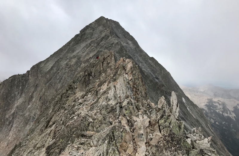
Of our foursome, I struggled the most with the decision to retreat. I was intensely aware of two competing facts. One was that this might be my only chance to summit Capitol. At age 60 and living in Illinois, it’s entirely possible I may never be physically able and have the opportunity to take another run at this peak. The other fact that I was aware of was that that sort of thinking is exactly what gets people like me in deep trouble on mountains. The weather was likely not severe, but this was Capitol, and you just don’t chance it on Capitol. It was a cautious, but for us this day, correct call. Others, perhaps faster, more experienced in dealing with weather, might shrug it off with hardly a thought. But we were heading down. The precipitation did hit us along here – in the form of a harmless light graupel that ended in a matter of a minute or two. I was extremely frustrated internally to be turned around by what turned out to be nothing. But we had needed to make a decision without knowing that. We would be hit with precipitation three or four times during our descent back to Capitol Lake. Each time, I sort of wished something nasty would come on us, just to justify our decision to retreat. But each time it was the same, a short, light, harmless spit of graupel. All told, it was a very nice day to climb a 14ers, just not quite nice enough for our group on Capitol. We would bypass the summit of K2 on our return. Mark and I headed for the north-facing rib, but when we reached it, Mark scanned the slope to our left and decided to take the shortest, most direct route to our destination, the west ridge of K2 below its summit. It didn’t look to be any “route,” but the slope and footing were not bad. I think we were above the typical bypass route that entails crossing a steep gully on some loose talus. I ended up veering up to the upper summit ridge of K2 while Mark took a more direct traverse around that upper part. Behind us, a guide who had short-roped a client across the knife edge called out to point out the “real solid” rib, but we were both comfortable with the terrain we were on. As we descended the east slope of K2 toward the basin, we again took to the orange slabs. On the descent of these slabs I began to question if our decision to use them was the best choice. The amount of time and energy expended on class 3-type scramble moves from one slab to the next, and the meandering route dictated by the way the slabs lay, was more apparent in the fatigue of the descent. I watched the guide and his client, who trailed us all the way down K2, now walk around and far ahead of us on the trail below. It drove home a simple rule of thumb that I intend to remember in the future: any time you’re using your hands, you are moving slower and expending more energy than you would be walking a trail, even if the trail is a bit longer and/or not great footing. The whole experience also exposed the fact that none of us were in the best shape for this year’s trek. The next time we go at Capitol, and I truly hope there will be a next time for me, we all need to be in better condition. A final retrospect for us is that we didn’t spend as much time in the mountains prior to this attempt as we generally have in the past. Mark and I had a solid week in Colorado, which is a lot for us compared to past years, but most of it was in Denver this year. Most years we have spent four or five days hiking and sleeping above 8,000 feet by the time we go at a hard 14er; this year we had two days in the Maroon Bells the preceding weekend, and one night in Basalt prior to hiking to Capitol Lake. We didn’t have altitude sickness symptoms, but I’ve been long convinced that as flatlanders we gain strength for hiking and climbing at a stronger pace with more days in the mountains. When we reached the gullies near the Daly-K2 saddle, the rest of the story about route options became more clear. From the rock outcropping overlooking the westmost “gully 3,” we could see a plausible route to go directly across it and ascend the rock outcropping on the other side, instead of dropping down the gully to the point where it joined “gully 2.” It was a bit spicy, with an initial descent of maybe 10-12’, followed by a short traverse right, leading to a climb directly up maybe 30-40’, all using tiny ledges and hand- and footholds, many around 3”-6” in size. By the time you climb back up, the gully has dropped away below you quite a distance, making it a definite no-fall zone. I could see how this route would be really hard to spot from above in morning light, especially if you don’t know it’s there. Knowing that it is available, it would go the other direction, although that initial descent would be a bit tricky. 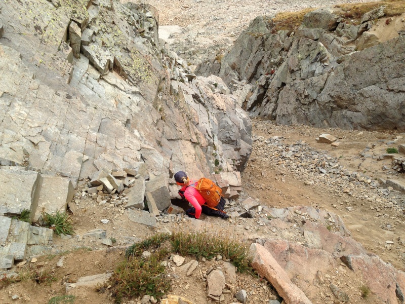
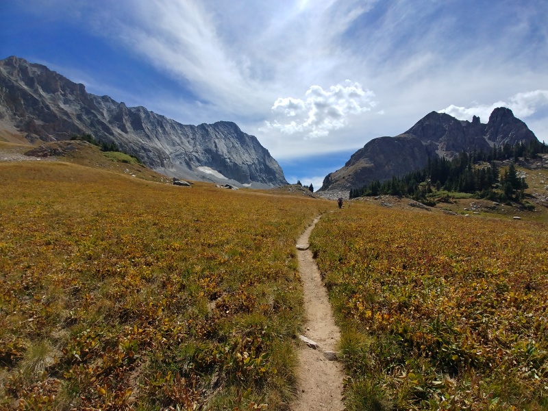
We reached the Daly-K2 saddle about noon. The descent from the saddle provides great views of Capitol Lake and the entire Capitol Creek valley. We broke camp and headed out for a long but still enjoyable hike out. The weather cooperated with a beautiful afternoon, interrupted only by a brief shower that was just enough to produce a gorgeous double rainbow. 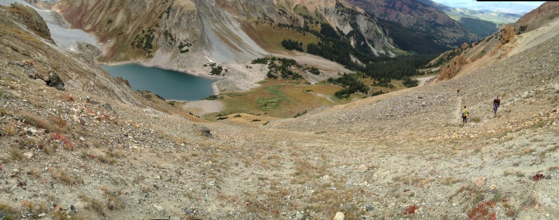
About a half mile from the trailhead we finally experienced the kind of cattle encounter that others have complained of. About a dozen cows and calves blocked the trail, and showed no interest in allowing us to pass. We tried yelling and waving hands to no avail. But then someone discovered that clacking two hiking poles together prompted a response, and by the time all four of us were doing that, they started grunting up the steep grassy slope beside the trail, with a fair amount of complaining. Last to move were a mother with two calves. She glared at us unblinkingly as we stepped delicately past. None of us knows anything about cattle, but we figured even docile cows should be treated cautiously when you’re passing within a few feet of their young. Despite not summiting, no effort was required to convince ourselves that this was a great day in the mountains. We had enjoyed the best that Colorado has to offer, and taken the mystery out of the knife edge. We’re now familiar with Capitol and know what we have to do to reach the summit. Now all we need is a chance to take another run at it while our bodies are still up to it. 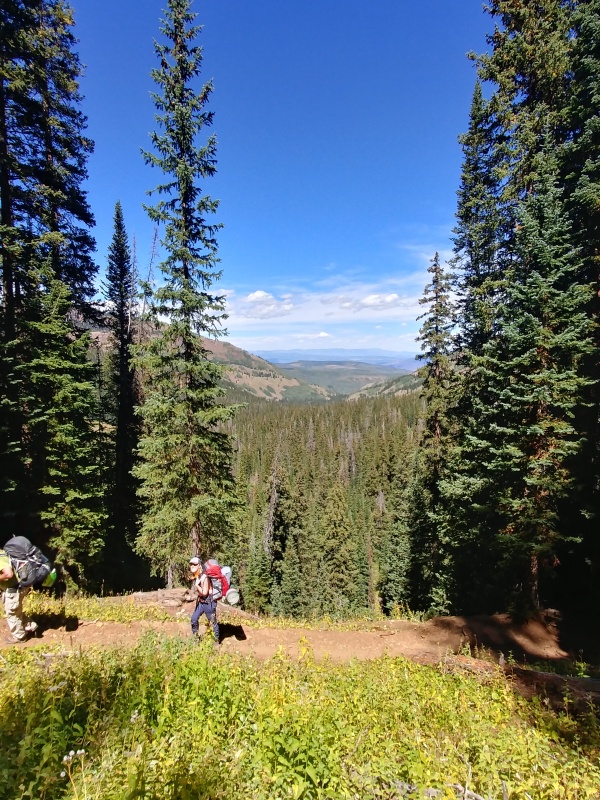
Thumbnails for uploaded photos (click to open slideshow): ")
")
")
")
")
")
")
")
")
")
")
")
")
")
")
")
")
")
")
")
")
")
")
")
")
")
")
")
")
")
")
")
")
")
")
")
")
")
")
")
")
|
| Comments or Questions | |||||||||||||||
|---|---|---|---|---|---|---|---|---|---|---|---|---|---|---|---|
|
Caution: The information contained in this report may not be accurate and should not be the only resource used in preparation for your climb. Failure to have the necessary experience, physical conditioning, supplies or equipment can result in injury or death. 14ers.com and the author(s) of this report provide no warranties, either express or implied, that the information provided is accurate or reliable. By using the information provided, you agree to indemnify and hold harmless 14ers.com and the report author(s) with respect to any claims and demands against them, including any attorney fees and expenses. Please read the 14ers.com Safety and Disclaimer pages for more information.
Please respect private property: 14ers.com supports the rights of private landowners to determine how and by whom their land will be used. In Colorado, it is your responsibility to determine if land is private and to obtain the appropriate permission before entering the property.