Download Agreement, Release, and Acknowledgement of Risk:
You (the person requesting this file download) fully understand mountain climbing ("Activity") involves risks and dangers of serious bodily injury, including permanent disability, paralysis, and death ("Risks") and you fully accept and assume all such risks and all responsibility for losses, costs, and damages you incur as a result of your participation in this Activity.
You acknowledge that information in the file you have chosen to download may not be accurate and may contain errors. You agree to assume all risks when using this information and agree to release and discharge 14ers.com, 14ers Inc. and the author(s) of such information (collectively, the "Released Parties").
You hereby discharge the Released Parties from all damages, actions, claims and liabilities of any nature, specifically including, but not limited to, damages, actions, claims and liabilities arising from or related to the negligence of the Released Parties. You further agree to indemnify, hold harmless and defend 14ers.com, 14ers Inc. and each of the other Released Parties from and against any loss, damage, liability and expense, including costs and attorney fees, incurred by 14ers.com, 14ers Inc. or any of the other Released Parties as a result of you using information provided on the 14ers.com or 14ers Inc. websites.
You have read this agreement, fully understand its terms and intend it to be a complete and unconditional release of all liability to the greatest extent allowed by law and agree that if any portion of this agreement is held to be invalid the balance, notwithstanding, shall continue in full force and effect.
By clicking "OK" you agree to these terms. If you DO NOT agree, click "Cancel"...
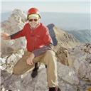
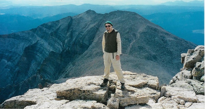
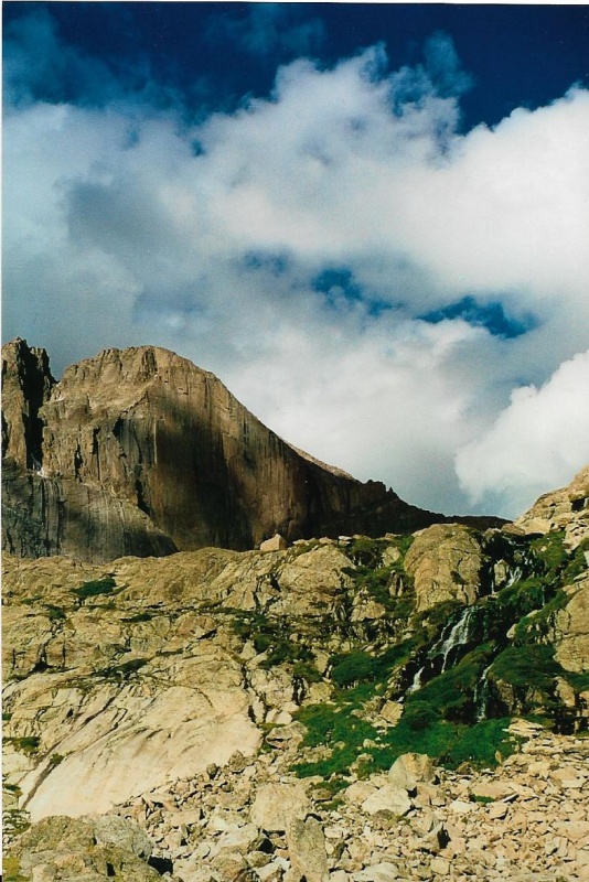
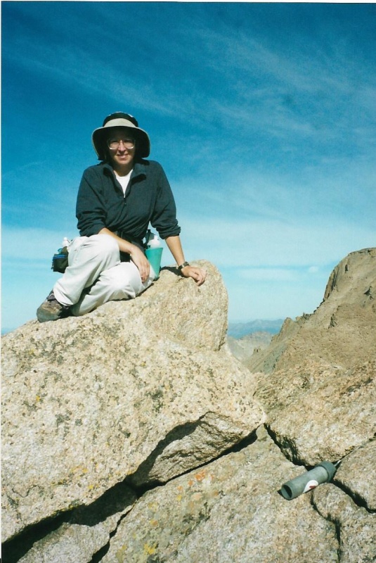
Meeker from Longs Summit, 2003 Eastern summit is to my right, western to my left, the gentle talus slopes leading from the loft to the summit are behind my back
I first succeeded at climbing Mount Meeker in September, 1999, via the Loft Route.Before finally succeeding, I had failed to climb the mountain three times by two other routes. Twice I tried and failed using an approach from Wild Basin, planning to climb the South Ridge Route.After that, caught up high on the East Ridge Route by a sudden thunderstorm, I bailed out by descending as fast as I could by the spectacular Iron Gates Route. All of these routes are described in Gerry Roach’s "Rocky Mountain National Park:Classic Hikes and Climbs." After these three successive failures, Mount Meeker had become a personal nemesis to me.
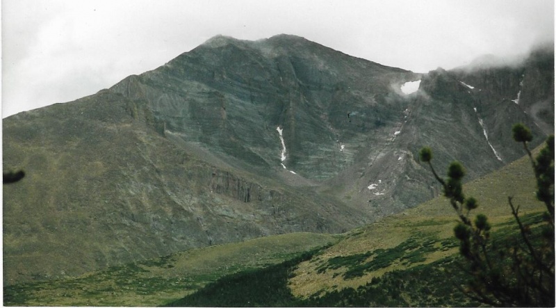
Telephoto of Meeker from the Estes Cone Trail. Ship's Prow is at right, the snow of the Apron above it. Low clouds rake the summit.
I hadn’t failed to climb Meeker because I didn’t have enough experience climbing.Before I tried to climb Meeker, I had climbed Longs Peak twice. The first time I climbed Longs was way back in 1969, as a college student, up the old Cables Route. The second time I climbed Longs was in June, 1999, via the Keyhole, just a few short months before my failures on Meeker. In addition, I was in good shape, and had done a lot of hiking in the Park and climbed many of its minor summits, Twin Sisters, Hallett’s, Estes Cone, Flattop, to name just a few. So why did I fail on my first three attempts at Meeker? Why did I turn back when I had hiked all the way from the Sandbeach Lake trailhead past the Hunter’s Creek Backcountry Campsite and then finally out of the timber at last to an exposed little ridge which provided a full view of the mountain ahead?
Both times, on my Wild Basin approaches, when I emerged from the last stunted trees and was standing out in the open with my first unobstructed view of the mountain, with just that mountain and me confronting each other through otherwise empty air at last, Meeker’s massive hugeness from that perspective, the distance and elevation between me and its summit, seemed so intimidating it overwhelmed me. I sat down on a rock, ate a granola bar, drank some electrolyte fluid, and just knew I could never muster enough energy to climb that mountain, either day.It seemed beyond my development, skill, and training as a mountaineer. I had already exhausted all my energy and will, except for a little bit I had left, and I would use even that all up turning around and hiking all the way back to the trailhead. That mountain seemed big enough to fill up the whole world.Humbled, I had re-shouldered my pack and headed down. On my next attempt after those, as I said, a sudden thunderstorm had turned me around on up high on the East Ridge Route. The rocks on the ridge had become dangerously slick, and the storm had brought not only rain, but thunder and lightning.
I needed to find a better way up Meeker.That way turned out to be the Loft Route. I talked to some other climbers who worked in a mountaineering shop in Estes Park, and they told be the Loft Route was the best way to go.In his climber’s guide to RMNP, Walter W. Fricke is uncertain when and by whom a first ascent of Meeker was done by the Loft Route, but believes it was before 1915, and speculates Dean Babcock was probably the climber.
For my own Loft Route climb, my fourth attempt to summit the peak, I gave myself an alpine start.It wasn’t 3 a.m., the time I usually chose to begin most of my climbs of Longs on my many ascents later through the years, but it was still plenty dark, and I wore a headlamp. I was beginning to learn some of the skills I needed to become a successful mountaineer.Dawn began as a gray luminescence in the eastern sky, and gradually the constellations and stars began to be absorbed by a greater brightness. First light brought anticipation and revealed the shape and texture of the terrain around me. I took off my headlamp, set it on a trailside rock, removed my pack, took a long welcome gulp from a water bottle, then put both the bottle and headlamp back into the specific places I kept them in my pack. Then, I re-shouldered the pack, and got going again. Soon the sun rose, and the day began to warm. I was already sweating from hiking fast uphill, and so I stopped to take my jacket off and put it back where it belonged, too. The process of removing layers had begun. Later, I already had learned, when I became more exposed to the wind in colder air high up, I would probably have to put some layers back on. These would become my familiar habits, rituals of climbing.
Morning has broken, like the first morning.
I was pretty high up on the trail already, but not yet in krummholz, or above tree line. Though I felt good, strong, and was determined to go on, the weather wasn’t the greatest:scattered wind-blown clouds around and above, a tempestuous gray sea of clouds below. Because of the clouds, I could not see down into the Tahosa Valley, but above it, as its far shore, rose a dark isolated island that was really the dawn silhouette of Twin Sisters Peak, a steep 12er.
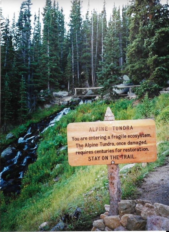
Alpine Brook
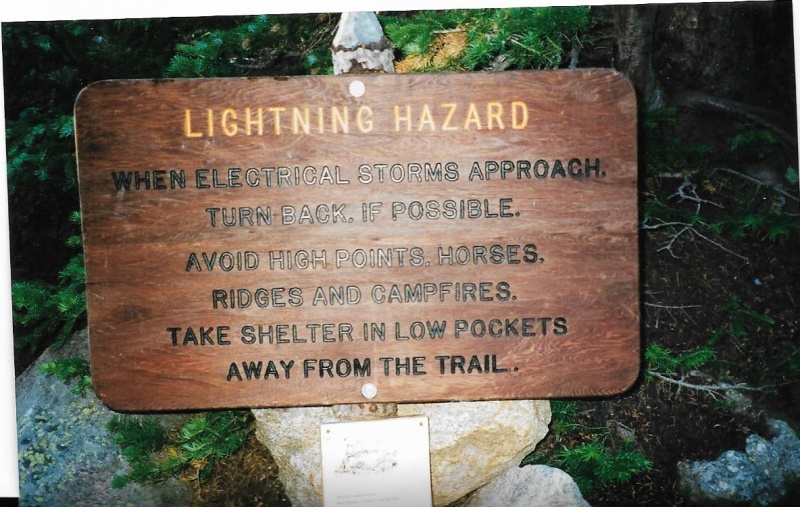
I crossed Alpine Brook on a makeshift log bridge with a pole railing. The rapidly flowing stream sang a water song to me.I read a wooden trail-sign about the delicateness of alpine tundra, and higher up, another trail-sign warned me of the dangers of lightning storms.I had already read these signs on any number of hikes and climbs before, but I welcomed these reminders as old friends when I paused to read each one again.
Jim's Grove
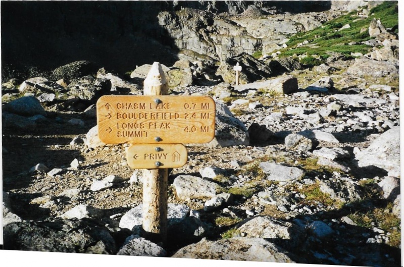
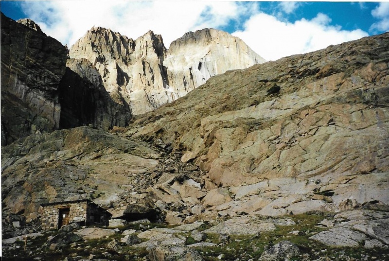
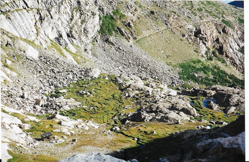
I climbed still higher, and, turning switchbacks, suddenly climbed over an edge to a flatter area above. This was Jim’s Grove, with its last vestiges of any kind of shelter, banner trees and krummholz. I took a left fork in the trail here, not the right fork going to the Battle Mountain Group Back Country Campsite. Another right fork I avoided would have taken me up the Jim’s Grove Trail Shortcut, which was a lot steeper than the trail I was on.I wisely stuck with the regular trail, and soon was above tree line, and then, after more hiking, I arrived at Chasm Junction. I turned left here, away from the Longs Peak/Boulderfield trail.Instead I headed for Chasm Lake and Chasm Meadow, from which I knew my Loft Route began. I wouldn’t have to go all the way to Chasm Lake itself.The Chasm Meadow Patrol Cabin below the lake was the landmark I was looking for.
Chasm Junction.1999. This old privy near Chasm Junction was replaced by an open, double -stall one.
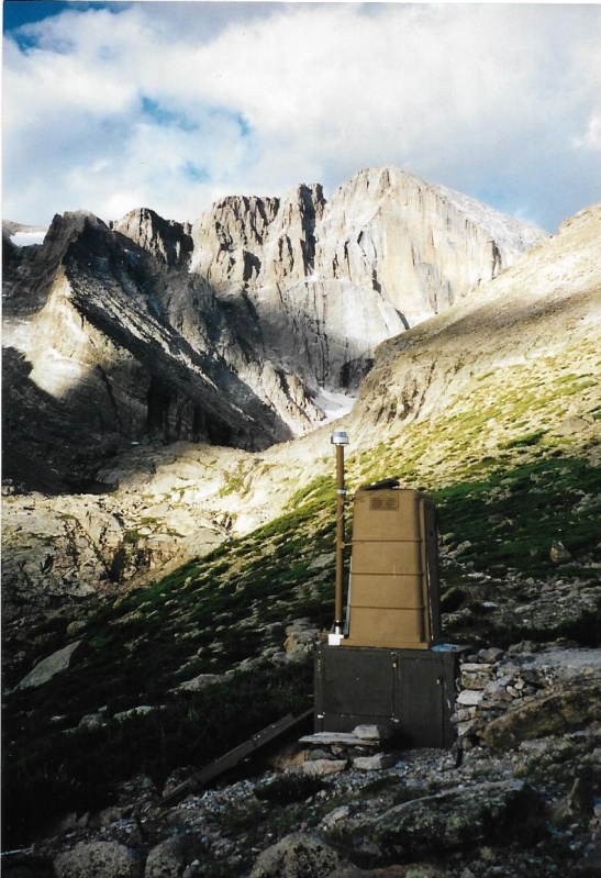
The Patrol Cabin wasn’t the same one that stands in the meadow today. It was far older, and had quite a history.It had been built in 1931, and though its mortar was now crumbling so that strong winds could now blow threads of snow into the building in wintertime, this old building would remain standing for another three years until 2003, when a massive freak springtime avalanche would completely demolish it into small pieces, scattering stones, broken boards, rock, climbing rope and even ice-axes with shafts bent at bizarre 90 degree angles for hundreds of yards. Longs Peak Ranger Jim Detterline had liked to tell a story in his talks about a brain surgeon who had successfully operated on a fallen climber with a fractured skull in this humble building. Without that immediate surgery, this climber would have died before he could be airlifted out. Because of its strategic location for rescues, when it was destroyed in 2003, the original cabin was immediately replaced by a temporary wooden structure, which served until 2008 when another, bigger permanent cabin could be constructed not in the same place, but in what is hoped will prove to be a more protected location behind boulders and large rock prominences at the southeastern edge of the meadow.
The Old Patrol Cabin
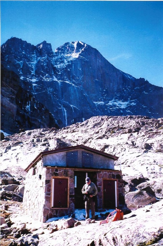
The Temporary Patrol Cabin Soon this cabin was painted a pale blue, the color of the sky, so its appearance wouldn't be so jarring to the eye.
Seasonal Park Ranger Jack Gladman, On A Day Off, At The New Patrol Cabin
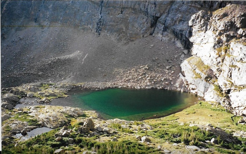
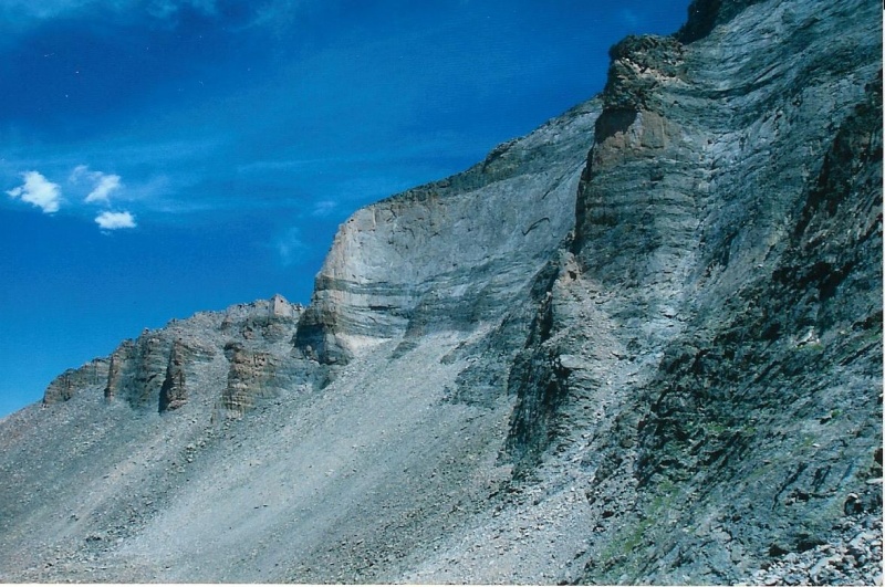
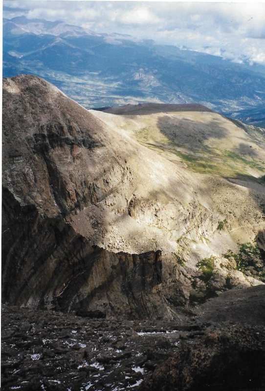
As I hiked, I could see Peacock Pool, bright with green iridescence, shaped like a spread peacock’s tail, below some cliffs ahead. I watched my step as the narrowing trail crossed over these cliffs with quite a drop below. The Roaring Fork Valley stretched away to the east from the Pool, and ahead of me I could see Columbine Falls spilling down cliffs of glacially polished granite. The whole scene was profound in its beauty. To my left, above me, toward the head of the valley, towered the awesome and steep cliffs of Meeker, billowing like the folds of some great gray curtain sewn and shaped by God himself. Beyond the cliffs, still further away and more forbidding, rose from shadow the dominating summit of the very peak I intended to climb this day. Wow. What a scene! I felt privileged to view a landscape like this one close up, personally, for real and not in a photograph.
Great Gray Cliffs
Columbine Falls
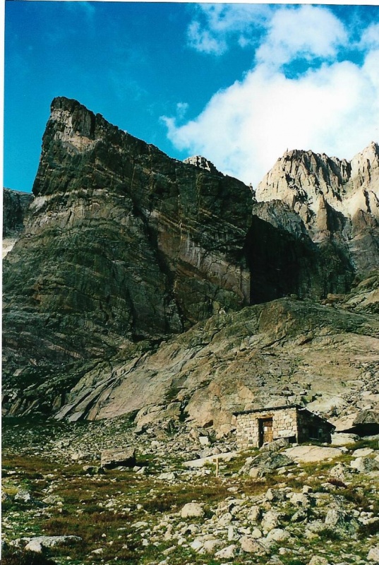
Up ahead, to the left of Columbine Falls, I could now see the Chasm Meadow Patrol Cabin. Constructed of local stones gathered right from the meadow, it was rustic and crude, blending perfectly and harmoniously with its natural surroundings.Frank Lloyd Wright himself could be proud of it, and would approve. I went right up to the door of the cabin, and took a good look at it. Then I started a big semi-circle left around the meadow towards a rock formation named the Ship’s Prow because, obviously, it resembles exactly that. On the other side of the Prow, the Loft Route started up a gradually narrowing gully. There was no trail up the gully over the rock. No cairns marked the way. None were needed. Any path up the gully would serve the purpose at hand, and I tried to choose the easiest one.
Old Patrol Cabin, Ship's Prow
“Easy is right.Begin right
And you are easy.
Continue easy and you are right.
The right way to go easy
Is to forget the right way
And forget that the going is easy.”
So believed Chuang Tzu, the ancient Chinese Taoist who lived maybe 2,200 years ago. Thomas Merton, the American writer and Trappist monk, translated that belief into a book of poetry I read in my own 20th century A.D. His book is titled “The Way of Chuang Tzu.”
I may have failed to climb Meeker on all three of my prior attempts, but now I was going to try to keep Chuang Tzu’s philosophy in mind on this, my fourth attempt. Meeker didn’t seem so intimidating when viewed from Chasm Meadow. I intended to “go easy. Doing so, maybe I would “go right” and succeed this time! I started up the Loft Route of Meeker.
Old Patrol Cabin Below Me On The Route
I went the easy way. Though I carried Roach’s pocket guidebook with me, I never had to take it out of my pocket even once. I didn’t have to “figure out” the route. The route was obvious, and presented itself to me whenever I needed it. I had already learned more about route-finding than I realized.
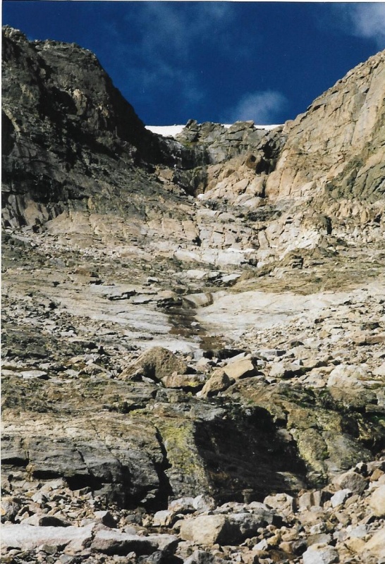
Looking Up The Route. The frozen waterfall and apron are visible above.
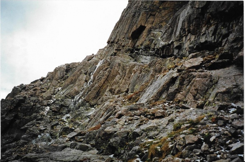
The gully narrowed, steepened, and finally ended at a waterfall that was frozen even in early September. I had read about the frozen waterfall, all right, and there it was. I had also read about a ramp system that led off somewhere to the left.I looked to the left, and there, sure enough, the Ramp appeared, obvious, but narrow and somewhat sketchy.
Beginning of The Ramp
Let me interject right here, and this is important, the ledge system is the crux of the route. When it is icy, or covered with snow, it is very dangerous. A fall from this ramp is usually fatal. Since the first climb in 1915, many people have died falling from this ledge system. It is not that difficult really, under the right conditions and circumstances. But we all know Murphy’s Law. Sometimes, very unexpectedly, things can go wrong. On the day before I had attempted to climb Meeker up the East Ridge Route, a man had fallen from this ledge system and died. He had lain up there dead during the night, and a body recovery was going on above the cirque when I entered it the next morning.
When I had arrived at the Chasm Meadow Patrol Cabin that day, and had climbed a bit above it in order to quarter around the mountain to the East Ridge Route, I had passed a woman who was anxiously scanning the terrain below the ledges, not through binoculars, but through the viewfinder of a camera with a long telephoto lens. It was early morning.She had been there all night.She was young, and I think she might have been the daughter or wife of the man who had fallen.Park Rangers and a Search and Rescue crew were still up above trying to recover the body, and she was watching them. She was alone. Her despair and sadness were so obvious that they weigh on my soul even now as I write this. She did not want to be interrupted from her watching. I could tell that. I did not stop to comfort her.
Unfortunately, hours later, when the storm had developed and I had bailed out on my own East Ridge climb, I found myself followed most of the way down the entire Longs Peak trail by a couple of uniformed Park Rangers, a male and a female, leading a mule. The despairing woman I had observed above was not with the Rangers now. The mule had a long, full canvas bag slung and lashed down over its pack saddle, hanging down on either side. The bag was about as long as I am tall. I think it must have contained the body of the fallen climber. My hike back to the trailhead that day remains with me still today as I write. It was a day I can never forget.
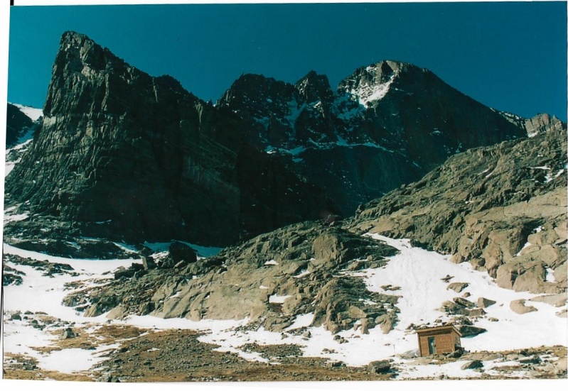
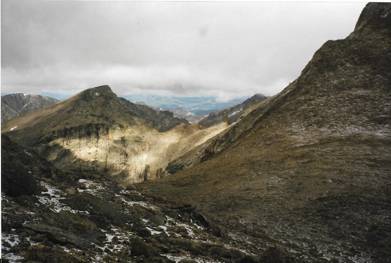
So, yes, I found the ledge system. It was narrow, and dangerous at first. There already was ice on it in September. I was careful with my foot placement, and I crossed it OK. It is a relatively long ledge system, with at least a couple of switchbacks, I remember.Most climbers call it simply the "Ramp.” As it climbs up away from the sheer cliffs, and begins the switchbacks, it becomes no longer dangerous. The cliffs give way to a talus and gravel slope. The route becomes just a steep trail. There is a permanent snowfield above the switchbacks named the “Apron.” The trail passes under this snowy apron in summer, passes up to climber’s left beyond it to the Loft proper, which gives its name to the entire route itself. The Loft is a broad flat saddle between Meeker and the snout of the "Beaver.” As even James Michener noted in “Centennial,” when viewed from down below, people have often believed the shape of a beaver, from snout to tail, can be discerned against the skyline on the south side of the summit of Longs Peak. Early French trappers discerned the shape, and thought it was maybe a sign from God that there was good beaver trapping in the valleys below, and for a while there was.
The Apron Above The RampCliffs of Meeker East of The LoftShip's Prow, Mount Lady Washington East of the LoftSnout of the Beaver, Longs Summit From The Loft
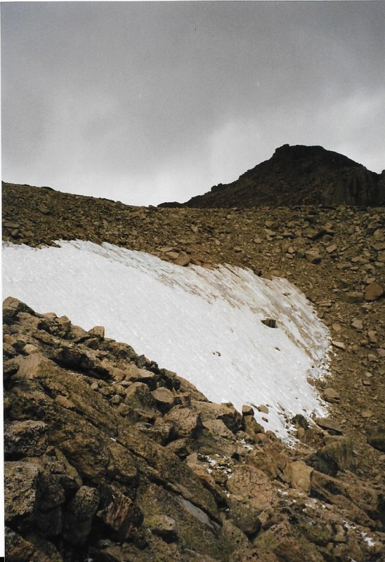
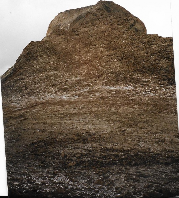
The Loft is in a significant location. I took off my pack to grab and quickly devoured an energy bar, then enjoyed the view. To the west, mountains fell away into Wild Basin., then rose again to form the Continental Divide. To the east mountains fell away into the Tahosa Valley, and beyond Twin Sisters, and even further away, the many cities along the Front Range. I was in a place where I could already see great distances now. From the summit of Meeker, I hoped I would see even further. For now, I looked off both edges of the Loft, and then at the snout of the beaver. Beyond the snout, over the “Notch,” peeked the tiny western corner of Longs Peak itself, Colorado’s northernmost 14er. After taking off my pack, retrieving the jacket I had placed inside, putting it on, zipping it up, and raising my hood and pulling its drawstrings tight, I re-shouldered my pack. I turned and looked at Mount Meeker’s gentle rock and talus slopes above me. Then I pressed on.
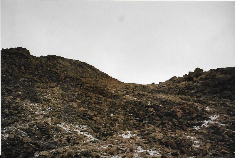
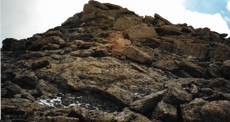
Pagoda to the West as I Start Up the TalusLooking Up the Talus Slope Slope Towards the SummitNearing SummitWestern Prominence of the Summit
I wasn’t quite sure what the best way to climb the slope ahead of me really was. Again, there were no cairns, no faint paths.I just figured I would keep trying to climb what I judged to be the easiest way, and I hoped the easiest way would go, and it turned out that it did. The right way to go easy is to forget the right way, and forget that the going is easy. I gave myself over to the final summit push, and found myself suddenly there. The summit register tube was plainly visible near a pillar capped by a slanted rock, but one end of the tube was missing and no register was inside.
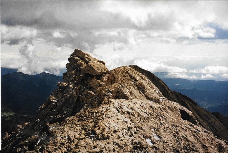
Summit Register, Western ProminenceWindy and Cold, Western Prominence
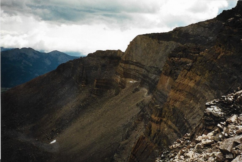
It was very windy.It was cold. I took a look around, but did not linger long. Let me interject something important here. There are two prominences on the western summit of Meeker. There has been some disagreement about which of these prominences is the true summit. I have climbed Meeker a number of times since this first successful summit. The first time I summited, the register was on one of these prominences. The second time I climbed it, a year or two later, the register had been moved to the other prominence! Crazy. I am not talking about the eastern summit of Meeker, which is a further distance away and involves a tricky, exposed ledge-walk while holding on to a knife-edge as a railing to get there. I am talking about two rocky prominences a short easy rock hop between each other on the western summit. Walter W. Fricke feels the true summit is the eastern one.I can’t tell, myself. To be sure I summited, I took that easy rock hop (though on this occasion it was a windy and cold one) over to the other prominence, and only after that did I begin my descent. You might do the same. That way you don’t have to wonder forever, “Did I pick the right prominence?”
Teresa Gergen on the Eastern Prominence on Our 2001 Climb of Longs by The Clark's Arrow Route. From the Loft we had tagged Meeker first, and discovered that the summit register was now on the Eastern Prominence. It is a different register tube, but once again one end is missing and there was no register inside.
There is no point in retelling my descent, which was proved to be an uneventful and safe repetition of my ascent in reverse order. Though I was pretty tired, my weariness was lightened and made easier by my feeling of elation at having finally succeeded at climbing Meeker on my fourth attempt. I may have lost much of the spring from my step, and was just plodding along, but I bore the distance well and trudged back to the trailhead like a happy soldier. I had finally climbed Mount Meeker! Wow. Whoopee! All the time I was heading back the way I had come, I thought about how my four attempts had taught me a lot, and that I was now ready to move on to other Park 13ers! I could hardly wait.
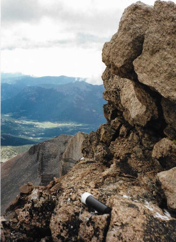
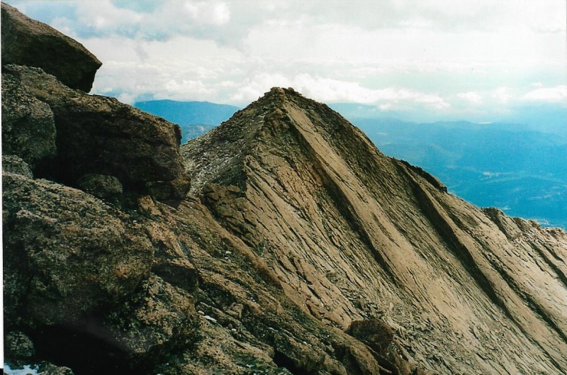
The Eastern Summit of Meeker, From the Western
Thumbnails for uploaded photos (click to open slideshow):
Good to see you're still around, John. I hadn't known that the original Chasm Meadow Patrol Cabin had been destroyed. My dad & I stayed in it in June 1972, the night before my first climb of Longs Peak. We'd brought our tent, but the cabin door was unlocked so we moved in. Good memories!
Yes, it is interesting to read your account, dated that it be. (It's also nice to see a 'new' report by you again!) My first ascent up Meeker occurred the following year in 2000, and I also took the Loft route. Your account brought back memories of my own. However my preferred route now is the Iron Gates. I love walking along the ridge to the summit!
And I also feel the same way about meeting the signage and regular landmarks along the standard trail. They've all become so familiar to me now and it IS like meeting old friends again.
The old photos, historical context, snapshot descriptions of seemingly minor moments, thoughtful musings on the feelings evoked in the moments ... classic, timeless, and yet very timely. Your description of the "camel route" on Longs guided our group up that way on our second ascent of Longs a few years ago, including the Jim's Grove alternative on the descent. I count sunrise at Chasm Lake as the most special single moment in my 32 14ers. Hopefully this account will take us up Meeker one day soon, combined, of course, with a Loft ascent of Longs! Thank you for sharing!
Many years ago I found a wallet melting out from under Lamb's Slide. The owner was James Disney, a park Ranger, who was a participant in the rescue at the patrol cabin. When I got back to the Long's Peak Ranger Station, I turned in the wallet. The Rangers on duty called James and told them about my discovery. As a reward, James sent me a VHS copy of the episode of Wild America devoted to the rescue. James was fairly certain that he didn't lose the wallet during the rescue, but my discovery was nonetheless remarkable considering that the wallet had been buried under the snow for many years.
Thank you for this truly neat trip report. I really enjoyed the
narrative and your side comments will be useful to anyone who's
contemplating a summit of Meeker (or even Longs via the Loft).
I'd like to add a little bit to 7dorihe's comment. In addition to his past service as a ranger in the Park, Jim Disney is an accomplished mountaineer. More than that he is a visual artist, a talented painter. Because he loves the mountains, like the rest of us, his primary subject is those mountains. If you would like to learn more about James, you can explore his website at jamesdisney.com.
I seem to remember one other thing about James,too. A close friend had either telephoned me or sent me an e-mail about a Fort Collins City Councilman, or maybe it was a Larimer County Commissioner, I can't remember which, who had come to a meeting in a foot cast, I think it was, a meeting anyway which my friend had watched on local public television. "When the guy's elected peers had expressed their concern, the guy had explained the cast by saying it was nothing, really, just something that had happened on a technical route he had been attempting up RMNP's "Arrowhead." Or maybe that sharp pinnacle is called Spearhead. Or maybe it wasn't either, but Sharkstooth instead. I forget. The details remain muddy in my mind. You know old men. They gradually grow feeble, then senile, and the whole incident is probably just a figment of my own imagination. This was all just hearsay told to me by a friend anyway. Forget I ever recounted this fiction.
Of course, I myself have always climbed flawlessly and perfectly, never making a single mistake or misjudgment. I have never developed hypothermia after being soaked to the bone by a rainstorm that came out of nowhere. Never bloodied my face, never torn clothing and bloodied my knees and or elbows. I have never broken bones. Never fallen on rock slickened by rain, hitting my helmetless head so hard,and realizing only afterwards that, miraculously, I hadn't been seriously hurt, though I could just as easily have been, could have died right there and then at that very spot. And afterwards, never felt like dropping down to my knees and offering prayers of thanks, but instead continued my descent down from the peak as if nothing had happened at all. Climbing? Why do we do it? Maybe because by testing ourselves against adversity, deliberately doing dangerous things in dangerous places, and most of the time actually succeeding at that, gives us some kind of comfort and inner strength that provides us hope we might be able to survive the worst of adversities that may befall us. It gives us some quiet peace.
Caution: The information contained in this report may not be accurate and should not be the only resource used in preparation for your climb. Failure to have the necessary experience, physical conditioning, supplies or equipment can result in injury or death. 14ers.com and the author(s) of this report provide no warranties, either express or implied, that the information provided is accurate or reliable. By using the information provided, you agree to indemnify and hold harmless 14ers.com and the report author(s) with respect to any claims and demands against them, including any attorney fees and expenses. Please read the 14ers.com Safety and Disclaimer pages for more information.
Please respect private property: 14ers.com supports the rights of private landowners to determine how and by whom their land will be used. In Colorado, it is your responsibility to determine if land is private and to obtain the appropriate permission before entering the property.

")
")
")
")
")
")
")
")
")
")
")
")
")
")
")
")
")
")
")
")
")
")
")
")
")
")
")
")
")
")
")