| Report Type | Full |
| Peak(s) |
North Maroon Peak - 14,022 feet |
| Date Posted | 11/28/2018 |
| Modified | 12/09/2018 |
| Date Climbed | 08/26/2018 |
| Author | DeTour |
| Additional Members | Lucky |
| No time for talus heaps |
|---|
 Life has a way of interfering with the most grandiose summit plans. My family group of four set our sights on two of the toughest 14ers for our August climbing trip. The preceding year had been the first since 2007 when we hadn't stood together atop at least one summit, for good reason: daughter Maryjane and Dennis had been married in Estes Park in August of 2017. But for 2018 we had our hearts set on climbing both North Maroon and Capitol. We normally start our trip with a relatively easy walkup 14er, but this year, Maryjane and Dennis could take very little time off work. We were basically restricted to the weekend before Labor Day, and an extended Labor Day weekend. So, we tabled the "relatively easy" plan and decided to go for North Maroon on Aug. 26, four days after Mark and I arrived in-state from Illinois.
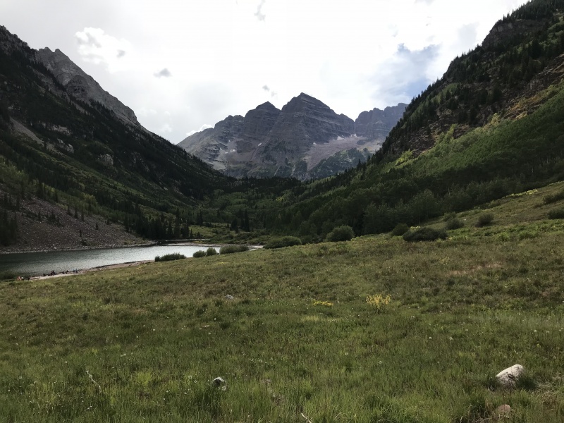
We planned to hike in to a high camp the preceding day, shortening the summit day climb. You might consider North Maroon a relatively short hike from the Maroon Lake trailhead, but without some time to get acclimated, even that is daunting. So we found a campsite near the turnoff from the Four Pass Loop trail toward North Maroon, just before you cross Minnehaha Gulch. From that campsite at about 10,760 feet, the summit was about 2.5 miles and 3,300 feet away - a do-able distance even for old, inadequately acclimated flatlanders, we hoped. It also offered a bit more backcountry experience than Crater Lake. But first we had to deal with the morass known as Maroon Lake camping. Arriving early enough to snag a parking spot in the day lot wasn't really an option, and whether or not overnight campers still got an exception was murky. We decided to just show up at the gate and hope for the best. That had worked for us three years ago, when the ranger let us through mid-afternoon, but this time it didn't. The ranger bluntly pronounced the lot was full, and resisted our efforts to reason with her - even as several cars drove down the road while we were talking, which any rational person would know meant there would be open parking spots. Back down the road we went to park and ride the bus, a confusing and overprice experience I hope to never repeat. One of the ironies of the Maroon Bells is that to reach them you have to run a gauntlet of the very thing you go to the mountains to escape - throngs of people, overpriced tourist traps, inane rules. On the bus, the driver, who clearly would rather have been performing at a night club, delivered a nauseatingly cheerful tourist talk in a sing-song voice to his captive audience, eventually breaking into a rendition of John Denver's "Sweet Surrender." Mark meanwhile did a slow burn which boiled over when we passed the overflow lot with plenty of empty spaces - which he loudly pointed out to the driver. The driver ignored him, happily announcing for the fourth time that the stand of aspen trees across the valley "all grew up from the roots." 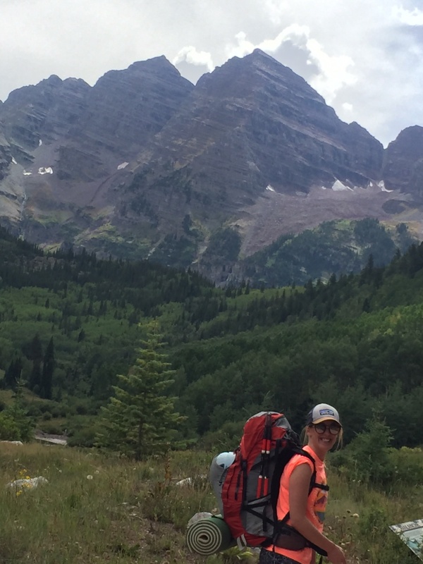
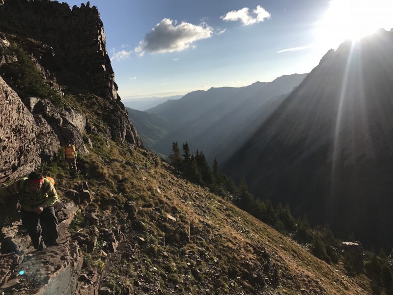
It was a profound relief to finally hit the trail and leave the crowds behind. Human interactions were limited to a few pleasantries with hikers, most of them coming from various destinations somewhere along the Four Pass Loop. We encountered 14ers.com member Lville in a group who had summited North Maroon. He flattered us by first recognizing us from trip reports (the Hawaiian shirts don't hurt there), then congratulating Maryjane and Dennis on getting married last year. I had been a bit concerned about the possibility of Minnehaha Creek running dry in this drought year. We had decided that chance was remote, but when we passed Crater Lake I began to wonder again. It was a stagnant puddle, showing far more dried-up mud flat than actual water. Fortunately some hikers we met who were coming down the trail reassured us that there was ample water in the creek. We knew of two campsites recognized by the Forest Service near the trail junction, and Google photos showed ample pine forest, usually good terrain for camping. Sure enough, when we arrived in the vicinity, several good sites awaited, some in use by others but a prime spot very close to the trail junction standing empty for us. And the creek was running strong. We set up camp just before an afternoon rain started. It persisted into the evening, leaving Dennis and me filtering water in a drizzle. But things dried up enough to enjoy a classic camp dinner before turning in. We timed our departure the next morning with the goal of reaching the rock glacier around daybreak, so natural light would help us spot cairns across that section. We were a bit slow but pretty close to the goal, with daylight breaking as we ascended the trail approaching it. 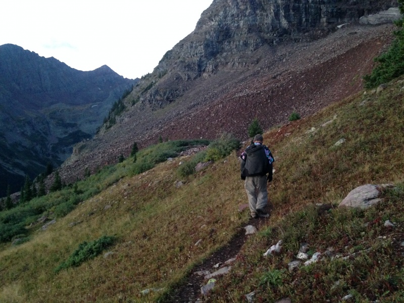
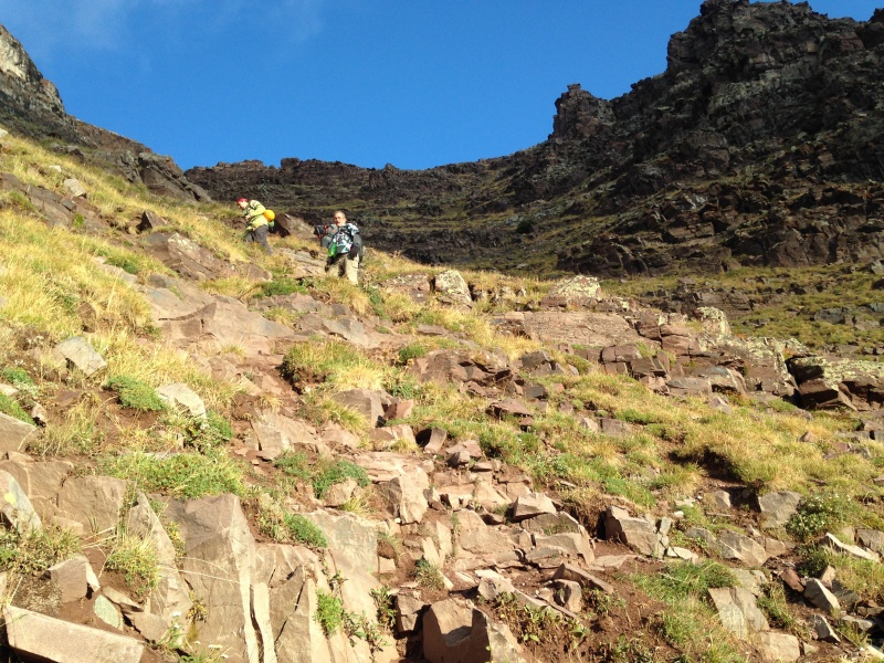
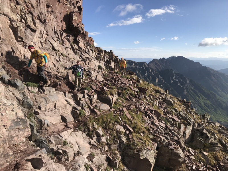
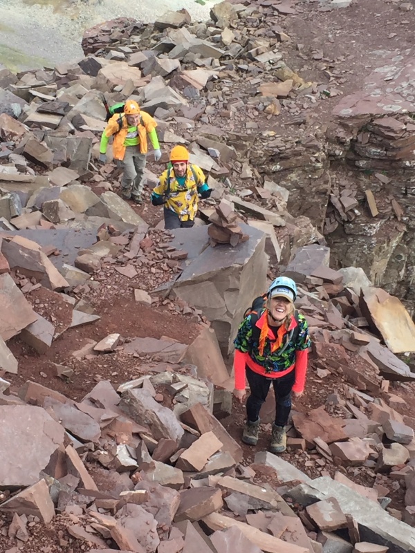
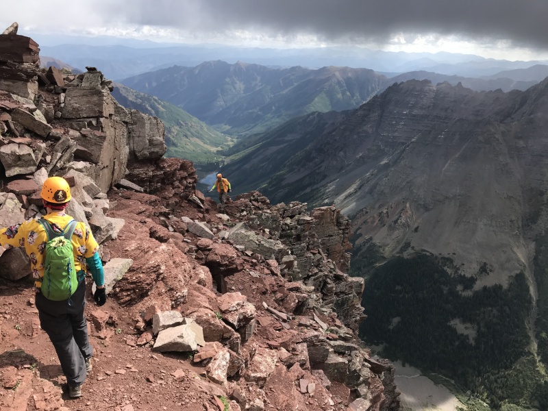
This section entails a little up-and-down over the rolling "waves" of rubble. We seemed to catch most of the cairns across, wandering off into random talus-hopping at times, then spotting another cairn to return to slightly better footing. This feature is very similar to the talus cross in Pyramid's amphitheater - if you've experienced either one, you have a real good idea what to expect on the other. 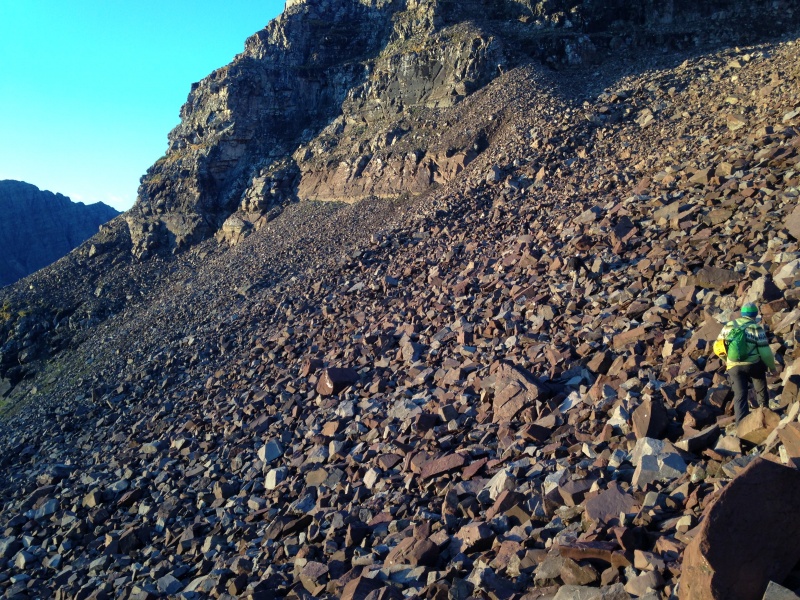
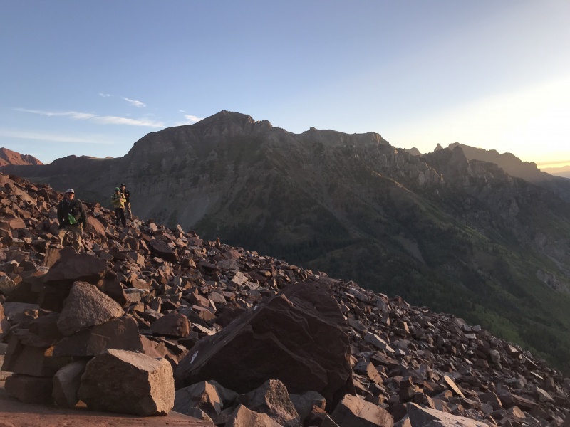
Beyond the rock glacier, the trail alternates between traversing and ascending until it reaches the first (east) gully. I was taken by surprise at the length of this section. I'd acquired a good sense of what to expect in the two landmark gullies and the broken ridge above the second gully, but had kind of overlooked the stretch from the rock glacier to the base of the east gully. It looks like maybe about a quarter-mile and 300' of elevation gain, but it felt like a lot to me. 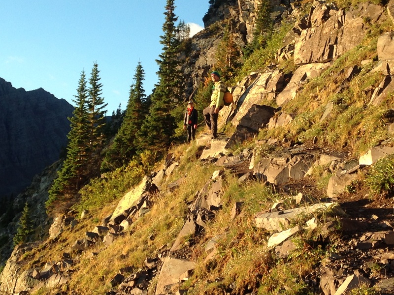
 Part of the reason this stretch felt long was that I was realizing at this point how much I was struggling. I had lagged behind crossing the rock glacier, and now I was pushing myself through exhaustion before we even reached 12,000 feet. While everyone else, including Mark, on the same acclimation schedule as me, seemed to be enjoying the hike on a beautiful morning, I was fighting off thoughts I'd never had on a 14er, like telling the rest of my group, "You all go ahead. I'll just lay down here and take a nap, and meet you when you come down." I was definitely slowing our group down - we pretty much stick together on the mountain - but we had camped high to accommodate a slow pace, so we kept plodding into and up the east gully. 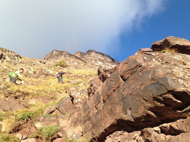
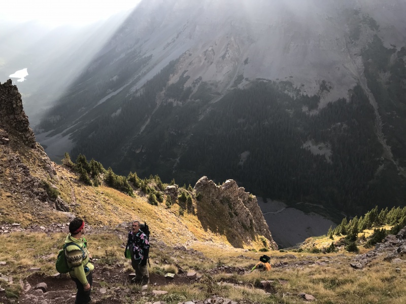
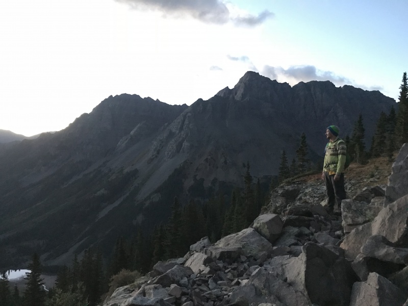
Eventually we reached the obvious exit ramp from the east gully, below distinctive white cliffs. We rounded one corner, crossed a shallow gully that forms a small break in the rib, and approached a second corner. This second corner provides an inviting spot for a break to fuel up and regroup, with the west gully visible ahead, and a commanding perch overlooking the Maroon Creek basin below from an elevation of about 12,600 feet. 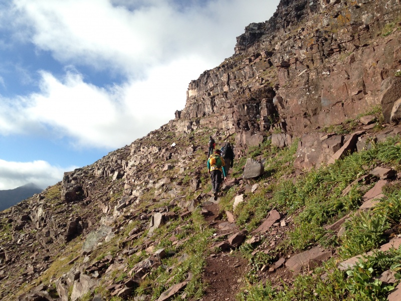
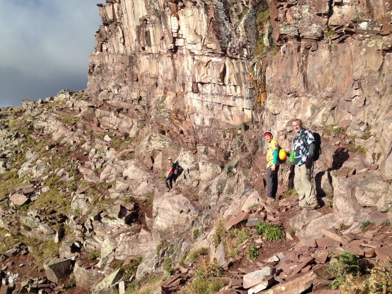
As we approached that second corner, Dennis, above and slightly behind me, exclaimed "oh, there it goes!" as I heard the ping-ping of what I thought was a small rock skip down the small gully. It turned out it wasn't a rock. It was his phone, which had worked up out of a pocket as he scrambled over some boulders, and plunged down the gully. Dennis said he had taken a good look down that gully and considered going after it, but decided the time and risk were too great. As with many of us, the cost of replacing the phone would hurt, but pale in comparison to the loss of many photos. We looked up the west gully, which looked steep and fierce from our vantage point. Beyond it, the upper reaches of the peak faded in and out of ominous swirling clouds. But it was still early and the clouds had no visible precipitation. While we rested, two faster climbers came across from behind us, greeted us briefly, and moved on ahead. 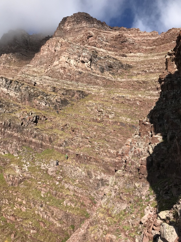

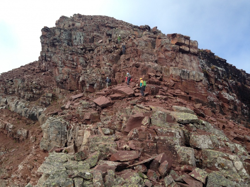
I managed to summon some energy to start up the gully out front with Maryjane. We ascended the left side, just below steep rock, on relatively solid terrain. We would stick with this route until about halfway up the gully, at which point the steep rock on our left choked down the width of the gully and funneled us into the main trail up the center. Mark and Dennis, following below, stuck with the main trail all the way up, if you can call it a trail. It's more of a mishmash of switchbacks and braided paths, loose but not miserably so. Our divergence of paths kept them out from directly beneath us, somewhat away from the fall line should we kick up any rocks. To my recollection, none of us did dislodge anything significant during this ascent. As many have noted, the gully gets steeper near the top and the scrambling intensifies. Caution is required - the consequences of rockfall are greater, especially if anything large should come loose - but it's not difficult as long as you take your time and pick your route with care. Unfortunately, we took very few photos along here. 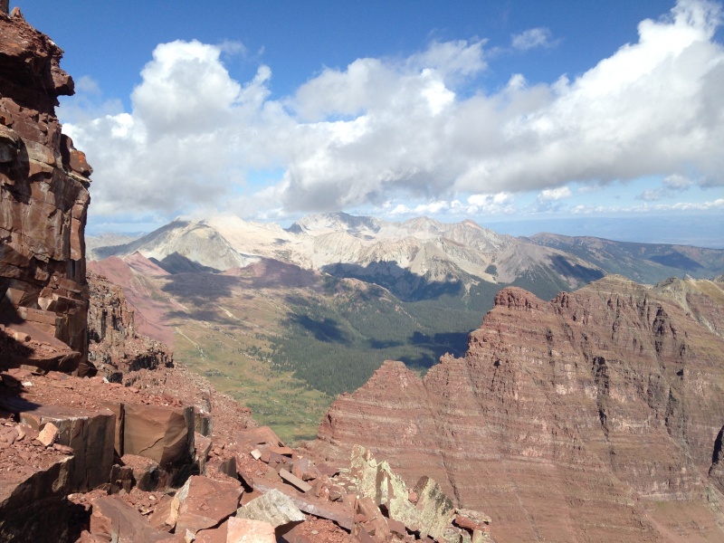
Beyond the gully, we found ourselves on a broad ledge that sloped up as we worked our way to our left, the classic Bells strata that's visible from miles away. Above us, the ridge followed the same line, up to the left. So as we followed the ledge we were gaining elevation but not getting any closer to the ridge, for a time. Where to ascend the steep final pitch to gain the ridge is a climbers' call. As we worked left, before long a weakness in the final pitch appeared, providing easy access to the crest of the ridge. When we got up on it, we found a smooth easy path along the top leading up to the next challenge, a steep wall of dark rock. As we neared that wall of rock, I realized the way up it was the notorious class 4 chimney. It caught me a little by surprise in how quickly we came upon it after gaining the ridge. I came up to the chimney first, with the notion of slamming right up it. Heh, not so fast, I discovered upon starting up. A small nub provides a good spot for a tall first step, but when I powered up that over steep rock into the chimney area, I couldn't find anything to grasp with my hands, and my weak attempt at a friction grip was inadequate. I had to back down and step back to regroup. While I shook out the jitters that come upon me from any failed attempt like that, the rest of our group scrambled up it, sharing advice and encouragement. Dennis helped talk me through my second crack at the move, which was successful. ("Make yourself large" against the walls of the chimney.) Once inside the chimney, the moves that follow entail some long reaches but are relatively straightforward, including grasping a great crack at the top which cannot be seen from below, but can be felt. Again, no pictures, as the more challenging spots tend to command your attention at the expense of the photography. Working out that problem together was quite a bonding experience, typical of the best things the mountains bring out. We would collaborate again in a similar manner on our descent back down through the chimney. (By the way, I would consider that chimney to be one of the most difficult single sections that I've encountered on a 14er - but nothing near the scariest, since exposure is minimal. Of the five routes that I've been on which are labeled class 4, I would say the gully crossover move on Crestone Needle, and one move on the descent of K2, would be comparable in that I would call them clearly class 4. I can't think of anything on Pyramid or S Ridge of Snowmass that I would call clearly class 4. I'd add that the "shortcut" gully on Eolus, shortly before the catwalk, has a steep, narrow point near the top that lacked good holds and had enough exposure to give me a good case of the heebie-jeebies.) The chimney is followed by a section of class 2 trail up to and onto the prominent point known as the precipice. There are several choices for getting up onto the precipice, all easy. I chose the one furthest left as far as I could tell, even though our destination was to the right, because the precipice is a cool feature and I wanted to maximize my enjoyment of it. I was bringing up the rear of our group again by this point, and would continue to right to the summit. One advantage of this is that you get in more photos, because the people out front have plenty of time to look around and take pictures while they wait for you. 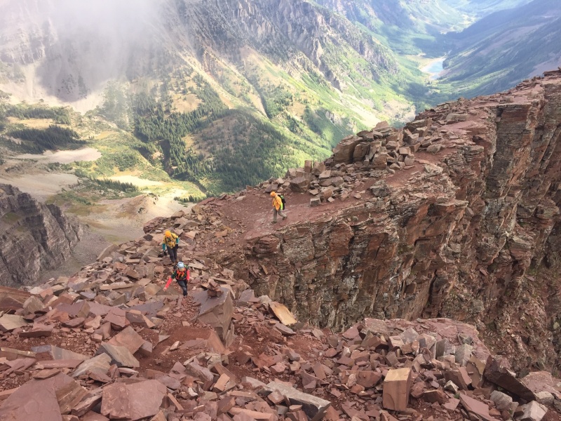
There is one more prominent rock point above the precipice and not far below the summit, providing fun, relatively easy climbing and lots of air up on it. Around here we encountered two groups descending, the guys who passed us on the ascent and another guy or two who had done the traverse from Maroon Peak. 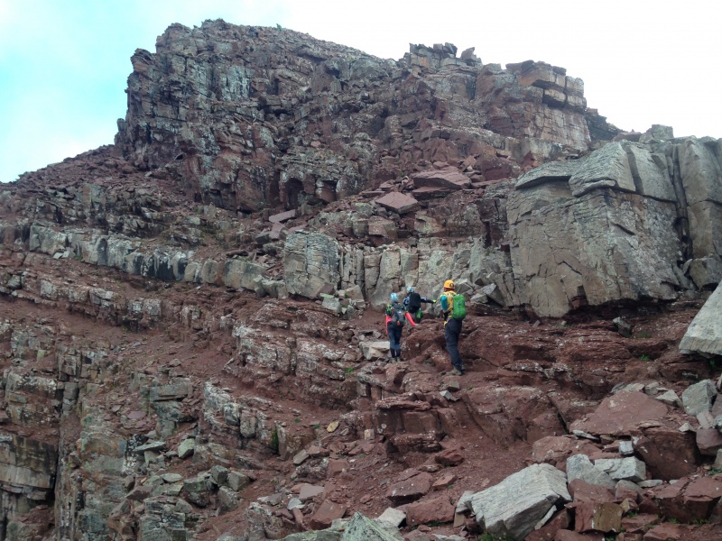
Beyond that, an easy scramble up a not-too-steep and seemingly solid rubble slope takes you to the cusp of the summit. Maryjane arrived here first, and she and the others waited for me to enjoy a triumphant walk up to the summit together. It was a few minutes after 10 a.m. 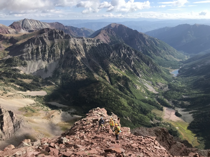
Our summit stay was leisurely, near 30 minutes of food, views and summit photos. A few thin grey clouds seemed to offer minimal threat of precipitation and none of thunderstorms. We admired the Capitol-Snowmass massif in the northeastern distance; the much closer Pyramid across the Maroon Creek Valley, and closest of all, "big brother" Maroon Peak. We had expected to feel some urge to go for Maroon Peak once we were this close, but none of us did. Though less than a half-mile away, it didn't look all that close, and the difficulty and danger of the traverse was obvious from the summit. The dark misty clouds that intermittently enveloped the summit helped drive the point home. We have no plans to ever try that traverse, and no regrets about the firm knowledge that that is on the other side of our limit line.
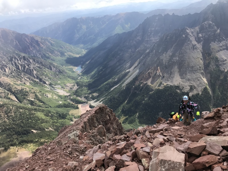
As we descended, the clouds dissipated and glaring high-altitude sunshine took over. My condition deteriorated rapidly as we neared the west gully and started down it. When the sun gets that intense it seems to take a fierce toll on me, exacerbated by the fact that I couldn't find my sunglasses. The down-climbing steps caused my knees to get wobbly, and the length of time at altitude was clearly draining my strength and coordination. I lagged far behind the rest of our group descending the gully. That overwhelming temptation to lie down and take a nap came over me again, but that wasn't an option. I knew I needed to get to a lower elevation, and somehow find some relief from the sun, to feel any better. 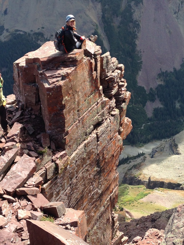
While I plodded down at my painfully slow pace, Mark reached the point at the base of the west gully first, and looking back saw that he was going to be waiting a while for me. He decided to use the opportunity to consider the possibility of finding and recovering Dennis's phone. Walking the short distance to the nearby ledge where Dennis had been when the phone fell, he picked four small flat stones that he judged to be roughly similar in size and weight to the phone, and tossed them down the gully. All four came to rest in the same general vicinity about 30-50' below. Studying the terrain, he judged it safe to carefully downclimb to that point. When he reached the spot, he saw the phone sitting almost at his feet. It suffered a cracked screen but was in working condition, and was re-united with its very appreciative owner a few minutes later.
I was revived somewhat by rest, lower elevation, a change in direction away from the glaring sun, and some disposable sunglasses that I had saved from my last optometrist visit and tossed in my pack for an emergency backup. We set off again feeling upbeat, but our fortunes were going to take a turn for the worse very shortly. As we walked along, the level trail seemed to fade away to nothing. We thought the trail had meandered somewhere below us, and if we continued ahead, scanning below us, it would show back up soon. Except it didn't. By this point we were approaching a large rib of rock with a wide ledge which provided an easy walking path but didn't really look like trail. Without really talking it through, several of us wandered off different directions to try to get our bearings. I walked around the flat section of the rib, expecting to find the top of the east gully on the other side, with the ramp leading into it below cliffs to my left. When I reached the other side of the rib, I saw cliffs to my left all right, but no trail. Rather, the cliffs fell away to a huge drop, and far below lay a vast sea of talus. I stared dumbfounded at the rubble for a moment until it dawned on me that I was looking at the rock glacier, 500 feet almost straight down below me. How can we be to that, I wondered, and how do we get down to it. The answer to both questions was immediately obvious: we had walked right past the east gully. Sure enough, when we looked behind us and down, there was the gully with the obvious trail zig-zagging downward. Where the trail had seemingly disappeared we had simply walked off the end of a switchback, duh. None of us had shown the awareness to just stop and look around to get our bearings there. We regrouped with more than a little frustration and frankly embarrassment over making such a boneheaded mistake together. And, we had collectively forgotten just how short the distance is between the two gullies. The only good news was that we had figured it out before anyone wandered off into really dangerous terrain. As we descended the gully we found two more spots where erosion paths led straight ahead but a look around showed the main trail switchbacked down. The false trail segments eventually devolved into obvious game trails, but they started out strong enough to be deceptive. I had read that getting confused on the descent of North Maroon was fairly common, but I assumed that was generally people who had traversed over from Maroon Peak. We proved that even those who had ascended the same route could get off-route on the descent if you get careless.
It took quite some time for the last of us to get back to camp, break it down and reach Maroon Lake, but Dennis provided welcome relief by descending ahead to catch the bus down and bring our vehicle back up to the lake. We had one last mini-crisis when Maryjane became ill, we think from dehydration and overheating on the final descent with a heavy camp pack. When we reached an area with cell signal and called our wives, Mark commented that Maryjane was out throwing up behind the car, setting off a mini-frenzy of half-serious rumor on social media that she was pregnant. (She wasn't.)
All in all, this endeavor was quite a stretch for us to tackle as early in our trip as we did, but we managed to overcome the obstacles and our own limitations to enjoy a classic 14er on an absolutely beautiful day in the mountains.
Thumbnails for uploaded photos (click to open slideshow): ")
")
")
")
")
")
")
")
")
")
")
")
")
")
")
")
")
")
")
")
")
")
")
")
")
")
")
")
")
")
")
")
")
|
| Comments or Questions | ||||||||||||
|---|---|---|---|---|---|---|---|---|---|---|---|---|
|
Caution: The information contained in this report may not be accurate and should not be the only resource used in preparation for your climb. Failure to have the necessary experience, physical conditioning, supplies or equipment can result in injury or death. 14ers.com and the author(s) of this report provide no warranties, either express or implied, that the information provided is accurate or reliable. By using the information provided, you agree to indemnify and hold harmless 14ers.com and the report author(s) with respect to any claims and demands against them, including any attorney fees and expenses. Please read the 14ers.com Safety and Disclaimer pages for more information.
Please respect private property: 14ers.com supports the rights of private landowners to determine how and by whom their land will be used. In Colorado, it is your responsibility to determine if land is private and to obtain the appropriate permission before entering the property.


