Download Agreement, Release, and Acknowledgement of Risk:
You (the person requesting this file download) fully understand mountain climbing ("Activity") involves risks and dangers of serious bodily injury, including permanent disability, paralysis, and death ("Risks") and you fully accept and assume all such risks and all responsibility for losses, costs, and damages you incur as a result of your participation in this Activity.
You acknowledge that information in the file you have chosen to download may not be accurate and may contain errors. You agree to assume all risks when using this information and agree to release and discharge 14ers.com, 14ers Inc. and the author(s) of such information (collectively, the "Released Parties").
You hereby discharge the Released Parties from all damages, actions, claims and liabilities of any nature, specifically including, but not limited to, damages, actions, claims and liabilities arising from or related to the negligence of the Released Parties. You further agree to indemnify, hold harmless and defend 14ers.com, 14ers Inc. and each of the other Released Parties from and against any loss, damage, liability and expense, including costs and attorney fees, incurred by 14ers.com, 14ers Inc. or any of the other Released Parties as a result of you using information provided on the 14ers.com or 14ers Inc. websites.
You have read this agreement, fully understand its terms and intend it to be a complete and unconditional release of all liability to the greatest extent allowed by law and agree that if any portion of this agreement is held to be invalid the balance, notwithstanding, shall continue in full force and effect.
By clicking "OK" you agree to these terms. If you DO NOT agree, click "Cancel"...
Time: 7.5 hours start to summit, 6 hours of moving
Forest bathing: All of it
Questioned own sanity: at least 12 times
Definitely Not Doing That
When I went to Europe in October, I wasn't planning to hike much. The Zugspitze wasn't on my radar when I planned my trip; I just wanted to visit Garmisch-Partenkirchen because I'd heard great things about the towns. As I shared my trip details with friends, though, it became a recurring theme that someone would inevitably bring up the peak. Even my mother asked me (or rather, asked me not to climb it). I looked into it briefly, and preliminary search results all mentioned a harness and crampons. None of the reports I checked were on this site, which has a single trip report for the scrambly and famous Jubilee Ridge. I didn't want to do sustained scrambling involving a harness and possibly crampons solo for my own safety preferences. I also assumed that in October, the mountain would be too icy to qualify as summer conditions anyway.
I Might Have A Problem
Before GaPa, I visited Fuessen and Schwangau to see Ludwig's castles, since that seemed like a requisite of traveling through southern Germany. While there, I happened to summit one of the local peaks, which gave me my first in person look at the Zugspitze, and the first inkling that I might make myself a liar.
I would love to go back here and do some skyrunning
I knew that I wanted to do a run of Mount Wank while in GaPa, since most google searches turned it up as a must do hike. Even before I did, I knew that I was in trouble just from walking through downtown Partenkirchen and taking in the intimidating backdrop of the Zugspitze looming overhead. Meandering my way up the trails on Wank, I knew that I had to at least look into hiking/climbing the tallest peak in Germany, that I would regret it if I didn't. Germany had a very hot and dry summer, and the whole valley was still very much in summer conditions.
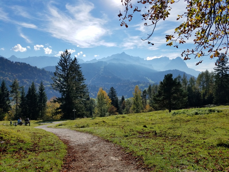
View across the valley
What I was able to find on summitpost didn't give me much. One trip report covered doing the peak in half a day, but mostly just said that they hadn't used much extra equipment. The other basic info made it clear that the Reintal (Pure Valley) is the easiest route. Based on that, I decided I would get up the next morning and start hiking and see how far I got. If the miles were slow or I felt in over my head, I would turn around.
It's easy enough to start the hike in Garmisch itself, from the Olympic stadium. Following the road in closer toward the mountain quickly brings you to the Partnachklamm (gorge), which I thought was well worth the 5 euro fee. It's really cool to see the tight, close rocks, soaring cliffs, and even the old blasted tunnels and walkways in the gorge. It felt a bit like going back in time, at least on the human timeline.
Partnachklamm
Enter the Woods
One of the beauties of the Alps is the regular, reasonably well marked trail signs. Though they won't give distances, they do have names of trails and berghauses, often with time estimates. Following signs for Reintal and Knorrhutte was very straightforward. The Reintal approach overall is definitely class 1 hiking. This might not be some people's cup of tea. For quite a few miles after the gorge, the hike is along a mellow crushed gravel path wide enough for (European) vehicles. I easily held a sub 3mph/5kmph pace for the first 11 miles/18km.
trail signs
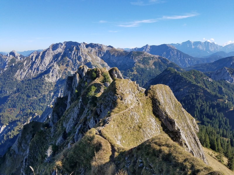
fairy tale views
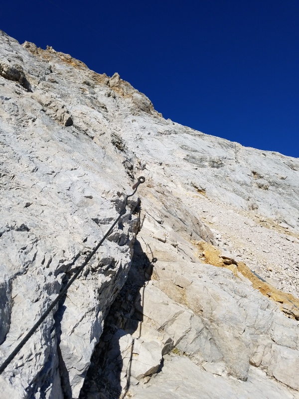
Eventually, after passing the Reintallangerhutte, the trail starts climbing, and how. The next 5 miles average over 1000 vertical gain per mile. This is also where the trail gets fainter and requires watching for cairns and Austrian flags blazed on rocks. This steep trail meanders into the upper valley and passes the Knorrhutte, and from that point the remaining trail deteriorates for a while. The Schneeferner glacier is basically gone, and it's obvious that much of the disappearance has occurred in just the past few decades. The moraine gets steadily more barren and junky the further you ascend, walking across what 100, then 70, then 15 years ago was snow and ice. This especially noticeable between Sonnalpin and beginning of the klettersteig (via ferrata), which presently is a highly traveled several hundred foot freeforall flail up kitty litter.
the klettersteig
Airy
The klettersteig itself was considerably easier than I had anticipated; imagine if the final wall on Colorado's Wetterhorn was less steep and had iron handrails switchbacking up it. This starts about 3/4 of a mile from the summit and was really fun class 3 scrambling, with the added safety of the iron. If it were icy, a harness and lanyard would definitely be helpful, as would microspikes.
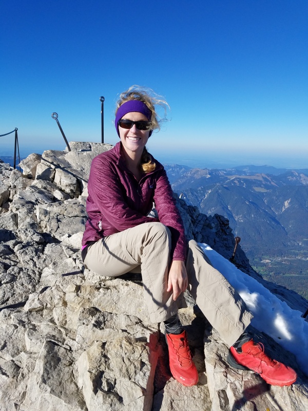
The downside of the summit development: ugly buildings (from the outside, anyway) and masses of tourists. The upside: hot food and drink that you didn't have to carry, so long as you've brought some euros with you, and the easy way down, should you so choose. That said, you do have to go through this infrastructure to get to the actual summit. There is a "proceed at your own risk" sign at the top of some scaffolding, and from there you can descend those stairs before scrambling the last little section of klettersteig, which is extremely airy.
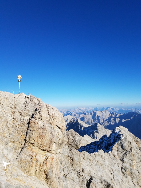
On the summit
The summit and Jubilaumsgrat from the viewing deck
After returning to the deck, I was pretty stoked to order a milchkaffee (latte) and pastry, before taking the tram and the train back to GaPa. If you visit the area during relatively dry conditions, I would highly recommend this route, which can be broken up into two days if you make a reservation at one of the huts.
My GPS Tracks on Google Maps (made from a .GPX file upload):
and chant: 'there's no place like Zugspitze' three times and you'll be back!
Enjoyed this one, Annalise. Your writing evokes your deep passion for adventure. I look forward to more from you!
Rob
Rob, I'm definitely going to go back. So much fun running/hiking/scrambling to be had in southern Germany. If you're at either of the December HHs, I'd be happy to chat about the trip...my writing is a bit rusty at present.
Conor, I'm glad that I ended up doing it, it was one of the highlights of my trip. I've also heard good things about the Hoellental route.
Did the Zugspitze years ago when I was stationed in Bamburg, Germany. An amazing four years of my life!
The Dolomites are another fairy tale destination to climb and ski!
Caution: The information contained in this report may not be accurate and should not be the only resource used in preparation for your climb. Failure to have the necessary experience, physical conditioning, supplies or equipment can result in injury or death. 14ers.com and the author(s) of this report provide no warranties, either express or implied, that the information provided is accurate or reliable. By using the information provided, you agree to indemnify and hold harmless 14ers.com and the report author(s) with respect to any claims and demands against them, including any attorney fees and expenses. Please read the 14ers.com Safety and Disclaimer pages for more information.
Please respect private property: 14ers.com supports the rights of private landowners to determine how and by whom their land will be used. In Colorado, it is your responsibility to determine if land is private and to obtain the appropriate permission before entering the property.


")
")
")
")
")
")
")
")


