Download Agreement, Release, and Acknowledgement of Risk:
You (the person requesting this file download) fully understand mountain climbing ("Activity") involves risks and dangers of serious bodily injury, including permanent disability, paralysis, and death ("Risks") and you fully accept and assume all such risks and all responsibility for losses, costs, and damages you incur as a result of your participation in this Activity.
You acknowledge that information in the file you have chosen to download may not be accurate and may contain errors. You agree to assume all risks when using this information and agree to release and discharge 14ers.com, 14ers Inc. and the author(s) of such information (collectively, the "Released Parties").
You hereby discharge the Released Parties from all damages, actions, claims and liabilities of any nature, specifically including, but not limited to, damages, actions, claims and liabilities arising from or related to the negligence of the Released Parties. You further agree to indemnify, hold harmless and defend 14ers.com, 14ers Inc. and each of the other Released Parties from and against any loss, damage, liability and expense, including costs and attorney fees, incurred by 14ers.com, 14ers Inc. or any of the other Released Parties as a result of you using information provided on the 14ers.com or 14ers Inc. websites.
You have read this agreement, fully understand its terms and intend it to be a complete and unconditional release of all liability to the greatest extent allowed by law and agree that if any portion of this agreement is held to be invalid the balance, notwithstanding, shall continue in full force and effect.
By clicking "OK" you agree to these terms. If you DO NOT agree, click "Cancel"...
Distance: ~9.5 miles (with an additional 5 bonus miles at the end!)
Start: 6:45am
Return: 7:30pm
Climbers: John L, MtnHub (Doug)
Introduction:
After a day of mixed emotions, exhilaration at finally climbing the Cathedral Trail and successfully attaining Katahdin’s summit once again, it was still disappointing not to be able to complete the loop around on the other side. I had really been looking forward to scrambling on the Knife Edge again especially since when I did it back in 2002, clouds had almost totally obscured my view. But it was just too dangerous to continue on with the gusty winds we had experienced.
Over supper that evening, John and I discussed our options. We had already paid for another day pass in the Park. So when we heard that the weather forecast for the following day was to be sunny with little or no chance of rain, we quickly reserved another night at Big Moose.
Feeling a little stiff and sore in the muscles and joints from the day’s hike we had just finished, I wasn’t exactly sure we could manage another long strenuous day in the morning. But I figured whatever John felt up to, I could manage as well. He’s two years my senior but he is in great shape. We planned to just start and do whatever we felt up to and then turn around and return if and when we needed to.
The Climb:
We started up the Chimney Pond Trail once again slightly later than the previous day. This time however, the sun was obviously out and already beginning to filter in through the trees. An encouraging sign to say the least!
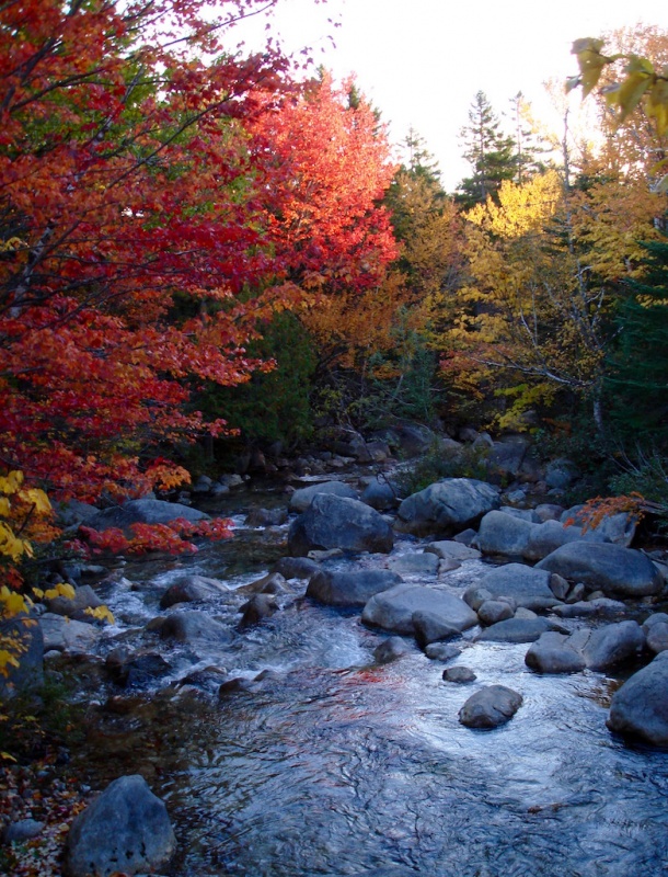
Once again, the Roaring Brook at the start of the trail.
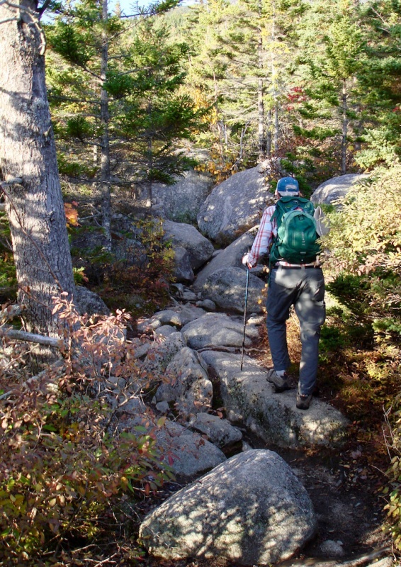
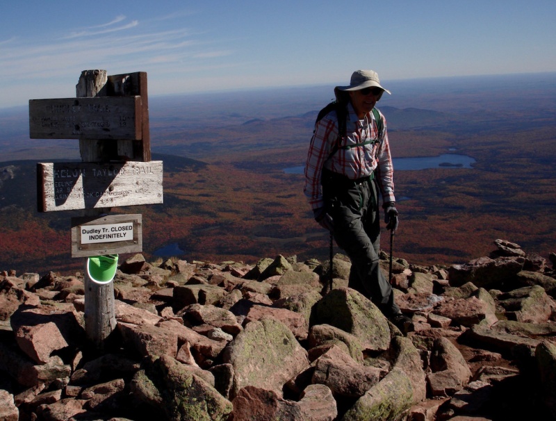
We came to the trail junction of the Helon Taylor Trail almost immediately and it started rising steeply.
John climbing the Helon Taylor Trail.
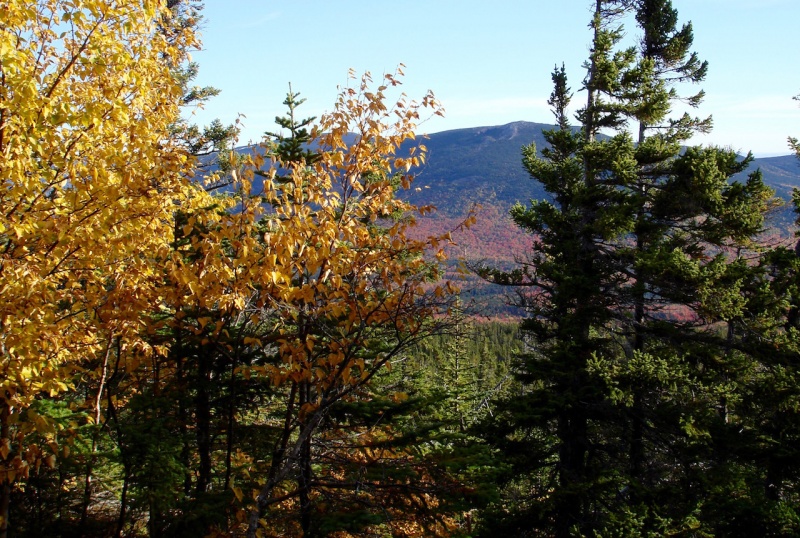
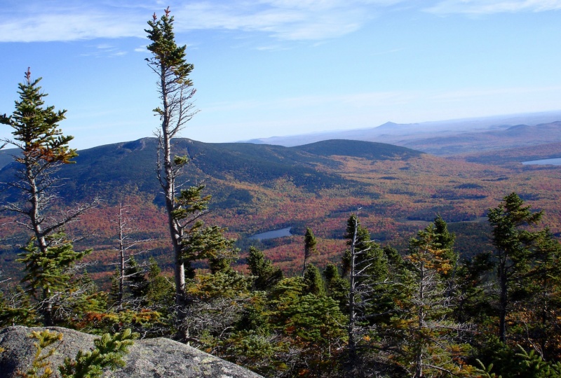
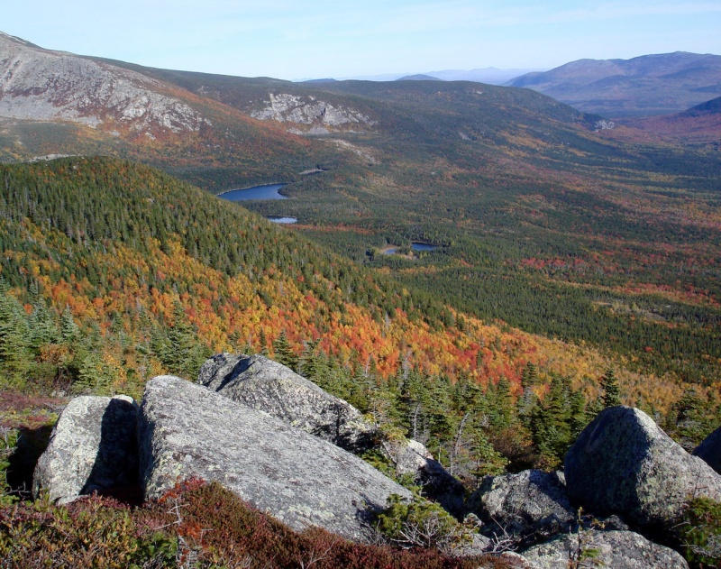
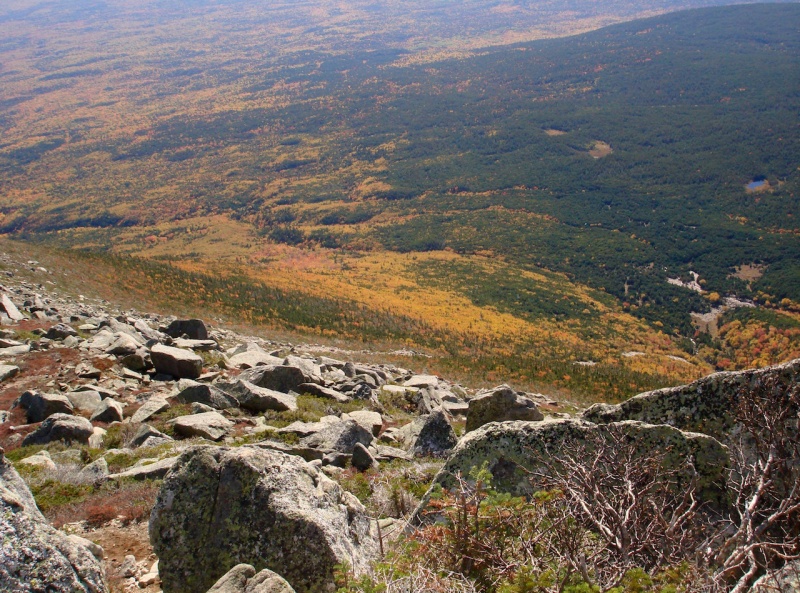
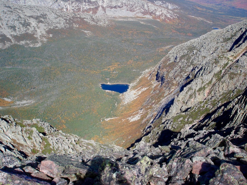
About a quarter mile in, the trail leveled off and wandered through a marshy area before it began climbing once more. It was not until we reached several sections of more exposed, bluff-like boulders that we got a better sense of the valley we were leaving behind. There were several places where you could look out over the valley and really take in the view. It was amazing! It was like a smokeless forest fire! The trees were ablaze with color!
The famous quote by Albert Camus came to mind: "Autumn is a second spring when every leaf is a flower."
If every leaf is a flower, then every tree is a huge bouquet with thousands of bouquets blooming in the valley below us! It was stunning!
South Turner Mountain.
Although I love all the seasons, each in their own due course, fall is my very favorite! This was exactly what I had hoped and dreamed of experiencing on this trip!
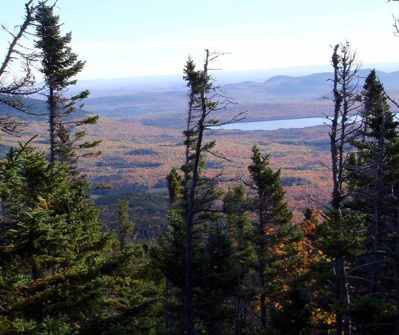
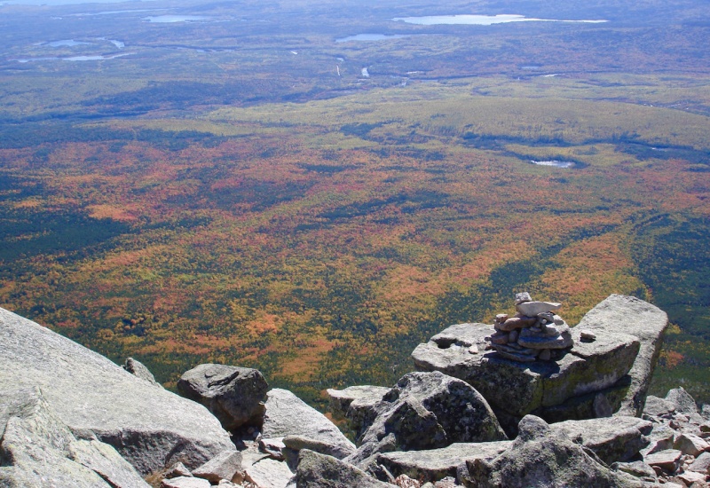
Katahdin Lake in the eastern valley.Smokeless forest fires! Trees ablaze with color!
We continued to climb up the steep slope which kept alternating through short sections of woodland trail, then more boulder-weaving. It was non-stop fun!
John scrambling through the boulders.A couple from Canada climbing up as well.
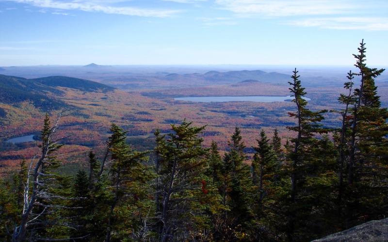
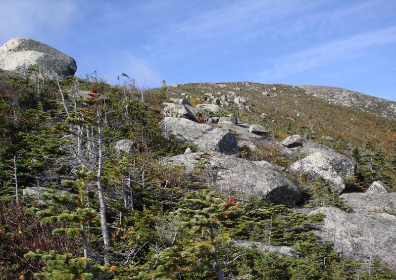
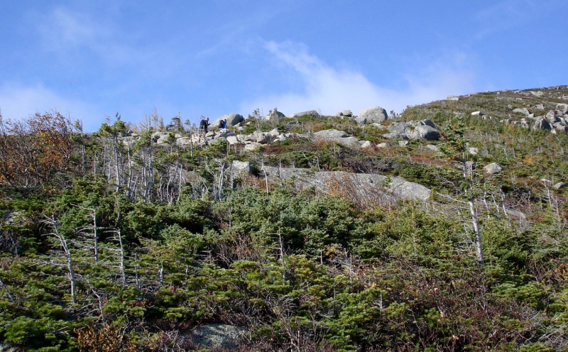
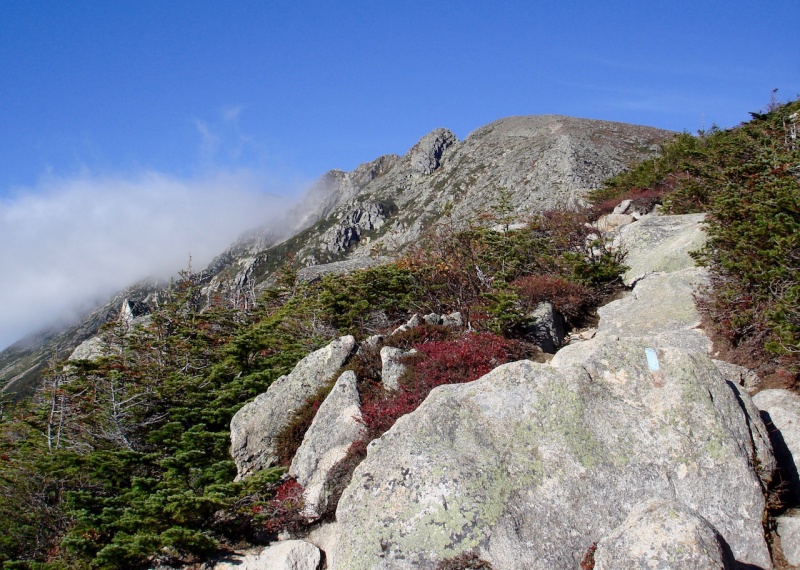
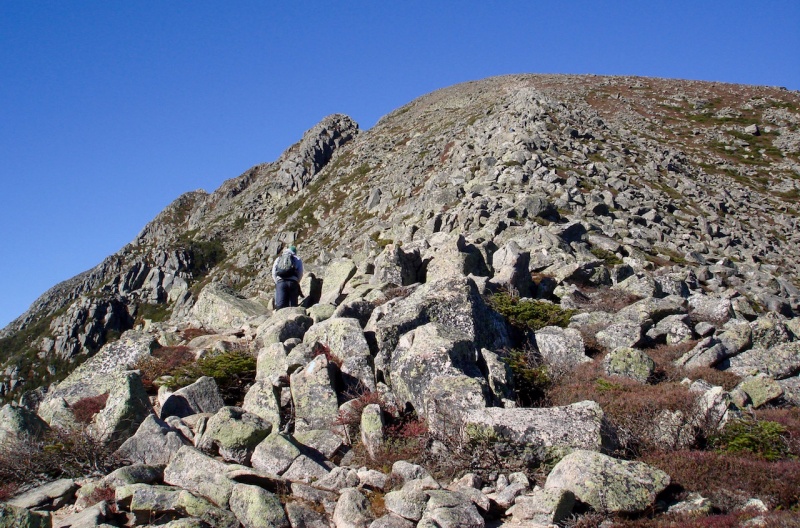
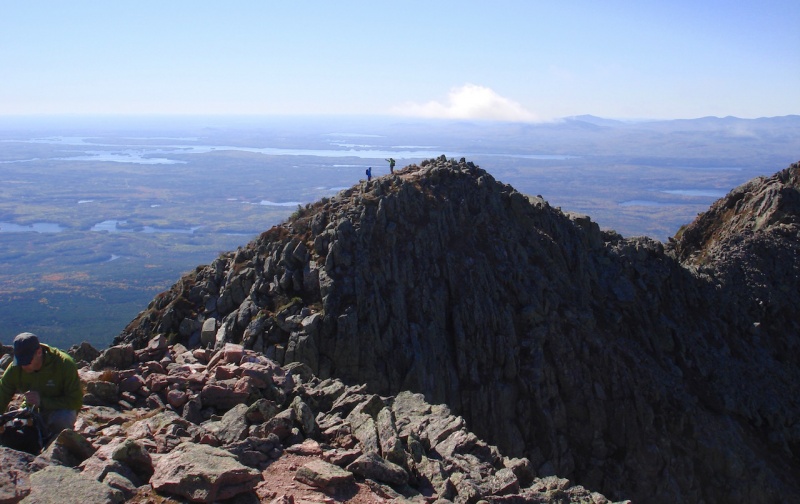
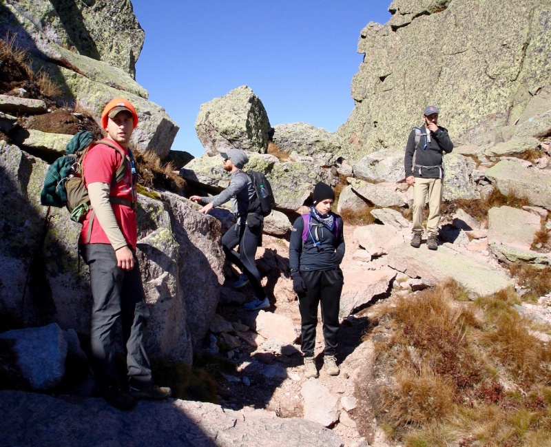
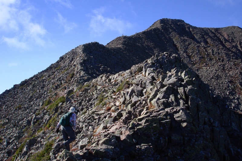
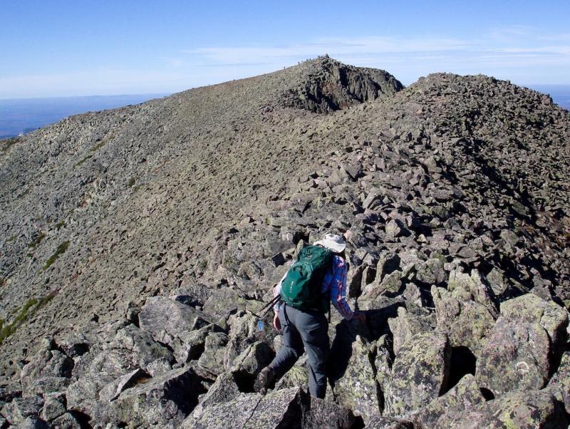
Eventually, when we got above timberline, we could finally see the long high ridge ahead which would lead us to Pamola’s summit, the first of four peaks along the crest of Katahdin.
The exposed Keep Ridge on Pamola's eastern side.Climbers along the ridge.
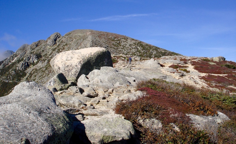
The higher we got, the better the views.
The Basin Ponds.South, Chimney, and Pamola Peaks.Climbers just ahead of us.John and another couple from VA climbing along the ridge. Katahdin Lake in the background.More scrambling along the ridge.And more color in the valley.John poses at a dramatic place.Another look down the ridge we've been ascending.John reaches the summit of Pamola Peak.
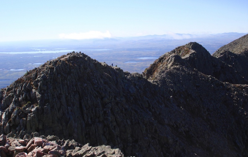
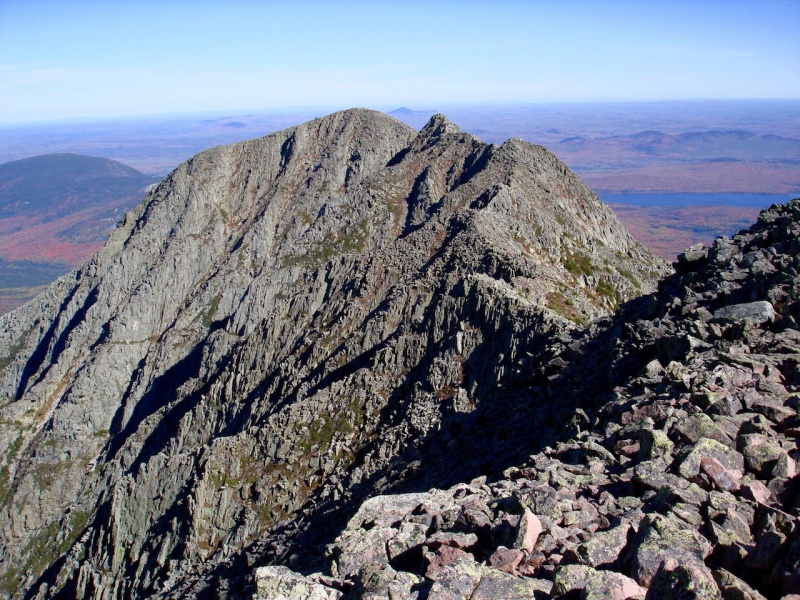
We took a good long break at the top of Pamola, eating a sandwich and some snacks, and enjoyed the fantastic views all around us. We also scanned the arête ahead of us with lots of climbers at various stages along their way to Baxter Peak.
Two climbers on Chimney Peak.Climbers on the Knife Edge.The rest of the way: South Peak and Baxter Peak.
Since John and I had never really discussed any firm plans for the day, both of us thinking we would just play it by ear, I wasn’t really expecting that we would continue any farther. I was hoping to sample at least the initial part of the Knife Edge just to get a taste of it again, but thought realistically that John would want to turn around at this point.
I certainly wasn’t anticipating going all the way to the summit again. If we did, we would have to descend one of three ways:
1) returning along the long Knife Edge immediately after we had just traversed it; that would be a long, grueling return;
2) descending down the Cathedral route which normally isn’t recommended;
3) descending again in the loose scree and rocks of the Saddle gully; I wasn’t looking forward to doing that again.
So it came to my surprise when John suggested that we consider another option entirely: descending down the other side of the mountain to the southwest – the trail to Abol Campground.
Neither of us had ever done this route and I asked him how we would get back to the Roaring Brook Campground where our vehicle was parked. He replied we could hitch a ride back as there are always cars going into the Park.
Initially, I was skeptical, knowing that it would be at least a good 12-15 miles back to Roaring Brook. But John assured me it would be no problem, so I finally agreed. But first we had to reach the summit of Baxter Peak. We still had a lot of serious climbing ahead of us before we could even think about our return.
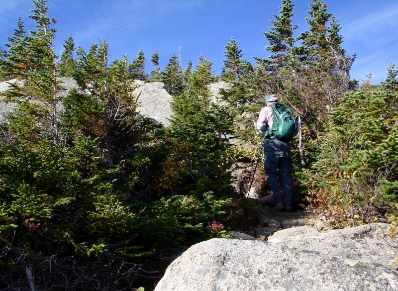
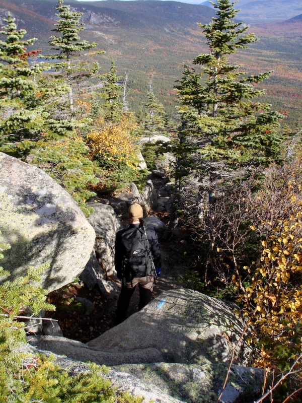
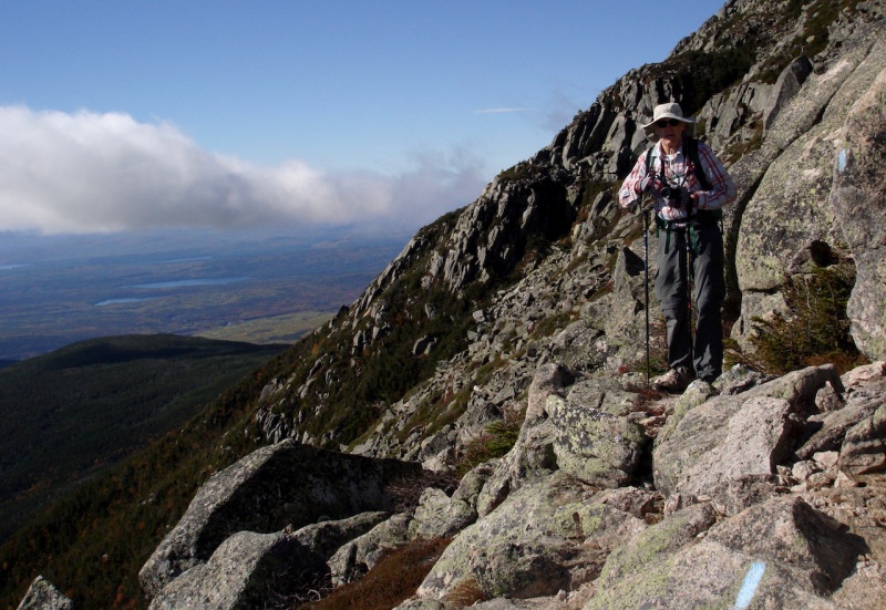
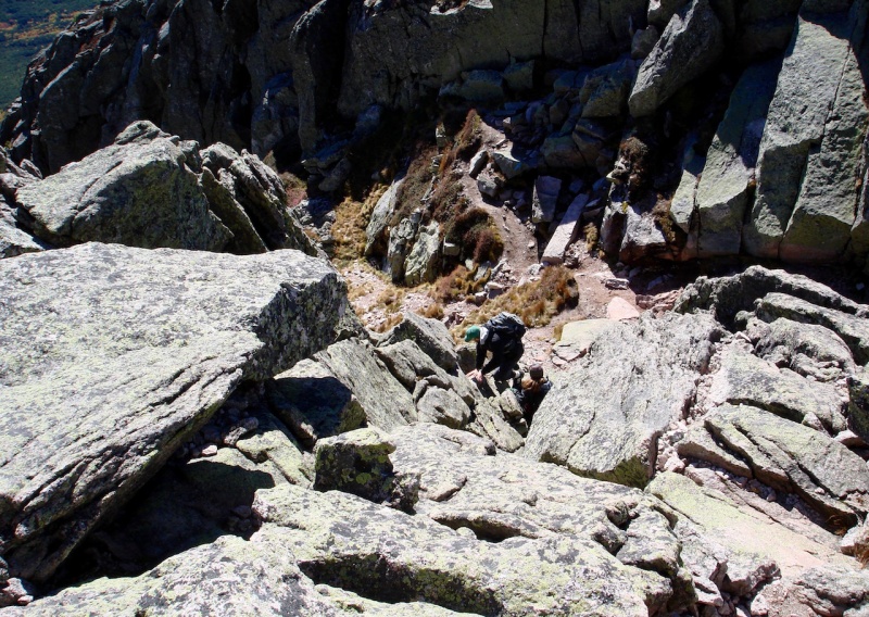
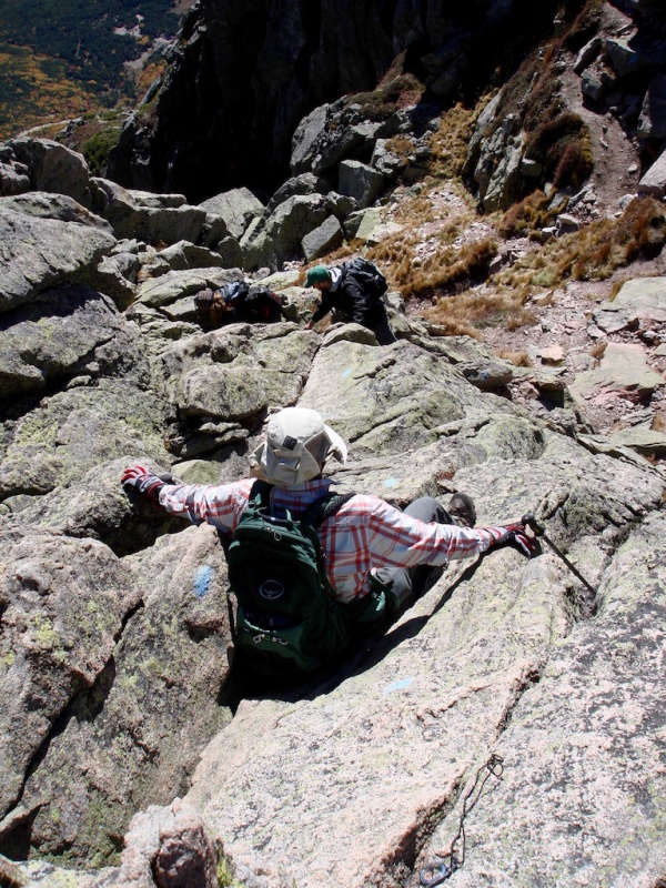
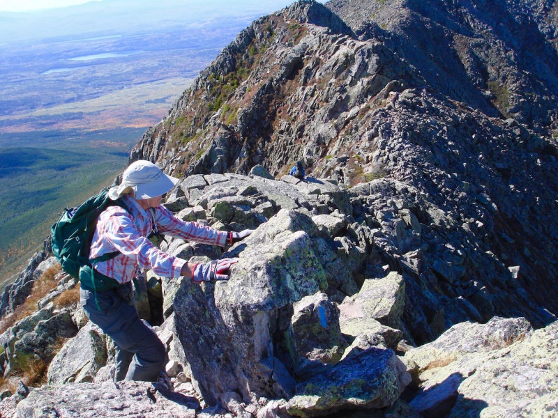
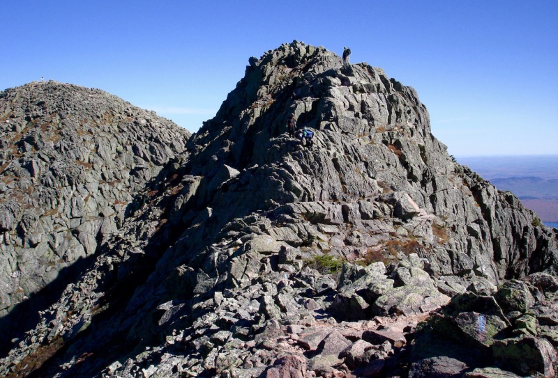
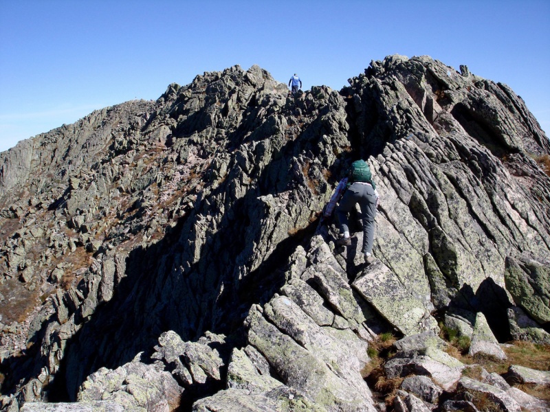
The first order of business was getting over to Chimney Peak just to our south. We needed to scale down to a notch between the peaks. This is the crux of the climb. There were several climbers going down this section so we had to wait until it was clear before we could even begin.
Although there are a few touchy maneuvers on it for sure, it is all marked with blue blazes so route-finding is not an issue. You just need to carefully look over your foot and handholds before making a move.
Looking down into the notch between Pamola and Chimney Peaks.John starting down.Climbers coming down (taken from the notch).(Taken from the base of the notch.)Climbers in the notch.
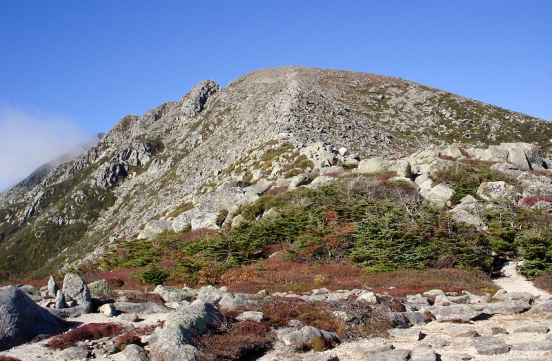
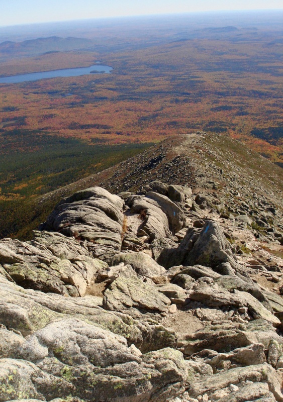
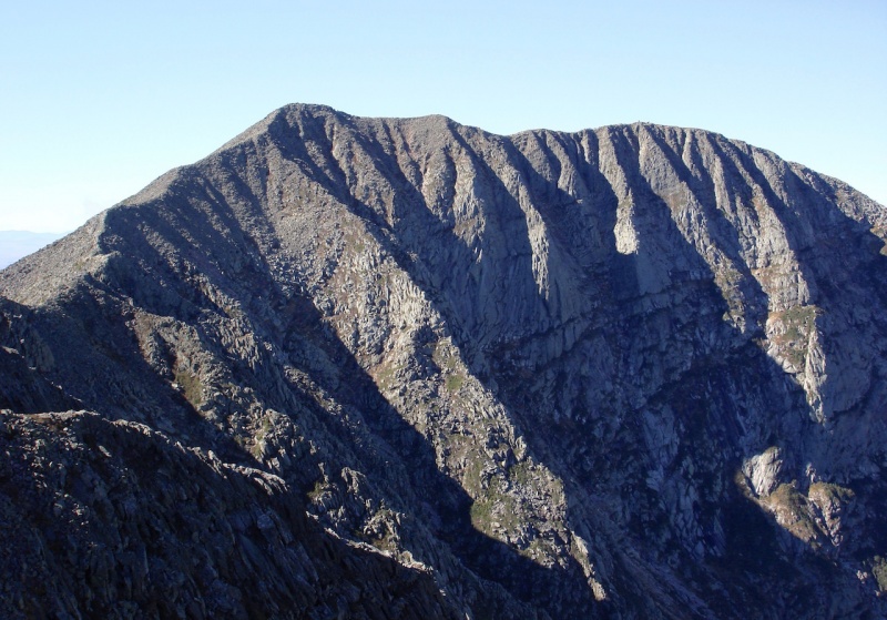
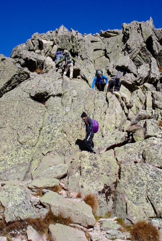
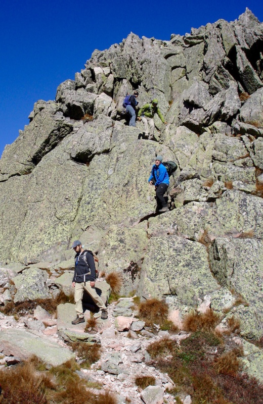
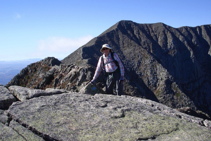
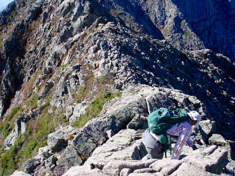
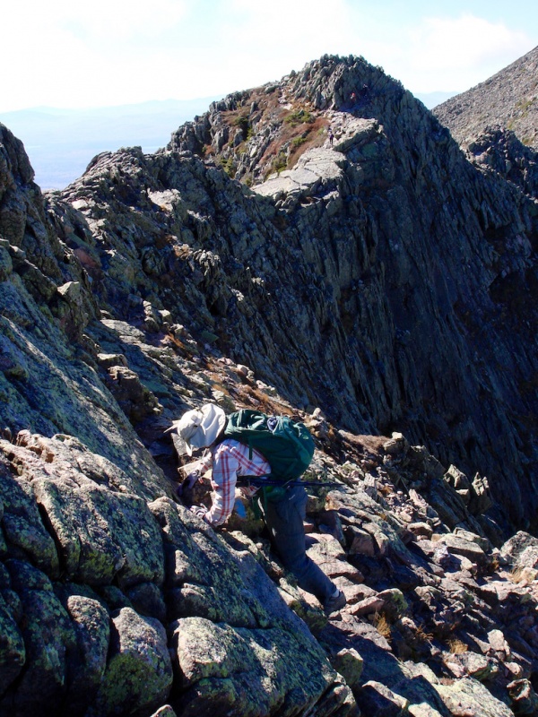
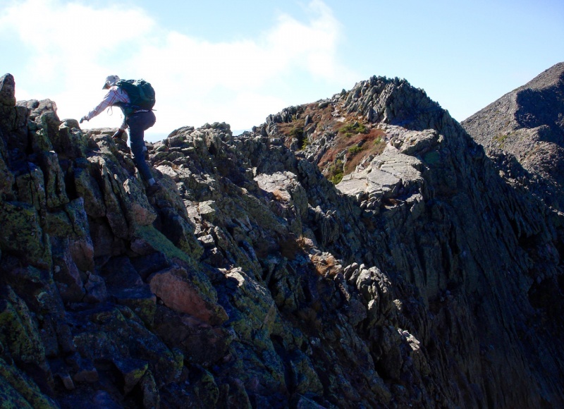
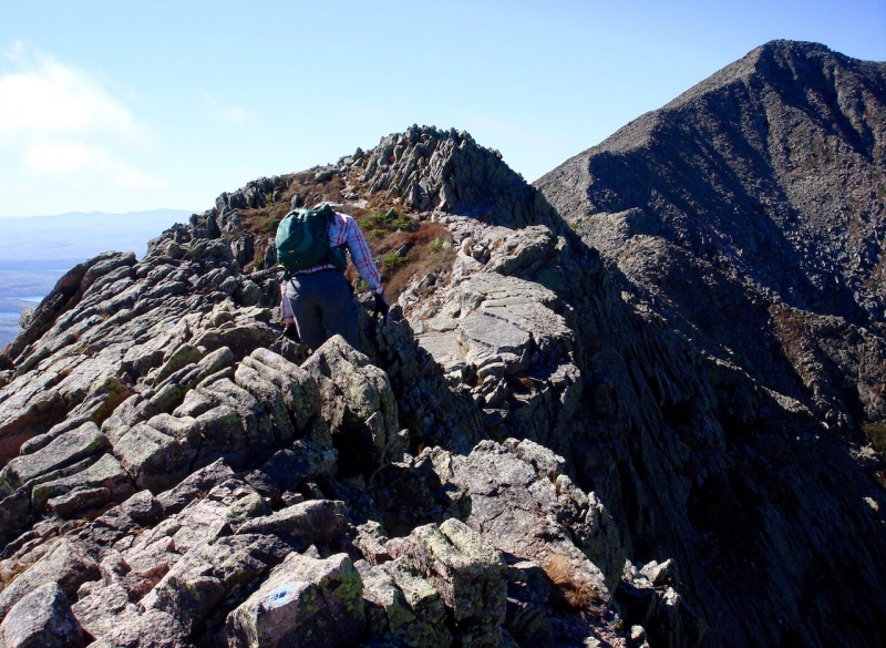
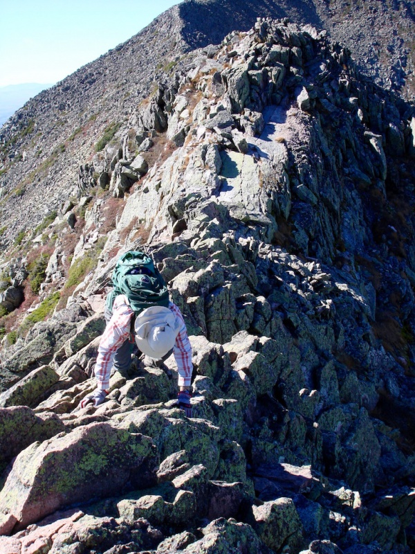
Once on the top of Chimney, the rest of the route is straightforward. The Knife Edge is really not a true Knife Edge, at least not in the Capitol Peak sense. It is narrow, but more like a catwalk, being at least a few feet across at the worst and several feet across in most places. But it is still exciting and extremely fun!
John on Chimney Peak.John posing with the rest of the route behind him. Other climbers can be seen along the ridgeline.John and two other climbers on the Knife Edge.Looking back at Pamola Peak on the left, climbers descending a short drop along Chimney Peak.John crossing another fun section of the Knife Edge.Coming up to South Peak. Again, other climbers can be seen along the ridge.Looking back from South Peak: Pamola and Chimney Peaks with Katahdin Lake in the background.A look down at Chimney Pond from the perspective of South Peak.
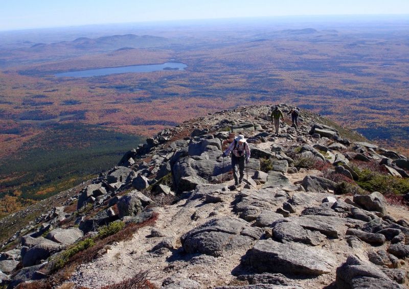
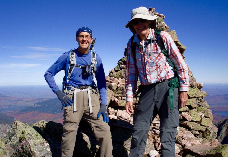
The final section from South Peak to Baxter Peak is all rock-hopping. It took us about 2 hrs time to cover the distance from Pamola Peak to the Katahdin summit. And once again there were streams of AT finishers coming up to the summit as they had the previous day. But today was considerably more pleasant as it was sunny and fairly warm with only a nice cool breeze to deal with.
The final push to Baxter Peak. Once again, AT finishers can be seen hiking up the Hunt Trail from the west.Our second summit together on Baxter Peak
We didn’t stay quite as long on the summit this time as it was getting late fast, and we had a lot of distance to cover and potential rides to hitch before we could return back to our room.
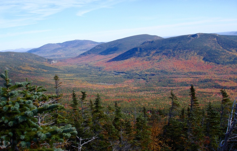
I remember the Abol Trail as being in four distinct sections. The first part was on the high backside plateau of Katahdin, an easy grade with little elevation loss. Once we arrived at the edge of the plateau, the next section dropped down quickly and sharply among huge boulders. There were some parts where, again, it was a little sketchy, but I welcomed this much more than going down the loose scree of the Saddle gully we had done the day before. My right knee was feeling strained by this time, so I had to be extra careful not to put too much stress on it when dropping down between boulders.
Looking west at the edge of the steep section of Abol Trail.
The third section occurred when we got below timberline and the trail turned into a steep, but soft dirt pathway. Easy on my tender feet at least, but even with my trekking poles, I had a little trouble bracing my knee on the downward slope.
It was during this section that I suddenly found the right side of my face crash hard on a basketball-sized rock along the side of the trail. I don’t remember slipping or tripping or even falling downward. I only remember the impact of my jaw against the rock.
I’m guessing my poles got wedged and stuck somehow which made me fall sideways. My arms were tucked under my chest so my face bore the brunt of impact. John, who was ahead of me, remembers hearing a “thud!” and then turned around anticipating the worst. I was a little dazed getting up, but after checking the movement of my jaw or any evidence of broken bones or teeth, I was relieved that except for the side of my face feeling tender, it was all good.
The final section was a fairly level woodland trail. This was really nice especially by this time; we were getting exhausted. And except for my knee being sore, it was very easy to walk on. We arrived at the Abol Campground around 4pm. Since neither of us had been there before, John consulted his map to see where we needed to go and where the road to the front entrance gate would be.
Right away I flagged a passing pickup truck and asked for a ride to Roaring Brook. He told me he was only going as far as the entrance gate but he’d be happy to give us a lift if we didn’t mind sitting in the back of his truck. We didn’t mind at all! He saved us about 6 miles of walking.
He dropped us off at the front gate where we immediately noticed the road to Roaring Brook was partially barricaded with orange hazard cones. We went up to the gatehouse and asked the ranger about it. She explained that the road was now closed to day-use vehicles and only campers were allowed to the lot.
This gave us a moment’s pause as we had hoped for more traffic down the road. This could greatly diminish our chances to catch a ride. We had 8 miles to go yet, so not seeing any vehicles in sight, we started walking briskly down the road. Even though there were a few ups and downs along the road, at least it was an easy dirt road to walk on.
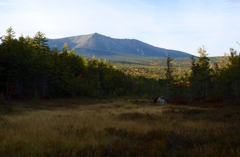
Mount Katahdin from the road just below the entrance gate of the Park.
In my mind I calculated that if we averaged 3mph, we would reach the parking lot around 7:30pm, well after dark. About two dozen vehicles did drive by, but every one of them was packed to the hilt with people and gear and none had any room to carry two more persons.
Finally, a white SUV drove by and stopped. They were two French-Canadian couples planning to hike Katahdin in the morning. After hearing our pleas for a ride, they doubled-up and squeezed us in and carried us the last 3 miles so we reached our car shortly after dark. Our heart-felt thanks goes out to them! We got back to Big Moose around 8:15pm, a long, but mostly a very pleasant day!
Thumbnails for uploaded photos (click to open slideshow):
Did that as our second peak together 17 years ago. We also hitched a ride back from the Abol Campground. Back then the trail went up Abol Slide but rockfall has forced a re-route since then. Thats a fun peak. We've since been up hundreds of mountains ranging from strolls to roped climbs since then but I'll always remember Katahdin with fondness. Thanks for the report.
Glenmiz - Yeah, it's now 15 days out since I crashed my face and my jaw remains a little sore when I move it side to side. The first 10 days or so it was very touchy to even chew anything. I had to be really mindful and careful, but it's all pretty much back to normal. I still can't believe I didn't break any bones or teeth as I came down pretty hard on that rock.
Workmanflock - I'm glad we did do the Abol Trail as now I've done pretty much all of them. I just wasn't planning on that day to be quite so long - Ha! Since we had just climbed it the day before and I got virtually no sleep that night, by the time we got back to our room I was pretty wiped out. But what a perfect day to have on Katahdin!
Hey Doug: Nice going on what looks like some really cool hiking.
Even though I grew up in New England, I've been away for so long
that I forgot how beautiful the Fall colors can be. You captured
them nicely in your photos. You and your partner did some pretty
substantial stuff for a couple of old guys ( :D ). Well done!
Ha! Yeah, we still did pretty good! Since we hadn't really talked about our second hike and because he didn't want to do the Cathedral route the day before, I was really surprised John wanted to go ahead and do the Knife plus the summit again. He just told me he didn't think he'd ever get the opportunity to try it again, so we went for it, and I'm glad we did. We had the perfect day for it!
Nice job on the circuit! That's on my list for next year after climbing the Saddle trail last year and the Hunt trail this year - both with near zero visibility.
Nyker - Thanks! Yes, it is a really fun mountain with lots of different choices.
Hoot - You'll LOVE the Helon-Taylor and Cathedral Trails much better than the Saddle. They really aren't technical at all and without exposure for the most part. Just mostly bouldering and fun scrambling, but they really are fun! And the views off the Helon Taylor are hard to beat. But that's the one thing about hiking out east, the weather can really mess up your plans and cause virtually no visibility. It's a gamble when making plans or reservations. The really nice thing about the western Rockies is, even if you do get into some rain, it's usually short-lived, and you can almost always get a good hike in anyway.
Caution: The information contained in this report may not be accurate and should not be the only resource used in preparation for your climb. Failure to have the necessary experience, physical conditioning, supplies or equipment can result in injury or death. 14ers.com and the author(s) of this report provide no warranties, either express or implied, that the information provided is accurate or reliable. By using the information provided, you agree to indemnify and hold harmless 14ers.com and the report author(s) with respect to any claims and demands against them, including any attorney fees and expenses. Please read the 14ers.com Safety and Disclaimer pages for more information.
Please respect private property: 14ers.com supports the rights of private landowners to determine how and by whom their land will be used. In Colorado, it is your responsibility to determine if land is private and to obtain the appropriate permission before entering the property.

")
")
")
")
")
")
")
")
")
")
")
")
")
")
")
")
")
")
")
")
")
")
")
")
")
")
")
")
")
")
")
")
")
")
")
")
")
")
")
")
")
")
")
")
")
")


