| Report Type | Full |
| Peak(s) |
Santanoni Peak - 4607 Couchsachraga Peak - 3820 Panther Peak - 4442 Rocky Peak Ridge - 4420 Bald Peak - 3060 |
| Date Posted | 10/13/2018 |
| Modified | 10/21/2018 |
| Date Climbed | 10/06/2018 |
| Author | nyker |
| Forever Wild, Adirondacks Autumn 2018 |
|---|
|
Forever Wild, Adirondacks Autumn 2018 This report details my climbs of four “46ers” and one sub peak in two days in the Adirondack Mountains in upstate New York. Day 1 Day 2 Autumn descends on the Adirondacks 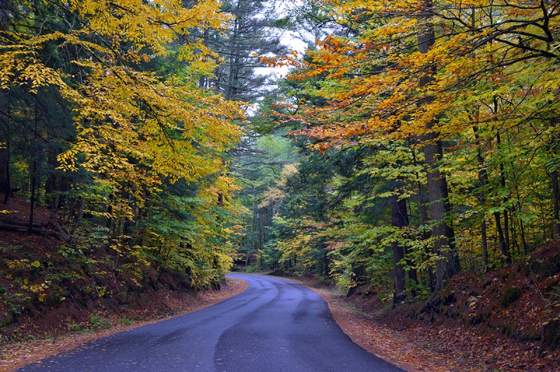 Rocky Peak Ridge Located in the Giant Mountain Wilderness, Rocky Peak Ridge (sort of synonymous with just “Rocky Peak”, the latter being the high point along the ridge leading up to near Giant Mountain), has two main routes, one from the south/east and a longer one from the northwest, each involves summiting another peak before getting to Rocky Peak proper. I did the latter, which begins off Route 9 in New Russia, a less crowded alternative to the main route off the Highway. Less crowded as in I didn’t see another human all day. As most peaks up here, the route starts off quite nicely on a pleasant marked trail through the woods gently gaining elevation for the first mile or two. Of course, it won’t continue like this. Foliage was just starting to turn around here. 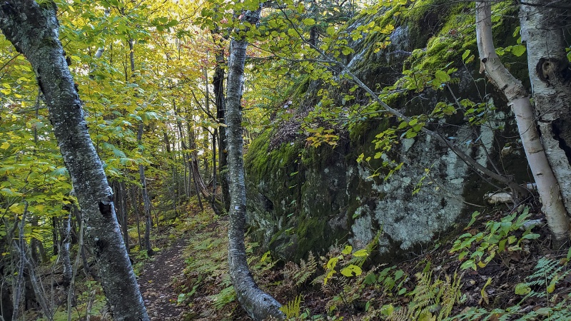 The definition of “trail” in the Adirondacks is rather liberal and has quite a bit of latitude… and the term “route” is more applicable on most mountains since the term “trail” implies a nice flat defined path you can walk along with Fifi the poodle on a sunny summer afternoon, maybe even bring your bicycle if allowed. On the popular peaks like Mount Marcy (State high point) and nearby mountains, there are nice marked trails with signs and colored blazes to follow which takes the stress out of the day, on many others there is no defined trail after certain trail junctions end. Routes are sometimes pretty loose and often there are pretty large gaps in an identifiable route, which provides part of the fun. Too much time in our lives is spent following defined routes. Luckily, Rocky Peak is one of the mountains that actually has a marked route, the next day would be on three peaks with no marked route. This mountain has a LOT of up and down and the down usually entails dropping several hundred feet down steep wet rocky ravines.  Rocks and boulders of all sizes 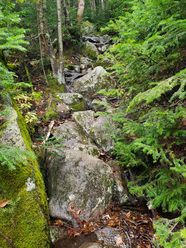 After the initial few hundred yards of hiking, there are some steep rock slabs and boulders in the forest, some of which you’ll have to climb up and over, others you’ll skirt by. These were dry at this point. These two overhanging rocks below are widow makers waiting to happen, you’ll have to move under them as you hike up. 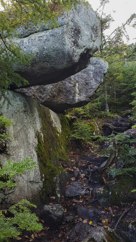 Passing under these huge boulders embedded in the embankment reminded me of Edward Abbey’s oft quoted comment that “Geologic time includes now”. One day someone might not be so lucky if they happen to be here at the wrong time. 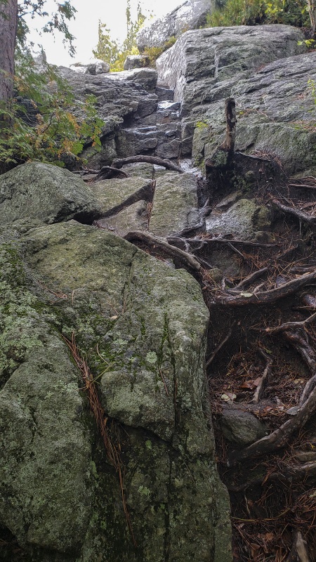 The shot above and below is the start of some climbing, wish there was another person here today for scale. 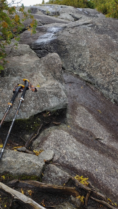 You make a trade here, wet for stable. The rock here is solid and in slab-like sections like this, the rock is essentially part of the mountain and holds are unlikely to pull out, though the vast majority of it is wet, often will water running down its face. In a few weeks this water will eggshell over, ice up and thicken until Spring which upon snowmelt, makes an cool ascent in crampons and axe in hand. Oddly, the forest was silent today save for several flocks of wild turkeys I saw lower down, possibly seeking deep cover in the forest looking to find refuge for upcoming Thanksgiving holiday. The weather was holding this morning and until about 11:00am, there was actually some sun out, I felt spoiled. This route, while longer than the standard route has one of the nicest views in the area, in large part due to the fact of an older fire which took out much of the old growth forest on the west side of the ridge but also the fact that the approach hike moves along a ridge, some of which is open on bare rock, allowing views of the forest below. Nice views of the wild forest in the distance, looking in a westerly direction  Depending on which side you choose to climb Rocky, you’ll have to summit another mountain first before getting to this one. From the northest the other route first climbs nearly over Giant Mountain, this route climbs over Bald Peak. Since I had already climbed Giant years ago, I figured I’d take the other route. On this route, the first goal to reach is the summit of Bald Peak, just over 3,000ft, not seemingly very high, but the trailhead is only at ~500ft elevation, so it makes for a decent gain and the last few sections to reach the summit are on steep bare rock for a quarter of a mile making you feel like you’re climbing up something more significant. Remember up here, the “alpine” and arctic environment starts at around 4,000ft above sea level. Hard to discern height or steepness in the below shot, but this is about 30 feet of rock you’ll need to climb up. It was dry so that was quite helpful and makes for a fun climb. You're also literally climbing up and out of the trees so will have nice views from the rock above. 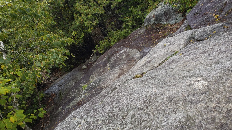 Continuing up the bare rock 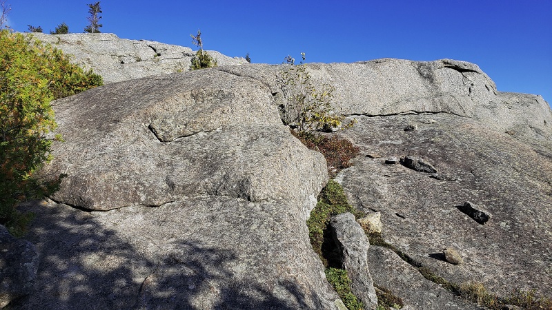 A sub summit of sorts enroute to Bald Peak. The route to Rocky Peak diverges to the left here towards the peak that is covered in clouds. 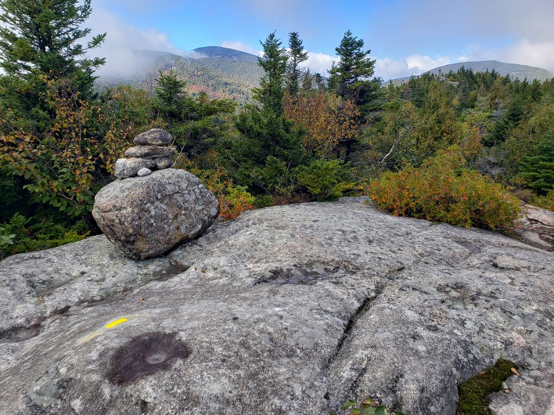 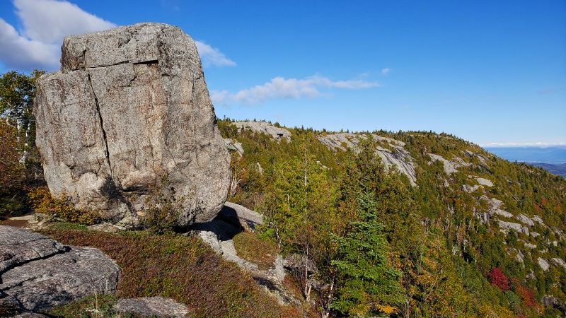 If one is not paying attention to the elevation, it’s easy to think this is the true summit, since it is open, has great views and in the often thick cloud cover, you might not even see the taller Rocky Peak further to the North and it feels like a summit. 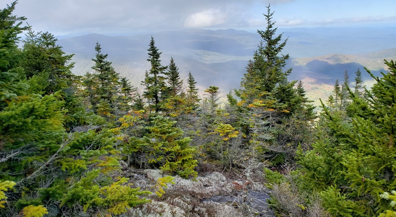 Blue skies were fading fast, but you could clearly see the main and taller objective, Rocky Peak in the distance. I took these from the summit of Bald Peak. 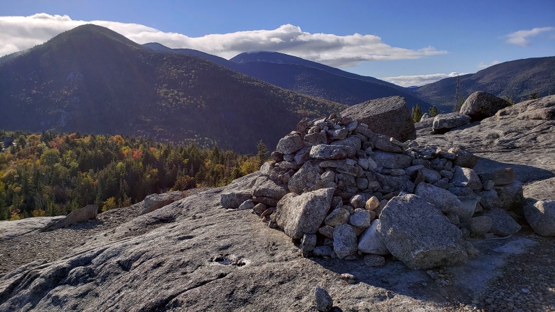 Foliage is starting in earnest down below in the hardwood forest 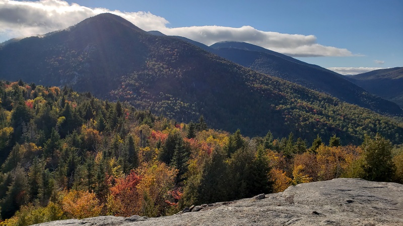 Moving off Bald Peak, you’ll need to descend steeply into several rocky ravines, losing a few hundred feet reaching a col between Bald Peak and Rocky Peak. The route is not entirely defined well, but once you start down, you basically follow a drainage/stream into a flat area filled with a forest filled with Paper Birch and Yellow Birch and some Aspen. 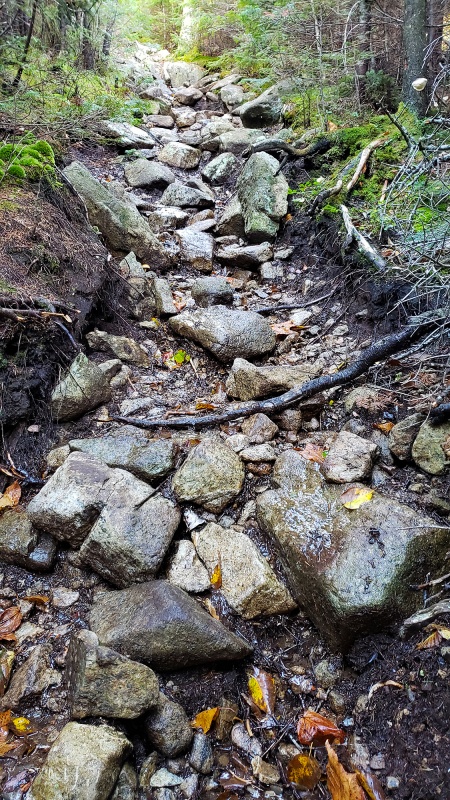 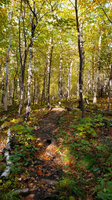 Walking on this relatively flat area for a few hundred yards, you’ll then reach Marie Louise Pond over a small section of which you have nice boards to move over, saving your feet and legs from a wet swampy hike through it (can’t say the same for Couchsachraga later). 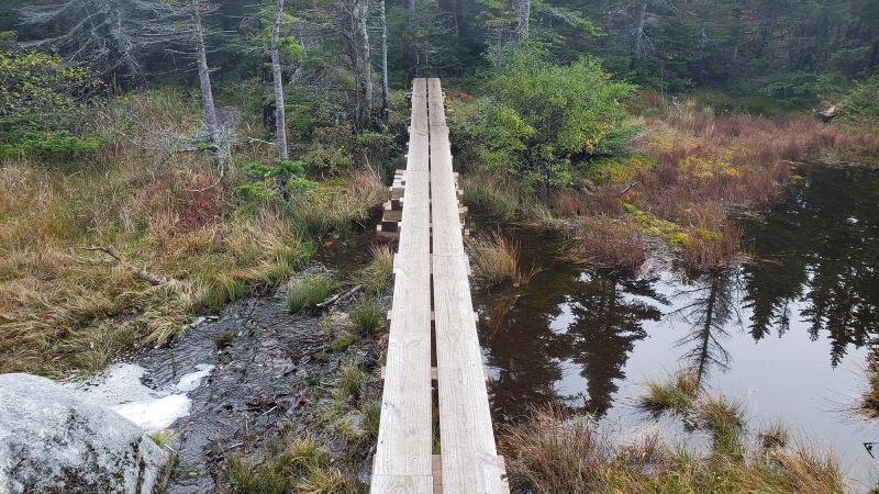 After regaining the few hundred feet of elevation you lost, you’ll start climbing up again, through a tighter forest of stunted Balsam Fir and Red Spruce when you abruptly reach the last remaining plateau before the true summit. The plants here are rare and fragile, so take care in stepping on them and try and step only on the rocks. Unfortunately, for a peak with a reputation for one of the better views in the area, the clouds were coming in thick and there were no views in any directions.  Summit cairns 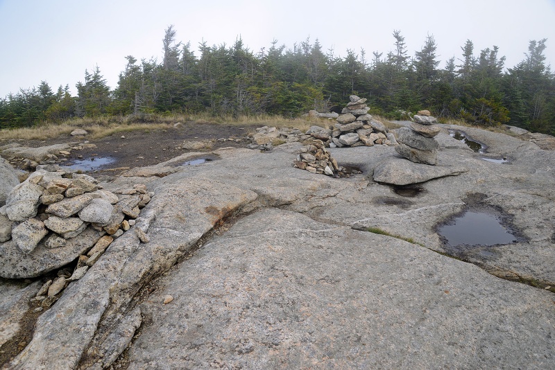 This was a nice hike and climb up, sadly I didn’t get to experience what this route is known for, i.e. grand panoramic views, great vantage point from which to see Giant Mountain from the summit and of the foliage (which hadn’t really yet turned around here yet). This is one hike I’d recommend highly and not too stressful and you won’t get too muddy. Santanoni Range This range is about 60 min drive south of the Giant Mountain Wilderness where Rocky Peak and Bald Peak are located. There are three taller “46er” peaks in the Santanoni; Panther Peak, Santanoni Peak and Couchsachraga Peak and my goal was to climb all three in one long day. I’ve been glued to a desk too long and needed a long, difficult day in the mountains to decompress, as it would turn out, this was it. Interesting how certain types of stress can balance other types of stress… ' It’s rare that I complain about a day in the mountains, but this day was tough, movement was tedious and the conditions made it tougher. In short, this hat-trick of peaks was more an exercise in endurance and suffering than an enjoyable hike/climb. It became more of just a challenge to finish them than to enjoy the scenery along the way. Located southwest of the more popular peaks such as Mt Marcy and Haystack and more crowded trailheads, The Santanoni Range is remote and wild with the peaks here having no marked trails to the summits. In many places, herdpaths have been well trodden enough to be able to identify the best routes up and down which help quite a bit. In many other sections you cross your fingers and ascend miles of boulder-strewn active stream beds and steep eroded ravines hoping you’re on the right path. 95% of your travel will be under cover of the thick forest, where higher up, stunted fir and spruce grow so tightly together, that you can almost rest your body on them without falling through to the ground. You cannot see over or through the trees to ensure you’re moving in the right direction, so use of a compass/gps is handy here. More often than not, you’ll be doing less walking, vs. rock hopping in a creek that is making its way down the upper reaches of the mountain. While the rock here is generally more stable than alpine talus found on Colorado peaks, the rock here is often wet and slippery or iced over once mid-October comes. This sub range within the broader Adirondacks has a reputation of being the wettest around. Believe it. You’ll lose track of the myriad of unnamed cascades and waterfalls you’ll be hiking over and through as you make your way up. Any route on these peaks is wet and you won’t stay dry. Once you understand that and take that to heart, acceptance will set in and you’ll start to ignore the foot dunkings, mud baths, the constant water running down the boulders and granite slabs you’ll be ascending. You’ll come to embrace the occasional stomach crawl under a fallen log or through an eroded pocket of muddy topsoil under a huge boulder when no other way through/up/over it exists. This could be ideal training ground for American Ninja Warrior. Doing these specific peaks in Fall is usually more advisable than Spring when water levels from snowmelt and late season storms is higher making everything far more wet and creek crossings difficult. Unfortunately, I arrived after a couple days of torrential downpours soaking everything pretty thoroughly. I had tweaked my knees earlier this past Spring, causing me to cancel several months of alpine plans. I started to ease back into it first with a few 13ers in Colorado last month, then here with a few peaks in the Adirondacks, my knees were still feeling a bit tender, likely making any climb feeling a bit harder than it was had my knees been 100%, especially on the descent. Be that as it may, depending on the path you take, the distance to summit all three peaks and back is roughly -16-18 miles as the crow files, but it feels like 30. Elevation gained is ~5,000ft over difficult terrain. It is best likened to an 11 hour crossfit workout while on a steep, Tough Mudder course. The rain today made it more fun. Panther Panther Peak was my first goal. Mountain lions were once common in the Adirondack Mountains (400 years ago). Much like many other areas in the U.S. they along with the Gray Wolf have generally been believed to have been extirpated from the region. However, every year sightings occur and depending on what source you hear it from these range from dozens of sightings to hundreds over the last several years, though most feel there is not a large breeding population here anymore. Panther Peak’s name harks back to a distant past (or possibly a distant future) when these big cats roamed the area. The trailhead for all three peaks is the same, starting near Echo Mountain on Tahawus Road. To reach all three peaks, you’ll start out from the trailhead on an innocent enough dirt road, which in the waning light beam of my headlamp, was covered in newly fallen Red Maple Leaves. Autumn has come to the Adirondacks. Following this road for 1.8 miles, you’ll see an abrupt but marked turnoff into the woods-below shot. Many people hiking with headphones or otherwise not paying attention miss this turnoff and wind up way off track. Don’t miss this. 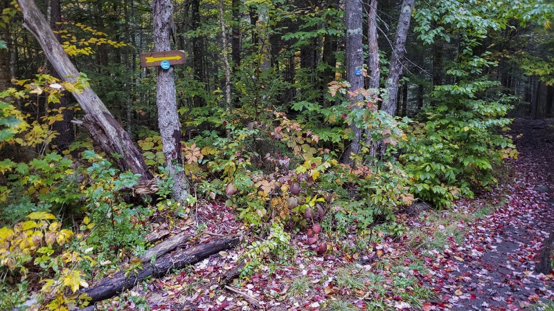 On the approach hike from the turnoff, there is a marked route for another mile or so, which is pleasant, enjoyable as it travels through the now peak Autumn foliage but lulls you into a false sense of complacency on the nice comfortable and level trail. 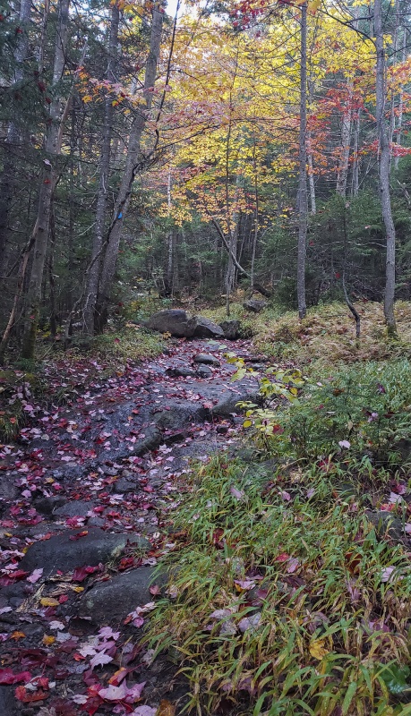 You’ll then cross a nice new bridge, eliminating one of the creek crossings that historically you have had to make. Given the poor route conditions this area has generally been known for trail crews have recently been doing some meaningful work here, such as this bridge. The terrain starts to get increasingly wet as you go deeper in the woods, though still a marked route. Note the blue blaze on the right post, from the dirt road approach you'll follow that trail for a few miles until the Giant Cairn turnoff. 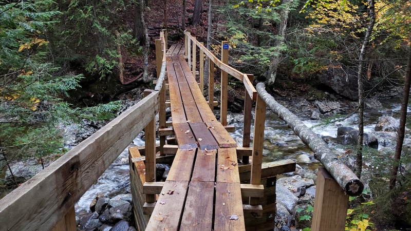 After a bit more hiking, you’ll reach a clearing where you’ll get a nice view of cascades with some Autumn color. This is a good spot to take a break and one of the last open areas where you can sit on a dry rock not to mention the nice scenery with the sound of water surrounding you. 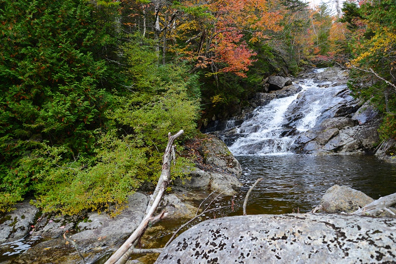 About 200 yards past the clearing, the giant cairn appears, and depending on which way you go, could mark the end of the marked trail. Left goes up Santanoni, right goes to Panther First via “Herald Square”. I opted to go right and climb Panther first. 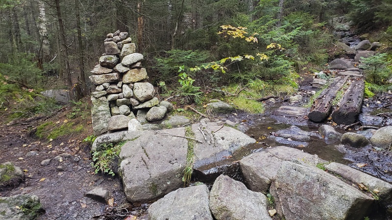 As I said, the route here is wet, here is a typical moment over the flatter areas, this is pretty much the route you move on lower down. Not hard to walk on, but it gets tedious after miles of it. 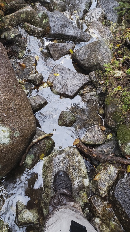 Despite the wetness, the views don’t disappoint. This is one region where if you’re concerned about carrying water or finding water to filter, you can rest easy for you’ll find water just about everywhere or hear it trickling under the rocks you’re walking on if you’re not actually walking through a stream or puddle somewhere. 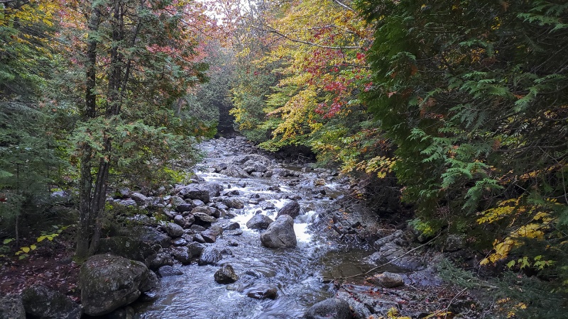 Climb over or crawl under?? I opted to climb over, by climbing up the tree first. 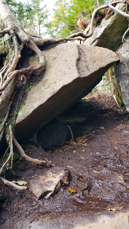 The boulders and rocks get bigger as you climb higher and water moves faster as the terrain gets steeper. Slipping and falling here won’t send you a thousand feet off a cliff, but it could easily break a limb and fracture your skull, so care is needed to move across this. The terrain continued like this for a slow 90 minutes or so. 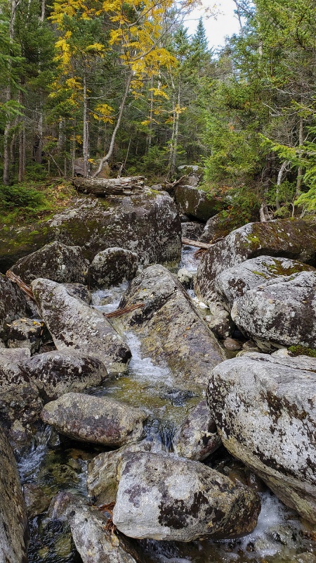 Mud everywhere. Flatter sections of the “trail” looked like this for most of the entire route that was not covered in boulders or granite slabs. Almost as soon as you step foot into the forest from the teaser mile or so on the dirt road leading from the parking lot, the mud is relentless. This is the main downside to these three peaks and trying to sidestep and otherwise avoid deep mudholes is the thing that slows you down the most. 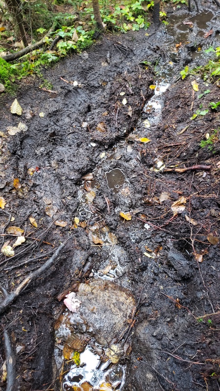 Another steep, wet slab of rock to climb up. This was the lower portion where the roots provided some traction. 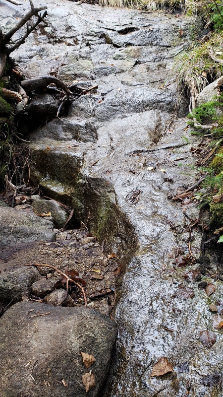 Upon reaching a small clearing called Herald Square, you see the first markers indicating you made the right call in directions. “P” stands for Panther and “TS” Stands for Time Square – a junction of sorts where the unmarked herd paths to Santanoni and Couchsachraga can be found. 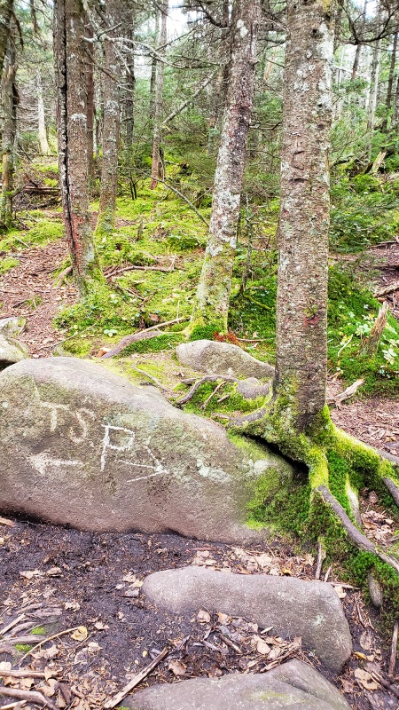 The last pitch to the summit reminded me of the Mountaineers Route on Mount Whitney, specifically the first few moves to gain the Final 400 after the notch at ~14,100ft. Since this was on bare rock, this was one section that was dry! The rain hadn’t started yet.  In places like Colorado or California, routes are often characterized by Class, Class 1,2,2+,3,4 etc.. In the Adirondacks, there usually is no distinction and routes are either considered “hikes” or technical rock climbs requiring gear, nothing really in between in terms of formal designations. I was shocked to see a USGS marker here. But, comforting to know I summited the correct peak as without signs and markers, sometimes one climbs the wrong mountain up here as many peaks have no summit marker or register. Note mud on pant leg. Many folks use gaitors here to protect against the mud. Probably not a bad idea to have, but I didn’t bring them today. 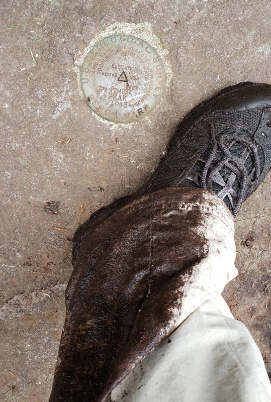 From the summit, I could see clouds moving in starting to obscure distant summits. Soon, they’d envelop the whole range and there’d be no view from any vantage point. The view was quite nice while it lasted: but note the clouds moving in… this would be the last view I would have. The main peak in the distance is Santanoni. 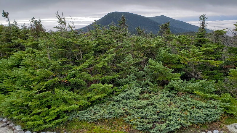 Miniature Spruce and Fir with the last views for the day before clouds sunk lower 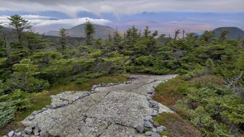 Taking only the time it took to snap a half dozen photos, I turned around and made my way back through the mud and steep rock to the “Time Square” Section and took the western path to Couchsachraga. Couchsachraga Couchsachraga (Kook-sa-KRA-ga) is an Algonquin term roughly translated into “dismal wilderness” …This should be a clue for what you’re getting yourself into. The 46ers were originally designated as the highest peaks in the Adirondacks, had to have a minimum elevation of 4,000ft and were considered to be the tallest mountains in New York. It was found in later surveys, not all of them were above this height, but still remain on the list of 46ers. The Catskill Mountains, further south in New York actually have a couple of peaks taller than the shortest 46ers (notably Slide and Hunter Mountain both over 4,000ft). When first measured, Couchsachraga was believed to be over the magic 4,000ft elevation mark and thus eligible to part of the coveted Adirondack 46ers. However, decades later, measurements revealed that it stood at 3,820ft, well below the required elevation, though for purposes of tradition, it remains a requisite peak of the Adirondack Mountain Club to be climbed for one to consider themselves a finisher of the 46ers. Its affectionately known as “Couch” (Kooch) by locals. One of the more remote mountains in the Adirondacks, its take some effort to reach this peak. If you thought the route to Panther was tough and uncomfortable, this one continues the trend and adds more water and mud to the equation as you move deeper into the heart of the Adirondacks away from civilization. Beginning from “Times Square”, an unmarked junction of sorts where rough routes to all three peaks can be initiated, you start west on a muddy herd path and descend several hundred feet of hard gained elevation into the dismal wilderness. 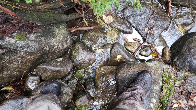 The first hundred yards or so are easy and flat, then drops off rather precipitously into a steep eroded slope filled with deadfall, exposed slippery roots, wet granite slabs and large boulders. Class T Route I always thought another Class grade of climbing should apply to mountaineering in these parts, that being Class T, for “Tree Assist”. Many of the steeper sections have areas where the only real way up is to either climb a larger tree, or a poor sapling or pull yourself up by any of the exposed hanging roots, having had their topsoil eroded over the years (test your roots first). This is especially true when these rocks are covered in a thin veneer of early season ice. 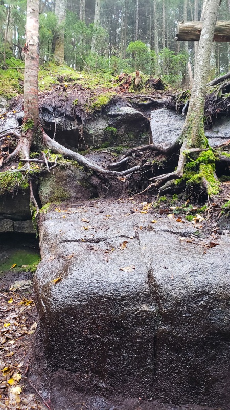 One last view of the surrounding wilderness –note the foliage in the lower deciduous forest is reaching peak. 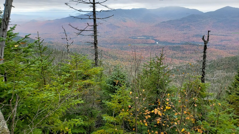 You then descend into the infamous bog, quite literally. There is no bridge, no stepping stones or dry stable logs, just swampy floating debris and a soggy muddy basin that you could sink to your thighs or higher in should you step in the wrong place. This is one section that should be earmarked for some board work or boardwalk which would save the landscape from people hiking every which way to get across and save maybe 20 minutes of hiking on this peak alone and save many a mud dunking. The grassy looking part looks solid, but its not. 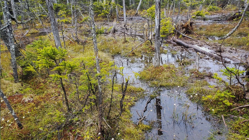 I was cursing this section as I floundered around looking for a way out before it sucked me down like quicksand. Both feet were now fully soaked including my socks. I should have carried an extra pair to change into once past here on the way back. Very little terra firm in here and it was best to cling tightly to the thin trees surviving here, stepping close as possible to the trunks where there was a few centimeters of soil before dropping off into muck around it. After some false starts and restarts, I made my way across to the firm footing of the forest on the other side. Once across the bog, I reentered the woods and began climbing up again. The mud actually seemed an improvement from the questionable / nonexistent footing that defined the bog. As this was late season, the rest of the route up was pretty well trodden and as such identifiable over the rocks and mud sections. The last bit before the summit was a 25 foot climb up granite with a nice generous crack for hand placements, making this easier. 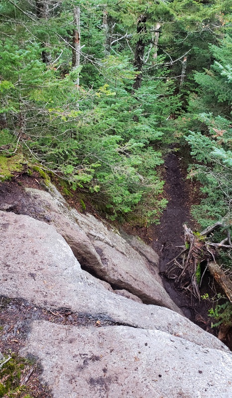 The summit arrives soon without much fanfare after this, and you’re welcomed with a sign confirming you followed the correct route and climbed the correct peak! The summit is basically treed over with no view even on a clear day. What a shame after all that effort. Couch's summit is treed over so a summit sign is nailed to a tree.  Given the rain, routefinding, slow movement in the mud and overall gain and distance, it took over 6 hours to get here and I still had one more summit to reach. Backtracking through the muddy woods and over the complex route of exposed roots and rock, I gradually made by way back to the “Times Square” junction and without pause, took the path to climbers right and started towards Santanoni Peak. Typical route to follow. It’s hard to move too quickly over this stuff. 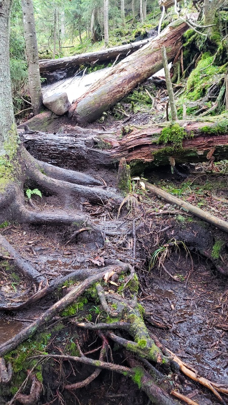 Traversing over to Santanoni in the mist of a low cloud surrounded by forest the whole way. Can you make out the route? haha 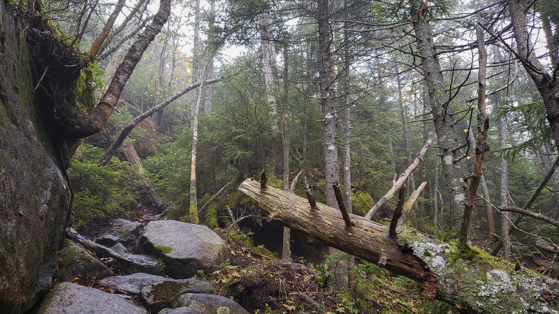 As you near the summit, the muddy rocky trail gives way to steeper rock sections you’ll need to climb up and over. About 0.2 miles from the summit, you’ll see an unmarked fork in the route, where a spur trail breaks off to the east (climbers left) – this is the “Express Route” which travels down off Santanoni which loops back the giant cairn in the trail from earlier, so you don’t have to go back the way you came up when ascending Panther. About 2 hours after leaving the summit of Couchsachraga, a bit bruised and beaten and thoroughly waterlogged, I made it to the summit of Santanoni Peak. Again, a summit that's treed over with no view. :-( 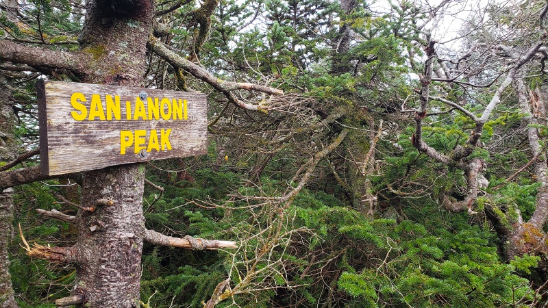 The whiteout continues with zero view other than closeups of the stunted fir and spruce on the summit. 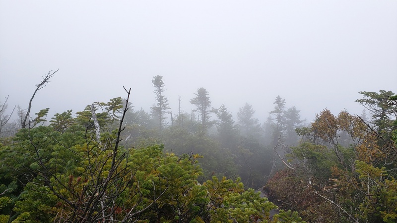 Because it was raining and i was soaked through my shell, without much ado, I backtracked to the fork in the route and headed down the Express Route. Foolish me, I was thinking this was an easier way down. It was not. Equally as wet, rocky and probably steeper since it descends the mountain directly , this was also slow going and tedious. While descending, I reached a clearing of sort and came across this large clearing on what grew into a large boulder/rock outcropping, which upon closer inspection looking from above, abruptly turned into a rounded cliff of sorts in one direction and from the other side resembled a miniature Sierra-like Half Dome in the middle of the forest . This is the lower section take from the ground. Guess I was so focused on finding a way down I didn’t take a shot from the top. 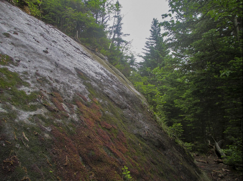 Problem solving time. I explored 2-3 directions and could not find a way down this dripping sloping rock face which was about 60+ feet off the ground. I tried downclimbing, but got cliffed out and moved back up, clinging on the wet rock and pulling on some limber roots of a fir to get back up. I ended up circumnavigating this section a hundred feet left and downclimbed a rocky/soiled section in the forest, then only had a 15 foot rock section to get down. Steep and mossy. This was my exit point from the easier section up, the path up is diagonally to the right. Clinging on some trees and roots helped move up and down this part. . 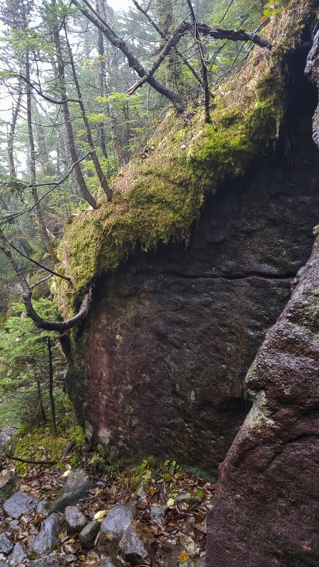 Granite slab, one part of a long section of this stuff - along with the above type terrain is the main reason you won’t ever see mountain bikes on these “routes” 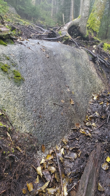 This option, however deposited me somewhere further away from any route with no discernible path nearby. After looking around for 15 minutes, I became a bit disconcerted, especially given the late hour of the day and weather. The route twists and turns so much, my compass wasn’t much help as any direction was either a rock wall or cliff or dense nearly impenetrable forest. The map wasn’t much use either as there is no defined trail or route, much less one marked on a map to know exactly where I was. After some trial and error and backtracking I found the way down and continued the descent. Typical rock to move over as you descend. 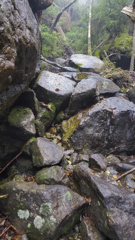 The flatter sections, were not a picnic either as there was a lot deadfall mixed in with the rocks. Note low clouds enveloping the area, casting a quiet eery feeling throughout the forest. Foliage lower down was at or just past peak, with many leaves still fresh on the ground. For those sections where there WAS a trail, it made it tough to follow as the leaves obscured the route. So, in short, I found what I was looking for in terms of a long and difficult day, though this one due to the mud in particular was just frustrating for the slowness you had to move, straddling the bog-like route up and down these peaks. I am thinking these might be better done in Spring snow. Either way, if you're after a long difficult day and don't mind the mud and getting wet, these peaks are a good challenge for a long day! Thumbnails for uploaded photos (click to open slideshow): ")
")
")
")
")
")
")
")
")
")
")
")
")
")
")
")
")
")
")
")
")
")
")
")
")
")
")
")
")
")
")
")
")
")
")
")
")
")
")
")
")
")
")
")
")
")
")
")
")
")
|
| Comments or Questions | ||||||||||||||||||||||||
|---|---|---|---|---|---|---|---|---|---|---|---|---|---|---|---|---|---|---|---|---|---|---|---|---|
|
Caution: The information contained in this report may not be accurate and should not be the only resource used in preparation for your climb. Failure to have the necessary experience, physical conditioning, supplies or equipment can result in injury or death. 14ers.com and the author(s) of this report provide no warranties, either express or implied, that the information provided is accurate or reliable. By using the information provided, you agree to indemnify and hold harmless 14ers.com and the report author(s) with respect to any claims and demands against them, including any attorney fees and expenses. Please read the 14ers.com Safety and Disclaimer pages for more information.
Please respect private property: 14ers.com supports the rights of private landowners to determine how and by whom their land will be used. In Colorado, it is your responsibility to determine if land is private and to obtain the appropriate permission before entering the property.