Download Agreement, Release, and Acknowledgement of Risk:
You (the person requesting this file download) fully understand mountain climbing ("Activity") involves risks and dangers of serious bodily injury, including permanent disability, paralysis, and death ("Risks") and you fully accept and assume all such risks and all responsibility for losses, costs, and damages you incur as a result of your participation in this Activity.
You acknowledge that information in the file you have chosen to download may not be accurate and may contain errors. You agree to assume all risks when using this information and agree to release and discharge 14ers.com, 14ers Inc. and the author(s) of such information (collectively, the "Released Parties").
You hereby discharge the Released Parties from all damages, actions, claims and liabilities of any nature, specifically including, but not limited to, damages, actions, claims and liabilities arising from or related to the negligence of the Released Parties. You further agree to indemnify, hold harmless and defend 14ers.com, 14ers Inc. and each of the other Released Parties from and against any loss, damage, liability and expense, including costs and attorney fees, incurred by 14ers.com, 14ers Inc. or any of the other Released Parties as a result of you using information provided on the 14ers.com or 14ers Inc. websites.
You have read this agreement, fully understand its terms and intend it to be a complete and unconditional release of all liability to the greatest extent allowed by law and agree that if any portion of this agreement is held to be invalid the balance, notwithstanding, shall continue in full force and effect.
By clicking "OK" you agree to these terms. If you DO NOT agree, click "Cancel"...
This report is for a very unloved mountain, point 13,374. I say unloved because it had a summit register from 2005, and on average about 6 people climbed it a year. My girlfriend and I were the 7th and 8th in 2018.
I figured this mountain needs some beta, as the directions and conditions of the road to it are basically nonexistent because other trip reports were done in winter. Hopefully someone wanting to climb this in the future will find this helpful.
We picked this mountain as it was an east approach, on a day with strong west winds forecasted. I enjoy having a mountain block the winds for me, and during the day it was very pleasant, with almost no wind until we reached the summit ridge. The mountain is also an orphan, and can't easily be combo-ed with anything else, except maybe Harvard if your a masochist. I figured we might as well get it checked off.
Total distance was 6.1 miles and 2,500 feet gain.
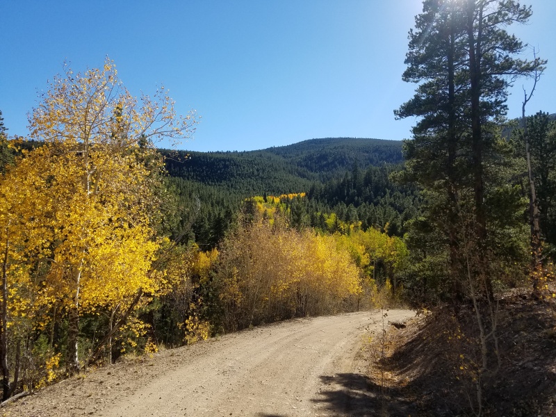
Aspens on way up CR 386
We started out driving up CR 386 which is north of Buena Vista. NOTE, this road is closed almost at the highway from December 1st through June 30th according to a forest service sign we passed. After about 1.5 miles, you turn right onto CR 387 and follow that for a few miles. The road comes to an unmarked T intersection. Turn left and go up the hill. In the last mile of the drive, the road gets rougher. There are two spots that are very steep inclines, that I think require 4WD to get up, especially if the road was muddy or icy. However, the rest of the road was actually pretty good, and I think a suburu type clearance could make it. However, it was extremely narrow, and passing someone would present problems on most of the road. After 5.9 miles total on the dirt roads, you get to an unmarked locked green gate. This is the entrance to the Leinhart mine. There is parking for a few vehicles, and a nice camping spot.
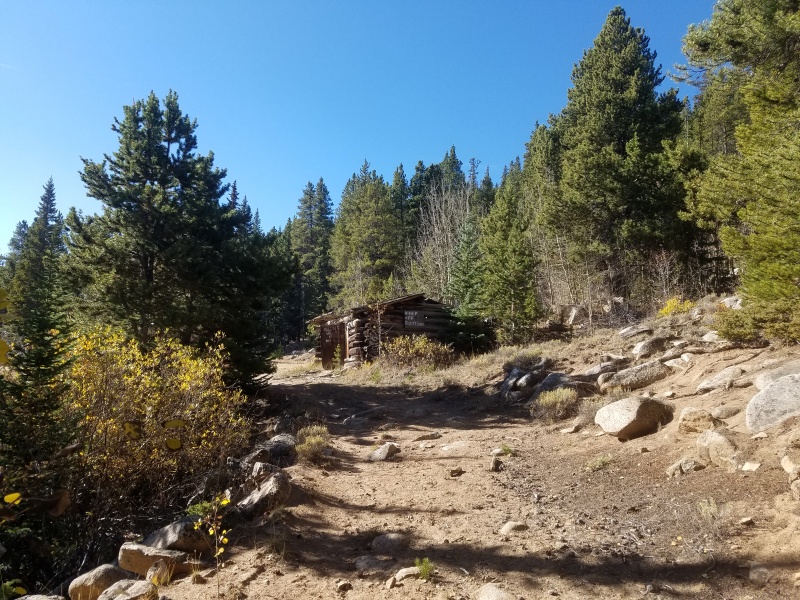
The Leinhart mine is about 100 yards up the road, behind the gate. The mine was active from 1906 to 1918 and again from 1935 to 1938. They mined silver, gold, copper, and lead. The mining site has a collapsed cabin and ore chute, and some old machinery and a very small bulldozer.
Leinhart mine cabin
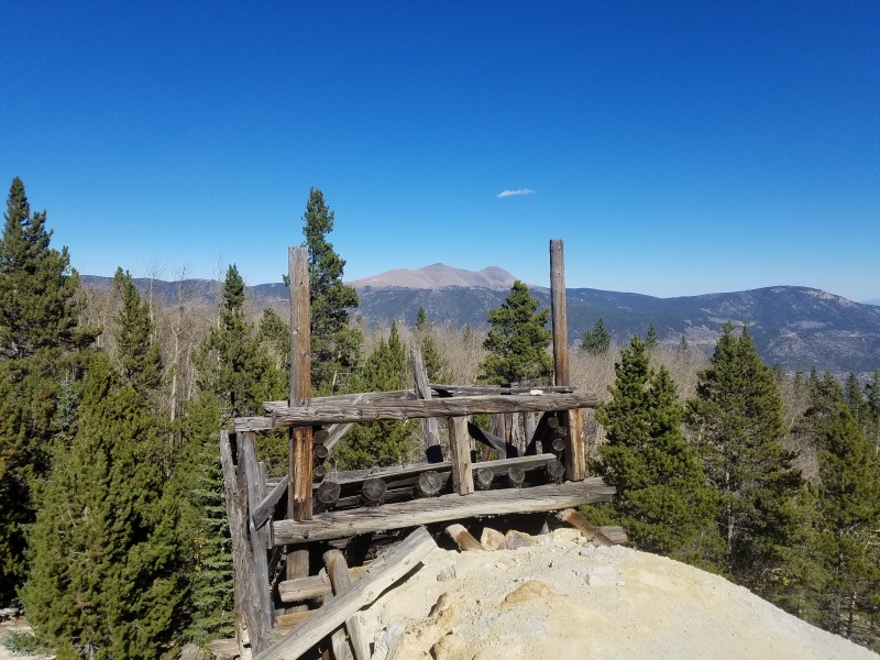
Leinhart mine ore chute with Buffalo peaks in backround
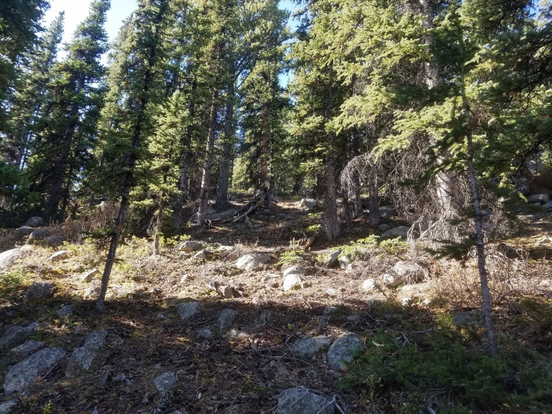
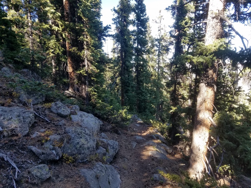
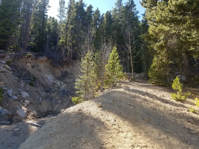
While we were getting ready for our hike, a horse trailer loaded with 4 mules made it up the road. We assumed he must be crazy to get a 20 foot trailer up that narrow steep road. Turns out to be an elk hunting guide, closing down his camp. He informed us of a trail that was above the mine, that went to the Colorado trail. So when we set out, we looked for it above the Leinhart mine. We found a very light trail that headed up the slope, and up we started. It quickly petered out (we weren't on the actual trail), and so we bushwhacked about 500 vertical feet until we hit the Colorado trail. Where we hit was an old mining site too, with another cabin in ruins, and a few prospect holes. We headed up the ridge from there. The bushwhacking through the forest was actually quite pleasant, as its not too thick, and deadfall was fairly minimal.
Looking down at the prospect mine cabin
Bushwhacking terrain
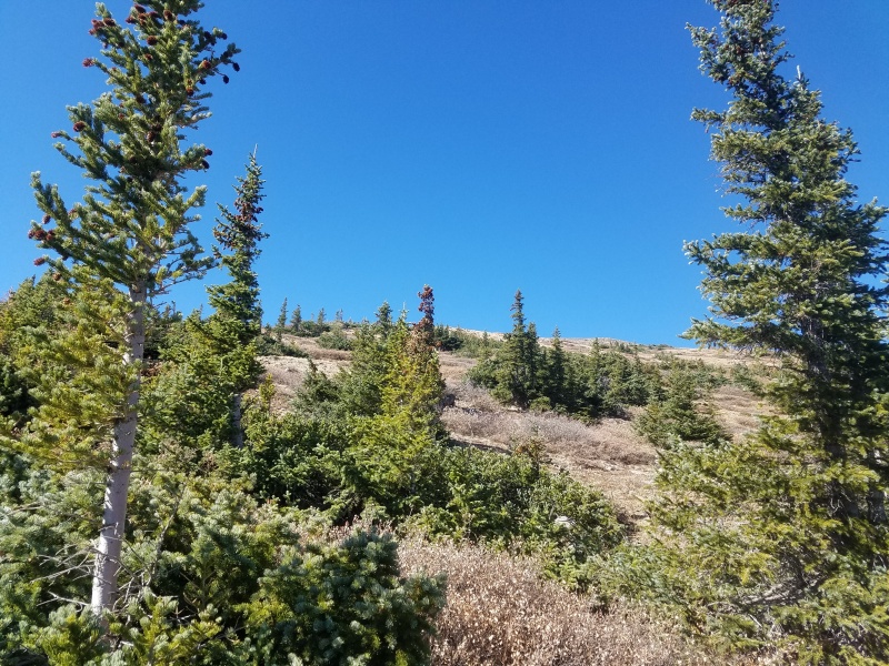
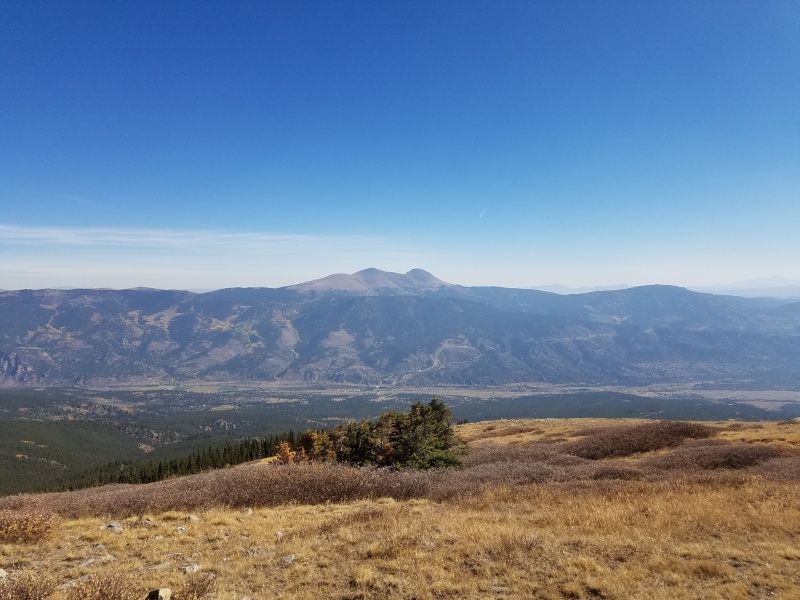
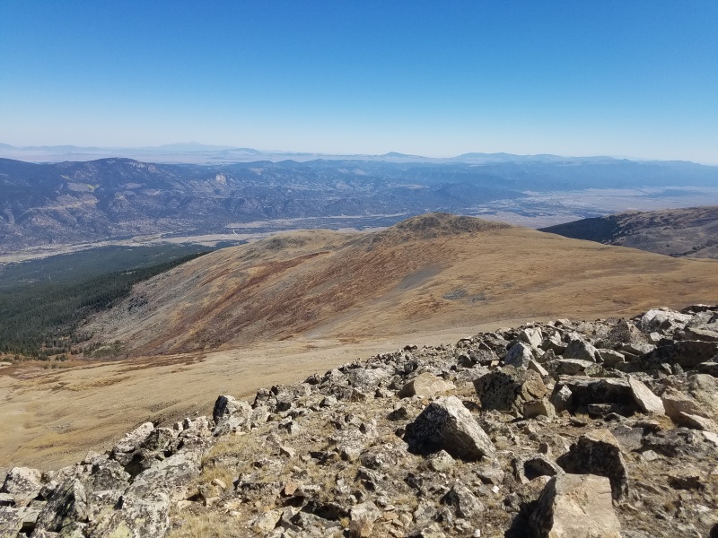
After a half mile, we broke out of treeline and continued upwards through knee high willows. They were spotty enough that finding a path wasn't too difficult. Eventually the ridge turned into blocky talus and grass. We reached a flat area and we continued upwards until we hit point 12,890. We finally had our objective in sight, and we walked across the tundra, contouring so we didn't walk extra distance. There was a few spots that were clearly ponds or creeks when there was more moisture, but for us they were dried up. We had excellent views of west and east buffalo peaks across the valley. We also had great views of Columbia and Harvard and the ridge connecting them. We also spotted several elk in the valley below us.
Heading up ridge above prospect mine
Great view of Buffalo peaks
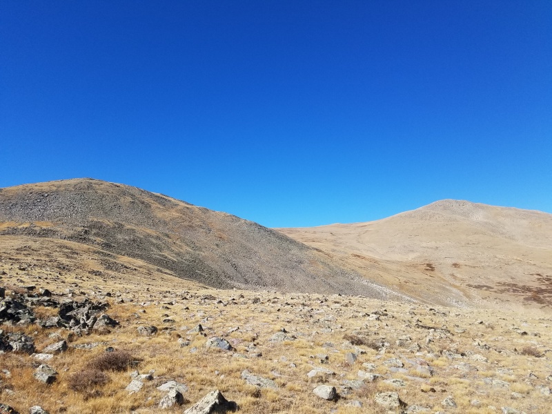
Point 12890 and UN 13374 on right
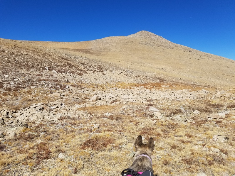
Summit clearly in view
About 300 vertical feet below the summit, the terrain gets into blocky talus, but still very class 2. The summit was nice and open, and with a summit register that was placed in 2005. This mountain doesn't see much traffic for sure.
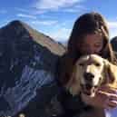
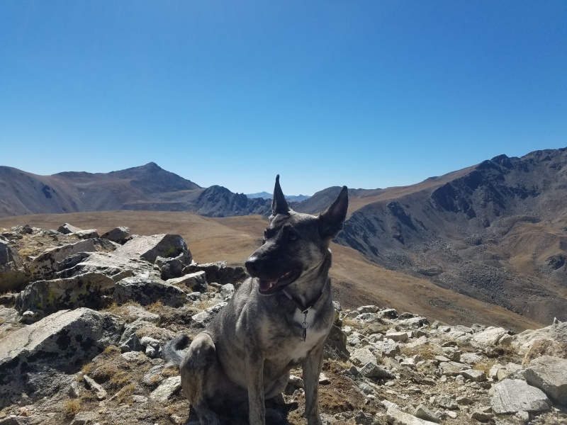
Tesla enjoying the views. Harvard and Columbia in backround
After enjoying the lonely summit, we headed back down. We decided to cut some distance off by contouring more aggressively, and staying below point 12890. It wasn't very pleasant, as large chutes of talus intersected our path, and who doesn't love sidehilling on talus? However, soon we made it back to the spine of the ridge we had taken up, and we headed back down through the forest.
Heading back down
Once we hit the Colorado trail, we noticed fresh mule tracks. We decided to do some detective work, and find where they had come from. The hunting guide had seemed very confident about the connecting trail, and we assumed he must have used it on the way up. So we followed the tracks back along the Colorado trail about 50 yards, and found the trail that leads down to the Leinhart mine. Its completely unmarked, but is about 50 yards SOUTH of the meadow with the prospect mines and old cabin. Its a surprisingly good trail, however it is much longer then the straight shot bushwhacking due to a couple huge switchbacks. We popped out at the Leinhart mine above where the collapsed tunnel is. We set up a cairn to mark where the trail starts.
Trail between prospect mine and Leinhart mine
Trail starts to left of the Leinhart mine cabin.
Trail goes above big hole in ground, to the left.
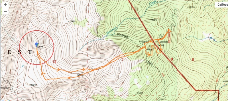
We then descended the last 100 yards to the parking area. Heres our route.
Our route.
In summation, if you want solitude and an easy hike with some routefinding, this is your peak
Thumbnails for uploaded photos (click to open slideshow):
I like that peak, thought the views of Harvard and Columbia were cool. Definitely one that I wouldn't mind repeating, seems your route may be a bit more reasonable than mine...
Peaks with solitude are the best.
How difficult would it be to access this route via the Colorado Trail?
I believe this is on segment 12 of the Colorado Trail,
What if you started from the Frenchman Creek trailhead. Would that work?
I think if you went up the Harvard trail road, then the Harvard trail on the topo map, you could either hook onto the Colorado trail from there, or follow the Harvard trail up to the 13374 ridgeline and go from there. But that would be a longer day for sure.
The road directions we used to get to Leinhart mine were based off a Colorado trail work crew, who used our route to access that part of the Colorado trail for maintenance work.
After I posted my question, I looked in Roach's 14er book. He describes a route to 13,374 that starts at the Frenchman Creek TH. It is route 14R3 EC. Does not use the Colorado Trail, however, it does intersect the CO trail. It approaches 13,374 from the south instead of from the east like the approach from the Leinhart mine. Your route looks cool too. And yes, your route defintely is shorter.
Unnamed but not unloved. That was great, thanks for the beta. I actually think this approach might also be the shortest route to Mt Harvard. At least similar to Frenchman creek but with an easier road. You would only have to climb to 13200 on that ridge and drop about 220 ft to the saddle with Harvard. Im guesstimating under 9m 4000 vert total.
Great beta in this TR. I ended up descending the northeast slopes to intersect the CO Trail - pretty much eliminated any bushwhacking/willows. I agree that this is probably the shortest and easiest route to Harvard.
I did this same route (though unfortunately without the benefit of your directions), on 9/2/2024. This peak overlooks my house and our HOA (Mountainview), so I had a personal interest in climbing it.
Thanks for the great write up. I chickened out on the road about 1.4 miles from the mine, the numerous high points on the road lead me to wonder if it was wise to continue in my Outback. I got extra exercise... I don't regret not pushing it any further. Cluck, cluck.
Caution: The information contained in this report may not be accurate and should not be the only resource used in preparation for your climb. Failure to have the necessary experience, physical conditioning, supplies or equipment can result in injury or death. 14ers.com and the author(s) of this report provide no warranties, either express or implied, that the information provided is accurate or reliable. By using the information provided, you agree to indemnify and hold harmless 14ers.com and the report author(s) with respect to any claims and demands against them, including any attorney fees and expenses. Please read the 14ers.com Safety and Disclaimer pages for more information.
Please respect private property: 14ers.com supports the rights of private landowners to determine how and by whom their land will be used. In Colorado, it is your responsibility to determine if land is private and to obtain the appropriate permission before entering the property.


")
")
")
")
")
")
")
")
")
")
")
")
")
")
")
")