Download Agreement, Release, and Acknowledgement of Risk:
You (the person requesting this file download) fully understand mountain climbing ("Activity") involves risks and dangers of serious bodily injury, including permanent disability, paralysis, and death ("Risks") and you fully accept and assume all such risks and all responsibility for losses, costs, and damages you incur as a result of your participation in this Activity.
You acknowledge that information in the file you have chosen to download may not be accurate and may contain errors. You agree to assume all risks when using this information and agree to release and discharge 14ers.com, 14ers Inc. and the author(s) of such information (collectively, the "Released Parties").
You hereby discharge the Released Parties from all damages, actions, claims and liabilities of any nature, specifically including, but not limited to, damages, actions, claims and liabilities arising from or related to the negligence of the Released Parties. You further agree to indemnify, hold harmless and defend 14ers.com, 14ers Inc. and each of the other Released Parties from and against any loss, damage, liability and expense, including costs and attorney fees, incurred by 14ers.com, 14ers Inc. or any of the other Released Parties as a result of you using information provided on the 14ers.com or 14ers Inc. websites.
You have read this agreement, fully understand its terms and intend it to be a complete and unconditional release of all liability to the greatest extent allowed by law and agree that if any portion of this agreement is held to be invalid the balance, notwithstanding, shall continue in full force and effect.
By clicking "OK" you agree to these terms. If you DO NOT agree, click "Cancel"...
This report is just adding another perspective on this interesting route.
I started fixating on Navajo Peak about 10 years ago as I am trying to summit all the high points seen from Longmont. I had some hesitation based on seeing the white walled summit from neighboring peak climbs; it looked like a fortress that would require real climbing. But finally the year came to go for it. I had explored the Niwot Ridge last fall but a light snow had fallen then night before and so I did not go very far on the ridge. I had no idea how far I was across but it was all great climbing so I expected more of the same.
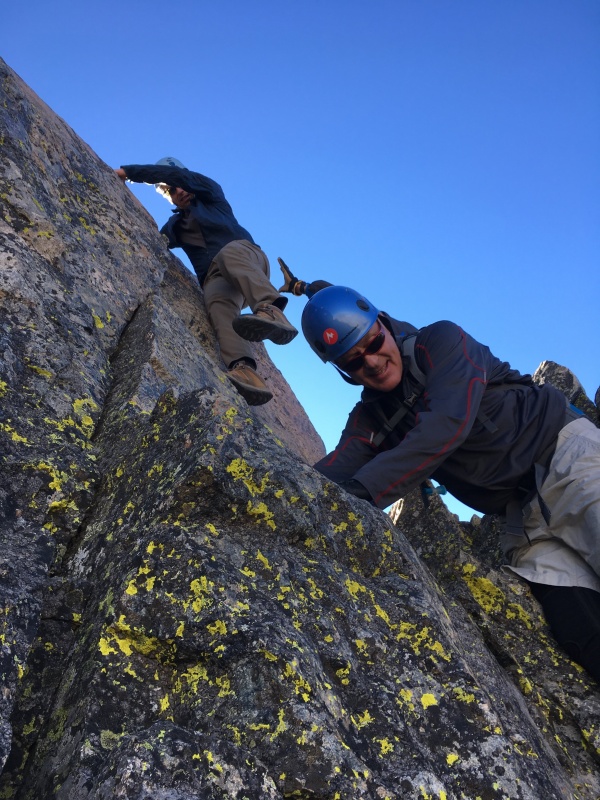
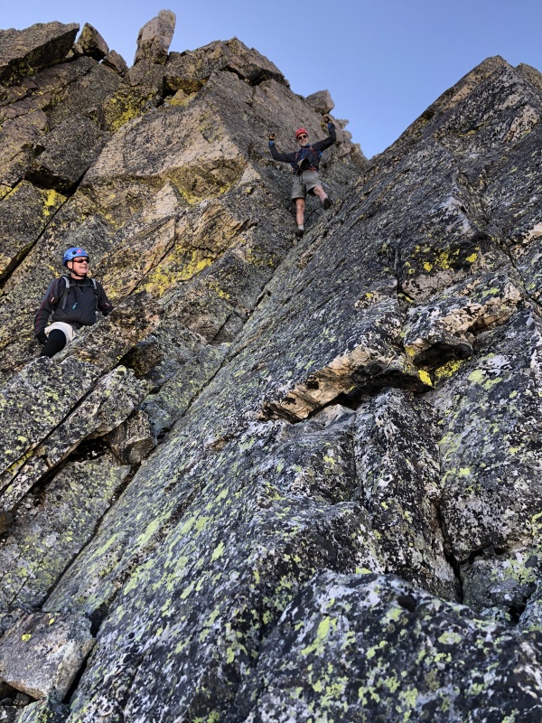
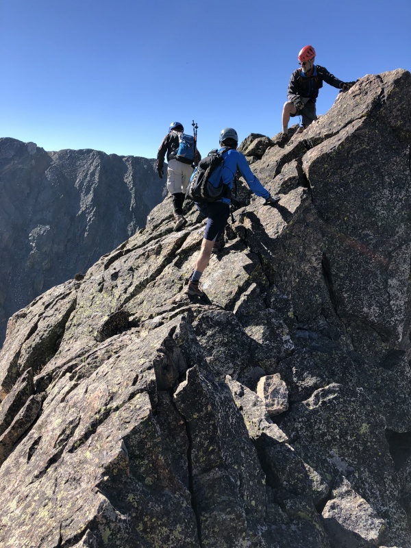
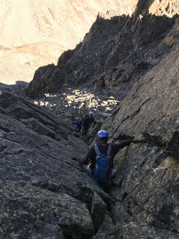
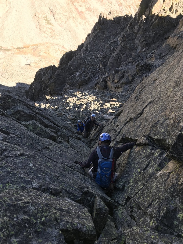
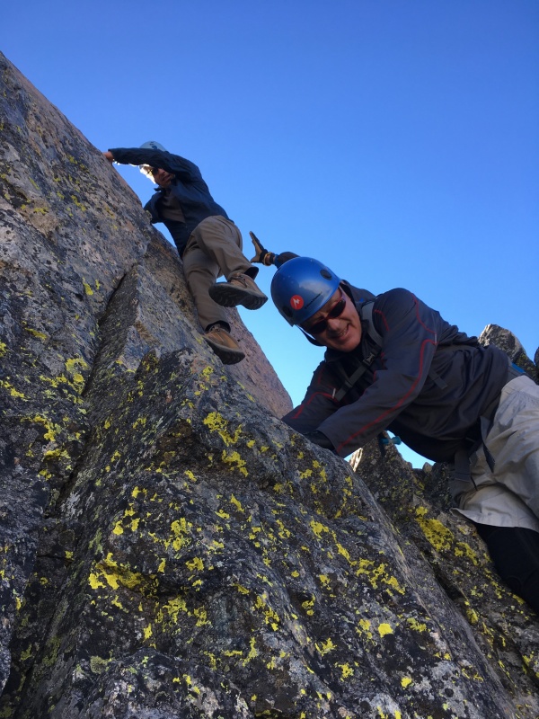
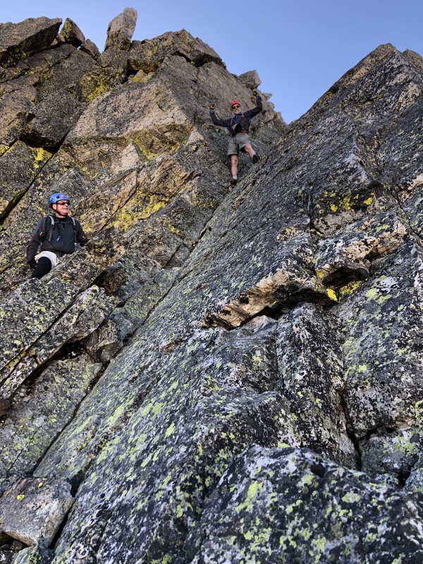
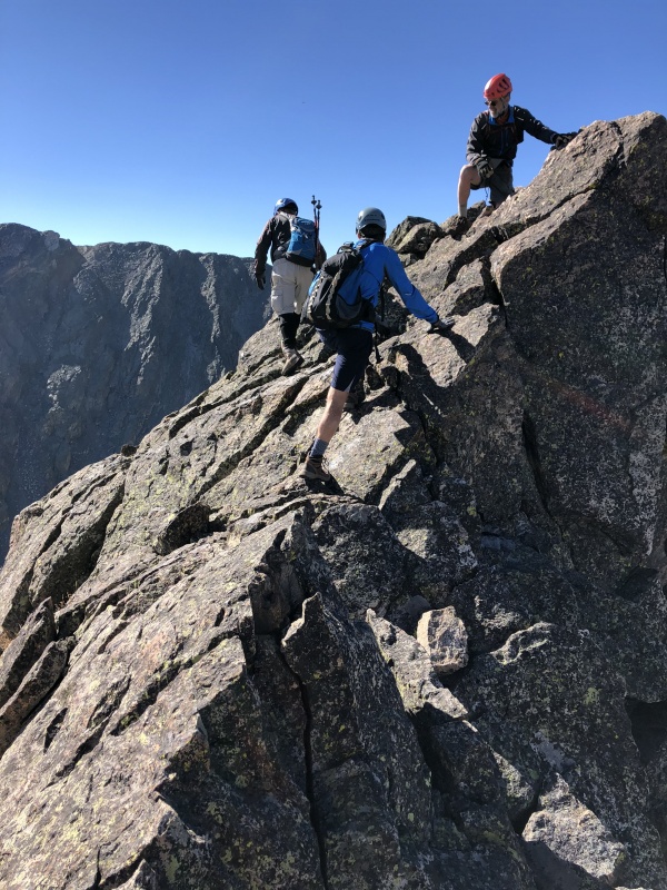
Our route was from the east and then down the airplane gully. The 4 of us have a fair amount of experience but granted none of us are rock climbers. The trip reports we studied did not mention much about the challenges and complexities of the ridge. The first part is all easy but it get's complicated and stays that way. We were not expecting what I consider about 4 required exposed class 4 moves before we even reached the actual Niwot Peak high point. Note that there is a high point with a man-made rock pile on top that is actually not the high point. As I recall, the tricky downclimbing beyond that was some of the most challenging. The rock is solid so this is not like the Bells, but there was a lot exposure and several places where we had to problem solve for several minutes and even spot each other for some downclimbing. It took several hours to get across the ridge to Niwot Peak, but it was much quicker after that. Another thing we found different than other reports is that most of the solutions around tough spots were on the south side of the ridge, not the north. Perhaps we stayed too high on the ridge in some places?
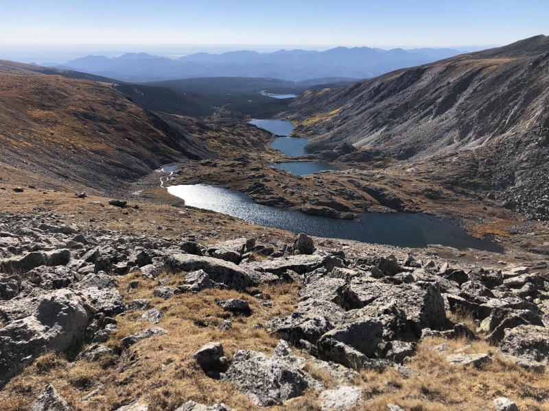
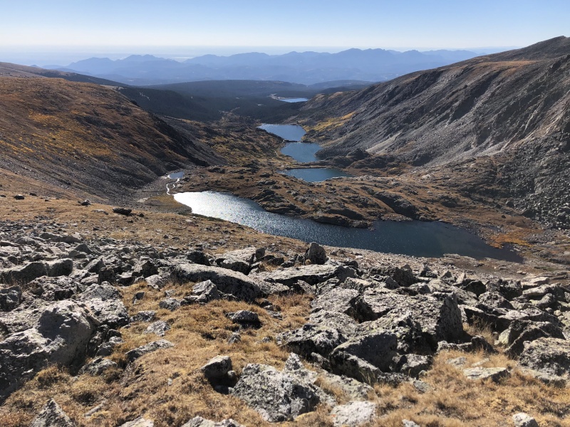
Awesome view from low on the ridge looking into the Boulder watershed.Caption HereCaption HereCaption Here
Caption Here
Unexpectedly, after Niwot peak the rest of the way was trivial. From the top of the airplane gully to the summit of Navajo was 20 min with one 4th class move, but we could have worked around that one, as I did on the return.
To put a fine point on it, I've been on several ridges like this: Meeker, Wilson-El Diente, Arapahoe and this one is comparable if not more serious. It certainly takes as long as the Wilson ridge. Of course now that it is done I look at the ridge from Brainard lake and wonder why I expected otherwise.
This is not to say this this was not FUN! It was great. But make sure you have time, a partner to help and no one who will freak at some exposure.
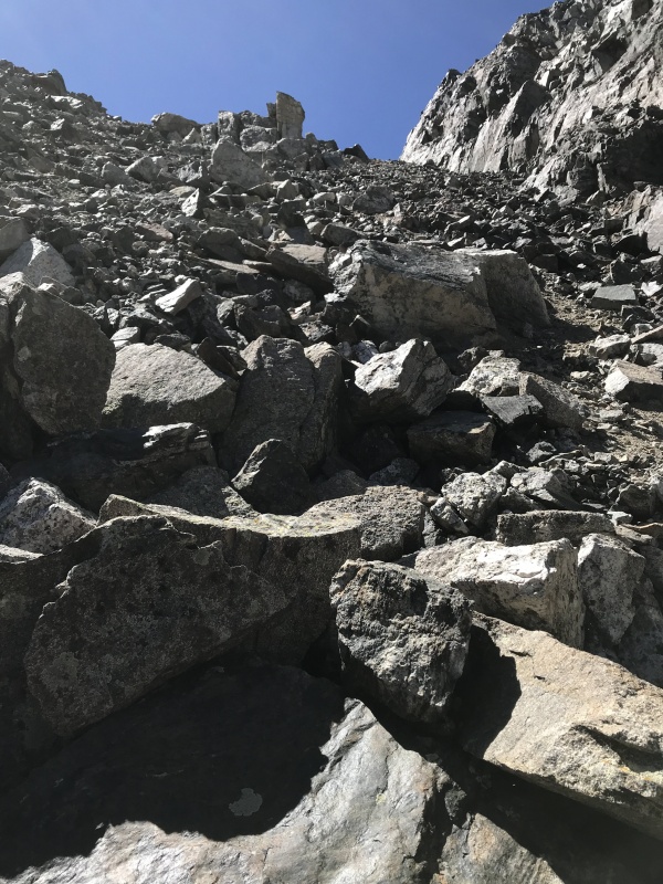
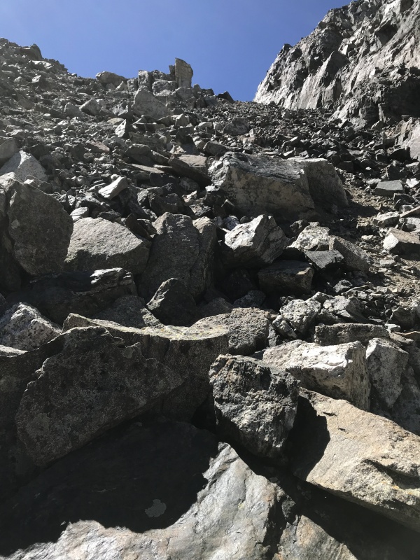
What to say about airplane gully? Not a fan. One of the worst. Narrow, very steep, lots of dirt, loose rock. I'm glad we were going down instead of up. Looking up I imagined misery climbing it; crazy steep loose dirt with nothing solid and no width to switchback.
Yeuch
Pretty exhausting trip at about 14 miles and 10+ hrs moving. It was a great day. The weather was amazing; blue sky, no wind. Great company with my son and good friends. It will be a pleasure to look up at this amazing part of God's creation with the satisfaction of having traveled it!
Thumbnails for uploaded photos (click to open slideshow):
Comments or Questions
Caution: The information contained in this report may not be accurate and should not be the only resource used in preparation for your climb. Failure to have the necessary experience, physical conditioning, supplies or equipment can result in injury or death. 14ers.com and the author(s) of this report provide no warranties, either express or implied, that the information provided is accurate or reliable. By using the information provided, you agree to indemnify and hold harmless 14ers.com and the report author(s) with respect to any claims and demands against them, including any attorney fees and expenses. Please read the 14ers.com Safety and Disclaimer pages for more information.
Copyright: Route information, text, risk factors, maps, GPX files, charts, photos, 14ers.com-created map imagery, flythroughs, and other content provided in this route description are copyrighted by 14ers.com and may not be copied, reproduced, republished, distributed, modified, or used to create derivative works without prior written permission.
Please respect private property: 14ers.com supports the rights of private landowners to determine how and by whom their land will be used. In Colorado, it is your responsibility to determine if land is private and to obtain the appropriate permission before entering the property.