| Report Type | Full |
| Peak(s) |
Horseshoe Mountain - 13,918 feet Peerless Mountain - 13,356 feet Mt. Buckskin - 13,871 feet |
| Date Posted | 09/09/2018 |
| Date Climbed | 09/01/2018 |
| Author | nyker |
| Mosquito Range 13ers, No DEET Needed. Part I |
|---|
|
Mosquito Range 13ers, No DEET Needed. Part I Horseshoe Mountain (13,898ft), Peerless Mountain (13,348ft), Mount Buckskin (13,865ft) Horseshoe Mountain (13,898ft) While the Mosquito Range has some very popular trailheads within its boundaries, you’ll also find a beautiful landscape with vibrantly colored rock, a veritable sea of mountains surrounding you and a good shot at seeing a variety of wildlife. Often on the less traveled peaks, you won’t see another person all day. This was a really pleasant hike and nice way to spend a morning. Getting to Fourmile Creek TH took longer than I expected and longer than I remember. It’s been a while since we had hiked Sherman and CR18 has gotten worse over the years. I think driving down this dirt road rattled a filling loose in my teeth. For those in a lower clearance or rental, it will be a slow ride, unless you want to fix a flat or two. Lots of mining history up this road though. 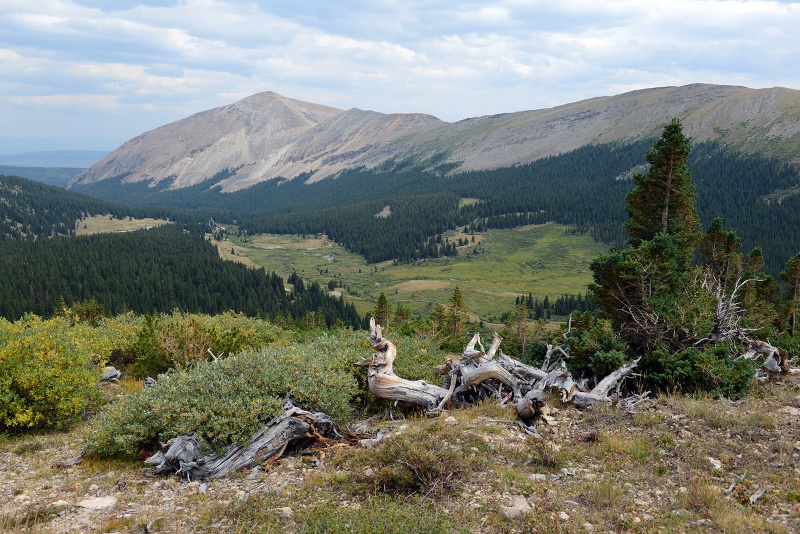 Luckily the road makes a nice walk in and of itself with some great scenery, more like a wide trail as it ascends the valley. While all of the other vehicles were parked at the trailhead for Mount Sherman, nobody else seemed to be planning Horseshoe this morning. After a short while you’re close to treeline and get your first closer view of Horseshoe Mountain and the ridge it both forms and is integral to. 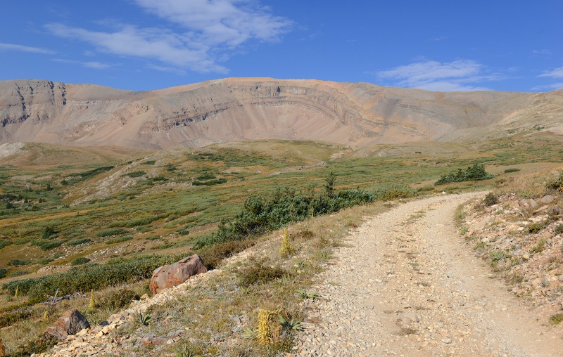 You can actually see Horseshoe from far away off Route 285 and the beginning reaches of 18. It has a pretty unique look to it. Much of the route travels along this old Jeep/mining road climbing up to near the saddle of Horseshoe and Peerless. In hindsight, I should have planned to do this one at night under a full moon, that would been neat. Getting higher hiking up one of the many turns in the road, the summit of Horseshoe is in the center of this photo in the distance. 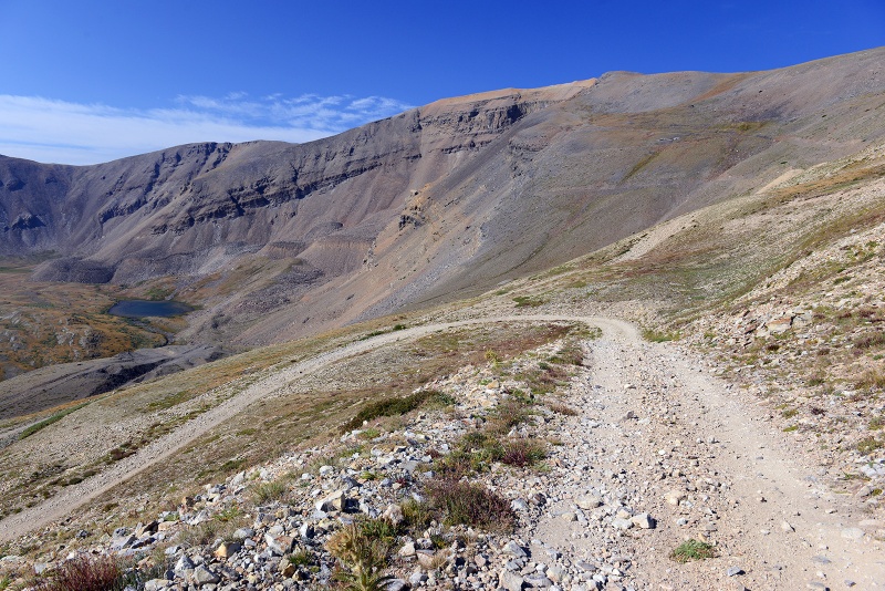 You’ll pass some mining ruins on the road, which could make some cool photo subjects, but watch for exposed nails and unstable ground if you venture around them. 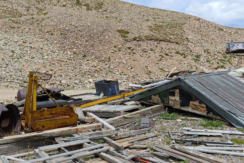 ...and unstable ground around these structures 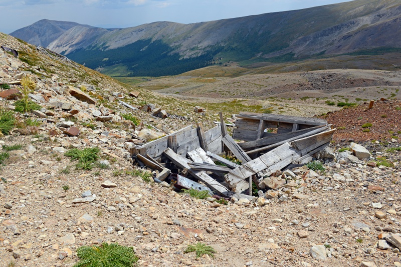 As you hike up, you’ll see Peerless Mountain peer its head out on climber’s right. 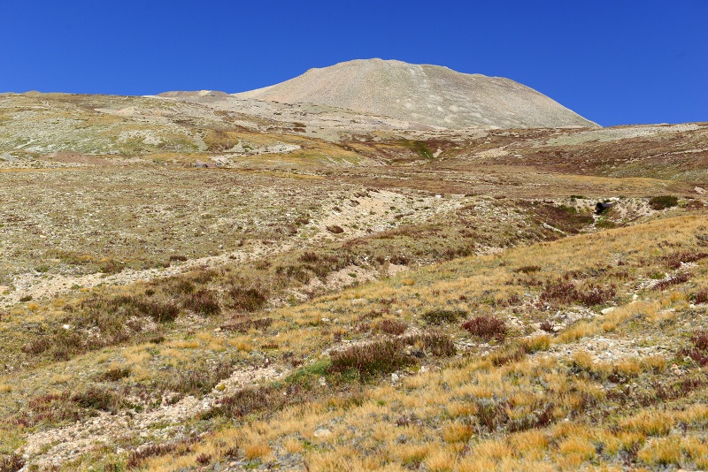 Reaching the saddle between Horseshoe and Peerless, you can see Mount Sheridan in the distance. The landscape here reminded me of the barren high desert of the Atacama and could easily be used to film a scene from another planet. The wind picked up pretty significantly here and kept up until sheltered by the east slopes of Horseshoe. 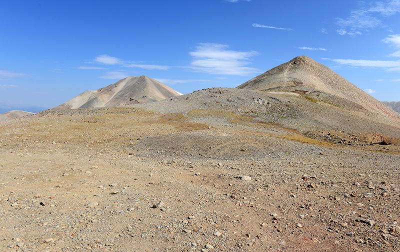 From the saddle, looking the other way, you see your objective, the summit is off to the right 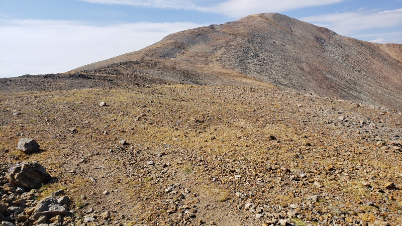 From here, there is a marked trail you follow which makes a pretty easy ascent up. 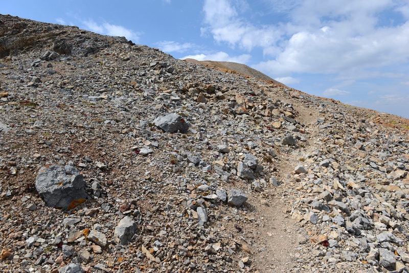 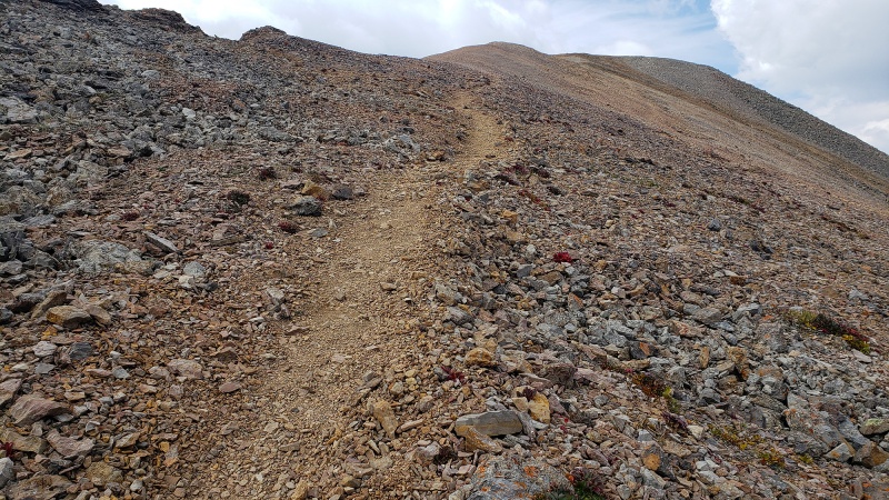 The views of the surrounding peaks were great though, especially with colors of the terrain and the cloud formations starting in the morning. Looking back, at what you just ascended, Fourteener Mount Sherman can be seen in the distance here in the middle, Sheridan to the left, White Ridge to the right.
The trail continues to the top where you’ll run into some minor bumps, not really considered false summits. No exposure up here, just a nice aerobic workout. 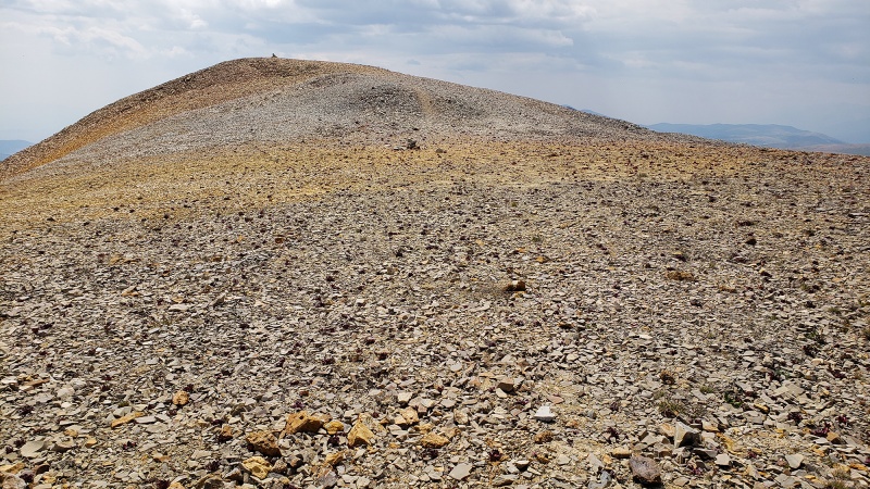 Looking back at the yellow gravel and rock. Its vibrancy contrasts well against the blue sky and peaks rising up from the landscape. "Follow the Yellow Brick Road"
You can see the summit over a few small bumps on the summit plateau. The 13,898ft summit is simply marked by a medium sized cairn
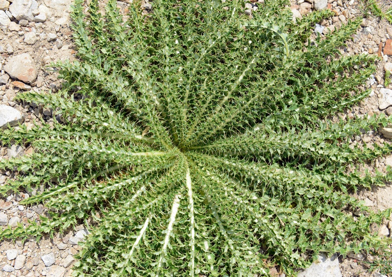
Tough little succulents on the summit. There were a lot of these plants, oddly concentrated on or near the summit. I find it amazing how nature can eek out an existence in the harshest places.
While pretty flat and open, the scene here is surreal with yellow rock and gravel with great views across both ranges. For a moment, the wind stopped and it became silent. I intensely focused on breathing and watching the clouds move across the sky. Ravens flew overhead in the thin air. The aggressive cliffs of the east face of Horseshoe can be seen from a different angle
As you descend, you can see the mining road you hiked up in the distance as it winds its way up the terrain.
Peerless Mountain (13,348ft) As you get back to the saddle, you can quickly climb up Peerless to get another view of Horseshoe and closer view of Sherman and Sheridan. It’s a pretty quick ascent some talus.
The top of 13,348ft Peerless
 The hike down the road was quite nice and ranks as one of the better with scenery.
 If it weren’t for the long drive in on the rough road, this would make a nice training run/hike to acclimatize and probably a great snow climb. Mount Buckskin (13,865ft) Mount Buckskin was also an enjoyable climb without much stress and the landscape is really nice around Kite Lake, once you get away from the masses doing the Fourteeners there. It was great, while hundreds of people were doing Decalibron I had Buckskin to myself. Straight from the parking lot, head west, breaking away from the crowds and tents and have the nice trail to yourself. This trail continues a few hundred yards then you’ll be on your own to find a way up, so enjoy it while it lasts. 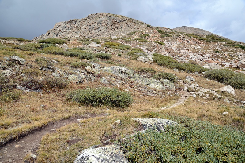 After you get up into the basin, you’ll break away from the trail and head south towards the power lines in the distance and start ascending the slope. There is residual water and marshy areas around here, so be careful around this stretch as there are some deep holes that you can drop a foot into, especially if you’re doing this section in the dark. The creek/water crossings here are not too bad though again, watch for the mud that might suck your shoe in. Looking back at the masses at Kite Lake, I counted 132 vehicles there and on the road, which means likely 150+ people, dogs, cats, etc.  Had Buckskin been another +135ft higher, I’d be hiking alongside those 150 people here as well, but because of that differential, nobody else was here this morning, it’s as if the mountain didn’t exist. Interesting how geology and erosional forces influence such choices. Keep on the nice trail until you get towards the end of the willows in the upper basin, where you can see remnants of a lake that was once there. Take in the sweeping views and listen for pika 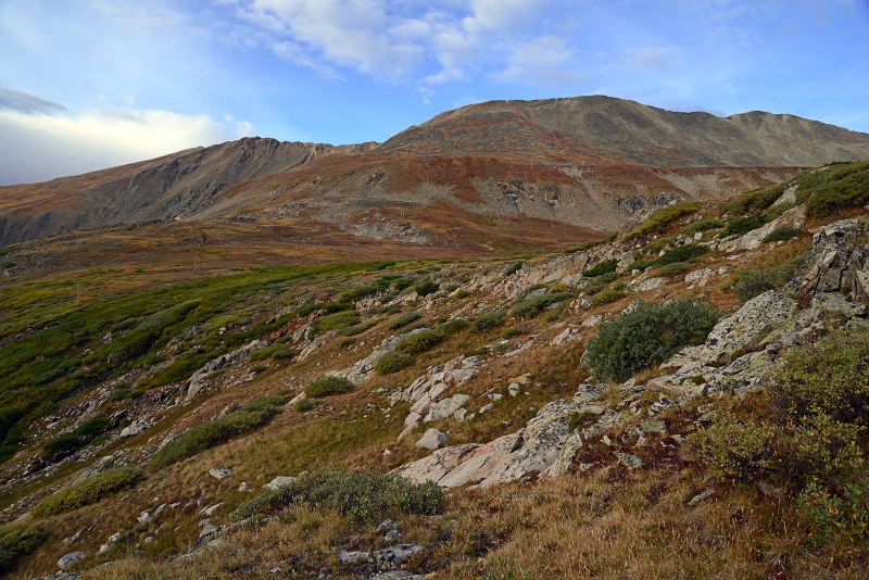 You can see the power lines ascending the Northeast side of the mountain, aim for those at the junction of the area where they start to get higher. Note clouds building  As you reach the area where you exit the willows (due South), you’ll be entering the basin. Great place to stop and take it in. It was just after sunrise and earlier, the sun bathing the ridgecrest in alpenglow. The current blue skies would soon turn dark. 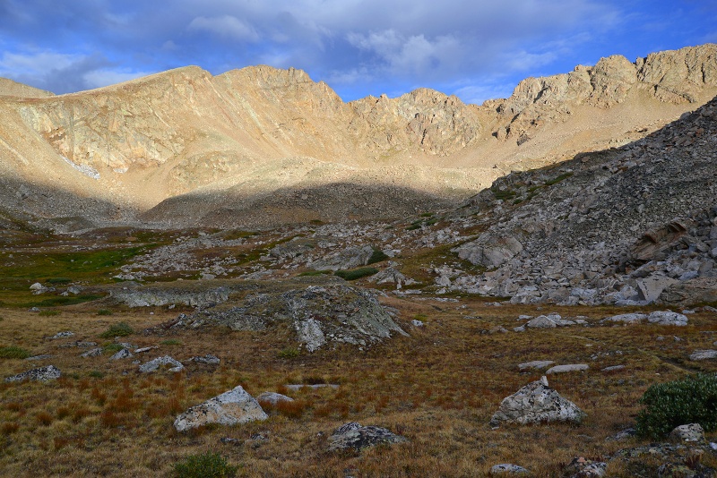 Within the next 30 min or so, the sky grew darker and I assumed I was going to have to bail with early thunderstorms coming in. The clouds started to really darken over the north/northwest ridge which connects to Mount Democrat. Scary dark. 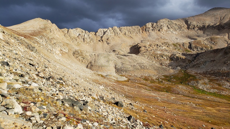 Some sprinkles and a bit of hail came down briefly, I stopped and waited to see how the weather developed. While I was not that high yet, I was above treeline and not the ideal place to be if an electrical storm came in, though up until this point the terrain was easy to get down fast if I needed to. Above here Within a half hour, luckily for once, the skies actually cleared pretty quickly and turned blue again with some innocuous looking clouds remaining. 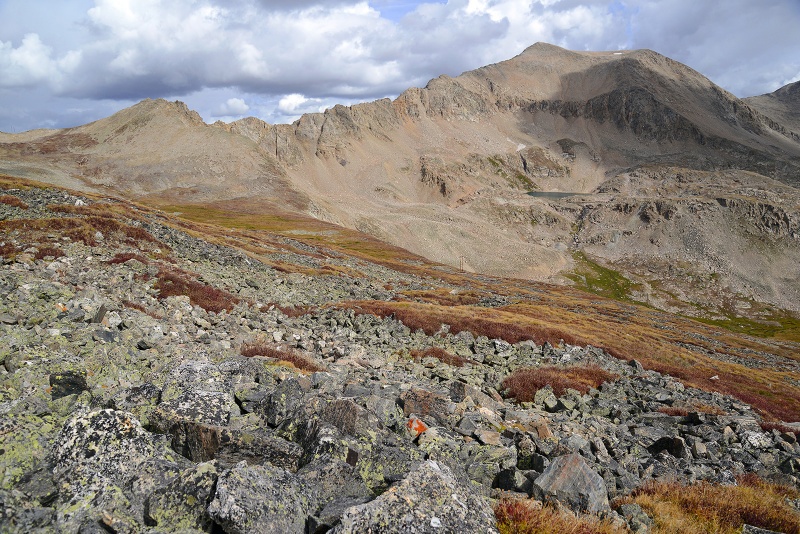 Continue southwest up the slope, crossing under the powerlines, yes, it’s a little weird to have to cross or even see power lines at 13,000ft. 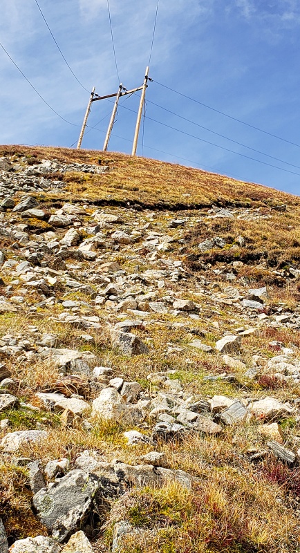 Mosquito Panorama 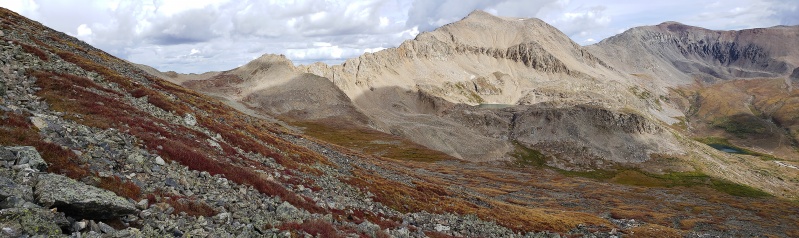 From the slope, you really have a fantastic view here and great vantage point from which to peer over Kite Lake and Democrat, Lincoln, Cameron and Bross and beyond as you get higher. 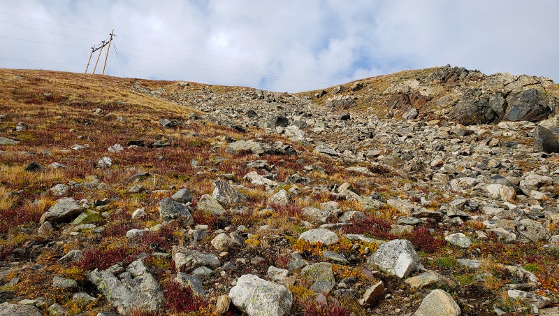 Keep climbing up the slope 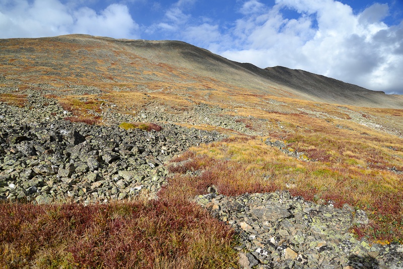 Veins of lichen covered granite talus thread their way all over the lower slopes, giving the flanks of Buckskin a nice character and coupled with the grasses interspersed on the hill in autumn colors, made for a nice scene. 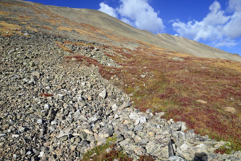 Views don't disappoint You’ll have Mount Democrat and friends in your sights the whole time. While Democrat is generally considered a tame peak, its noteworthy that many times over the course of that morning, I heard rockfall coming down its steep cliffy southern face, loud enough and frequent enough for me to stop and turn around. 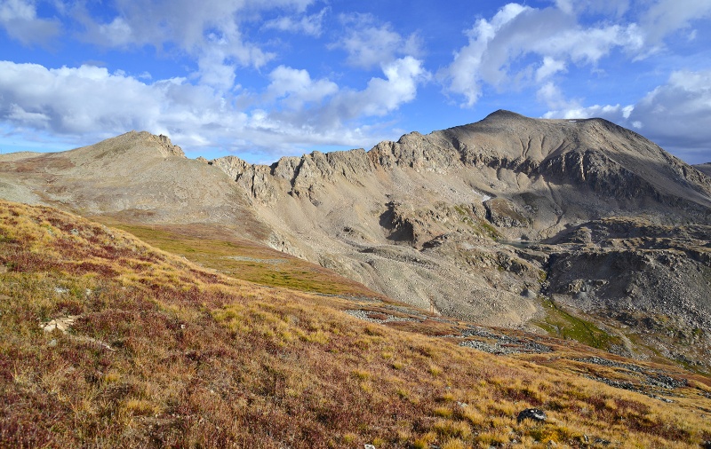 Nice Colors 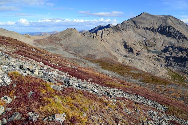 Moon Setting
Of course, you’ll start to run into some more solid fields of talus. While there is no trail or defined route up here, there is an easier way and harder way to pick your way through this route, so pick a line you like and go. As it would turn out, I unknowingly picked a harder way up, and found an easier way down on the return. All relative though, even the harder way wasn't that tough, it was more a question of the size of the talus you were climbing over.
The summit comes into view
Soon, you’ll top out on the ridge, and be able to sneak a peek off looking southwest into the basin on the other side. Turn right (West/Northwest), walk a bit further and reach a minor sub-summit and with a bit more walking and without much fanfare, you’ll find yourself on top. No false summits to contend with on this one. You can see the Northwest summit which is a bit lower.
The summit!
Looking back down at Kite Lake area (North/Northeast)
Looking West/Northwest
Looking southwest
Pay attention to descending off the ridge since that will start you on either a harder path down or easier one depending on where you start descending from. If it looks too steep/sketchy, keep walking on the ridge a bit more until it looks better. As I started down, clouds came in faster in earnest and started to thicken and were pretty low by the time I got to the road
Still lots of folks up high given all the cars still parked there.
Buckskin was a nice fun climb, I imagine it would make a fun snow climb if you could get anywhere near the trailhead, otherwise could be a long day in the snow. Definitely worth the hike up so if you’re at Kite Lake and don’t want to deal with crowds turn west and likely have a mountain all to yourself on Buckskin! Part II of this report will be at a time to be determined when I can get out again! Thumbnails for uploaded photos (click to open slideshow): ")
")
")
")
")
")
")
")
")
")
")
")
")
")
")
")
")
")
")
")
")
")
")
")
")
")
")
")
")
")
")
")
")
")
")
")
")
")
")
")
")
")
")
")
")
")
")
")
|
| Comments or Questions | |||||||||
|---|---|---|---|---|---|---|---|---|---|
|
Caution: The information contained in this report may not be accurate and should not be the only resource used in preparation for your climb. Failure to have the necessary experience, physical conditioning, supplies or equipment can result in injury or death. 14ers.com and the author(s) of this report provide no warranties, either express or implied, that the information provided is accurate or reliable. By using the information provided, you agree to indemnify and hold harmless 14ers.com and the report author(s) with respect to any claims and demands against them, including any attorney fees and expenses. Please read the 14ers.com Safety and Disclaimer pages for more information.
Please respect private property: 14ers.com supports the rights of private landowners to determine how and by whom their land will be used. In Colorado, it is your responsibility to determine if land is private and to obtain the appropriate permission before entering the property.


