Download Agreement, Release, and Acknowledgement of Risk:
You (the person requesting this file download) fully understand mountain climbing ("Activity") involves risks and dangers of serious bodily injury, including permanent disability, paralysis, and death ("Risks") and you fully accept and assume all such risks and all responsibility for losses, costs, and damages you incur as a result of your participation in this Activity.
You acknowledge that information in the file you have chosen to download may not be accurate and may contain errors. You agree to assume all risks when using this information and agree to release and discharge 14ers.com, 14ers Inc. and the author(s) of such information (collectively, the "Released Parties").
You hereby discharge the Released Parties from all damages, actions, claims and liabilities of any nature, specifically including, but not limited to, damages, actions, claims and liabilities arising from or related to the negligence of the Released Parties. You further agree to indemnify, hold harmless and defend 14ers.com, 14ers Inc. and each of the other Released Parties from and against any loss, damage, liability and expense, including costs and attorney fees, incurred by 14ers.com, 14ers Inc. or any of the other Released Parties as a result of you using information provided on the 14ers.com or 14ers Inc. websites.
You have read this agreement, fully understand its terms and intend it to be a complete and unconditional release of all liability to the greatest extent allowed by law and agree that if any portion of this agreement is held to be invalid the balance, notwithstanding, shall continue in full force and effect.
By clicking "OK" you agree to these terms. If you DO NOT agree, click "Cancel"...
Take what the weather offers you and ignore the list
8/31/18 - 9/3/18 47 miles total with a dayhike to Titcomb Basin
Day 1: 10 miles to Seneca Lake Day 2: 11 miles RT to Titcomb Basin Day 3: 16 miles RT to Fremont and back to Seneca, ~4000 feet of elevation gain Day 4: 10 miles back to the car
I hate to say that we've gotten really good at figuring out alternate plans at the last minute but that's the way that summer has gone for us. We had planned on Vestal and the Trinities this weekend but as we kept checking the weather before Labor Day the forecast kept getting worse. Not wanting to take the chance on driving all the way to the San Juans only to get rained out we started working up a new plan. Earlier in the summer we had bailed on a trip to the Wind Rivers because of snow conditions and ended up in Utah to climb Kings Peak. This time we checked the weather in Wyoming and it was saying 0% chance of storms for the entire holiday weekend. New plans were made, backpacks were packed, and we headed off early on Friday morning for Wyoming instead with a plan to climb Fremont Peak. For years I've been wanting to visit Titcomb Basin and with 4 days to hike it looked like we'd have time for a dayhike to Titcomb and a climb of Fremont both.
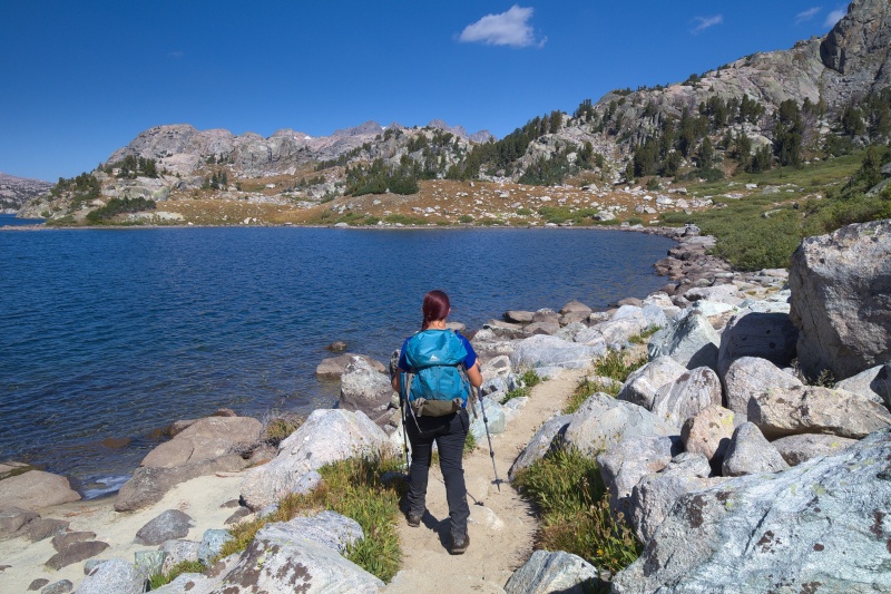
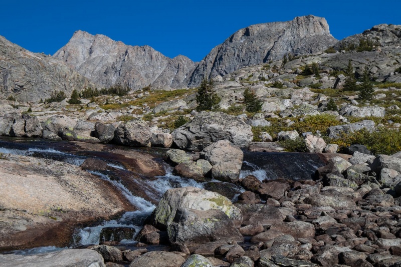
With a few minor delays along the way we got to the Elkhart Park Trailhead to start backpacking mid-afternoon on Friday. The first 5 miles of the trail wind through the forest at a nice steady grade until you reach Photographers Point where you get a spectacular view of the mountains ahead of you. We discussed some ideas for where to backpack along the way because we weren't sure how far we'd get before running out of daylight. The original idea was to backpack to Island Lake and camp there but by the time we reached Seneca Lake about 10 miles from the trailhead it was 7:15pm and getting cold so we took a nice campsite at the end of Seneca instead. We pondered moving camp over the weekend but ended up just staying put because we had a wonderful site and decided a few extra miles weren't that big of a deal.
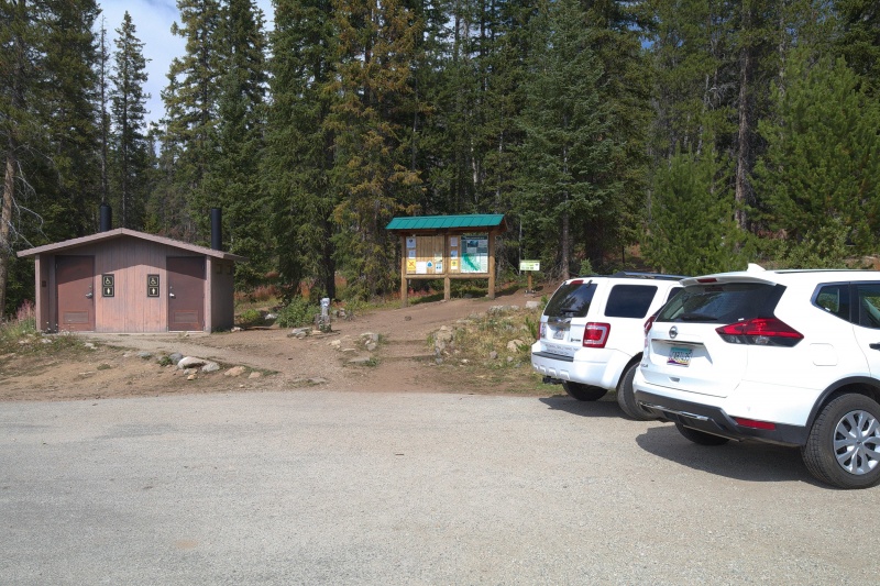
Elkhart Park Trailhead
Photographers Point about 5 miles from the car
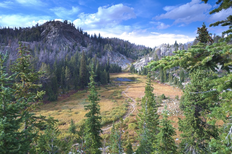
Meadow along the way
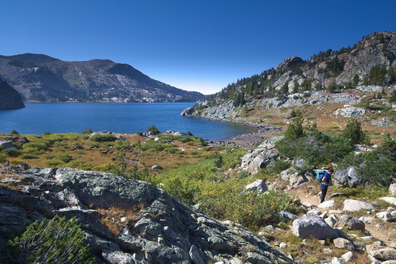
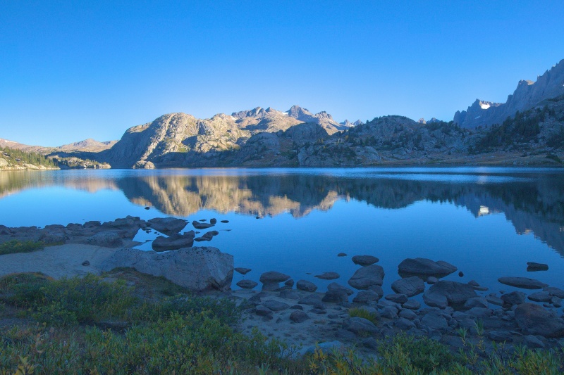
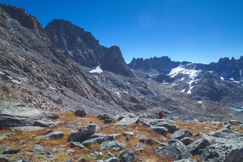
Seneca Lake and Fremont in the distance
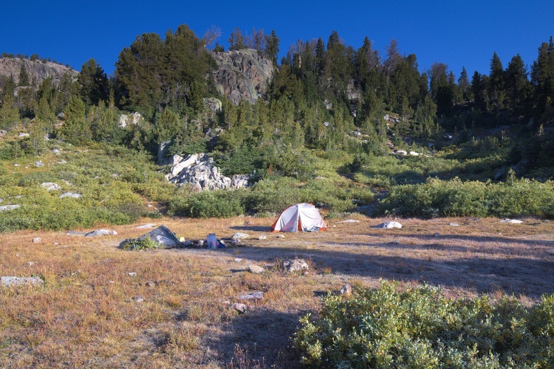
Seneca Lake basecamp
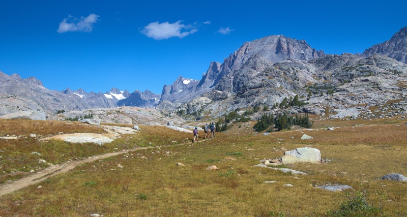
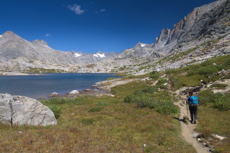
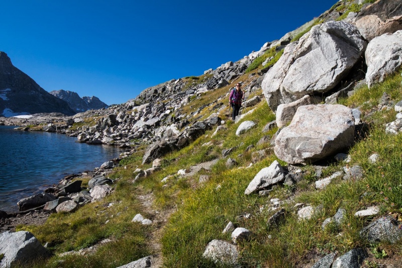
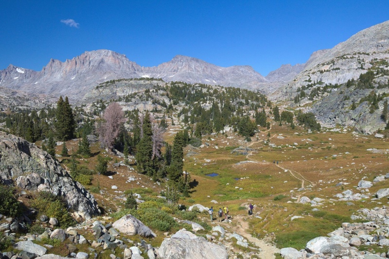
We decided to start late on Day 2 and do a hike to Titcomb Basin instead of trying for Fremont. Turns out our idea of a "rest day" was a 10 mile hike. From Seneca Lake the trail winds around Little Seneca Lake and then some other ponds and meadows before you finally see Island Lake ahead of you. We also encountered what we later deemed Camp Gladiator (older 14ers members will remember this) on the way. Thankfully everyone else we ran into on the trails was friendly and awesome.
Heading out for a dayhike to Titcomb
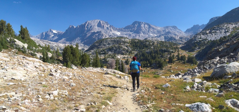
On the way to Island Lake. Fremont ahead.
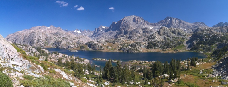
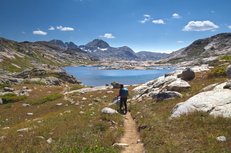
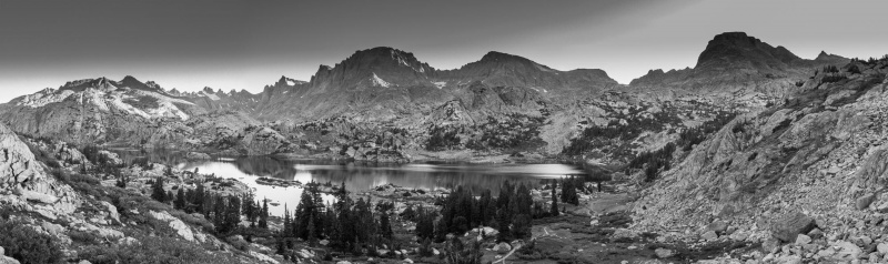
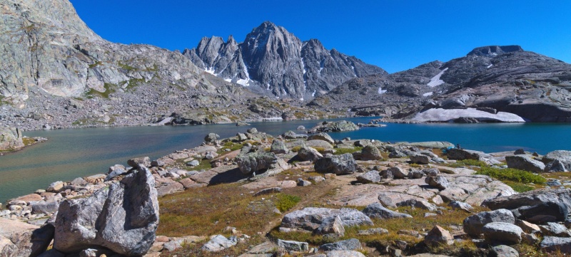
One last small rise brings you to a spectacular viewpoint above Island Lake that stopped everyone in their tracks. We saw a number of tents scattered around the lake but it's a huge area and everyone was pretty spread out.
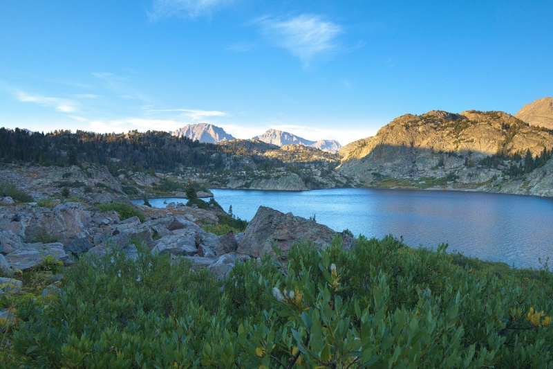
Island Lake
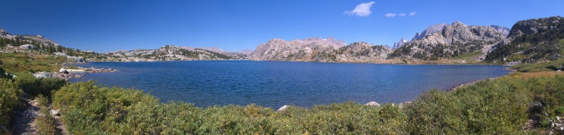
The trail contours around Island Lake and passes a small beach before starting to head towards Titcomb Basin for real.
More Island Lake
Passing around Island Lake
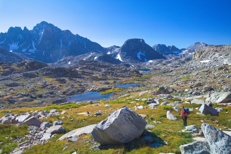
Fremont on the way to Titcomb
Approaching Titcomb
Spectacular place
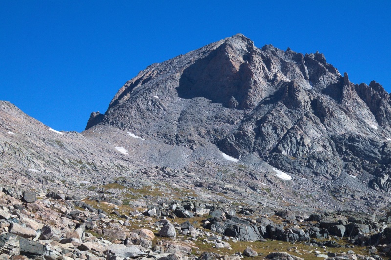
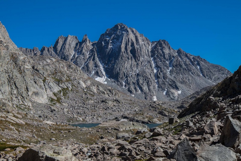
Fremont risiing above Paula
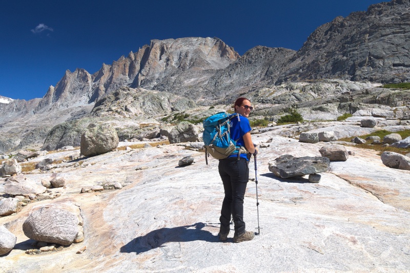
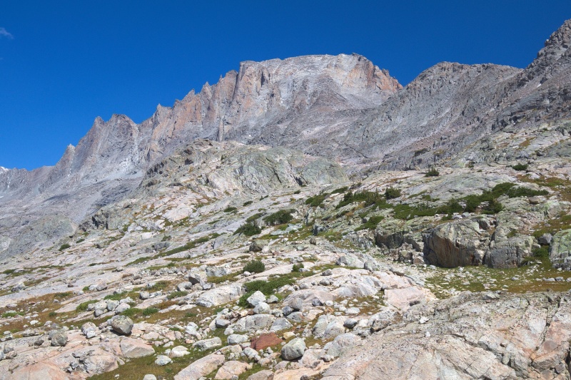
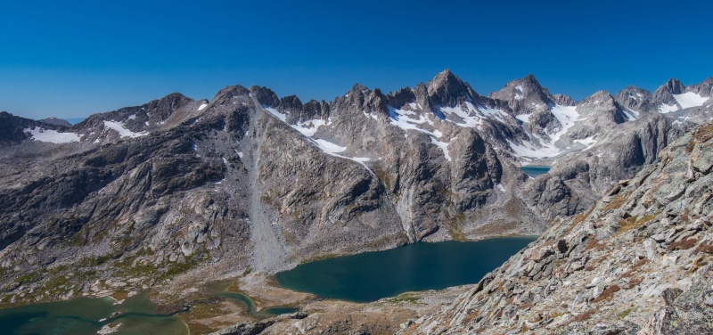
As we approached Titcomb we got a better look at Fremont and it seemed that it wouldn't be quite as hard as it had appeared from a distance. The Southwest Buttress route that we would be taking was visible above the saddle and the closer we got the less steep it looked. At Titcomb we found a rock outcropping with an amazing view and sat down for a long lunch. There were people around but it never felt all that crowded. It also helped that the basin is huge and people had plenty of room to spread out.
Titcomb
Another Fremont view
After lunch we started the long hike back down to Seneca. We enjoyed a bit of relaxation on the beach before heading back to camp for dinner.
Headed back to basecamp
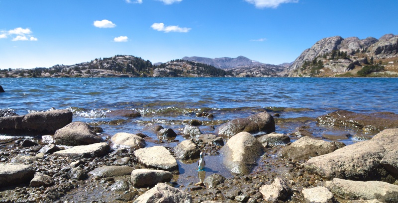
Mascot on the beach
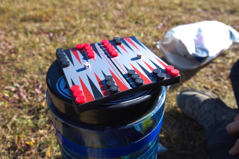
Backcountry backgammon. I even won a game.
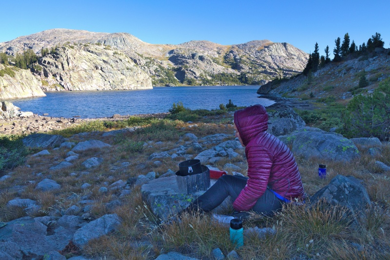
Dinner at Seneca
The next morning we packed up again and hiked back to Island Lake before reaching the trail junction for Indian Basin.
Island Lake black and white
Island Lake morning
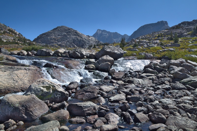
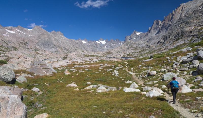
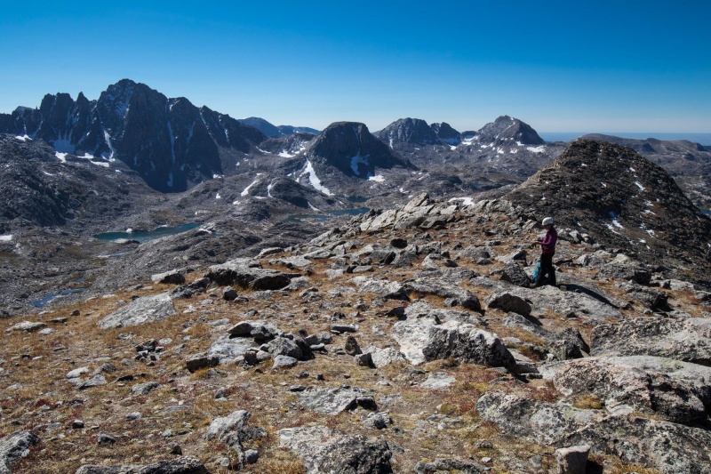
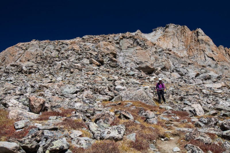
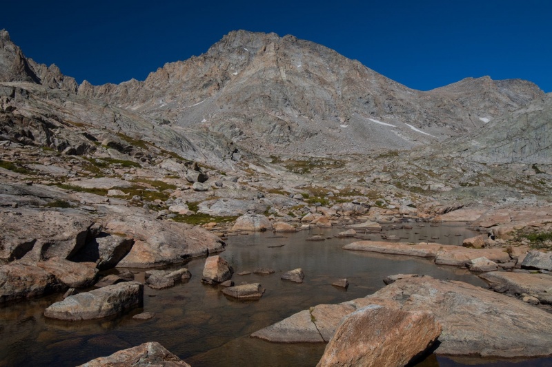
The trail up into the basin does a steady climb to about 11,000 feet before you can leave the trail and find your way towards the Fremont saddle. It turned out later that if we had stayed on the trail longer we would have had an easier time getting to the saddle but in the morning we just went cross country around a lake and then through the tundra and boulders towards the saddle. Eventually we intersected a trail that led to the saddle. The saddle was at about 12,100 feet and it was time consuming getting there. We were thankful for the perfect weather forecast though and just made steady progress.
Contouring around the lake in Indian Basin
Indian Basin on the way up
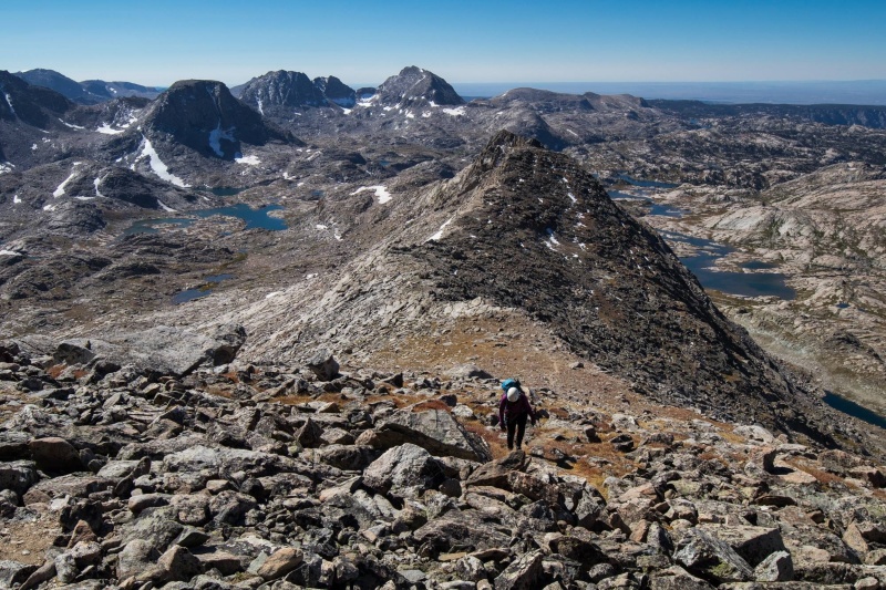
Better view of the saddle and the upper slopes of Fremont
Nearing the saddle. Jackson Peak in the background.
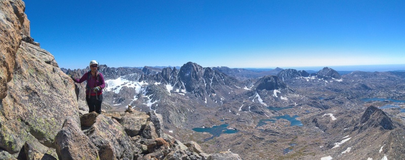
At the saddle we donned our helmets and looked up at the rather imposing 1600 feet of vertical in front of us. We followed a trail to the base of the buttress and started up through the rocks. There were plenty of cairns and trail segments and for the first 800 feet or so we really had no trouble figuring out the route.
Getting helmets on
Starting up from the saddle
We ran into a couple at about 13,400 feet that was heading down from the summit and chatted with them briefly. They had come up the far right side of the buttress instead of following the route we had taken and it sounded like they had a rather interesting climb. We gave them some advice for the hike down and parted ways before continuing to the ridge. We had gone to the right on the way up in order to talk to them and once we reached the summit ridge it become obvious that the summit was farther left along the ridge. On the way down we picked a more direct line instead of traversing the summit ridge again.
Most of the route was really only Class 2 or 2+ with a few Class 3 moves here and there. Mostly right on top of the summit ridge. It really isn't as hard as it looks from a distance. Still this is a big climb and in bad weather I can only imagine it would turn epic fast. At least on our climb we just had epic scenery.
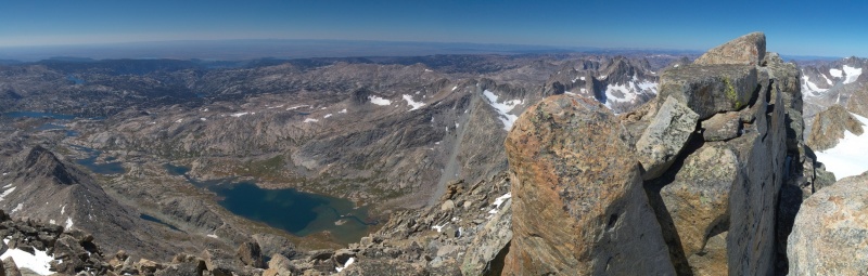
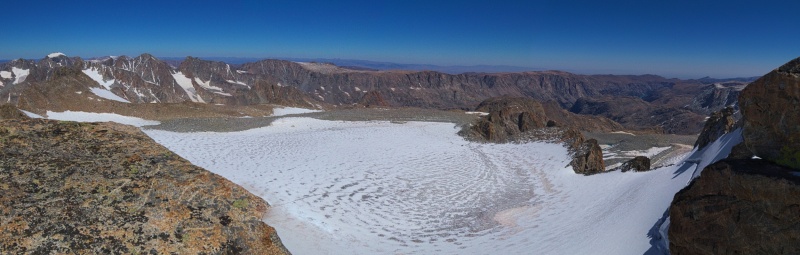
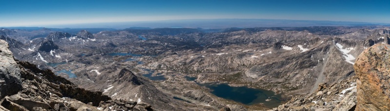
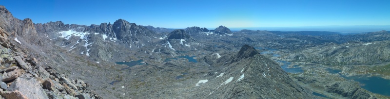
Summit pano to the west
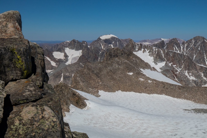
Summit pano east
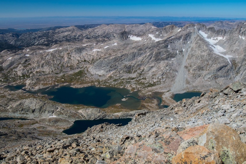
On the way up we hadn't had much wind but when we reached the summit register the wind got intense. The exposure to the east was also intense and it was a bit exciting trying to take a summit photo and sign the register. We could see Gannett a few miles away and we also had a pretty incredible view of the Fremont Glacier.
Gannett
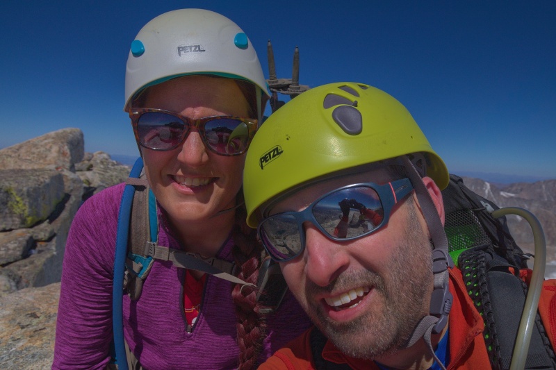
We got our faces in there at least
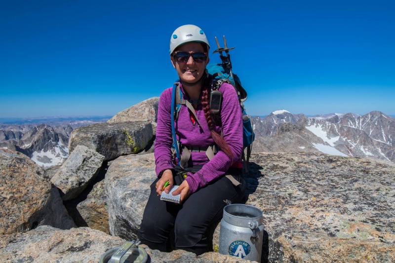
Signing in on the summit
We didn't stay long on the summit due to the wind and the cold so we started heading back down. We ran into a few people on the way down. The cairns were easy to spot on the way back and after about an hour we found ourselves back at the saddle.
Not a bad view
Titcomb Basin from the summit
Back on trail just above the saddle
Titcomb from above
Titcomb Lakes
When we got to the saddle we ditched our helmets and had lunch with a view down into Titcomb Basin.
On the way down we followed the trail back into Indian Basin and then did some cross country travel to join up with the Indian Basin trail higher up than we had left it that morning. The trail took us on the other side of the basin and past some absolutely gorgeous lakes. We were rather glad we'd gone a different way and got to see some different scenery because it was amazing. A few hardy souls had camped up there and probably had a spectacular night (and cold too I bet).
Other side of Indian Basin
I think this is Harrower Peak
Jackson Peak
Eventually we got back to the trail junction that led back to Island Lake and filtered some water for the long walk back to our camp. We ended up doing a 16 mile summit day that took about 12.5 hours. We took some painkillers at camp and drank the wine we had brought to celebrate with dinner and then promptly passed out just after 8pm.
One last view on the hike out to camp
The next morning we were sore but we packed up and headed out from camp to begin the 10 mile journey back to the car. We reached the car just after noon and headed into Pinedale for food and beer at Wind River Brewing. Then began the long drive home.
This trip was absolutely unreal. The views are out of this world. Truly enjoyed this one and I'd go back in a second.
Thumbnails for uploaded photos (click to open slideshow):
I'm jealous about your TH situation though. I had no bathroom at any of mine this weekend, and I paid the price. This report really makes me want to get into the Wind Rivers. Interesting that Fremont had its own 'keyboard of the winds' type formation.
I made it to photographer's point a couple years ago on a one day "scouting" trip looking to future. I clearly need to move forward on this. Congrats on a great trip.
I was JUST going to say, great minds think alike for bailing in the SJs. Looks like your plan B was also pretty spectacular. Great photos!
Caution: The information contained in this report may not be accurate and should not be the only resource used in preparation for your climb. Failure to have the necessary experience, physical conditioning, supplies or equipment can result in injury or death. 14ers.com and the author(s) of this report provide no warranties, either express or implied, that the information provided is accurate or reliable. By using the information provided, you agree to indemnify and hold harmless 14ers.com and the report author(s) with respect to any claims and demands against them, including any attorney fees and expenses. Please read the 14ers.com Safety and Disclaimer pages for more information.
Please respect private property: 14ers.com supports the rights of private landowners to determine how and by whom their land will be used. In Colorado, it is your responsibility to determine if land is private and to obtain the appropriate permission before entering the property.


")
")
")
")
")
")
")
")
")
")
")
")
")
")
")
")
")
")
")
")
")
")
")
")
")
")
")
")
")
")
")
")
")
")
")
")
")
")
")
")
")
")
")
")
")
")
")
")


