| Report Type | Full |
| Peak(s) |
"Lackawanna" - 13,826 feet Unnamed 13645 - 13,645 feet |
| Date Posted | 09/04/2018 |
| Date Climbed | 08/31/2018 |
| Author | nyker |
| Lack-a-weatha on Lackawanna |
|---|
|
Lack-a-weatha' on “Lackawanna” Northwest Ridge from North Lake Creek For those of you loyal readers that remember the poll I posted a couple of weeks back showing two photos with ominous looking skies with the question I posed of “what would you do?”, those photos came from my earlier recent attempts on Lackawanna. Note I said “attempts” as I turned around twice due to weather that later developed into thunderstorms. Right decision? Yea, probably, as I likely would have still been above treeline when that storm moved in, but you’re never happy about turning around, right decision or not. See photos below from those two attempts 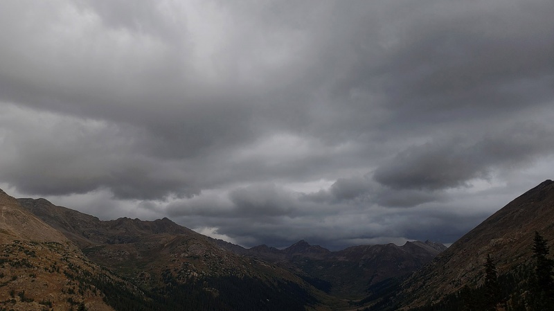 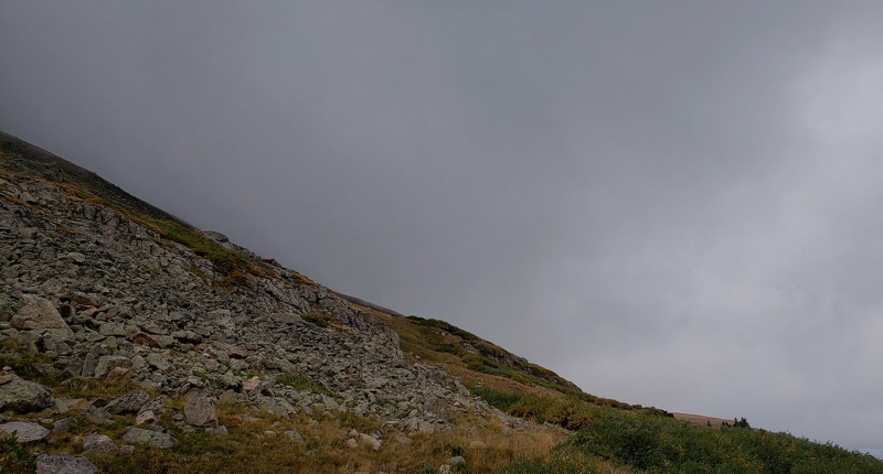 Thank you all to those who responded to that poll with thoughtful commentary, I appreciate that and I always find it interesting to hear thoughts from folks, each of you who have different experiences from me. For inquiring minds, of the 71 responses, 62% said turn around, 38% would keep going with a healthy mix of feedback. The Climb I was pretty determined to climb Lackawanna and wanted to give this another shot, since I don’t like having unfinished climbs on my mind. So on this day, skies were better and any inclement weather held off! Precipitation chances were running 10-20%... Lack of weather on Lackawanna!; definitely a “GO” Finally! Apparently not a lot of people opt for the Northwest Ridge route and instead do the South slopes route in Spring/Winter under a blanket of snow. Many times during this climb I was thinking I should have waited until the Spring and do the same thing. Under a waning gibbous moon, I started out early in the morning. Fortunately, given my prior and recent turn arounds, I memorized the initial route up to approximately 12,100ft, and at this point, I probably could have done it without a headlamp, moon or not! Give the lack of precipitation in general this year, all creek crossings were a non-event: The first one however does still have the potential to soak you above you boot if you slip in, which would make for a soggy day with wet socks making blisters a lot more probable. 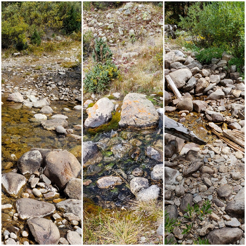 Once you leave the parking area on that initial well defined trail, finding the start of the more faint trail is tricky and better done in daylight as are the first couple spots you need to watch for to enter the forest. Just look for two large boulders and turn there. Once you are across the creeks, there is a faint trail that you need to find which crosses the third creek then leads to a fairly well defined path that follows an old mining/jeep road up the mountain. A crucial turnoff to watch for is right at the second vintage dilapidated cabin, after which you will begin your ascent in earnest with the terrain steepening immediately, but there is a good trail at this point now. Turn south here. 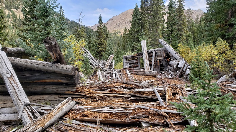 As you make your way up the old overgrown mining road, the beginning of this approach hike passes through a wonderful forest and is filled with the rich aroma from the pine/spruce/fir trees. Pay attention to the few key turnoffs you need to make or else you’ll be way off route as there are a few trails and paths that look like trails that go off in different directions. The below shot was taken on the descent. Postcard-like rich forest here. Hopefully the bark beetles won’t find these trees. 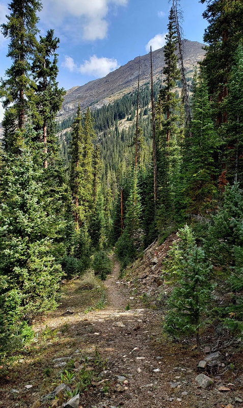 The trail traverses some steep slippery terrain in a few spots in the forest and is easy to lose in a few places so watch out for that as it fades away in places, backtrack when in doubt and look more closely. Downed trees cause some discontinuity in the trail in a couple of places, but it’s not too hard to follow if you’re paying attention. I made treeline fairly quickly this third time around and was greeted by the grand views in all directions: 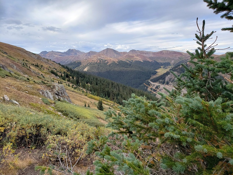 Above treeline you’ll see the remaining climb. There is no marked trail or defined route from here. You’ll see a cairn here and there, though there are many of them indicating several possible routes up so be careful if you opt to follow them. As you exit the forest, the terrain flattens out briefly under some rocky outcroppings and before the slope steepens above this point. Lower down, you’ll find more tussock-type tufts of grass which becomes increasingly interspersed with talus and scree higher up. You can find some grassy sections most of the way up though. 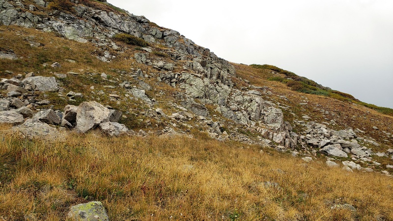 As Bill suggests in his description, I found the terrain initially easier by hiking a bit more south to the area in the below photo. 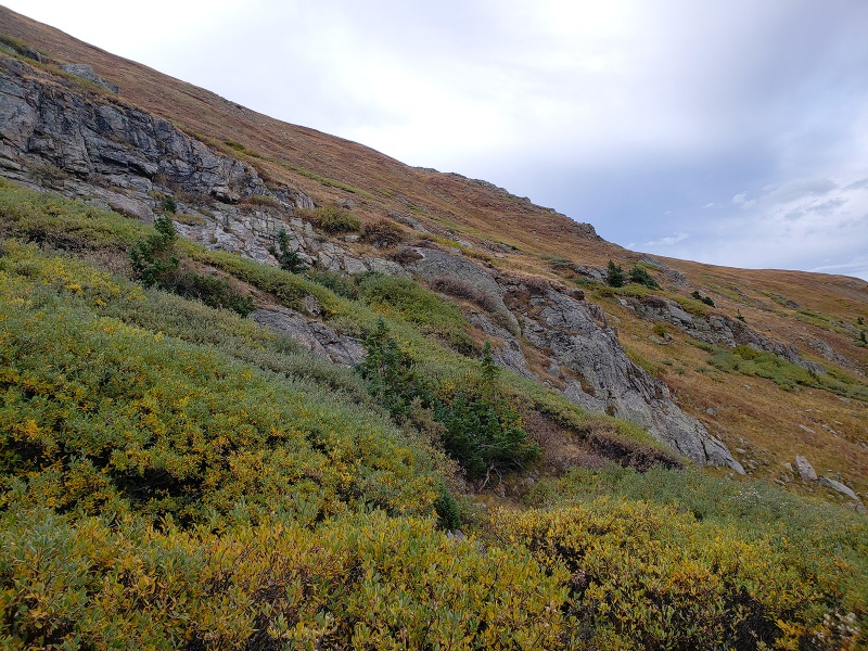 Look for signs of mountain goats. There is a small cairn here in the pic below, this is one way to start up, make a hard left here on the ascent. 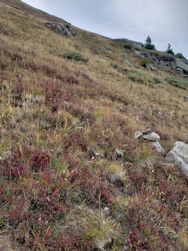 Don’t let the nice grass fool you, it’s steep no matter which area you decide to climb up, so choose your poison and start climbing. Views only get better as you get higher. You really have nice views of the Sawatch from here and can peer into the Elks from a distance. This is from shortly after turning east/southeast up the hill at about 12,500ft: 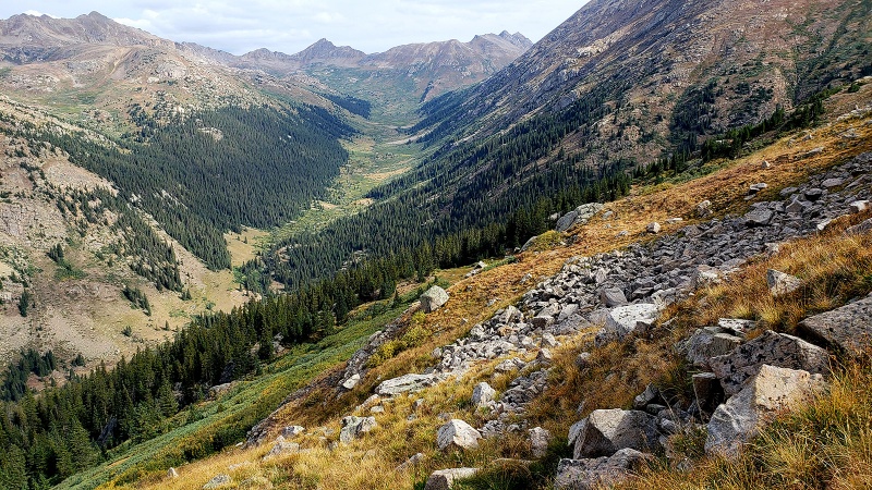 The steepness continues. There is some problem solving to do to find the best way up as you navigate over the remaining grassy sections, loose scree/dirt mixed with rocks and sections of talus. The morning dew was drying off the grass so that was helping with traction as it was more slippery down lower when wet. On the hill, there was evidence of a lot of mountain goat activity and I found that by following their tracks and scat sign was the easiest and safest way up and down. Follow the goats or at least follow the clumps of white fur. Due to steepness and the lack of stable rock to move over, this seemingly simple hill takes its toll to ascend. 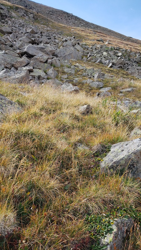 After the leg burning ascent up the steep slippery slope, you'll reach the ridge at roughly 13,000ft and see the remaining route, or what you’ll discover is the route up to false summit #1. The view when you topout on the ridge  Another perspective 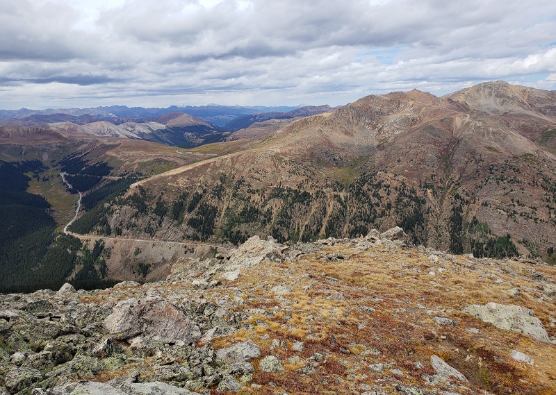 Looking at the route to Point 13,660, your next objective 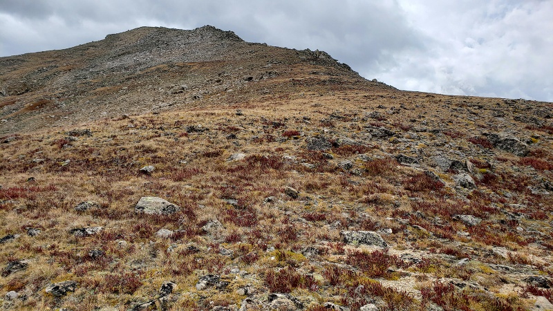 Looking back North/Northwest from where you topped out on the ridge 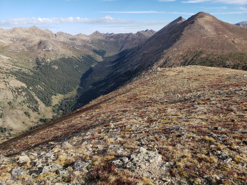 Climbing higher into still gentle but more rockier terrain 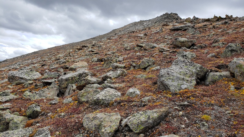 Soon you’ll have to surmount some larger talus and boulders to get to the upper slope to finally get to Point 13,660, false summit 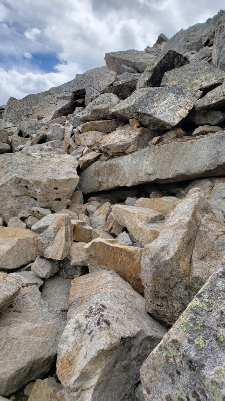 While it looks intimidating, the rock was fairly stable (as stable as boulders and talus can be) and climbing on this was actually easier than the “two steps forward, one step sliding back” effort of the initial steep loose hill to gain the ridge at ~13,000ft. Unbeknownst to me at the time, the rock jetty hopping I did as a kid while surf fishing on Long Island prepared me well for this sort of talus! 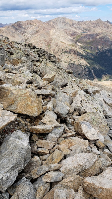 Getting closer to Point 13,660, which has some surprisingly dramatic exposure to the east of this ridge, the terrain seeming more Elk Range-like and uncharacteristic of what you'd expect in the heart of the traditionally more rolling hills of the Sawatch: Great views though, really. As Gerry and Jennifer Roach comment on the French Group within which Lackawanna resides, these peaks "rest regally in the home of the giants". 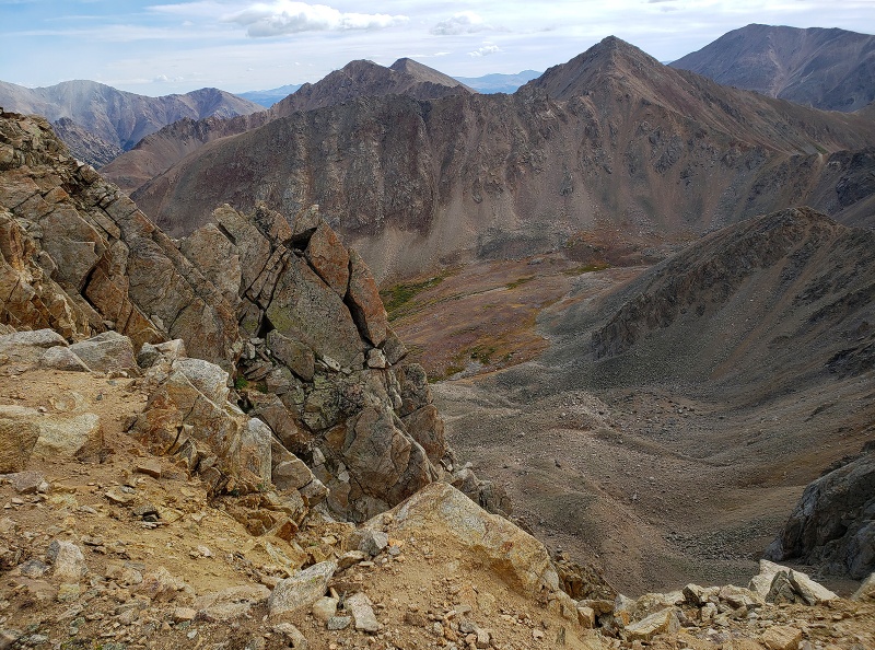 Standing here, the wind is silent for a moment. Surrounded by 13,000ft and 14,000ft peaks, you feel small. You can feel the power and energy here, far more powerful than down below. This is why we climb. Approaching 13,660 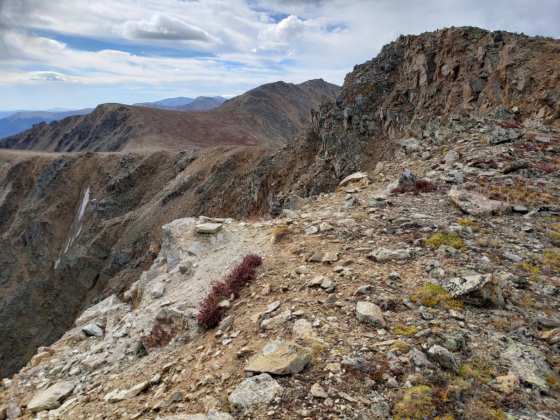 Reaching another milestone... 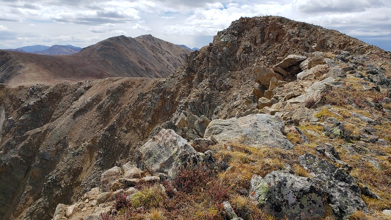 From here, the rest of the route to the real summit becomes visible, which is about a mile away. Keep in mind this mile is all over 13,300ft, so unless you’re well acclimatized, you’ll be moving slowly… 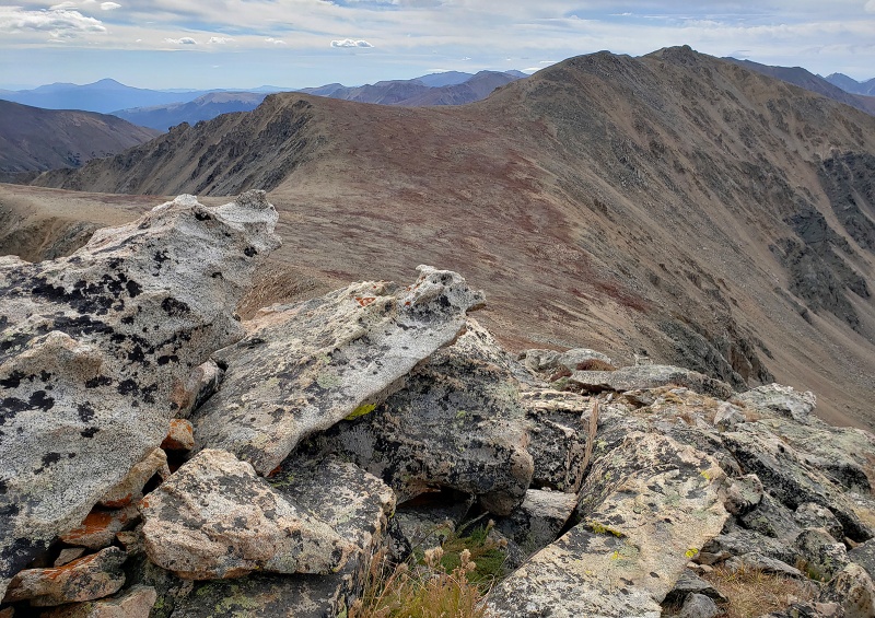 The view from this area was spectacular and I wanted to hang out here and take it all in, but I wasn’t going to wait around too long risking another possible storm coming in again so I moved on quickly without stopping any longer than to snap these shots. Once you get on top, you’ll need to drop down and lose a couple hundred feet of precious elevation you just climbed. Below are two views upon coming off Point 13,660 and moving down across the high plateau/saddle between it and the true summit. This is a really cool place to sit and take it all in. The wind picked up quite a bit across this flat area. Point 13,590 in the image below to climbers left (East) 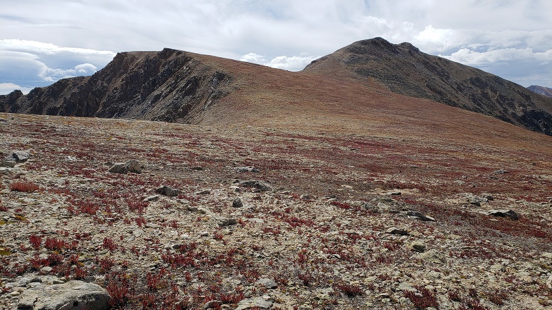 Getting closer. The groundcovers were in red fall foliage and made the terrain look surreal, almost Martian-like from a distance. Despite the wind, I heard the faint chirps of pika and marmot in the nearby rocks. 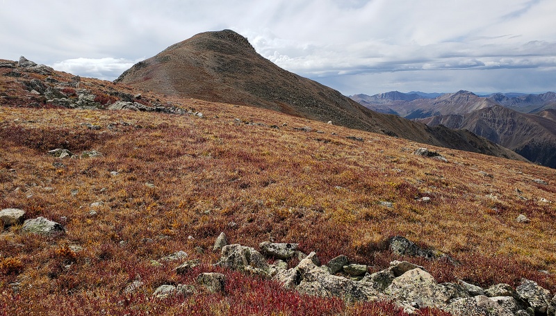 I half expected a golden eagle to swoop down on one of the marmots running around Would the Real Summit please stand up! Thinking I am just about there, I unbuckled my pack ready to take a break and have a bite to eat on the summit. Getting to what I thought was the top revealed yet another false summit...errrr... No summit Snickers yet… I keep moving… 
Surmounting this small hill on a hill, another seemingly summit-looking prominence comes into view…
Alas, this was not the summit either! I keep moving… One more rocky outcropping comes into view…was this finally it??
Yes, this was the summit! After short climb up the summit blocks I was finally on top. Three times a charm! And I was met by a newish looking 7.62mm ammo can holding the summit register, which consequently, 20 minutes later while heading back I realized I didn’t sign.
Views from the top were awesome! Possible showers in the distance, but all dry and clear around Lackawanna today.
Looking back at the way you came at Point 13,660
On the return you will reclimb the first false summit, ascending over this sloping plateau below. Colors were great.
This false summit looks quite a bit more aggressive from this angle and worthy of a more captivating name than “Point 13,660”.
Once past Pt 13,660, the descent was as “fun” as climbing up, poles helped quite a bit here providing that 3rd and 4th leg. Once back on the edge of the ridge at 13,000ft, you can basically see the route down and along with Route 82 far below in the distance it’s pretty hard to get off route, unless there is a white out or you’re doing this part in the dark. I am thinking this slope might also lend itself well to a snow climb in addition to the customary winter route on the south side, but timing would be important to make sure the road is open to the trailhead...either way, in spite of the steep slippery slope, the views up top are world class and worth the climb! Thumbnails for uploaded photos (click to open slideshow): ")
")
")
")
")
")
")
")
")
")
")
")
")
")
")
")
")
")
")
")
")
")
")
")
")
")
")
")
")
")
")
")
")
")
|
| Comments or Questions | ||||||||||||
|---|---|---|---|---|---|---|---|---|---|---|---|---|
|
Caution: The information contained in this report may not be accurate and should not be the only resource used in preparation for your climb. Failure to have the necessary experience, physical conditioning, supplies or equipment can result in injury or death. 14ers.com and the author(s) of this report provide no warranties, either express or implied, that the information provided is accurate or reliable. By using the information provided, you agree to indemnify and hold harmless 14ers.com and the report author(s) with respect to any claims and demands against them, including any attorney fees and expenses. Please read the 14ers.com Safety and Disclaimer pages for more information.
Please respect private property: 14ers.com supports the rights of private landowners to determine how and by whom their land will be used. In Colorado, it is your responsibility to determine if land is private and to obtain the appropriate permission before entering the property.


