| Report Type | Full |
| Peak(s) |
Cronin Peak - 13,872 feet |
| Date Posted | 08/24/2018 |
| Date Climbed | 08/14/2018 |
| Author | nyker |
| Cronin Peak via The Dragon's Back Ridge |
|---|
|
Cronin Peak – via the Dragon’s Back Ridge, a.k.a. North Ridge Route (Note Dragon’s Back Ridge is my name for this route if I were to name it, see description further down below…) Climbing this peak has a little bit of everything; some dirt road walking, off-trail bushwhacking in the forest, creek crossings, willows, steep hills, unforgiving talus, some minor exposure and 360 degree unobstructed views from the summit all in roughly 12 miles roundtrip and +4500ft elevation gain for the day. The below shot I took from Antero a few years ago. After I saw this mountain, I’ve always wanted to climb it, though didn’t know the name of it then nor did I realize it was a Centennial 13er. 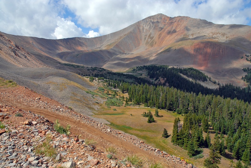 No summary of a Cronin Peak climb would be complete without a mention of the road. This is the same road you walk up when climbing nearby Mount Antero. Both peaks share the first few miles on their “standard” routes. I took this just after sunrise. 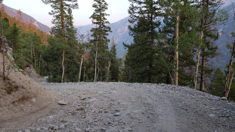 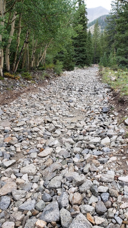 I should add that the sunrise this morning was particularly vibrant with the smoke from recent fires in the surrounding air undoubtedly making the sky more orange with a brilliant red disc rising from the horizon turning the sky pale orange for a few minutes. At the junction of the #278 Jeep Road, you will see a great view of the backside of Cronin Peak with a reflection of creek/water on the road. Turn left here to continue your ascent. Baldwin Creek was not running too high this morning and the crossing was a non-event. Brings back memories of climbing Antero. 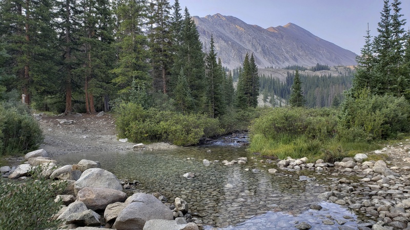 After hiking about a mile and paying attention to my altimeter at approximately 11,650ft I turned off into the forest and this is where you begin your routefinding for there is no trail here and no cairns to point the way. Best to follow a Southwest bearing on your compass and navigate the downfall accordingly. From this point to the summit there is no trail.  The forest here is pleasant and pretty sparsely populated with trees unlike the dense Adirondack forests, so it’s not too hard to follow a bearing here and this section is pretty flat. It does seem like good bear territory with plenty of juicy greens for them and some good cover. I saw two deer in the woods this morning. The spongy ground of pine needles and soft earth is nice to walk on after the rocky dirt road. 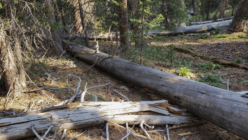 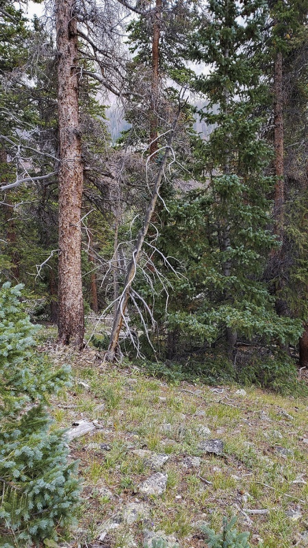 After traveling cross country through the forest, you’ll come to an opening as you emerge from the woods, a comforting moment indicating that you seemed to be on the right track. Your objective comes into view as the colorful upper reaches of Cronin Peak become visible 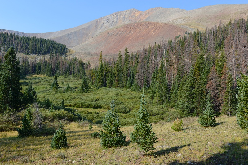 A zoomed in shot, showing the unfortunate sections of beetle kill forest in the foreground. There is a spot to cross the creek towards the right in this photo. Descend this hill into the creek bed and walk to the right of the two spruce in the middle of the image. 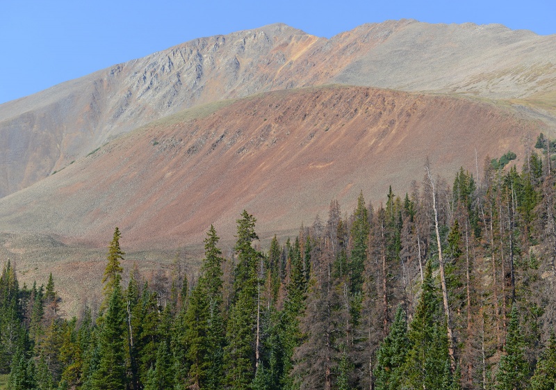 Looking at the above shot, the keen eye will note that there is at least one false summit up there; start managing your expectations now… Entering the forest again, you’ll be walking through a nice spruce forest, many of which look like they were planted there. It gets thick in places, but follow your bearing and you’ll be ok. If you have a GPS, you might want to mark where you crossed the creek with a waypoint.  Passing a talus field/rockslide on the way. This shot is looking back as the talus will be on your right ascending. 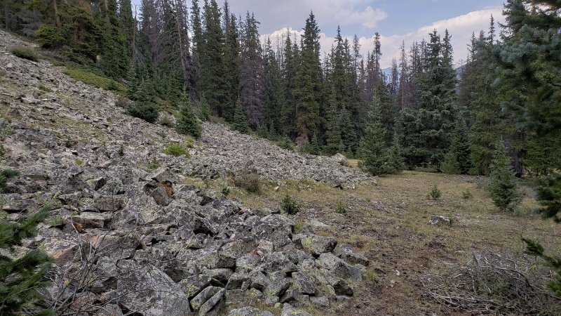 Continuing up, you’ll soon exit the forest and start climbing up a hill on the flanks of Cronin and you’ll get views of the surrounding basin including Mount Antero and the alternative ridge approach. 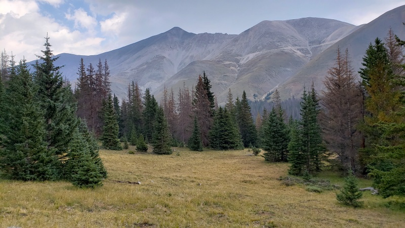 Mostly grassy slopes here interspersed with some talus and rocky outcroppings, but keep going on an ascending traverse to the talus fields. 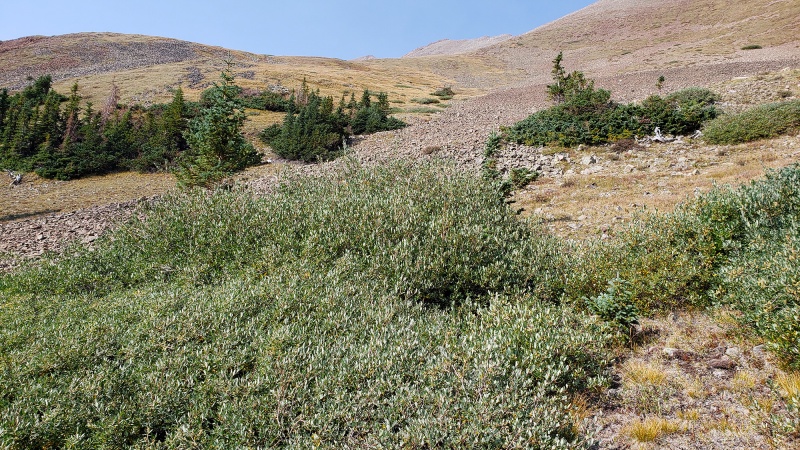 Moving higher above just about above treeline 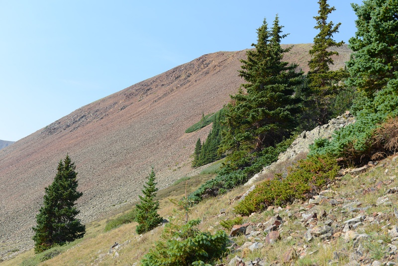 Another way to Climb Cronin is the ascend Antero part of the way and break off from that road and follow the ridge which you can see here in the distance: 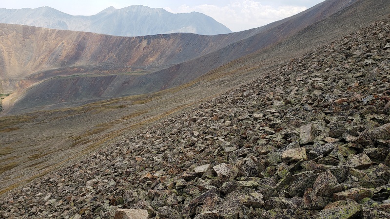 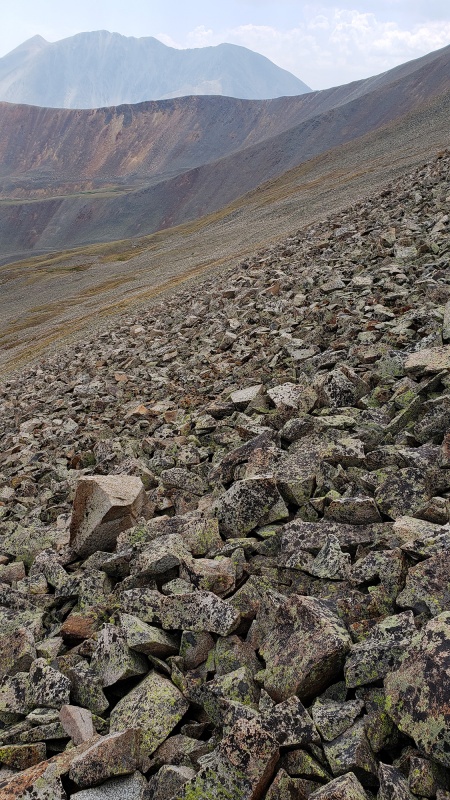 Continue climbing as you get into more talus and scree. Get used to it as this will be the rest of the route. Goal is to gain the ridge then traverse the ridge across all its bumps and false summits to the real summit. There is no defined route from this point so pick your way across the slope aiming eventually for the top of the closer ridge. As you gain the ridge there will be a small plateau with great views and good spot to take a breather from that hill and re-assess the weather before committing to the rest of the route. There will be a few more of these plateaus as you climb up towards the summit. In the below shot, you can see some of the haze/smoke in the air from the fires 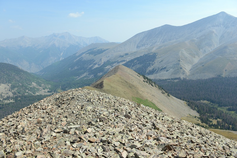 Looking at the remaining route, subsummits and all. I found following the ridge or close to it proved to be the easier approach 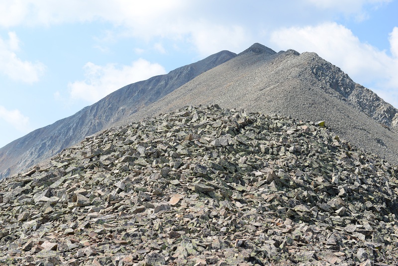 As you do your talus walk higher, you’re increasingly surrounded by awesome views. The movement here is on fairly easy talus, it gets steeper and more loose as you climb higher. It also gets slower to get back off in case weather moves in so watch the skies. You don’t want to run across these sections. 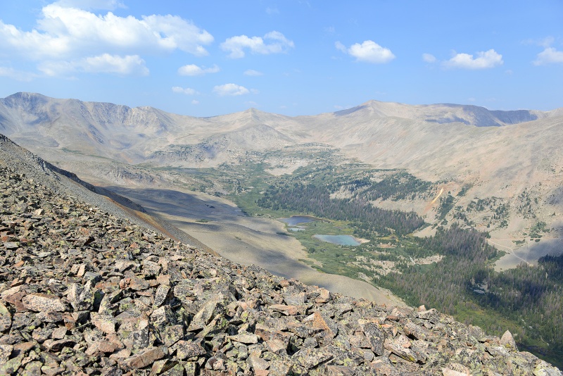 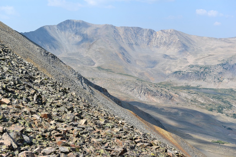 The talus and rubble you’ll be on for half the day. Gentle at first, steeper as you climb higher. 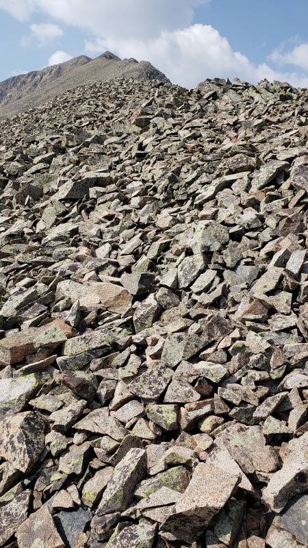  Getting closer... from here, a combination of pretty much dead-reckoning will get you there, and/or on or just below the ridge 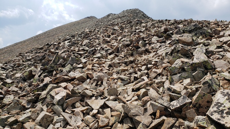 The upper reaches of the ridge come into view now and the remaining route. The terrain steepens and there is some exposure to the sides for the faint of heart that might give some a bit of vertigo, but nothing that is too bad. Antero Fills the view to the Southeast. 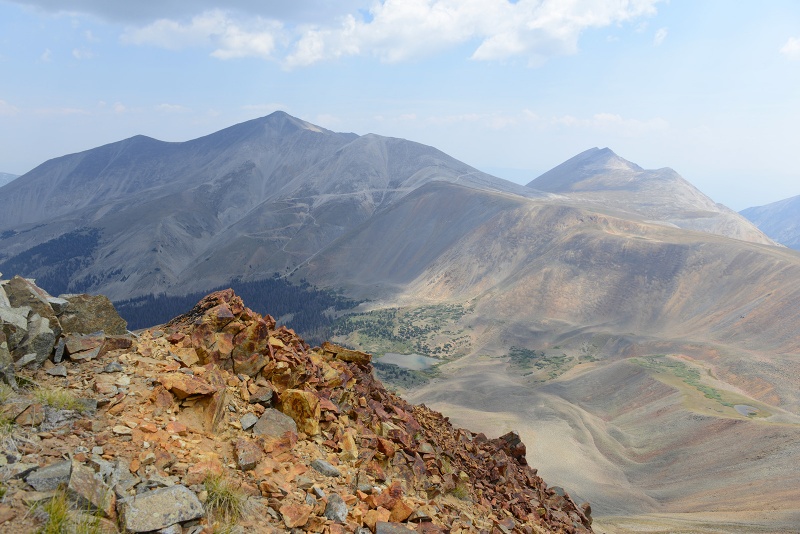 Looking back at the ridge and vibrant colors of the rock
“Dragon’s Back Ridge” Route Looking back again at the lasagna-like ridge. I was thinking a better name for this route is the “Dragon’s Back Ridge” …Sounds cool too. The “Dragon’s Back Ridge” name is far more meaningful and invokes a more visceral feel as you are in the middle of the talus slope, continuing to push higher making your way up to one of the false summits, out of breath, struggling to get air into your yet-to-be-acclimatized lungs. It takes on less of a meaning sitting here reading this from your office!
The photo from a far looks like your climbing up the back of a giant creature resting, ....the secretive Sawatch Dragon.
The final sections come into view as you move towards the Dragon’s Head in the distance! 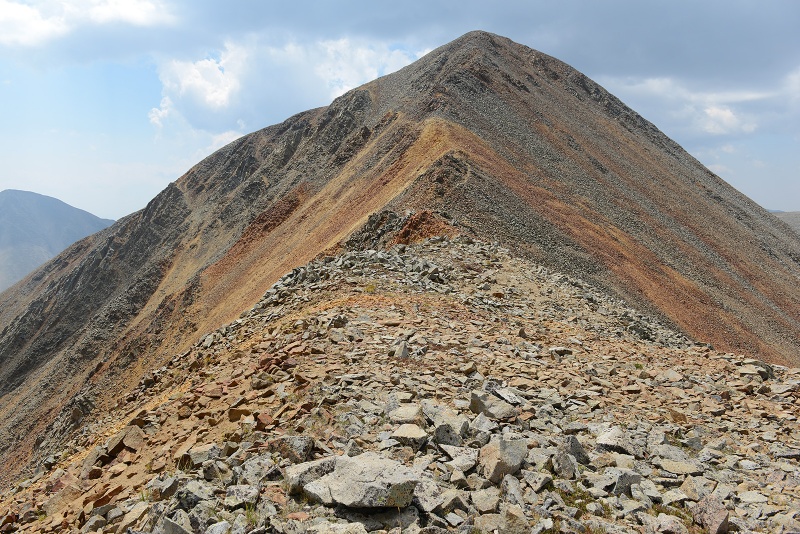 As you climb higher, the color of the rock is stained red and orange from the Dragon’s fiery breath Let’s call this the Brimstone ridge 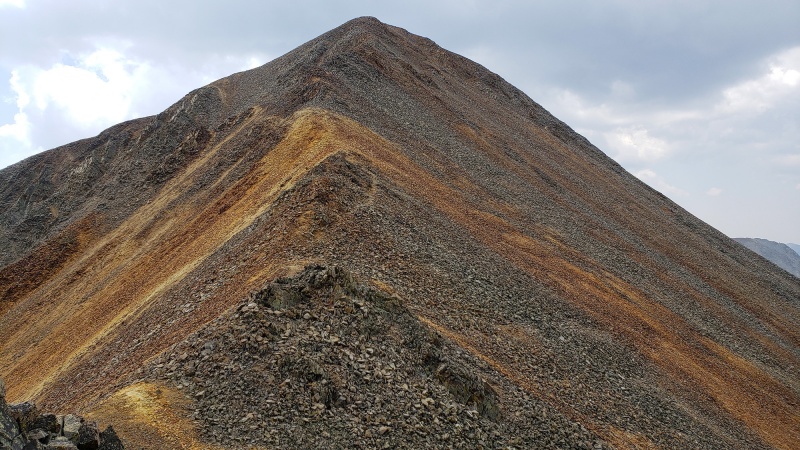 Climbing up the Dragons Neck, relentless talus and steep rock
As you get closer you’re greeted with awesome views, colorful rocks, steep drop-offs and just grand scenery. Mount Princeton off in the distance
It does get steep and airy in some sections so watch your footing and stay the course, be careful if these rocks have frost or ice on them
Just a little more talus…
Topping out on the Dragons head and summit!
Summit cairn above and views from the top, you can see the jeep road up Antero below
A parting shot of the sleeping Dragon from just under the summit of Mount Antero, showing off its nice lines, steepness and prominence. This is also a photo I took back in 2009 on the climb of Antero.
This was a great mountain. If you’re up for a little more challenging day with some routefinding this makes a great outing and beautiful scenery surrounds you most of the day, even on parts of the road. I didn’t see anyone else on the peak all day and only saw an ATV later closer to the “trailhead” further down the Antero road. So go climb the Dragon! Thumbnails for uploaded photos (click to open slideshow): ")
")
")
")
")
")
")
")
")
")
")
")
")
")
")
")
")
")
")
")
")
")
")
")
")
")
")
")
")
")
")
")
")
")
")
")
")
")
|
| Comments or Questions | ||||||
|---|---|---|---|---|---|---|
|
Caution: The information contained in this report may not be accurate and should not be the only resource used in preparation for your climb. Failure to have the necessary experience, physical conditioning, supplies or equipment can result in injury or death. 14ers.com and the author(s) of this report provide no warranties, either express or implied, that the information provided is accurate or reliable. By using the information provided, you agree to indemnify and hold harmless 14ers.com and the report author(s) with respect to any claims and demands against them, including any attorney fees and expenses. Please read the 14ers.com Safety and Disclaimer pages for more information.
Please respect private property: 14ers.com supports the rights of private landowners to determine how and by whom their land will be used. In Colorado, it is your responsibility to determine if land is private and to obtain the appropriate permission before entering the property.


