Download Agreement, Release, and Acknowledgement of Risk:
You (the person requesting this file download) fully understand mountain climbing ("Activity") involves risks and dangers of serious bodily injury, including permanent disability, paralysis, and death ("Risks") and you fully accept and assume all such risks and all responsibility for losses, costs, and damages you incur as a result of your participation in this Activity.
You acknowledge that information in the file you have chosen to download may not be accurate and may contain errors. You agree to assume all risks when using this information and agree to release and discharge 14ers.com, 14ers Inc. and the author(s) of such information (collectively, the "Released Parties").
You hereby discharge the Released Parties from all damages, actions, claims and liabilities of any nature, specifically including, but not limited to, damages, actions, claims and liabilities arising from or related to the negligence of the Released Parties. You further agree to indemnify, hold harmless and defend 14ers.com, 14ers Inc. and each of the other Released Parties from and against any loss, damage, liability and expense, including costs and attorney fees, incurred by 14ers.com, 14ers Inc. or any of the other Released Parties as a result of you using information provided on the 14ers.com or 14ers Inc. websites.
You have read this agreement, fully understand its terms and intend it to be a complete and unconditional release of all liability to the greatest extent allowed by law and agree that if any portion of this agreement is held to be invalid the balance, notwithstanding, shall continue in full force and effect.
By clicking "OK" you agree to these terms. If you DO NOT agree, click "Cancel"...
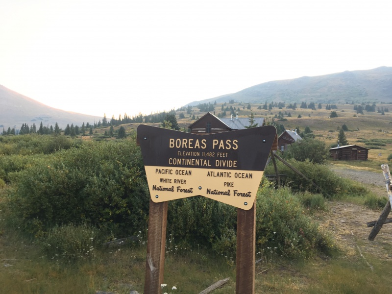
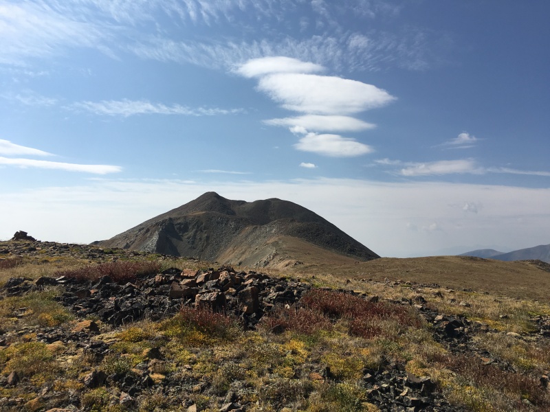
Bald Mountain and Boreas Mountain from Boreas Pass
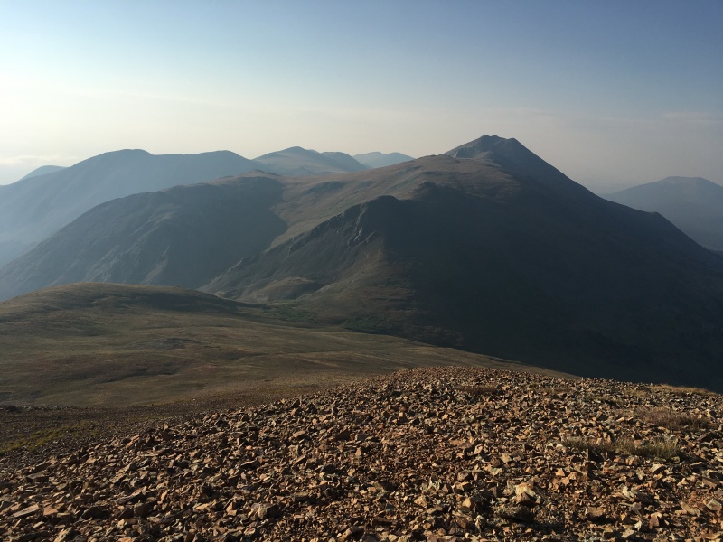
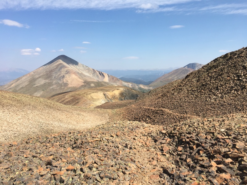
Pano from Bald's slopes - Boreas on the left, Silverheels, Hoosier Ridge and the Reds and Quandary off in the distance.
Stats Solo TH - Boreas Pass Time to Bald Mountain (4,171 meters) - 1:52 Time back down to saddle - 3:06 Time to Boreas Mountain (3,987 meters) - 3:50 Car to car RT - 4:40 Vertical Feet ~3,300 (or about 1,006 meters - more on that later)
The Hike
I wanted a short hike this morning that wasn't too far away from Denver. Bald Mountain was my last Front Range Bi-Centennial, so I chose it and its neighbor, Boreas Mountain, and decided to start from Boreas Pass. While not a difficult hike in the least, my quick research last night didn't show many trip reports of this combo from Boreas Pass (and you don't have any idea what a FR4K is yet), so I thought I'd add one.
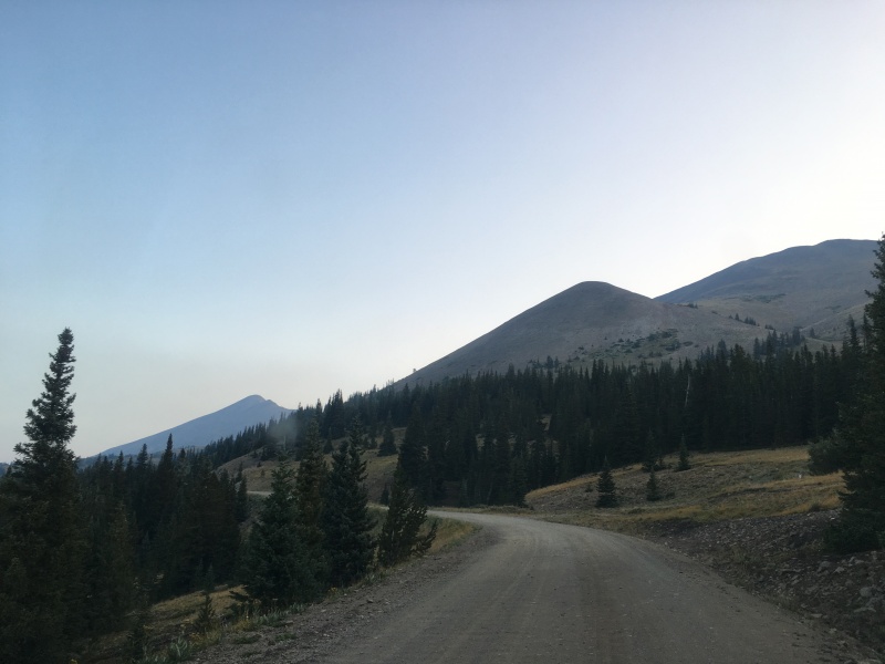
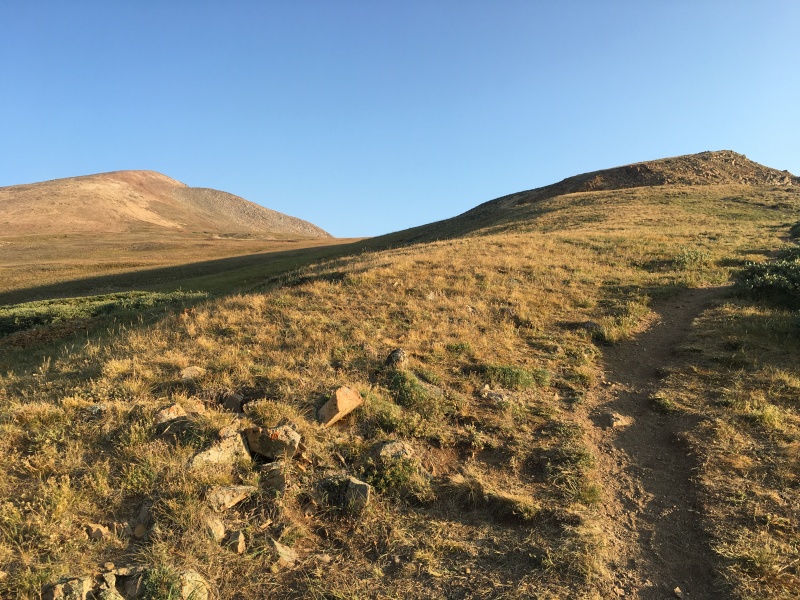
Getting close to the pass from the 285 side. The road is great - any passenger vehicle would be fine. Bald on the left and Boreas on the right.
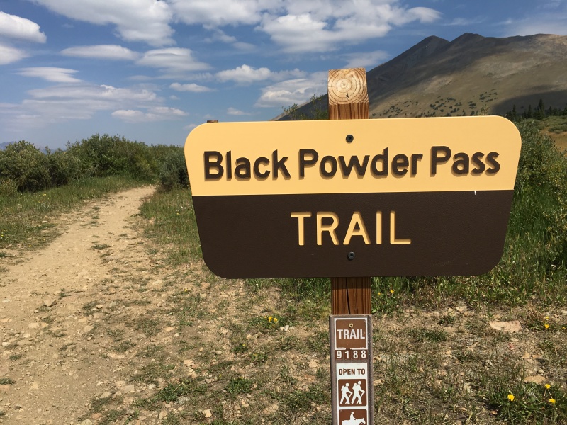
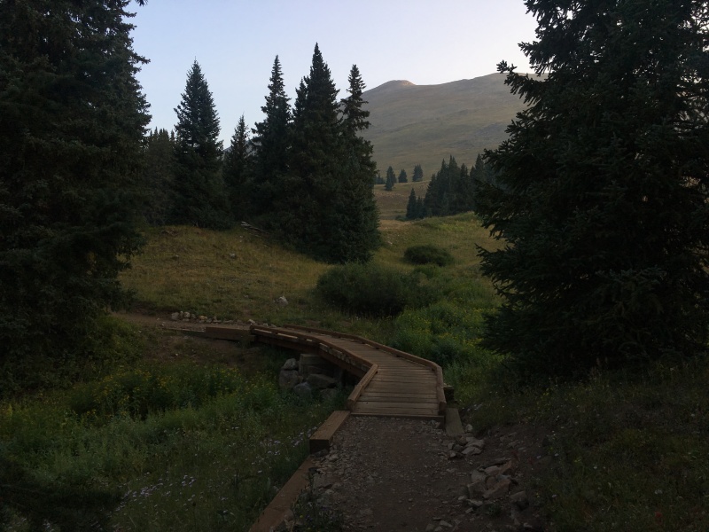
I started up the Black Powder Pass trail just past the Boreas Pass Continental Divide sign on the east side of the road. The trail is in great shape all the way to the saddle between the two peaks.
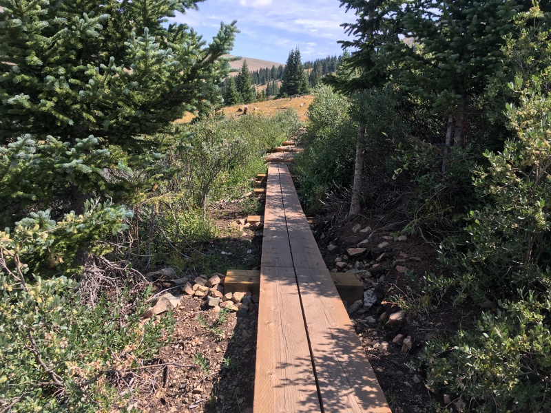
Starting Point.This trail heads off to the left towards Bald Mountain and quickly curves back right and leads you to the saddle.New bridge on the well-maintained trail.New boardwalk over some wetlands.
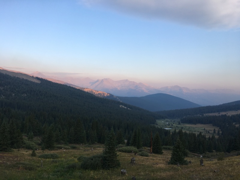
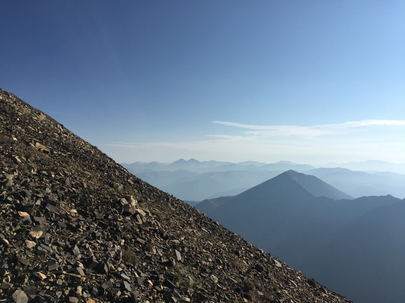
With the fires burning in California and Colorado, it was a smoky start to the day.
Quandary just peaking out with the Tenmile range through the smoke.
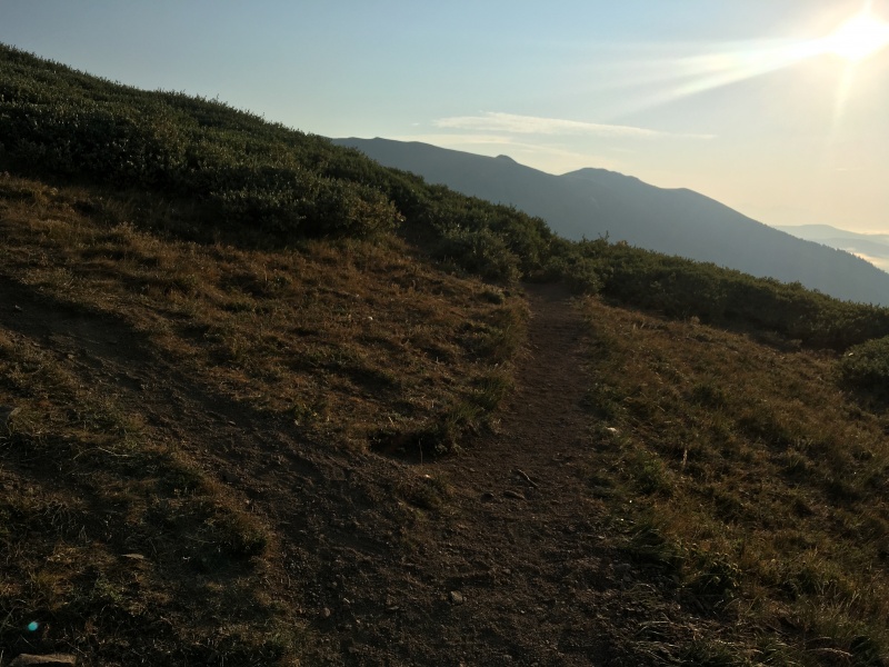
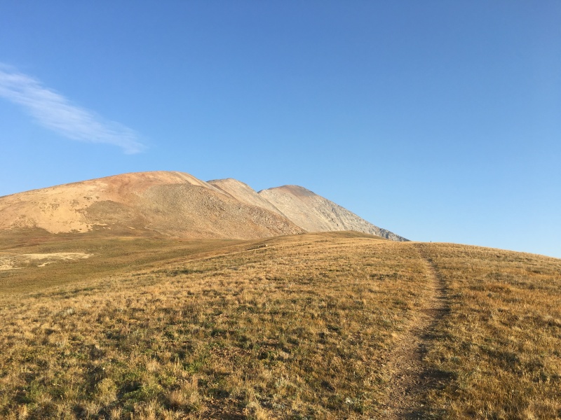
At Black Powder Pass, the trail turns up and left and goes up the ridge for a ways.
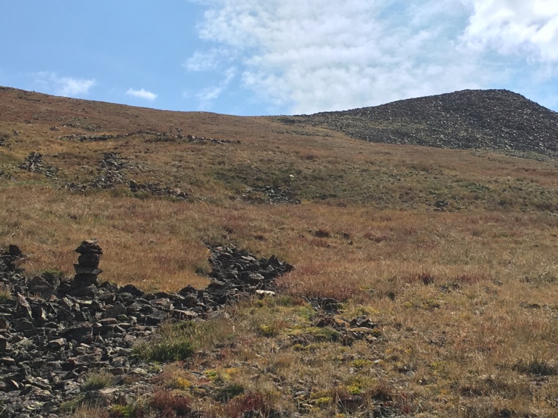
Left hand turn to go to Bald.Heading up the ridge.Bald's many false summits come into view.The trail peters out at this cairn on a small bump. There are more cairns to the left up the talus slope.Looking back down the talus at the pass and Boreas Mountain beyond.
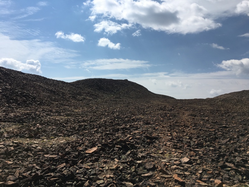
When you get to the top of the big talus slope, you've done most of the elevation gain, but are still many, many bumps away from Bald's actual summit at the very northern end of the mountain.
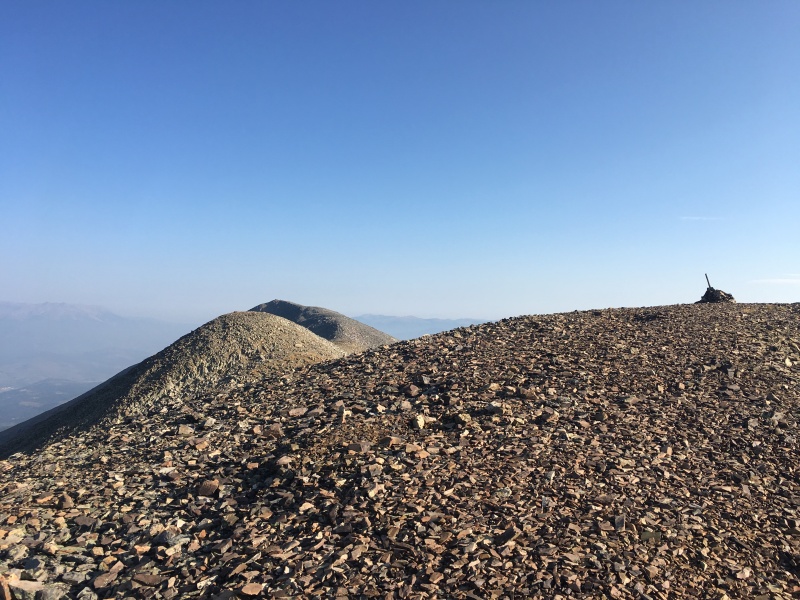
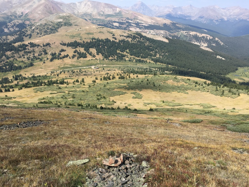
A cairn near the top of the talus slope with two more false summits coming into view.Don't get excited about the first wind shelter....you aren't there yet...Grays & Torreys through the smoke with Guyot in the foreground.Another false summit. Only two more bumps to go.
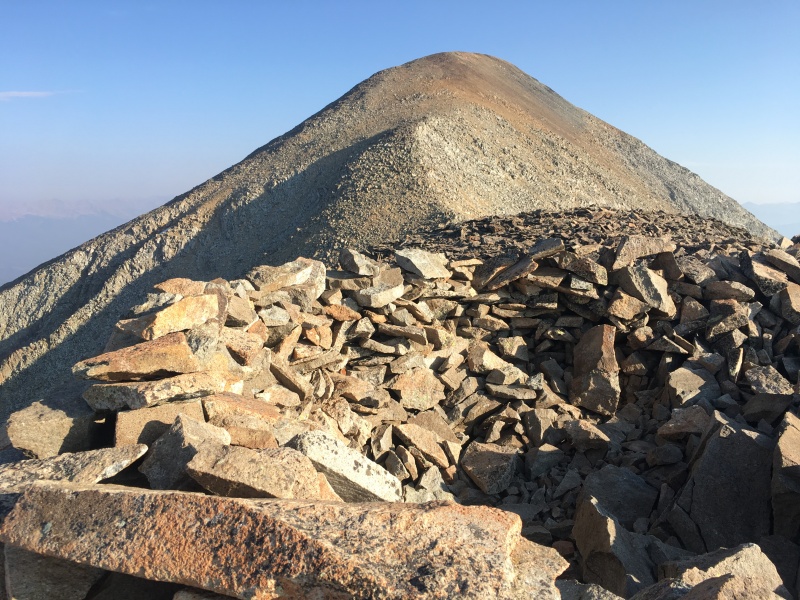
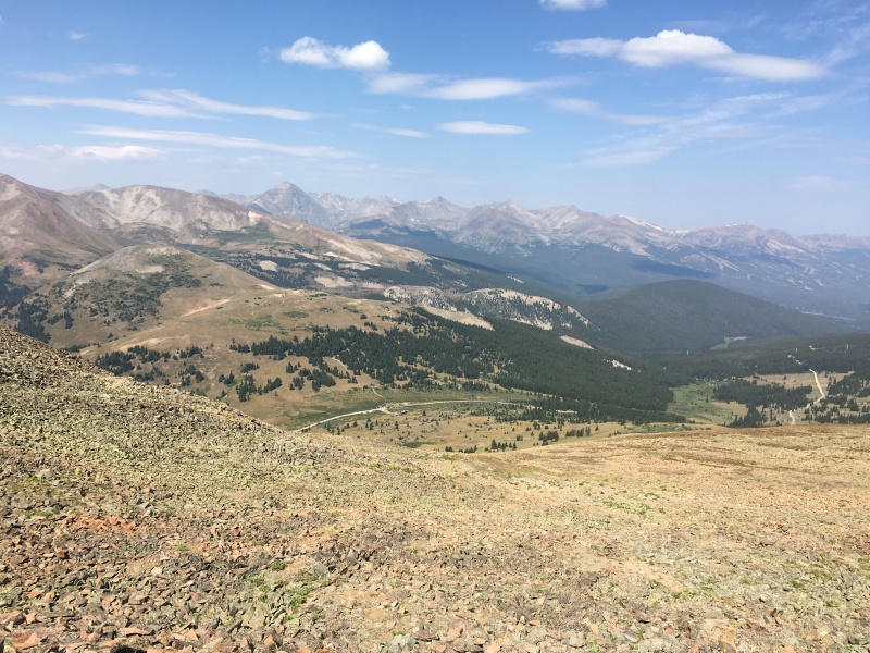
After all the false summits are finally done (not much elevation gain or loss in between thankfully), you will finally get a great view down on Breckenridge and know you're there!
Summit at last with Breck down below.Looking back at the false summit (nearly its twin) from the true northern summit.
With the Front Range Bi-Centennials now done, I grabbed a quick snack, sent Melissa my summit message, signed the register (more on that later too) and retraced my steps to head over to Boreas.
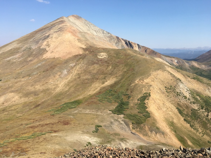
Boreas and some of the bumps of Bald on the return.
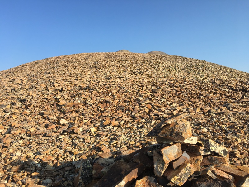
The least pleasant part of the day was climbing the initial loose rock slope up Boreas from the saddle. It could have been much worse, but it certainly wasn't fun.
Type 3 Fun - starting up Boreas from the saddle.A look back over towards Bald with the trail going up the right side of the lower ridge. Easier on me; easier on the mountain.
Once up the loose rock, Boreas was quite a pleasant little ridge walk to the summit.
Looking over at Boreas from above the loose rock slope.Boreas summit at center of photo.Lots of character in the terrain near Boreas' summit. Looking back towards Bald.
For the return to Boreas Pass, I went down the grassy slope pretty close to Bill's .gpx. I found a few cairns along the way, but no trail to speak of. I eventually connected back into the Black Powder Pass trail and hiked out the last 10 minutes to my car.
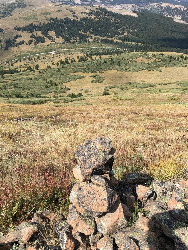
Boreas Pass on the return.Cairns on the way down.Cairns on the way down.Cairns on the way down.
In Closing
We'll see if anyone is still reading...So why did I give the elevations of these peaks in metric? Simple - supply and demand.
I have heard many discussions related to overuse issues on the 14ers. Demand is increasing each year. That's a good thing in my mind. Getting more people off of their couches, off of their technology, out of their offices, and doing something that is good for their total health (mind, body and spirit) is great. But it's tough to argue that the 14ers aren't getting loved to death. Most discussions focus on "demand side" solutions - generally limiting access, requiring permits, etc. I'm not a big fan of demand side solutions.
What if there was a "supply side" solution? Impossible you say - more 14ers can't be made (and in fact, a couple might not be 14ers much longer).
Here I was today, driving to peaks within two hours of Denver on a road that any car could get up and down. I didn't see a single Jeep turned over on its side if you can believe that (reference "Grays & Torreys Road getting rough" thread). I saw four people on Bald and three people on Boreas. Someone posted yesterday that they counted 75 people on Bierstadt on a Tuesday early in the AM. Why can't we increase supply?
We can - go metric. Instead of newbies going out to do their first 14er, let's take them out and help them do their first 4,000er. Ok, that's not catchy at all. Even if we only did this in the Front Range, think of the impact of spreading the traffic out on the the Front Range 4kers (let's call them FR4Ks, pronounced "Forks"). Everything over 13,123 is a FR4K. There are magically 58 FR4Ks. Isn't that nice? Same number everyone is already used to. 52 of the ranked 13ers in the Front Range are FR4Ks (sorry Boreas, you didn't quite make the cut) plus the six 14ers.
Some will say this will just ruin 52 more mountains. We should leave the 13ers be. Response - there are still MORE than enough 13ers in all the other ranges outside of the Front Range that will stay remote, rugged and wild. Would it be worth it to spread some of the traffic out from those six Front Range 14ers? With the traffic spread out, it's possible our collective impact on the peaks we all enjoy will be considerably smaller.
And for the couple of people maybe still reading....check out this brand new summit register holder from Bald. Someone put some work into this - wrapped in tape, nail through the top to make it easy to open, baggie with register and two sharpened pencils inside - very nice.
Nice shiny, new summit register.
I remember a long, long time ago when most of the 14ers had these. I think people enjoyed signing them. I wonder if we would see fewer cardboard summit signs and sharpied rocks on top of 14ers if the land managers would allow summit registers to be reinstalled. Clearly not something that is natural on the peaks, but I'd sure rather see one of these than I would cardboard signs and graffiti on rocks to let people feel like they get to record their accomplishment.
Just food for thought on the FR4Ks and summit registers. Thanks for reading.
My GPS Tracks on Google Maps (made from a .GPX file upload):
Great report, have been looking at getting those two from this same direction and really only had Wolfe's book to go on, so this is even better. Thanks.
Thanks for the report! I hiked Bald a week and half ago up the North Ridge, and all the way up and all the way down I never saw a single person. It was a Saturday morning. I remember sitting on the summit looking over at Quandary and thinking about how crowded the ridge and summit must have been right then. That old school summit register must be brand new cause it was not there when I was there. Also, as someone with a bit of a background in economics, I like your proposal on increasing the "supply" of mountains.
I like it. I remember climbing Pacific Peak (probably my first non-14er Centennial), in the eighties. My climbing partner and I had the summit to ourselves, on a summer Saturday and could see the horde of people on Quandary. Pacific is just 50 feet shy of the arbitrary 14,000 feet, and arguably a much more interesting mountain than any of the Tenmile/Mosquito 14ers.
Funny thing, I started the drive from Evergreen thinking of doing these two Tuesday (reversed order) for similar reasons. I got to Bailey and realized I forgot my socks so had to retrace my tire tracks. After retrieving the booty, I went back out 285 and climbed Whale Peak (Gibson Lake TH is a little closer than Boreas Pass). Although it doesn't qualify as a FR4K, who cares! The hike was great and I saw one other person on the mountain and two more near the trailhead (they probably were only going to Gibson Lake).
I'm guessing supply side mountaineering could be as successful as Reaganomics.
Wanna know how come you adopted a metric system against a huge majority of Americans. The metric system makes mountains look much smaller than they actually are. :oops: :oops: :oops:
I like this idea. Although I was born in the States I have traveled extensively and I am quite accustomed to the metric system, especially as it pertains to mountaineering. I think it has a great ring to it and since I passed on a summit attempt on Capitol last weekend due to being behind 15 people and a tight time line, anything that might help take the pressure off some of our 14ers is a great plan. Just my 2 cents worth. Climb on, Be safe and Tread light.
I think to the younger generation, an easier pronunciation of FR4K would be "Frak" (FRAK). But people as old as you and me will probably always be stumped with letter substitutions :-)
Caution: The information contained in this report may not be accurate and should not be the only resource used in preparation for your climb. Failure to have the necessary experience, physical conditioning, supplies or equipment can result in injury or death. 14ers.com and the author(s) of this report provide no warranties, either express or implied, that the information provided is accurate or reliable. By using the information provided, you agree to indemnify and hold harmless 14ers.com and the report author(s) with respect to any claims and demands against them, including any attorney fees and expenses. Please read the 14ers.com Safety and Disclaimer pages for more information.
Please respect private property: 14ers.com supports the rights of private landowners to determine how and by whom their land will be used. In Colorado, it is your responsibility to determine if land is private and to obtain the appropriate permission before entering the property.


")
")
")
")
")
")
")
")
")
")
")
")
")
")
")
")
")
")
")
")
")
")
")
")
")
")
")
")
")
")
")
")
")
")
")
")
")