| Report Type | Full |
| Peak(s) |
Blanca Peak - 14,350 feet |
| Date Posted | 08/14/2018 |
| Modified | 08/16/2018 |
| Date Climbed | 08/09/2018 |
| Author | ColoGary |
| Blanca - standard route |
|---|
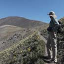
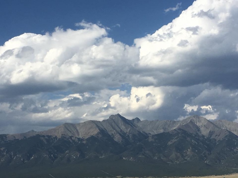 I clung to the rock of Blanca Peak’s knife-edge ridge, a few hundred feet below the 14,345-foot summit, like a baby Koala hanging onto its mum. To my immediate left, about a foot away, a horrifying drop of thousands of feet filled me with pure terror. To my right, I couldn’t see past the smooth, rounded shelf of granite which I leaned into with all my might. Just above me, on top of that shelf, stood Paul Endacott, who had unconcernedly climbed up, like a sailor traipsing about in the rigging of a tall ship, which he actually has been. No fear of heights there. Behind and below me, Mike Miley waited his turn to be in this frightening place. Though later he said his knees were knocking, he seemed cool, even bursting out with a bit of song now and then. Already on the summit, the other two members of our Blanca Peak expedition, Aug. 6-12, 2018, Al Levine and Jeff Beecher, waited for us. But for the moment, I was too scared to move, totally buffaloed by the fact that I couldn’t reach a handhold above, or find a foothold to push myself up. Still don’t know how Endacott did it. Later, I learned there was a fairly safe path to the right of the shelf, which I believe Al and Jeff had taken. But I didn’t know that then, and was fairly frozen with fright. Our expedition began in earnest the day before, Wednesday, Aug. 8, 2018, as I followed Mike, Jeff, Al and Paul up the notorious Lake Como Road, widely known as “the worst road in Colorado” -- which is an understatement. I carried all our backpacks, each between 40 and 50 pounds in the back of my “Li’l Red” 4WD Toyota Tacoma, with red camper shell. Li’l Red has slightly oversized aggressive tread off-road 10-ply tires (standard tires are usually 4-ply), but no lifts or other modifications. 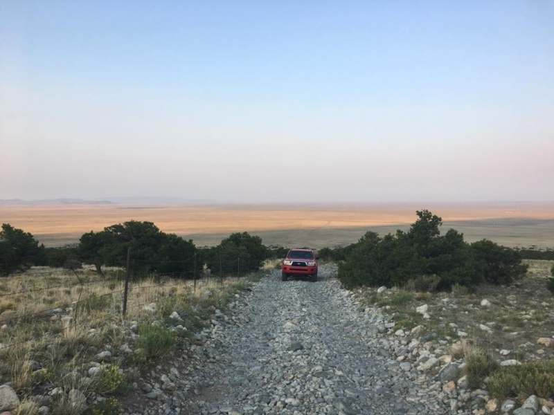 The idea was to truck the packs as high up Lake Como Road as possible, on the way to our base camp at beautiful Lake Como, at about 11,500 feet, and about 6 miles from the road’s junction with Highway 150, which is at roughly 7,500 feet, in territory that looks like high desert. I crawled along after the boys (no one younger than 50-something) getting my teeth rattled as the truck bounced and jounced over the rocky road like a bucking bronco. As we climbed ever higher, we encountered evergreen forest and increasingly frightening exposures. I worried what would happen if I met another vehicle coming down, since backing up to a pull-off area would have been a nightmare on that steep, narrow, twisty road of rocks.  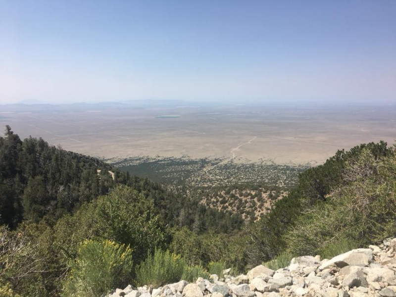 Didn’t happen though, until our descent on Saturday -- but that encounter was with a customized Jeep which could ride partly up the sloping wall to our left without tipping over, letting me get past. At 10,100 feet, I parked at a switchback, about 2.5 miles from the lake, and about 1,400 feet below it. The next pitch in the road was too steep and rocky for me. Li’l Red could likely have made it, but I didn’t have the guts to try. So we strapped on our packs to hike in the rest of the way to Lake Como. 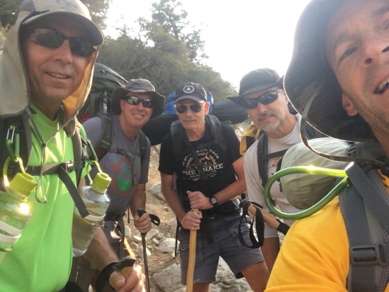 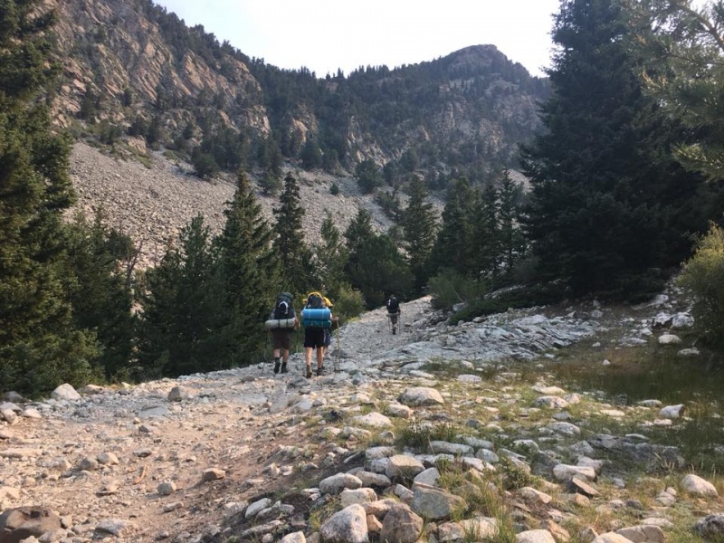 Packs weighed on us, and the day was sunny, warm and blue, but we made Lake Como in about 90 minutes or so, not counting a couple of breaks. It was mid-week, so we got our pick of the forested campsites, treeline still being a few hundred feet above. Immense gray granite ridges sheltered the lake, and Little Bear Peak, one of the lowest 14ers, though one of the hardest to climb, dominated the lake and ridges. 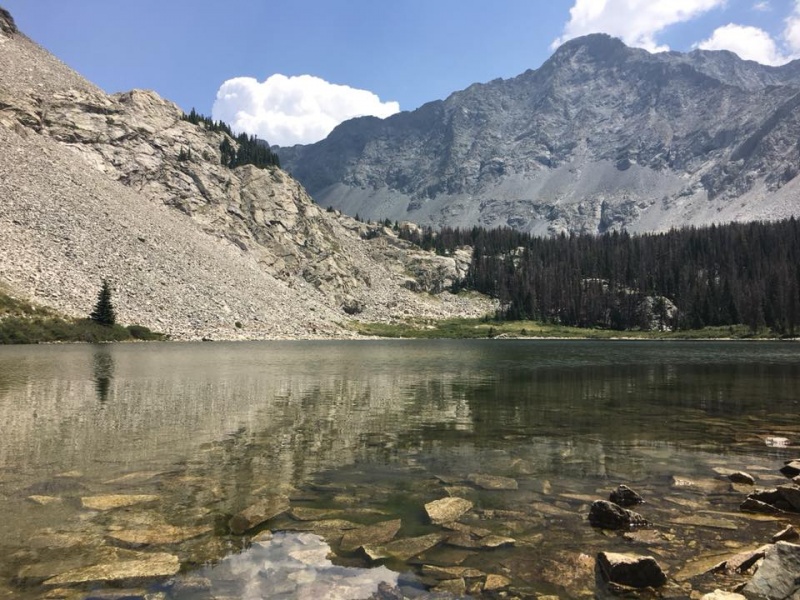 Dawn Thursday, Aug. 9, summit-day, found us continuing on Lake Como Road, our packs reconfigured as daypacks, past the lake, though the road seemed more like trail than road. During our trip, we saw several customized big-tire vehicles make it to the Lake and beyond. We walked some steep uphill to get above treeline to where the road ended and trail began. We followed a mild incline past the Blue Lakes, pools large and small set in high mountain meadows. The “mild” didn’t last long, and we found ourselves switchbacking up steep trails, by a narrow waterfall, to Crater Lake, another crystal pool, though set among the glacial debris of moraines. Looking back down the valley, we could see all the way to the brown plains, baking in the summer sun, where we had entered Lake Como Road.  As we hiked ever upward, we searched for the fork in the trail that to the right leads to Blanca; and to the left, Ellingwood Point, another low 14er at 14,042 feet. A jagged, nightmarish (imho) saddle separates the two mountains. Going up, we never found the fork in the trail, at least that I recall. Approaching the saddle, the trails grew ever steeper and more exposed. In some places, we needed four points of contact. Exposures began to grow nerve-wracking, though the views were exquisite. I tried not to look at the vast, rugged panoramas of rock and ridge, but couldn’t resist, thrilled and scared at the same time. 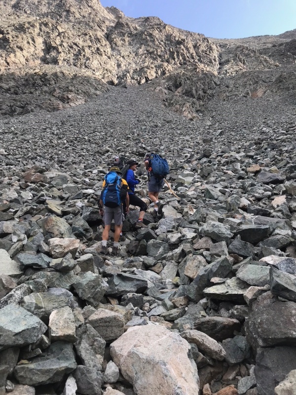 The saddle looked unreachable, so high and steep above us, but sooner than I thought we did reach it, switchbacking up the steep granite wall. We took a break on the saddle, as two climbers came down from the summit. They gave us helpful advice: leave packs on the saddle for the summit attempt; and keep the knife-edge ridgetop to the left. Starting up the steep ridge to the summit, going at separate paces, I lost sight of Al and Jeff who were leading, and somehow found myself on top of the narrow ridge, instead of keeping it to my left. I wasn’t sure if my route was correct or not. Scary as it was, it led up, the direction I wanted to go, so I continued until dead-ending at that smooth, rounded shelf of granite; the ways forward and up, and back and down equally unthinkable. 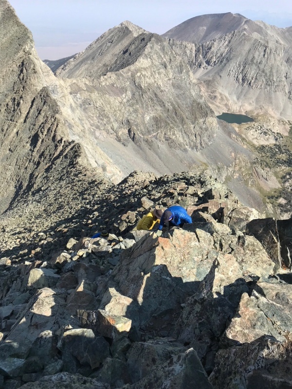 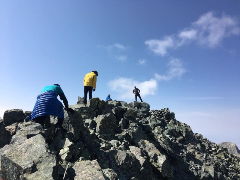 Just to my left, the rock seemed to offer footholds below and handholds above, though inching over to it meant inching closer to the sheer drop. Even as I write, the memory of it makes everything in my body clench. “You don’t have to go home, but you can’t stay here,” I thought. With no other choice, I edged over, then hauled myself up onto the shelf where Paul had been standing. I did not stand, but hands-and-kneed forward. The way got easier for a few feet, dipping toward the right of the ridge, more in line with the recommended route. The trail, if you could call it that, really just a faintly flatter line than the surrounding rock, narrowed to a gut-sucking little ledge, maybe a foot wide, smack up against a recessed wall on the left, the right dropping away, apparently to forever. I took heart from Paul just ahead of me, and Mike behind, and made it past on hands and knees. From there we edged up to relatively flat rock -- the summit! Paul again walked around like he was on a ballroom floor; at one point I had to cover my eyes with my hands, like a little kid at the scariest part of a monster movie, he was so close to the edge. The 360-degree view both inspired and terrified me, shaky as I still was from what felt like two close calls. The weather was perfect for us on the summit. Warmest and stillest I’ve ever seen on a 14er summit. Had it been cold and windy, like most of them, I probably wouldn’t have made it. 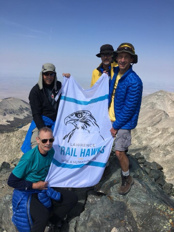 We took some pics, then my anxiety rose again at the suggestion of having to head back down, re-navigating that terrible knife-edge ridge in reverse, before the afternoon storms. I needn’t have worried. Going down, we found the route the two climbers on the saddle had recommended to us. It was still steep, and we had to do some butt-sliding (“buttressing” I call it), but the horrifying exposures that had been inches away as I came up were now out of sight behind the ridgetop. To my left was steep rocky slope, but no sheer drop like the knife-edge offered. I walked right by the smooth, rounded granite shelf that had so scared me on the way up, and never did see that gut-sucking little narrow ledge again. We regained our packs at the saddle, and continued down after a short rest, toasting the summit with water. This time we did find the Blanca/Ellingwood Point fork, marked by a beautiful, symmetrical cone-like cairn that looked more like a Christmas tree than a pile of rocks. Jeff stumbled to his knees once as we descended the steep rocky route, but the hike down was otherwise uneventful. We went off-route once, following a cairn set a little too far back, but quickly corrected our mistake. We tried to hurry, as we saw gray clouds streaming our way over Blanca. Soon we were off the wall and back in the valley by the Blue Lakes. The first drops of the afternoon storm hit, and we got into rain gear -- just as pea-sized hail pellets began their bombardment. We didn’t mind the ice-peas too much, having just missed a bombardment of baseball-sized hail on our drive through Colorado Springs on the way in. Nevertheless, we sheltered in some trees for awhile, but when it looked like the storm was going to last, we toughed it out and continued back to camp, where we found our tents had withstood the weather and stayed dry inside. Soon, I was inside my tent, stretched out on sleeping bag and mat. With memories of rock and sky in my head; the relaxing pit-pat of rain on the tarp over my tent; and a full dose of exercise and mountain air drugging my system, I was quickly fast asleep. 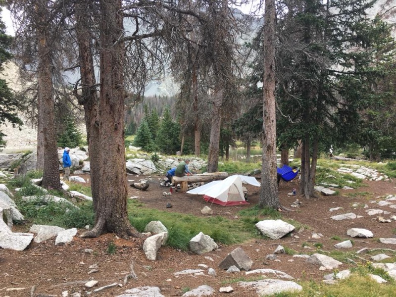  Thumbnails for uploaded photos (click to open slideshow): ")
")
")
")
")
")
")
")
")
")
")
")
")
")
")
")
|
| Comments or Questions | ||||||
|---|---|---|---|---|---|---|
|
Caution: The information contained in this report may not be accurate and should not be the only resource used in preparation for your climb. Failure to have the necessary experience, physical conditioning, supplies or equipment can result in injury or death. 14ers.com and the author(s) of this report provide no warranties, either express or implied, that the information provided is accurate or reliable. By using the information provided, you agree to indemnify and hold harmless 14ers.com and the report author(s) with respect to any claims and demands against them, including any attorney fees and expenses. Please read the 14ers.com Safety and Disclaimer pages for more information.
Please respect private property: 14ers.com supports the rights of private landowners to determine how and by whom their land will be used. In Colorado, it is your responsibility to determine if land is private and to obtain the appropriate permission before entering the property.