Download Agreement, Release, and Acknowledgement of Risk:
You (the person requesting this file download) fully understand mountain climbing ("Activity") involves risks and dangers of serious bodily injury, including permanent disability, paralysis, and death ("Risks") and you fully accept and assume all such risks and all responsibility for losses, costs, and damages you incur as a result of your participation in this Activity.
You acknowledge that information in the file you have chosen to download may not be accurate and may contain errors. You agree to assume all risks when using this information and agree to release and discharge 14ers.com, 14ers Inc. and the author(s) of such information (collectively, the "Released Parties").
You hereby discharge the Released Parties from all damages, actions, claims and liabilities of any nature, specifically including, but not limited to, damages, actions, claims and liabilities arising from or related to the negligence of the Released Parties. You further agree to indemnify, hold harmless and defend 14ers.com, 14ers Inc. and each of the other Released Parties from and against any loss, damage, liability and expense, including costs and attorney fees, incurred by 14ers.com, 14ers Inc. or any of the other Released Parties as a result of you using information provided on the 14ers.com or 14ers Inc. websites.
You have read this agreement, fully understand its terms and intend it to be a complete and unconditional release of all liability to the greatest extent allowed by law and agree that if any portion of this agreement is held to be invalid the balance, notwithstanding, shall continue in full force and effect.
By clicking "OK" you agree to these terms. If you DO NOT agree, click "Cancel"...
What Is It About Mummies That Causes Madness?: A Traverse of the Mummy Range
A couple of weeks ago I finished up climbing "The List," all 58 14ers. This had been such a longstanding goal that I had essentially precluded all other options until I was finally done with it, mostly so I just wouldn't have to think about it any more. Once I was done though I quickly realized I had no goal. I still don't, but while I formulate something even bigger and far more stupid than a multi-year project to climb "The List" I had to do something. A friend suggested Nolan's 14, which is indeed a worthy goal. I had that in mind as well but it might be too big to train for in a year. I had been thinking range traverses myself. Get out to seldom-visited peaks where I can sharpen both my research skills and my just-go-for-it skills. I've slowly been realizing that I'm much better on the endurance side of an endurance-strength spectrum so both options sounded great, and being a somewhat uncreative person I went for my first range traverse this weekend to test my theory: the Mummy Range in Rocky Mountain National Park.
Those familiar with the Mummy Range most likely know it by its easy hike to the summit of unbelievably spectacular Ypsilon Mountain, or simply by the mountain itself, whose defining features are its massive, narrow southeast face and dual curled ridges, Donner and Blitzen. Blitzen is allegedly the best ridge climb in the park, though I have yet to climb it myself. Hopefully I'll be able to tackle it yet this year. Other peaks in the range are not so noteworthy though some have gorgeous features themselves, like Mummy's southwest face and Fairchild's east face. For those who, like me, particularly enjoy solitude, there's plenty of that to be found in the Mummies too.
Based on a couple of trip reports I skimmed I put together a GPS track to follow on my watch and figured that at about 16 miles and 8,500' of elevation gain with at least some Class 3 and Class 4 climbing thrown in I'd have my work cut out for me.
As always, these statistics are best case scenario. That's an ugly elevation profile too.
Most of the hard work here was already done: figure out the route. The rest was just making sure I wasn't getting in over my head, which meant being overprepared and knowing options to escape if need be. The weather was looking great for the entire weekend but who knows what might happen. I set my alarm for the ungodly hour of 2am the day of the climb since I'd have to drive up from Boulder, then went to bed early.
When my alarm went off I was wide awake despite it being crazy early. My body knew that it had mountains to climb and it was ready. I arrived at the Park around 4:20am and hit the trail at 4:34am. It was a gorgeous day, even in pitch black. Within minutes I had stripped down to a t-shirt as I was already getting sweaty in the dead calm morning. The trail miles flew by quickly, and what a trail she is! Lawn Lake Trail is one of the best trails I've ever been on - well signed and easy to follow, reasonable grade and switchbacks, not littered with loose rocks, etc. Truly a gem of a trail.
Glorious trail.
The miles flew by in the mild weather and the views were beyond amazing.
Looking towards Trail Ridge Road.Longs Peak in the distance.
Eventually I hit the Lawn Lake/Black Canyon trail junction, where I turned south for a few tenths of a mile before walking east off the trail into the forest towards a saddle visible above the trees. I weaved in and out of the trees and rocks until I hit treeline, where I turned back north again and headed up Mummy Mountain's Class 2 southeast slopes. At this point the going slowed down since I had to avoid rocks everywhere, though this was far from the worst of the random/loose rock that covered nearly everything on the traverse.
Closeup of some of the terrain below Mummy's false summit. Tedious but Class 2 at worst.
Rounding over the false summit revealed the true summit, whereupon it was a short stroll to the top of the first 13er of the day, 13,425-foot Mummy Mountain.
Fairchild Mountain's east face and Crystal Lake from the summit of Mummy.Hagues Peak on the left, from the summit of Mummy. I thought the point on the end of the ridge behind and to the right was Rowe Mountain but it is unnamed and unranked. Don't go there.
I ate a quick snack and pressed on; I still had tons of climbing to do and everything I had left would be harder than what I'd already done. To evidence this things slowed down even further on the summit ridge of Hagues Peak. The saddle across to Hagues Peak was easy enough but the rock became both steeper and looser the higher up on the summit ridge you got. It was easy to climb directly up to the ridge crest but not easy to climb directly across the crest, so I tried to stay a few feet below it and traverse along it. I decided not to go to the summit of Hagues at this point since I'd have to go back over Hagues after returning from Rowe Peak/Mountain anyway, so I might as well save myself some time and effort. I crossed over the ridge and dropped down into a steep Class 2 basin with a small glacier (Rowe Glacier) and glacial lake in it.
Rowe Peak is right of the broken ridge.
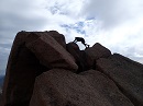
Crossing the basin left something to be desired, what with all the loose, junky rock, but it didn't take long to hit the ridge on the other side and head up 13,420-foot Rowe Peak, 13er number two for the day.
Final pitch on Rowe Peak. Rather boring peak.
From the summit of Rowe Peak I had only one peak left in this out-and-back spur; Rowe Mountain. It would never be cheaper than right now. What I have to say about Rowe Mountain though is that what looks like Rowe Mountain is not in fact Rowe Mountain. Remember that bump on the end of the ridge I said not to go to? Well I went there. It was visually higher and seemed more prominent but it turns out that only the former is true. The saddle between it and Rowe Peak is very short. Rowe Mountain is instead to the north and is a totally unassuming lump of broken granite blocks. One further thing to note about Rowe Mountain is that the pin shown on the map on this site is wrong! It's actually the closed contour interval to the northeast of what is shown on the map.
Like an idiot I hiked first and asked questions later, arriving at the bump on the end of the ridge before checking my GPS only to find I had of course gone to the wrong "peak". Well whatever, I tagged it anyway then set off towards the real Rowe mountain. Another chunk of annoying Class 2 later I found myself below 13er number three, 13,184-foot Rowe Mountain, wondering which shapeless blob of granite was higher; it's the one on the right, to the northeast. I wish I had taken a picture of the summit register here, since there was one sign-in on July 1st, two on June 22nd, and the ones prior to that were from October, 2017 or earlier! Rarely visited peak indeed!
I bounced off Rowe Mountain after a couple of minutes and traversed my way back along aaaallllllll of the still annoying, still junky Class 2 rock to the Rowe Peak summit ridge, down and across the still annoying, still junky Class 2 rock in the basin to the summit ridge and summit of my fourth and overall highest 13er that day, 13,560-foot Hagues Peak. For some reason there's a weather station on top of Hagues, and I figured it'd be a bad place to be during a storm since you'd probably get struck by every lightning bolt within a 5 mile radius.
Science!
The down climb off Hagues to the Saddle (yes, it is a proper noun in this case; there are literally signs referencing "The Saddle" on the trail) is the most interesting and involved climbing on the entire traverse, but still nothing too wild. It's mostly Class 2 scree covered ledges, a bit of Class 3 scrambling, and an occasional, isolated, and never very exposed Class 4 move. The rock is, as usual, pretty loose, but all of the harder climbing can be done on solid rock.
Looking down from the summit of Hagues. It's steeper than it looks.The easiest terrain is skier's left of the summit. Taken from just below the summit.
Looking back up towards Hagues Peak from where the difficulties return to purely Class 2. The down climb zig zags several hundred vertical feet through ledges on the south face.Just because you're through the "hard" part doesn't mean the "fun" is over! Plenty of janky rock to hike down to the saddle, which as you can tell is far below Fairchild Mountain's summit.
Though the difficult scrambling was over once I reached the Saddle there's still many miles and thousands of feet of Class 2 climbing to go, and by this point I had put on at least 6,400+ vertical and 15+ miles and was half exhausted. Too bad, I came here to climb some mountains and so I'm going to climb some mountains! I really didn't want to have to come back. I could have easily escaped down the Saddle trail to the Lawn Lake trail but nay, push on, soldier.
I finished hiking down to the saddle and took a good break. It would be my lowest elevation break all day, and one of the prettiest, so I made sure to milk it. Ahead of me, Fairchild Mountain loomed large.
Nothing crazy here, just a lot of re-gain in beautiful terrain.
I wasn't sure how much water I had left at this point, a little over nine hours in, and didn't want to check. It didn't matter anyway, I had no way to treat or filter the water I could get from one of the alpine lakes anyway. Besides, a quick shake of my pack gave a sloshing sound and that was good enough for me.
Fairchild went by quickly, about 45 minutes for the 1,000-something vertical from the saddle to the top. I took the grassiest route I could find which was a little longer up the right skyline instead of directly up the rocky slope. Reaching the summit I checked off 13,502-foot 13er number five. Once again I was greeted with a beautiful but discouraging view from the top: there was another huge dip between Fairchild and Ypsilon, and Ypsilon was considerably steeper and rockier than Fairchild. To keep the hiking at Class 2 instead of Class 3 would mean dropping down even farther. When would this Madness end?
Fairchild-Ypsilon saddle.
This time I didn't bother taking a break. I just crammed more gummies in my mouth and kept moving. I tried staying as high as possible but once again went for the easier, grassier option. Easy, but tedious, that is. I don't think I could escape the tedium anywhere though.
Low point on the Fairchild-Ypsilon saddle. The grade was shallow but weaving in and out of all of the rock was tiresome.
Looking up at Ypsilon I kind of wondered what the hell I had done. I was over the 11 hour mark and still feeling good (I'd been eating a ton, something I've learned over the years is most important than almost anything else on long endurance hikes like this) but just kind of over it. I was definitely enthused to have Blitzen Ridge directly ahead of me looking like a million bucks but Ypsilon just looked so big. It was a mix of appreciation and not altogether undeserved irritation. On I trudged, once again taking a right up a steep talus slope to the ridge.
Over the swell directly in front of me then a weaving traipse up to the saddle, crossing to the other side. No, not that Other Side.
A quick jaunt got me to the top of 13,514-foot Ypsilon Mountain, 13er number six, where I attempted to take a photo down to Spectacle Lakes but couldn't find a good spot that I also felt was safe from falling down Ypsilon's enormous southeast face.
Looking down one of the branches of the Y Couloir at one of the Spectacle Lakes. I didn't want to get any closer than this.
Most importantly the remainder of the hike was now in view. All of it. And it was mostly downhill! Hurrah! I felt reinvigorated knowing that finally, truly, once-and-for-all, the difficulties were over. There was even a trail down Ypsilon extending into the distance! I wasted no more than a couple of minutes atop Ypsilon trying to take a photo (instead of sitting there) before practically running over to Mount Chiquita. On the way down Ypsilon I talked to a gent who had separated from his two friends near Chiquita and hadn't since seen them in quite some time. I hope he found them, though it's likely they just went back to the car. It'd be hard to get lost there with an obvious trail that's visible from everywhere, but crazier things have happened.
Mount Chiquita's trail split faintly off the main trail but given that Chiquita is unranked it was quick and easy getting up it from the Ypsilon saddle. 13,069-foot 13er numero siete. The last one for the day. Done.
Chiquita has some unique geology going on - streaks of white rock sandwiched between the black granite on this half of the range, stuff that looks like it had been injected into weaknesses in the black rock. There was at least one dike like this on Ypsilon, running vertically, but Chiquita had several of them running in parallel. They all were vertical and extended up and down faces and flats alike.
This is an Oreo Sandwich that's somehow worse for your teeth than an actual Oreo Sandwich. Ypsilon is high on the left.
I had no time to pause here, since I was so close to finishing. Mount Chapin was so close I could practically taste it. Taste a mountain? I must have Oreos on the mind. Or maybe a Chiquita banana. Whatever the case it was right there.
Mount Chapin, the very last peak of the day.
I met another fine gent near the trail up Chapin, Joshua, a pedicab driver from DC. He and his daughter, Lebi (@LifeofLebi) were on the roadtrip of a lifetime and were hiking up to Ypsilon. She was one of the highlights of the trip, asking who I was and why I was wearing such funny clothes (I wear a #nerdhat with a neck cape, as well as sun sleeves and gloves, the latter two purely to protect my tattoos). She proceeded to take off one of my gloves and run away with it to show some other hikers. I guess I was a highlight for her too! Joshua and I talked for 20 to 30 minutes before parting ways. I didn't have too much farther to go but he and his daughter, what with her tiny little legs, definitely did.
Yeah, she's way cuter than I am. That's a smile of pure bliss if I've ever seen one! Photo: Joshua R.
Chapin, like Chiquita, had a trail to the summit that went by quickly. The hike off of Chapin was another story. I sidehilled all the way down the thing, crossing innumerable, parallel gullies full of loose rock with parallel stretches of grass between them, like big rock/grass stripes. There's a similar feature in the left foreground of the photo two photos above. These stripes of course ran up and down the mountain instead of across so I couldn't just follow one grass strip all the way. It would have been easier to just go back down the beaten trail I had come up and back to the main trail, but given all the rest of the tedious junk I had walked across this didn't seem too out of place. There was nothing to do but grin and bear it, and before long I was back at the main trail and really making quick progress. I raced down that sucker as fast as I possibly could, since by now I had run out of both food and water, and I still had to hitch a ride from the Chapin Creek Trailhead back to my car at the Lawn Lake Trailhead miles away. Mercifully it was only a few miles, all of it downhill, and quickly enough the trek came to a close. Chapin Creek Trailhead. Finally!
I hope that black SUV facing downhill knew to make a second U-turn and go back uphill, since Old Fall River Road is one-way.
I stuck my thumb out (and wiggled it seductively, of course) at a number of cars going by on the road until one pulled over and rolled down their window. "You guys headed back towards Estes after this?" I asked. "Yup." "Cool, I'm down at the uh... uh... Lawn La-" I stammered out in my exhaustion. "We don't care where you're going, get in!" Good enough for me! I liked these two already, a father and his 30-something year old daughter from Oklahoma. We chatted with liveliness the whole way back. It had been decades since they'd been up in the Park and they were, of course, blown away by the scenery. Only an unfeeling, callous soul wouldn't be. I didn't even get their names until we were back at the Lawn Lake Trailhead, where I thanked them profusely for making my life far simpler by driving me the many miles back instead of hiking it. Truly kind, generous people. If you see this trip report, thank you!
I quickly stripped off what unnecessary gear I wouldn't need for the drive back to Boulder, slammed a liter of water, and downed a handful of dark chocolate peanut M&Ms (sure to make an appearance on every single trip report I write) before getting in and jetting off to home, arriving after dark, tired but so satisfied. I ate an entire pizza for dinner and snacked idly through the rest of my hours awake before surrendering to a merciful sleep. This trip was a massive success, and though only the first and a single point of data towards my loose theory posited early in the report, was a very big and positive data point towards continued enjoyment of the mountains and continued progress towards my goals, whatever they be. For right now, absent anything specific, that goal seems to simply consist of "Climb and Be Happy". Roger that. Over and out.
Statistics
Climbers: Ben Feinstein (myself) Total distance: 22.92 miles Total elevation gain: 10,214 feet Total time: 14:22:19 Peaks: 7 thirteeners (4 ranked, 3 unranked), 1 twelver
Mummy Mountain, 13,425'
Rowe Peak, 13,420' (unranked)
Rowe Mountain, 13,184' (unranked)
Hagues Peak, 13,560'
Fairchild Mountain, 13,502'
Ypsilon Mountain, 13,514'
Mount Chiquita, 13,069' (unranked)
Mount Chapin, 12,454'
Splits:
Starting Location
Ending Location
Via Time (h:mm:ss)
Cumulative Time (h:mm:ss)
Rest Time (m:ss)
Lawn Lake Trailhead
Mummy Mountain
4:15:50
4:15:50
5:05
Mummy Mountain
Rowe Peak
1:46:32
6:07:26
9:52
Rowe Peak
Rowe Mountain¹
1:06:58
7:24:16
4:41
Rowe Mountain
Hagues Peak
47:44
8:16:41
11:52
Hagues Peak
The Saddle
43:24
9:12:00
6:59
The Saddle
Fairchild Mountain
45:35
10:04:34
6:10
Fairchild Mountain
Ypsilon Mountain
1:28:24
11:39:07
0:00²
Ypsilon Mountain
Mount Chiquita
49:49
12:28:56
0:00²
Mount Chiquita
Mount Chapin
1:00:57
13:29:54
0:00²
Mount Chapin
Chapin Creek Trailhead
52:25
14:22:19
0:00²
¹This includes a brief detour to a peak I thought was Rowe Mountain but was not. See the trip report for details. ²Where I took breaks at most other spots I opted to just eat and keep walking for the last few summits. Garmin Connect activity link
My GPS Tracks on Google Maps (made from a .GPX file upload):
This has been on my list and this report is perfect! If you did it again would you reverse the direction (like it seems most people do) so you can start higher at Chapin TH and hitch back up Fall River at the end? Or do it the way you did it?
@dwoodward13: I'm not sure, honestly. It's about the same either direction, though I chose to do it this way for what I considered to be a major reason: I thought it would be easier to hitch a ride from someone at Chapin Creek TH, since they'd already be there (and likely going back towards Estes/Lawn Lake TH) than to hitch a ride from Lawn Lake TH and possibly have to convince them to go well out of their intended path of travel to drop me at Chapin Creek. Not to say that it would be impossible, I just figured that part would be a lot easier and given that it's totally out of my control I wanted it easy. Otherwise I'd say the route is fairly similar in both directions. There's a lot of trail miles on the ends, a lot of class 2 in the middle, and all of the semi-technical scrambling is dead in the center, it just depends on whether you want to climb up it or climb down it. The Saddle is also somewhat near the middle in either direction as an escape, if necessary. If I did it again I'd definitely do it in reverse just for a different perspective, but really the pros/cons of doing it in a particular direction are very equal and ultimately depend on personal preferences.
Yep I think you are probably right. Ending at Lawn Lake TH late in the evening-ish, there might not be anyone heading up Fall River that late in the evening, Chapin you have that similar issue, but also the chance people are just out day hiking from that TH. Worse case scenario you'd be road hiking downhill to your car versus up...
It's definitely one to do with a partner if you can, so you can drop a vehicle and not have to worry about hitching. That goes without saying for any one-way trip though. I didn't have a partner for this one and so I had to manage that. With an early enough start you can blast a few hours of easy trail in the dark and be at a trailhead before darkness returns, which could be a lifesaver, literally and figuratively. Another thing to note is that there are likely emergency phones near either trailhead, if needed. The Fall River Visitor Center is near Lawn Lake and the Alpine Visitor Center is near Chapin Creek, though you'd have to hike uphill (and above treeline, which could be dangerous) to get to the latter. I don't think I got cell reception at either trailhead.
That's some lot of hiking for one day. I've done a much
more casual version of Mummy Mania (less Rowe Peak and
Mountain) by splitting it up into three hikes; let's call
it the "senior version" of what you did. But I really
enjoyed revisiting this beautiful area through your great
pics and narrative.
By the way, I think the equipment on the Hagues' summit
is actually a signal repeater for the radios that the
Park rangers use.
A couple years ago, I started @ Chapin Creek, did Chiquita and Ypsilon and then exited @ Lawn Lake and hitched back up to Chapin Creek. Obviously, I didn't do NEAR the route that you did (nor am I capable of doing it!) but I didn't have any trouble catching a ride. I did a TR that pales next to yours - and reading yours makes me want to go back up and catch a couple more of those. Excellent report!!!!!
Apparently I must enter a title... 8/17/2018 5:29pm
@mathguy: Isn't it a wonderful area? These are the ones I enjoy most, since there's a little bit for everyone: hikes, couloirs, ridge climbs, scrambles, difficult technical faces, and of course a heaping serving of eye-popping beauty to go along with it. I've been to the Park countless times to climb in Glacier Gorge but never here. It's definitely going to be a repeat occurrence! That makes total sense about the radio repeater too. I didn't notice the lack of obvious weather instruments like an anemometer until I read your comment!
@Jay521: Thank you! I really enjoy the suffering, honestly. There's something special about wearing yourself into a stupor, and anyone of any age can do it. I think you should definitely go back and tag Mummy at least. You'll get the best views of Fairchild's east face and the lakes below the Saddle. The sunset light on Mummy as we drove back was beyond incredible as well! Make a picnic out of it, that's a day worth remembering.
Nice haul. Hagues and the Rowes were one of my toughest days. You miss Gibraltar?
For what it's worth now, there's a trail from Chapin summit down the east ridge to the Lawn Lake trailhead/alluvial fan area. It's not on most maps but is clearly visible from the summit. I also heard the equipment on Hagues was a repeater. Odd whats in wilderness.
Also, the best one in the Mummies is East Desolation peak.
Ha! We were that vehicle facing downhill. And yes, one way street. But somehow 5am logic thought it'd be better to park facing downhill. ?? We must have passed you along the way, we did the reverse (I only did the 6, one of our party did the 9 including Gibralter Mtn which was the unranked peak you mentioned not to bother with ) Pretty great day up there but it certainly sounds harder going Mummy > Chapin. When Mummy is your last peak it's only 400' gain to the summit. Then a 7 mile death march to the Lawn Lake TH. Nice work! Fun to see the views in reverse order!
@cougar: I guess based on what @koeffling said, the bump I went to on the end of Rowe Peak's summit ridge was Gibraltar? I have no idea really, I just went by the list on this very site. I haven't heard of (Mount?) Gibraltar (Peak? Mountain?) until the two of you mentioned it and haven't found it listed on any maps either. About the trail down Chapin's east ridge I was actually planning on that originally but it seemed so long and I had no beta on it. I figured if Donner Ridge went, which is much steeper and shorter and only Class 3, then Chapin's east would as well but didn't want to bank on it. At very near the end of the day I had totally forgotten to even look at it, but good to know it goes. I guess I'll have to make a return trip for East Desolation and combine it with Flatiron Peak. It's only appropriate as a Boulderite.
@koeffling: Nice! Congrats to you and your party! I passed three (I think?) people on either the dip between Hagues and Fairchild, or Fairchild and Ypsilon, I can't remember which. All I know is there were at least two in the group, though I'm remembering three for some reason, and they were higher up on the ridge than I was. I didn't speak to whoever it was, maybe that was you guys?
@SchralpTheGnar: Thanks and you're welcome! It is indeed a fun, long day. Without question one of the finest long, moderate hikes and scrambles I've done.
@Julie Davenport: Thanks and you're welcome! I'm glad you enjoyed the read and the spirit boost.
Caution: The information contained in this report may not be accurate and should not be the only resource used in preparation for your climb. Failure to have the necessary experience, physical conditioning, supplies or equipment can result in injury or death. 14ers.com and the author(s) of this report provide no warranties, either express or implied, that the information provided is accurate or reliable. By using the information provided, you agree to indemnify and hold harmless 14ers.com and the report author(s) with respect to any claims and demands against them, including any attorney fees and expenses. Please read the 14ers.com Safety and Disclaimer pages for more information.
Please respect private property: 14ers.com supports the rights of private landowners to determine how and by whom their land will be used. In Colorado, it is your responsibility to determine if land is private and to obtain the appropriate permission before entering the property.