Download Agreement, Release, and Acknowledgement of Risk:
You (the person requesting this file download) fully understand mountain climbing ("Activity") involves risks and dangers of serious bodily injury, including permanent disability, paralysis, and death ("Risks") and you fully accept and assume all such risks and all responsibility for losses, costs, and damages you incur as a result of your participation in this Activity.
You acknowledge that information in the file you have chosen to download may not be accurate and may contain errors. You agree to assume all risks when using this information and agree to release and discharge 14ers.com, 14ers Inc. and the author(s) of such information (collectively, the "Released Parties").
You hereby discharge the Released Parties from all damages, actions, claims and liabilities of any nature, specifically including, but not limited to, damages, actions, claims and liabilities arising from or related to the negligence of the Released Parties. You further agree to indemnify, hold harmless and defend 14ers.com, 14ers Inc. and each of the other Released Parties from and against any loss, damage, liability and expense, including costs and attorney fees, incurred by 14ers.com, 14ers Inc. or any of the other Released Parties as a result of you using information provided on the 14ers.com or 14ers Inc. websites.
You have read this agreement, fully understand its terms and intend it to be a complete and unconditional release of all liability to the greatest extent allowed by law and agree that if any portion of this agreement is held to be invalid the balance, notwithstanding, shall continue in full force and effect.
By clicking "OK" you agree to these terms. If you DO NOT agree, click "Cancel"...
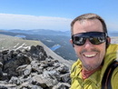
On a blue bird Saturday in mid August we decided to chip away at the Bi-Centennials by tackling Lightning Pyramid (Pt 13,722) and Len Shoemaker Peak (PT 13, 631).
We left the overflow lot around 6:00am and hiked the standard trail for close to 4 miles before breaking off and heading east toward Len Shoemaker Basin.
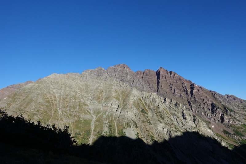
The Bells fro mjust below Len Shoemaker Basin
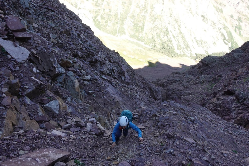
From the basin we located a gully that lead to the Thunder - Lightning saddle. The gully is located across a scree field just to the left of some white/yellowish rocks.
Climbing the gully was extremely loose and felt a bit dangerous. It was difficult not to knock rocks down. I would not want to ascend/descend this gully with more than two people. It could be disaterous if there was another group (or careless goats) above you in this gully. It is narrow enough that there aren't many places to go if rock were to come tumbling down.
While the gully was an amazing place to be... I can't say the climbing was enjoyable. It was more of a loose choss fest.
Kristi close to topping out to the Thunder - Lightning saddle
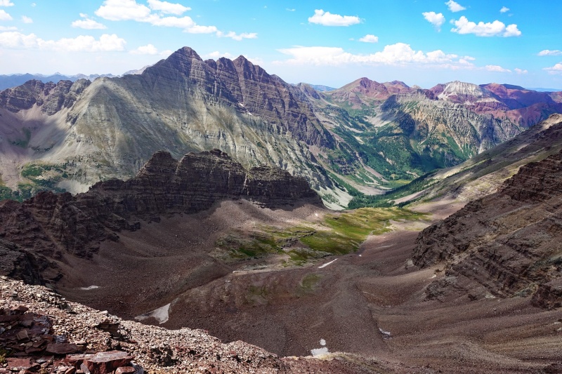
Once on the ridge the hike to Lighting's saddle was enjoyable. We spent about 25 minutes on the summit taking in the views and discussing our descent options. We came very close to traversing to Thunder instead of descending the loose gully.
Kristi on the ridge to Lightning's summit. Thunder Pyramid in the distance. Pyramid peaking out (top center)
We descended the gully just as we climbed it... one by one in pitches protecting each other from tumbling rock.
Although rotten... it was a pretty cool place to be. Next time I would opt for snow and skis.
Once at the basin, Kristi opted to rest and read while I climbed Len Shoemaker Peak.
From the basin I hiked to the obviouse saddle on the north side of the peak. The hike to the saddle was a bit tedious but once on the saddle there was quality class 3 scrambling to the summit.
The Bells and Len Shoemaker Ridge
Round trip on Len Shoemaker took roughly 2 hours plus 20 minutes of summit time.
After meeting back up with Kristi some locals escorted us out of the basin and the we made our way back to the TH. Our round trip was 14.7 miles and 7750 vertical. It took just short of 13 hours with 40 minutes of summit time.
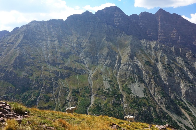
The locals were friendly
My GPS Tracks on Google Maps (made from a .GPX file upload):
...had I been there a day earlier. I was on 13,140 & 13,180 the next day. Based on your account - I think I'll wait for a decent snow year to go get Lightning! Thanks for writing the TR up!
I think snow would make Lightning an enjoyable route. Unless you want to traverse from Thunder.
On a side note... I think we met walking out from Lake Como a number of weeks back. Hope you are having a good summer and surviving all of the smoke!
Caution: The information contained in this report may not be accurate and should not be the only resource used in preparation for your climb. Failure to have the necessary experience, physical conditioning, supplies or equipment can result in injury or death. 14ers.com and the author(s) of this report provide no warranties, either express or implied, that the information provided is accurate or reliable. By using the information provided, you agree to indemnify and hold harmless 14ers.com and the report author(s) with respect to any claims and demands against them, including any attorney fees and expenses. Please read the 14ers.com Safety and Disclaimer pages for more information.
Please respect private property: 14ers.com supports the rights of private landowners to determine how and by whom their land will be used. In Colorado, it is your responsibility to determine if land is private and to obtain the appropriate permission before entering the property.


")
")
")
")
")
")