Download Agreement, Release, and Acknowledgement of Risk:
You (the person requesting this file download) fully understand mountain climbing ("Activity") involves risks and dangers of serious bodily injury, including permanent disability, paralysis, and death ("Risks") and you fully accept and assume all such risks and all responsibility for losses, costs, and damages you incur as a result of your participation in this Activity.
You acknowledge that information in the file you have chosen to download may not be accurate and may contain errors. You agree to assume all risks when using this information and agree to release and discharge 14ers.com, 14ers Inc. and the author(s) of such information (collectively, the "Released Parties").
You hereby discharge the Released Parties from all damages, actions, claims and liabilities of any nature, specifically including, but not limited to, damages, actions, claims and liabilities arising from or related to the negligence of the Released Parties. You further agree to indemnify, hold harmless and defend 14ers.com, 14ers Inc. and each of the other Released Parties from and against any loss, damage, liability and expense, including costs and attorney fees, incurred by 14ers.com, 14ers Inc. or any of the other Released Parties as a result of you using information provided on the 14ers.com or 14ers Inc. websites.
You have read this agreement, fully understand its terms and intend it to be a complete and unconditional release of all liability to the greatest extent allowed by law and agree that if any portion of this agreement is held to be invalid the balance, notwithstanding, shall continue in full force and effect.
By clicking "OK" you agree to these terms. If you DO NOT agree, click "Cancel"...
Granite Peak in Montana was pretty amazing. First off, I must thank Britt (globreal) for the excellent TR he did in 2016. His extensive info was so useful that we chose SW Ramp instead of FTD. What a great choice!
I couldn't put Britt's TR link in this report for some reason, so I posted it below in the comment section.
Stereo311 and I met in Cody on Wednesday and drove to the TH on Thursday. We had an easy time finding an obscure TH. There was no signage for SW Ramp TH. The only sign was for Lady of the Lake which would work but adds some mileage.
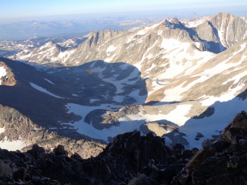
Around 9am we left the TH and made great time to the Tri-Creek crossing. Britt is correct in stating this could become the "standard route" as the trail is very defined until around Rough Lake (~ 8 miles in).
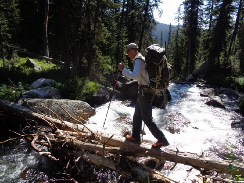
No shoes off for this crossing! pc: Stereo311
Approaching Lone Elk Lake pc: stereo311
We did have a few water crossings that required shoe removal but it felt good actually. We made such good time that instead of camping at Rough Lake we decided to go to Sky Top Lakes....somewhere. After Rough Lake we missed the turn off Britt mentions because we didn't want to cross the river again and cairns marked an obvious route to Sky Top. Unfortunately, this added 1/2 a mile or so to the hike but it was straightforward. After 10.8 miles and 7.5 hours hiking we camped at a grassy spot around 10,400. The mosquitoes were really bad after Rough Lake but curiously neither of us got bit. Lucky or the bug spray worked.
Friday we woke around 4:15am and started hiking at 5am. We made good time early but made another mistake Britt warned about gaining the saddle between Cairn and Granite peaks. We shot up right when we should have walked a bit further up and left. It's counter-intuitive because it looks like you'll drop down and head to far left. It doesn't. Both of the mistakes we made on the way up we didn't make on the way down and we saved time and energy. Pay attention to these two areas to avoid unnecessary hiking.
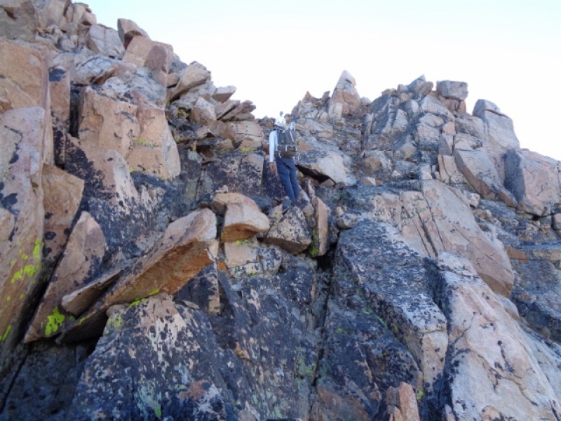
Looking up... pc: stereo311
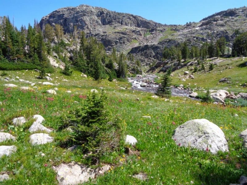
Looking down...at camp somewhere down there. pc: Stereo311
Interestingly, after a "record snow year" we were shocked and amazed to find less snow than Britt had on his trip. We brought ropes, ice screws, pons and axe only to find the ramp completely dry. There were hand-lines in place for the two cruxes and we used them if needed. Again, a really well cairned route meant we had no problems moving up the gully and ultimately the summit. We stood atop the summit at 7:30am. We chose to rap down the missing "ice crux" to save time and ultimately got back to camp at 11am. Packed and on the trail we put on the afterburners. It was akin to a mini death march. Three river crossings later we finally made it to the TH at 4:00.
This route is deceiving in one respect: elevation gain. On paper it looks like the TH is at 8800 and camp at Rough/Sky Top lakes is around 10,200. So it looks like 2000' of gain in 9-10 miles. But, you have a lot of up and down and twists and turns that add up. There was several areas where the creeks required you to go up and around rather than walk thru water. Also, there is quite a bit of boulder hopping above Lone Elk Lake so be prepared to be off trail for a while.
Other notes: there was snow in many other areas. We crossed several snow slopes to get to camp and the summit and some were at an angle that required kicking steps. In the morning, walking on the snow vs the rock made for quick travel. Also, the snow "tongue" was passable on the left. Feel free to PM if you want other info. If Granite Peak is on your list, go get it!
Day one mileage: 10.8 7.5 hours
Day two mileage: 16 11 hours
Stereo311 took some great photos and made a video which can be seen below.
I'm really stoked for you Jon! I still have mixed feelings about tent camping in grizzly country. Pic 4 really reminds me of some of the terrain in the northern Elks. Awesome job getting this peak so efficiently! We gotta get out together soon!
Caution: The information contained in this report may not be accurate and should not be the only resource used in preparation for your climb. Failure to have the necessary experience, physical conditioning, supplies or equipment can result in injury or death. 14ers.com and the author(s) of this report provide no warranties, either express or implied, that the information provided is accurate or reliable. By using the information provided, you agree to indemnify and hold harmless 14ers.com and the report author(s) with respect to any claims and demands against them, including any attorney fees and expenses. Please read the 14ers.com Safety and Disclaimer pages for more information.
Please respect private property: 14ers.com supports the rights of private landowners to determine how and by whom their land will be used. In Colorado, it is your responsibility to determine if land is private and to obtain the appropriate permission before entering the property.
")
")
")
")