Download Agreement, Release, and Acknowledgement of Risk:
You (the person requesting this file download) fully understand mountain climbing ("Activity") involves risks and dangers of serious bodily injury, including permanent disability, paralysis, and death ("Risks") and you fully accept and assume all such risks and all responsibility for losses, costs, and damages you incur as a result of your participation in this Activity.
You acknowledge that information in the file you have chosen to download may not be accurate and may contain errors. You agree to assume all risks when using this information and agree to release and discharge 14ers.com, 14ers Inc. and the author(s) of such information (collectively, the "Released Parties").
You hereby discharge the Released Parties from all damages, actions, claims and liabilities of any nature, specifically including, but not limited to, damages, actions, claims and liabilities arising from or related to the negligence of the Released Parties. You further agree to indemnify, hold harmless and defend 14ers.com, 14ers Inc. and each of the other Released Parties from and against any loss, damage, liability and expense, including costs and attorney fees, incurred by 14ers.com, 14ers Inc. or any of the other Released Parties as a result of you using information provided on the 14ers.com or 14ers Inc. websites.
You have read this agreement, fully understand its terms and intend it to be a complete and unconditional release of all liability to the greatest extent allowed by law and agree that if any portion of this agreement is held to be invalid the balance, notwithstanding, shall continue in full force and effect.
By clicking "OK" you agree to these terms. If you DO NOT agree, click "Cancel"...
Thanks first of all to those who responded to my recent forum entry by the same name as this report. I’m mainly writing this report to highlight a very good combo route that’s not specifically identified in the 14ers.com route options but which makes a very good alternative to the infamous Crestone traverse route for those of us who aren’t quite ready for a class 5 with 5/6 exposure (though avid climbers say it’s not that bad and even call it “fun”).
Short overview: starting from the 4WD trail this makes for a real doozy of a day hike at ~15mi RT and a whopping 7,000ft elevation gain (see detailed times at the bottom). I literally hugged my Jeep when I finished. I would highly recommend you consider camping at the lake rather than following my footsteps. The hike back to the trailhead was torturous after having already knocked off both peaks that day.
Since there’s already plenty of great info out there on the Crestones in general, I’ll just add a few observations that might help someone considering this combo, starting with the fact that having arrived at the 4WD trailhead at about 8pm on a Friday night I barely found a place to park and there were no open spots near the trailhead to camp so I just slept in my Jeep.
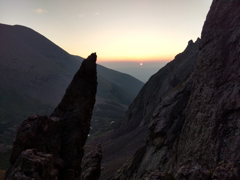
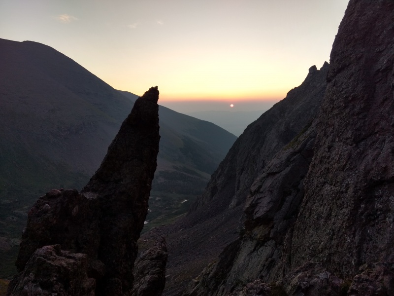
Sunrise through the haze as seen from Broken Hand Pass
Starting from the 4WD trailhead at 2:42am it was still dark when I reached the lake. It should be noted that it is VERY easy to lose the trail in the area near the lake if you’re hiking in the dark and your mind has starting wandering after several miles of hiking along a very obvious trail. It’s not so hard in the daytime but given all the great many spur trails going to different camping sites near the lake – some of which are pretty much as well defined as the main trail – you’ll want to pay closer attention than I did when getting near the lake. Apologies to the various campers I likely woke up by stumbling into your campsites and then backtracking. Having the gpx file downloaded and open might be useful if you’re hiking through here in the dark like I did.
Going up Broken Hand Pass, even in somewhat low light, wasn’t as bad as I feared from some reports. Not exactly a “fun” section but it really wasn’t too bad – though a bit worse on the way down. There is some loose scree, just need to take your time. Dropping down the other side of the lake and over to Crestone Peak it’s very easy to follow the trail to the tremendously obvious “Red Gully.”
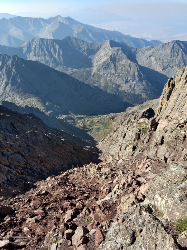
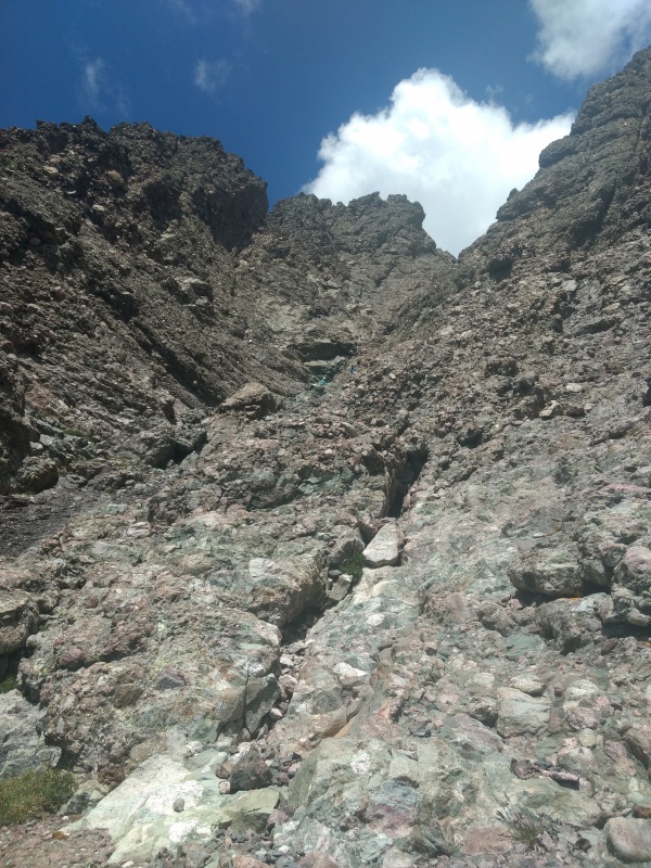
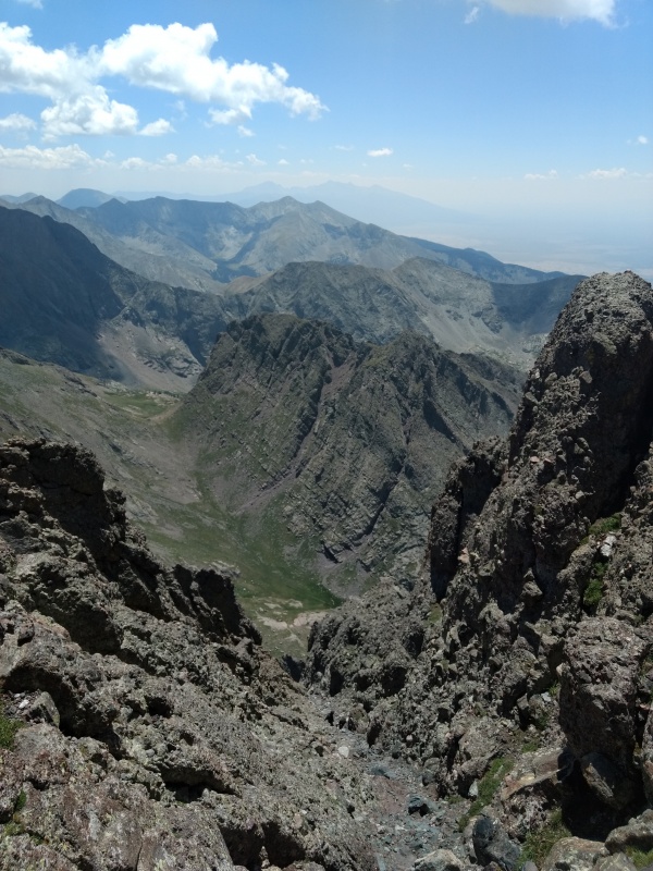
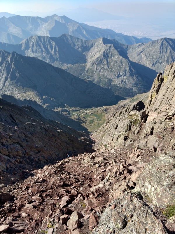
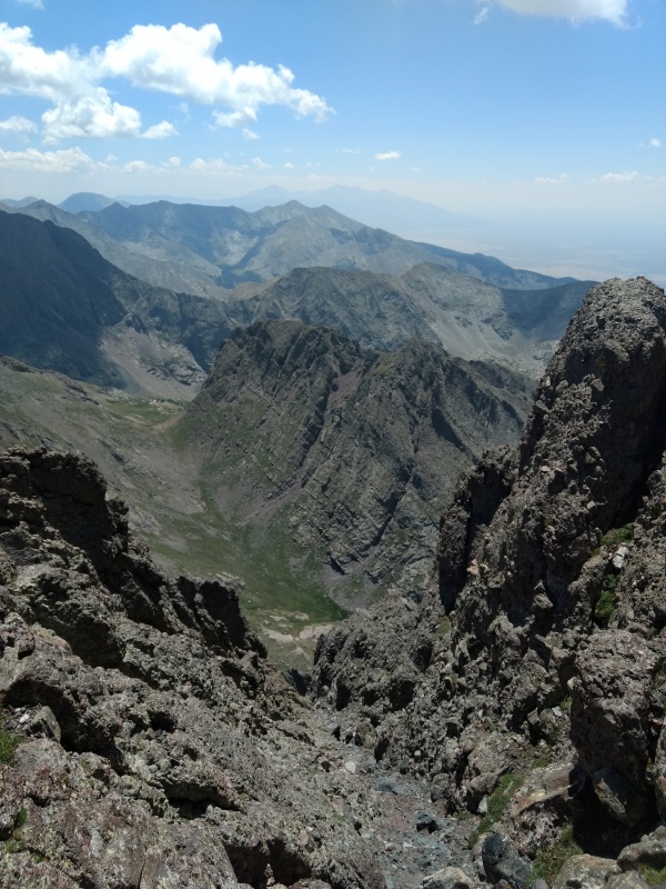
Looking down the Red Gully – a couple hikers for scale.
Crestone Peak is an easier climb up than Crestone Needle (the higher exposure rating on the Needle should give you a hint). I comfortably kept my trekking poles in hand much of the way up the Red Gully. From the top, the traverse to the Needle gives the appearance of being tantalizingly close but in reality I met several folks on the Peak who left for the traverse at the same time as I dropped down to take the Needle from the standard route. Some of them I met near the base of Crestone Needle – others I met when I was nearly at the summit.
So the traverse doesn’t appear all that much faster than dropping down and regaining BHP to go the standard route up the Needle (took me about 4.5 hours peak to peak and I’m not all that fast).
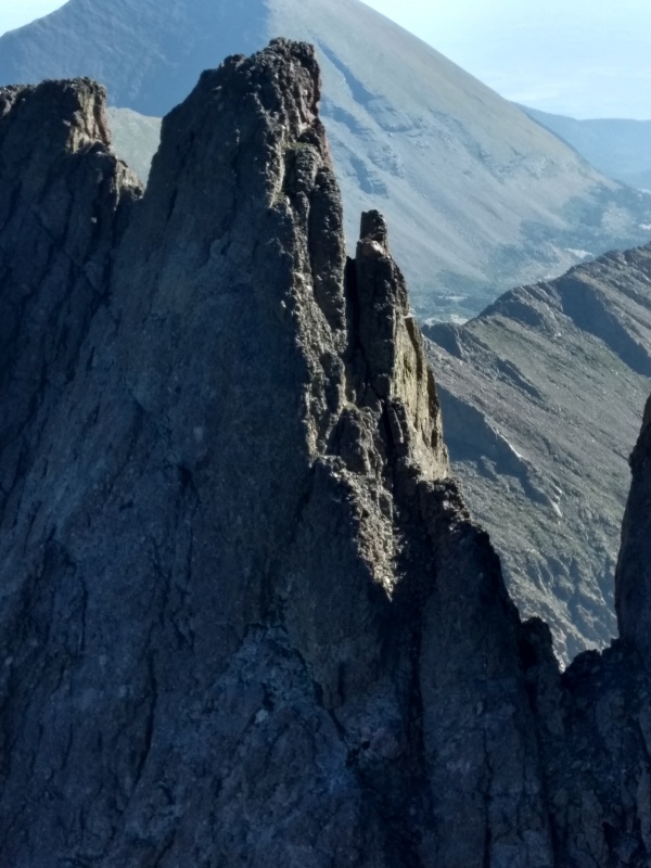
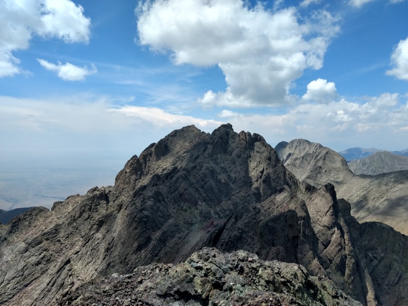
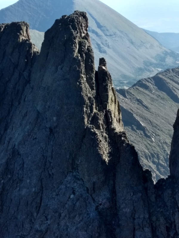
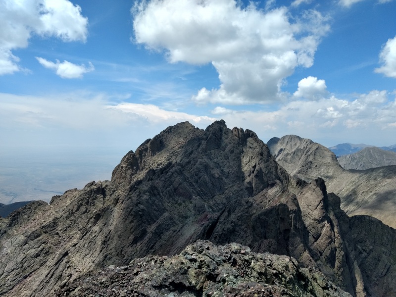
Parts of the traverse as seen from Crestone Peak. Climbers drool with anticipation, hikers say nope.
EDIT: Nope, this is Northeast Crestone; a 14er sub-summit and now one of my most favorite climbs!
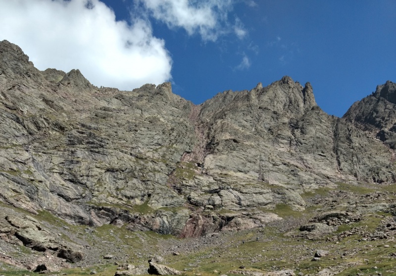
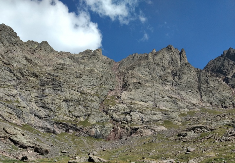
Looking back up the Red Gully. Looks steeper than it is.
Dropping down the Red Gully wasn’t all that difficult but it felt like it took forever. Going back up the back of Broken Hand Pass is a mostly easy, gentle trail, though not enjoyed by this point in the day.
From this point of the hike you have a very easy decision to make. You’re standing at the top of Broken Hand Pass. Option 1 if you’re already toasted is go back down the pass to where you started. Option 2 is add a mere 1 mile and ~1,300 feet gain to bag a second peak on the same day. As long as the weather is good it’s hard to pass up that option.
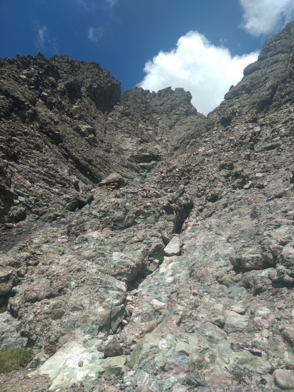
Looking up the lower, easy portion of the East Gully. A couple hikers in view for scale.
Looking down the steeper section of the West Gully. Again a couple hikers in view for scale. I believe is where the 4/6 exposure rating comes in. These guys took their dog up this and actually got all the way to the summit with him!
Crestone Needle is easily the steepest peak I recall climbing and also about the only one so far I felt like I could actually say I “climbed” – not in the sense of needing ropes or anything, just that it’s the first one where I felt it totally necessary to stash away my trekking poles and engage both hands and feet fully for sustained stretches (I’m the sort of guy who guys up the trough on Longs with trekking poles in hand). It wasn’t difficult climbing given how solid everything was and your hands are typically just needed to help with balance but I did end up doing a couple simple, short class 4 moves which made it easier than hunting around for purely class 3 moves.
In that regard it’s actually kind of a fun place to get a little class 4 experience (there I go using the word “fun” for potentially life threatening maneuvers – before you know it I’ll be back for the traverse – nah!). Actually there are spots going up the Needle where you can choose to attempt some class 4 moves where the danger if you fall isn’t really too bad, and you can generally avoid all the class 4 on this route if you’re patient in picking your line up the gullies.
It should also be noted that at the crux, where you cross from one gully to the next I was very uncomfortable making that one move to get you across the trench separating them – I thought that was pretty close to a class 4 move there (though very brief and without bad exposure) but one guy merely jumped across it (and hoisted a dog over it!). However I was told another lady reached that section and totally freaked out, having such a meltdown that two other young ladies decided to go ahead up the class 4 east gully rather than try to get around the lady who was freaking out.
View of Crestone Needle (foreground that I’m standing on) then East Crestone (shadows) and Crestone Peak (sunlight to left).
Going back down the Needle I would stress the cautions about picking the right spot to descend. There were 4 Texans that day who went too far west and got cliffed out above the west gully as me and some other guys were coming up. They asked how to get down to us and the only viable response was – don’t! They had to climb back up and start the descent over again (we met them later at the bottom). Also, I accidently started down the east gully myself, being convinced for a moment that it was the west gully. But as the climbing quickly got much steeper than I remembered I realized my mistake in time to easily correct it. Some people had tied some orange ribbons to some rocks on either side of the cross over point between the gullies. I know some people freak out over Leave No Trace principles but I hope those little bright orange ribbons will be left alone because they really do help make it easier to find the correct cross over point (I almost didn’t even notice the dihedral when going up because I was coming up the far right side of the gully). Thank you whoever put those there. LNT fanatics: please take a deep breath and keep moving – there is some difficult terrain in these gullies if you miss this cross over spot and these very minor “traces” are very helpful to folks who are just learning more difficult routes like this.
Final thought: the road back to the 4WD trailhead is really stinking long (you used to be able to drive up much further), especially if you do this whole thing in one day instead camping at the lake as I should have done.
Times:
2:42am start 4WD trailhead
~6:30am top of Broken Hand Pass (after getting lost in the dark by the lake a couple times)
7:21am bottom of the main part of the Red Gully (Crestone Peak)
8:40am top of Red Gully
8:53am Crestone Peak summit
9:13am begin descent
10:41am in valley below red gully
11:21am back on top of Broken Hand Pass
11:31am start up Crestone Needle
12:36pm in middle of east/west gully cross over
1:22pm Crestone Needle summit
1:50pm start down
3:56pm down off the worst of BHP
5:51pm hugged my Jeep at the 4WD trailhead
Thumbnails for uploaded photos (click to open slideshow):
The traverse, which I did about a month ago, is much quicker than the 4ish hrs (summit to summit) your trip took. I get many don't feel comfy doing the traverse, but in sheer terms of time the traverse is about half the time.
Great report. I was one of those Texans. The orange ribbons were really helpful. I appreciate you helping us spot our mistake. One of the guys in our group had the Gaia GPS Hiking, Hunting Maps app. It tracked our route up and we were able to use that to backtrack and find the right spot to cross over and get back on track. It was an awesome hike and a wonderful challenge. We took everything slow and easy and took plenty of breaks. Those of you who are able to hit both Crestone peaks in one day are a real inspiration; even more so that you were able to do it from the 4WD lot! I look forward to picking a spot next summer and appreciate all of the information you all share from your experiences. I learned a lot from our hikes this summer and am excited to be a part of the 14ers community!
Loved the report! I was another one of the 4 Texans. Thanks so much for the great advice not to free climb down the cliff face! I'm always thankful to find so many kind and helpful people every time I'm up there! The 14ers community really is a blessing! KEEP CLIMBING!!! :D
What cliff will the 4 Texans show up on next? Lol, you guys could make a great series out of this - 4 Texans on a Cliff - just need someone at the bottom to take a photo! I realized a little after going further up that gully that would have been an awesome photo of you guys atop the cliff with the 2 guys at the bottom for scale but alas, it was too late by then. Glad you all made it down safely - there was a great deal of interaction that day with lots of folks helping each other - always great to see! Best of luck on your next adventure!
Caution: The information contained in this report may not be accurate and should not be the only resource used in preparation for your climb. Failure to have the necessary experience, physical conditioning, supplies or equipment can result in injury or death. 14ers.com and the author(s) of this report provide no warranties, either express or implied, that the information provided is accurate or reliable. By using the information provided, you agree to indemnify and hold harmless 14ers.com and the report author(s) with respect to any claims and demands against them, including any attorney fees and expenses. Please read the 14ers.com Safety and Disclaimer pages for more information.
Please respect private property: 14ers.com supports the rights of private landowners to determine how and by whom their land will be used. In Colorado, it is your responsibility to determine if land is private and to obtain the appropriate permission before entering the property.