Download Agreement, Release, and Acknowledgement of Risk:
You (the person requesting this file download) fully understand mountain climbing ("Activity") involves risks and dangers of serious bodily injury, including permanent disability, paralysis, and death ("Risks") and you fully accept and assume all such risks and all responsibility for losses, costs, and damages you incur as a result of your participation in this Activity.
You acknowledge that information in the file you have chosen to download may not be accurate and may contain errors. You agree to assume all risks when using this information and agree to release and discharge 14ers.com, 14ers Inc. and the author(s) of such information (collectively, the "Released Parties").
You hereby discharge the Released Parties from all damages, actions, claims and liabilities of any nature, specifically including, but not limited to, damages, actions, claims and liabilities arising from or related to the negligence of the Released Parties. You further agree to indemnify, hold harmless and defend 14ers.com, 14ers Inc. and each of the other Released Parties from and against any loss, damage, liability and expense, including costs and attorney fees, incurred by 14ers.com, 14ers Inc. or any of the other Released Parties as a result of you using information provided on the 14ers.com or 14ers Inc. websites.
You have read this agreement, fully understand its terms and intend it to be a complete and unconditional release of all liability to the greatest extent allowed by law and agree that if any portion of this agreement is held to be invalid the balance, notwithstanding, shall continue in full force and effect.
By clicking "OK" you agree to these terms. If you DO NOT agree, click "Cancel"...
After doing some research before the hike, I was left with the impression that the West Ridge is not a great route and would make for a long slog of a day. This turned out to not be the case for me. I am writing this report primarily to offer another perspective and give my two cents of this not-oft climbed route. There is no information here that cannot already be found in the official route description on this site.
The Cliffsnotes version: there is a defined trail for the majority of the hike if you pay attention. The trail itself is in good shape, especially considering it’s not the standard route and not maintained.
The trail below treeline is narrow and climbs steeply for 0.5 miles before reaching the tarn and turnoff. The turnoff for the West Ridge is now much more defined than the old trail leading to the SW Ridge. It would be hard to miss.
The talus field in the valley sounds like it often gives people trouble, but it can be avoided entirely by staying left on the trail whenever possible. There was a hiker today who ascended via the talus and I would estimate it cost him 30 minutes of wasted time and energy. Stay on the trail, stay left, and you will be golden.
Trekking poles will make life easier on the steep ascent/decent to/from the saddle. For comparison, this section feels like a shorter version of the loose pitch on La Plata’s SW Ridge route.
Perhaps the roughest trail section and most physically challenging part of the day was on the ridge ascent to Point 13,936; however, there is still some semblance of a trail the entire way. Rock hopping is definitely not required with careful route-finding.
From the top of Point 13,936, the false summit looks intimidating, but the true summit is surprisingly close. The remainder of the path to the summit is straightforward. Like the official description says, stay on or to the right on the ridge. The difficulty never exceeds class 2.
As always, take special care on the way back to not descend into McCoy Gulch. I can see how this would be an easy mistake to make if one is not paying attention. After descending the false summit, look for Point 13,936 off slightly to the hiker’s right and reascend it.
Roach’s book gave this route 294 R points, which in terms of difficulty, is about the same as the North Ridge of Mount of the Holy Cross. Moreover, this rating implies that the West Ridge is even more challenging than the standard combo of Shav/Tab, which would make the West Ridge moot for many. I do not doubt that it was this difficult when the book was published, but this rating is definitely an overestimate now. Perhaps years of hiker’s boots have stamped out a decent trail or there has been trail work done that I’m not aware of.
Do not get me wrong: the quality of the trail is not on par with the standard routes of Mounts Yale or Harvard, but it certainly does not require bushwacking and extensive rock hopping. Overall, I would say this route is a somewhat tamer version of La Plata’s Southwest Ridge from the 4wd trailhead. If you feel comfortable with your route-finding skills and do not mind a little solitude, this is definitely a nice alternative to the standard combo route. It is not the most aesthetically pleasing hike overall, but it sure beats Bierstadt and its weekend hoards.
Timestamps at a moderate, sometimes lumbering pace:
Start: 0620
Turnoff: 0640
Saddle: 0745
Point 13,936: 0845
Summit: 0930
End: 1230
S/O to Nick from Boulder for the excellent company on the summit push and descent!
The tarn and turnoff point
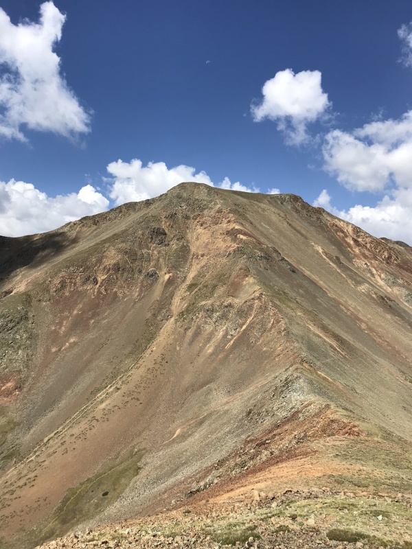
The remaining route seen from Point 13,936. Tab is off to the left of the false summit. The true summit is much closer than it appears.
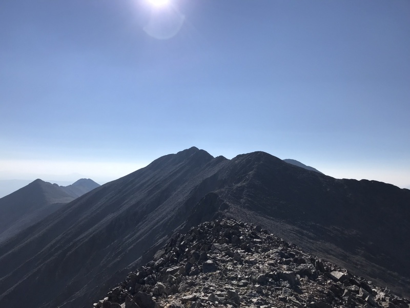
Looking back at the West Ridge from the Summit
On the descent from Point 13,936. The steep pitch can be seen to the left of the saddle.
The valley
Back into the trees. Another beautiful day in the hills.
Thumbnails for uploaded photos (click to open slideshow):
Thanks very much for your report. Just yesterday I was looking at the Jennings Creek/west Ridge route to hike with my teenage son. The day we summited Shavano from the east, t-storms were threatening so we bailed on Tabeguache. Your report makes route finding look easy, thanks again.
"After doing some research before the hike, I was left with the impression that the West Ridge is not a great route and would make for a long slog of a day"
Oh, darn, you must have missed the route description here on the site!
Glad it helps, Tim! It's definitely a good option to tag just Tab.
Bill, read two sentences on: I am not presenting any new information that cannot already be found in the official route description (on the site).' Some of the other trip and condition updates, along with the route's RPs from Roach's book made it out to be a bear of a climb, so mainly addressing that.
Thanks aweskamp for your report. I've been thinking to do Tab via this route and had the same impression, that it was not as pleasant as advertised on the 14ers route description. You put in all the important 'consumer report' details for me to give this a try. Well done.
Caution: The information contained in this report may not be accurate and should not be the only resource used in preparation for your climb. Failure to have the necessary experience, physical conditioning, supplies or equipment can result in injury or death. 14ers.com and the author(s) of this report provide no warranties, either express or implied, that the information provided is accurate or reliable. By using the information provided, you agree to indemnify and hold harmless 14ers.com and the report author(s) with respect to any claims and demands against them, including any attorney fees and expenses. Please read the 14ers.com Safety and Disclaimer pages for more information.
Please respect private property: 14ers.com supports the rights of private landowners to determine how and by whom their land will be used. In Colorado, it is your responsibility to determine if land is private and to obtain the appropriate permission before entering the property.