| Report Type | Full |
| Peak(s) |
Carson Peak - 13,662 feet Bent Peak - 13,405 feet "Tundra Top" - 13,453 feet "Cataract Peak" - 13,541 feet Unnamed 13573 - 13,573 feet Unnamed 13702 - 13,702 feet Gravel Mountain - 13,596 feet |
| Date Posted | 07/15/2018 |
| Modified | 07/16/2018 |
| Date Climbed | 07/15/2018 |
| Author | bmcqueen |
| Additional Members | RyGuy |
| The Little Audi that Could - San Juan 6 Pack |
|---|
|
The Best Laid Plans I thought my #ChasingRichardson project would come to a close this weekend with an ascent of Rio Grande Pyramid, deep in the San Juans. That would put me at 99/100 on the Centennials, poised for a joint finisher on Jagged next month with Ryan (RyGuy). I planned to do RGP along with its four ranked 13er neighbors, and Ryan offered to join me since he had only done RGP and not the other four. I dropped my car off at the Toyota dealership on Thursday afternoon to have some repairs done and planned to take my wife's car on this weekend adventure while she headed out on a ladies' trip around Mont Blanc. The trailhead for RGP is pretty tame - especially for the San Juans - so we didn't need Ryan's Jeep. We opted for the better gas mileage of Melissa's Audi Q5. When we arrived at the 30-mile Campground to pack in for RGP, we saw three different versions of signs describing upcoming closures on the Weminuche 818 trail. Apparently a new bridge was going in and they had moved up the closure date from July 15th to July 10th. The trail was scheduled to be closed until August 1st, so it looked like I'd be doing RGP in August in just-in-time mode before Jagged. 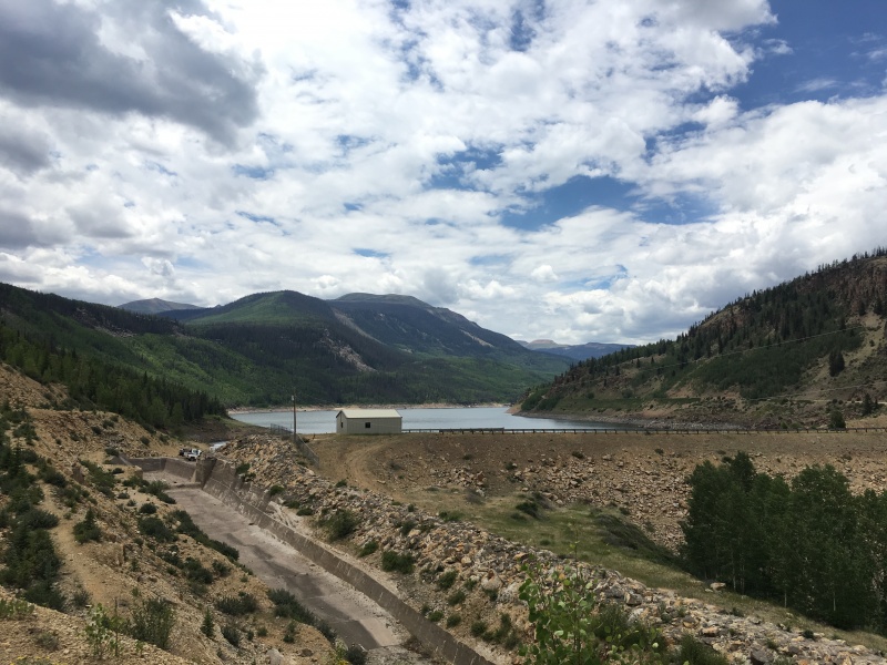 Just like when the train broke down on the way into Chicago Basin last fall with John Balciar, the silver lining was we were in the San Juans and that meant that we had TONS of peak options. Ryan is somewhat of a walking peak (among other topics) encyclopedia, so he began tossing out other options. We decided to head over the pass into Lake City and make a decision while we ate an early dinner. A Plan Comes Together We knew Carson Peak wasn't too far outside of town, and saw that it had lots of nearby neighbors. Some quick research on 14ers.com yielded a couple of trip reports by furthermore and bergsteigen (of course - thank you both!). It looked like we could string at least four and maybe as many as six peaks together for the following day. The big wild card was the Audi. Otina said the Wager Gulch Road wasn't that bad IF you could get past the first mile. Ryan suggested we drive by and see if SanJuanRon was home to get his input - gate locked - rats. It was still light, so we decided to see if maybe the Audi would go up the road. Otina had started her climb from the top of the pass at almost 12,400'. Wouldn't that be nice if we could get the Audi that high! The road was easy for a bit through the residential area, then got a bit rougher. Ryan gave me stats regularly on how much farther to go in our magic mile when the difficulties were supposed to ease. Twice he jumped out of the car, walked up the road and spotted me through tougher sections. Audi was on the cutting edge of 4WD systems, so that was no issue; clearance was our concern. Up we went, around a few corners, then up some more. Just after a mile in, the slope eased and the road became MUCH more mellow. We drove past a family of ATVers camped in the trees, waved and continued on up. Could we get all the way to 12,400' in my wife's borrowed car??? A final stream crossing and a couple last switchbacks marked the final obstacles, but slowly and steadily, up we went, finally topping out on the pass. We patted the Audi on the dashboard, parked and got our tents set up for the night. 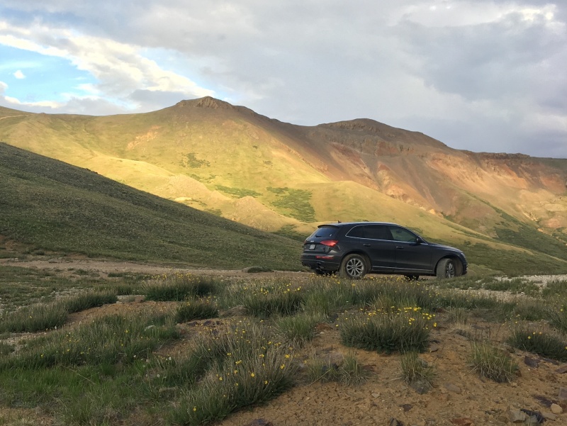 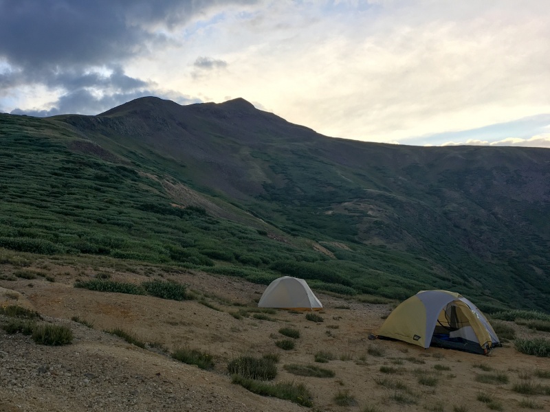 Day One - Saturday July 14th Stats 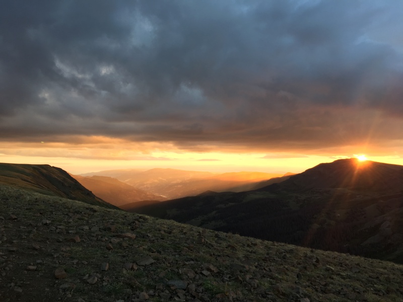 We started walking at 5:40 AM and headed up the 4WD road that leads up towards the summit of Bent Peak. The hike to the summit was quick and easy with great sunrise views behind us. We signed the register and kept moving, knowing it could be a long day. We also had some precipitation in the forecast and were unsure of how long our weather window might last. 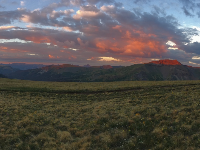 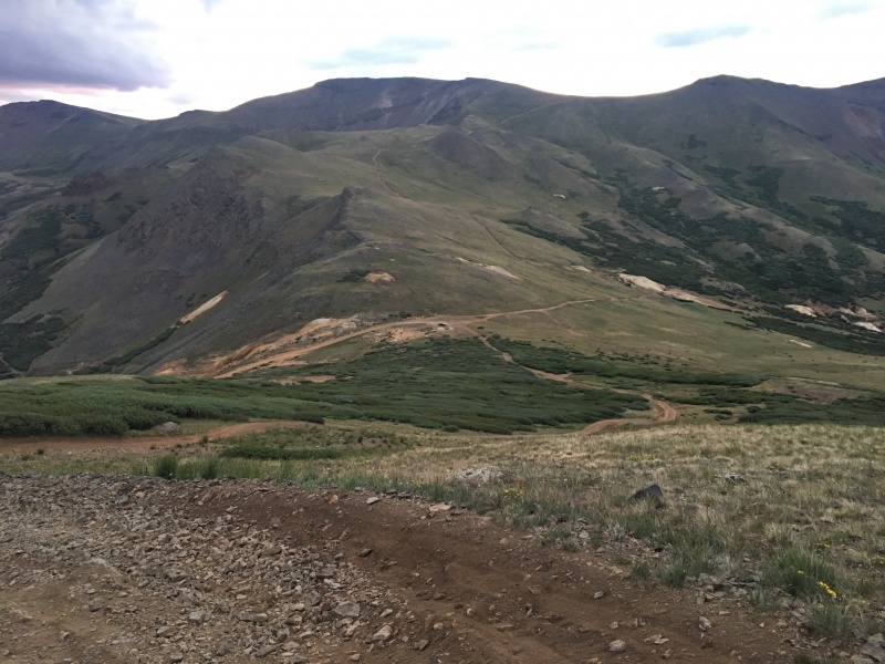 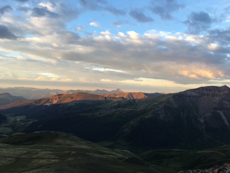 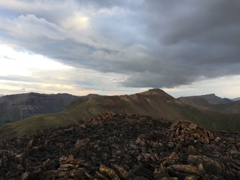 The question of how long our weather window would last was answered. It turned out to be not very long. By the time we had descended down to the Bent/Carson saddle, it was lightly raining. We stopped and threw on our rain shells and Ryan put his pack cover on. The walk to Carson was pretty easy, alternating between faint trail segments, grassy slopes and a broad grassy summit ridge. Another register signing and we were on our way again, hoping maybe the sun would come out for a bit to dry us off. 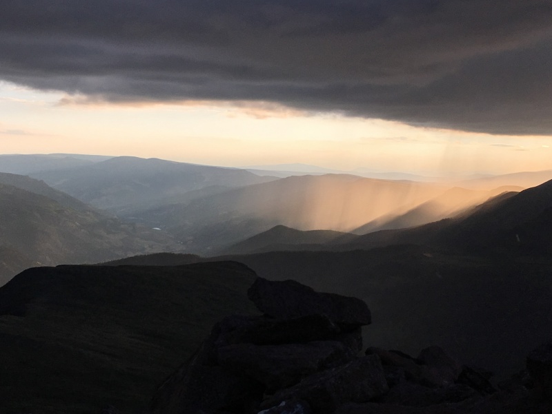  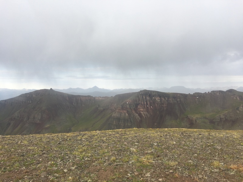 The ridge to Tundra Top is much rockier. We bypassed a couple of towers on the ridge on the south (left) side, gingerly stepping across the loose and wet talus. Once across the more difficult area, we cruised along on the now gentle grassy slope towards the summit of Tundra Top (its name is not an accident). The rain had let up and there were some signs of blue sky to the west, but the sun was still obscured by the rain clouds to the east. 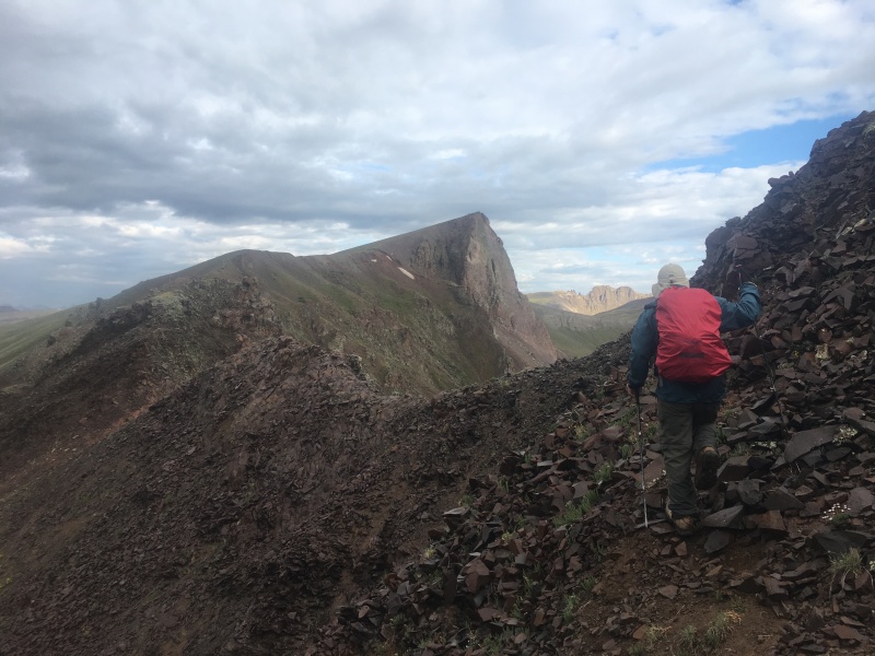 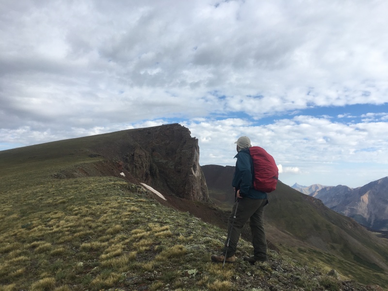 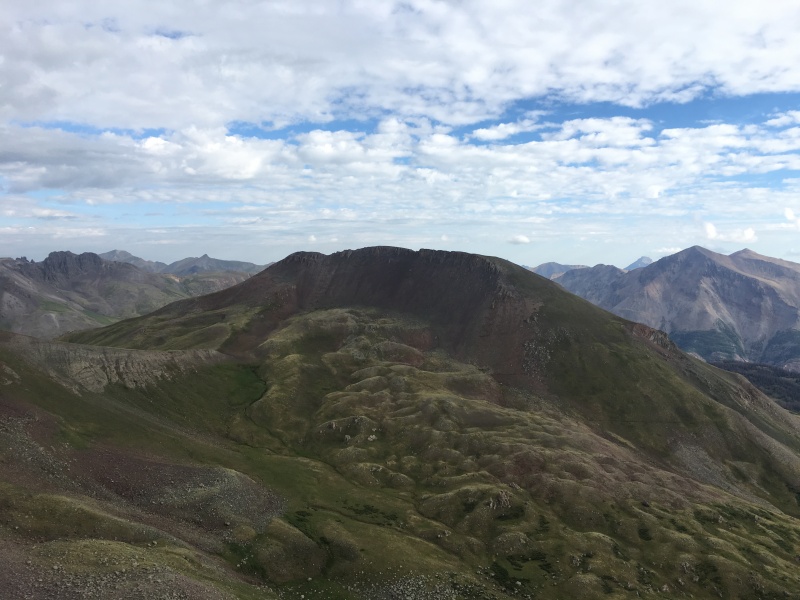 It looked like the drop down to the saddle between Tundra Top and Cataract was going to hurt a little worse, so we kept going without giving ourselves much time to ponder it. We followed a steep, but good use trail down the north slope of Tundra Top and chose our line up Cataract. For the ascent, we opted to aim far left (west), which worked well. We scrambled through a minor Class 2+ band just below the summit, then walked over and enjoyed another vintage summit register - this one placed by Gerry Roach way back in 2005! The sun was finally out, our shells were drying out nicely on our packs, and the weather seemed decent. We stayed for a while and studied the names in the register with Ryan taking many photos of the all-star pages. 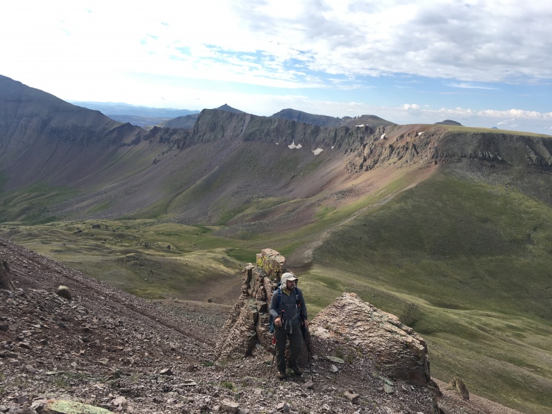 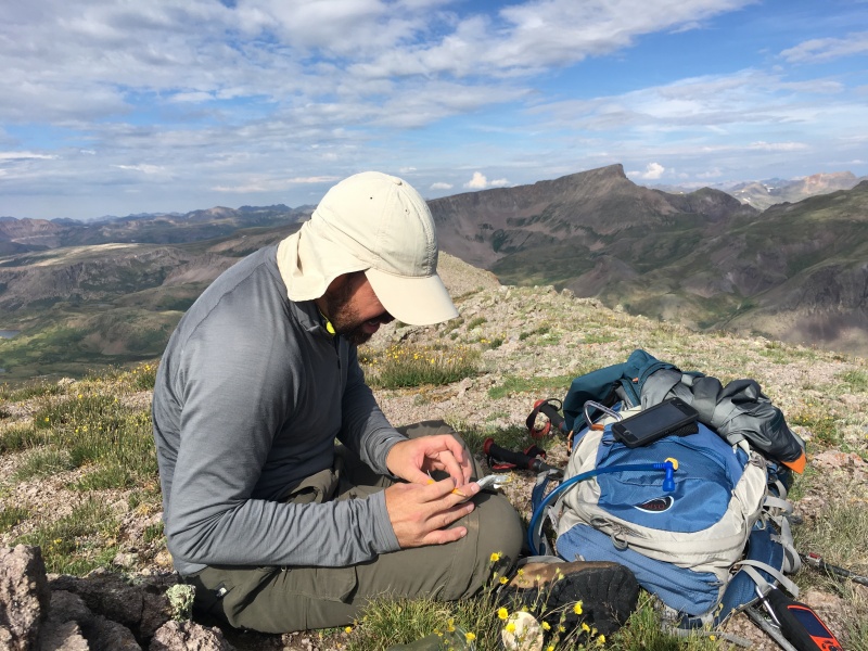 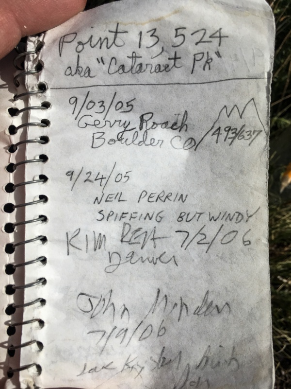 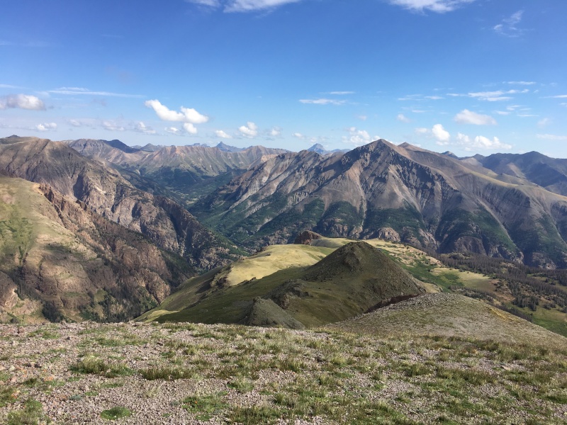 We had scoped a descent line on our approach - a scree slope with a use trail dropping across the center. We followed that and were back at the saddle in no time. The re-climb of Tundra Top awaited. With four ranked peaks already done, our legs began to protest a touch. We coerced them up - surely if the Audi could do it, they could too! 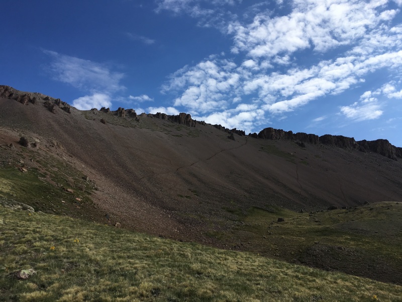 We figured we had a built-in break coming since our next stage was to descend the south side of Tundra Top to the saddle with Unnamed 13,580 B, which shares the elevation with the lowest Bi-Centennial Peaks, but draws the short straw as the one without a name (it's actually #202 behind 13,580 A, which also just misses the Bi-Centennial cut). We grabbed a quick snack at the 12,900' saddle, then proceeded on with a bit more protest from the legs. Point 13,580 B has two summits. The real one is naturally the one farther away. The nice thing about getting to that summit was that every step we took from there was a step closer to the car. 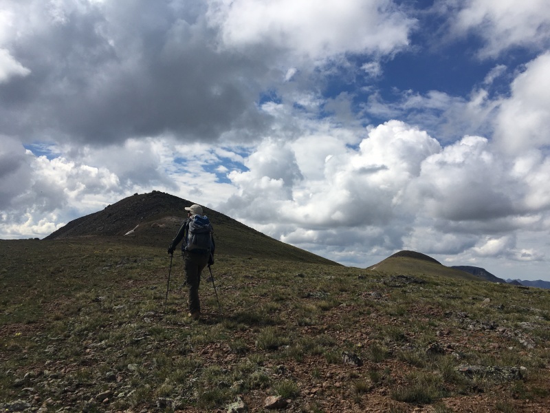 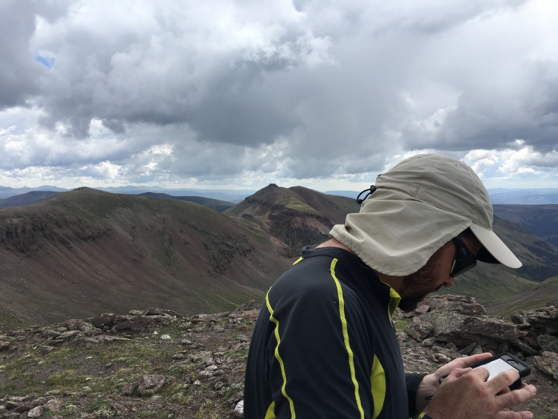 We hoped to complete the day by getting Point 13,581, an actual Bi-Centennial, but knew the ridge between was a little rough. We had taken a few screen shots of the TRs that we had quickly used for research, so we dropped below the initial difficulties on the ridge on the south side. It was loose, unpleasant and time consuming, but soon enough, we were back on solid ground. The clouds were building again and getting darker. We continued on up to a false summit (that actually had a register marked as Point 13,568). We quickly signed and continued on to what looked like the crux. 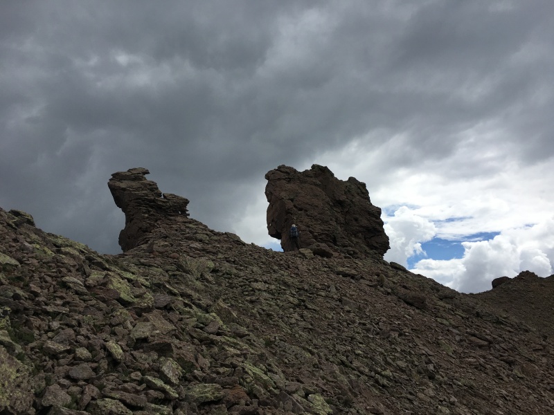 It began to rain again. Ugh. Surely we can just scoot across this last section of ridge. There hasn't been any thunder or lightening at all - just overcast skies and some light rain. I walked to the edge of a drop-off. Nope - that's not going to go. I told Ryan it must be the loose gully on the north side of the ridge where he was. He looked down and looked back at me. "I don't think this goes. Let me check over here." He looked at another section to the south. Nope. We pulled out the photos of the TRs and re-read them. Suddenly it makes sense how Otina calculated over 5,000 vertical feet. She and furthermore both got to this spot, concluded it didn't go (we agreed!), descended down the north side of the ridge, bypassed the fragile tower section, then climbed up a steep scree gully to get to what we then understand is a Class 3 summit block. 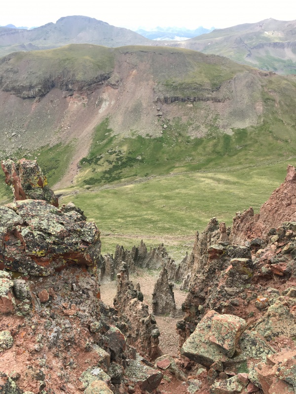 The rain was coming down with a bit more vigor and the clouds didn't look likely to break. We made the tough decision to call it and descend. We started down the grassy slopes just to the west of the difficult ridge section and basically followed the drainage all the way down. The rocks of the drainage led us right across the willows, then we contoured to the northeast and eventually intersected the Colorado Trail, where we chatted with a few through-hikers who were all still drying out and shaking off the hail that had hit them farther to the east. We cruised up the good trail, regaining about 500' to get back to the pass and our car and called it a day. 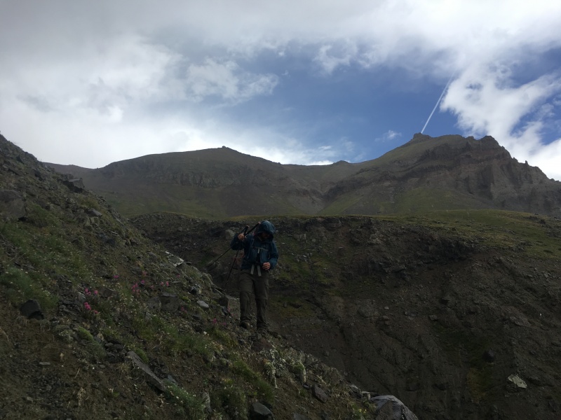 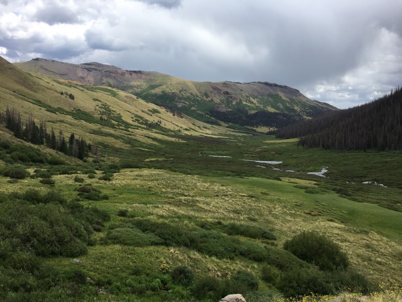 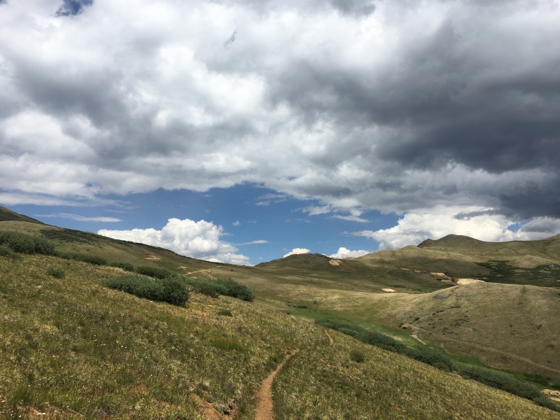 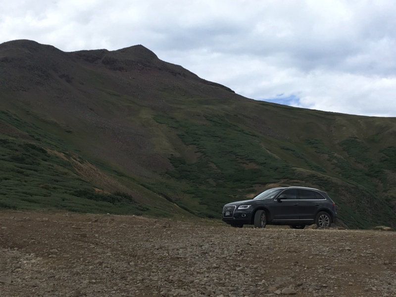 We waved to the Jeeps and ATVs as we descended the Wager Gulch Road and headed to Lake City. 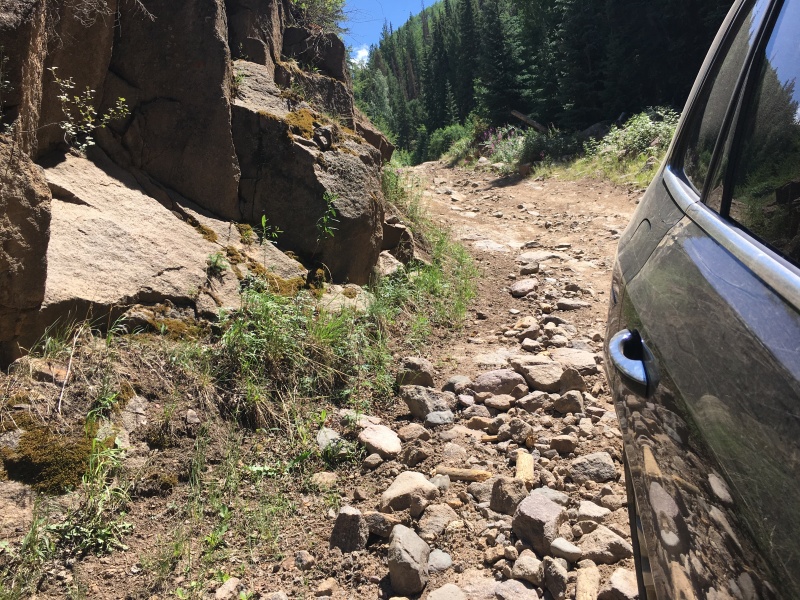 Day Two - Sunday July 15th Stats After our five peak day Saturday, we scoped a nice, easy day for Sunday. The weather looked worse than Saturday and we had a long drive home Sunday afternoon. We decided to drive up towards Engineer Pass, camp for the night, then climb a Bi-Centennial, Point 13,688, and its unranked neighbor Gravel Mountain (aptly named). With another 4:45 AM alarm, we were walking at 5:27 AM, this time up an easy 4WD road. Otina had indicated it was more of a challenge, so we decided to leave the Audi at camp (which required a descent down off of the main Engineer Pass road down a steep rocky road to a lovely camp site near where the Marmot King lives - biggest one either of us have ever seen). Ryan did a quick calculation that it would be about 3 miles each way, so it was set up to be a short day. 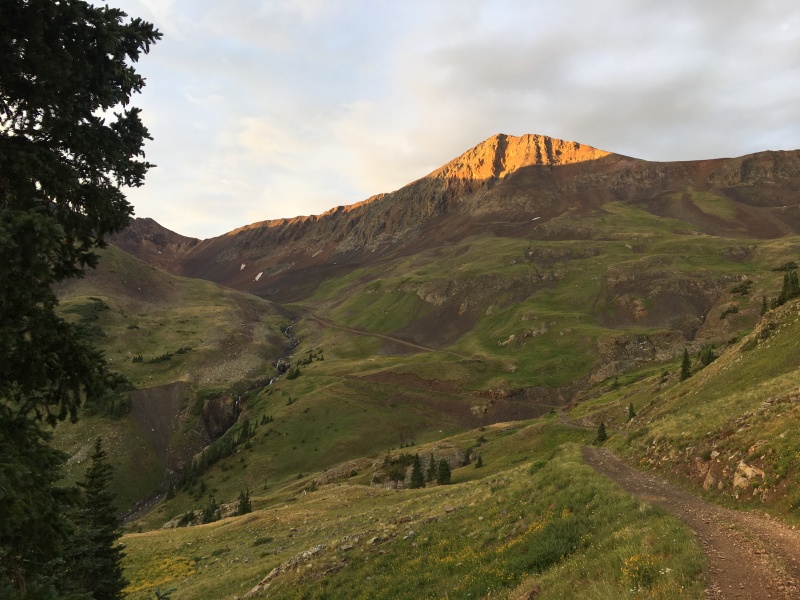 The road led to a couple of restored mining buildings - the Golconda Compressor House and Blacksmith Shop. From there, we angled up and left and started climbing the steep slope directly up towards Gravel Mountain. We played our usual game of keeping score of rockfall that we cause with awards given for first, biggest, most and farthest. Hitting your partner results in disqualification. Today's game was like a world cup soccer match. We ended in a 0-0 tie. Perfect. There are no penalty kicks in our game though. 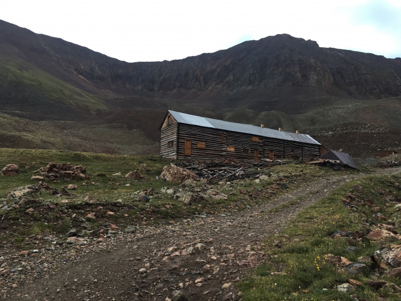 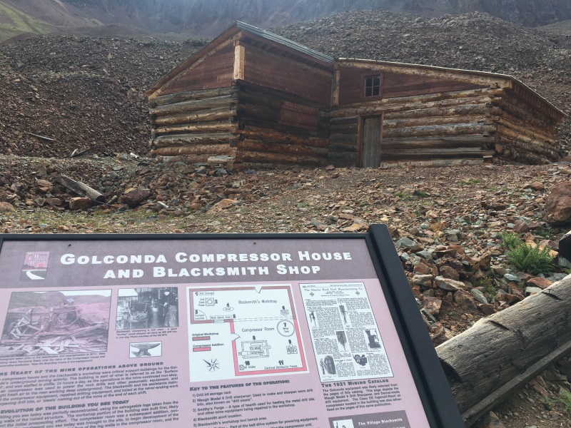 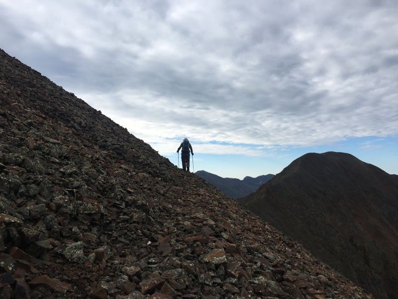 From Gravel Mountain, we took the easy traverse over to Point 13,688, walking along one Elk Range-like shelf that went around the east side of the ridge to keep the difficulty Class 2. There was unfortunately no summit register on Point 13,688, so we didn't get to scroll through the all-star list. Oh well. We retraced our steps back to Gravel and descended back to the mine and along the road. The Marmot King appeared to have left our camp and my wife's car alone (I made sure he wasn't in the engine compartment before we left). The little Audi who could made it back up the last big scary hill to get back to the Engineer Pass road and rejoined the Jeeps and ATVs for the drive back down into Lake City. 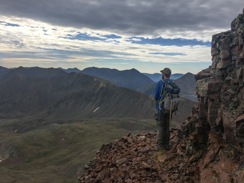 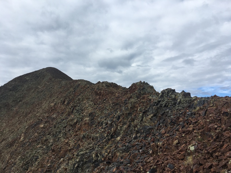  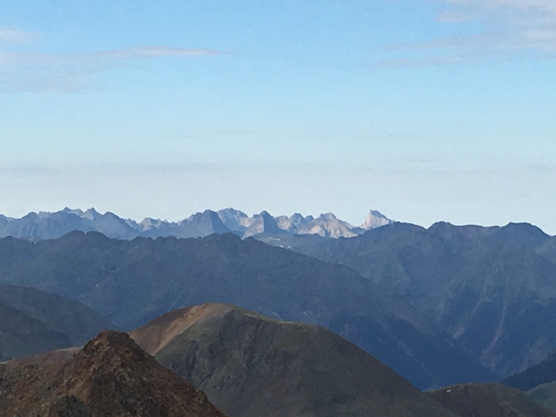 Where Does this Leave Us? We drove to the San Juans with the intent of getting me Centennial #99 and getting 5 ranked 13ers between RGP and its neighbors. That didn't happen. Instead, the #ChasingRichardson project continues for at least a few more weeks, but we did manage to climb a 6-pack of ranked San Juan 13ers plus another unranked. The rains came on the way home starting about noon and continued for most of the drive back into Denver. Another trip to the San Juans where we had to call an audible, but still an amazing experience as always. Thanks for reading. Thumbnails for uploaded photos (click to open slideshow): ")
")
")
")
")
")
")
")
")
")
")
")
")
")
")
")
")
")
")
")
")
")
")
")
")
")
")
")
")
")
")
")
")
")
")
")
|
| Comments or Questions | ||||||
|---|---|---|---|---|---|---|
|
Caution: The information contained in this report may not be accurate and should not be the only resource used in preparation for your climb. Failure to have the necessary experience, physical conditioning, supplies or equipment can result in injury or death. 14ers.com and the author(s) of this report provide no warranties, either express or implied, that the information provided is accurate or reliable. By using the information provided, you agree to indemnify and hold harmless 14ers.com and the report author(s) with respect to any claims and demands against them, including any attorney fees and expenses. Please read the 14ers.com Safety and Disclaimer pages for more information.
Please respect private property: 14ers.com supports the rights of private landowners to determine how and by whom their land will be used. In Colorado, it is your responsibility to determine if land is private and to obtain the appropriate permission before entering the property.


