| Report Type | Full |
| Peak(s) |
Grauspitze - 8527 Zugspitze - 9718 Mont Blanc - 15781 |
| Date Posted | 02/07/2019 |
| Modified | 03/06/2019 |
| Date Climbed | 07/01/2018 |
| Author | mtn_nut |
| Euro Highpointing |
|---|
|
First, some background. This trip started to be planned in August 2017. I know, that's WAY out there, but I knew with the 4th of July being on a Wednesday, I would want to have a full week off to take advantage of the holiday since it wouldn't match up well for a single long weekend. I've wanted to do some alpine climbing in Europe for a few years and decided that early July would be a good time to give it a go. I wasn't really sure what I would climb, but there were 14ers in Europe, and I've run out of 14ers in the lower 48. Okay, now that the travel hacking was done, I needed to figure out what I wanted to climb. Mont Blanc was the easy answer. Its huge at 15,781 feet, its one of the most prominent mountains in the world, and it has pretty straightforward access. It also seemed like it was within my abilities so that one made the short list. Second on the list, I decided on the Matterhorn. It was easily the most famous mountain in Switzerland, had hard sustained climbing that looked fun. With that in mind, I left the trip alone and didn't do much planning until early June of 2018. I had other trips to worry about (Ecuador, Paris, Japan, and other domestic trips). Turns out, this year was a banner year for snow in Europe. And my attempts at getting a climbing partner dwindled as my four prospects went to two then to one, then to none. So, I was left to solo whatever I decided, but with the additional snow and ice on the Matterhorn, I wasn't feeling great about soloing it. So I started looking into other options. 2017 was my year to do L48 Ultra prominent peaks and state high points, so I started to look into the country high points and Ultras of the core of the alps, and a road trip began to form in my head. The closest and easiest to Zurich would be Liechtenstein, a small monarchy that was essentially an autonomous state of Switzerland, but the country high point, the Grauspitze, looked like an interesting scramble, so it made the list. Next closest was Germany and the Zugspitze. This one had multiple routes, ranging from walk-ups to a demanding Via Ferrata route called the Höllental/Hammersbach. I put both the hard route and the easy long route up the Partnach river on my list. Next, there was the Großglockner, which looked more demanding than the first two but looked like a beautiful mountain to climb, and pretty straightforward, so I put the western approach standard route on my list, with an option for the Studlgrat ridge if the conditions looked good. I also still liked the idea of going for something around Zermatt, but at this point I wasn't sure how much time the previous three mountains would take me and their conditions, plus the driving, so I more made a plan to visit Zermatt, gave myself two days to climb there if I wanted to, and focused the rest of my planning on Chamonix and Mont Blanc. I figured that the Gouter route would be the easiest logistical route, and after doing some more research, found out that the Aiguille du Midi gondola that leads to the Cosmique/Three mount route was closed for repairs until the end of the trip, as well as the last cog train station of the Gouter route, so the Gouter route was also the best option without doing some other route from the base of Chamonix. The best part of my routing was that the trip was a large loop that worked either direction, so it gave me some flexibility with the weather. My original plan was to go for Mont Blanc first, but weather and timing had other ideas. Fast forward to the week of the trip, the weather looked stellar for the first 2-3 days of the trip, then it disintegrated into thunderstorms, with snow in the higher areas. My flight was scheduled to arrive at 1 pm in Zurich, and it was a 4 hour drive from Zurich to Chamonix, and the last cog train would have left at 3:10 pm, so there was no way I was making that, and the train the next day had a late start around 8 am on Sunday. Given that I would probably summit early on Monday morning, the forecast made it look like that was right when my weather window would close. Instead, Zugspitze and Grauspitze looked like their weather window would be good until Tuesday, and I wouldn't run into the same issues with timing, so I crossed my fingers and hoped that I would get another weather window for Mont Blanc later on during my 9-day trip. 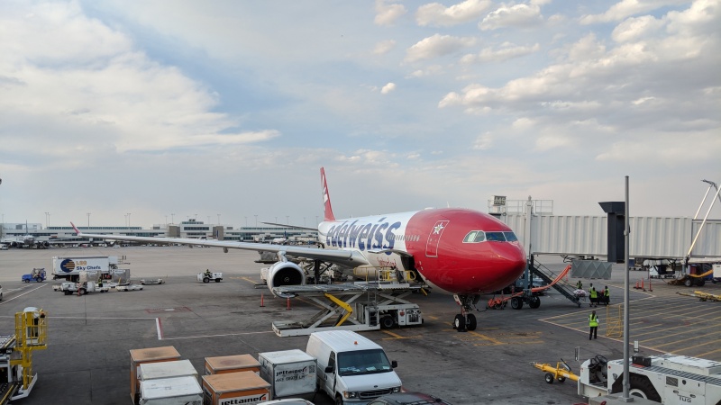
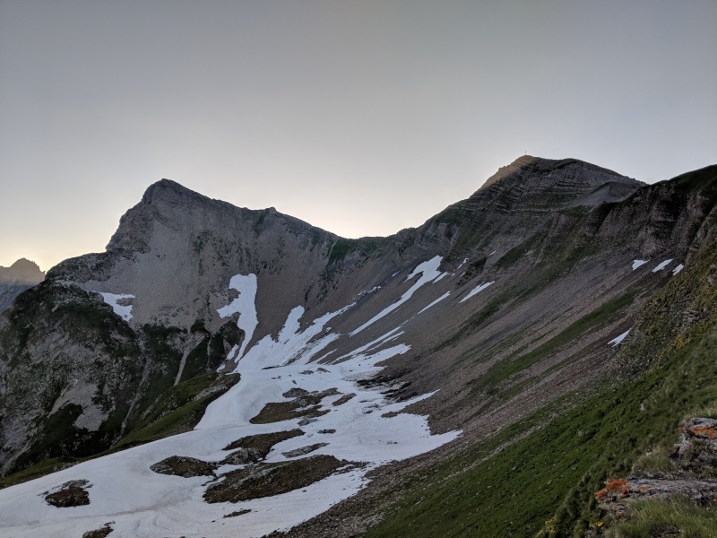
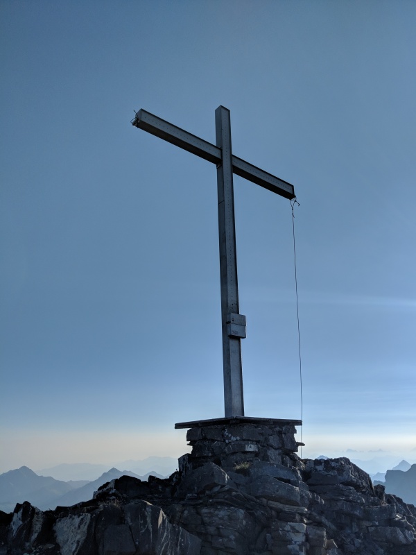
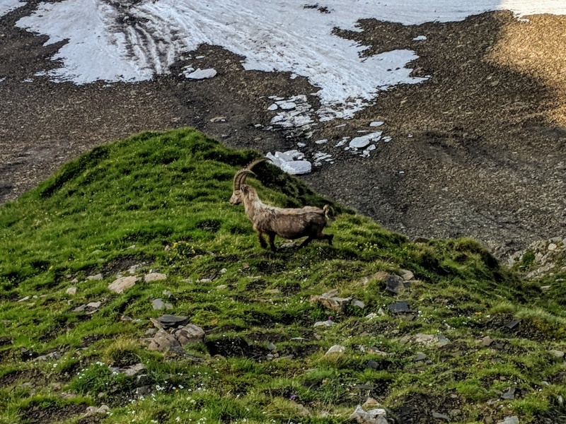
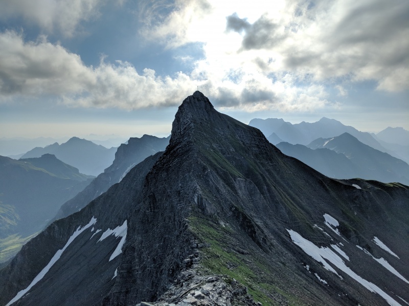
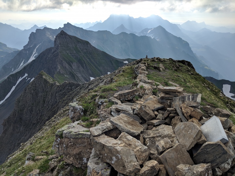
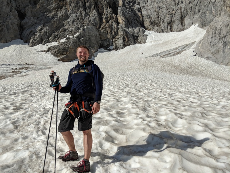
The flight from Denver to Zurich was excellent. I got moved up to economy max just for asking the baggage agent at the desk nicely if it was available, which had lots of leg room and free wine. I was able to sleep for about 4 hours on the flight and arrived at Zurich about an hour late. After getting through customs, which was surprisingly not as efficient as Iceland, given the Swiss's reputation, and picking up my car, a Volvo V40 station wagon, I was off to my first stop. Made it to the Älplibahn gondola without any problem. The people who worked there seemed almost surprised that I showed up without a reservation, and had no issue with me going up that afternoon, as the morning is the busy time for them, but said that if I wanted to ride the gondola down, that the only open reservations were the next morning, as descent trips were booked up in the afternoon. No issue, I wanted to be down in the morning anyway, so I paid my 18 CHF, made the morning reservation, and took the ride up. It was a beautiful afternoon, and I felt pretty good considering the jet lag. The route was mostly a road-walk, going over a pass, and then down into a valley before going back up to the trailhead. It felt like I was walking around in the sound of music, except there were electric fence lines everywhere to keep the cows corralled, so no frolicking in the greenery for me. I made good time, getting to the final ridge just before sunset. I didn't really want to summit in the dark, so instead, I chose to bivy up high on the ridge, and climb the next morning at sunrise. The morning came, and I started up, having more issues with the dewy grass than the rock scrambling. Made quick time to the top of the Hinter Grauspitz (Schwarzhorn), where I signed the register at the giant cross, then started the ridge traverse towards the Grauspitze. Here again, the dewy grass made things a little harder than they should have been, and some of the rock was flaky, but eventually, I got down to the saddle and got to see three Ibex along the way. The climb from the saddle to the Grauspitze had better rock, and the sun had evaporated some of the dew, so it went easily, and again I found another register, but this one went back further to the '90s and looked like an Ibex had munched on it. 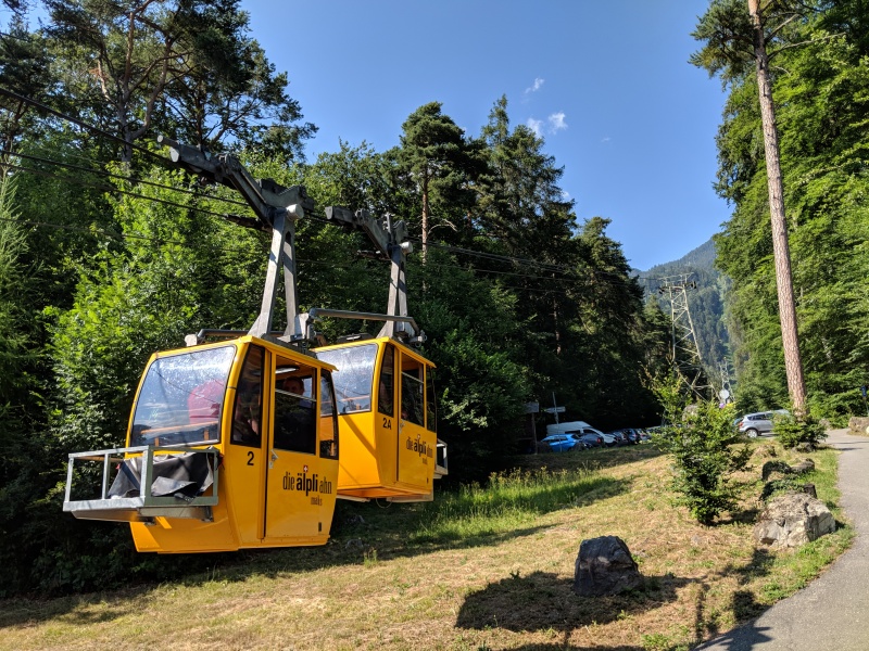
After hanging out at my car, switching clothes, I started heading towards Vaduz. Since Liechtenstein doesn't have an airport or any passport control, the only way to get a passport stamp is to visit the tourist center and pay 3 euros for an official tourist stamp. After getting my stamp, I headed towards Austria, briefly stopping at a gas station on the Liechtenstein side of the border to get an Austrian highway permit. Austria, like Switzerland, requires people to pay for a highway permit sticker, but since my rental car was from Switzerland, it already had the Switzerland highway permit. I was still a little sleepy, but I made my way all the way to Garmisch-Partenkirchen, stopping briefly to admire the clouds over the Zugspitze at a tourist restaurant along the highway. After getting to Garmisch-Partenkirchen, I started looking for somewhere to get some food before backpacking up the first part of the route, and to my dismay, it seemed like the two grocery stores in town were closed for the day. I stopped off at a gas station, got some German pretzels and some other junk food snacks since they didn't have much to choose from, and headed towards the trailhead. The normal trailhead parking lot (47.468255, 11.040721) required paying a daily fee, and me being cheap, found a free street parking spot about a half mile away. I quickly repacked my bag and started out towards the Hammersbach trailhead. I was fighting fatigue but made good time along the river and up to the Höllentalklamm hütte. Since I got there after-hours, there wasn't anyone else there in the gorge and had the entire place to myself as I hiked through. After making it through, I made it to the Höllentalanger hütte just before sunset, and set up my bivy sack and ate my convenience store dinner while watching the light fade, then passed out. 
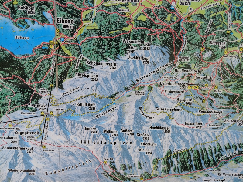
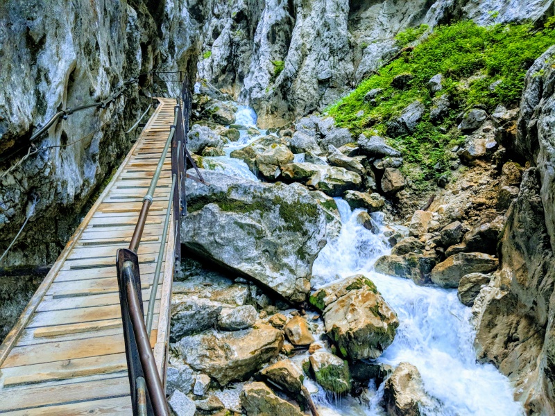
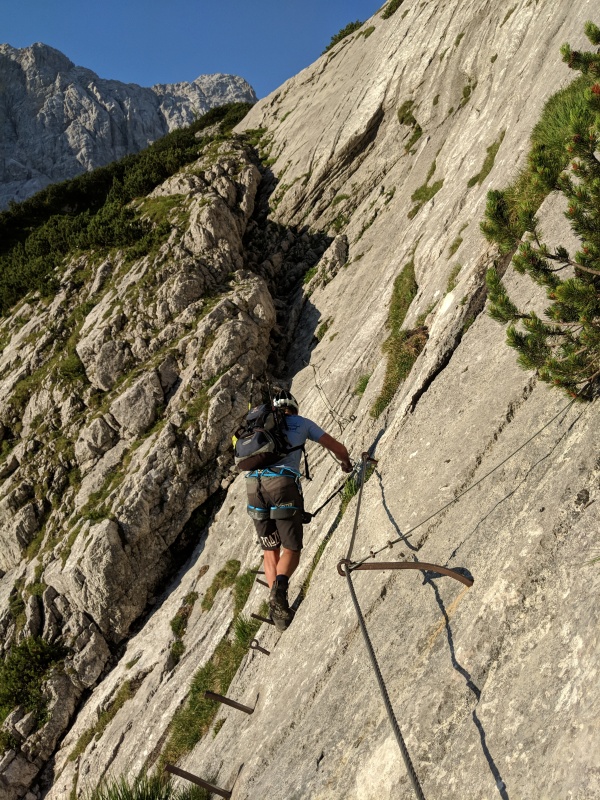
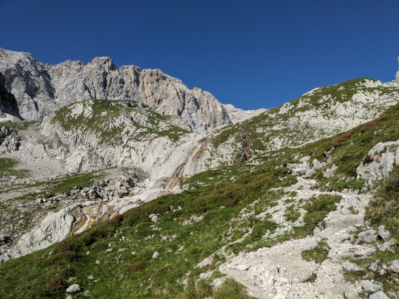
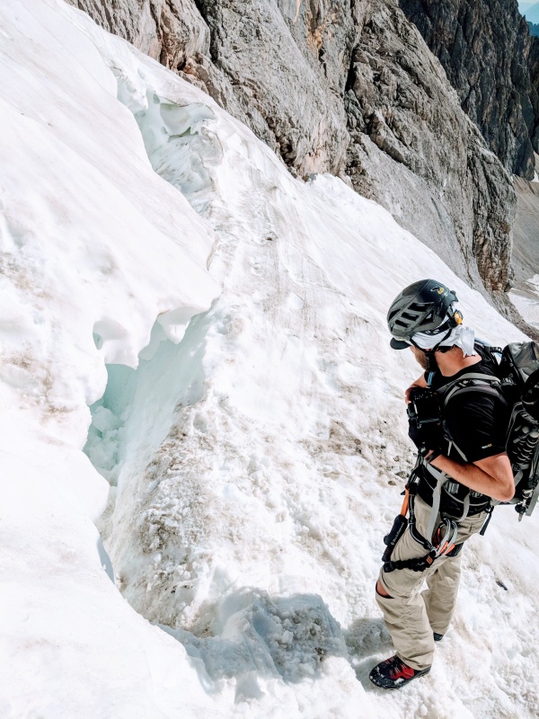
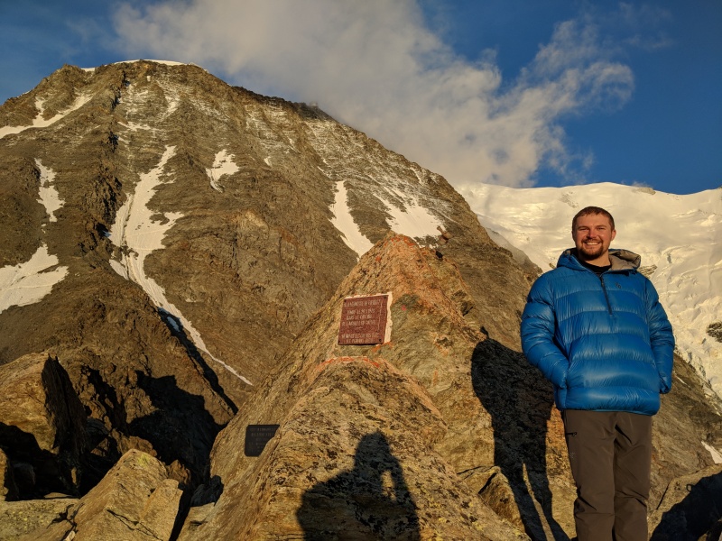
Morning came early, and I had a big vertical day, so I got up before sunrise and packed up quickly. I stopped briefly at the Höllentalanger hütte, which was very nice, used the bathroom, and continued on. There's 5000 feet of gain from the hut to the summit in around 3 miles of horizontal, distance, so I figured the earlier the better. I was greeted with some fantastic alpenglow but was in the sun the rest of the day. Near the end of the valley I hit the first section of Via Ferrata and cruised up the iron, which then went back to more of a trail. It was very hot on the route, but eventually it passed next to a creek, where I filtered a little water and soaked my shirt to get a little evaporative cooling. After leaving the creek, I started hiking next to a German named Marcel. I started talking to him, and his English was very good, where my German was limited to a few phrases like hello and thank you. As we neared the glacier crossing, I asked him if he had brought anything like a snow axe or spikes, and he said no, his wife had done the same route the day before and told him the snow was in good shape. Sure enough, the snow was firm with a soft top layer and was easy to kick steps into. The snow also wasn't too steep, so I left my microspike in my pack and just booted up it with my trekking poles. Near the end of the snow was the first and only bottleneck, a 30ish foot vertical section of via ferrata that would have been mid 5th class climbing if it wasn't for the iron cable you could pull on. After waiting for the short bottleneck to clear, I got my turn and made it up easily, and continued on the via ferrata, which was mostly 3rd and 4th class climbing with 5th class exposure. Marcel ended up having a similar pace, and since we were both solo, we decided to stick together and he told me about himself and some of the other climbs he had done in the area, including Jubilee ridge, which was visible to the south. After the fact, I could have easily climbed the entire route without the via ferrata lanyard, but it was nice to have when the exposure was significant. I actually found the via ferrata to be a lot of fun, since you're doing more rock climbing movements, but you're not having to be on belay and you're moving quickly. We hit the summit around 10:30, marking my second country highpoint in under 48 hours, and 12000 feet of gain since touching down. 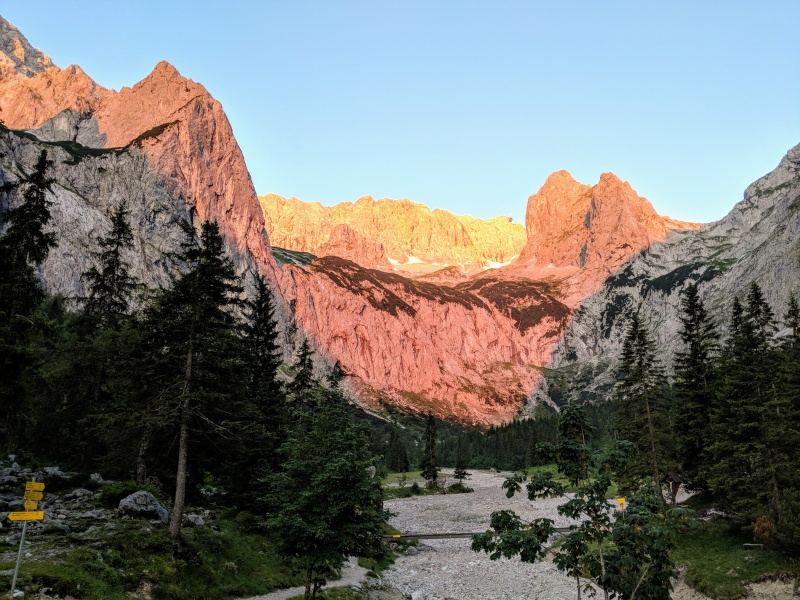

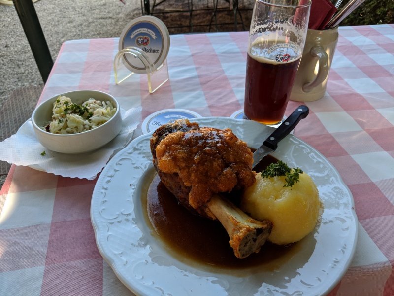
Luckily, getting down the Zugspitze is pretty easy if you want it to be, with multiple gondolas serving the summit from the Austrian and German sides, and took the German gondola to Eibsee, which is apparently the longest free-span gondola in the world and dropped over 6000 feet in a few minutes. From Eibsee, I was able to take the train back to Garmisch-Partenkirchen, which was included in my gondola ticket, and walked from the Bahnhof Grainau train station back to my car. At this point, I checked the weather and it wasn't looking like much had changed. The weather over the high central Alps of Austria and Switzerland looked unsettled and stormy and didn't look like it was going to clear up for a few days. I decided that the best option was to switch to tourist mode, relax and rest, and keep an eye on the weather over in Chamonix. I went to the public pool in town, hung out for a few hours in the sun and washed up, and got dinner at a local restaurant that served me something I didn't understand but ended up being a leg of pork with some coleslaw and a dunkle bier. I drove back into Austria and found a good car camping spot on the side of the highway to pass out. 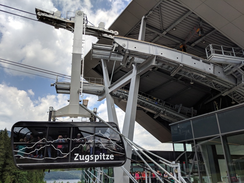
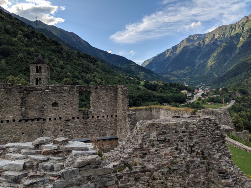
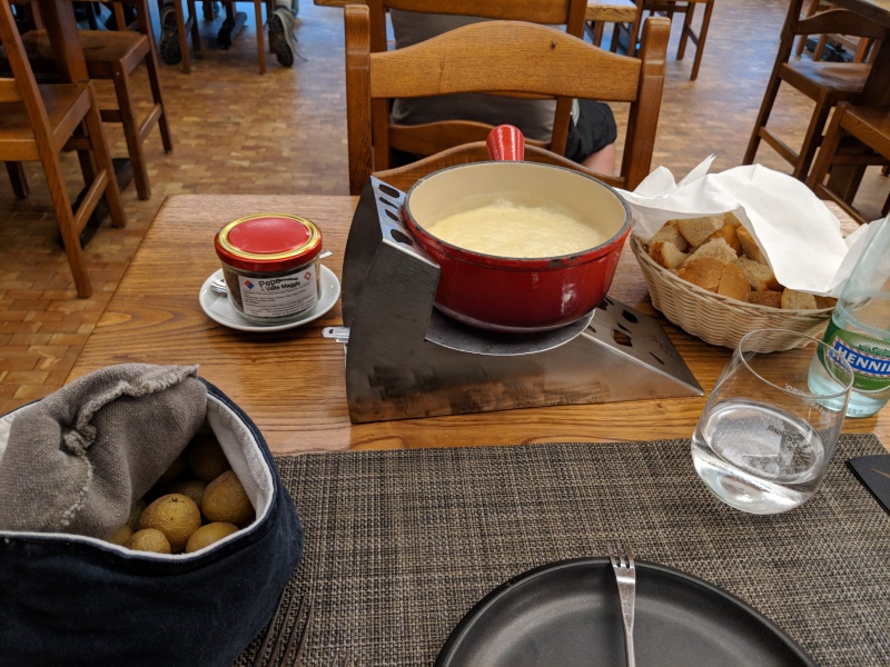
I had 4 days to burn before the weather started to shape up, so when I woke up, I started planning my route. Swiss National Park was directly south of me, and I would have to pass through Italy briefly before going back to Switzerland, so I decided that would be a good first stop. There were a few interesting looking peaks, including Piz Daint, and the weather was still decent that morning, but the jet lag exhaustion hit me hard that morning, and I couldn't muster enough motivation to pack up my daypack again and hike, so instead I just took a brief nap and enjoyed the scenery as I drove through. The only 4000-meter peak this far east was Piz Bernina, and I figured I'd try to sneak in a peek at it, but the weather was spitting sleet as I drove the Passo del Bernina road, and ended up going back down and driving through the resort town of St Moritz. I tried to drive north from the town of Silvaplana, but the road was shut down due to construction and my only way was to drive back the way I had come, or drop down into Italy again, and drop it did, going all the way down to 1300 feet in Chiavenna before climbing back up to 7500 feet at the Swiss Italian border along a very twisty one lane road. It continued this way, down from one pass, up another, but at least in Switzerland the roads were a little better maintained. There were several medieval castles visible along the route, and I stopped at the roadside one called Castello Di Mesocco, which was empty so I hopped around the stone walls. Eventually, I made it to Airolo, where I found a fun little cheese shop that served fondue for dinner. I was starting to crash, so I drove up to San Gottardo pass and fell asleep. 
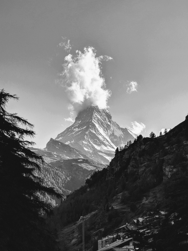
The next day was more of the previous day. I still felt jet-lagged, although not as badly, and didn't feel too motivated to do much. My sleep schedule seemed to be correcting, as I felt more like my normal self instead of wanting to sleep all day. I started to get into the high central Alps of Switzerland as I drove through Andermatt and stopped to see the Rhone Glacier. They have a glacier walk, but the only way to get to it was to pay admission through a random tourist hut. Turns out the reason why they were charging admission is that the same family that owned the hut was cutting the tunnel in the ice, but also were trying to control access to the glacier too. I didn't care much to go through the glacier tunnel, but I wanted to see the glacier and the mountains behind it, so I drove to the next hairpin turn and hiked across the tundra below to the edge of the glacier lake and the glacier, avoiding the whole thing. From there I started heading towards Zermatt, finding some free parking in Täsch near the trailhead for the Weisshorn hütte. The train quickly zipped me up to Zermatt, and I checked in to the only hotel stay of the trip, the BW butterfly (since I could use points to book it). I was very lucky, as they had a great room on the top floor available. After dropping my stuff, I headed out to go hiking along the Zmuttbach. I never saw the full summit of the Matterhorn, as it was cloaked in clouds most of the day, but it did clear up a little near the end of the day when I got back to town. I decided to go to bed early and hike up to Hörnli Hut first thing in the morning for nothing more than just to see the area, but the weather different ideas. 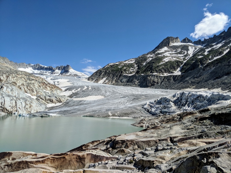
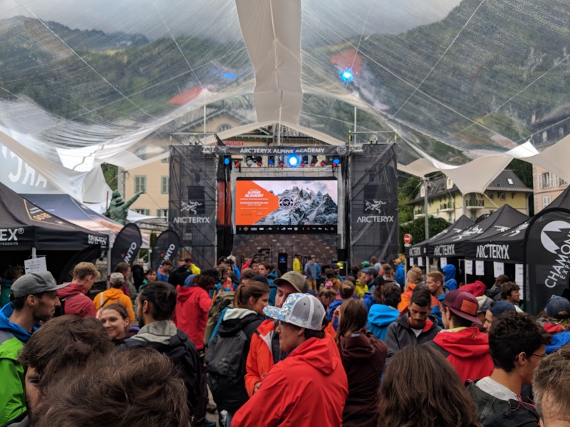
Halfway through the night, an enormous thunderstorm hit Zermatt, waking me up and shaking the town, and when I woke up in the morning at twilight, the low cloud deck and continued rain flattened my enthusiasm to go hiking anywhere since there wasn't anything to see. I headed back to Täsch on the train and made my way to the drier region around Sion. In Sion, a hill in the middle of the town held another large medieval fortress called Château de Tourbillon that I toured around, and then headed over to Chamonix, hitting sleet and rain as I drove over the Swiss/France border. The weather report was showing that the next day would have more of the same unsettled terrible weather, but Saturday looked perfect, with the clouds and rain lifting late on Friday night. As I came into town Thursday night, the clouds lifted momentarily and I could see the long glacier tongue of the Glacier des Bossons extending down the mountainside before another round of rain hit, and I found shelter and good beer in the Micro-Brasserie de Chamonix, a Canadian microbrewery that ended up being my go-to while I was in town. As I drove in, an advertising board said something about the Arc'teryx Acadamy event in the main city square, and since I had nothing better to do, I went to go hang out and watch them kick off the event, plus there was a gear store nearby so I could get a small can of stove fuel for Mont Blanc. After that, I made my way down to Saint Gervais Les Bains to find somewhere to park and crash for the night. 
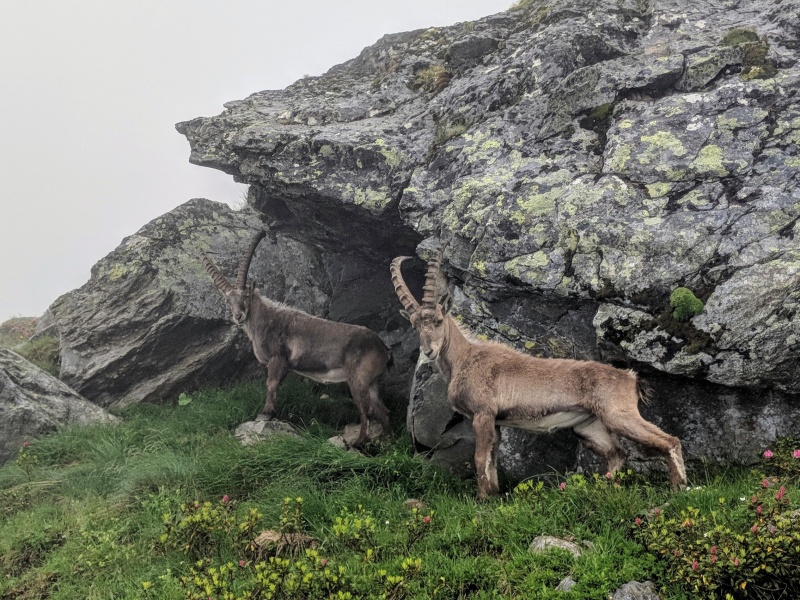
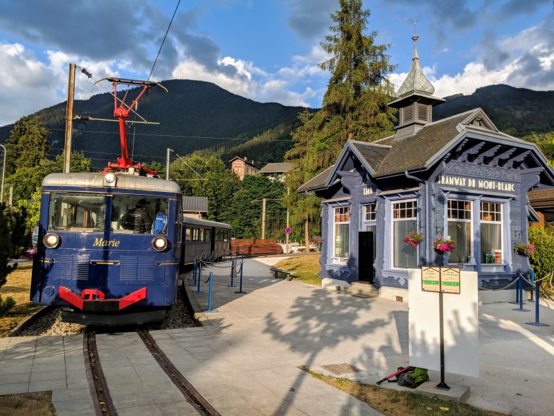
Finally, the big day had arrived, and the weather report was still looking good for Saturday. After a quick stop at the grocery store (which opens pretty late by USA standards), and getting my gear together for a night at Tête Rousse, I headed towards the train station. After packing everything up in my little Patagonia ascensionist pack again, I set off to get onto the train. The train (Anne - Tramway du Mont-Blanc) normally goes all the way to Nid d'Aigle at 7800 feet, but for some reason, the train wasn't going all the way, stopping at Mont Lachat at 6800 feet. It seems like most of the people that got off at Mont Lachat followed the train tracks up to Nid d'Aigle, I followed the standard path on the north side to Baraque des Rognes, which had several very sketchy crossings because of the way the snow had formed in the gulleys in June. At no point between when I left the train to Baraque des Rognes did the clouds give me more than 20 feet of visibility, so I was very surprised when I found two ibex's hanging out right next to the trail. After getting to Baraque des Rognes, I continued up to Tête Rousse at 10400 feet. Apparently, camping on Mont Blanc is forbidden except at Tête Rousse, so even if I had wanted to camp higher, like at the Refuge du Goûter hut, it wouldn't be allowed. I couldn't actually see Refuge de la Tête Rousse till I was around 30 feet away, but when I saw it, I went inside, delayered and enjoyed the dining room. As I stepped out onto the back deck, the clouds started to lift, and within 15 minutes of arriving the mountain had cleared. Glacier de Bionnassay crawled down the mountainside in front of me, and the Grand Couloir could be seen just above the hut, where most accidents happen because of rockfall. I exchanged a few euros for some chocolate, used the bathrooms, and went back outside with my gear to set up camp. There were lots of people at the camps, but the only other Americans I saw were inside in the refuge. I spoke with some Brits and Serbians, and everyone seemed like they were going up early the next morning and were seeing the same weather clearing I had seen. I called it a night around sunset and woke up in the dark the next morning to start the climb. 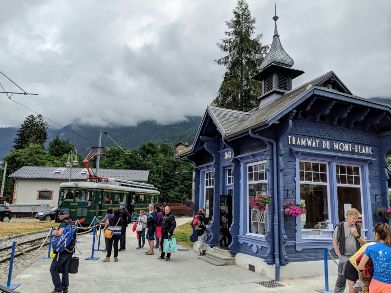
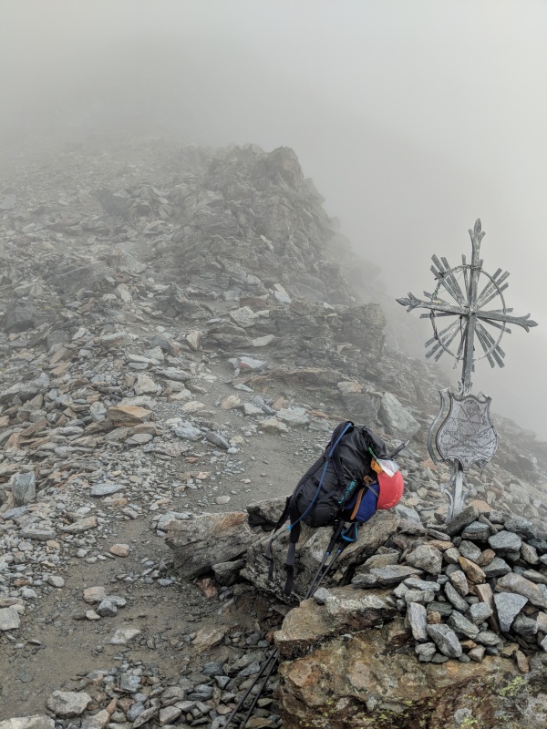
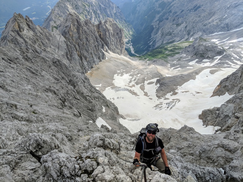
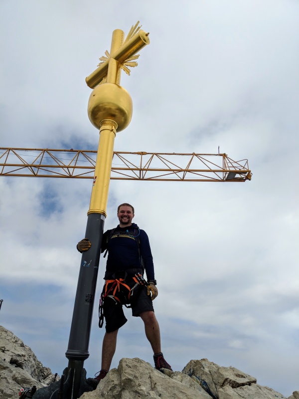
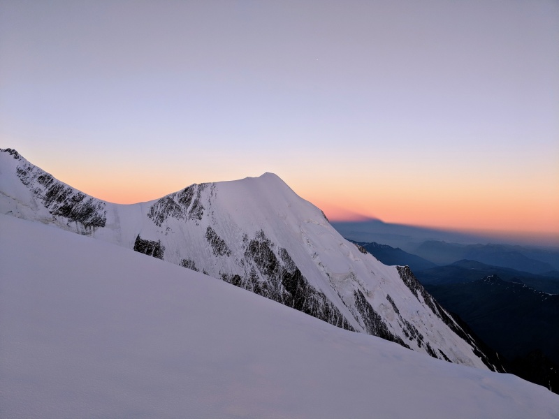
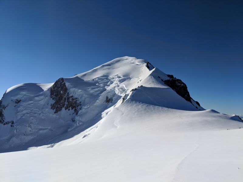
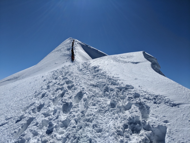
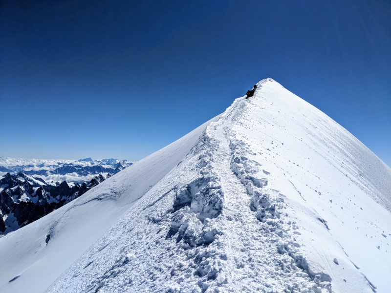
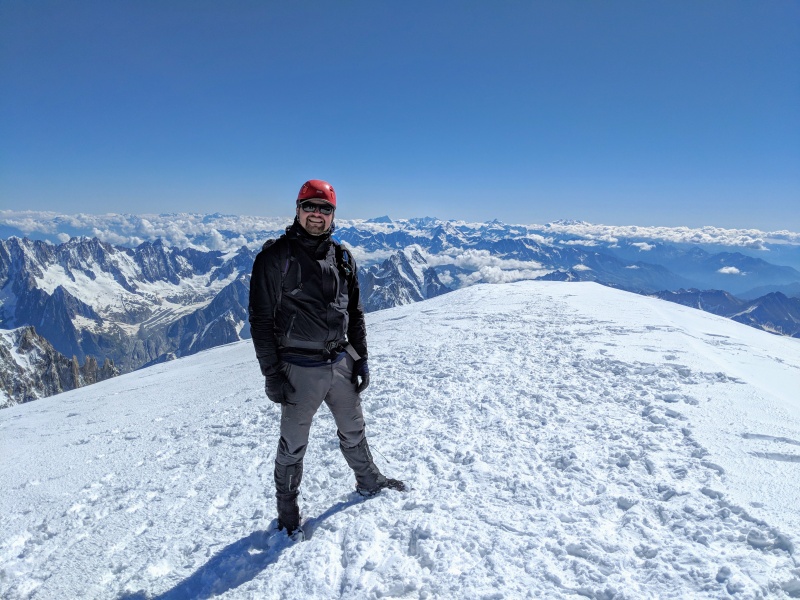
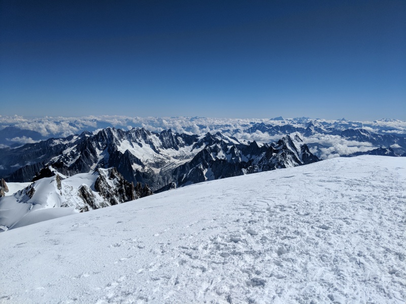
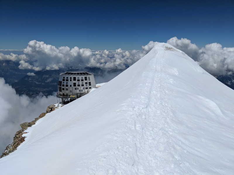
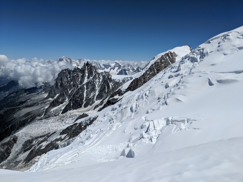
The next morning, the climb through the Grand Couloir was a shit show. A group of French climbers decided to climb the left side of the Couloir instead of the standard route on the right side. This, of course, sent rocks straight down the gully. I ended up getting to the couloir crossing at the same time as the Serbians I talked to the night before, and we all hustled across quickly, hoping that one of the rocks the French group let loose wouldn't hit us. After we all made it across, my headlamp suddenly went dark. With all the preparations I had made back home before the trip, I had forgotten to check and change the batteries in my headlamp, but luckily there was about a half-moon in the sky, so I scrambled up the route by moonlight and occasionally used my cell phone light, guided by the occasional cairn or cable. Eventually, I got up to the same level as the French group on the other side of the gully, shouted at them in English calling them idiots, which made me feel better and continued on towards the top of the Grand Couloir. The sky started to turn from black to blue as the twilight started, and I made it to the old Refuge du Goûter (~12500 ft) just as the sun was about to rise. From there, it's just a snow slog to the top of Dôme du Goûter, crossing two small crevasses along the way, and then onto the high hut of Refuge Vallot (14,250 ft). Refuge Vallot is supposed to be an emergency shelter, but by the looks of it inside, it seems like people use it regularly, no doubt in part to the camping restrictions on the mountain. I took a small break here, checked out the inside of the hut, and then started up the final climb. The final climb is on a pretty narrow ridge with steep sides on both sides, and you can see all the way down to Chamonix 11,000 feet below. The ridge also forms the French/Italian border, so on the other side, which seemed even steeper, you could see down the valley that would eventually lead to Entrèves. There are three false summits on the way to the top, and especially the last one was bad since I got very excited that I was at the top only to see that the top was still ahead. Finally, I made it and enjoyed the summit views. Off to the east I could see the high peaks near Zermatt, with the Weisshorn and Monte Rosa dominating the skyline. I snapped a few pictures, looked down onto Chamonix, now over 12,000 feet below me, and even it being so far below, I could still make out the track and basketball courts near the Canadian brewery I stopped at on Thursday night. 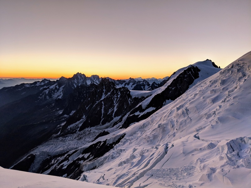
I started down, being very careful with my steps. Eventually I made it off the ridge and back to Refuge Vallot, taking a quick break there before heading over towards Dôme du Goûter, and then back down to the Goûter refuge and eventually back to the Grand Couloir. At the top of the grand couloir, I took off my boots, wrang the water out of my socks to try to dry my feet a little, and then headed back down the rock below. This time when I had to cross the gulley, I had found a crossing a little higher up that seemed shorter, and was able to run across and avoid any rocks. I checked my watch after packing up my camp at Tête Rousse, and realized I only had about an hour and a half to make it back down to Nid d'Aigile, and my feet were already tender from the 10,000 feet of elevation change I had already done that day in hard boots, but I toughed it out, jogging down the rocky path in my mountaineering boots for another 2600 feet of descent, making it back just in time to catch the Marie train car back down to Saint Gervais. I decided to head back over to Chamonix, got a beer and watched a world cup soccer match at the brew pub, and got a shower at hostel Chamoniard Volant for a few euros before finding a place to park and crash for the night. 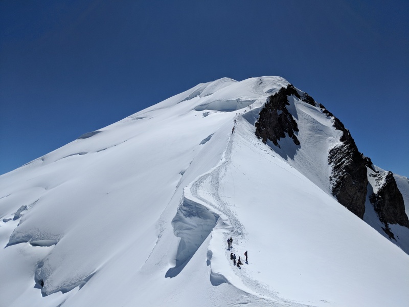
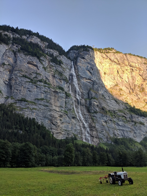
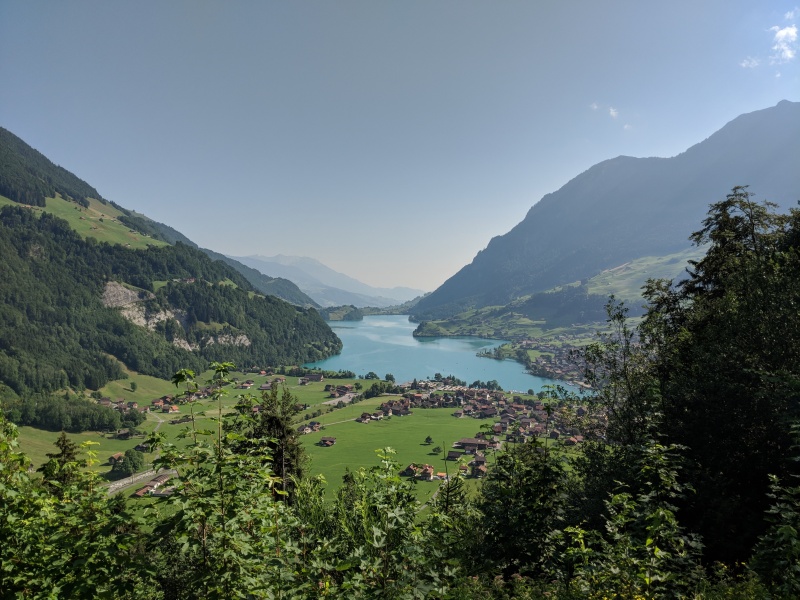
The next day I decided to sleep in, waking up in time for a late breakfast of cheese and baguette bread and walk around downtown Chamonix to see the shops and find a few souvenirs. I still had two full days before my flight Monday evening, so I decided to take the scenic route from Chamonix to Grindelwald, with an excursion to Gran St Bernard Pass. The mountain road between Aigle and Interlaken was a lot of fun to drive with the Volvo, but as I started driving from Interlaken to Grindelwald, the clouds covered the mountains of Bernese Oberland in front of me, hiding the Monch, Eiger, and Jungfrau from view. I was tired still from the day before and my feet were still feeling a bit tender, so I decided to find a good spot up on the hillside, opposite of the Eiger, and crash there for the night. Apparently, the locals don't really like tourists driving on their roads, as there were multiple signs talking about how all the roads were not allowed to be driven on, even though I saw lots of locals driving up and down. After watching this, I decided to go up one of the roads and found a nice secluded spot that would give me a great view in the morning if the clouds lifted, and checked in to my flight online, snagging another economy max seat for free, but unfortunately not a window seat since I was hoping to get a glimpse of Greenland on the flight home.
I woke up the next morning and sure enough, the cloud cover had lifted, revealing the almost unbelievably steep north face of the Eiger. After a quick drive back down to Grindelwald and seeing Stechelberg down the other road, I headed back to Interlaken and drove back to Zurich. Since I had plenty of time before my flight, I toured downtown a bit, enjoying some chocolate and picking up some chocolate souvenirs for friends. I had lounge access at the Zurich airport (the aspire lounge there is really nice), so I got there a little early, took a shower at the lounge, had some food and drinks, and got ready to board my flight. The flight home was uneventful, and to kill the jet lag, I decided I would stay up the entire flight since it was landing in the evening in Denver too. Customs in Denver was quick and easy, and I made it home just before exhaustion kicked in. 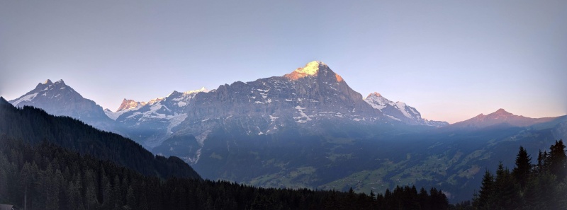
Some things to be aware of: Thumbnails for uploaded photos (click to open slideshow): ")
")
")
")
")
")
")
")
")
")
")
")
")
")
")
")
")
")
")
")
")
")
")
")
")
")
")
")
")
")
")
")
")
")
")
")
")
")
")
")
")
")
")
")
")
")
")
")
")
")
|
| Comments or Questions | ||||||
|---|---|---|---|---|---|---|
|
Caution: The information contained in this report may not be accurate and should not be the only resource used in preparation for your climb. Failure to have the necessary experience, physical conditioning, supplies or equipment can result in injury or death. 14ers.com and the author(s) of this report provide no warranties, either express or implied, that the information provided is accurate or reliable. By using the information provided, you agree to indemnify and hold harmless 14ers.com and the report author(s) with respect to any claims and demands against them, including any attorney fees and expenses. Please read the 14ers.com Safety and Disclaimer pages for more information.
Please respect private property: 14ers.com supports the rights of private landowners to determine how and by whom their land will be used. In Colorado, it is your responsibility to determine if land is private and to obtain the appropriate permission before entering the property.