| Report Type | Full |
| Peak(s) |
Grizzly Peak - 13,997 feet Garfield Peak - 13,778 feet |
| Date Posted | 07/04/2018 |
| Date Climbed | 06/30/2018 |
| Author | E_A_Marcus_949 |
| Additional Members | TwoMeterTrophy |
| Grizzly & Garfield - 12 feet short of crowds |
|---|
|
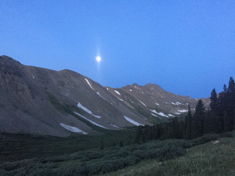
Saturday June 30, 2018 - Grizzly Peak East Ridge over to Garfield then descend and go back to TH
 Upon arriving at the gate/upper TH, we expected to be the only ones there, but someone else had driven up from Denver the night before and was just getting up. Hopefully we didn't wake him while we were getting ready to head up the trail! I am not the quietest when we reach a trailhead because I am way too excited to start climbing. Maybe I should reign this in a little if there are other people that may be asleep around... Anyway, it turns out Terry wasn't far behind us most of the morning, and we met up with him partway up Grizzly and continued the day with him. He was a great climbing partner - lots of experience and there for the joy of it. Anyway, back to the start of the day - shortly after starting past the gate, you won't go far before leaving tree line and entering into the start of the basin. Lots of good opportunities for sunrise behind La Plata and Ellingwood Ridge (turn around) and seeing the morning sun on Garfield and Grizzly. 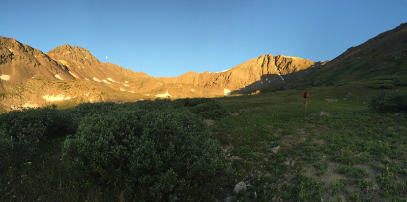 Soon you'll come across the mine, which means you're just about out of road (trail) and will need to start angling up the slope and going for the goal - Grizzly. There's a lot of old mining equipment strewn around up here. 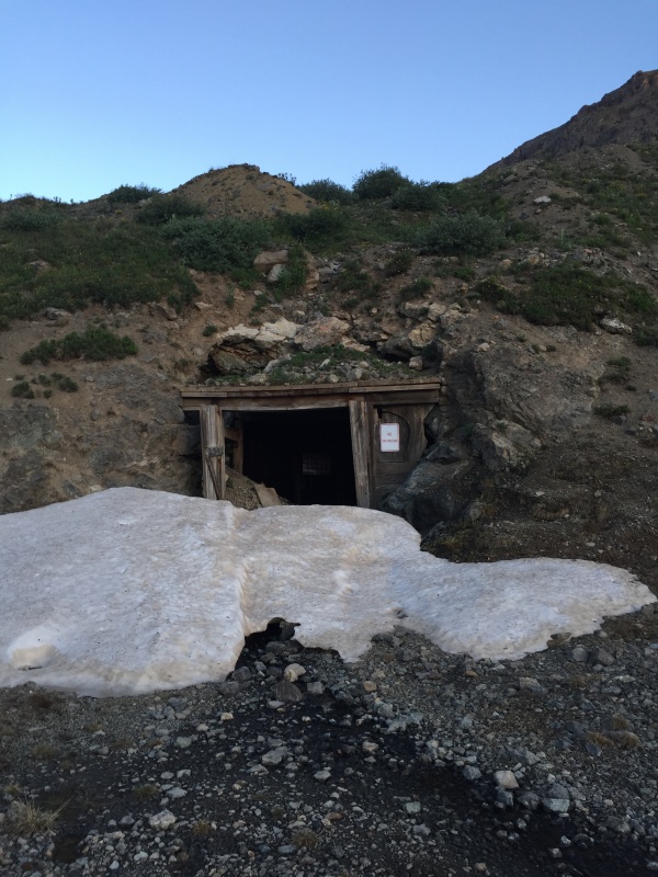 There are a few ways you can angle up the slope to gain the ridge on Grizzly. I only had some blurry screenshots of the route photos (you know, one of those "here are all the photos that can fit on one screenshot" images) and the description itself. We did our best and angled up and worked our way with the elevation guidelines. We found a trail and followed that some in the basin and angled up the slope. But then the trail turned nasty and loose, so we just angled on up to the ridge. Terry was steadily behind us and caught-up when we were just about to the ridge. Below is the approximate route we took. Photo from summit of Garfield. 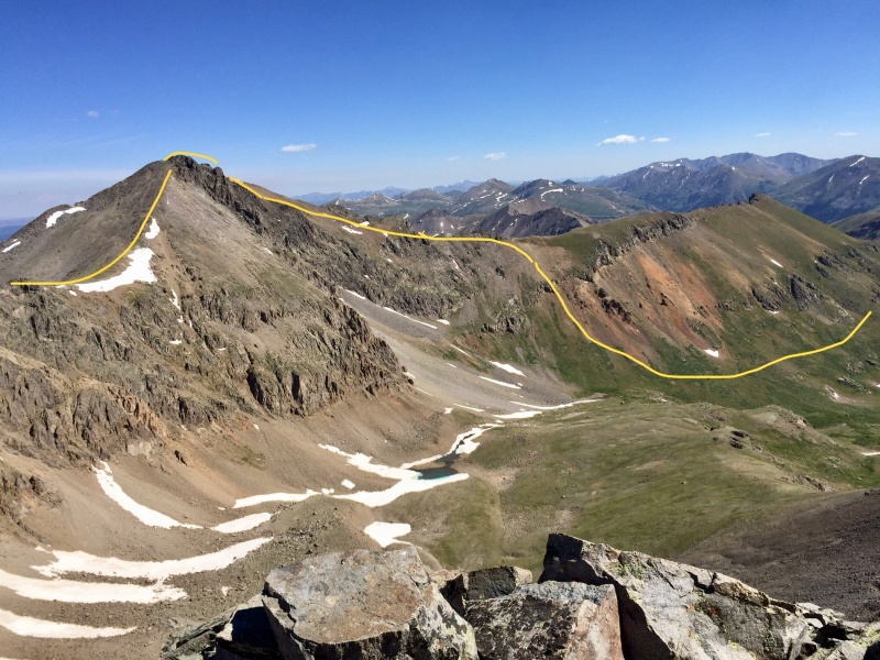 We went to the left of the red rocky out droppings then went essentially straight up. It's loose. It's steep. We saw some mountain goats and marmots. Then some more steep rocks and maybe some fun class 2+ hopping. 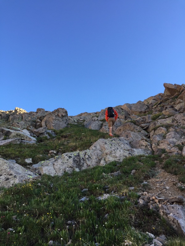 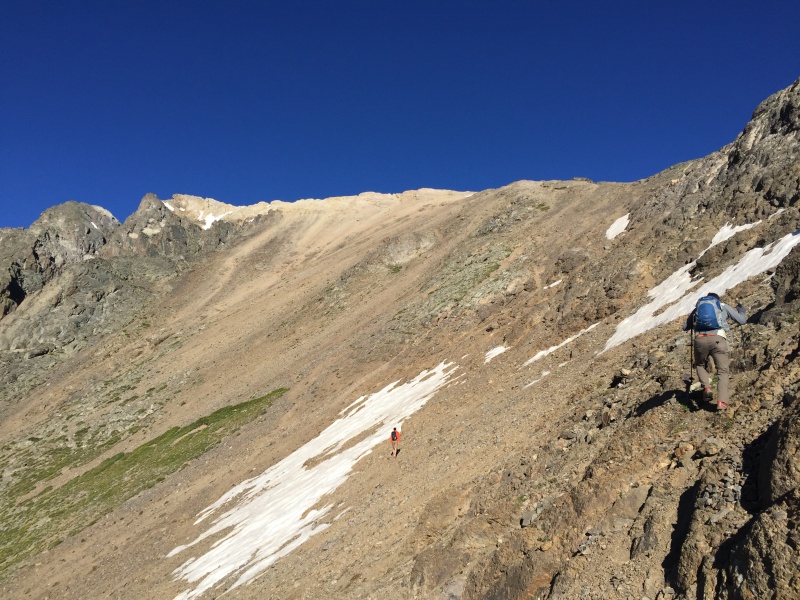 The above photo and below are similar areas. We essentially went straight up from here. I'm not sure if that's the appropriate route, but that's what we did. It was a lot of elevation gain in not much distance seeing as we went up..and up.. and up. We were the only 3 out there today, so it was very much "choose your own adventure". After coming down from Garfield and seeing the full route, I'd be tempted to have gone lower in these sections and angled up from the grass area to the ridge. It'd have saved quite a bit of slippery scree. It was about this time I was really regretting forgetting my trekking poles in my car in Leadville. They'd have been much more useful than my hands at certain points gripping the scree. My long-legged partners, one of which did remember his trekking poles, seemed to be doing well and moving quite gracefully. I was not graceful going up this, but I made it. It was helpful to use some of the sturdy rock and go up those rather than the scree. Again, pick your own adventure! Once you gain the ridge, admire the views on the other side. There are some gnarly ridges on the other side that are fun to look at and day dream about... as well as the ridge you're on and summit aiming for! It's a great opportunity to grab a quick snack and re-up on the sunscreen. From here on out you're above 13k until the descent of Garfield, so don't get burned! I'm usually in that group of folks that forgets sunscreen and burns... Saturday was not that day - I not only remembered to apply it, but reapply it! Emily: 1 / Nature: 0. It was about this time I realized my layers, apart from a beanie, were also in my car with the trekking poles. My gloves will hopefully keep me warm in the wind without an additional layer! Emily: 0/ Nature: 1. The wind did get a bit stronger up on the ridge proper over to the summit, but it wasn't debilitating and easy to have some "mind-over-matter" in this situation. Ok, the wind was typical ridge wind. It wasn't bad. I was certainly well-enough prepared, it can just be a bit irritating when 1:30am Emily packs everything in the car but then 3:30am Emily proceeds to forget said items. 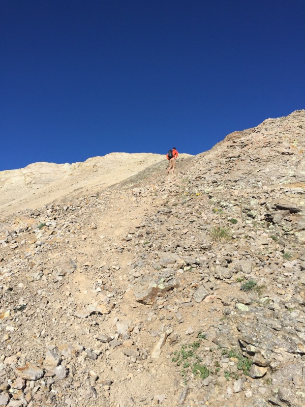 Once you gain the ridge, you'll still have some more dirt to climb up before you turn to the summit. From there it's a quick jaunt over to the summit.  Trevor and I took the low road; Terry took the high road. The next photo is taken looking toward the summit - the one last minor challenge before summitting. We all made it at similar times. Ok, that's a lie. Terry made it first. Trevor waited for me and my slow-going legs up the ridge, and then he summited with me close behind. 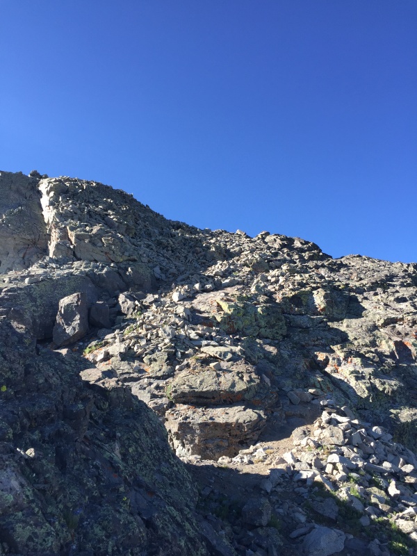 And we made it! 12 feet short of glory. 12 feet short of crowds. 12 feet short? Nah. I say 12 feet short of nothing! Grizzly is wonderful. It has a little bit for everyone, and the fact that it's 13,988' makes it more desirable. If this were a 14er, the road would be worse. The trail would be crowded. We wouldn't have seen deer frolicking in the basin. The mountain would be eroding. And the mountain goats with their babies would not have been comfortable there. All in all, 12 feet short of 14,000' is nothing - it's just as it should be and magical all on it's own. We took a decent break on the summit. We all chatted and got to know each other, how many 14ers/13ers we've done, favorites/least favorites, etc. I also took this opportunity to munch on some gold fish. Like I said in my first trip report, it's the best summit snack - try it, and you'll never go back. We also took a lot of photos and studied our next goal - Garfield. 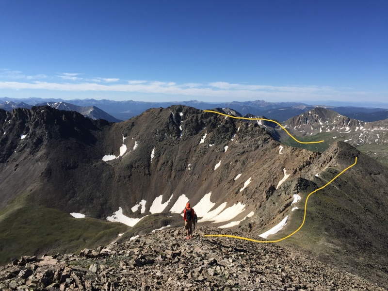 The yellow lines I do are not the most accurate, but they are approximate - which is hopefully helpful. Going around the first bump is straightforward. There's a nice trail. Even partway past that, it's straightforward. Then we lose the trail. And by that I mean the trail disappears. So we "gain the ridge" per the route description. At this point, I was in the back of the line, so I was following Trevor and Terry. They were doing well with route finding and finding some stable rocks, so I followed suit. 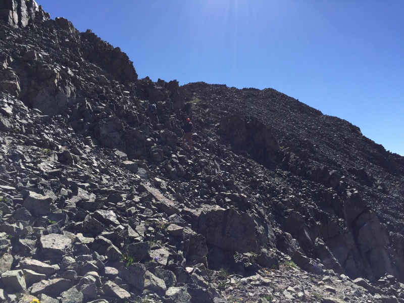 The climbing here is about 2+ up to the ridge. There is some exposure and a fair amount of lose rock, but there is nothing to worry about. Careful foot placement and route-finding is all you'll need. Do take some glances (or some long ones instead of 'breaks') to admire the surrounding basins on this side of the mountain. Each one has its own lake. The mountains are all different and worth admiring. Then you can look back up to your ridge goal and move on. The summit of Garfield was small, but there is a summit register! We all signed it as we admired the traverse, basin, and the route we took up Grizzly. We could see people on Elbert and La Plata from this summit as well. Everyone on those summits did not have a whole basin to themselves, nor did they have the enjoyable conversations and day we did. This is why we do 13ers and those "short of glory". That's not to say we haven't all climbed La Plata, Elbert, and the other surroundings 14ers, but there's something different about a 13er. The wind died down on Garfield too. It was calm. The skies were clear. The sun warm. Perfect chance to eat my PB&J and some more gold fish. After talking some more, taking photos, and planning our route down Garfield (no way were we going back across Grizzly to go down that slope), we strapped on our packs and went down. This is the section where there is one fairly easy class 3 move. Fairly easy if you have long legs. Unfortunately, the rocks are also not the most stable, so be careful or shout "rock" if one does dislodge (I'm not saying this from experience.... she said sarcastically as she had to shout "rock" at the only two people around on this mountain). And even more unfortunately, I do not have the longest legs... This is a straight-forward class 3 move; I just got in my head. Trevor killed it with the photos of making me look more hardcore than I really am, though, so let's pretend like I didn't just talk about how I may or may not have struggled a tad bit with the class 3 move and pretend like I really am hardcore and killed it. 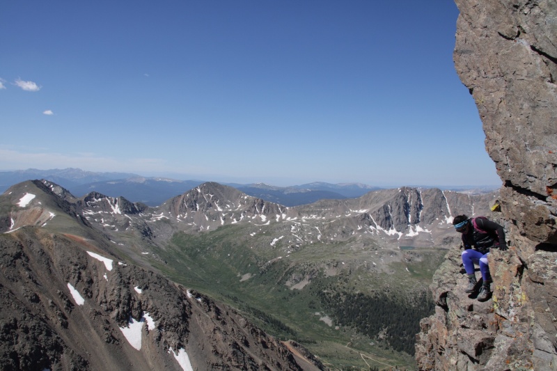 So now that the fun scramble was done (fun, scary, beautiful, insert choice adjective here), time to go. 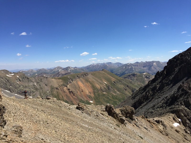 Go across and down a little scree (the "decent" scree) and pick your line. 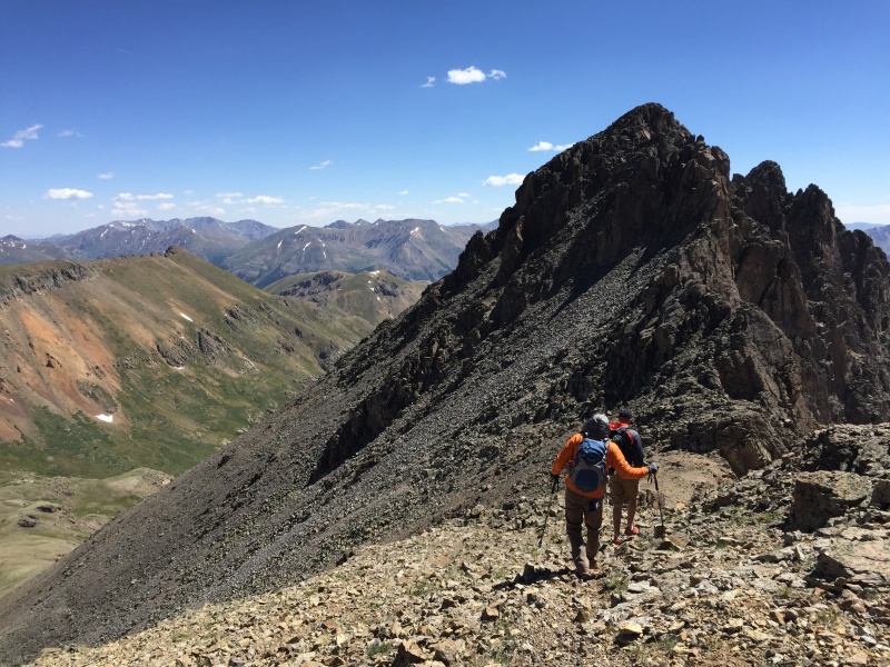 We all picked different routes to go down. Trevor angled down the whole time. Terry zigged and zagged and went down. I kinda scree-slid the whole time and picked a good dirt line and went down. There will be rocks in socks. Just embrace it. You'll build character. 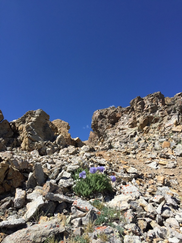 Partway down I looked up at some wild flowers. They were in full bloom in this basin, and they were so gorgeous to look at! This one made her appearance rather high on the slope, so I wanted to give her some attention. And let the rocks settle in my boots. 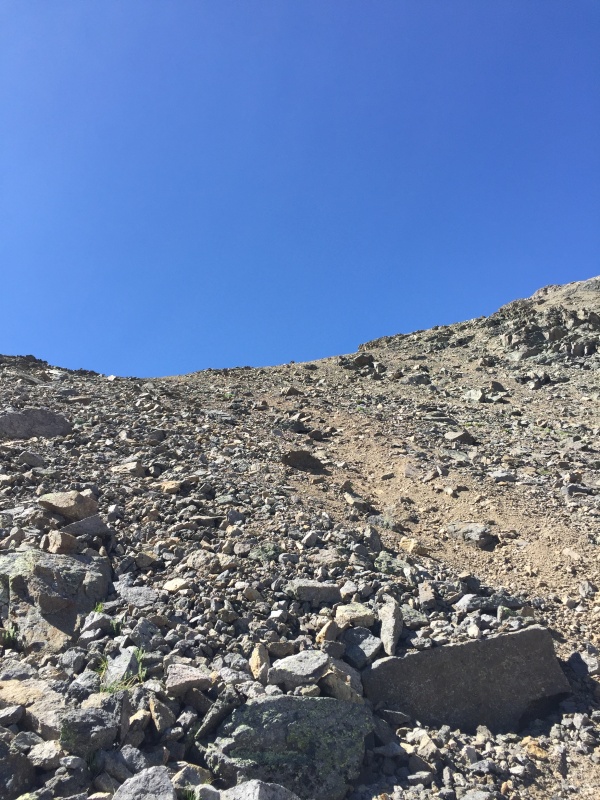 Almost down... somewhat... I looked up to see our progress. It was looking promising, but we then realized there was more rock to travel down before the green grass of the basin. The grass is always greener right? It's really not as bad as you'd expect from reading some of these trip reports. It's loose but not Lindsey, C3 on Zapata approach of Ellingwood, or Columbia loose.  Our approximate route is outlined in yellow. Again, a bit messy, but what can you do. It's a guideline not a hard-and-fast rule afterall. Happy to be back on grass with wildflowers all around, we made our way back through the basin. You'll want to aim toward Grizzly's East Ridge rather than going straight down to the trail you see far in the basin. There are a few cliffs and harder climbing. If you want to climb, I'm sure it'd be ok, but we wanted the path of least resistance. Please note that I do not know for sure if it'd actually be ok to downclimb or not and what kind of obstacles await those that would travel there. From my few moments of observation, it was a cursory glance and who really knows what kind of climbing that would entail - safe or not. 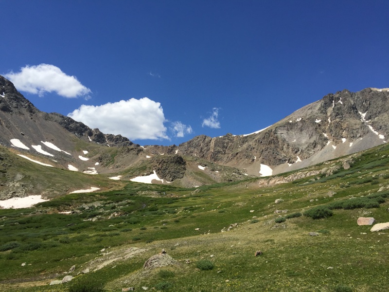 There were some clouds but nothing threatening. We saw some gorgeous waterfalls, creeks, butterflies, and flowers on the way down. It was nice to be on gentler terrain and a great way to work our way to the end of the day. Saturday was a fun day on the less traveled peaks. Once we reached the road, we only saw one other person near our cars at the gate. It was still so quiet! But the farther down the road you get (which is surprisingly easier in the light than in the dark) you'll see more cars and people - camping, La Plata, and more. Thumbnails for uploaded photos (click to open slideshow): ")
")
")
")
")
")
")
")
")
")
")
")
")
")
")
")
")
")
")
")
")
")
")
")
")
")
|
| Comments or Questions | |||||||||
|---|---|---|---|---|---|---|---|---|---|
|
Caution: The information contained in this report may not be accurate and should not be the only resource used in preparation for your climb. Failure to have the necessary experience, physical conditioning, supplies or equipment can result in injury or death. 14ers.com and the author(s) of this report provide no warranties, either express or implied, that the information provided is accurate or reliable. By using the information provided, you agree to indemnify and hold harmless 14ers.com and the report author(s) with respect to any claims and demands against them, including any attorney fees and expenses. Please read the 14ers.com Safety and Disclaimer pages for more information.
Please respect private property: 14ers.com supports the rights of private landowners to determine how and by whom their land will be used. In Colorado, it is your responsibility to determine if land is private and to obtain the appropriate permission before entering the property.


