Download Agreement, Release, and Acknowledgement of Risk:
You (the person requesting this file download) fully understand mountain climbing ("Activity") involves risks and dangers of serious bodily injury, including permanent disability, paralysis, and death ("Risks") and you fully accept and assume all such risks and all responsibility for losses, costs, and damages you incur as a result of your participation in this Activity.
You acknowledge that information in the file you have chosen to download may not be accurate and may contain errors. You agree to assume all risks when using this information and agree to release and discharge 14ers.com, 14ers Inc. and the author(s) of such information (collectively, the "Released Parties").
You hereby discharge the Released Parties from all damages, actions, claims and liabilities of any nature, specifically including, but not limited to, damages, actions, claims and liabilities arising from or related to the negligence of the Released Parties. You further agree to indemnify, hold harmless and defend 14ers.com, 14ers Inc. and each of the other Released Parties from and against any loss, damage, liability and expense, including costs and attorney fees, incurred by 14ers.com, 14ers Inc. or any of the other Released Parties as a result of you using information provided on the 14ers.com or 14ers Inc. websites.
You have read this agreement, fully understand its terms and intend it to be a complete and unconditional release of all liability to the greatest extent allowed by law and agree that if any portion of this agreement is held to be invalid the balance, notwithstanding, shall continue in full force and effect.
By clicking "OK" you agree to these terms. If you DO NOT agree, click "Cancel"...
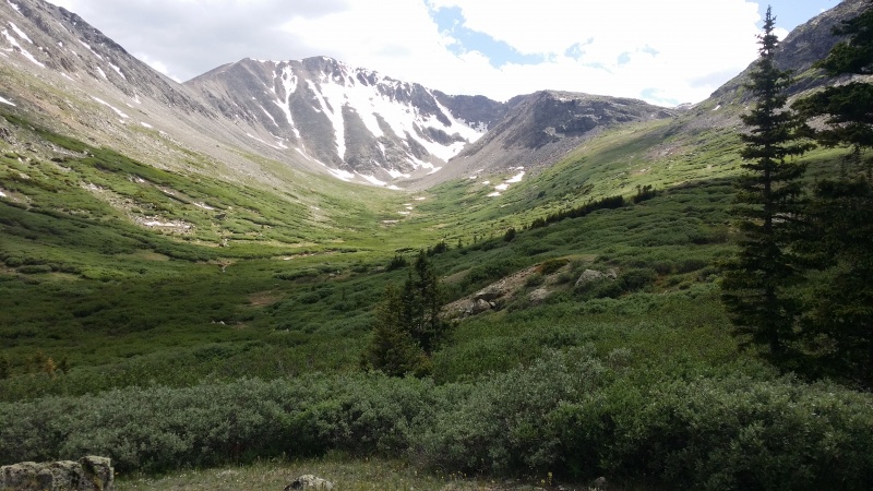
Launching from Montgomery Resevoir -- Had planned on hitting up Mount Wheeler - or fallback to Clinton -- but that road right at the base of Wheeler lake was jammed with 4x4's. Plus looking down the valley towards Democrat just looked way cooler.
Nice valley
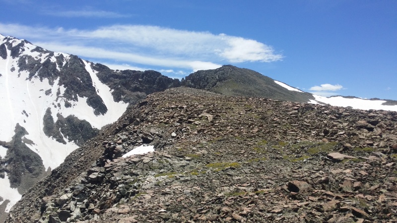
That ridge on the right was enticing to say the least. And once up on it - it was like a dream-like dare I say "lord of rings" like environment.
Final stretch
At the time I thought maybe that was McNamee (?) or whatever the southernmost point was in this area. But it ain't nothing. "Point 13,400 ?" I may put myself in charge of naming it someday.
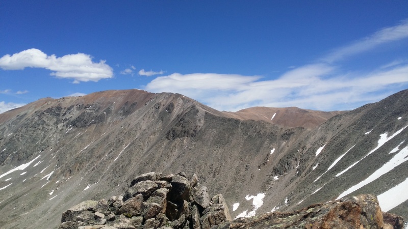
Looking back towards Cameron and Bross country
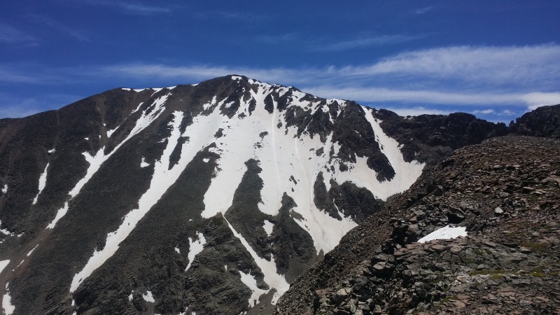
Democrat just dominates the scene up there - I can see why there's no 'western' route' !
Rocky road up Demo's west face
Democratic Dominance
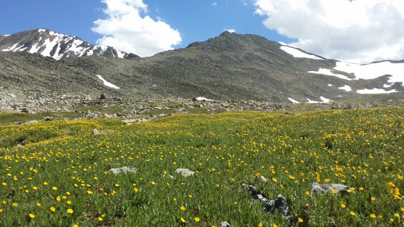
So nice up in their -- no one around - whatsoever. And flowers were ready for their moment!
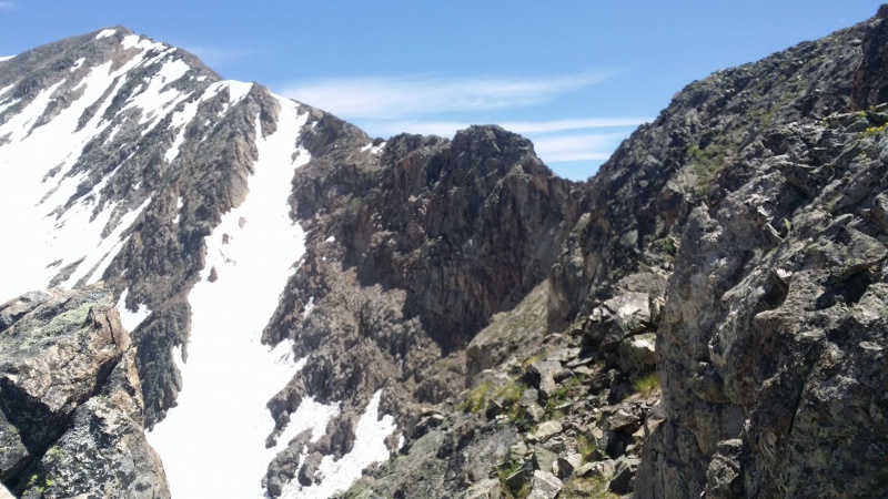
Democrat and No Name Point
I've lived on the South Platte my whole life - was cool to be back at from what I can tell is the true headwaters of the whole thing!
Thumbnails for uploaded photos (click to open slideshow):
So has anyone done Democrat's west route? 6/25/2018 11:09am
Having fully scouted this - I don't want to do it!
But you wonder -- someone's done it -- right?
Caution: The information contained in this report may not be accurate and should not be the only resource used in preparation for your climb. Failure to have the necessary experience, physical conditioning, supplies or equipment can result in injury or death. 14ers.com and the author(s) of this report provide no warranties, either express or implied, that the information provided is accurate or reliable. By using the information provided, you agree to indemnify and hold harmless 14ers.com and the report author(s) with respect to any claims and demands against them, including any attorney fees and expenses. Please read the 14ers.com Safety and Disclaimer pages for more information.
Please respect private property: 14ers.com supports the rights of private landowners to determine how and by whom their land will be used. In Colorado, it is your responsibility to determine if land is private and to obtain the appropriate permission before entering the property.
")
")
")
")
")
")


