| Report Type | Full |
| Peak(s) |
Kings Peak - 13528 |
| Date Posted | 06/25/2018 |
| Date Climbed | 06/22/2018 |
| Author | climbnowworklater |
| Kings is ready |
|---|
|
Kings Peak in Utah is in prime summer conditions. No snow on the standard Henry's Fork Trail. Once I finished the 14ers I decided to start hitting state high points. The only problem is I have Zero interest in the high-points of Alabama, Ohio, and North Dakota. No offense to those on that list, but for me, the only high points I care about are what I refer to as the "Western Half" high points. These are the high points of the states west of Montana to New Mexico. These high points actually require some challenge to summit and therefore are of interest to me. After success on Gannet and Wheeler last summer, my goal this summer is Kings, Borah, and Granite. Since the rangers office said Kings was essentially snow free, I decided to make the drive. And what a drive it is. Long, boring, and really remote. After arriving at Henry's Fork TH I set up a tent at their FREE campsites. I couldn't believe they were free. 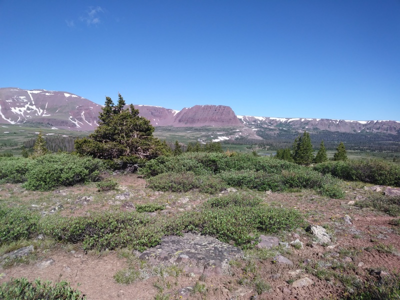 I woke up and proceeded to leave the car by 2:05 am. Hiking via headlamp in the dark on a trail I have never been on was interesting. Being solo made it even more so. This actually helped as I couldn't see anything and therefore I made very good time. After a few hours and 7-8 miles the sun started to rise. I made it to Dollar Lake by 6 am and was on Gunsight Pass by 6:45 am. Here, I left the main trail and took the "short cut" across the shoulder of the peak west of the pass. Contouring around at ~elevation 12,400 was slow going and the side hill was made up of rocks that were loose and varied in size making the hike somewhat challenging at this point. Still, the hiking was class 2. Eventually, I made it to Anderson Pass and started up to summit. Be aware, there are several false summits and it was tiring. Finally, at 7:30 am I reached the summit! At first, I wasn't sure I was on the summit. South Kings Peak looks like it might be higher. Luckily, I brought a map and realized that I was in fact on the correct summit and I allowed myself a chance to relax. Quick summit photo and pic of the GPS on top....Ok, 10 mins later and it's time to go. On the descent I decided to try and shave off some mileage. Instead of following my route back, I checked out the "Toilet Bowl" gully. This drainage is an optional descent but it is sketchy. Not the loose scree of Columbia but the hard-packed dirt with rock ball bearings of Princeton kind of sketch. Besides, in certain spots the mud was frozen and a fall here would be a problem. Ultimately, I made it down and began the cross country hike back to the main trail. I think this shaved at least a mile off the hike and quite a bit of time. Trekking poles saved the day here! The hike back to the TH was uneventful. I was tired, sore, and ready to be done. Luckily, the timing of this hike was right as the bug problem was non-existent. Lastly, after 10 hours 31 minutes I was back at the TH. Total mileage was 25.21 miles according to my GPS. All in all, the hike was nice. Given the distance I'm glad I day hiked it but in the future, this would be a great backpacking trip. Thumbnails for uploaded photos (click to open slideshow): ")
")
")
|
| Comments or Questions |
|---|
|
|
Caution: The information contained in this report may not be accurate and should not be the only resource used in preparation for your climb. Failure to have the necessary experience, physical conditioning, supplies or equipment can result in injury or death. 14ers.com and the author(s) of this report provide no warranties, either express or implied, that the information provided is accurate or reliable. By using the information provided, you agree to indemnify and hold harmless 14ers.com and the report author(s) with respect to any claims and demands against them, including any attorney fees and expenses. Please read the 14ers.com Safety and Disclaimer pages for more information.
Please respect private property: 14ers.com supports the rights of private landowners to determine how and by whom their land will be used. In Colorado, it is your responsibility to determine if land is private and to obtain the appropriate permission before entering the property.


