Download Agreement, Release, and Acknowledgement of Risk:
You (the person requesting this file download) fully understand mountain climbing ("Activity") involves risks and dangers of serious bodily injury, including permanent disability, paralysis, and death ("Risks") and you fully accept and assume all such risks and all responsibility for losses, costs, and damages you incur as a result of your participation in this Activity.
You acknowledge that information in the file you have chosen to download may not be accurate and may contain errors. You agree to assume all risks when using this information and agree to release and discharge 14ers.com, 14ers Inc. and the author(s) of such information (collectively, the "Released Parties").
You hereby discharge the Released Parties from all damages, actions, claims and liabilities of any nature, specifically including, but not limited to, damages, actions, claims and liabilities arising from or related to the negligence of the Released Parties. You further agree to indemnify, hold harmless and defend 14ers.com, 14ers Inc. and each of the other Released Parties from and against any loss, damage, liability and expense, including costs and attorney fees, incurred by 14ers.com, 14ers Inc. or any of the other Released Parties as a result of you using information provided on the 14ers.com or 14ers Inc. websites.
You have read this agreement, fully understand its terms and intend it to be a complete and unconditional release of all liability to the greatest extent allowed by law and agree that if any portion of this agreement is held to be invalid the balance, notwithstanding, shall continue in full force and effect.
By clicking "OK" you agree to these terms. If you DO NOT agree, click "Cancel"...
Trailhead: Junction of Baldwin Gulch and Baldwin Creek Route: Baldwin Creek 4X4 road to mine, then up. Length: 8 miles Vertical: 2900 feet Partners: Solo
After doing Mt. Mamma last week (described here ) and eyeing Grizzly Mtn, I just couldn't resist going back to spend another day in such a pretty area. Although that involved the Baldwin Creek Road AGAIN! I have vowed to never ever drive that road unless it is either paved or someone wants to buy me beer for life. And, given that I am 70 years old, that lifetime obligation wouldn't be as bad as it sounds.. <smile>
Anyway, I did drive the road without issues and gave a couple guys who were doing Antero a ride up.
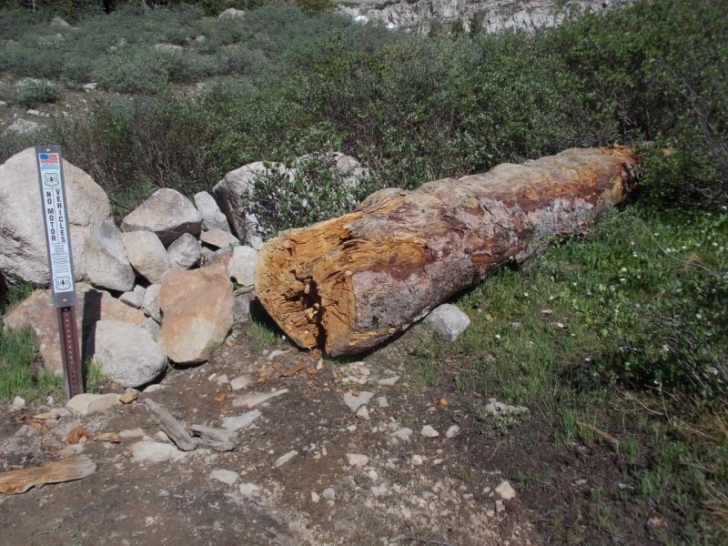
I parked at the same place I did for Mt. Mamma and followed the same road until the trail split off to Baldwin Lake. That split occurs where there is a large log and a pile of rocks that blocks motorized travel on that trail.
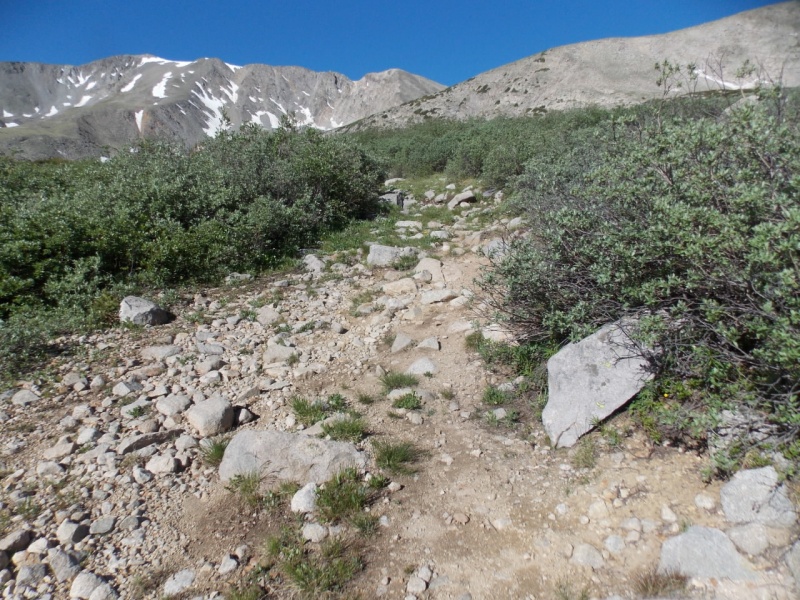
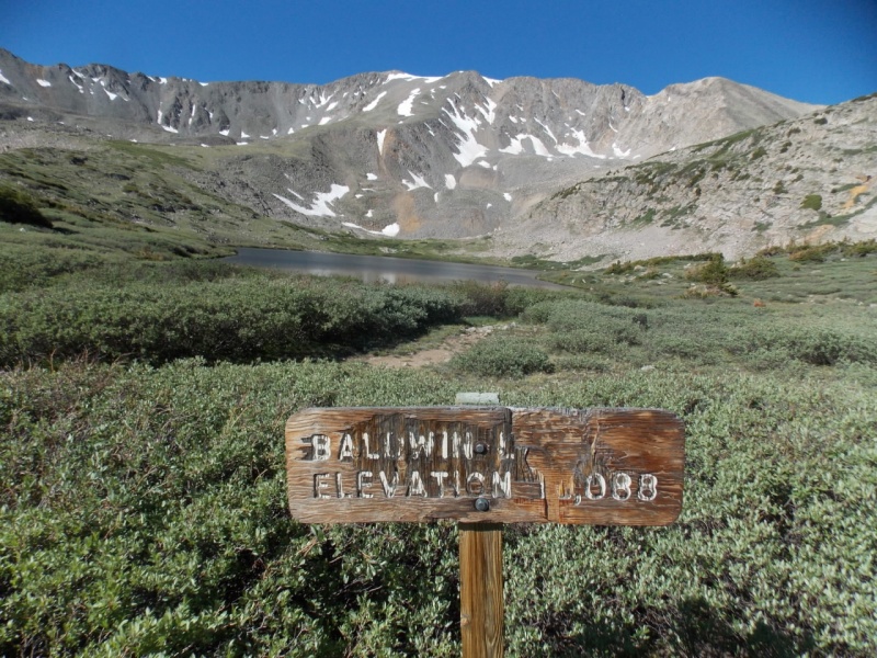
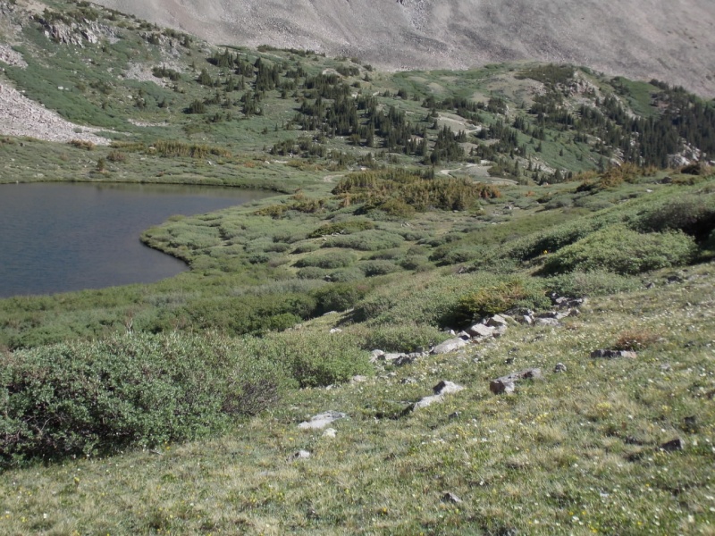
Go over the rocks to follow the trail.It's a good and obvious trail to Baldwin LakeBaldwin Lake -
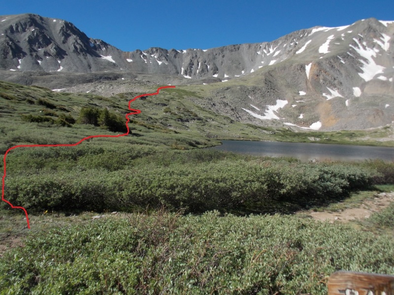
I chose to go around the lake on the east side and it was pretty easy working my way through the willows.
Approximate route I took.Looking back at the willows. Easy peasy
Once above the willows, just pick your route to the top.
My route in red
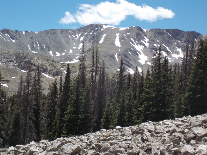
Views as I was going up...
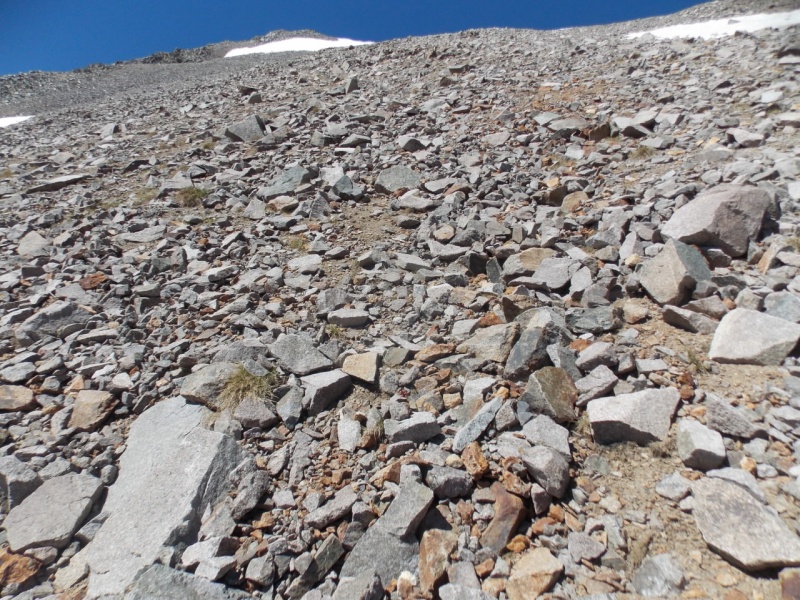
For the most part, this was an easy climb. It did get a bit loose at the end but I found Grizzly much more enjoyable that Mt. Mamma
A pretty loose area
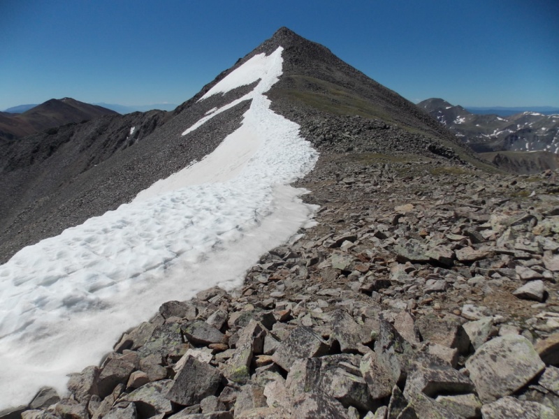
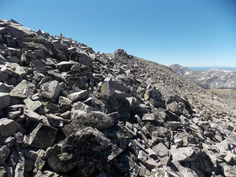
I hit the ridge to the right (north) of the summit and it was an easy walk to the summit.
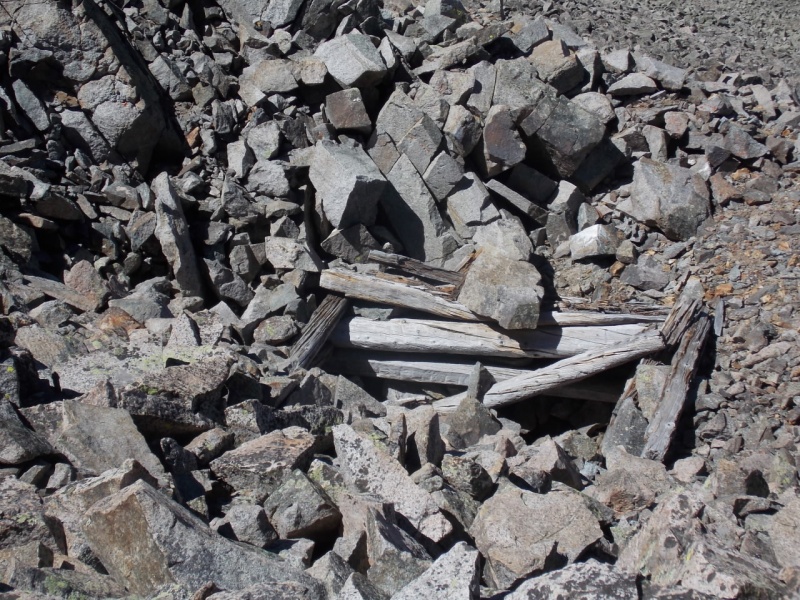
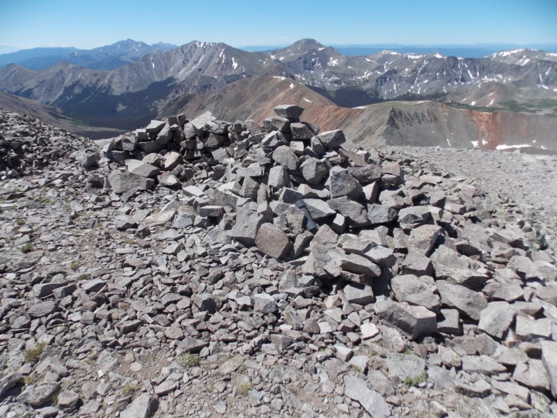
Sure looks like the summit. But it isn'tLooing north to Mt. MammaA mine shaft on the ridge. Those hard rock miners were really tough folks to haul timber and tools up the mountain.Speaking of tough.....From that first false summit, looking south The true summit is just beyond that pile of rocksSummit cairn
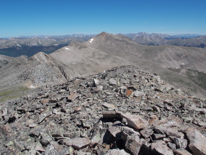
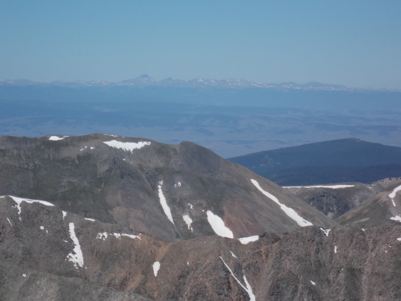
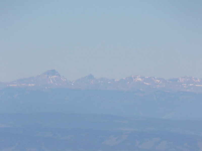
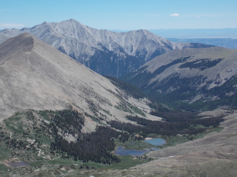
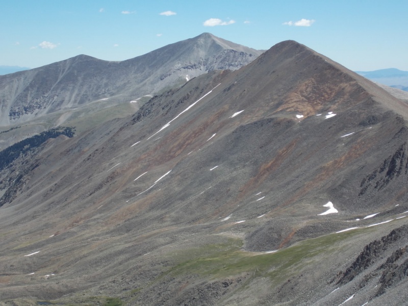
As always (with good weather anyway), the views from the summit were awesome.
The San JuansA zoom on the San Juans - Unc and Wetterhorn, I think
PrincetonAntero and Cronin
And a short 360 shaky vid from the summit.
The hike down wasn't bad at all - much easier than Mt. Mamma
A last look back on the way out.
An approximation of my route...
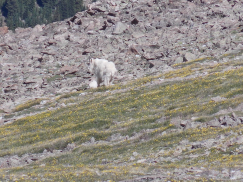
The wildflowers were killer - these are some of the pics I took.
As always, thanks for taking the time to read this and please be careful out there!
Thumbnails for uploaded photos (click to open slideshow):
Doug - I sure hope so. I do have some concerns as my strength isn't what it should be. I will email you with some specific questions about the climb. Thanks for the compliment on the flowers. It really was a stellar day. Scenery was killer.
Despite all the times I've been up that way, I have never driven that road myself. I'll call that a win! Though walking/skiing it is not always a picnic either.
I think I've driven it 4 times. Walked it once (winter). Not having driven or hiked the Lake Como road, I can't say the Baldwin Creek road is worse (probably isn't), but it's as bad a road as I ever care to drive. And yeah - it is a pretty basin. I was surprised I didn't see anyone at the lake. I saw fish in it and figured some angler would be after them.
Thinking of doing Grizzy & Mamma tomorrow. The 2nd picture in your report, also where you parked for Mamma - is that where the 4x4 road ends? Looks like it is not very far from the split off? Not a fan of that road either but have a capable truck and would rather drive a bit further if possible and avoid hiking up the road.
... sorry - I have been out of town for a few days and just got to see your comment. The road does go beyond where I parked but I was just sick and tired of getting tossed around in my FJ and decided to park where I did. The road goes up to the cutoff fo Baldwin Lake but it appears to be even rougher than the road to the split. Again, this is probably too late to help you and I will be curious how it went for you.
Caution: The information contained in this report may not be accurate and should not be the only resource used in preparation for your climb. Failure to have the necessary experience, physical conditioning, supplies or equipment can result in injury or death. 14ers.com and the author(s) of this report provide no warranties, either express or implied, that the information provided is accurate or reliable. By using the information provided, you agree to indemnify and hold harmless 14ers.com and the report author(s) with respect to any claims and demands against them, including any attorney fees and expenses. Please read the 14ers.com Safety and Disclaimer pages for more information.
Please respect private property: 14ers.com supports the rights of private landowners to determine how and by whom their land will be used. In Colorado, it is your responsibility to determine if land is private and to obtain the appropriate permission before entering the property.


")
")
")
")
")
")
")
")
")
")
")
")
")
")
")
")
")
")
")
")
")
")
")
")
")
")
")
")
")
")
")
")
")
")
")
")
")
")
")
")


