Download Agreement, Release, and Acknowledgement of Risk:
You (the person requesting this file download) fully understand mountain climbing ("Activity") involves risks and dangers of serious bodily injury, including permanent disability, paralysis, and death ("Risks") and you fully accept and assume all such risks and all responsibility for losses, costs, and damages you incur as a result of your participation in this Activity.
You acknowledge that information in the file you have chosen to download may not be accurate and may contain errors. You agree to assume all risks when using this information and agree to release and discharge 14ers.com, 14ers Inc. and the author(s) of such information (collectively, the "Released Parties").
You hereby discharge the Released Parties from all damages, actions, claims and liabilities of any nature, specifically including, but not limited to, damages, actions, claims and liabilities arising from or related to the negligence of the Released Parties. You further agree to indemnify, hold harmless and defend 14ers.com, 14ers Inc. and each of the other Released Parties from and against any loss, damage, liability and expense, including costs and attorney fees, incurred by 14ers.com, 14ers Inc. or any of the other Released Parties as a result of you using information provided on the 14ers.com or 14ers Inc. websites.
You have read this agreement, fully understand its terms and intend it to be a complete and unconditional release of all liability to the greatest extent allowed by law and agree that if any portion of this agreement is held to be invalid the balance, notwithstanding, shall continue in full force and effect.
By clicking "OK" you agree to these terms. If you DO NOT agree, click "Cancel"...
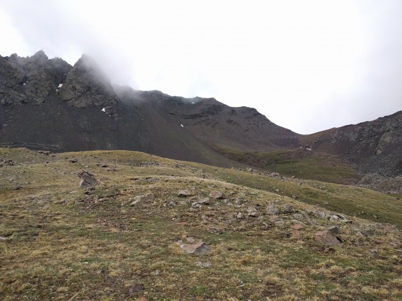
The weather for the entire state was looking stormy and a couple of friends wanted to do Lindsey. I was not in the mood for Lindsey so decided to instead go up 'Huerfanito Peak' It's a shame I couldn't get to see all the surrounding peaks from the summit as everything was clouded in. We started a little before 5, here is Huerfanito from the approach. This was the theme of the day, cloudy.
Gloomy
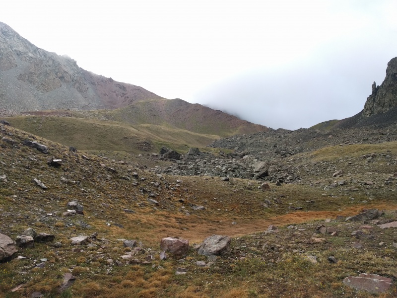
The route pretty much follows the Mt Lindsey trail up to 12,200 before you branch off and take a right and head towards the saddle. I followed the route description for Mt Lindsey gully route till photo #8 of the Mt. Lindsey trail. From here you gain the saddle shown in the upper right corned and pick the path of least resistance to reach it.
Saddle on the right corner of the picture to gain.Looking down on the way upNearing the saddle
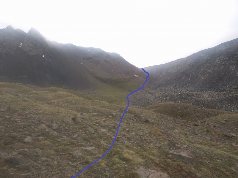
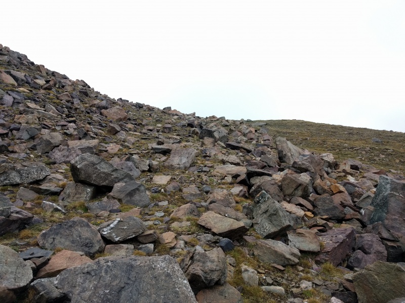
As you keep going on for the saddle it is very tempting to gain the slopes on the left of the picture shown here. Avoid the temptation, those slopes are a a loose mess despite how stable they seem. I ended up in them on the way down as the visibility was really low and they were not fun.
This is the line I picked, the soil here was very stable and avoided all the loose slopes on the left side of the picture.
Approximate LineHuerfanito mastiff
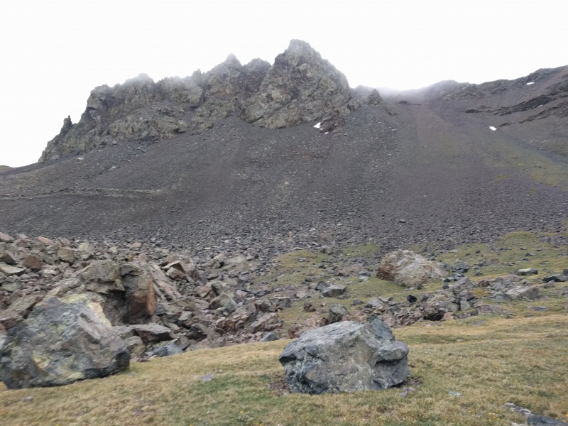
Almost to the saddle. Aim for the middle section of the photo below
Saddle
Nice and stable tundra/talus hopping
The joy of 13ers
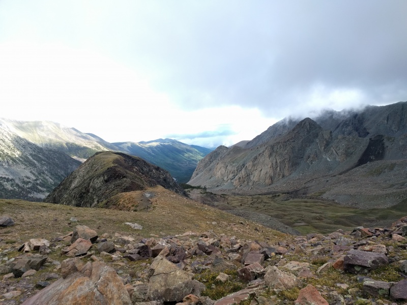
At the saddle looking at the basin below.
Beautiful
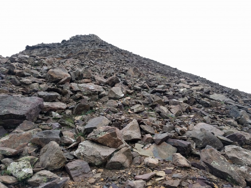
Now staying on ridge proper to go to the summit. Fairly stable class 2 hiking.
Ridge
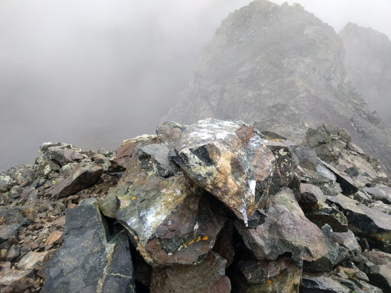
Almost there, at this point the visibility was very low.
Search for the actual summit
More ridge fun, going up because of the low visibility I missed the summit cairn and kept hopping on to all the false summits.
Summit cairn. There was a small summit register here in the form of a salt shaker bottle, but it was empty , no USGS marker either.
Summit Cairn
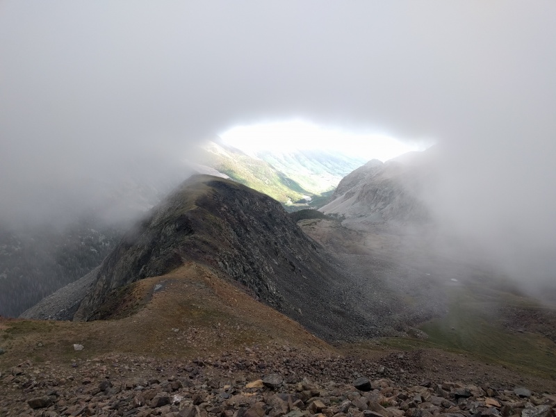
Initially I wanted to take the eastern slopes for the way down, but my exit gully still had a lot of snow in it so I decided to take NW ridge route on the way down. Coming down, a break in the clouds looking at the valley below.
WOW
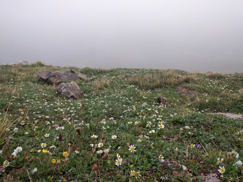
Wildflowers are coming out.
Wildflower fest
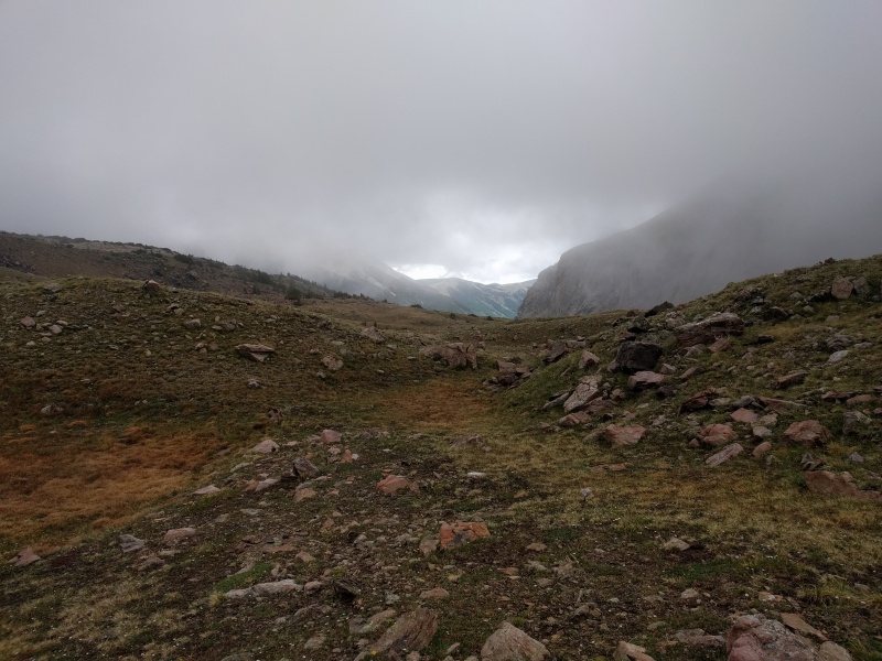
Almost back to the saddle.
Back to saddle
Looking back.
I was there?
Overall a very beautiful day considering how the weather conditions were although it's a shame I couldn't scope out Gash ridge. GPX track was way whacked out too.
My GPS Tracks on Google Maps (made from a .GPX file upload):
Thumbnails for uploaded photos (click to open slideshow):
Comments or Questions
Caution: The information contained in this report may not be accurate and should not be the only resource used in preparation for your climb. Failure to have the necessary experience, physical conditioning, supplies or equipment can result in injury or death. 14ers.com and the author(s) of this report provide no warranties, either express or implied, that the information provided is accurate or reliable. By using the information provided, you agree to indemnify and hold harmless 14ers.com and the report author(s) with respect to any claims and demands against them, including any attorney fees and expenses. Please read the 14ers.com Safety and Disclaimer pages for more information.
Please respect private property: 14ers.com supports the rights of private landowners to determine how and by whom their land will be used. In Colorado, it is your responsibility to determine if land is private and to obtain the appropriate permission before entering the property.


")
")
")
")
")
")
")
")
")
")
")
")
")
")
")
")
")
")
")
")
")
")
")
")
")
")
")
")
")
")
")
")
")
")
")
")


