Download Agreement, Release, and Acknowledgement of Risk:
You (the person requesting this file download) fully understand mountain climbing ("Activity") involves risks and dangers of serious bodily injury, including permanent disability, paralysis, and death ("Risks") and you fully accept and assume all such risks and all responsibility for losses, costs, and damages you incur as a result of your participation in this Activity.
You acknowledge that information in the file you have chosen to download may not be accurate and may contain errors. You agree to assume all risks when using this information and agree to release and discharge 14ers.com, 14ers Inc. and the author(s) of such information (collectively, the "Released Parties").
You hereby discharge the Released Parties from all damages, actions, claims and liabilities of any nature, specifically including, but not limited to, damages, actions, claims and liabilities arising from or related to the negligence of the Released Parties. You further agree to indemnify, hold harmless and defend 14ers.com, 14ers Inc. and each of the other Released Parties from and against any loss, damage, liability and expense, including costs and attorney fees, incurred by 14ers.com, 14ers Inc. or any of the other Released Parties as a result of you using information provided on the 14ers.com or 14ers Inc. websites.
You have read this agreement, fully understand its terms and intend it to be a complete and unconditional release of all liability to the greatest extent allowed by law and agree that if any portion of this agreement is held to be invalid the balance, notwithstanding, shall continue in full force and effect.
By clicking "OK" you agree to these terms. If you DO NOT agree, click "Cancel"...
Trailhead: Junction of Baldwin Gulch and Baldwin Creek Route: Baldwin Creek 4X4 road to mine, then up. Length: 7.5 miles Vertical: 2750 feet Partners: Solo
After reading GreenhouseGuy's Mamma report on Facebook here I decided I had to give it a shot and use his report as a guide. I had forgotten just how much I hate the Baldwin Creek road but given that it is probably the best access to Grizzly Mtn, I will likely have to drive it one more time.
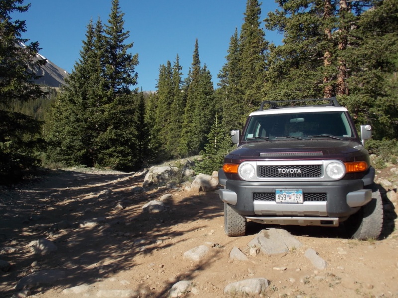
Just like GreenhouseGuy, I drove to the creek crossing, hung a right and parked.
My FJ parked almost exactly where Brian parked.A nice view of Cronin as I started out.
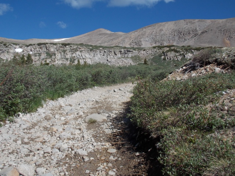
Although I don't like hiking roads much, this one wasn't too bad.
As GreenhouseGuy states in his report, this next junction seems like the right path would be the correct route but in fact, you should go down and to the left.
Go left
If you were to go right, you would end up at this mine on the side of Boulder Mountain
The 4X4 trail goes by some unnamed ponds with some postcard views of Grizzly Mountain.
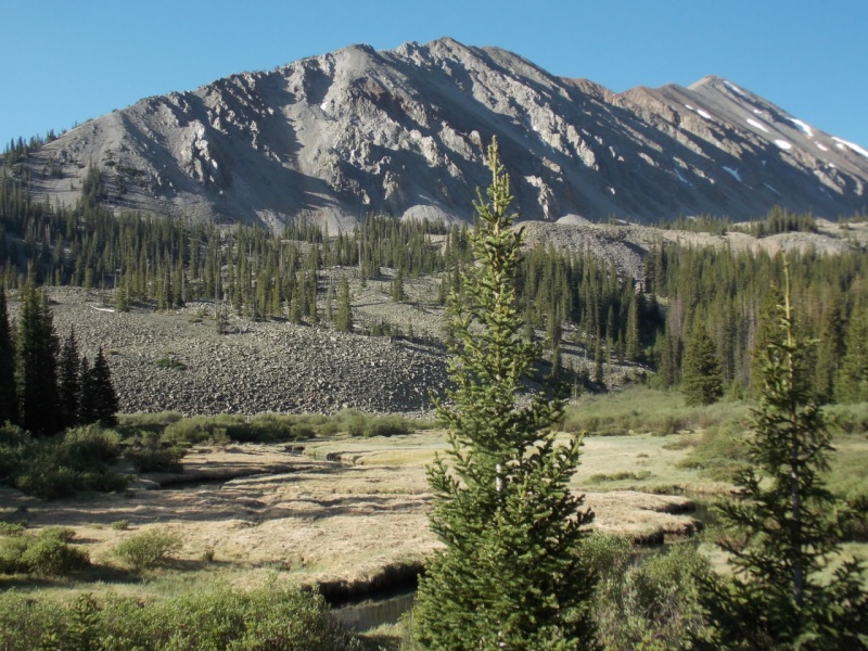
Thee road continues and one gets the first real view of Mt. Mamma
Mt. Mamma is the point in the background.
Is this where Rocky Road Ice Cream got its name?
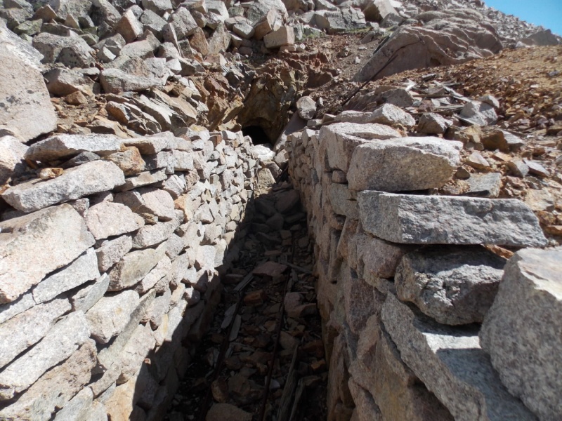
You finally reach the mine and the road ends.
I suffer with mild claustrophobia (which is why I didn't EVEN consider volunteering for submarine duty when I was in the Navy) so there was no way I was going to venture into the mine tunnel.
Tunnel
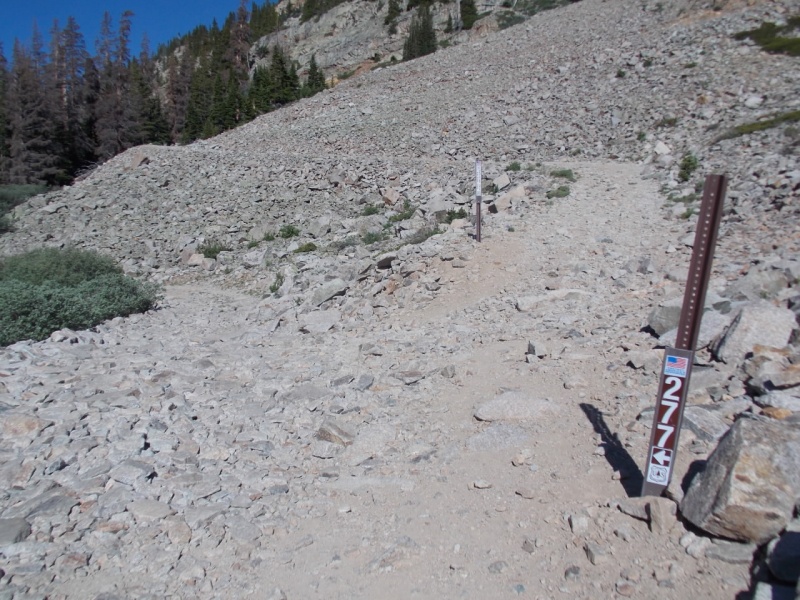
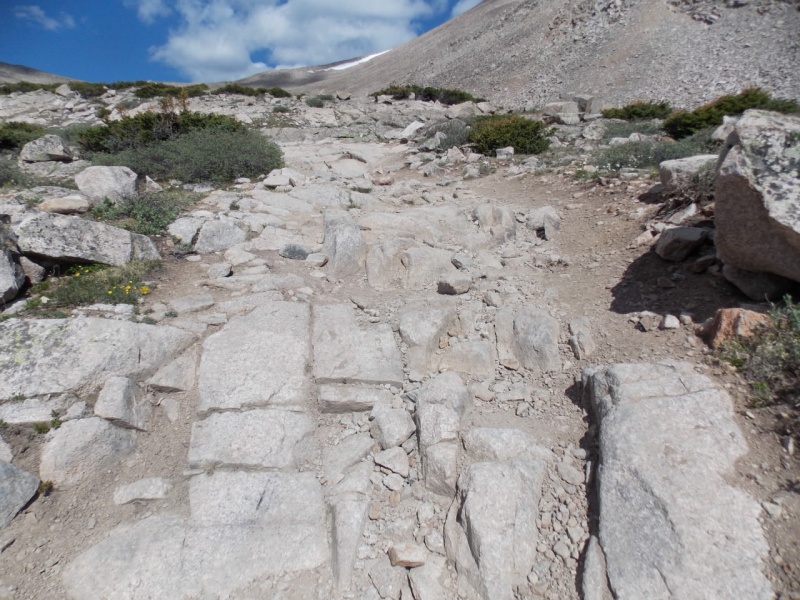
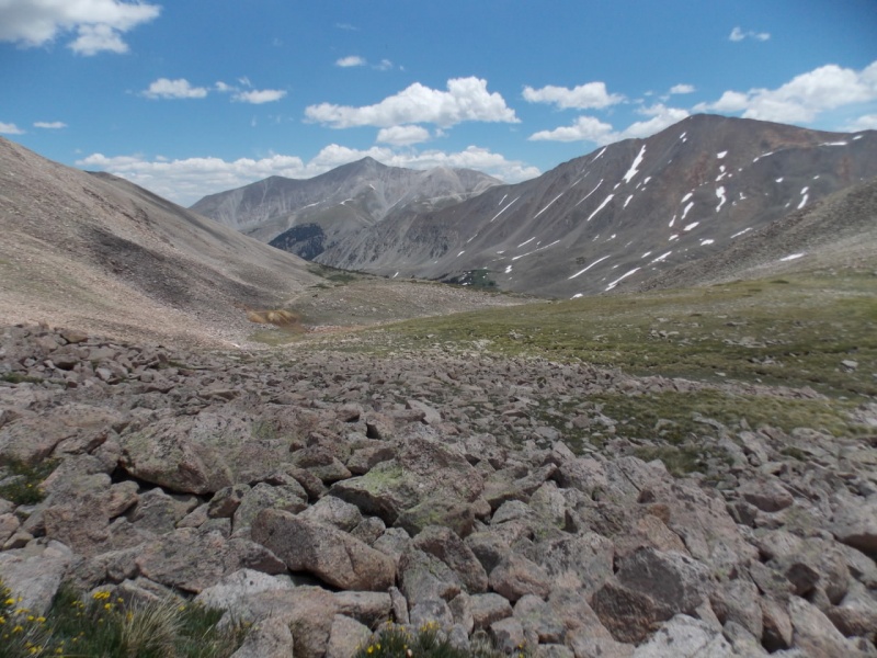
Now the fun begins. I chose to take route up that GreenhouseGuy used to come down in his report. And I think the talus was as difficult on that route for me going up as it was for him going down. Loose dinner plate (and larger) talus is a bother no matter which way you are going. It looks like it ought to be stable but it isn't. One has to be careful to avoid a twisted ankle or worse.
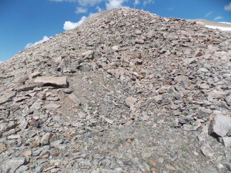
Lert the talus beginNearing the top and the talus is lose and troublesome all the way.
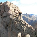
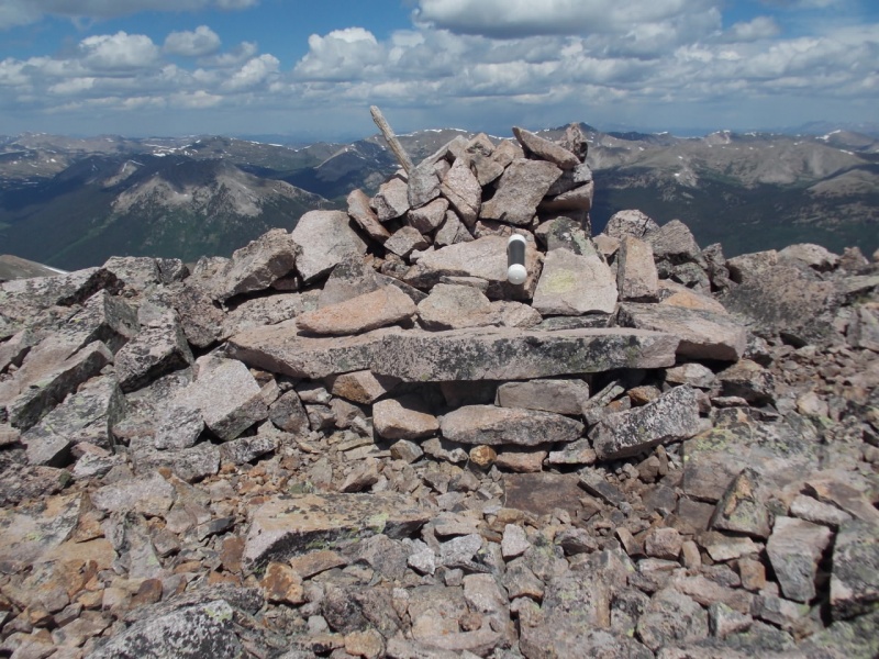
But - as with most mountains, the views from the top were worth the trouble to get there.
Summit cairnPrincetonAntero and WHiteCronin and Tabeguache
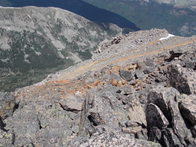
Unusual color streaks
And a short 360 vid from the summit
I chose to come down a slightly different way heading southeast into a bowl and then heading back to the mine. Not sure it was easier but it did provide for a mini-loop.
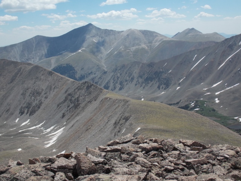
On my way back to the mine with Antero and Cronin in view.
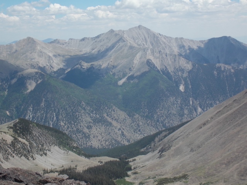
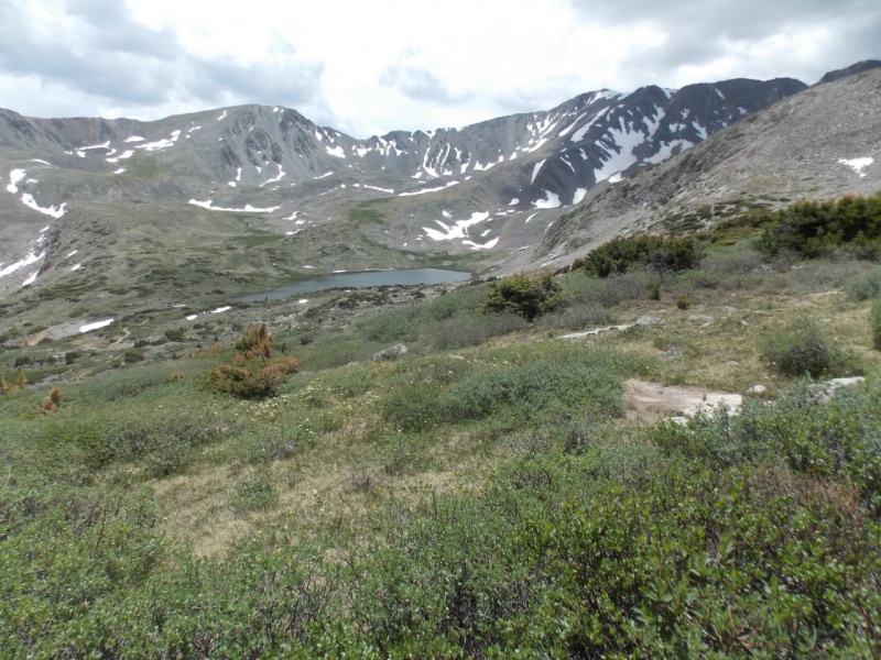
And, a couple looks back over my shoulder at Baldwin Lake and Grizzly Mountain.
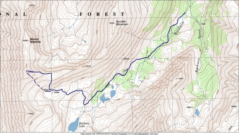
As I don't carry a GPS, this is an approximation of my route.
Up using solid route, down using the dash route
And, some wildflower pictures to end this report.
Thanks for taking the time to read this and please be careful out there!
Thumbnails for uploaded photos (click to open slideshow):
Thank you, Doug. Yeah - the flowers are really starting to make themselves known up there. And, Otina's pics always put mine to shame. Hers are always really, really good.
But from the topo map, it looks like you an unnamed peak next to mt Mamma. Surely Mt Mamma is the ranked 13646 and not the unranked 13553. But every topo map says its not?
I'm guessing your recovery goal has been met, congrats on getting through it. Nice TR! Glad there were no concrete benches up there to play on! I have fond memories of that road to the creek up to Antero. Going the other way looks like a lot of fun. I've been doing my own recovery odyssey/saga lately, had pneumonia in May, but doing okay now, did a test hike on Colo Mines Pk a few days ago, did well, better than expected. So hopefully I can do bigger things in July? Thanks for the inspiration!
@ Trotter - Yeah - the topo map is off. The one on this site shows the summit south of the actual and the one I plotted my route on shows it as the next bump north. I think I read somewhere that the entire ridge is known as Mt. Mamma. I do know that I was on the tallest point, tho. I will go back and add some verbiage to my report to try and clarify that.
@ T-man - Yeah - loose talus. Ugh
@ Boudreaux - Wow! Pneumonia is NOT fun. My Dad had a bad case of it when I was a kid. Glad you are doing better. I am slowly getting there - still don't have all my strength back and it aches about half the time but I WILL recover.
A few years ago I tried to drive that road when we did Grizzly. I didn't get very far. That first big hill after the creek crossing is a beast and I backed down pretty quick.
Did you stay night up around there? Was it cold? 6/20/2018 12:16pm
I'm pondering car camping on the other side of that mount mamma some time soon - but I wonder if that high mtn valley is going to get unusually cold at night?
I recall a night near Mt Harvard being cold as a$$ a few years ago is all....
@ Strato - Thanks! And it is good to be back out there.
@ Kirsten - Still don't have all my strength back and it hurts occasionally, but I do see the light at the end of the tunnel. Thanks for your kind comments
@ Jon - Yeah... I hate that road. Although I think I'm gonna head up it again tomorrow to give Grizz Mtn a try. I must love getting my kidneys jostled around.
@ jibler - Nope, I didn't spend the night. I think it drops down to the 30's @ night up there but I'm sure if you post a question on the forum, someone will be able to advise you.
Too legit to quit. It looks like your recovery is coming along nicely. Just driving the Baldwin Gulch Jeep Road is exhausting, but the destination is worth it. The scenery around Baldwin Lake is incredible.
Nice work and nice photos. For alternative route to Grizzly Mountain on a better road see my report:
https://www.14ers.com/php14ers/tripreport.php?trip=17981&cpgm=tripmine
@ GG - Yeah - I'm back. Still can't do C3 stuff but trying to get into some sort of decent cardio shape so I can (sorta) keep up with you and Senad... And you are correct - the scenery @ Baldwin Lake is gorgeous. I did Grizz Mtn yesterday and had a great time (but I STILL hate that road...)
@ WineGuy - Damn! Like I just told GG, I did Grizz yesterday and (hopefully) did the Baldwin Creek Road for the last time! Thanks for the compliments - I really appreciate them.
Caution: The information contained in this report may not be accurate and should not be the only resource used in preparation for your climb. Failure to have the necessary experience, physical conditioning, supplies or equipment can result in injury or death. 14ers.com and the author(s) of this report provide no warranties, either express or implied, that the information provided is accurate or reliable. By using the information provided, you agree to indemnify and hold harmless 14ers.com and the report author(s) with respect to any claims and demands against them, including any attorney fees and expenses. Please read the 14ers.com Safety and Disclaimer pages for more information.
Please respect private property: 14ers.com supports the rights of private landowners to determine how and by whom their land will be used. In Colorado, it is your responsibility to determine if land is private and to obtain the appropriate permission before entering the property.


")
")
")
")
")
")
")
")
")
")
")
")
")
")
")
")
")
")
")
")
")
")
")
")
")
")
")
")
")
")
")
")
")
")
")
")
")
")