Download Agreement, Release, and Acknowledgement of Risk:
You (the person requesting this file download) fully understand mountain climbing ("Activity") involves risks and dangers of serious bodily injury, including permanent disability, paralysis, and death ("Risks") and you fully accept and assume all such risks and all responsibility for losses, costs, and damages you incur as a result of your participation in this Activity.
You acknowledge that information in the file you have chosen to download may not be accurate and may contain errors. You agree to assume all risks when using this information and agree to release and discharge 14ers.com, 14ers Inc. and the author(s) of such information (collectively, the "Released Parties").
You hereby discharge the Released Parties from all damages, actions, claims and liabilities of any nature, specifically including, but not limited to, damages, actions, claims and liabilities arising from or related to the negligence of the Released Parties. You further agree to indemnify, hold harmless and defend 14ers.com, 14ers Inc. and each of the other Released Parties from and against any loss, damage, liability and expense, including costs and attorney fees, incurred by 14ers.com, 14ers Inc. or any of the other Released Parties as a result of you using information provided on the 14ers.com or 14ers Inc. websites.
You have read this agreement, fully understand its terms and intend it to be a complete and unconditional release of all liability to the greatest extent allowed by law and agree that if any portion of this agreement is held to be invalid the balance, notwithstanding, shall continue in full force and effect.
By clicking "OK" you agree to these terms. If you DO NOT agree, click "Cancel"...
Mt. Ouray East Ridge from Grays Creek TH Start time: ~5am Summit: ~8:50am Time on summit: ~30min Back to TH: ~11:50am RT, including any stops/breaks/wind pauses/sunscreen application stops: ~7 hours
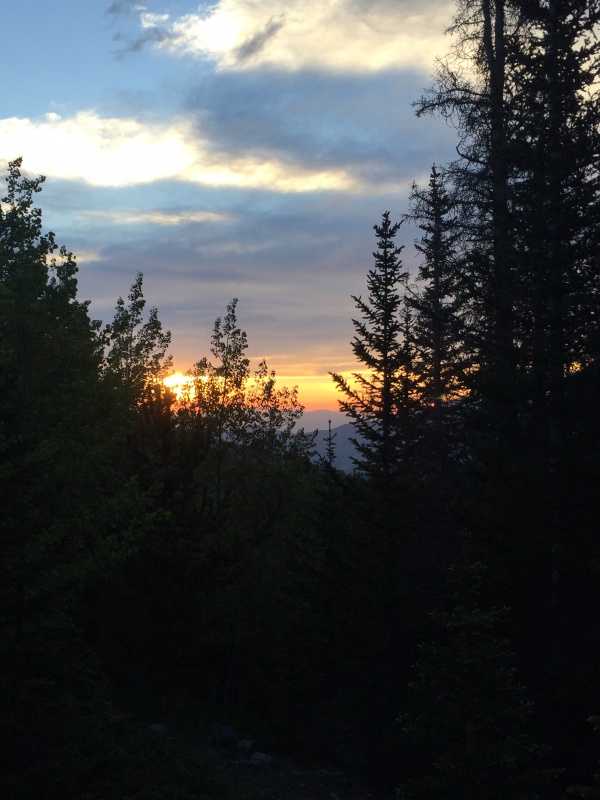
I drove down from Denver, met up with Trevor (TwoMeterTrophy) in Buena Vista around 4am, and we headed to the TH in the darkness of morning. We started on the nice trail at precisely 5:02am. I'm a fan of looking at the start time, and for some reason, the exact number always sticks in my head. We only needed headlamps for 20-30 minutes before the early-morning light started to make its appearance through the aspen grove the trail was winding through. After a few, well, probably closer to 5 or 6, stream crossings on logs, we could see above the aspens and view the sunrise.
Sunrise through the aspens grove turning to pines.
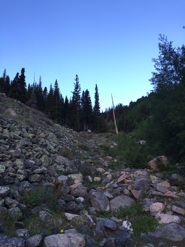
We made our way to the rocky slope at about 1.6 miles an hour after starting (we made surprisingly good time - thank you well-kept trail). The sunrise from here was great, though we could certainly tell the 416 fire smoke was starting to make its appearance early in the morning. We could see an outline of the Sangres through the smokey sunrise, and it made for some great viewings, which made going up the rocky slope and gully a slow process - we wanted to keep looking! But alas, we must continue. We shortly found the white trunk partway up the easily-navigated gully.
White trunk partway up the rock gullyTrevor making his way up the gully, entering the bristlecone area, past the white tree.
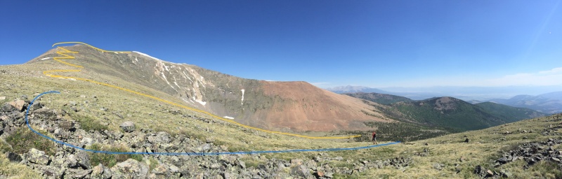
We soon made our way up the gully and into the bristlecone arena. We lost the trail through here for the most part and just angled our way toward the ridge. The below photo shows our approximate route. You can't see a huge portion of the area from bristlecone meadow/basin, but you can see the general slope and route to the summit. The yellow line was our ascent, the blue line our descent. More on that shortly.
Yellow line ascent. Where the second switchback starts is where we discovered there's a trail. We took the blue line down. It's a much steeper line. Would recommend yellow down or an angle between the two.
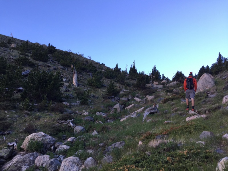
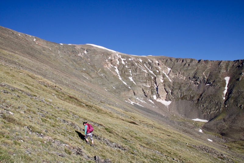
Slowly we made our way up the steep slope to the ridge. We angled slightly toward the false and real summit switching between boulders and grass, depending on which made sense on the angle of the slope and for stability purposes. This slope is no joke - it's long and steep.
Trevor making his way up the slope; About halfway at this point.
Similar area, myself making my way up the slope with the summit point in the background (near the snow line).
We made our way up and aimed for a flat pitch. I thought I saw a wood spoke up there but thought, no way could that be a trail, and disregarded it. We kept going. I then saw another area that could be a trail within the rocks (typical Sawatch style). Thought, no, I don't recall seeing much indication of trail on the route description, so again, I disregarded it. Then we both saw a more definitive trail outline. We took it - and did that make life easier! Less rock hopping, more traversing and switchbacking, but for once, I didn't mind the switchbacks.
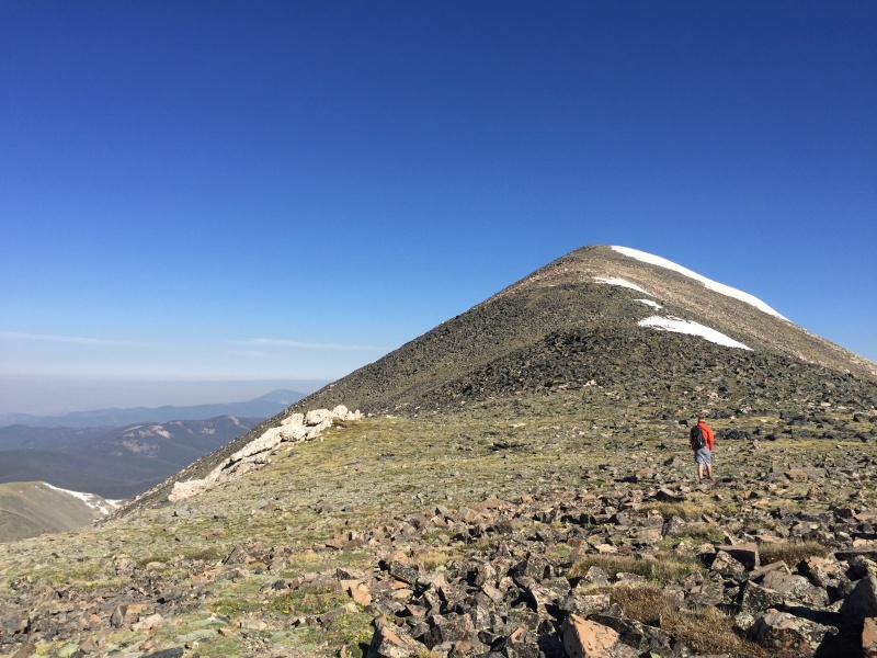
The trail took us around some of the bumps rather than in front of or over the top. It meant we went straight into the wind and gusts that were predicted to be strong that day, but again, small price to pay for an actual trail on a 13er. Do not be fooled by the false peaks on Mt. Ouray though. They keep going. And going.
Trevor in the flat pitch of some false summits.
Don't get me wrong, I like flat pitches. But when there are multiple false summits after an already long slog up a steep slope, it can get mentally exhausting. Please, do yourself a favor, and find the trail. It will make you much happier. And it will make the going much easier.
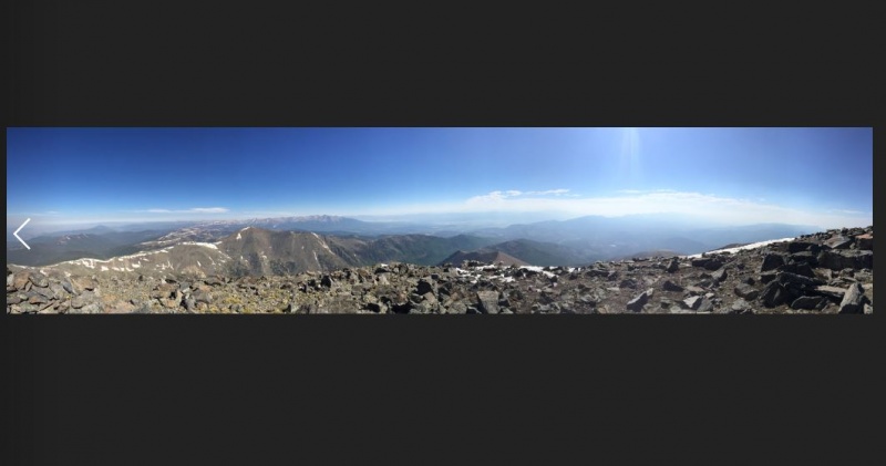
We finally made it to the summit at around 8:52-8:54am. A little bit before our projected time! We made quick work of what we thought was slow-going. Thank you mental game! It's a big summit with a few wind shelters, a summit marker, and some collapsed brick structures. I don't know much about the history of Mt. Ouray, but it was fun to explore. Excellent views of Savano, Tabeguache, the Sangres, and more. By the way, if you haven't had goldfish on the summit, you're missing out. It's been one of my standard summit snacks, and it's hard to beat.
Summit view
After about 30 minutes, we hit the trail and meandered back down the same way we came. There is an option to make a loop and go down the other ridge, but we were content retracing our ascent steps. We followed the trail a bit too far though. This is where that blue line comes in on the photo earlier in the post. We went past a large cairn with a wood spoke then angled down... it was a steep slope to descent. I would recommend following the line you took up and angle down toward the basin. Your knees and ankles will thank you.
Do take notes of the line you took through the bristlecones too. There is a faint trail you can find again and then descend back through the gully. We did not encounter much bushwhacking at all on this route, just gorgeous trees, flowers, and views. Mt. Ouray is a daunting mountain - she's big and powerful. We only saw a few other people ascending through the aspens and bristlecones as we were on our way back to the car. They didn't look like folks attempting a summit push though. Before noon we made it back to the car. A few other cars had parked, though we only saw one man with his car - and he asked what was up the trail - a lake? Surprisingly, no. No water but the creek and some mountains to climb. He then walked away and left us to change shoes. I opened my standard Hi-Ball Energy Water for the drive home, and off we went.
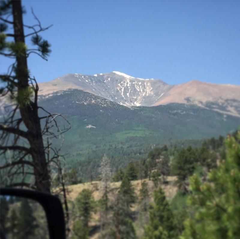
View of Mt. Ouray from the dirt road on the drive out.
Overall, Mt. Ouray was a successful (and surprisingly fast) day. Take the standard preparations for a 13er - know your route, plan your line, and go for it. You never know what you'll encounter or where the route will take you but that's why we go for 13ers, isn't it? The solitude and additional challenge.
Thumbnails for uploaded photos (click to open slideshow):
My son and I took his cross country teammates on a trek up Ouray a few years ago. It was a lot of fun, but finding a trail up the grassy slopes to the ridge was a tedious and time consuming endeavor. Still a great mountain with some great views all along the way.
For those familiar with this mountain, which way is the least-calorie burn? North along the Divide from Marshall Pass, with more bushwack, but shorter, or this Devils Armchair route with trails most of the way?
Caution: The information contained in this report may not be accurate and should not be the only resource used in preparation for your climb. Failure to have the necessary experience, physical conditioning, supplies or equipment can result in injury or death. 14ers.com and the author(s) of this report provide no warranties, either express or implied, that the information provided is accurate or reliable. By using the information provided, you agree to indemnify and hold harmless 14ers.com and the report author(s) with respect to any claims and demands against them, including any attorney fees and expenses. Please read the 14ers.com Safety and Disclaimer pages for more information.
Please respect private property: 14ers.com supports the rights of private landowners to determine how and by whom their land will be used. In Colorado, it is your responsibility to determine if land is private and to obtain the appropriate permission before entering the property.

")
")
")
")
")
")
")
")
")
")
")


