| Report Type | Full |
| Peak(s) |
Crestone Peak - 14,299 feet Crestone Needle - 14,196 feet |
| Date Posted | 06/01/2018 |
| Modified | 06/04/2018 |
| Date Climbed | 05/27/2018 |
| Author | jmanner |
| Additional Members | lintylint |
| Memorable Springtime Traverse |
|---|
|
Crestone Traverse: Upper Trailhead to Crestone Peak to Crestone Needle back to the TH. Car to C. Peak summit: 5 hours Summit of the Peak to the Needle: 2 hours 5 minutes Total time: 10:59:39 14 miles round trip 6,414' of uphill (or so Garmin and Caltopo tell me) I have a somewhat frustrating person history with Crestone Peak, I had a pretty abysmal fail in February 2014 from the Cottonwood Creek TH, a bailed attempt for the Peak and the traverse last summer due to nearly constant rains and finally after a terrible winter and spring snowpack plans to ski Crestone Peak this spring. So after chatting with the wife, I changed the plans for finishing this spring and summer to include a Culebra Peak and Red Mountain A solo hike with a hike of Crestone Peak. I figured I could head up from the trailhead and if I met someone headed over for the traverse I could tag along with them and offer what route information I remember of the Needle’s descent in exchange for my chattiness. Fortunately, a friend hooked me up with someone who was also headed up for both Crestones and I was able to organize a meet up with her at South Colony Lakes Sunday morning at 5 AM. After a rather worrisome night of high winds and substantial gusts and some teenagers thinking it’s a good idea to start a fire during a red flag warning, I awoke at 3:10. After making coffee and finishing packing my bag, I was moving up the road at 3:52. I tried to move as quickly as possible in order to get there at the meeting time and I found myself at the Humboldt turn off at 4:40 AM. The last mile of deadfall slowed me down considerably, but I was at the lake at just after 5 and yelling “Lindsay” at random campsites. I wonder what people in their tents made of that? Pro-tip never take the old mine road, just head towards the Humboldt side and then cross over at a well maintained trail. At some point, after walking back and forth for fifteen minutes I realized she was camped at the other side of the lake. So, I crossed over and immediately saw a women standing by herself, jackpot! We were only 25 minutes behind schedule, what’s new? We moved relatively quickly up the trail to Broken Hand pass, stopping a few times to take in the views along the way. About a half hour after setting out we were putting our micro spikes on and I pulled my axe out to work our way up the snow towards the top of the pass. We made relatively quick time up the snow slope to the pass, where we were greeted with intense wind.  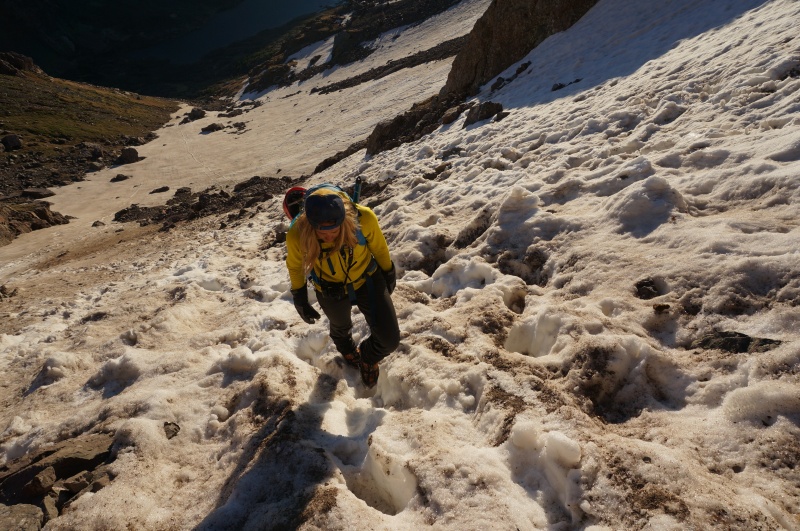 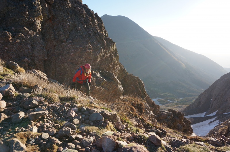 We hustled down from the pass to get out of the wind and before long we were out of the squall, however we also found ourselves a little off trail, which was remedied by a short tundra tread. The trail down to Cottonwood Lake went by rapidly, where I stopped to filter some water for both of us.  
Lindsay stoked to be in the Alpine.  From the lake we quickly hiked around the base of Crestone Needle and made our way through the still brown tundra towards the Red Gully on Crestone Peak. The Red Gully is pretty easy to find in good visibility. The line in the gully was fairly intuitive, but there was still some snow in the gully which forced us up onto harder terrain on the sides, but nothing that exceeded easy Class 4. We zig zagged up the gully towards the summit, which has the appearance of being just out of reach for most of the scramble.  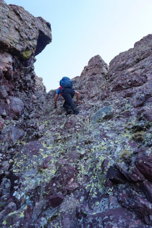 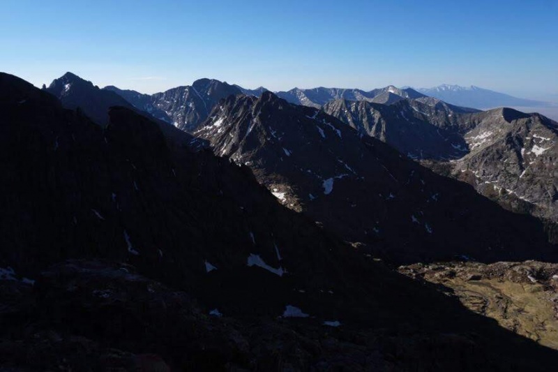 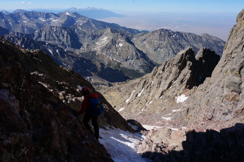  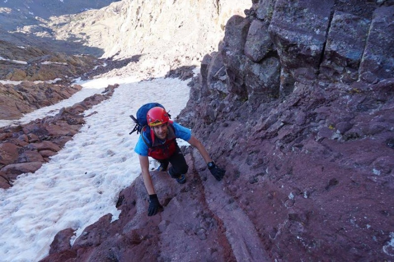 As we passed through 13,600’ we looked out for the cairns that marked the entrance for the traverse. We caught a glimpse of a cairn off to climber’s right, but it seemed to point to nowhere. We concluded we’d have to deal with that on the way back down. After about an hour of scampering up the gully we came to the top and found it covered in still frozen, freeze-thaw, snow. We traversed to climber’s left of the snow and worked our way up the face below the summit towards the ridge crest, where we meet the top of the route. From here we summited in mild winds and blue skies at 8:50. We both felt good about the winds, so we figured we would give the traverse a go. We didn’t waste much time on the summit of the Peak, before heading down, just enough time to take some photos and eat a quick snack. We descended the way we came up, climbing down the ridge and then leaving the standard route to avoid the snow at the top of the gully. The down climbing was a bit more committing than normal class 3, but we made quick work of the face and then headed back over to lookers left of the gully and began to poke around for the cairn we remembered from earlier. Unfortunately, we kept climbing into harder rock, and wasted a good ten minutes, in our attempt to find the traverse entrance, until Lindsay pulled her phone out and saw we were 300’ above the entrance. So we moved back in the gully and descended to the cairn we had seen earlier in the morning. The problem I had with follow this cairn was that it looked like it led to a blank ridge, but it was the only way that seemed to go, so we walked over to it. To my surprise the line opens up just on the other side and there is a good ledge which moves off towards the Needle, with countless cairns marking the way. This more or less describes most of the route to me, you go from gully to gully and every time the line seems like it’s going to cliff out at some rib, you turn the corner and you can see a good ledge that leads on. 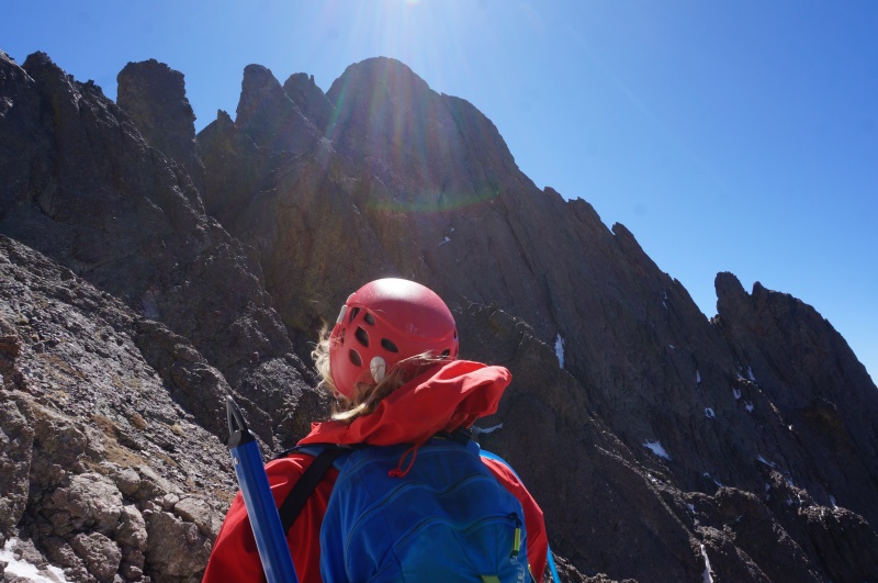 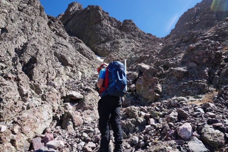
Credit: Lindsay  Before long we were at “the bulge” with its class 5 move. We both threw on our shells, figuring that the wind would be funneling throw pretty briskly. Not sure what to say about it, other than it wasn’t particularly challenging. We both stepped up and then worked our way climbers left and up into the cleft or whatever. Neither of us felt the need to remove our gloves.  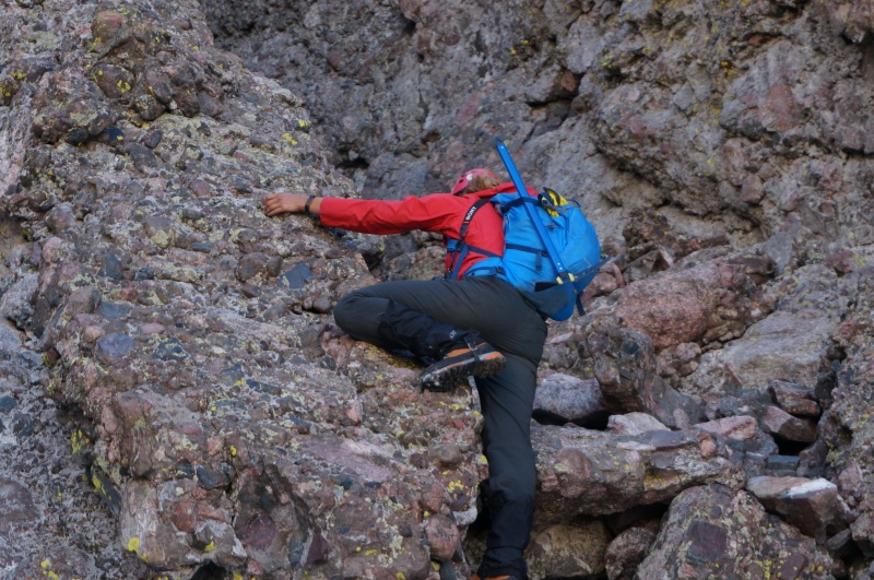
 I noticed after the climb that Roach and Dawson’s guides don’t mention this feature and have you continue a little further down and over to the Needle before headed straight up towards the final summit pitch, so I guess that would be an option worth pursuing if the bulge and the little knife edge bother you. Anyway, after the bulge we climbed up the very windy notch to the knife edge. Lindsay went first, since she was clearly the stronger climber and set a good example of how to climb along the knife edge without straddling it. I followed her lead and crawled over, stopping half way to remove my gloves. 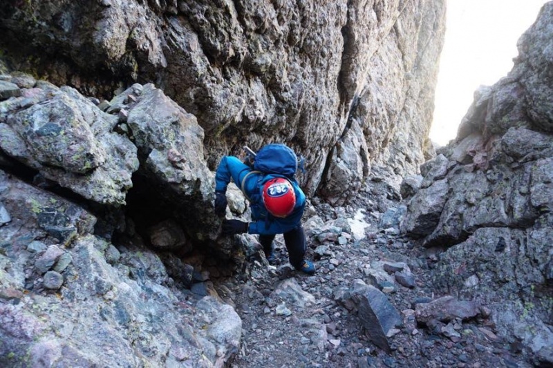 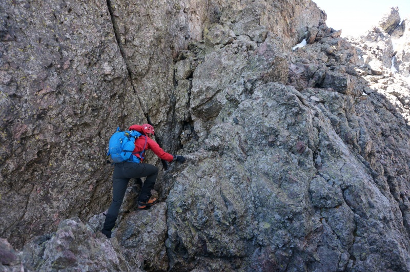  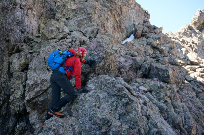 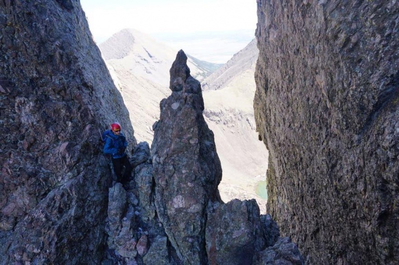
John working his way across. Credit Lindsay After the knife edge we took a lower ramp which didn’t lead anywhere, so we climbed up a wall which led back to the route. Once back on route we quickly found class 3 terrain over to the base of the final pitch. I had worried about the pitch for years reading about the route, so I volunteered Lindsay for first crack at it. She giddily scrambled up the pitch kindly kicking some snow I hadn’t seen down onto me. “Is there snow up there?” her: “not really, just what I just kicked down”.
Lindsay's first few moves.
John's first few moves. Credit: Lindsay
Credit: Lindsay After another minute or so, I continued on after her, trying to focus on testing the holds as I went, which I was surprised to find a good 50% of the ones I pulled on wiggled a fair amount, ‘uh… isn’t this supposed to be the bestest rock ever?’ About half way up, I felt and heard a crack on my helmet and a flash of light and then a rock popped me in the right check, which caused another flash of light. This was followed quickly by “ROCK!” Lindsay had apparently sent a missile down and not even known it until she heard it pop my helmet. Luckily, the rock wasn’t very big and didn’t free fall very far before finding my helmet, but it certainly gave me a start and a brief headache. I stood there for a second and then proceed on, I suddenly found that the ample holds seem to thin out after the rock hit, but even then I was up and over the top of the wall in another minute or so and found that we were just a few tens of feet from the summit.
John finishing off the steep bit. Credit: Lindsay We were both pretty pumped about the climb and after a hug and few adult words from myself we texted our families and sat down for a snack. We set there taking it all in and congratulating ourselves for doing in just a bit over two hours, summit to summit, even with some messing around in the Red Gully on Crestone Peak. We both felt that the final pitch wasn't has horrid as it had been made out to be. 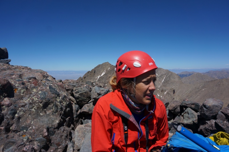  After about a half hour we proceeded over to the east gully route, since I am convinced that the benefit of easier terrain in the west gully isn’t worth the possible risk of missing the turn off. 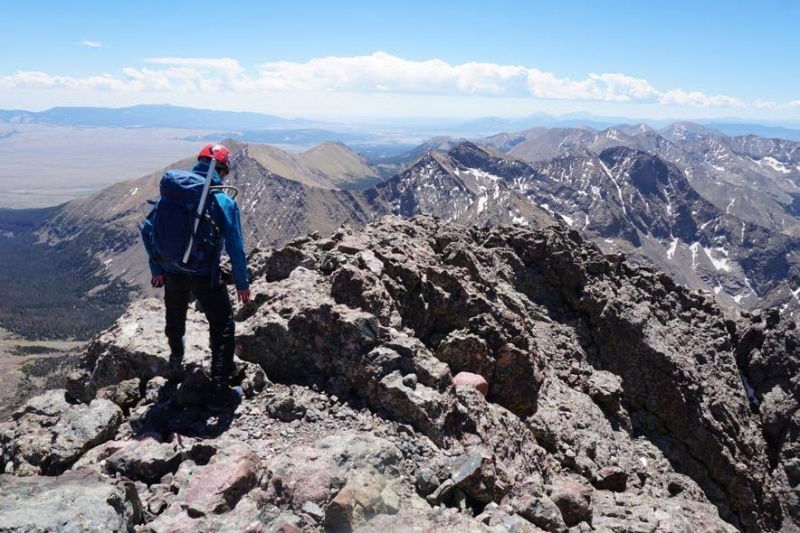 The east gully suffered from the same issues as the Red Gully on the Peak, the easiest lines were still buried under what remained of the sad spring snowpack. 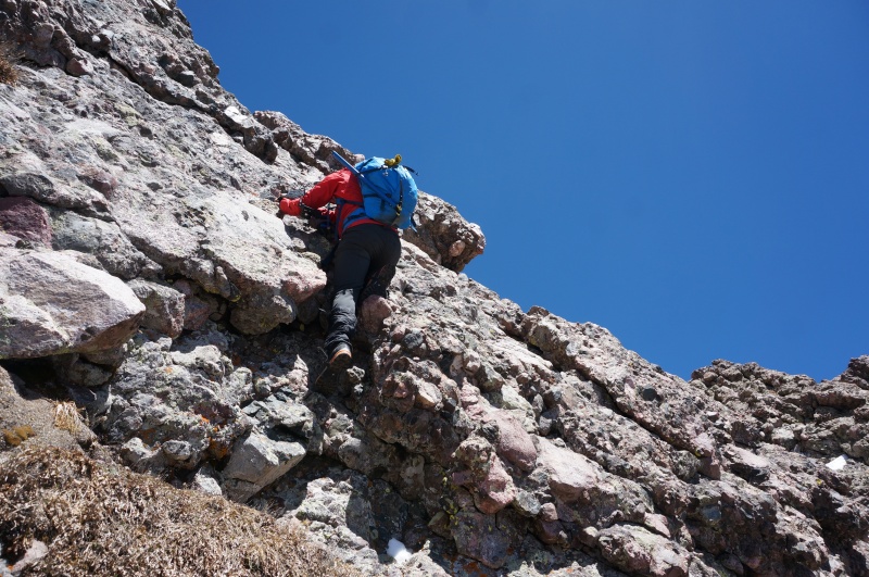  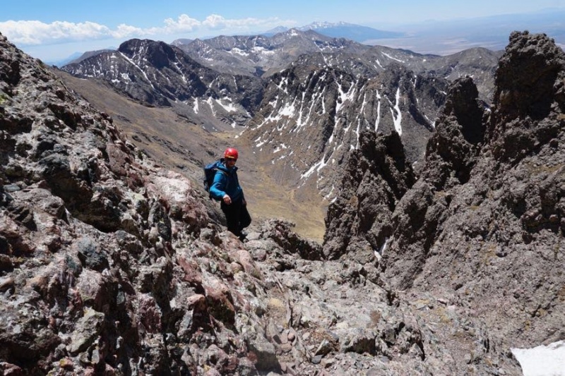 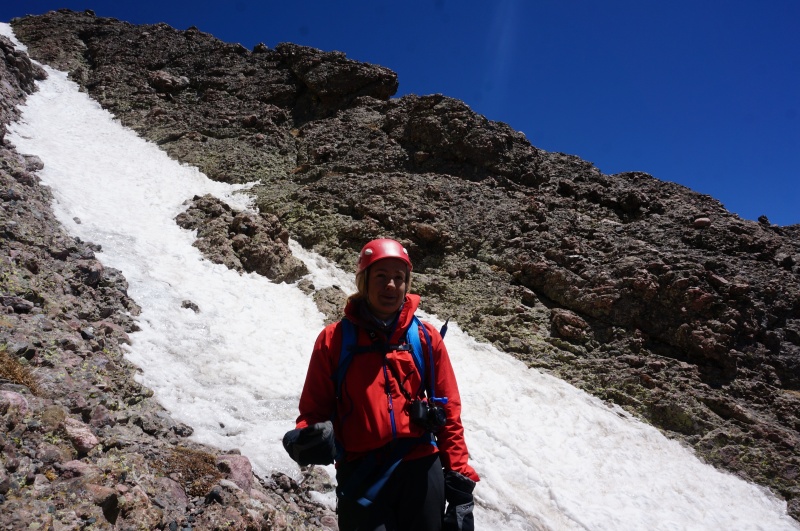 We therefore were forced to pick some slightly difficult lines working our way down the gully, but the rock is good and free from rubble. In about an hour we had worked our way off the summit and to the apparent exit, where I attempted to replenish my water supply, but unfortunately my MSR filter broke with the third pump. I guess no water for me then… Oh well.  Moving on, we took the trail to lookers left and descended another gully towards the trail below, which I am pretty sure is a mistake I’ve made before. I think it’s faster to continue to descend a bit further to an easier trail, but either way it goes at class 3/4 back down. After another 15 minutes of scooting down we were back on the standard trail and at the weird class 4 wall that always seems to be left off route descriptions. I climbed up it and pulled the camera out and waited for Lindsay to see it and react. She didn’t disappoint, she immediately asked “Are you sure this is the right route?” which it is, since there is a good trail leading up to it. After this quick pitch it’s a short stroll over to the top of Broken Hand Pass. 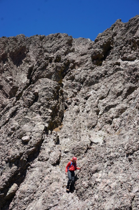  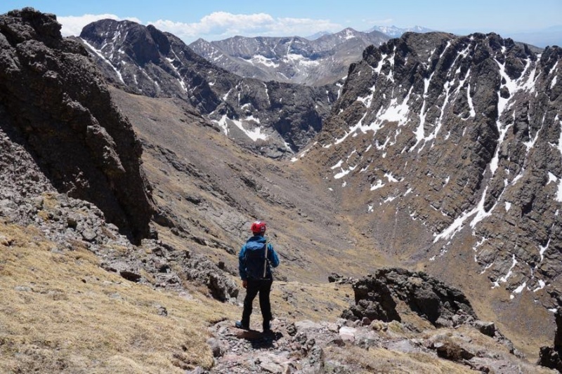 As we were about to head down, we ran into a group of male teens, the same that thought it was a good idea to start a fire the night before, just topping out and asking us where we were coming from. They asked about the traverse and the Peak, but seemed confused by the geography of the area. We suggested the Needle would be a good idea, since it was already 1:30 pm, said our good byes and headed down the pass. We both wondered how those guys would make up either mountain or if they would even make it back down to the pass by sunset. Once we hit the snow coming down from the pass, it was pure isotherm snow, so we pulled the axes out and down climbed. It took about a half hour before we were back on rock, where we both wondered how those kids would make it down that slope without axes or traction, particularly if they came back by after sunset and the snow refroze. 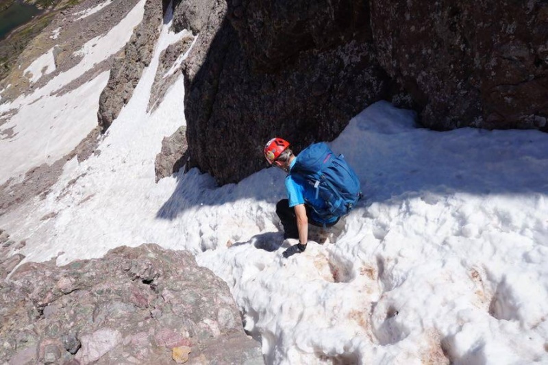 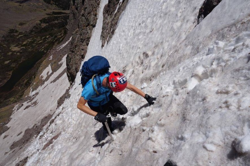  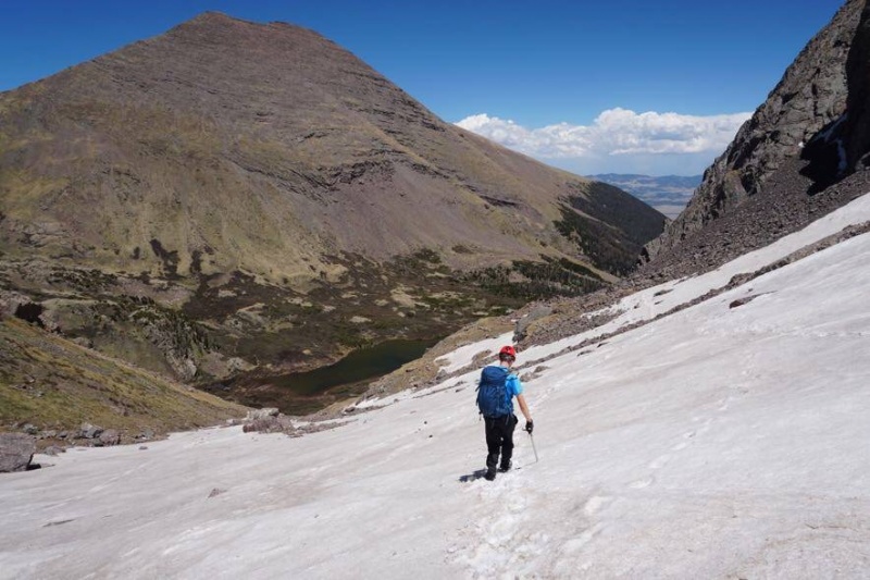 Once we got off the snow we both stripped some clothes off and quickly made our way back to the lakes. We reached the South Colony lakes at around 2 PM, I said bye to Lindsay and started running back to the trailhead via the Humboldt trail.  I was pretty thirsty at this point, but I figured running it out would get me to water in the car much faster, which it did. It only took about 50 minutes from leaving Lindsay to jogging up to the car. I’d like to say that was the end of the adventure, but as I was putting up my stuff and sipping my coffee a 300 series BMW (small four door sedan) rolled by. His departure caused quite a stir among the folks packing up, ‘what the hell was this guy up to?!’ Another guy and myself gave him a thumbs up and “good lucky with that shit, buddy”. A minute or two later two guys and myself jumped into my car and started making our down in my Xterra, it wasn’t a quarter mile before we saw a red fluid trail on the road, before long we came upon our BMW stopped in the middle of trail. Apparently, he had burst open his transmission line and his transmission had frozen. Later on I heard from some hikers that he had been bombing it down the road, making no attempt to dodge rocks when they heard a load “thwack!!” and saw the transmission fluid coming out. After about twenty minutes of the driver and his wife heaping abuse on folks stuck behind him, he was able to get it into neutral and get it out of the way, the wife of the driver had my phone so I pulled out of the way and let them get in touch with friends to get a tow and then I took off, but not before giving the wife a lecture about how stupid it was to take a sports car up that road. At any rate, I was home in Denver by 6:20 pm, with enough time to stuff some food down and read a book to my son and put him to bed. What a weekend, 20 miles hiked and climbed, 10,000’ of uphill and now only the Wilsons left to finish. Thanks to Lindsay for coming along, helping with route finding and showing a non-climber how it’s done! Thumbnails for uploaded photos (click to open slideshow): ")
")
")
")
")
")
")
")
")
")
")
")
")
")
")
")
")
")
")
")
")
")
")
")
")
")
")
")
")
")
")
")
")
")
")
")
")
")
")
")
")
")
")
")
")
")
")
")
|
| Comments or Questions | ||||||
|---|---|---|---|---|---|---|
|
Caution: The information contained in this report may not be accurate and should not be the only resource used in preparation for your climb. Failure to have the necessary experience, physical conditioning, supplies or equipment can result in injury or death. 14ers.com and the author(s) of this report provide no warranties, either express or implied, that the information provided is accurate or reliable. By using the information provided, you agree to indemnify and hold harmless 14ers.com and the report author(s) with respect to any claims and demands against them, including any attorney fees and expenses. Please read the 14ers.com Safety and Disclaimer pages for more information.
Please respect private property: 14ers.com supports the rights of private landowners to determine how and by whom their land will be used. In Colorado, it is your responsibility to determine if land is private and to obtain the appropriate permission before entering the property.


