Sierra Estrella (Hayes Peak)--4,512'
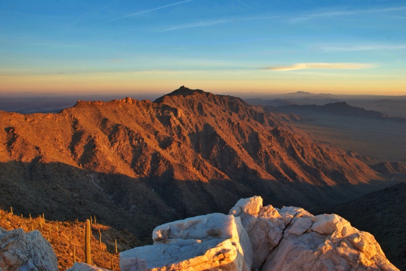
photo credit: Mikesanchez1109 from Wikipedia
I had a trip back to the Phoenix valley to celebrate my niece’s high school graduation. I knew I’d have several free days, and so I set my sights on a peak I’ve contemplated climbing for years. It sits majestically above Phoenix to the southwest and can be seen for miles. I use to live and work in Phoenix for 6 1/2 years and looked up at this mountain often. So now, the goal….Sierra Estrella also known as Hayes Peak. Most of the mountains in the valley like Camelback, Piesta (Squaw) Peak, and South Mountain have hoards of people all hours of the day and night. Sierra Estrella is a peak that is often goes a whole year with out seeing a single climber come to visit. I could only find 2-3 trip reports and resources from others who have climbed it. The mountain is blocked by a Indian Reservation on the east and the Gila River on the north. Those who venture out to climb it must come from the west. To get to the trailhead, I took I-10 west to Jackrabbit Trail turning south. After about 8.5 miles and crossing the Gila River turning east on Elliott Rd. One mile later going south on Rainbow Valley Road for about 10 miles all the way to Riggs Road. Then it’s east on Riggs Road for 9.3 miles. About halfway it turns to desert and travels through sandy washes. At the Powerlines that runs northwest/southeast, turn left or north and follow the Powerline road north for 2.5 miles. Then turn right on what is called Ocotillo Rd (no signs marking it) and drive to a camping area/dead end with a fire ring. Note, these roads go through sandy washes and some rough terrain and I would suggest a higher clearance, 4-wheel drive to play it safe. In fact, this area could be deadly during the monsoon season. And, there is no trail up this mountain! I joined several different Phoenix area Meetup groups and attended a few local hikes to attempt to land a partner. It worked, I met a guy named Mike on a hike up South Mountain and he agreed to join me. After reading a few reports of those who have done it, I found out others have taken about 4 hours from car to summit. So, with this being the end of May, I wanted to beat the heat. This meant Mike needed to meet up with me at 2:30am so we could drive to the trailhead in time for a planned 4:30am start hiking time. We got off a few minutes late with a 4:45am start.
I wanted some skylight so we could see the ridge as neither of us had climbed this route before and neither of us had a GPS track to follow.
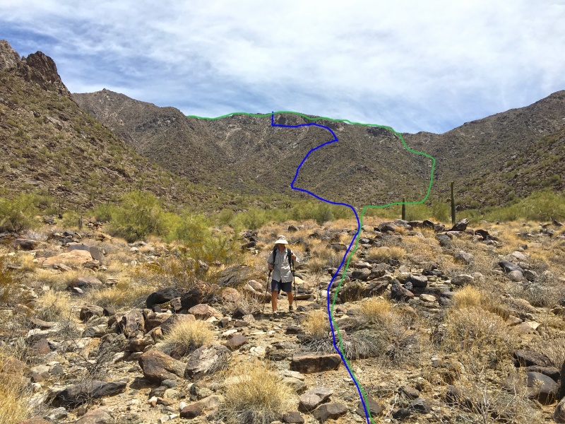
I had read about a climber who tried a route (marked in blue on map) who ended up turning around. So my goal was to aim for the green route. (See map below) As it turned out, the one route I was looking to avoid (blue) was the route we ended up on.
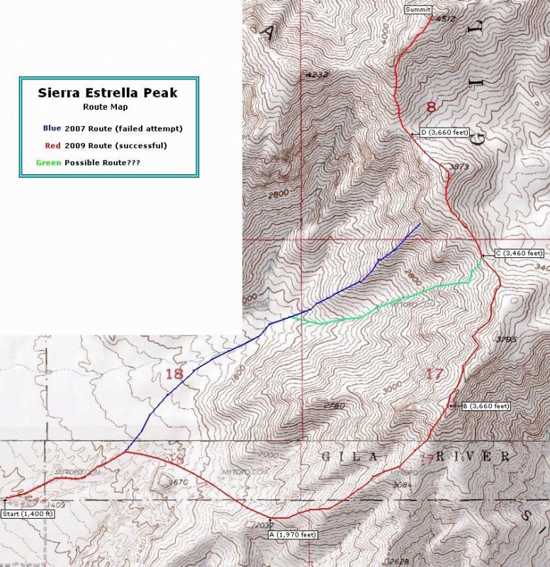
map credit: surgent on SummitPost --https://www.summitpost.org/sierra-estrella-az-route-map/578516
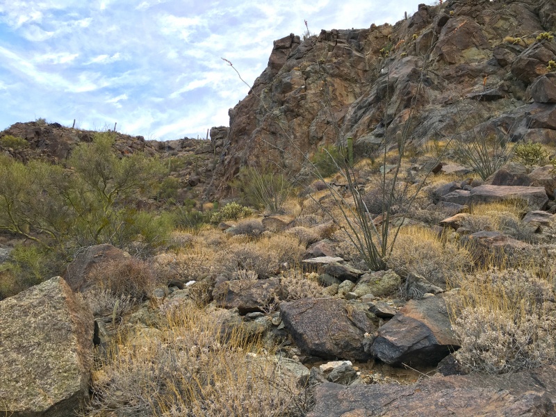
It turned out that it got steeper and steeper the higher up we went. We were heading up the main wash but decided to turn more towards the right (south) to head to a ridge coming down into the wide drainage.
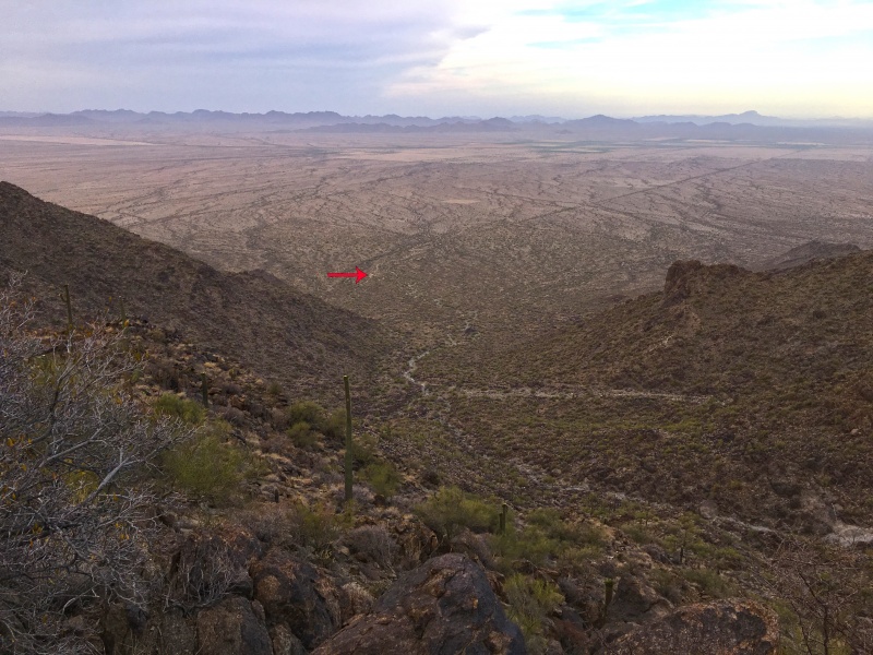
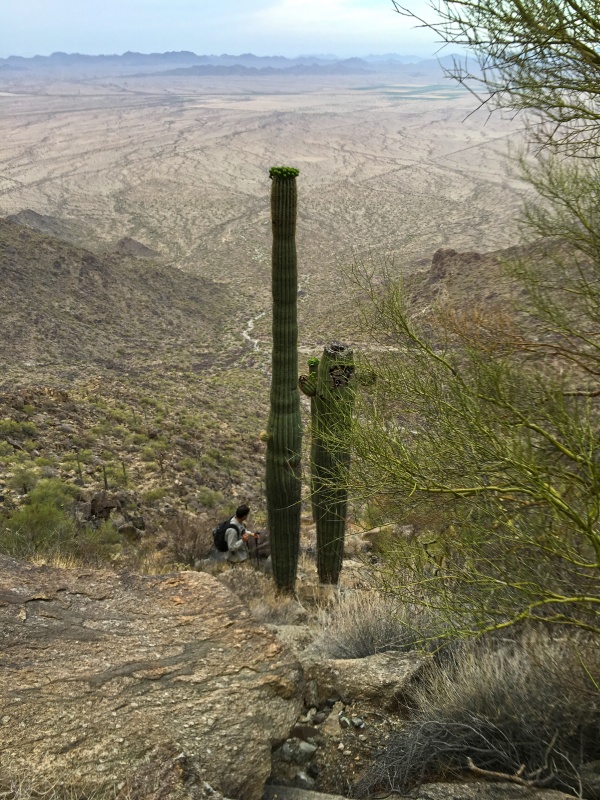
Once we made the top of the western ridge, (but not yet to the main north south ridge) we stop to look back from where we had come. The view was amazing! I drew in the location of where our directions led us to park…next to the campfire ring. We were also blessed this day to have some early morning cloud cover to keep the heat a bay for a while.
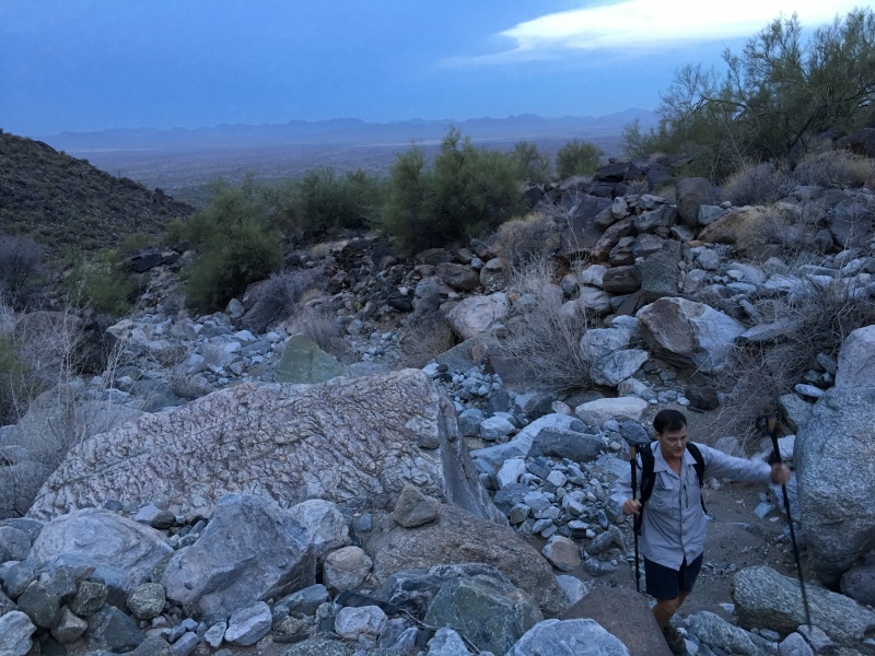
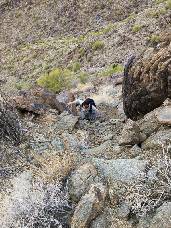
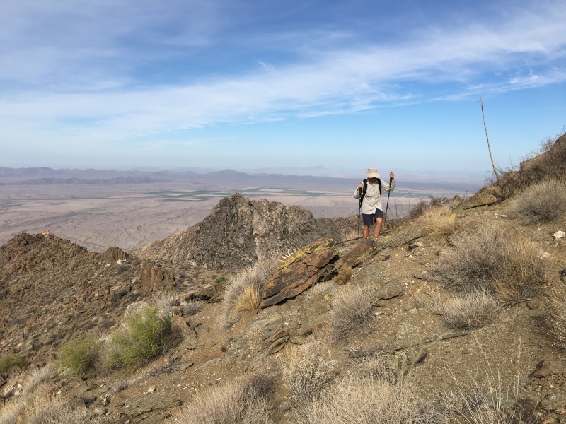
When I said mentioned that there is no trail up this mountain, that is the truth. This is a true bush whack through tough desert/mountainous terrain.
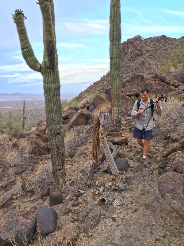
There are all of the typical desert hazards just waiting to jump up and bite you. It goes without saying that is impossible to not get pricked by cactus, scratched by bushes, or scraped on rocks, especially as the terrain steepens and the footing becomes more precarious. I told my partner I was wearing longs pants and he thought I was nuts due to the heat. He later mentioned I made the right choice.
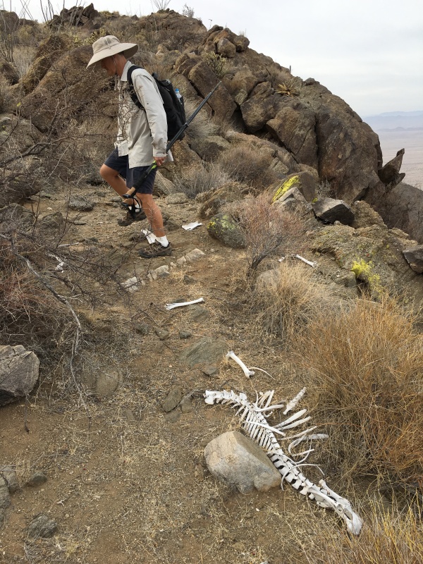
As we were driving out I-10 this morning, Mike mentioned to me that he hope to find some old bones or a carcus of some kind. Up on the north-south ridge after going over Point 3,874’, he got his wish down in the low saddle. Crazy that he just so happen to tell me that!
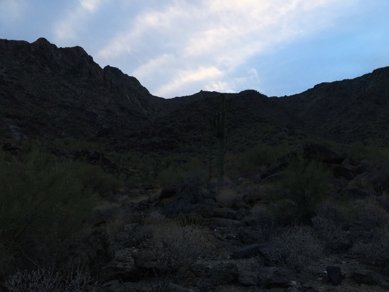
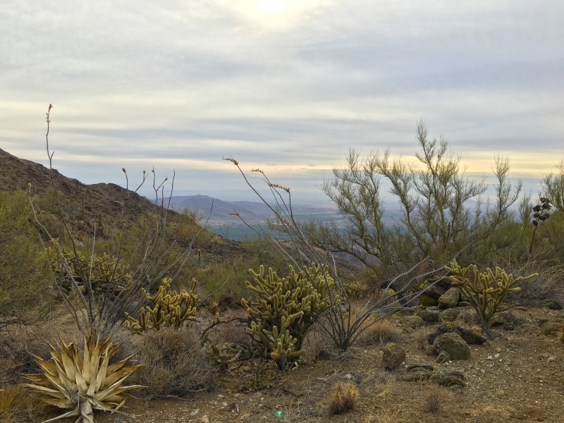
Since I now live in Colorado, I miss the desert flora and the desert smells that are so distinct.
Looking back from where we came, you can see the saddle where the bones lay.

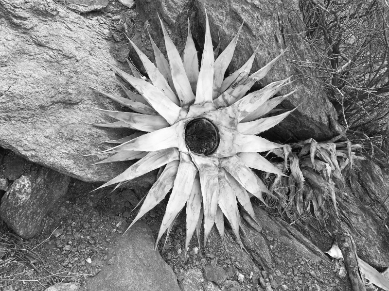
Desert art!
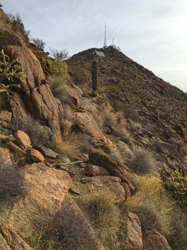
Up on the north-south ridge, you get the view of our summit which is easily marked with all of the transmission towers.
When we came up over Point 3,874’ Mark had mentioned to me he wanted to turn around. He got the typical false summit woes. I explained to him that we were less than a mile and 1,000 vertical feet away and that we would be on top in less than an hour. Then I went on to distract him with my reading of the book DEEP SURVIVAL by Laurence Gonzales. I’ve shared that with many a partner wanting to give up. It worked and he kept climbing with me.
It turned out we were at the radio towers in only 45 minutes arriving at 8:06am. That made our ascent time 3 hours and 20 minutes.

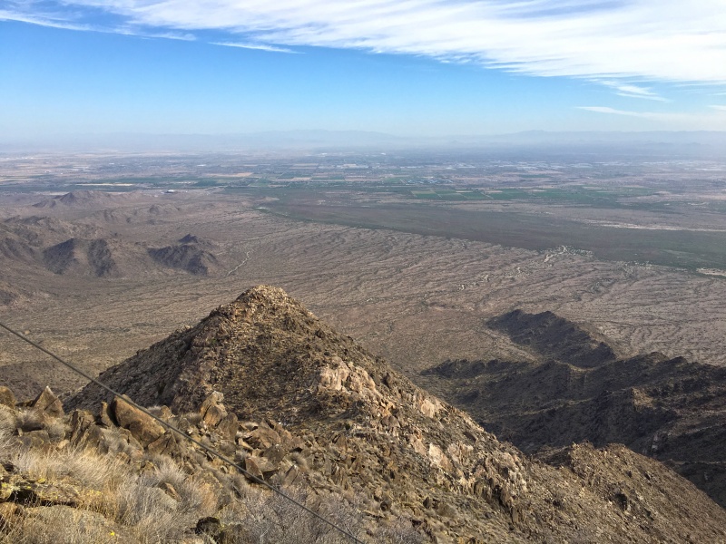
The view down on South Mountain to the east made it obvious that we were twice as high as that mountain. South Mountain looks kinda puny from up here.
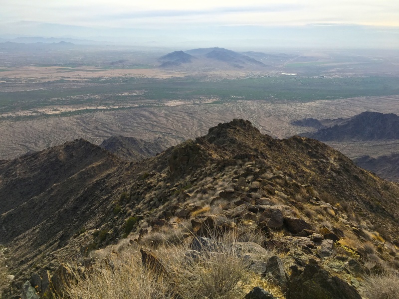
The view over the west valley gives appearance that we are a long ways off. Which is the opposite of looking up at Sierra Estrella from the city. It doesn’t appear to look this far away.
There is a helicopter landing pad just to the northwest of the towers.
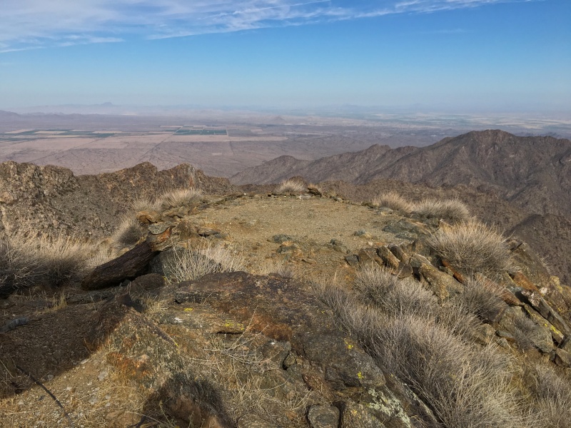
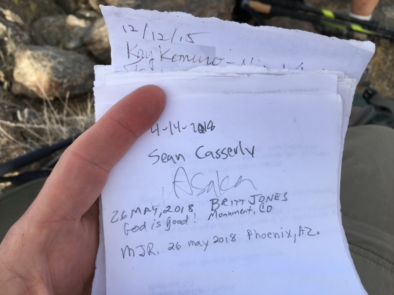
That is your key to finding the summit register. Between the helipad and the towers is where a plastic jar is stashed in some rocks.

We went ahead and left our mark with the few other adventurous souls.
Since we had our bearings now as to where things are, we decided to traverse the north-south ridge further south to descend the less steep green route. For those ascending, the key is to look for the black set of cliffs that are furthest to the south and aim for the drainage just to the right of them.
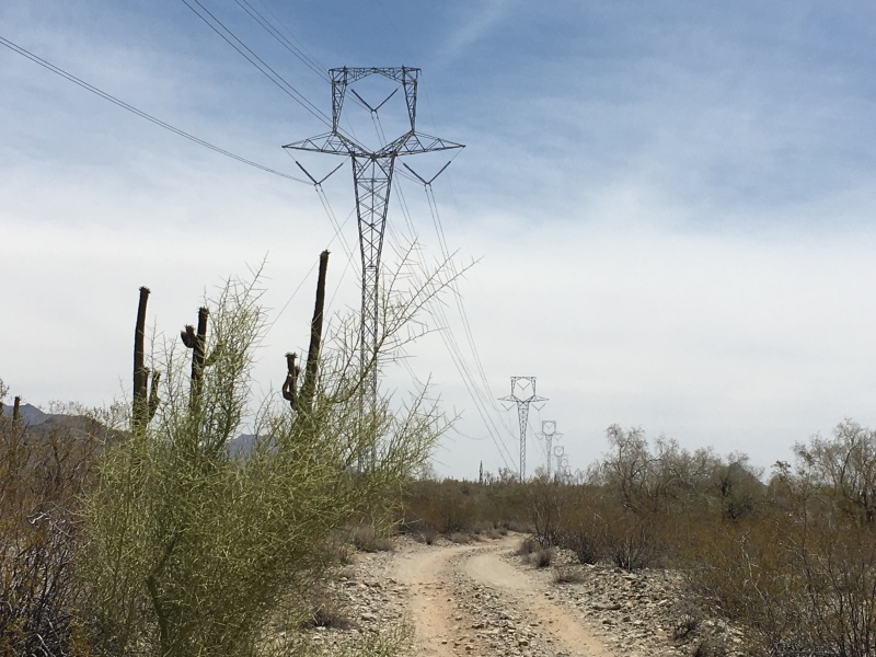
It was May when I was looking to do this climb. And because of that, I had some people respond to my posts for a partner saying, "it was way to hot this time of year to do this climb", and "it is way to strenuous with close to 8 miles of hiking and about 3,500 vertical feet of gain". Note taken…as most people climb Sierra Estrella only from October through April. This was a cooler day (high forecasted only 93 degrees) with cloud cover and a nice breeze. I ended up taking 5 liters of fluids with me, and ended up with one left over. Mike took up 4 liters and drank them all. So I guess I too should pass on the warning: don’t attempt this in the summer months unless you are regularly doing climbs of 3,000-5,000 vertical feet and know what you are doing. We did, and were back at the car at 12:15pm for a 7.5 hour round trip. Here is what the powerlines look like and the northwest/southeast road in the day time during our drive out.
It turned out to be a beautiful climb in the desert and made me miss not living here anymore. We prayed for safety and success before starting this climb and were granted both.
")
")
")
")
")
")
")
")
")
")
")
")
")
")
")
")
")
")
")
")
")
")
")
")
")


