| Report Type | Full |
| Peak(s) |
Harrower Peak - 13057 Mount Helen - 13619 |
| Date Posted | 05/19/2018 |
| Date Climbed | 05/07/2018 |
| Author | Jrodicon |
| The Great Wind River Suffer-Fest of 2018 |
|---|
|
TL;DR: When I was in school at CSU I set out to hike all the 14ers and in the process I found this website and loved reading all the epic trip reports from you animals setting out on epic adventures like week long solo excursions in the Weminuche, and climbing first ascents on Shermapangma. I always dreamed of going on a trip cool enough to warrant writing a trip report about it, and well, I think I finally did it, I did something worth writing about. Hopefully those writing skills that I have hardly exercised since freshman year can do it justice. 1.5 years ago I moved away from Colorado (regretfully before finishing the 14ers) and moved in with a friend in Jackson Hole, WY. That first ski season I went buck wild and skied in the backcountry around Jackson Hole Mountain Resort almost every day and come spring, I found myself climbing up and rappelling into big burly Teton couloirs. I learned a lot last year and even though I wasn't focused as much on peak bagging anymore like I had been in Colorado, I was loving the challenges that ski-mountaineering brought. That summer I stayed in Jackson and did a couple of solo backpacking trips into the Wind River Range to poke around and summit a few 13ers. I had heard about the range before and researched it some while still living in Colorado, but never got a chance to pay a visit. If you haven't been, you are in for a treat. Trust me, no mountain wilderness I've ever been to can equal this spectacular place. The only places in the lower 48 that I think can compare are maybe the Weminuche, North Cascades, and deep in the Sierra backcountry. One of my Wind River trips was to the famous Titcomb Basin and this is when the gears really started turning. I looked around, saw countless couloirs, and knew I had to go back and ski there some day. Fast-forward 7 months: It's March, I'm dealing with a minor but nagging leg injury and can't ski much. Depression sets in, questioning why I'm living at the base of a ski resort when I can't ski. So in that dark moment is when I came up with a plan to make it all worth it. I was going to go to ski in Titcomb Basin in May. I knew my leg would be healed up by then, and it was the only realistic thing crazy and out there enough to make myself feel like I had made the most of my ski season. I knew it would be hard, really hard. I talked to some people I knew who had done it and they made the approach in winter sound like something out of a horror movie. Reading a few trip reports further confirmed this sentiment. So the next month and a half were spent researching the hell out of the route, putting a team and plan together, training, and purchasing the appropriate winter camping gear. I somehow managed to sell a few of my regular ski partners (Conor, Rick, and Matt) on the idea with promises of epic scenic couloirs and lounging in the spring sun at camp sipping on margaritas. I was very careful to say as little as possible about the approach. I honestly had my doubts that it would all pan out, and it still feels like it was all a dream, but at 2:00am on May 7th my alarm went off and it was go time.
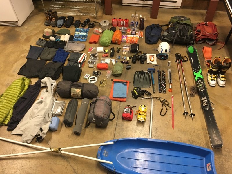
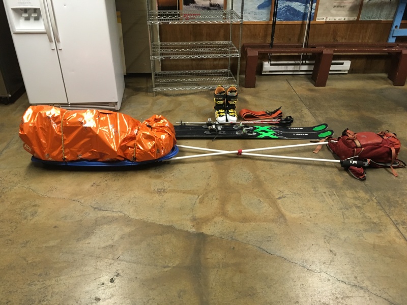
I know the ultralight studs are hyperventilating, I promise I cut a few things before setting out. And yes that is a full liter of whiskey next to the water bottles. Day 1: Jackson to Seneca Lake - Stoke: 3/10 After driving in circles around Jackson picking everyone up and shuffling gear, we were on our way to Elkhart Park outside of Pinedale. I was simultaneously super excited, and also full of dread as I was aware of the suffering that was in store for us. We were able to drive to about a mile from the summer trailhead. We didn't dilly-dally much; once we parked we quickly got our sleds (read torture devices) out from the back of the truck, put on our ski boots, and silently accepted what we were getting ourselves into as we set off at 6:45am.
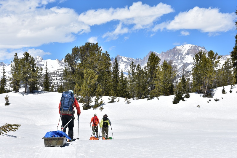
After making quick work of the mile of easy flat travel to the trailhead, the Wind River Range quickly threw its first punch. For the first couple miles the trail follows a stream in a mellow drainage. This meant side-hilling, no big deal if we were hiking on a trail or skinning with packs, but the sleds made this relatively mundane terrain feature a nightmare. It became apparent that our sleds needed some work as they repeatedly rolled in tree wells and dumped all of our gear. We had originally planned on going all the way to Titcomb Basin in a single day but when it took us 4 hours to go the first 3 miles of 16, we realized that maybe we were a bit too ambitious. After making adjustments to the weight distribution and securing our gear better, we began to make better progress. The next 5 miles of the approach are mostly flat through thick forest, luckily we found a faint skin track to lead the way and we hardly had to use GPS at all to navigate to Elklund Lake, the first major landmark along the way. Finally, 7 hours in we felt like we were getting somewhere, and the scenery improved along with our spirits.
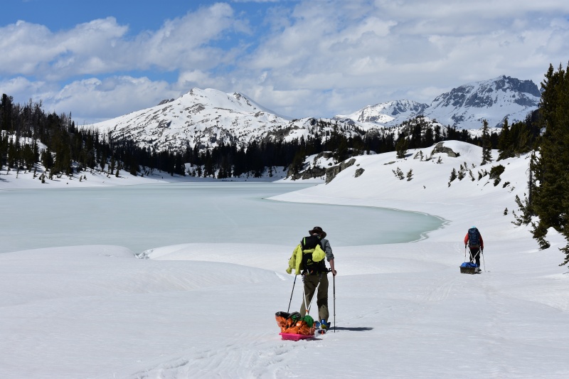
When planning the approach to Titcomb Basin, one of the things I had banked on was that the lakes would be still frozen enough to skin across. The Winds are maze-like and some of the lakes cut through the maze and make navigation and travel much easier. The idea that the lakes were going to be too melted out weighed on my mind a bit, but I honestly thought we would be fine. I guessed wrong... Upon our arrival at Elklund Lake it was obvious that the edges of the lakes were melting out badly, and it was already mid-afternoon on a very hot day. We found a safe-ish looking spot to cross and made it in one piece. This gave us confidence that maybe we could pick our way across the lakes. It was about this time that the Winds decided that we didn't get the message and threw the second punch. At the very next small lake Rick fell right through the ice on the edge and sank up to his knees. I must say I'm impressed by how well he brushed that one off, about 20 minutes of changing socks and trying to squeeze as much water out of his boot liners as possible and he was back skinning. The message was received: lakes are sketchy.
This is when spirits started to drop again. Seneca Lake is a huge lake and skinning across it is vital to making the approach tolerable. At this point we had ruled out skinning across any more lakes and so with disappointment and lots of dread, we made the turn at Hobbs lake towards the summer route rather than taking the shortcut to Seneca Lake. The next few hours are a bit of a blur, all I know is it was miserable, spirits were low, there was lots of steep vertical, and I have memory of being pinned down by my sled in a tree well on a steep slope above a raging stream. I tried my best to block it out and I didn't take any pictures. Eventually we made it to the other side of Seneca Lake and yelled in desperation at Rick to stop as he had kept on skinning ahead. We refused to take another step, we were camping right there. We lazily setup camp, totally worked, but happy as we knew the rest of the way to Titcomb Basin would be easier than what we had already done. We had a small fire to help Rick dry out his boot liners from his polar plunge earlier and turned in for the night. Day 2: Seneca Lake to Titcomb Basin - Stoke: 8/10
With day 1 behind us we were excited for day 2. Originally we had planned on day 2 being a rest day so even though we still had to complete the approach to Titcomb Basin, we treated the day as such. It started with sleeping in and packing up at a leisurely pace. We started skinning away from Seneca Lake around 11am as the sun started getting intense. Hiding under our buffs and thick layers of sunscreen we made our way past Little Seneca Lake and over a couple small passes to Island Lake basin as the view continued to improve.
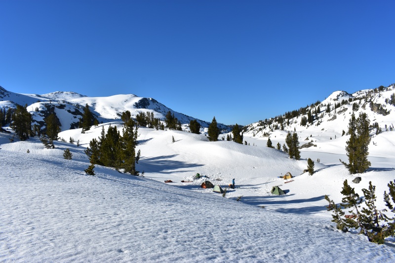
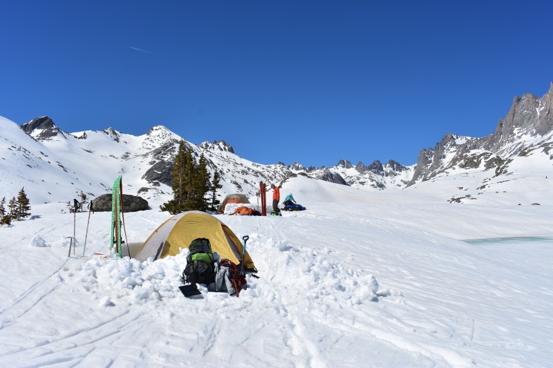
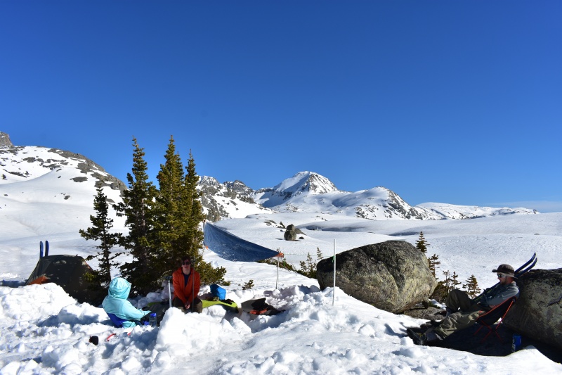
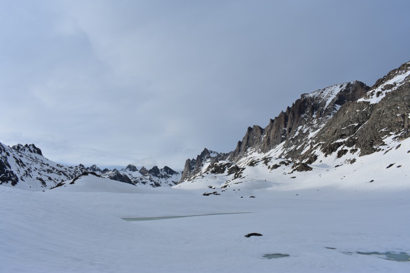
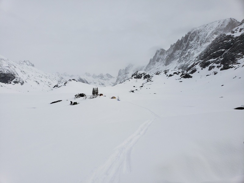
Island Lake is where I had camped the previous summer and I've never had a more scenic campsite, it might be my favorite lake anywhere. What a treat it was to be back with skis on my feet and a deep spring snowpack. We moved quickly through easier terrain and found ourselves at the mouth of Titcomb Basin in about 2 hours and started to look for a good spot to setup basecamp. We wanted easy access to the adjacent Indian Basin so we opted to keep camp in the lower part of the basin. We picked a small hill with a few rocks and trees and spent the afternoon building our dream camp. We had snow walls around our tents, places to hang clothing and skins to dry, dug out a common area to hangout and cook, and made a network of paths in the snow to connect it all together.
We were feeling like kings, my promises of lounging in the spring sun and drinking had panned out, all we had to do now was ski and try not to think about how bad the slog out was going to be in a few days. The rest of the afternoon we just enjoyed the scenery, ate a big dinner, drank more whiskey, made plans for day 3, and watched the sunset in one of the most beautiful places I've ever been. We were stoked that we pushed through and made it this far.
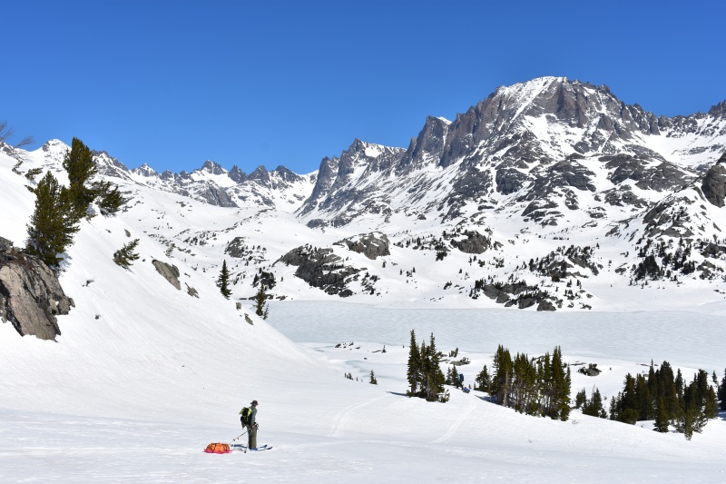
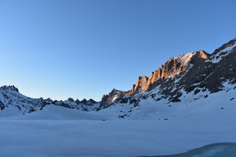
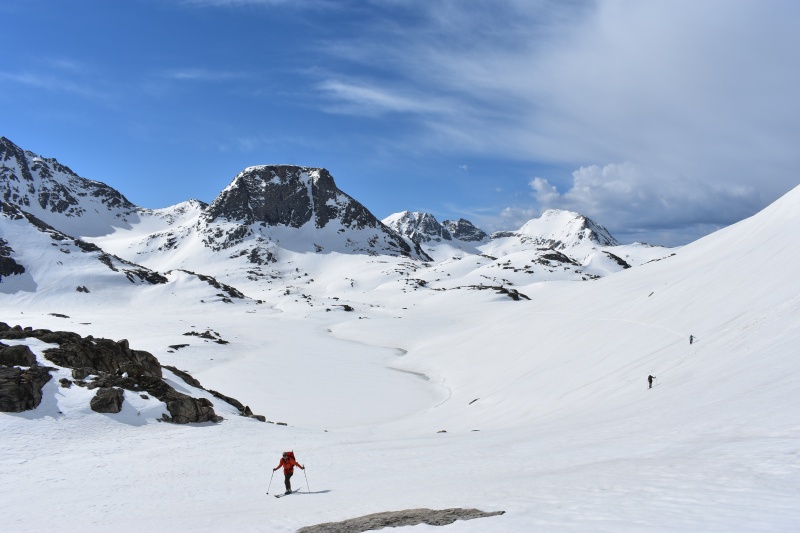
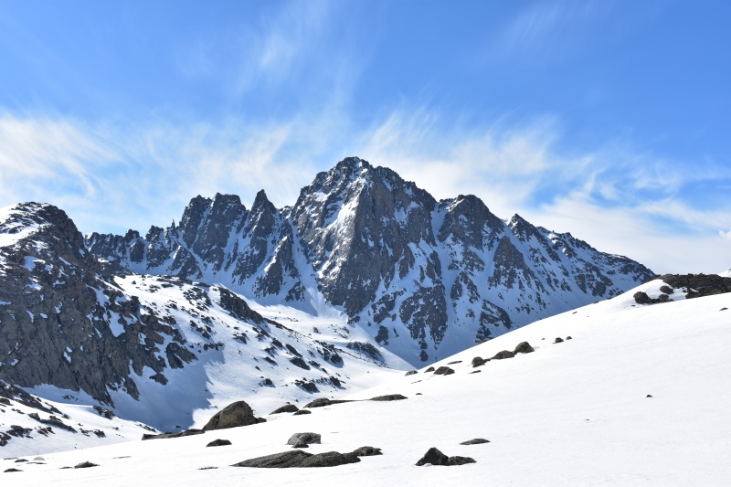
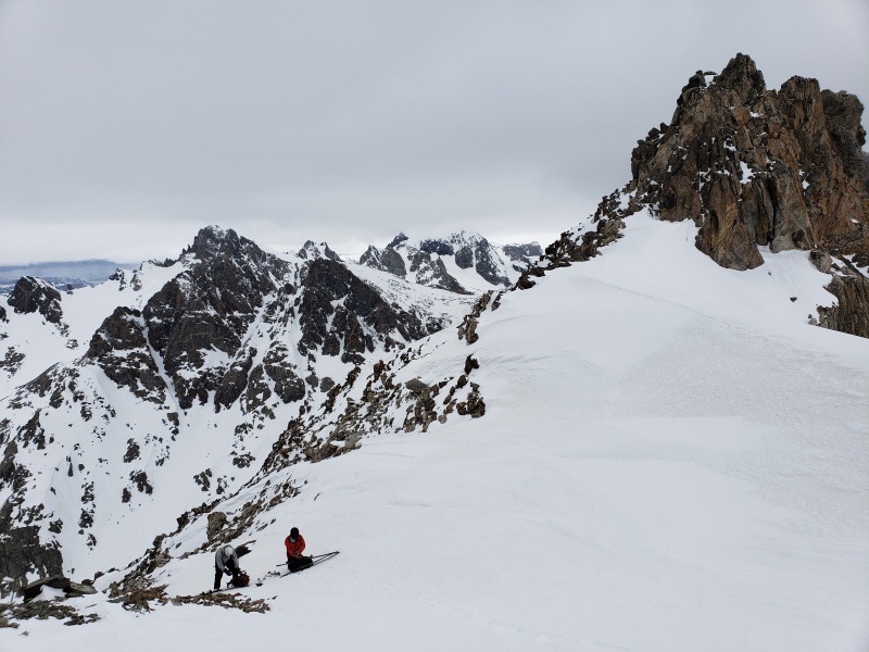
Day 3: North Couloir on Harrower Peak - Stoke: 9/10 We woke up to overcast skies and initially there was a lot of uncertainty about snow conditions and if we would be able to ski. It seemed to freeze pretty well the night before so we hoped for sun to continue the corn cycle. I guess the Winds decided that we had passed the test and earned a good ski day; it quickly cleared and we started skinning towards Indian Basin with light packs. Our initial plan was to climb and ski the South Couloir on Fremont Peak, the 3rd highest peak in Wyoming. It was a big, steep, tight couloir and was our top objective. We skinned through Indian Basin towards the base of our line but it soon became obvious that our delayed start due to overcast skies had ruined our plan. It was really warm, the sun was high, and our line was South facing. So we shifted our focus, we decided a North facing line would give us a better chance of hitting the corn cycle and we turned to head for our second highest priority, Harrower Peak, which was conveniently just across the basin.
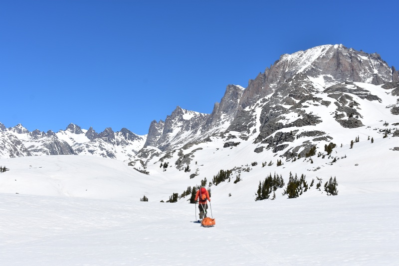
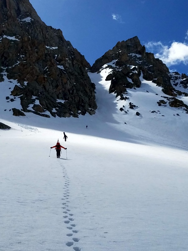
First turns of the trip on the way to Harrower, Fremont and the South Couloir in the background.
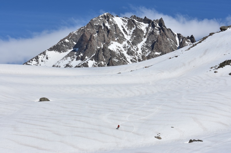
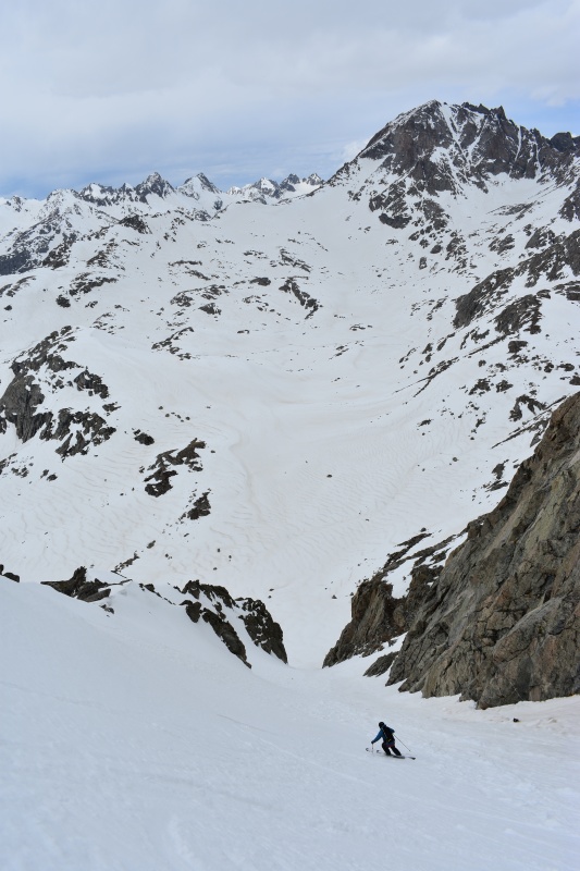
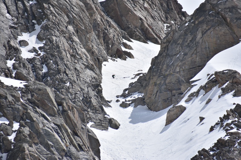
I've never laid eyes on a peak begging to be skied so badly, so many lines! We picked the one just lookers right of the summit as it provided the most vertical. After a quick skin and a few nice turns across the basin we threw on the crampons and started the long boot pack up on firm (and sometimes bulletproof) snow. I felt good and charged ahead, setting the boot pack all the way up to the rocky crux 3/4 of the way up where we found a nice flat spot to hang out and wait for corn-o'clock.
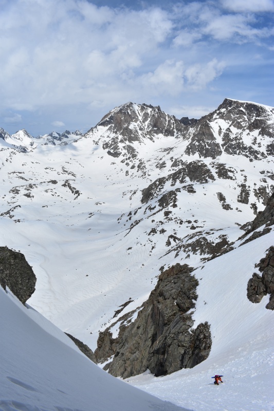
At this point Matt and myself were feeling a little intimidated by the crux, it looked navigable, however it was tight and required a couple sketchy jump turns. I wanted to wait for it to soften up more before committing to it, however Conor and Rick wanted to push on and go for it anyways. So we agreed to split up, the top of the couloir was easily within yelling distance so we could still communicate. All the while clouds were starting to build more and more and we began to worry that it would stop softening up. Eventually Matt and I made the decision that we should ski it while we still can and get down before it freezes up again. So we transitioned and I dropped first. On my first turn I realized that I was selling myself short. With the corn primed and ready the rocky crux above looked a lot less intimidating and I wished that I had kept going. Regardless the clouds were still building and I couldn't abandon Matt so we continued with our descent. I made a few turns and got off to the side to take some pictures as Matt skied out the Couloir in front of me. It was spectacular, exactly the conditions I was looking for. We milked turns down to the apron, went to collect the gear we stashed at the bottom, and turned to wait for Conor and Rick. Of course the sun came back out once we were at the bottom and Conor and Rick enjoyed even better corn conditions with good light. We gathered at the bottom on cloud 9. It didn't matter that Matt and I hadn't gotten the full descent, we had found what we were looking for: steep corn on an aesthetic line.
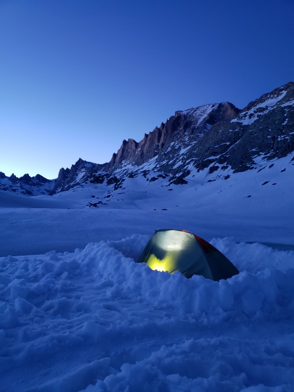
We considered going for another smaller couloir on Harrower to try and get the most of the corn cycle, but a building storm shut us down and we had to make our way back to camp doing our best to not get wet. At camp we hid in our tents from a couple waves of rain before the sun made a quick appearance near sunset, giving us just enough time to enjoy a celebratory drink and dinner outside. With a successful day 3 we had high hopes for the rest of the trip as we turned in for the night with dreams of Fremont Peak.
Day 4: NW Couloir on Mount Helen - Stoke: 7/10
Yup, it snowed. It was only about 3 inches, but it was dumping when we woke up and to top it off the snowpack never froze after the rain the previous day as it had been cloudy the whole night. Fremont was obviously out, because it was south facing and really steep we only really wanted to do it in good corn. We considered doing some powder skiing near camp instead but opted to wait out the snow and sleep in. Before too long the snow let up, however we had overcast skies the remainder of the day. Our dreams of perfect corn couloirs were gone, instead we had wet pow on top of slush. The one thing we had on our side was that even though there wasn't a freeze, the snowpack in the area had already been through such a vicious melt-freeze cycle that everything had shed and we saw no natural avalanche activity beyond a couple small wet loose sloughs. After sitting around not knowing what to do we decided to set out at 1pm and skin to upper Titcomb Basin with the relatively mellow NW Couloir on Mount Helen in mind.
I had somehow managed to forget how long Titcomb Basin is, it was so cruiser and scenic when I hiked through in the summer that I just hadn't noticed that it is nearly 5 miles long. After the last few days we were definitely feeling it, and navigating around the lakes in flat light was tiring even if it was mostly flat. As we approached the base of the couloir Conor made the call to turn back, he wasn't feeling well and decided it wasn't a good day. Matt, Rick, and I continued to the base of the couloir at a snails pace and agreed to keep going only if Rick would set the boot pack. He agreed and so we followed.
As we got into the couloir the slushy base firmed up a bit and the temps were cool, we felt we had the green light and so we continued climbing. The going was slow, we were more exhausted then we thought. The NW couloir is around 2000 vertical feet and it seemed to just go on and on. Despite our agreement, Rick slowed down a lot and so I took over leading and ended up setting the boot pack for most of the top half of the climb. Honestly we really had to reach to make it up that couloir, we were all tired, and it was getting late, we were worked and ready for another rest day. We crested over the top of the couloir at about 5:30pm to get a quick view of Mount Warren and Gannett Peak before turning to try to make it back to camp at a reasonable hour. The skiing was a bit variable, but we found some great soft turns in between the debris and had a great leg burner of a descent.
After briefly rejoicing about the fact that we still managed to find good skiing in a beautiful trophy line we started the long slog back down Titcomb Basin to camp where we greeted Conor and celebrated before an approaching thunderstorm forced us into our tents for the night. Day 5: Hiking out - Stoke: 2/10 It snowed, again.... This time about 6 inches overnight and still dumping when we awoke. We had planned to ski one more line on day 5 and hike part way out in the afternoon, but we didn't even need to get out of our tents to realize that there was too much new snow for anything aggressive. We once again slept in until the snow let up mid-morning. We briefly considered doing some powder skiing and then starting the hike out, however it looked like it was going to snow more so instead we opted to take advantage of the lull in the storm to pack up camp and start hiking out.
It was sad to leave this amazing place, especially with powder skiing on tap, but at the same time we were exhausted, tired of the weather, and ready to get out and have a beer and proper meal back in civilization. It didn't take long after we started hiking for the snow to start back up again, and this time it showed no signs of stopping. We made quick work back to Seneca Lake where we began to try and pick our way around the edge of the lake to avoid suffering through the summer route once again. About halfway around the lake the going got tough, the shore was cliffed out, and the slope above the lake was steep. Right on queue the one and only other group out there (which we had past earlier that morning as they were packing up) caught up to us and skinned right by across the middle of the lake. It felt like they were mocking us as they went right on by without a care in the world. We gave in, we took our chances and found a solid enough place to cross the edge of the lake and proceeded to skin the rest of the way across Seneca. Despite how sketchy it felt it sure felt worth it when we made it back to Hobbs lake in no time at all. This whole time it continued to dump snow and even though we were geared up in gortex, it still managed to soak through all of our layers and we were getting more and more wet by the minute. It was even finding ways to creep through the tarps around the gear on our sleds. The thought of camping another night in these conditions sounded appalling. It wasn't a difficult decision, we made the call to push all they way to the truck, even if it meant getting back late. The rest of the way back was brutal, truly a suffer-fest. I know it was miserable because I didn't take any pictures. Navigation was tough with all the fresh snow and we were almost totally reliant on GPS. At one point we found a recent skin track from someone out on a day hike that morning. Not only did it help with navigation, but also served as a beacon of hope that we weren't that far. It felt like we skinned for an eternity, all the while it continued to snow heavily. Eventually we got within a couple miles of the trailhead and became increasingly excited for burgers and beer at the Wind River Brewery. But the Winds had 1 more big punch to throw. The side-hilling section at the start from day 1 came back with a vengeance. We were so close to the trailhead, and yet, my sled was rolling in tree wells every 10-20 feet, it was heartbreaking and it took forever. I was about to have a mental breakdown when finally I saw it, the trail sign and pit toilets at the trailhead. I've never been so relieved. We still had a grueling mile on the road back to the car, which felt more like 3 miles in the dark after a mega day in the snow. We weren't even capable of talking when we finally made it back to the truck, we just communicated in caveman-like grunts as we escaped the prisons that were our ski boots and scarfed down donuts and beers. I've done some big slogs in my short 24 years, but I think this day takes the cake for the hardest I've ever pushed myself. The hellish side-hilling section had taken up so much time that the Wind River Brewery was closed by the time we made it to Pinedale. The best we could do was a convenience store before making the drive back to Jackson and slipping into bed at 2am, exactly 5 days after we set out. When we arrived back we found out that the storm we hiked out through was forecasted to drop 20 inches on the Winds and it wasn't going to be blue again for another 5 days. I've heard a few different people say "never again" after getting back from a Wind River ski trip, now I understand why. But I think given enough time I'll forget about all the suffering and before I know it I'll be dreaming of getting back to ski in Titcomb Basin once again. If you made it this far, thanks for reading, I hope you enjoyed. And remember, if you don't go, you won't know. Thumbnails for uploaded photos (click to open slideshow): ")
")
")
")
")
")
")
")
")
")
")
")
")
")
")
")
")
")
")
")
")
")
")
")
")
")
")
")
")
")
")
")
")
")
")
|
| Comments or Questions | |||||||||||||||
|---|---|---|---|---|---|---|---|---|---|---|---|---|---|---|---|
|
Caution: The information contained in this report may not be accurate and should not be the only resource used in preparation for your climb. Failure to have the necessary experience, physical conditioning, supplies or equipment can result in injury or death. 14ers.com and the author(s) of this report provide no warranties, either express or implied, that the information provided is accurate or reliable. By using the information provided, you agree to indemnify and hold harmless 14ers.com and the report author(s) with respect to any claims and demands against them, including any attorney fees and expenses. Please read the 14ers.com Safety and Disclaimer pages for more information.
Please respect private property: 14ers.com supports the rights of private landowners to determine how and by whom their land will be used. In Colorado, it is your responsibility to determine if land is private and to obtain the appropriate permission before entering the property.