Download Agreement, Release, and Acknowledgement of Risk:
You (the person requesting this file download) fully understand mountain climbing ("Activity") involves risks and dangers of serious bodily injury, including permanent disability, paralysis, and death ("Risks") and you fully accept and assume all such risks and all responsibility for losses, costs, and damages you incur as a result of your participation in this Activity.
You acknowledge that information in the file you have chosen to download may not be accurate and may contain errors. You agree to assume all risks when using this information and agree to release and discharge 14ers.com, 14ers Inc. and the author(s) of such information (collectively, the "Released Parties").
You hereby discharge the Released Parties from all damages, actions, claims and liabilities of any nature, specifically including, but not limited to, damages, actions, claims and liabilities arising from or related to the negligence of the Released Parties. You further agree to indemnify, hold harmless and defend 14ers.com, 14ers Inc. and each of the other Released Parties from and against any loss, damage, liability and expense, including costs and attorney fees, incurred by 14ers.com, 14ers Inc. or any of the other Released Parties as a result of you using information provided on the 14ers.com or 14ers Inc. websites.
You have read this agreement, fully understand its terms and intend it to be a complete and unconditional release of all liability to the greatest extent allowed by law and agree that if any portion of this agreement is held to be invalid the balance, notwithstanding, shall continue in full force and effect.
By clicking "OK" you agree to these terms. If you DO NOT agree, click "Cancel"...
South Mt. Elbert - East Ridge / end of 4WD road - 9/5/05
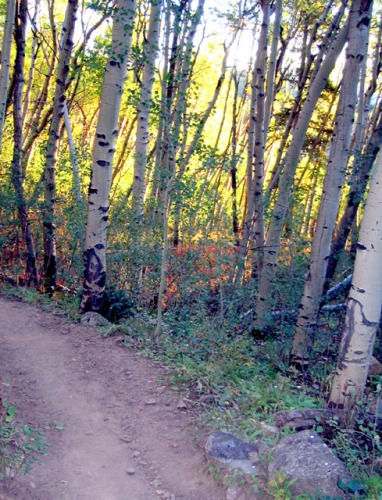
Made it up the 4WD road just fine in my stock Xterra, though there were a few sections that required careful tire placement. Left the trailhead at 6:45 a.m. Traversed through the thick Aspen grove with the morning sun trickling through -- very nice. Some leaves are already gold.
After doing Yale two days earlier (and hiking a little the day before), my legs were a little stiff, but not bad. Really noticed it on the steeper sections, but amazingly, it went away and I got in a groove.
Great weather at first, but above treeline the wind picked up and I found myself putting on the warm-weather hat on more than one occasion (that said, I was still OK in shorts all day).
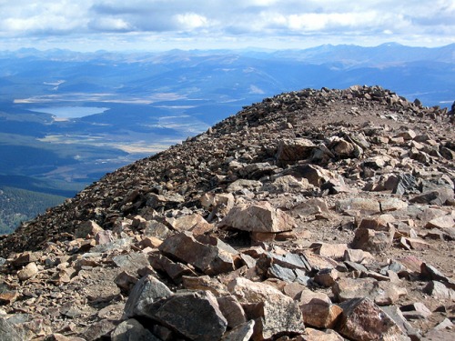
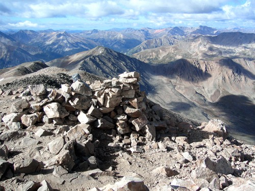
Hit the summit at about 9:45 and met just one other guy. Stellar views, naturally. Felt good to be on the highest point in Colorado. My GPS displayed a solid 14,466, though it had to be off (or was it? ).
Clouds started building and bloating around the peaks. Some had dark bottoms, but none looked threatening. On the way down we passed at least 10 others that were on their way up ... and looking northeast I counted at least 15 climbers.
Great climb ... beautiful mountain.
Thumbnails for uploaded photos (click to open slideshow):
Comments or Questions
Caution: The information contained in this report may not be accurate and should not be the only resource used in preparation for your climb. Failure to have the necessary experience, physical conditioning, supplies or equipment can result in injury or death. 14ers.com and the author(s) of this report provide no warranties, either express or implied, that the information provided is accurate or reliable. By using the information provided, you agree to indemnify and hold harmless 14ers.com and the report author(s) with respect to any claims and demands against them, including any attorney fees and expenses. Please read the 14ers.com Safety and Disclaimer pages for more information.
Please respect private property: 14ers.com supports the rights of private landowners to determine how and by whom their land will be used. In Colorado, it is your responsibility to determine if land is private and to obtain the appropriate permission before entering the property.
")
")
")

