Download Agreement, Release, and Acknowledgement of Risk:
You (the person requesting this file download) fully understand mountain climbing ("Activity") involves risks and dangers of serious bodily injury, including permanent disability, paralysis, and death ("Risks") and you fully accept and assume all such risks and all responsibility for losses, costs, and damages you incur as a result of your participation in this Activity.
You acknowledge that information in the file you have chosen to download may not be accurate and may contain errors. You agree to assume all risks when using this information and agree to release and discharge 14ers.com, 14ers Inc. and the author(s) of such information (collectively, the "Released Parties").
You hereby discharge the Released Parties from all damages, actions, claims and liabilities of any nature, specifically including, but not limited to, damages, actions, claims and liabilities arising from or related to the negligence of the Released Parties. You further agree to indemnify, hold harmless and defend 14ers.com, 14ers Inc. and each of the other Released Parties from and against any loss, damage, liability and expense, including costs and attorney fees, incurred by 14ers.com, 14ers Inc. or any of the other Released Parties as a result of you using information provided on the 14ers.com or 14ers Inc. websites.
You have read this agreement, fully understand its terms and intend it to be a complete and unconditional release of all liability to the greatest extent allowed by law and agree that if any portion of this agreement is held to be invalid the balance, notwithstanding, shall continue in full force and effect.
By clicking "OK" you agree to these terms. If you DO NOT agree, click "Cancel"...
It all started with a poor nights sleep. Originally we had planned on climbing a 13er on Saturday. After shutting off the alarm repeatedly we finally struggled awake and decided we needed a new plan. Turns out Paula had a Plan D bookmarked on her phone: Dicks Peak. Where is Dicks Peak you ask? Good question. South of Hartsel near Highway 9 apparently. Frankly that still meant nothing to us. Neither of us knew anything about this area other than the directions on the webpage she had bookmarked. Since we had decided our original plan was too big for us to handle a 10,000 foot peak sounded like just the right size. We packed up the dogs and off we went to venture into the unknown. It was time to find out if Dicks Peak would be fun or if it would come up a bit short.
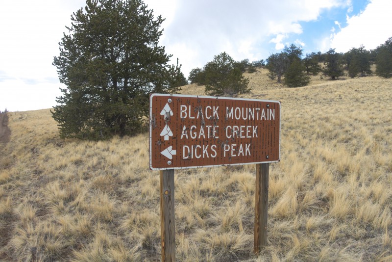
After you turn off Highway 9 onto Forest Service 108 you are looking for an obvious sign after about 4 miles.
Well, we're going left obviously....
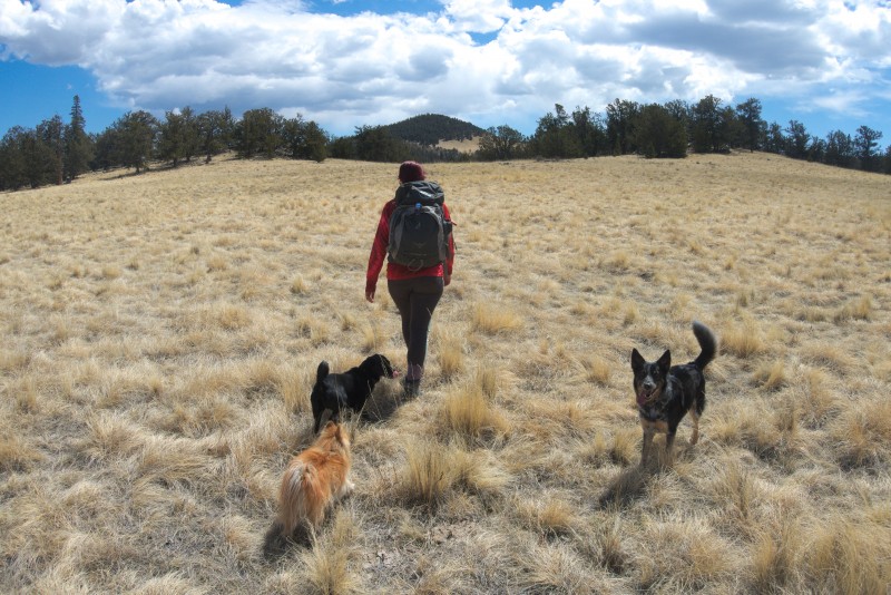
After about a mile on an unnamed forest service road in the middle of nowhere the directions said to park the car and start hiking east. So we did. We hoped we were up for this. Shortly after starting out we had to go down. I guess it only makes sense that if you're going to climb onto Dicks Peak you need to go down a bit first.
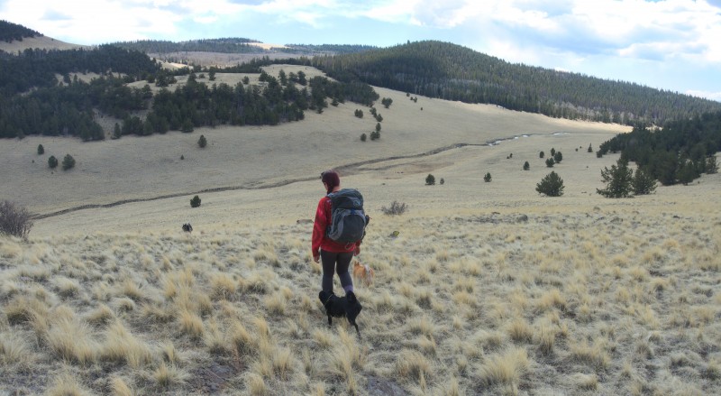
Starting out from the car with all of the dogs
Going down
We had to cross a dry creek which proved to be no obstacle. The area was completely dry and the creek wasn't even a little bit moist.
The dogs are already starting to wonder how many bad jokes we are going to make. Turns out ...all of them.
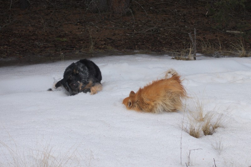
Dogs did manage to find some snow to roll in (no bad joke here, just dogs in snow)
This wasn't supposed to be a long hike but it turned out we couldn't see the actual summit for most of the hike. We had to contour around some bumps on the way. We eventually decided that one of them was just a wart.
Not the tip. Just a wart.
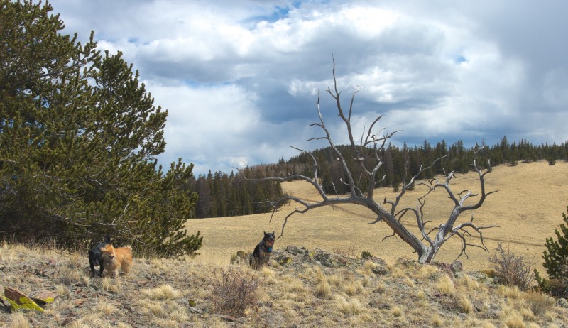
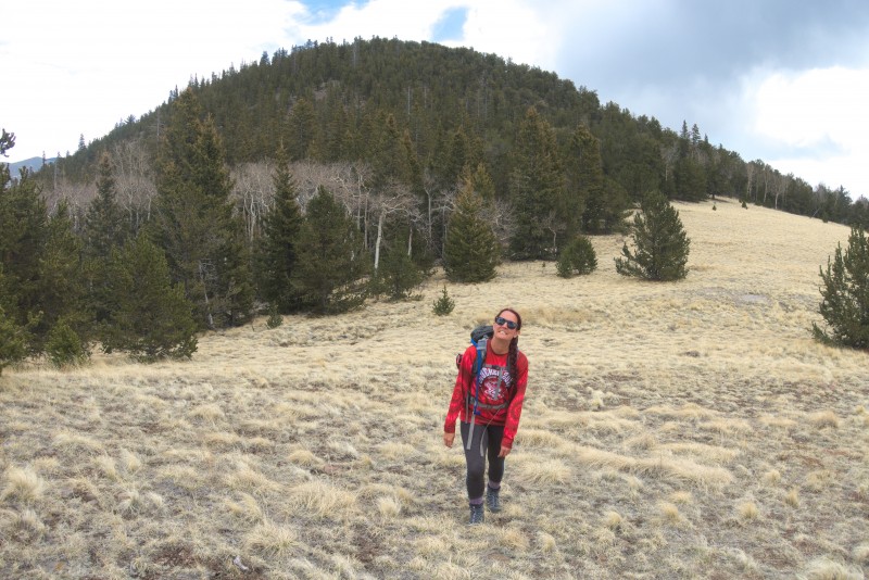
Beautiful open views on the way. A bit bald so to speak.
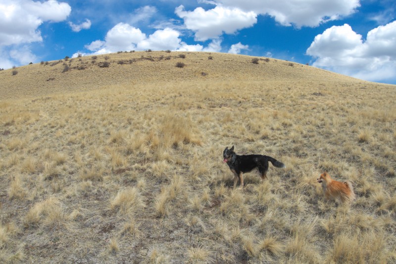
Posers. Also they are not finding this nearly as funny as us.
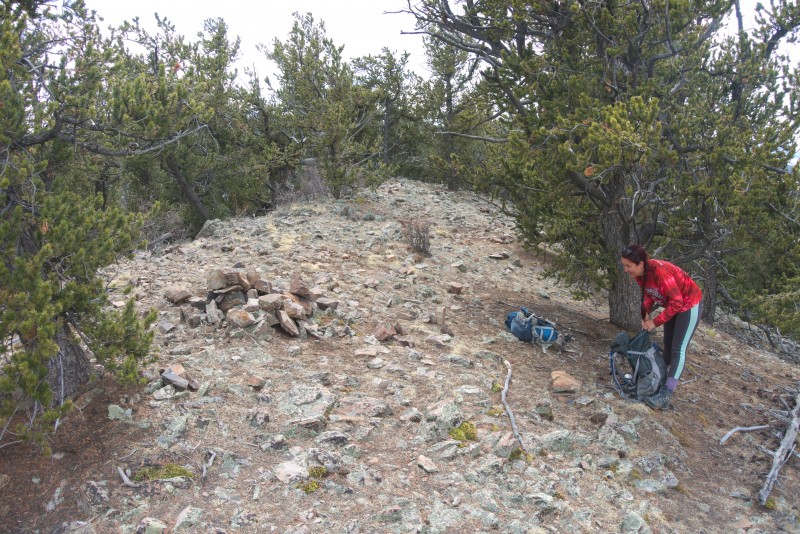
We got a little too high on the wart and had to go back down a little before heading back up. We had to pass through some stubble...err, trees to get to the actual base. Once we saw the actual summit we briefly discussed whether to circle around the summit to check out the girth. For future travelers of course. We didn't want anyone else to get surprised by the size of the peak.
At one point I asked Maya to find me a shrubbery. She did not.
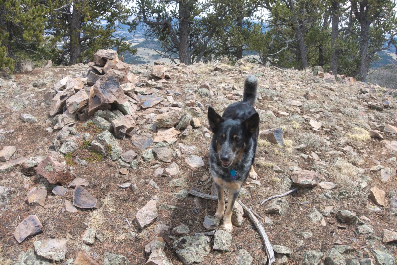
We passed through one more open area and saw the actual summit. It looked like it might be pretty hard. We figured that this summit was below treeline so it was unlikely the summit would be bald but we didn't know. I also expressed that if there wasn't a register on this peak I was going to be very disappointed (there wasn't, someone should take one). I commented that I hoped there wasn't a hole on top of the tip either.
Finally we reached the climax of our adventure and found the tip.
Just the tip
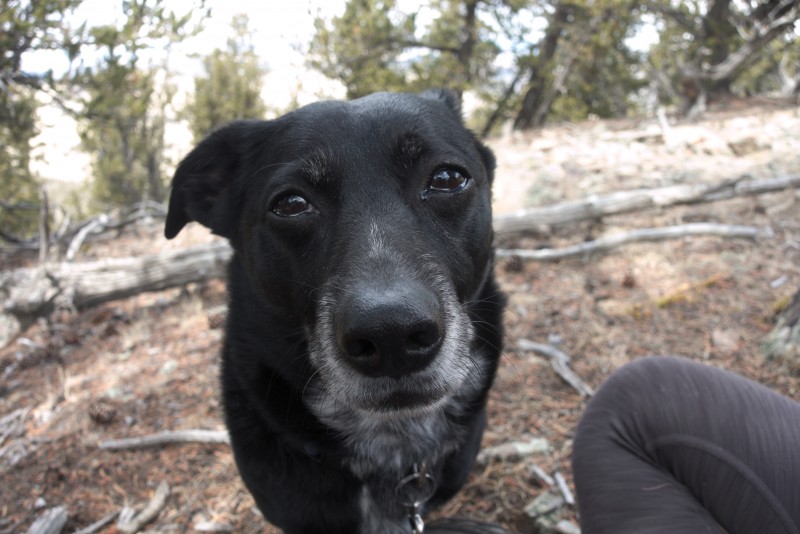
Dad, can we lay off the jokes now that we made the summit? No, Maya. No we cannot.
We enjoyed a summit meal of sausage (what else?) and cheese. Not much of a view from the summit. Dicks Peak just doesn't rise that high and have enough prominence. We remarked that we didn't know how many people had climbed Dicks Peak and figured it might be pretty lonely. At least it got some love today.
Why do you keep making these jokes?
Eventually it was time to get off and head back to the car. We saw some clouds forming but they never did anything. No one was getting wet on Dicks Peak today.
Happy that we gave Dicks Peak some attention today
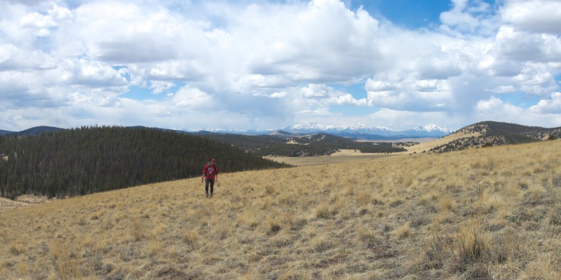
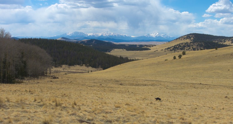
Views on the way back to the car
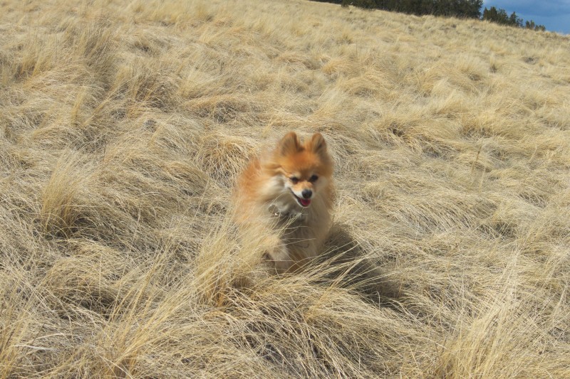
Zero tries to blend in with the grass
We spent an enjoyable few hours on Dicks Peak. It was about 4 miles RT and we did about 1200 feet of elevation gain. Everyone had fun. Plan D was pretty wild and certainly rose to our needs. It's also completely safe to climb unprotected.
Thumbnails for uploaded photos (click to open slideshow):
I'm not sure which is funnier - the TR or the comments. Thanks for the laughs, guys!
Caution: The information contained in this report may not be accurate and should not be the only resource used in preparation for your climb. Failure to have the necessary experience, physical conditioning, supplies or equipment can result in injury or death. 14ers.com and the author(s) of this report provide no warranties, either express or implied, that the information provided is accurate or reliable. By using the information provided, you agree to indemnify and hold harmless 14ers.com and the report author(s) with respect to any claims and demands against them, including any attorney fees and expenses. Please read the 14ers.com Safety and Disclaimer pages for more information.
Please respect private property: 14ers.com supports the rights of private landowners to determine how and by whom their land will be used. In Colorado, it is your responsibility to determine if land is private and to obtain the appropriate permission before entering the property.

")
")
")
")
")
")
")
")
")
")
")
")
")
")