Download Agreement, Release, and Acknowledgement of Risk:
You (the person requesting this file download) fully understand mountain climbing ("Activity") involves risks and dangers of serious bodily injury, including permanent disability, paralysis, and death ("Risks") and you fully accept and assume all such risks and all responsibility for losses, costs, and damages you incur as a result of your participation in this Activity.
You acknowledge that information in the file you have chosen to download may not be accurate and may contain errors. You agree to assume all risks when using this information and agree to release and discharge 14ers.com, 14ers Inc. and the author(s) of such information (collectively, the "Released Parties").
You hereby discharge the Released Parties from all damages, actions, claims and liabilities of any nature, specifically including, but not limited to, damages, actions, claims and liabilities arising from or related to the negligence of the Released Parties. You further agree to indemnify, hold harmless and defend 14ers.com, 14ers Inc. and each of the other Released Parties from and against any loss, damage, liability and expense, including costs and attorney fees, incurred by 14ers.com, 14ers Inc. or any of the other Released Parties as a result of you using information provided on the 14ers.com or 14ers Inc. websites.
You have read this agreement, fully understand its terms and intend it to be a complete and unconditional release of all liability to the greatest extent allowed by law and agree that if any portion of this agreement is held to be invalid the balance, notwithstanding, shall continue in full force and effect.
By clicking "OK" you agree to these terms. If you DO NOT agree, click "Cancel"...
Bill asked if I would try out Version 2.0 of the Trip Report editor, so I figured I might as well do a real one to learn the new format (love it so far - thanks Bill!).
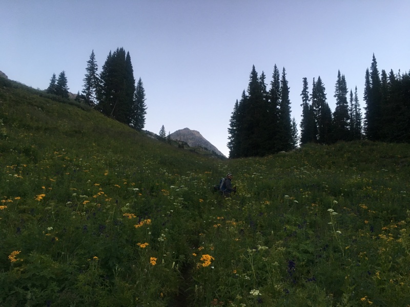
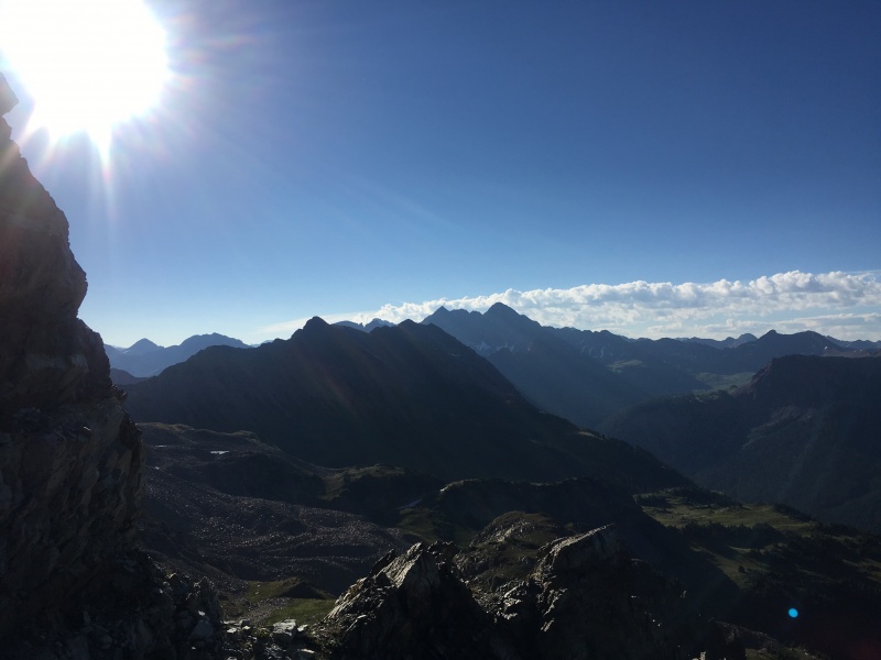
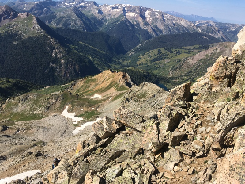
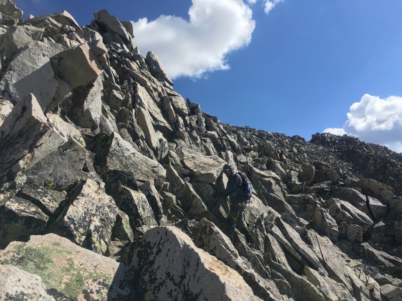
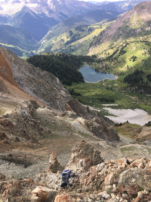
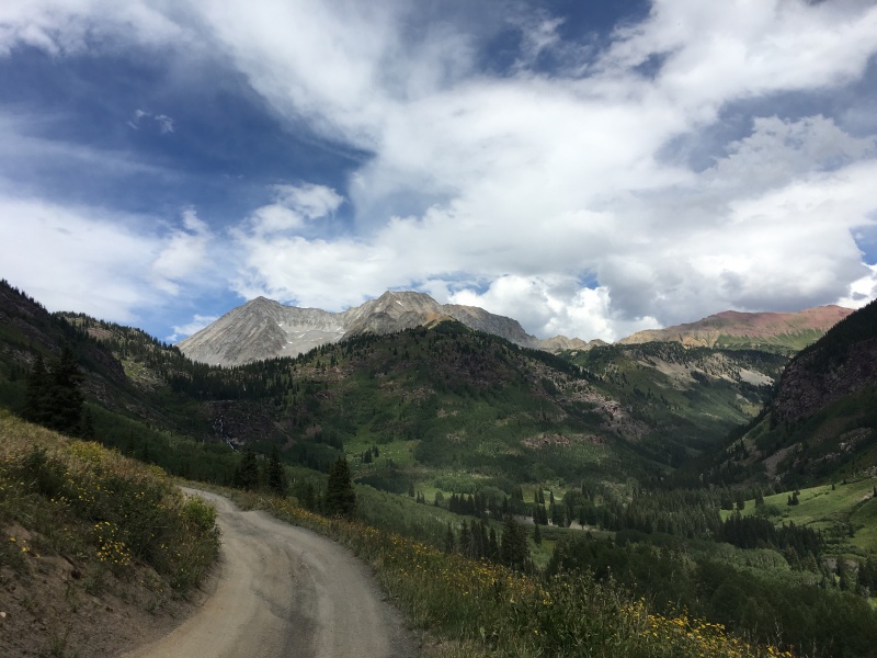
Ryan surveying the lower portions of Hagerman's SW Ridge.
On this fine August Saturday, Ryan Richardson (RyGuy) and I had our sights set on Hagerman Peak. Ryan is getting close to finishing the Centennials and I've been working on catching up to him. Hagerman is a peak that scared us both a bit. It is known for loose rock that is large enough to do some real damage if it moves on you. We played a game that day. We would keep track of rockfall that we each caused, and like golf, lowest score wins.
Summary Stats
Trailhead - Geneva Lake 4WD (thanks Ryan's new Jeep) Miles ~10.5 Vertical ~4,600' To summit - 4:46 Car to car - 8:37
The Climb
Ryan wanted to try out his new Jeep getting up to the 4WD trailhead, so we left the front range Friday afternoon and tried to get up there before dark. The Jeep did great working its way up the challenging road and we arrived at the 4WD trailhead just after dark, quickly setting up our tents to get some rest before the climb.
We headed out pre-dawn Saturday morning to make sure we were up and down before any afternoon electrical storm activity.
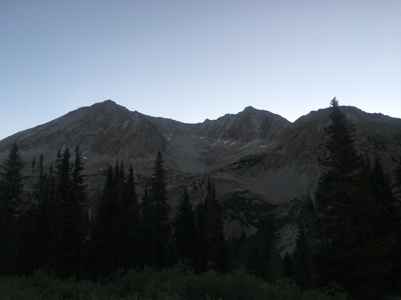
Ryan following the faint trail to Geneva Lake and I finally understood why he wears gaiters in the summer. My pants were soaked!Snowmass on the left and Hagerman to the right.
At Geneva Lake, we put on our helmets and opted for a gully ascent to gain the Southwest Ridge. Time to start the rockfall golf game. Awards were to be given for First, Biggest, Most and Farthest. A player would be disqualified if a rock hit his partner. I led the way up the gully and quickly got on the scoreboard for First and Biggest. Thankfully, it didn't go far at all and I was not disqualified. It was a good reminder of our loose terrain and we re-committed to taking good care of each other the rest of the day.
Starting up our approach gully.Looking back down the approach gully.Snowmass from the approach gully.On the SW Ridge and the Bells come into view!
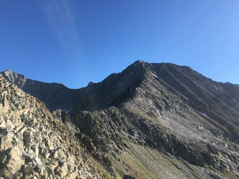
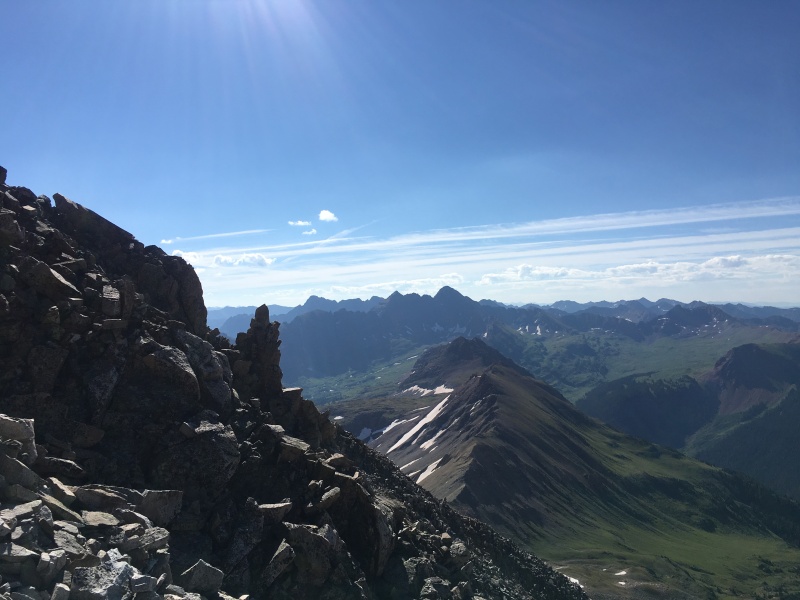
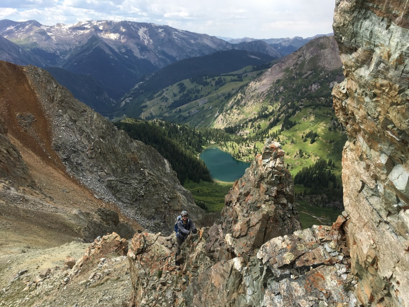
Once on the ridge, our goal was to stay ridge proper as best we possibly could. This turned out to be a VERY good strategy. While there was certainly a bit more exposure here and there as we worked our way up the ridge, we found the rock to be far more solid along the spine than if we ventured below the ridge crest looking for easier ground.
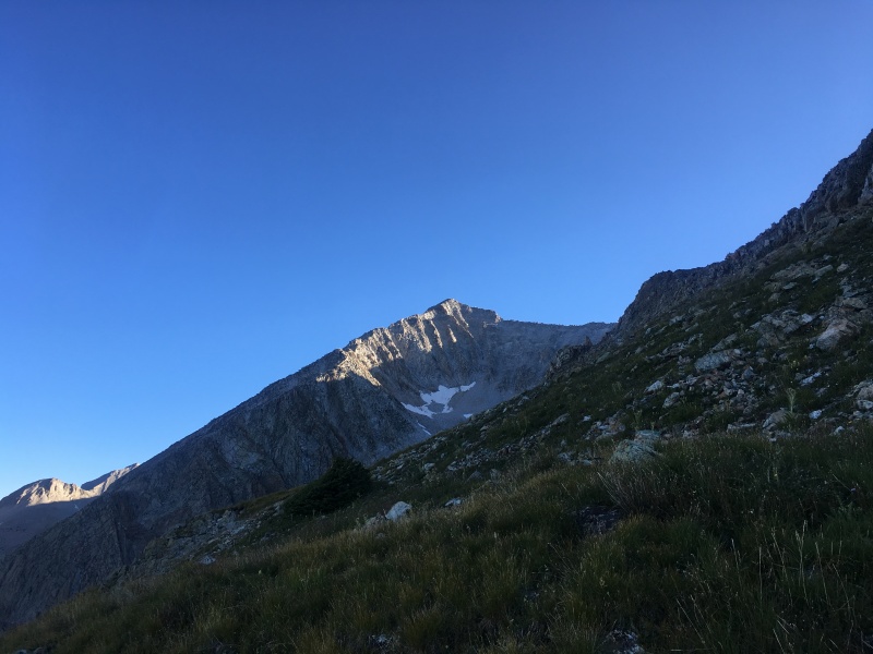
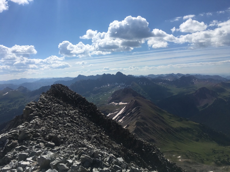
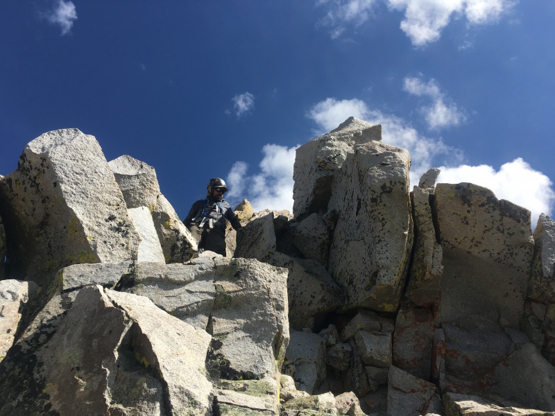
Looking at the SW Ridge up to Hagerman.One of the more solid sections of rock.Looking back down the ridge. Our approach gully came up the right side of the prominent notch below the brown slope.Near the top the slope angle eases up a bit.Nearing the top on a section that would access the South face route.
It appeared things would get a bit easier near the top, but we found that the easier slope angle also led to less solid rock. This is one of the few places where you could transition over to the South Face route that Roach indicates is the easiest way to climb Hagerman. It looked loose and crappy to us - we were pretty pleased that we had chosen the SW Ridge route and never even talked about moving to the South Face route for the finish (or for the descent for that matter).
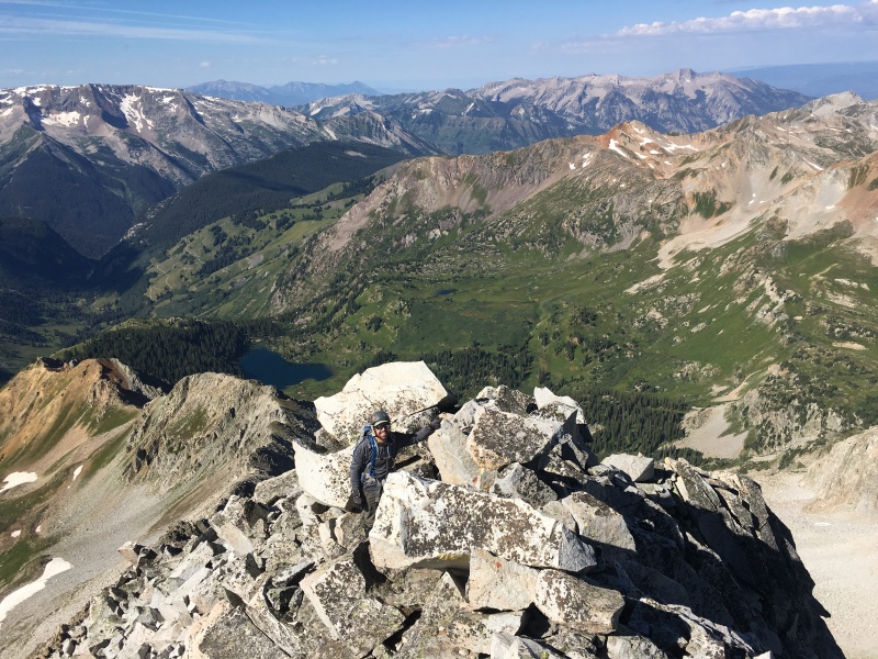
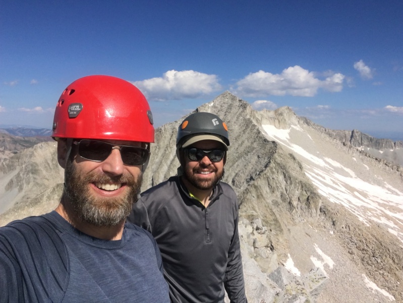
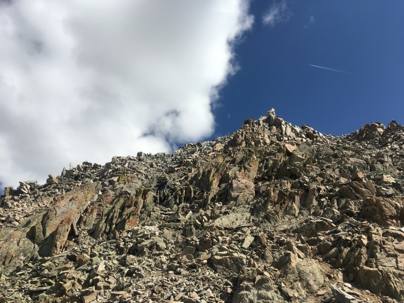
Looking across at the Bells.A loose mess just below the summit.Ryan topping out.Summit shot with Snowmass in the background.
We tried to sign the summit register, but it was hanging on by a thread. It was soaking wet, ripped, tattered and torn. We were able to make out many familiar names on it and decided to take it down with us since it was clearly not doing well up there and wouldn't survive for much longer (see photo at end after its rehab).
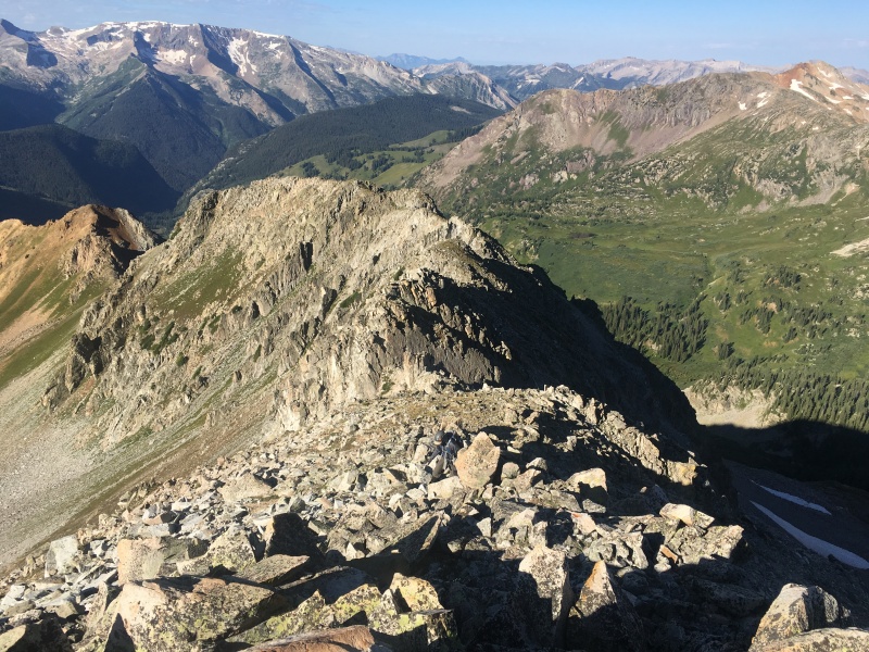
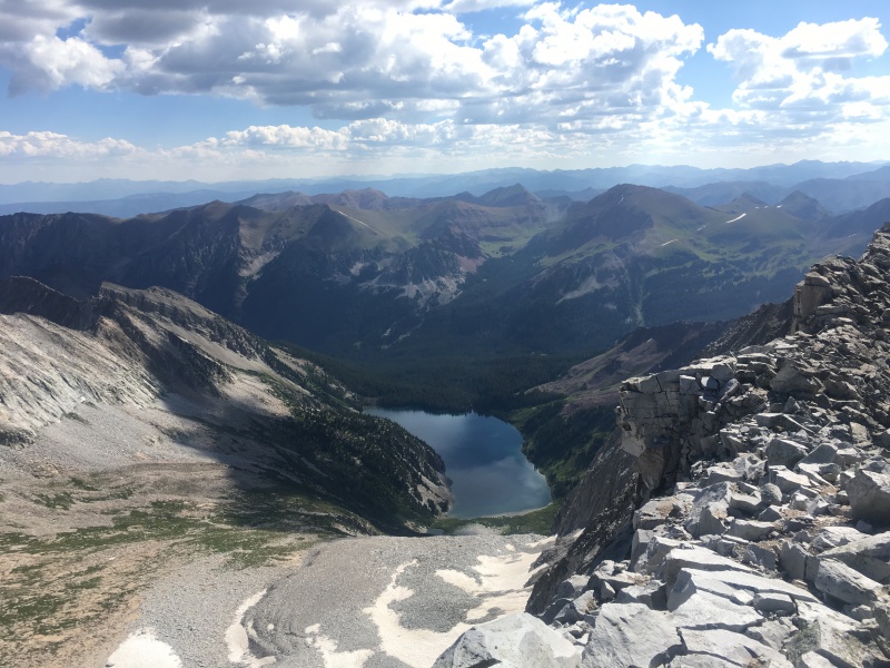
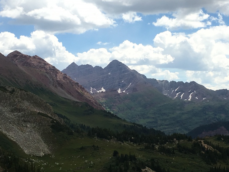
The Bells.Snowmass Lake.A nicer view of Snowmass without our mugs in the way.
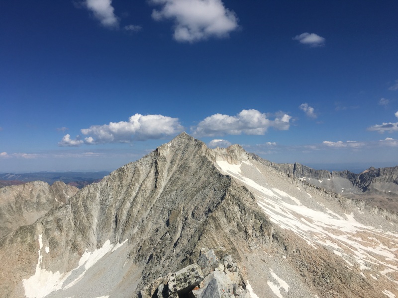
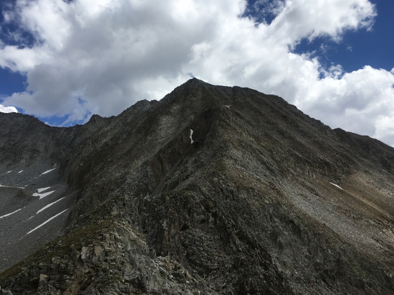
We talked a bit on the summit about going over to unranked 13er Snowmass Peak (13,620' - the prominent peak seen from Snowmass Lake on the other side). There were some clouds building to the west, so we opted to play it safe and head down, not wanting to be on the ridge in a rainstorm (or worse, with lightning). We reminded each other again to take it slow and push down and in on the rocks to keep things from moving. Ryan took the lead at some point during the day on the "Most" and "Farthest" categories, but he never came close to my first one that still reigned "Biggest". No one had been disqualified yet and we intended to keep it that way.
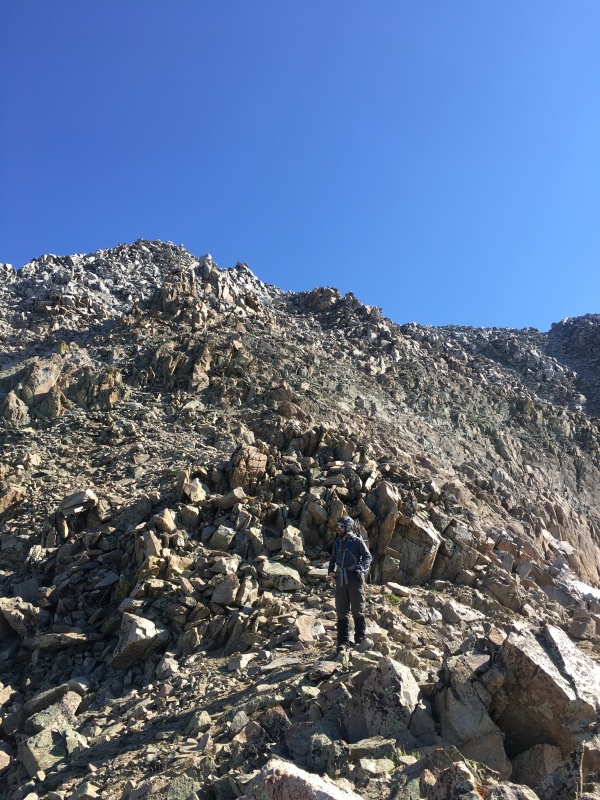
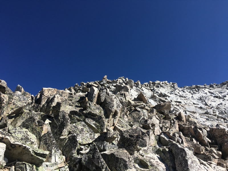
The game is still on. Nice and careful on the descent.One of the few times we weren't ridge proper.Microwaves and refrigerators everywhere!Why do they say this mountain is loose?Clouds moving in - good thing we didn't go for Snowmass Peak too.
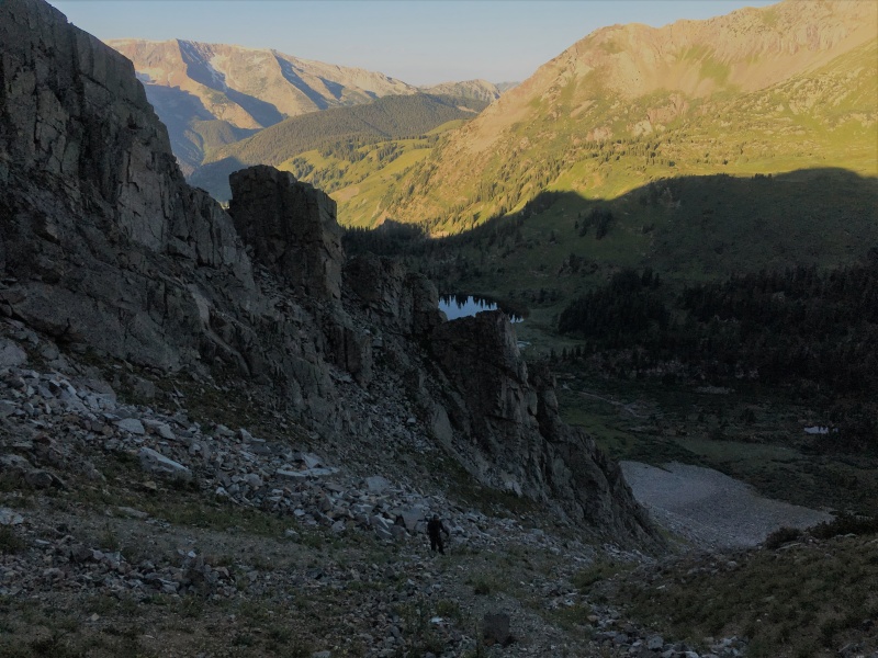
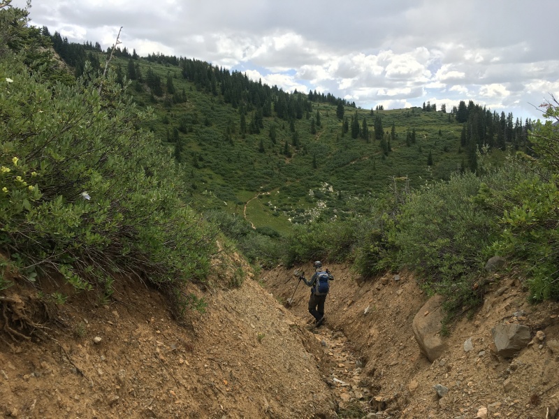
As we got closer to our approach gully from Geneva Lake, we decided it looked easier and safer to drop down the east (left) side of the ridge to the Trail Rider Pass trail. Ryan led the way down a few tricky, exposed sections and finally we were down to easy ground. We cut left and headed down to a deep dirt gulch in the mountain that led right down to the trail.
Almost back down to our approach gully. We would descend down to the left to the Trail Rider Pass trail.Downclimbing to easier ground.Lake Geneva from nearly down to our approach gully.Bells close-up.Descending a dirt gully down to Trail Rider Pass trail (seen above and left of Ryan).
Once down to the Trail Rider Pass trail, we turned right and followed it around the corner and back over to Geneva Lake so that we could head back down to Ryan's Jeep.
Nice feeling of accomplishment on the way out.
All in all, Hagerman's Southwest Ridge was better than we were expecting it to be. We had ourselves ready for a miserable, loose, dangerous day, so I guess it was pretty easy to pleasantly surprise ourselves. This route is certainly one that requires care and attention. We were the only ones on it that day, and that is how I would want it again the next time. More people in your party or more groups on the mountain would increase rockfall danger for sure. Thanks for reading.
An old fragile summit register taken home for rehabilitation.
My GPS Tracks on Google Maps (made from a .GPX file upload):
Nice report, Brad!
As your rehabbed summit register shows, Kevin Baker and I, along with Pete K(can't remember full last name, but was a guy from 14erW), did the same route. We approached from Trail Rider Pass trail, and then ascended a gully that looked good to us to gain the ridge.
We opted to go to Snowmass Pk, and let me tell you, you didn't miss much! The three of us scored plenty of points on your score card, but thankfully, I don't think any of were disqualified either! The traverse to Snowmass Pk is steep and loose, and then we descended the S face between the two, and that sucked!
Now I'm curious as to what the editing changes are....maybe I'll update one of my reports that have broken links to find out!
Any chance you have a picture of the page with Maya and I in it? Hagerman is probably the hardest thing I'll ever take her on and I kind of regret not taking a picture of the register after I signed it.
This report was very helpful. Thanks for the track! My friend and I used your route and were pleased with the alternate route down the gentler southeast slope/ dry ravine to Trail Rider Pass trail and around to Geneva Lake.
Caution: The information contained in this report may not be accurate and should not be the only resource used in preparation for your climb. Failure to have the necessary experience, physical conditioning, supplies or equipment can result in injury or death. 14ers.com and the author(s) of this report provide no warranties, either express or implied, that the information provided is accurate or reliable. By using the information provided, you agree to indemnify and hold harmless 14ers.com and the report author(s) with respect to any claims and demands against them, including any attorney fees and expenses. Please read the 14ers.com Safety and Disclaimer pages for more information.
Please respect private property: 14ers.com supports the rights of private landowners to determine how and by whom their land will be used. In Colorado, it is your responsibility to determine if land is private and to obtain the appropriate permission before entering the property.


")
")
")
")
")
")
")
")
")
")
")
")
")
")
")
")
")
")
")
")
")
")
")
")
")
")
")
")
")
")
")
")


