Download Agreement, Release, and Acknowledgement of Risk:
You (the person requesting this file download) fully understand mountain climbing ("Activity") involves risks and dangers of serious bodily injury, including permanent disability, paralysis, and death ("Risks") and you fully accept and assume all such risks and all responsibility for losses, costs, and damages you incur as a result of your participation in this Activity.
You acknowledge that information in the file you have chosen to download may not be accurate and may contain errors. You agree to assume all risks when using this information and agree to release and discharge 14ers.com, 14ers Inc. and the author(s) of such information (collectively, the "Released Parties").
You hereby discharge the Released Parties from all damages, actions, claims and liabilities of any nature, specifically including, but not limited to, damages, actions, claims and liabilities arising from or related to the negligence of the Released Parties. You further agree to indemnify, hold harmless and defend 14ers.com, 14ers Inc. and each of the other Released Parties from and against any loss, damage, liability and expense, including costs and attorney fees, incurred by 14ers.com, 14ers Inc. or any of the other Released Parties as a result of you using information provided on the 14ers.com or 14ers Inc. websites.
You have read this agreement, fully understand its terms and intend it to be a complete and unconditional release of all liability to the greatest extent allowed by law and agree that if any portion of this agreement is held to be invalid the balance, notwithstanding, shall continue in full force and effect.
By clicking "OK" you agree to these terms. If you DO NOT agree, click "Cancel"...
I've got a few tardy trip reports from this past winter that I wanted to share. These are ones from peaks that don't have much written from the winter perspective. Hopefully they provide some inspiration. Abe was supposed to write this one, but he got too busy promoting his bike adventures and trying to convince people to move to Idaho. Warning for those of you that like reports with a lot of narrative, whit and humor...I'm too busy and unmotivated for that.
Vestal Peak
Approach on Thursday:
-Silverton to Elk Creek Camp
-10 miles...7 on tracks, 3 on Elk Creek Trail
-1487' of gain
-9:30am - 2:30pm
Summit and Return to Car on Friday:
-Vestal Creek to Wham Ridge down Standard Route
-18 miles...7 on tracks
-5000' of gain
-5:45am - 8:15pm
Abe first approached me about doing Wham Ridge in winter earlier in the year. I was originally planning on some variation of the SE Ridge, but I liked the idea of doing Wham with some experienced people that had done it in the summer. After my bad day on Ice, I was convinced I was done with this winter thing. It's amazing what a week away from the mountains and a little encouragement from friends will do. I called Abe up, told him I wanted in and a plan was hatched. We got the gang together...Fire, Monster, Toes and me...and we set out down the tracks from Silverton.
We chose the tracks over Molas Pass because we thought the tracks would be dry and to avoid the elevation loss and gain. I think we added about 8 miles to our round trip, but walking the tracks was easy and went by pretty fast with stimulating bridge and tunnel talk.
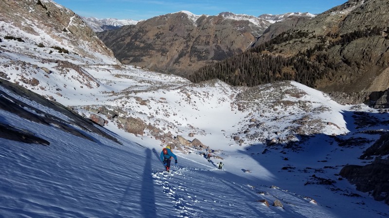
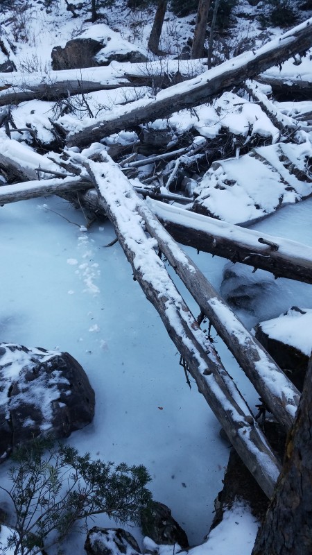
We took a break at a dry Elk Creek train stop and then started the 3 mile hike to camp near the beaver ponds. To our surprise, there was very little snow on the trail...no snowshoes required.
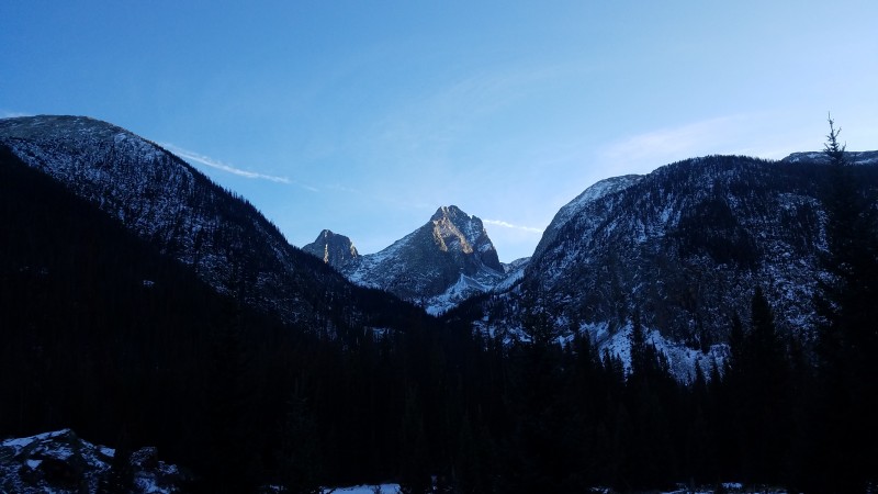
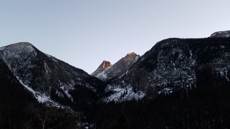
View from camp of Arrow and Vestal
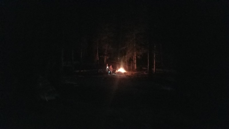
We got to camp a lot earlier than expected so we built a fire and got comfortable. "Since we hate each other" we all brought separate tents except for Abe and Ryan. They decided to get cozy. Which was smart because Ryan was still nursing a cold and Abe was looking to get sick around the holidays.
We started the next day in embarrassing fashion. We separated into 2 groups and quickly found ourselves far enough apart that we couldn't talk to each other. It's a good thing no one was around to witness the 45 minutes or so of valley yelling that ensued. You know the feeling you get when you ski a line through the trees, you get to the bottom and your partner isn't there. Then you wait there thinking, did they fall in a tree well, did they hit a tree, should I go up and look for them or should I wait here...it was like that. Total chaos. We even considered turning around. Luckily there is treeline. We got up above it and reunited shortly after.
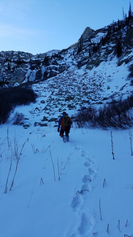
Abe starting up the boulder field
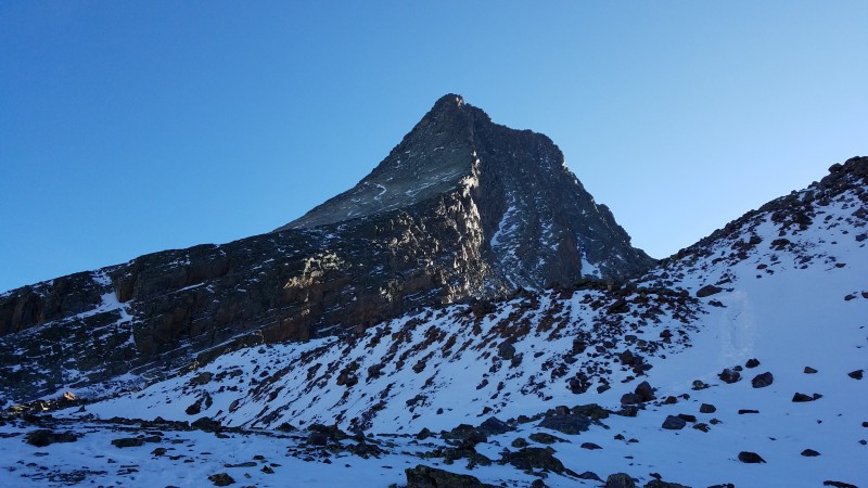
First view of Vestal and Arrow
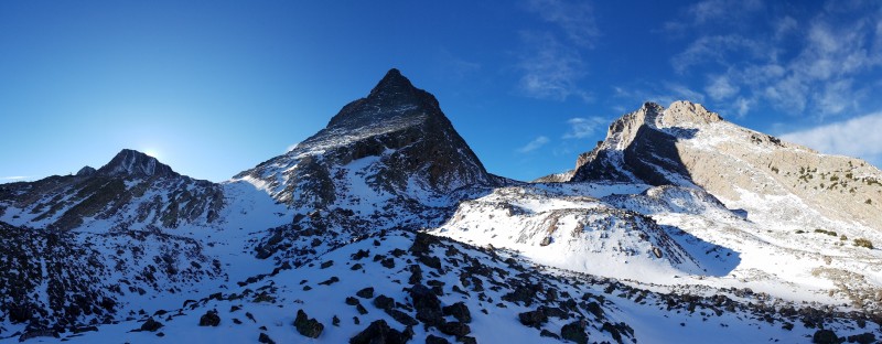
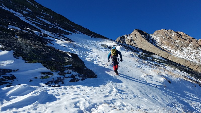
It felt good to know I was with people that had been on Wham ridge before. I think I would have been too intimidated by it to try it alone. The steepness never relents. I have heard it described as a wave and I agree. It's like you are riding a surfboard, trying to get over the top of the wave before it crashes down on you. It just keeps rearing up and getting steeper the higher you go. But in my opinion, I would say that it is easier than it looks. The route-finding is pretty straight forward...follow the right to left ramp until you find a weakness in the cliffs, then follow the left to right ramp until you reach the ridge, then follow the ridge to the summit. The climbing was fun and never so difficult that we felt the need for ropes. The dry conditions definitely helped.
The first ramp
The second ramp
On the lower section of the ridge
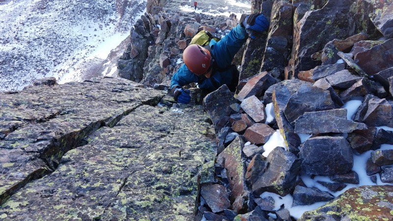
Abe on one of the more exposed cruxes
Upper section of the ridge
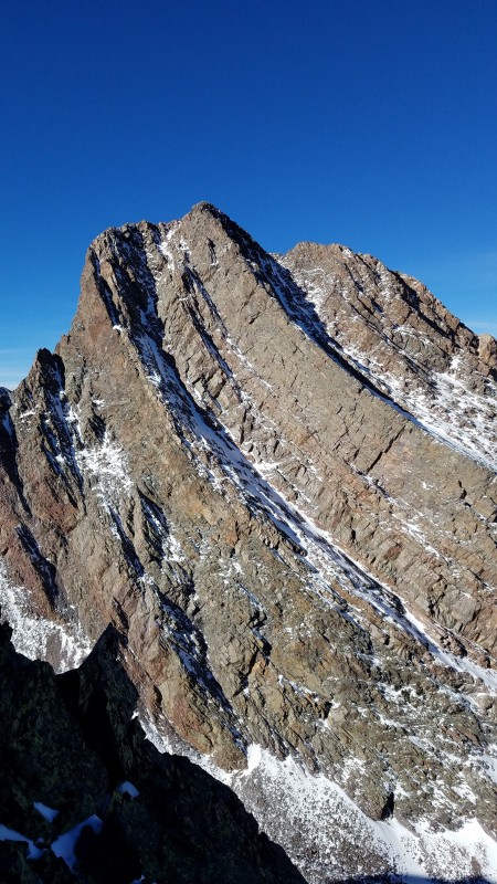
View of Arrow
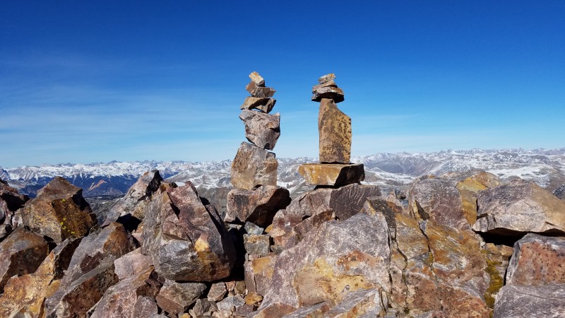
Abe and Ryan coming up over the false summit
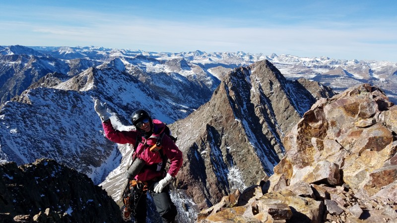
Amy capturing the feeling we all had as she walks up on the summit....heeeeey
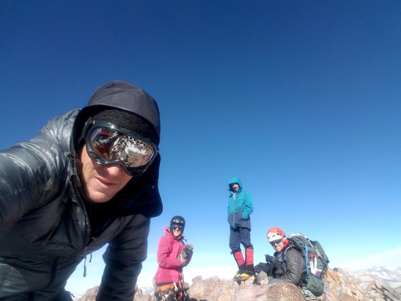
The Winter Wham Team...finally in the sun
Brooke & Ben Cairns
We opted for the standard route on the descent. This route follows a loose gully for a few hundred feet down the south side and then wraps around to the Arrow, Vestal saddle. It was pretty dry and the route has just the right amount of cairns.
Descending from the saddle
As great as our camp was, I started to get the itch to be home. I knew that Abe and Ryan were going to spend another night and that Amy had tentative plans to go after the Chicago Basin 14ers (which she would get 2 days later). I hauled ass back down to camp, packed up and started the long hike back to Silverton.
This is the Elk Creek crossing. In May it took me an hour to figure out how to cross this creek and got soaked up to my chest. Today it was a non-issue.
One last look at Vestal and Arrow
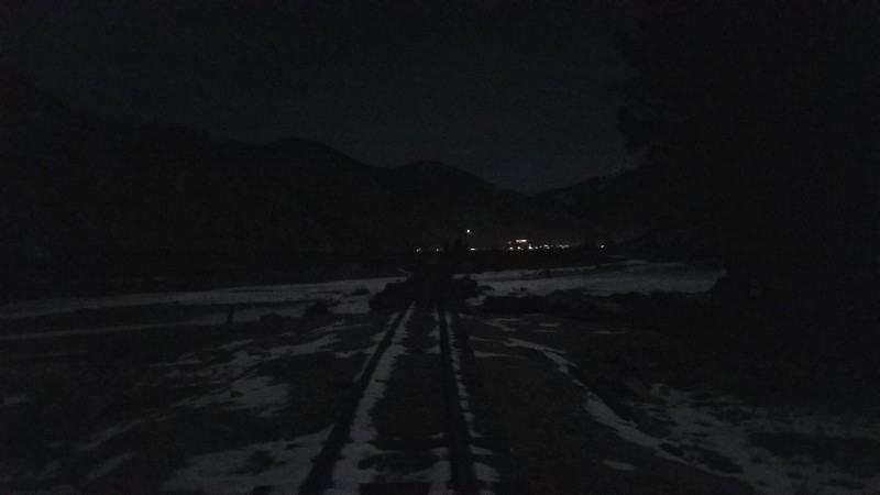
I got back to the tracks around 6pm, ate a sandwich, changed to my comfortable shoes and started the hike back up the tracks.
So happy to see the lights of Silverton.
After crossing the last bridge, I dropped my pack off at the Mineral Creek TH and then hiked back to the train station where we left our cars. We thought about parking our cars at this TH, but the road was blocked with some safety cones. We could see that someone had driven it recently so I decided to give it a try. I quickly found out that the reason the road is closed is because there are multiple ice flows that pass over it in winter. I was able to get my jeep up and down the road, but not without losing control a couple times. I would stay clear of this road unless you have chains.
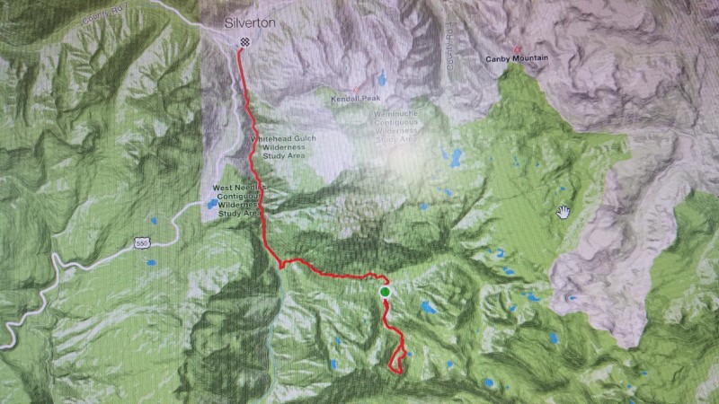
Strava map from Thu
Strava map from Fri
Thanks to Abe, Ryan and Amy for this incredible trip and for helping me get back into things. I think the 4 of us would all agree that the only thing we would change were the conditions. It seems strange to say this, but we wanted Winter Wham to be harder. We had all the gear for it, we were prepared for it and I know we would have gotten it. But what can you do?
Peace homies or as my daughter would say...2 homies
Thumbnails for uploaded photos (click to open slideshow):
Congrats on a Winter Wham! Perhaps not as wintry as most years, but you have to take what Mother Nature gives you. You continue to inspire with your ascents!
Would have indeed been nice, but such is the game we play. Super fun trip, glad we all got to hang!
Just lastly gotta say that your drive is infectious dude. Hope the fam is doin good...poppa bear bout to go into summer hibernation.
Caution: The information contained in this report may not be accurate and should not be the only resource used in preparation for your climb. Failure to have the necessary experience, physical conditioning, supplies or equipment can result in injury or death. 14ers.com and the author(s) of this report provide no warranties, either express or implied, that the information provided is accurate or reliable. By using the information provided, you agree to indemnify and hold harmless 14ers.com and the report author(s) with respect to any claims and demands against them, including any attorney fees and expenses. Please read the 14ers.com Safety and Disclaimer pages for more information.
Please respect private property: 14ers.com supports the rights of private landowners to determine how and by whom their land will be used. In Colorado, it is your responsibility to determine if land is private and to obtain the appropriate permission before entering the property.