Download Agreement, Release, and Acknowledgement of Risk:
You (the person requesting this file download) fully understand mountain climbing ("Activity") involves risks and dangers of serious bodily injury, including permanent disability, paralysis, and death ("Risks") and you fully accept and assume all such risks and all responsibility for losses, costs, and damages you incur as a result of your participation in this Activity.
You acknowledge that information in the file you have chosen to download may not be accurate and may contain errors. You agree to assume all risks when using this information and agree to release and discharge 14ers.com, 14ers Inc. and the author(s) of such information (collectively, the "Released Parties").
You hereby discharge the Released Parties from all damages, actions, claims and liabilities of any nature, specifically including, but not limited to, damages, actions, claims and liabilities arising from or related to the negligence of the Released Parties. You further agree to indemnify, hold harmless and defend 14ers.com, 14ers Inc. and each of the other Released Parties from and against any loss, damage, liability and expense, including costs and attorney fees, incurred by 14ers.com, 14ers Inc. or any of the other Released Parties as a result of you using information provided on the 14ers.com or 14ers Inc. websites.
You have read this agreement, fully understand its terms and intend it to be a complete and unconditional release of all liability to the greatest extent allowed by law and agree that if any portion of this agreement is held to be invalid the balance, notwithstanding, shall continue in full force and effect.
By clicking "OK" you agree to these terms. If you DO NOT agree, click "Cancel"...
Gladstone Peak
Time...5:15am - 2:15pm
Distance...12.6 miles
Elevation Gain...4775 feet
Trailhead...Cross Mountain
Route...Cross Mountain Trail to Lizard Head Pass up East Face
One more from last winter...
This would be my first day out since our accident. I was still pretty banged up, but was tired of sitting around, wasting away. I would be mad at myself all year if I didn't at least try to climb one more peak this winter. I was most worried about my hip so I lubed up with vitamin I and BioFreeze and headed out.
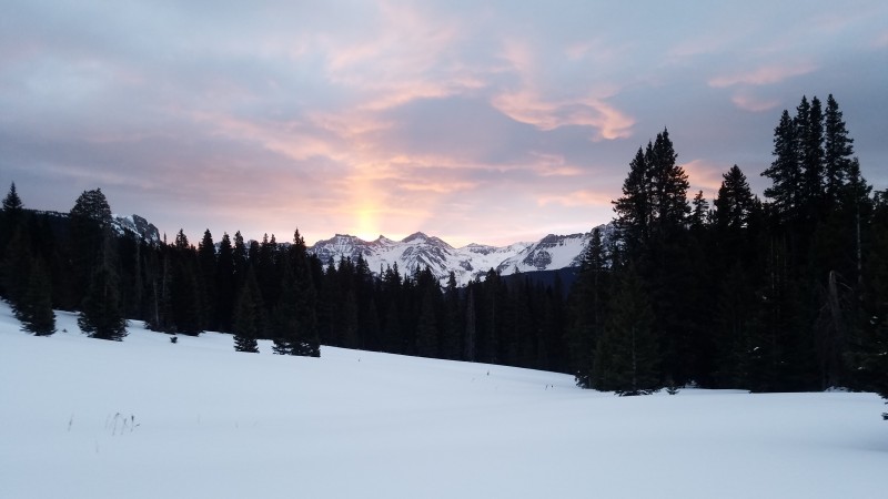
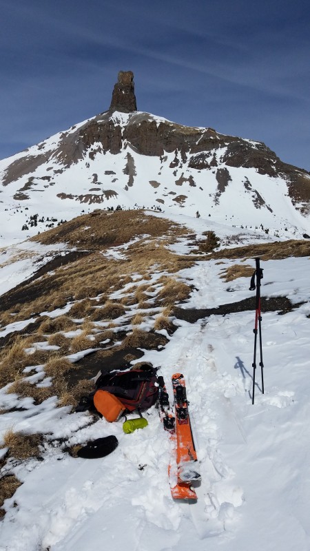
This was my 6th time starting a hike from the Cross Mountain Trailhead and this view never gets old. Shooting for the notch between Lizard Head and Cross Mountain.
Sunrise over Vermilion, Golden Horn and Pilot Knob
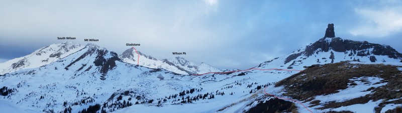
Route pics
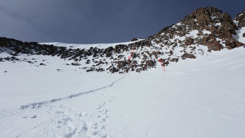
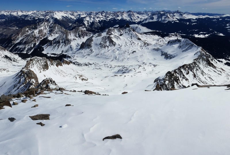
It's tempting to try to stay high and left after hitting the pass, but better to just drop down to the creek. The side-hilling sucks and there are some cliffs to negotiate.
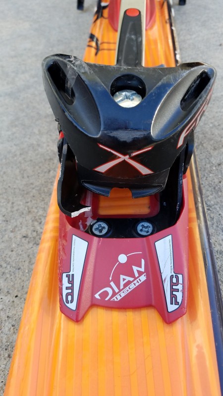
In the process of dropping down, I felt like something was off with my ski binding. When I got to the valley I found the problem...my binding was broken on one side of the toe piece. When I was in walking mode, the slightest terrain variation would push the binding out of alignment. If the piece broke off completely, it was going to make for an interesting descent. I didn't have a way of repairing it so I just concentrated on going as straight as possible when I was in touring mode.
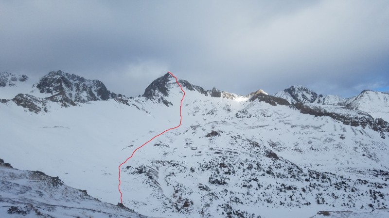
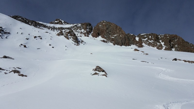
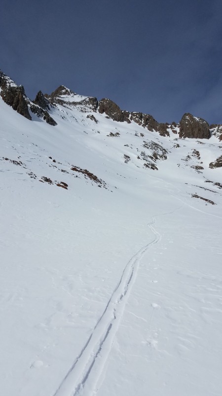
The 2 big challenges for this route are the snow conditions on the east face and the rock band. I didn't see any reasonable way to avoid going straight up the face...both ridges are pretty gnarly. So you really need stable conditions. And it's hard not to fixate on the rock band once the east face comes into view. At first it looks impossibly steep, then it doesn't look too bad as you get closer, and then it is steeper than it looks when you start climbing it. Here are the routes I took up and down. You can probably find an easier option if you continue all the way to the left of the band (closest to the SE Ridge), but then you will have a cornice to contend with.
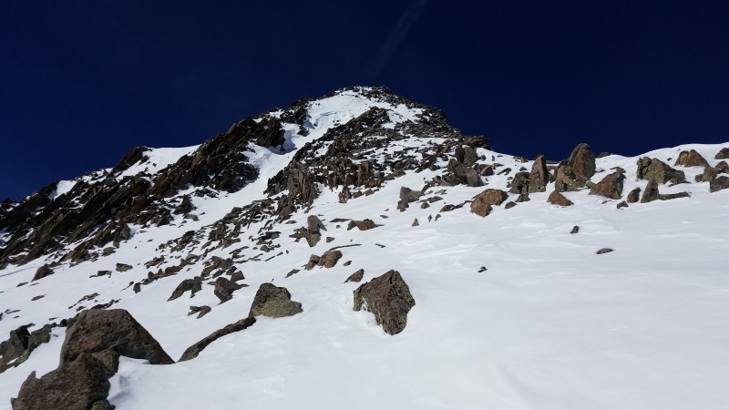
The last 200 feet are a nice relief from the steep terrain of the rock band. I stayed on the right ridgeline to the summit.
Summit of Gladstone Peak...#99 on my winter cents list. I didn't intentionally leave Dallas (#100 on the elevation list) for last. I would much rather it be Horseshoe or Dyer. I've tried and turned around on Dallas 3 times now, including twice within 100 feet of the summit. Hopefully I will have a story to tell about my failures and success on Dallas this coming winter...if not, I can at least say I climbed the 99 highest peaks in winter.
If you're looking for a rusty crowbar, I know where you can find one.
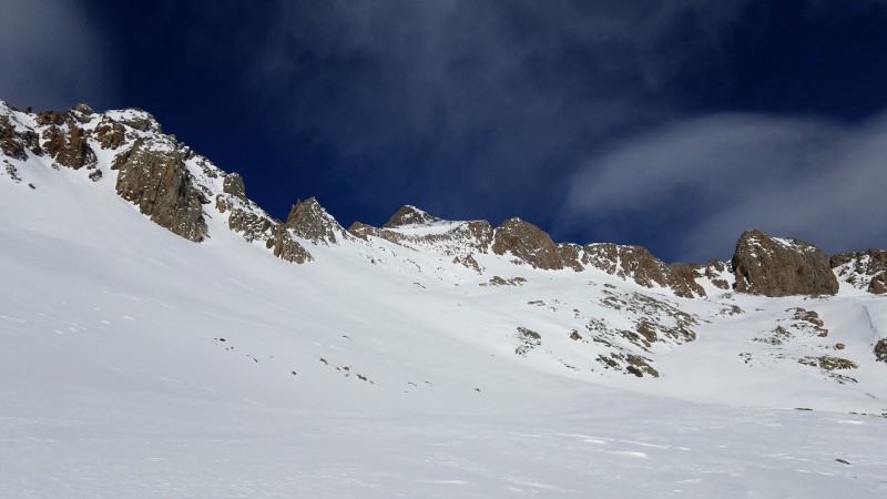
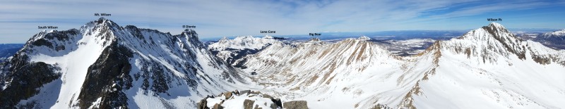
View to the west
View to the east
I strapped my skis back on just below the rock band and cruised down Bilk Creek towards the pass.
Here's my final break spot before the mellow ski back to the trailhead. I was relieved to have made it to this point without breaking my binding.
Strava map
Thumbnails for uploaded photos (click to open slideshow):
@cochsman Sorry, I do not. I don't even know what that is. But the route is not hard to figure out. It follows the most obvious line up the east face.
Caution: The information contained in this report may not be accurate and should not be the only resource used in preparation for your climb. Failure to have the necessary experience, physical conditioning, supplies or equipment can result in injury or death. 14ers.com and the author(s) of this report provide no warranties, either express or implied, that the information provided is accurate or reliable. By using the information provided, you agree to indemnify and hold harmless 14ers.com and the report author(s) with respect to any claims and demands against them, including any attorney fees and expenses. Please read the 14ers.com Safety and Disclaimer pages for more information.
Please respect private property: 14ers.com supports the rights of private landowners to determine how and by whom their land will be used. In Colorado, it is your responsibility to determine if land is private and to obtain the appropriate permission before entering the property.


")
")


