| Report Type | Full |
| Peak(s) |
Sunshine Peak - 14,004 feet |
| Date Posted | 04/08/2018 |
| Date Climbed | 03/14/2017 |
| Author | Tim A |
| Sunrise Solitude on Sunshine |
|---|
|
How have I been viewing these trip reports for years but just this week discovered the "view with large photos" button? Surely I'm not the only fool who's been clicking on each thumbnail picture in trip reports and opening new windows to see the full pictures? This is over a year old, but there are only a handful of TRs of Sunshine's East ridge in March, so what's one more to the small collection? Here's a series of clips of the climb set to Eric Whitacre's "Lux Aurumque." Fitting poetry for the beautiful morning. Lux Aurumque-Edward Esch Lux, Calida gravisque pura velut aurum Et canunt angeli molliter modo natum. Light, warm and heavy as pure gold and angels sing softly to the new-born babe. Another March, another spring-break for this public-school choral director from Texas to drive up to Colorado and play in the hills. Living and teaching in Lubbock TX has it's perks, but the scenery isn't one of them. All winter I looked forward to this upcoming trip and getting a break from spending my days with moody adolescents. The entire winter of 16/17 had seen storm after storm dump tons of snow onto the mountains (basically the opposite of this winter) and while I was excited about upcoming couloir season later in April and May, I was a little nervous that the timing might not work out in March and that a storm might strike during my limited time off to be in the state and keep me tent-bound. To compound my anxiety, the ice park in Ouray closed in mid-February due to water-supply issues and unseasonably warm temperatures, so my typical back-up plan of climbing ice during winter storms was also out. My original plan was to attempt some class 3 ridge routes with some strong partners, but all of those strong partners became unavailable the week before my trip for various reasons. I tossed out my plans for Kelso ridge or Pacific's west ridge and set my mind to doing something safer since I would be solo. I didn't have any winter summits in the San Juan yet, just a failed attempt on Uncompahgre from the previous year where cold feet on a windy day turned me around. I decided on Sunshine's East ridge, which is the perfect first winter 14er in the San Juan. A little bit of research on this site looking at trip reports from the winter months distilled three general thoughts about the route: 1. It's steep. 2. It's easy to get lost on the descent and get cliffed out above the road. 3. There's a mysterious talus slope before treeline that some people only see in one direction while others never encounter it at all. I studied topo and satellite maps of the route and downloaded a gps track into my Garmin to avoid issue #2. Issue #1 I would just suck it up with. And I would look for the talus slope. First, I had to get to Colorado. The week before my spring-break, I came down with the familiar feeling of an upper-respiratory infection. I can generally ignore the raspy throat, the drainage from the nose, and the pressure behind the eyes and forehead, but the being winded when taking a single flight of stairs in the apartment is hard to ignore. I gradually fought the infection off over the course of the week, only to wake up Saturday morning planning to drive to Lake City but instead being barely able to drag myself out of my bed. I got myself into a clinic and got the usual round of antibiotics and steroid shot in my hip and was told to rest for 3-5 days if possible. At the moment of the shot, I debated asking the nurse if she could give it to me straight in my butt and avoid my hips, where a backpack would shortly be sitting, but I didn't say anything to avoid an uncomfortable conversation with my doctor about climbing mountains while unable to breath. In the meantime, the forecast in Colorado was for a magnificent week of mild temperatures and clear skies the week of March 12th. I went home, drank Nyquil, slept, woke up and drank more Nyquil, and slept some more. Sunday morning I woke up with a feeling that can only be described as "not horrible." I figured if nothing else, I could just camp around the mountains for the week and be in the quiet as I continued recovering. Cue the ten hour drive to Lake City, coming over Slumgullion pass just before dusk. I stopped to enjoy the light show. 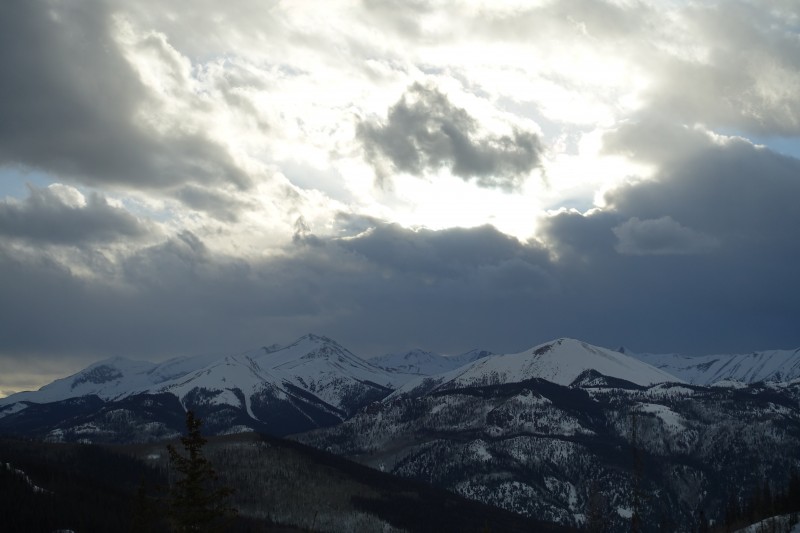 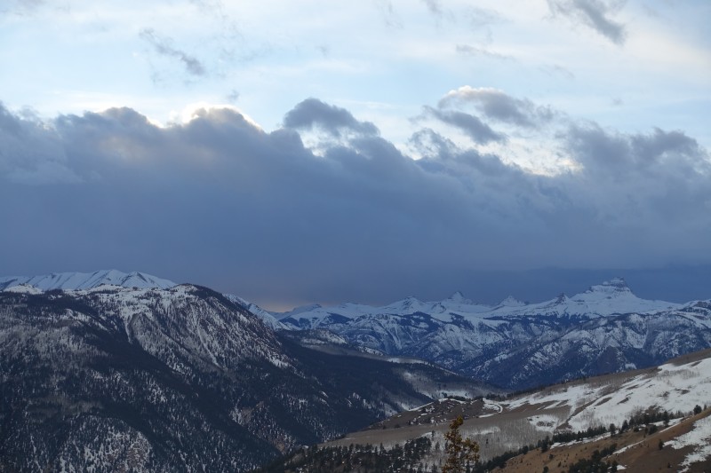 I had a good night's sleep in the back of my Subaru outback down near Mill Creek, planning on sleeping in and resting another day before trying Sunshine on Tuesday. I had pm'd a group of guys going up the route on Monday and had planned to join them, but I was still feeling pretty weak and so slept with the confidence of knowing that a nice trench was being put down. "Sleeping in" turned out to be waking up with a coughing fit around 5am and then shivering, so I figured I'd cut my losses, drive up to Slum pass and watch the dawn from there and take some pictures. This was a good choice. 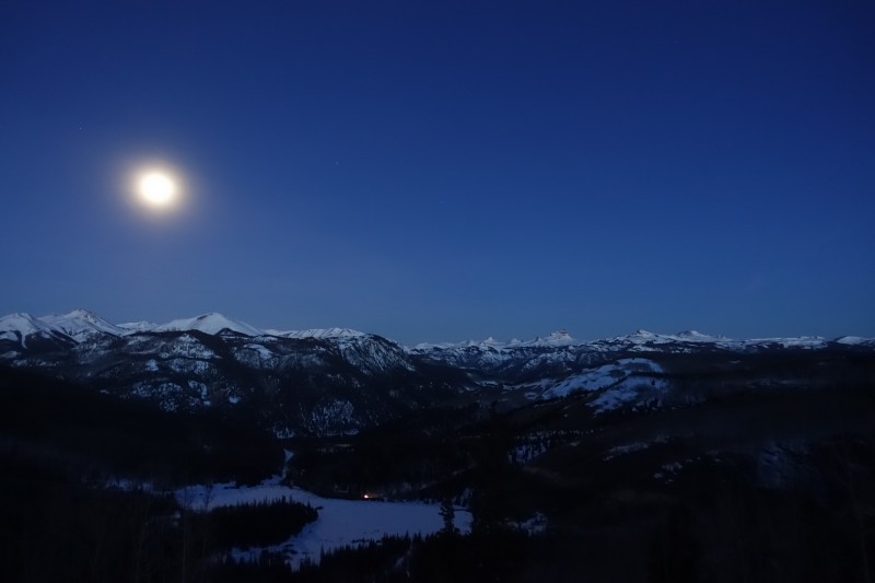 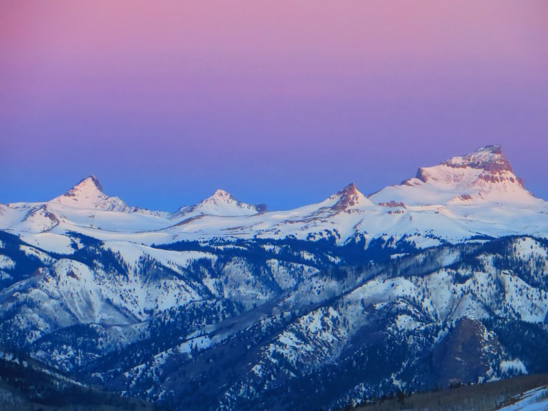 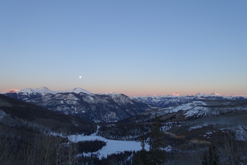 I spent a relaxing day taking pictures and sleeping up on the pass and then drove down to Mill Creek for an early night. The route from here looks really unclear. Cliff bands, steep grass and shrub-covered terrain, and no obvious trail. 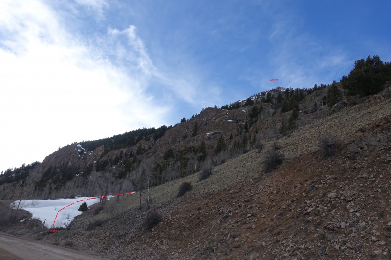 Picking the way through this in the dark without a GPS seems unnerving. I would have a full moon and Garmin to mitigate the complexities of route-finding. I passed out in the car next to the road and set an alarm for 2am. The alarm goes off as it does, and I woke up with a mercifully clear head, mostly pain-free throat, and just a little bit of stuffiness in my nose. Good enough. I scarfed down a bag of Nature's valley granola (over 1000 calories in the bag) and was off. The route was easy to follow for the first half mile, sort of doubling back parallel to the road and not gaining much elevation. Then it turns back towards the cliffs and carefully gains elevation over them, at one point skirting them on the edge. It wasn't until moving up the full length of these cliffs and then turning inward to the thick trees that I had any route-finding difficulties. At a spot around 10,500', the snow becomes consistent and very deep, and I came upon a scene of previous carnage, with numerous lines of postholes branching out in many directions. The route my Garmin suggested led directly into a really steep and unsupported bank of snow. I put on my snowshoes and tried scaling it but just plunged in to my hips. Pulling a snowshoe'd leg and foot out of a deep hole is never pleasant. I figured I'd try to contour around this and followed a set of postholes to the right and around it, eventually linking back up with a trench a little higher after a few minutes of miserable plunging to my knees in the shoes. I'm not sure why the snow in this particular area of forest was so much worse than elsewhere, but I was grateful it was short lived once back in a trench that aligned with my GPS. This trench came and went as I continued up the ridge. I did find the mysterious talus slope and actually picked my way up a sort-of trail that traversed across it. I always dislike being in the trees in the dark. This is true with partners, larger groups, and regardless of season. It's a combination of sleepiness from the early start, boredom, and having nothing to look at to take my mind off of the sweat I'm putting into the hike. As soon as I break treeline and the wind picks up, the boredom goes away as I squint to make out ridgelines and peaks towering overhead. As soon as the sky begins to lighten in the east, the views offer something to think about. But at 330am deep in the San Juans below treeline, while slogging up Sunshine Peak's east ridge, I had none of those distractions. The full moon did cast some light on the valley behind me, and at one point a dog started barking far away and below, but beyond those things, there was nothing to occupy my mind. Going solo makes the boredom even more profound. Of all the hours I spend in my life either commuting, working, teaching, planning, or hanging out at home, I can say that I am never bored. There are too many things I can do to alleviate boredom, like glance at a screen or turn on a podcast or music to accompany menial tasks like folding laundry. For some reason though, I refuse to bring music or distractions up to the mountains with me. I dislike the boredom, but I also get something intangible out of it that I don't want taken away by popping in earbuds and listening to "This American Life" during a pre-dawn slog. 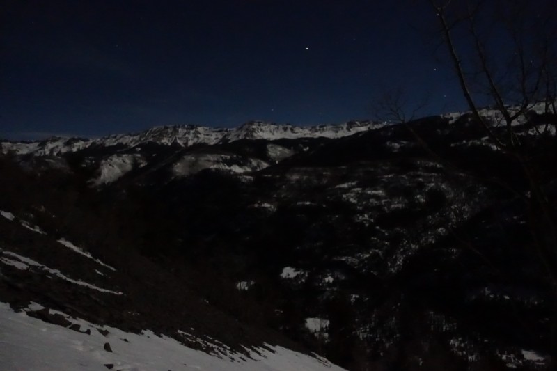 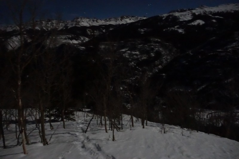 Eventually the forest ends and under a full moon, this means views open up before the sun arrives. 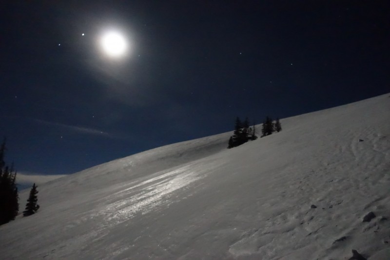 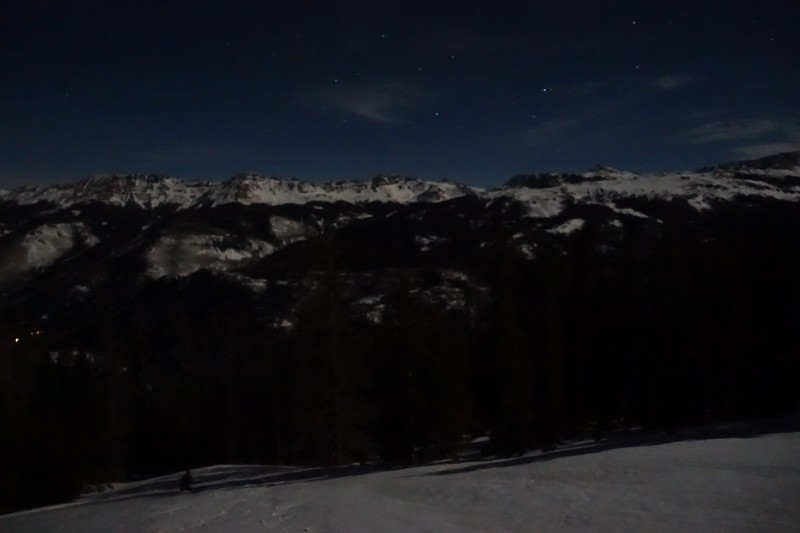 There's a massive open and flat plateau at around 12,500' that could probably fit an entire subdivision of houses, and from here the remaining route up to the summit glowed white under the moonlight. 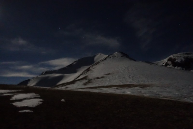 The lack of snow cover here betrays how windy it is. At this point I felt pretty tired and demoralized, and my hip where I'd gotten that steroid injection groaned with pain each time I took a step and the hip-belt dug into my side, but the views of the summit and the light gathering in the east gave me strength to ignore the discomfort. I was now on a race to try to beat the sun to the summit of Sunshine. I removed my snowshoes but stashed them to my pack in case of deep snow high on the ridge. I would end up ditching them entirely halfway up the ridge and using microspikes from plateau to summit. 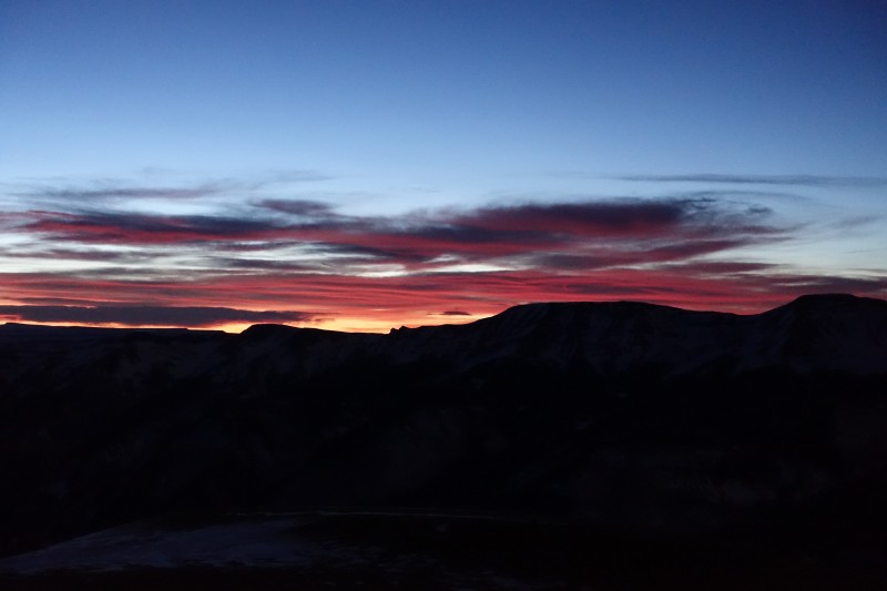 As usually happens, I slow down significantly above 13,000', so I wouldn't manage to beat the sun to the summit, but being on an east-facing aspect at dawn in winter in the San Juans still leads to some magnificent views. My pace continued slowing as I kept turning around and taking in all that was glowing below and around me.  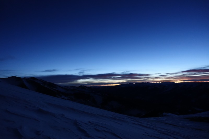 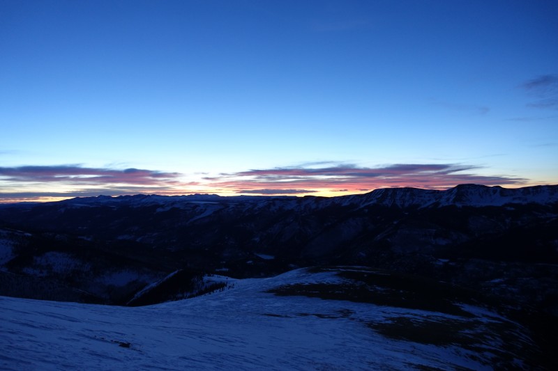 The shift in color from darkness to light moves from blue to red. Clouds add color and shadow, and clouds between the viewer and the sun add shades and hues. 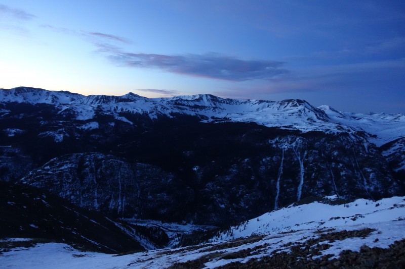 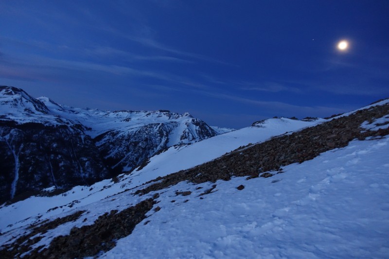 The previous morning I'd watching the alpenglow strike the mountains from Slumgullion pass. This morning I was on one of those mountains watching the sun itself rise over Slumgullion pass. It was nice to see it from both locations within a single day of each other.    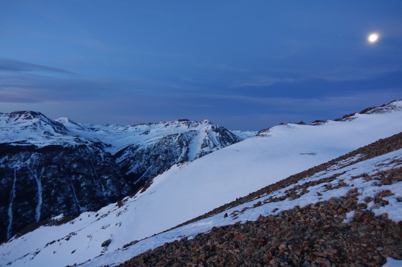 The few minutes of pink are my favorite part of an alpine morning. 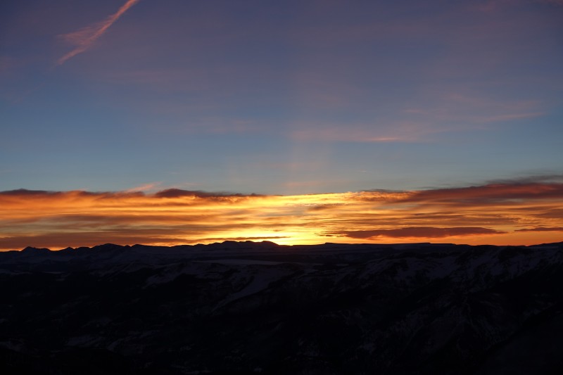 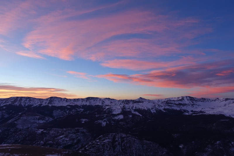 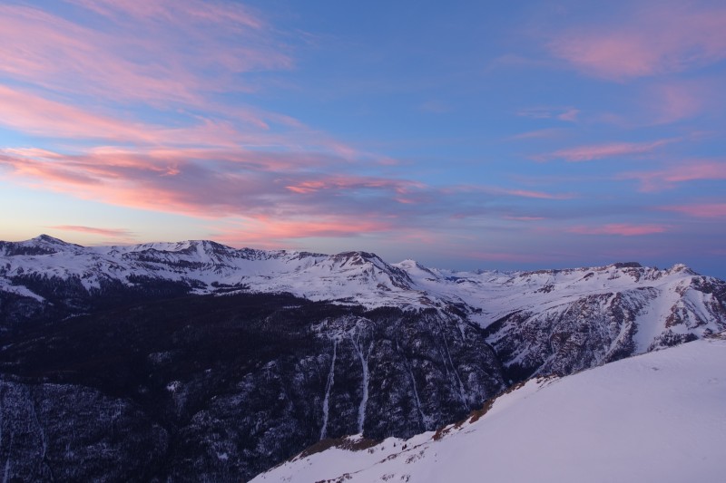 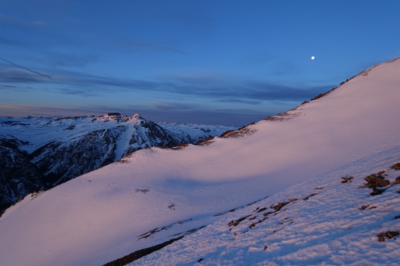 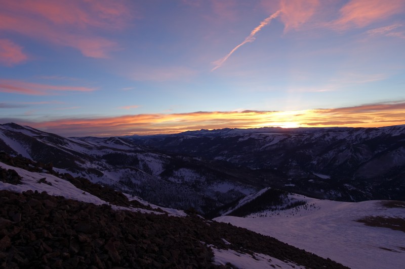 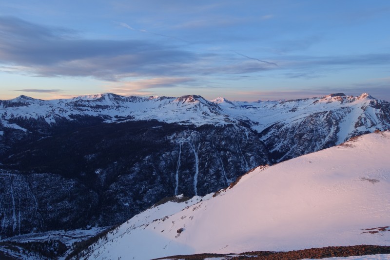 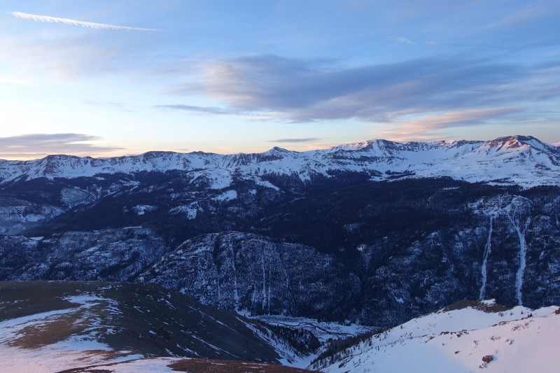 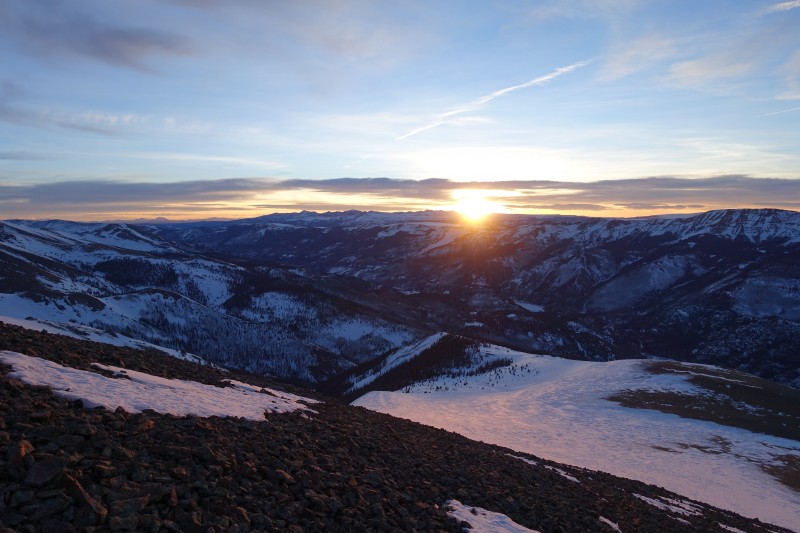 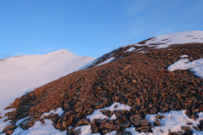 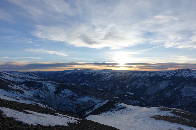 Once the sun is clear of the horizon and clouds, the light becomes less beautiful if a little warmer. The remaining route to the summit involves passing over a few bumps on the ridge to a small flat area near the saddle with Redcloud. Having lost my race with the dawn to the summit, I took my sweet time here and enjoyed the solitude and the simple act of walking over each gentle undulation in the ridge. The trail bypasses these to climber's left but you still gain and lose a little with each passing bump. 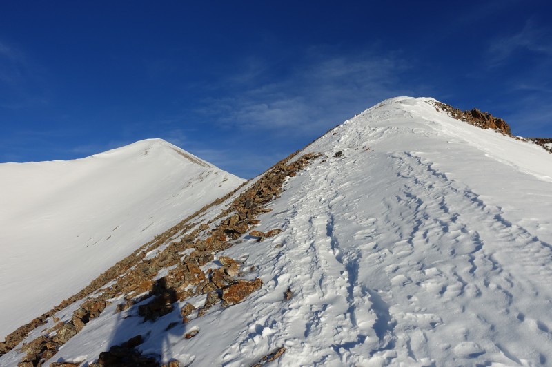 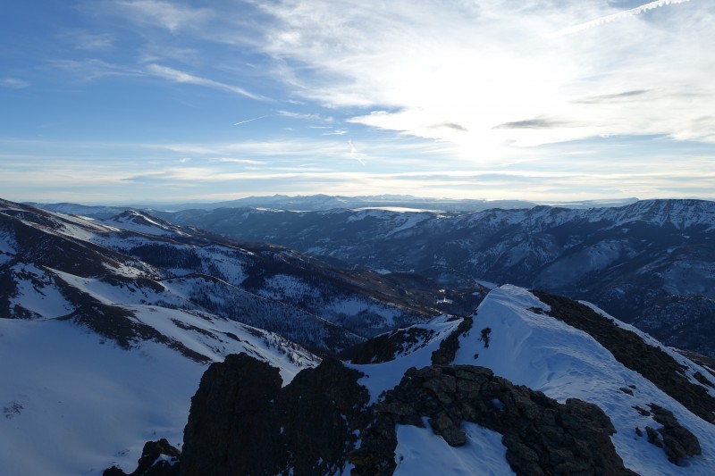 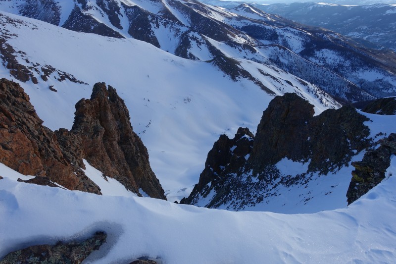 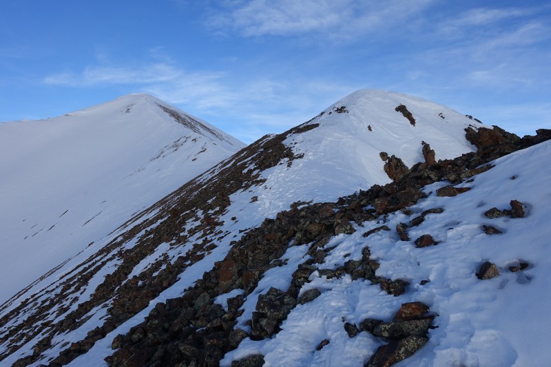 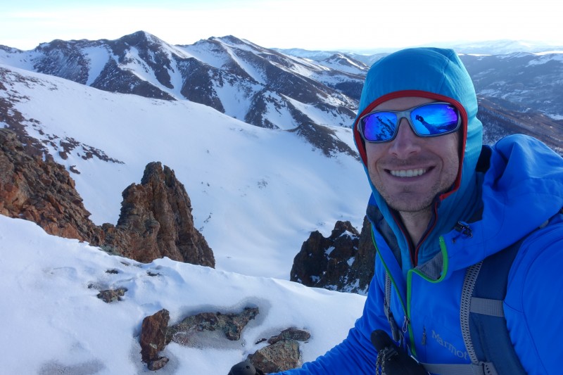  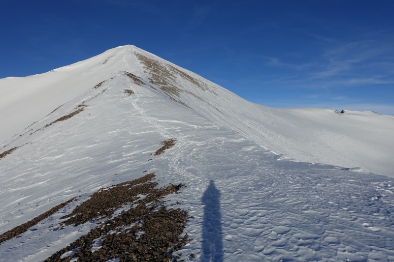 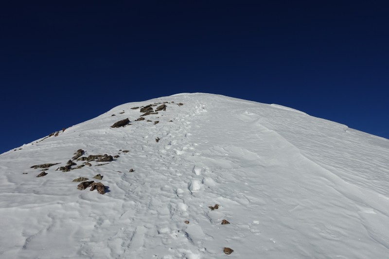  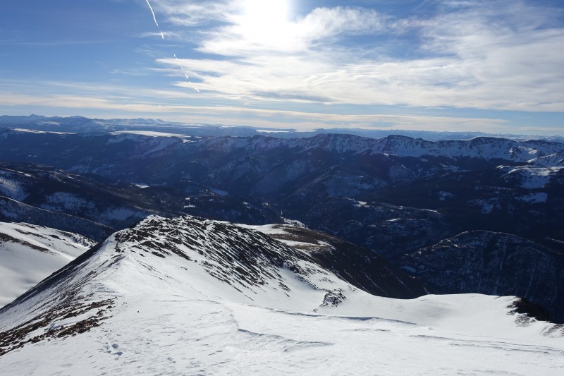 San Juan summits, for views, are superior to summits in any other range in CO. I still have yet to see a Sangre summit, or most of the Elks, but I still feel confident making this statement. The huge snow year especially for the southern mountains made for a pristine display. 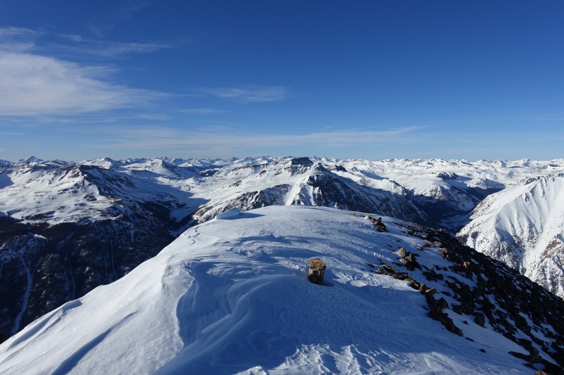 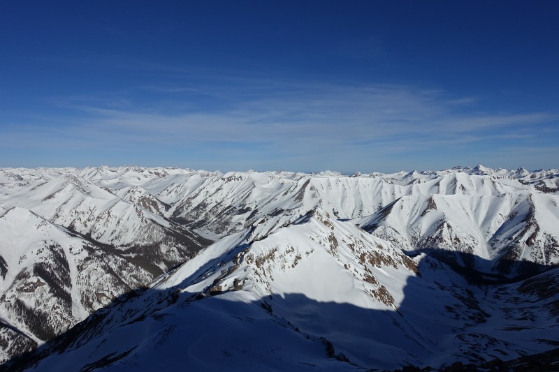 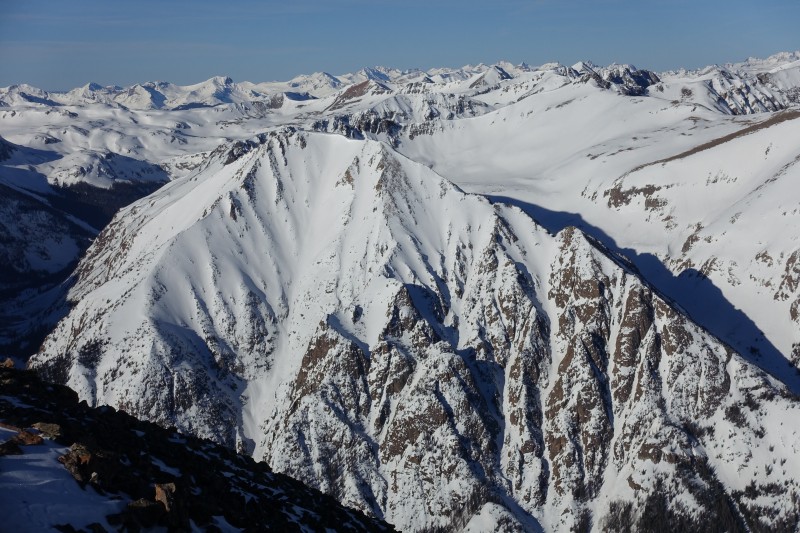 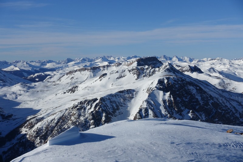 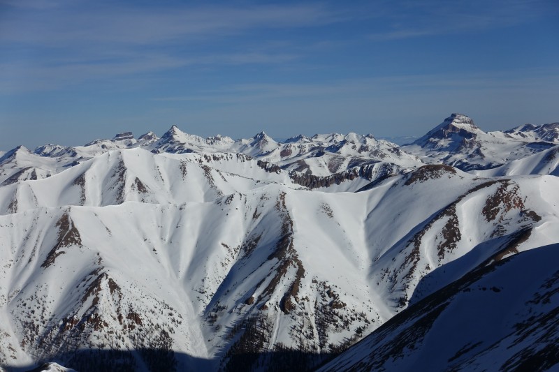  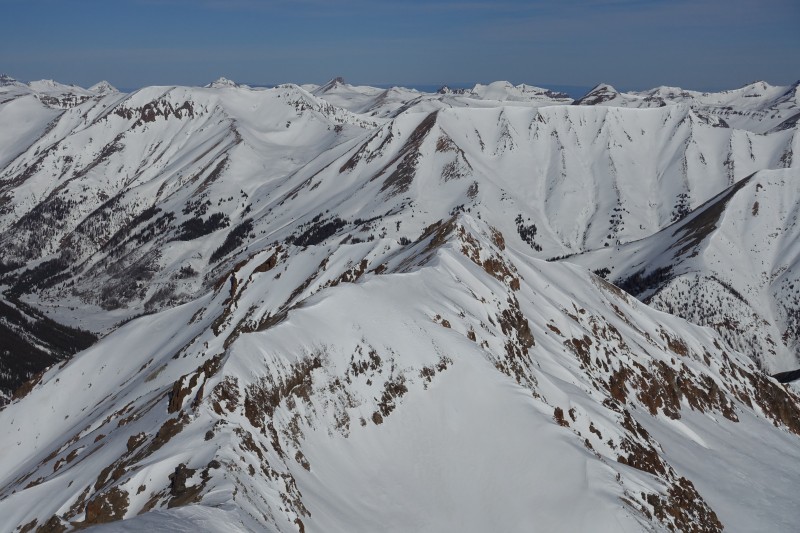 It was 830am and I lingered on the summit for about half an hour. A gentle breeze didn't make things unpleasant and there was much to admire in the view. I looked over at Redcloud Peak and contemplated doing the traverse and getting the twofer. At that moment I felt stronger than I had six hours and 4500' earlier. The restorative effect that alpine air and a crisp winter breeze can have is incredible. Still, I sensed getting down could turn into an epic if I waited for the snow to warm, so decided to be satisfied with the single summit for the day and return down the ridge. While on the ascent I had felt comfortable in spikes and trekking poles, I felt that a slip while descending the ridge could end with a long ride into the bowl south of Sunshine's summit, so I stowed my poles and got my axe out. I would have felt uncomfortable without it, as the snow was already getting slippery and icy in the sunlight. The 1500' down the ridge to the flat grassy area went quickly, pausing only to pick up my snowshoes and lash them back to my pack. From there, it's another fast walk across gentle terrain to get back down to treeline. Here the GPS was essential in finding the exact place where I had exited the trees. It isn't clear at all where to turn off the ridge proper and drop back down into the trees, and there were numerous lines of ski tracks and snowshoe trenches going in all kinds of directions down into the trees. I found my earlier track and took it down into the trees, where the slog to get back to the car would begin. The steep terrain going up that morning hadn't been fun, but going down this same route in deteriorating snow conditions was downright unpleasant. I alternated snowshoes and microspikes multiple times, as the snowshoes found little purchase in the steep icy snow and frequently slid out from under me, but were necessary in some spots where I wanted to avoid longer stretches of postholing. I slipped and slid several times on the descent and was grateful for my axe to arrest those slow-moving slides. The talus slope I found easily, but crossing it took a lot of effort as it looked nothing like I remembered from the morning, and the blocks are perched precariously on one another and wobble when weighted. Once below that slope, I ran into numerous places where the trench I was following forked, and again I was glad for my GPS to pick the right one. It took me about an hour to drop from 14000' to treeline at 11,800'. From there to the trailhead, only about another 1500' of vertical, took three hours. 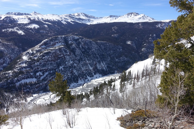 At last the forest spits you out atop the cliff bands over the road, and the slipping and sliding is finished. The car sits down there at Mill Creek and smiles at you for 45 minutes while you traverse back down across the crest of the cliffs. By this point my hip was really achy from the many postholes and slides I'd taken on the descent but I was at least grateful that I'd opted to avoid the Redcloud traverse which would have put me on all that miserable terrain ninety minutes later and made the descent even worse.  The road comes at last, and I spent probably an hour by my car near the Mill Creek campground eating lunch, resting and enjoying the views and the sound of running water in the creek below and behind the campground. There are several waterfalls running along Sunshine's cliffy eastern-facing aspects and they were running pretty loudly that afternoon in the warm sun of mid-March. Any pull-out spot along the road leading to Cinnamon Pass is a worthy spot to just sit and relax in the sights and sounds of the San Juan. I confess that I prefer Lake City and it's environs in the winter, when most of the town is deserted and there are no humans to be seen in the wilderness areas. In summer, the road becomes a noisy and dusty pathway for the tourists driving the Alpine loop, and the charm of the area is lost. I wound up back in the area a few months later in late June to do the Redcloud standard route at dawn, and my 2am start guaranteed I didn't see another person between trailhead and summit, but on the descent I passed dozens of people making their way up, and Grizzly Gulch was a joke when I returned in the late morning to find a bunch of roudy people drinking and carrying on in the parking area there next to their rented four-wheelers. I don't know that I'd repeat this route in any season, but I'll gladly spend spring break in Lake City as often as I can to find the solitude that's becoming harder to access in the Colorado high country. Thumbnails for uploaded photos (click to open slideshow):
|
| Comments or Questions | ||||||||||||
|---|---|---|---|---|---|---|---|---|---|---|---|---|
|
Caution: The information contained in this report may not be accurate and should not be the only resource used in preparation for your climb. Failure to have the necessary experience, physical conditioning, supplies or equipment can result in injury or death. 14ers.com and the author(s) of this report provide no warranties, either express or implied, that the information provided is accurate or reliable. By using the information provided, you agree to indemnify and hold harmless 14ers.com and the report author(s) with respect to any claims and demands against them, including any attorney fees and expenses. Please read the 14ers.com Safety and Disclaimer pages for more information.
Please respect private property: 14ers.com supports the rights of private landowners to determine how and by whom their land will be used. In Colorado, it is your responsibility to determine if land is private and to obtain the appropriate permission before entering the property.


