Download Agreement, Release, and Acknowledgement of Risk:
You (the person requesting this file download) fully understand mountain climbing ("Activity") involves risks and dangers of serious bodily injury, including permanent disability, paralysis, and death ("Risks") and you fully accept and assume all such risks and all responsibility for losses, costs, and damages you incur as a result of your participation in this Activity.
You acknowledge that information in the file you have chosen to download may not be accurate and may contain errors. You agree to assume all risks when using this information and agree to release and discharge 14ers.com, 14ers Inc. and the author(s) of such information (collectively, the "Released Parties").
You hereby discharge the Released Parties from all damages, actions, claims and liabilities of any nature, specifically including, but not limited to, damages, actions, claims and liabilities arising from or related to the negligence of the Released Parties. You further agree to indemnify, hold harmless and defend 14ers.com, 14ers Inc. and each of the other Released Parties from and against any loss, damage, liability and expense, including costs and attorney fees, incurred by 14ers.com, 14ers Inc. or any of the other Released Parties as a result of you using information provided on the 14ers.com or 14ers Inc. websites.
You have read this agreement, fully understand its terms and intend it to be a complete and unconditional release of all liability to the greatest extent allowed by law and agree that if any portion of this agreement is held to be invalid the balance, notwithstanding, shall continue in full force and effect.
By clicking "OK" you agree to these terms. If you DO NOT agree, click "Cancel"...
Following favorable reports of larger lines on the I-70 corridor from Ben Conners, I began to hit up my backcountry ski partners in earnest to see if they'd be down this past weekend for a peak ski descent. Sadly Joel Paula was working, and even worse, Otina Fox had sadly suffered a broken leg on Vail Pass. Both my backcountry mentors, my teachers, were out.
Finally, my friend Joe from Denver, a Denali and Aconcagua summiter, as well as a fantastic backcountry boarder to boot, took me up on my offer at 9pm Saturday, March 10th. "What the hell, why not?" seemed to be his attitude. In this mediocre snow year, getting into the backcountry was a fun diversion and escape from overcrowded lifts and groomers littered with rocks.
I filled Joe in on my plans. A post to Instagram revealed Ben Conners had skied Hagar Mountain mid-week, and he was gracious with sharing his beta.
The CAIC reports were green above tree line.
And a storm had just deposited some new snow, not too much, but enough that I thought it could provide great skiing without weakening the snowpack in such a way that I'd be wary to avoid the heights.
The worry and question was wind loading. Would that make a ski descent out of the question?
The only way to find out was to load up, head out the door early Sunday morning, and find out. The forecast for Sunday looked almost too good to be true: no wind, and warming temps. This was the window I was looking for.
This season, I hope to ski Golden Bear, The Citadel, and of course, Hagar (now skied.) Worst case scenario, I figured we would play on the low angle terrain and capture some photographs for beta for other skiers and riders to use to inform their own decision making.
The Road to Hagar
Joe skins up from the forest.
Joe and I departed the Dry Gulch trailhead sometime after 7am, and met a few other skiers, none of whom were going for Hagar (or even seemed to know it existed.) We skinned alongside I-70, coughing from the fumes from vehicles until we were safely in the woods.
It was then we encountered two badass snowshoers, one man with a thick accent, and a woman with the build of a marathon runner, who totally smoked us breaking trail. Our paths would diverge and cross one another as we made our way out of the forest in the most efficient means possible for each of our chosen means of transport: skis didn't like the meandering up and down along steeps like the snowshoes did, and the snowshoers grew impatient with our less direct means of ascent.
Joe's skins were giving him some trouble, as they struggled to grip on steeps, and the split board didn't seem to help things. Alas, Joe suffered through it until we came into sight of our chosen ski line.
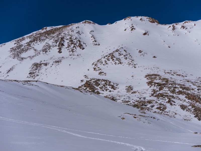
Above the forest, we now had a 360 degree view of Golden Bear, The Citadel, and Hagar. The Citadel and Hagar appeared skiable, with promising snow. Golden Bear looked out of the question: dry, dry, dry. I didn't bother taking a photo.*
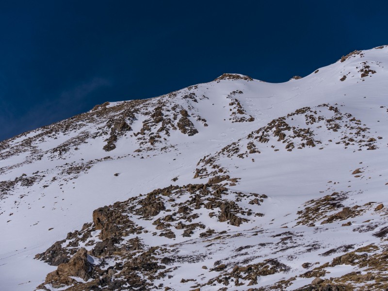
The Citadel.
Hagar looking delicious.
Our line on Hagar, the Southeast Face, looked absolutely delicious. The new snow had filled in the tracks Ben Conners had made. I couldn't believe it. Here Joe and I were, seemingly the only skiers going for this line! What a treat. We would have to get closer and examine the snowpack to get a feel for it. Going for the summit seemed inevitable, whether we would ski down we would decide once we got closer.
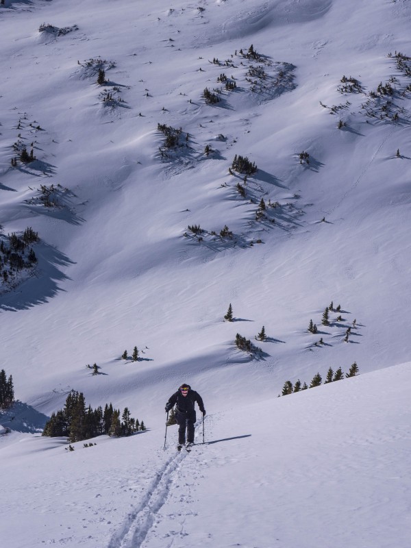
It was with great joy (at least for me) that we removed skis, put on crampons, and began the boot pack to the summit, following our snowshoer companions. There's something about putting in boot pack I really enjoy. The closeness to the mountain, the cardiovascular workout, and the reassuring bite of the whippet, ice axe, and crampons in the snow and ice. I'm so much more comfortable on steeps when snow is involved.
The climb up the steeps, photo of me by Joe.
Summit Time
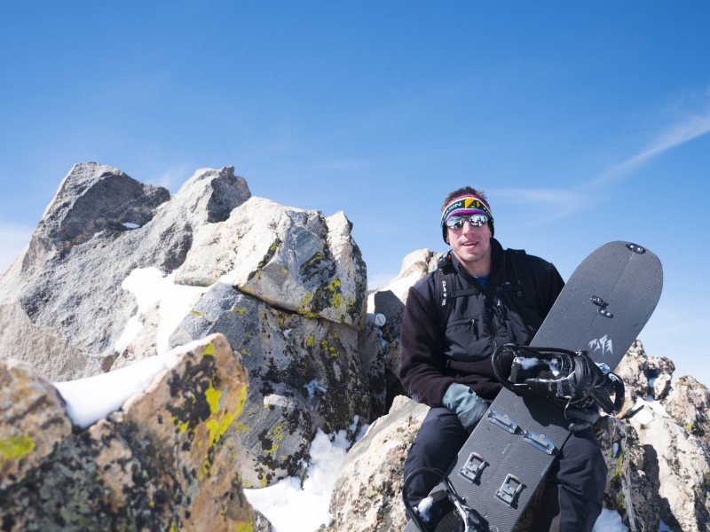
Joe on the summit.
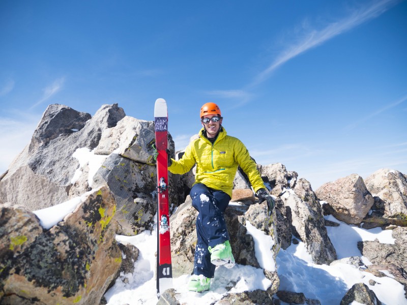
Me representing team orange and yellow on the summit.
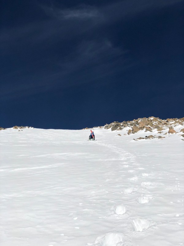
Scrambling to the summit in ski boots was somewhat awkward, but Joe and I came out on top shortly after noon. The concern now was the snow heating up too much, and possibly causing additional dangers. Joe and I snapped quick summit photos, and then I began to gingerly walk down from the summit to see if the snow covered up the hidden rocks.
Yep. Lots of hidden rocks. If we skied from the summit, it meant core shots for sure, and possibly a dangerous tumble. We would have to descend slightly to ski safely. This didn't concern me, as when it comes to skiing, it's the quality, and ease of travel on skis, that makes me ski peaks. Not notching a peak from the very summit isn't a huge concern for me.**
The Descent
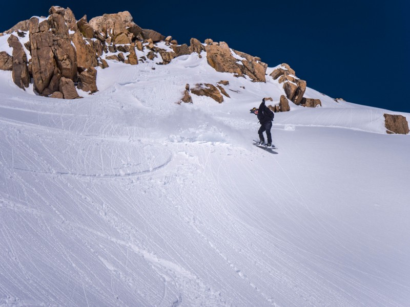
Joe and I keyed our BCA radios on, and I set out to ski the line first, as I would pull over and retrieve my camera to capture photos of Joe's descent.
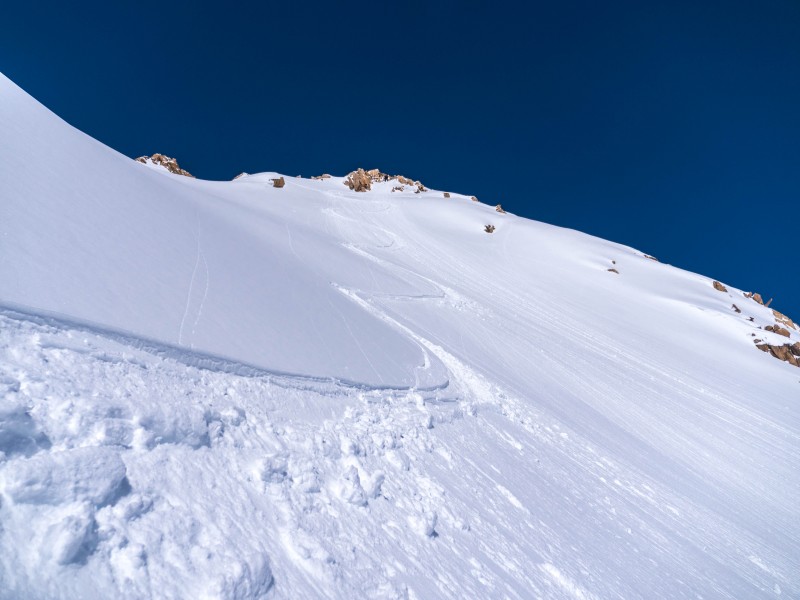
My initial turns down the Southeast Face. I pulled over for photo ops.
The descent was glorious, and worth all the effort, as I hope these pictures showcase.
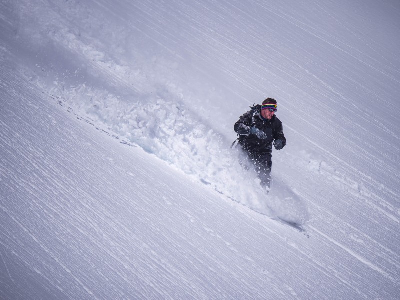
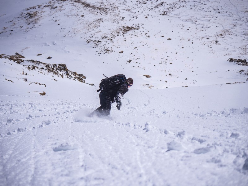
Joe starts the descent.
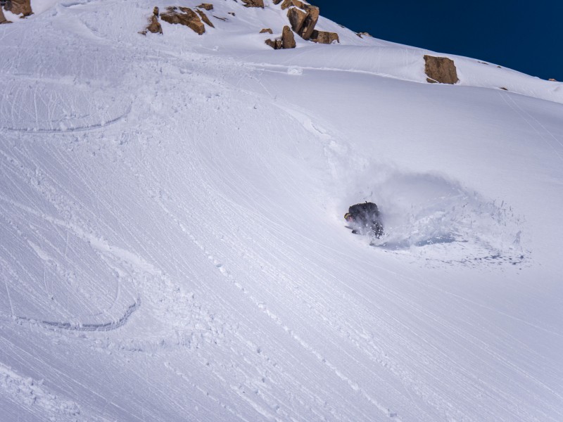
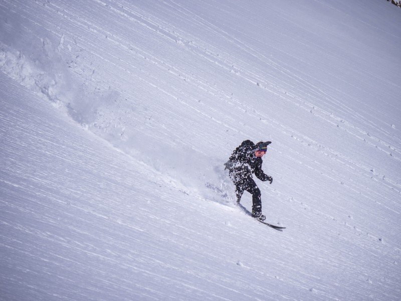
Catching air and then spraying snow.
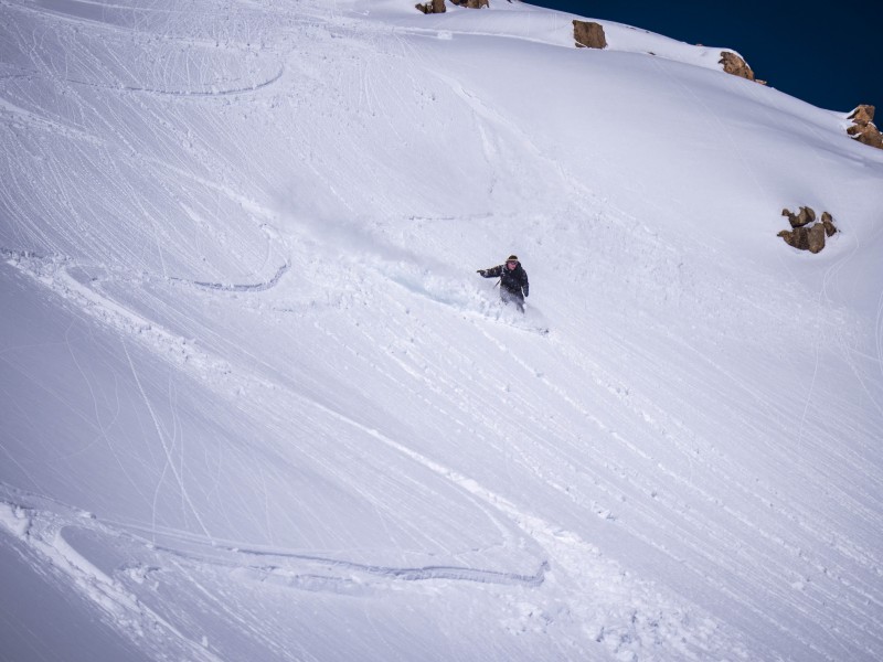
Keeps getting better.
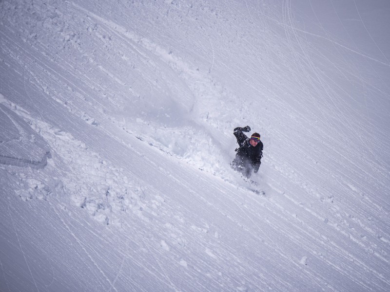
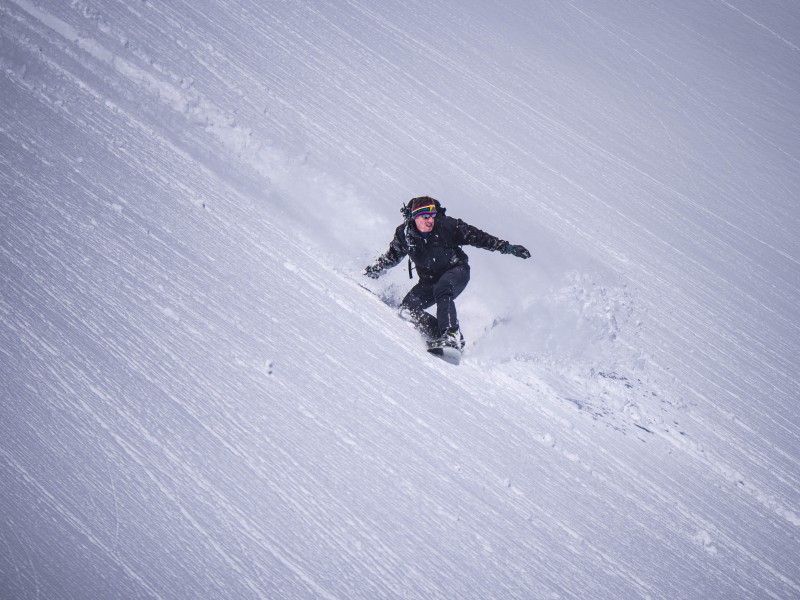
Joe makes it look effortless.
Just fantastic all the way down.
Can't see Joe anymore.
Joe passes me and heads down the rest of the face.
Looking up at what we just skied.
Joe and I were all smiles until the base of the face, where we knew we'd have to put on skins again before we could ski out. All in all, our trip comprised of ~8 hours, a trip made longer by the fact that the warming caused the horrid glop to appear on our skins. Not so much fun. But we got back to the car, enjoyed some water, and then Joe began the battle back to Denver while it was smooth sailing driving the Outback back to Vail.
Leaving our mark on this beautiful line.
*It's worth noting that sometimes I can be mistaken in identifying peaks. Ryan Richardson is WAY better at identifying peaks. So if I identify a peak incorrectly, feel free to comment and correct!
**A note. I consider and list this as a ski descent, but I can understand if some insist you ski right from the summit. I'd love to repeat Hagar again, and do it from as close to the summit as possible and still avoid core shots.
Thumbnails for uploaded photos (click to open slideshow):
I wouldn't be too concerned about getting smoked by a female snowshoer. She's probably the most accomplished female winter mountaineer on here. Nice ski!
SarahT: I did not know I was in the presence of such a star! Salutations. Also, Joe and I were way too slow for you guys to witness the ski descent, haha. We did see you guys make your swift exit!
Natalie: Good question, the new Armada sticks are legit great in corn and powder, and an absolute blast up the skin track. Joe commented on how I wasn't breathing hard at all, haha. They handle Colorado "ice" well too, but refrozen crusty shit is not their friend, that's when the lightweight penalizes me.
Caution: The information contained in this report may not be accurate and should not be the only resource used in preparation for your climb. Failure to have the necessary experience, physical conditioning, supplies or equipment can result in injury or death. 14ers.com and the author(s) of this report provide no warranties, either express or implied, that the information provided is accurate or reliable. By using the information provided, you agree to indemnify and hold harmless 14ers.com and the report author(s) with respect to any claims and demands against them, including any attorney fees and expenses. Please read the 14ers.com Safety and Disclaimer pages for more information.
Please respect private property: 14ers.com supports the rights of private landowners to determine how and by whom their land will be used. In Colorado, it is your responsibility to determine if land is private and to obtain the appropriate permission before entering the property.


 The peak after our ski.")
 Joe skins up from the forest.")
 A wider view of Joe on the skin track.")
 The Citadel.")
 Hagar looking delicious.")
 The climb up the steeps, photo of me by Joe.")
 Joe on the summit.")
 Joe starts the descent.")
 Catching air and then spraying snow.")
 Keeps getting better.")
 Joe makes it look effortless.")
 Just fantastic all the way down.")
 Can't see Joe anymore.")
 Joe passes me and heads down the rest of the face.")
 Looking up at what we just skied.")
")
 Leaving our mark on this beautiful line.")
")
 Me representing team orange and yellow on the summit.")
 My initial turns down the Southeast Face. I pulled over for photo ops.")
")