Download Agreement, Release, and Acknowledgement of Risk:
You (the person requesting this file download) fully understand mountain climbing ("Activity") involves risks and dangers of serious bodily injury, including permanent disability, paralysis, and death ("Risks") and you fully accept and assume all such risks and all responsibility for losses, costs, and damages you incur as a result of your participation in this Activity.
You acknowledge that information in the file you have chosen to download may not be accurate and may contain errors. You agree to assume all risks when using this information and agree to release and discharge 14ers.com, 14ers Inc. and the author(s) of such information (collectively, the "Released Parties").
You hereby discharge the Released Parties from all damages, actions, claims and liabilities of any nature, specifically including, but not limited to, damages, actions, claims and liabilities arising from or related to the negligence of the Released Parties. You further agree to indemnify, hold harmless and defend 14ers.com, 14ers Inc. and each of the other Released Parties from and against any loss, damage, liability and expense, including costs and attorney fees, incurred by 14ers.com, 14ers Inc. or any of the other Released Parties as a result of you using information provided on the 14ers.com or 14ers Inc. websites.
You have read this agreement, fully understand its terms and intend it to be a complete and unconditional release of all liability to the greatest extent allowed by law and agree that if any portion of this agreement is held to be invalid the balance, notwithstanding, shall continue in full force and effect.
By clicking "OK" you agree to these terms. If you DO NOT agree, click "Cancel"...
Report Type
Full
Peak(s)
Lead Mountain - 12537
Hart Ridge - 12500
Mount Cirrus - 12797
stats : ~20 miles RT (15 on a flat road), 4000ft elevation gain, 12.5 hrs (sad)
The Never Summer Range has some great scenic peaks, but it's a lot of work to summit many of them. There's long approaches, long lasting snowpack, and lots of scree. But fantastic scenery, and no crowds.
I'd been working my way down the range north to south, having done the shorter/easier peaks from Colorado State Forest and that area,
and had been eying a loop around Lake of the Clouds basin to bag four 12ers around it - from the unofficially named Never Summer/Jiffy Pop Peak (Lisa Foster's name), to Lead Mountain, then following the ridgeline over unranked Hart Ridge, to Mt Cirrus and Mt Howard. Basin loops were a theme for me this year. Dave and Derek were also working more of this range.
Approach options: There are two main approaches to Lake of the Clouds basin - with trade-offs either way:
1) The more standard approach is from the Colorado River TH in RMNP, and taking the Red Mountain trail up to meet the Lake of the Clouds trail. This approach trail has a ridiculously long 3 mile switchback/horseshoe, and starts at under 9000 ft, but is about a mile shorter overall. Resist the temptation to shortcut through the aptly named Hell's Hip Pocket.
2) Start from La Poudre Pass at the end of Long Draw Rd and the park boundary. Walk the flat Ditch Road for 6 miles each way to access the Lake of the Clouds trail. It starts at over 10,000 ft, and its a long, flat scenic walk. So less elevation gain, but an extra couple miles on the day on a flat road. I figure the time/energy is similar either way. We settled on this option coming from Fort Collins. Added benefit of not hitting Trail Ridge Rd traffic. I'd also recommend the north approach if doing these peaks, as in retrospect, the approach through Skeleton Gulch would be better, as a snow climb, to avoid some nasty scree.
As a side note, the park should really open this road up to mountain biking and maybe other vehicles. It's a service road for the ditch company, so they don't actually own it, but I don't see why bikes are banned while hikers and horses and heavy equipment are allowed. And there appeared to be ranger outside the cabin even at 5:30am. There's lots of good stuff accessible off this road, and just the ride itself would be great.
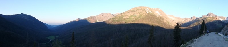
For a long walk on a flat road, the Ditch Road has some great views throughout, overlooking the Colorado River headwaters and passing the various Never Summer Range peaks.
alpenglow on Ditch Road
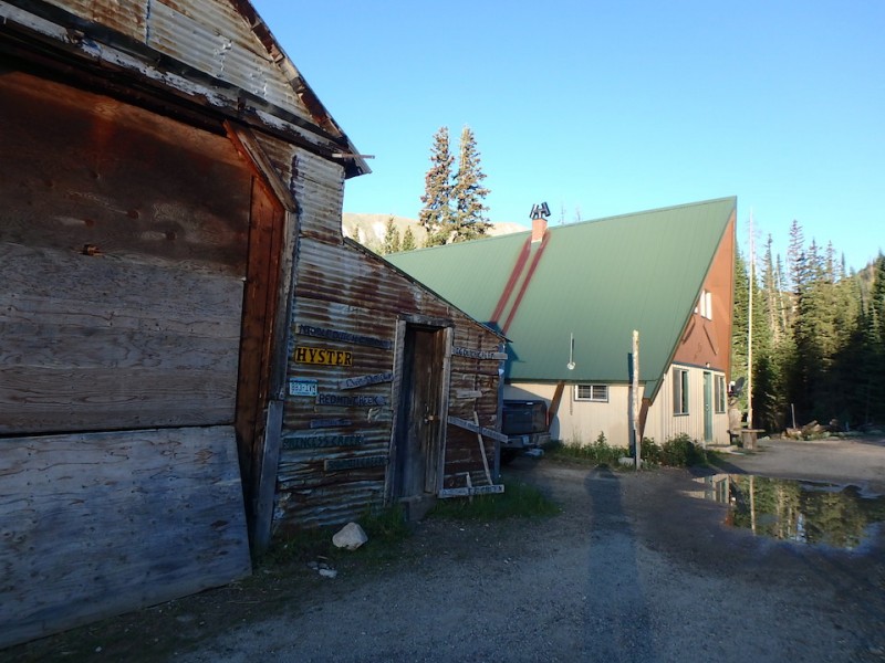
A couple miles in is Ditch Camp, a few cabins for the maintainance workers. Quirky things abound.
Ditch Camp
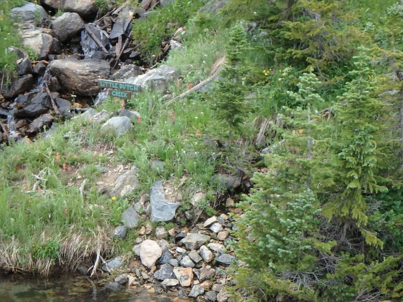
The Grand Ditch has some kitschy signage at its feeder creeks.
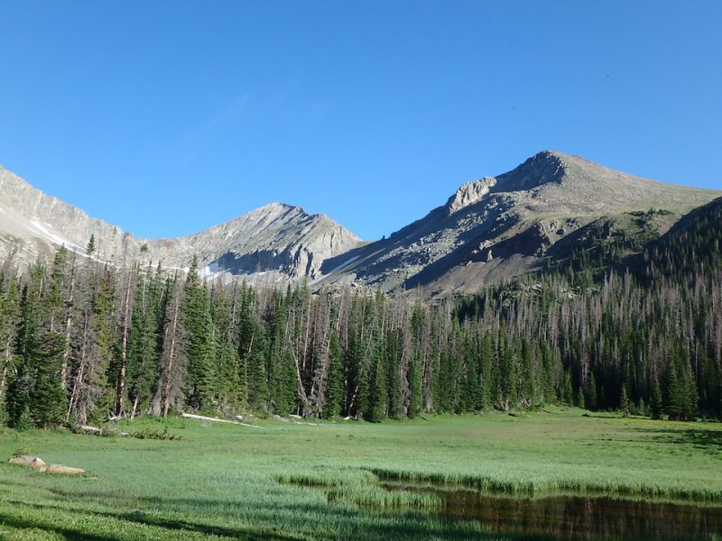
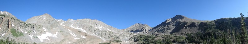
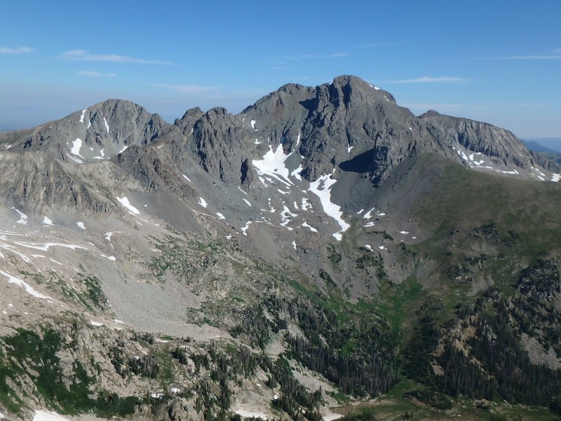
Eventually we hit the Lake of the Clouds trail, and get a view of some of the route and a good view of Never Summer (Jiffy Pop) Peak and Lead Mountain. As an aside, there's a couple Never Summer Peaks in the area.
Never Summer Peak and Lead Mtn
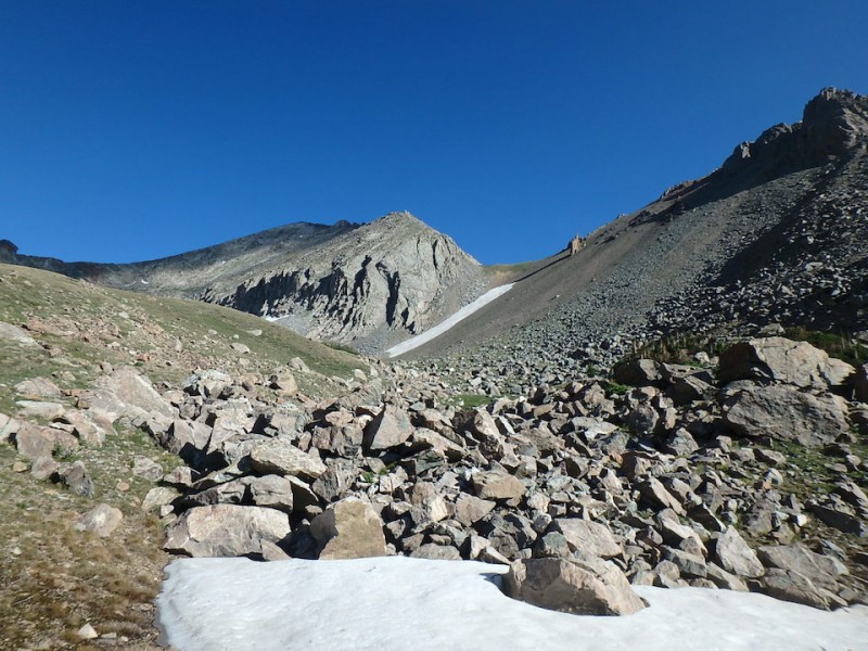
At treeline, the basin opens up to great views. The trail also ends around treeline, despite some perception that it goes up to Lake of the Clouds, the route up there is through fields of loose talus and moraines.
at treeline
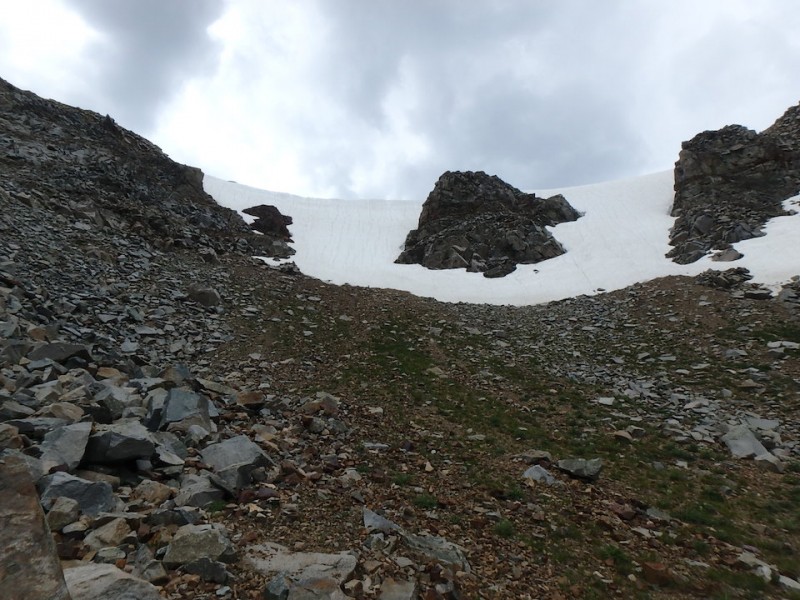
Getting closer to the first goal, we settle on going up the ramp to the saddle, because it's the 'standard' route. Doesn't look so bad from afar, but it was a slog to ascend.
the scree ramp to the saddle
Plunge stepping/postholing up steep scree, several inches deep, it was like climbing a sand dune at 12000ft, as my Yelp rating went down. The grass/vegetation doesn't help much at all. climbing up the scree
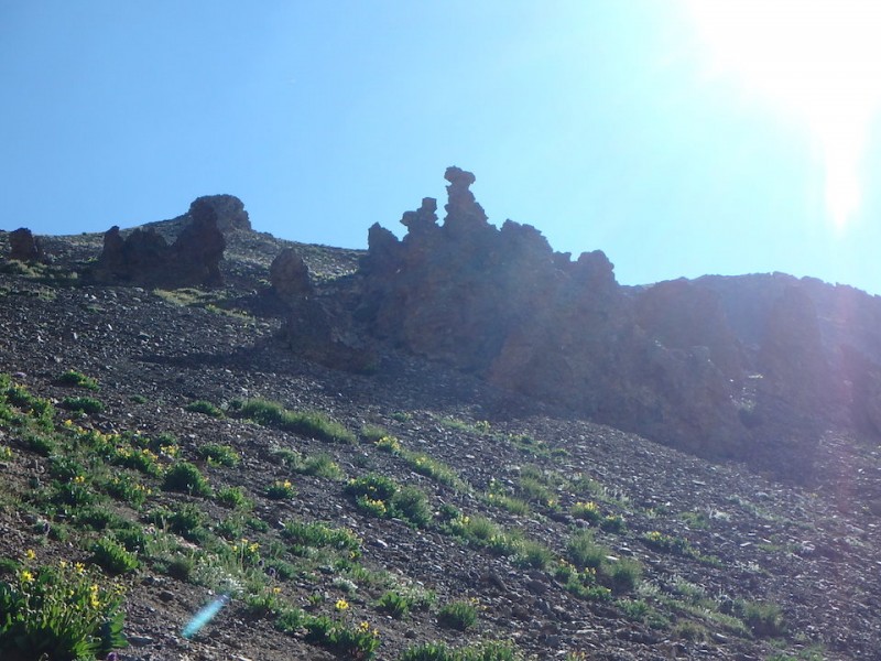
Some volcanic hoodos near the top of the saddle. hoodos near the top of the saddle
Eventually we got to the saddle, and things eased up considerably. Following the ridge from the saddle to Never Summer Peak, we got up in 10 minutes or so on relatively more solid ground.
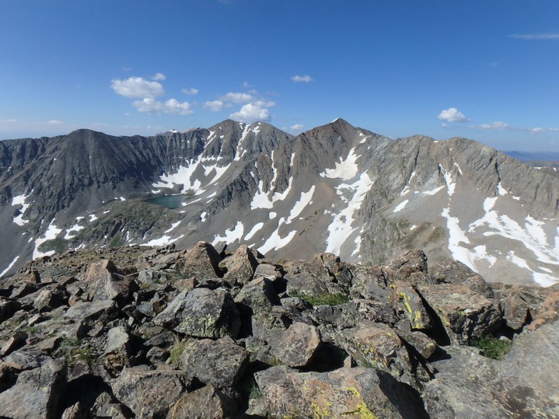
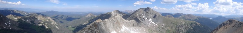
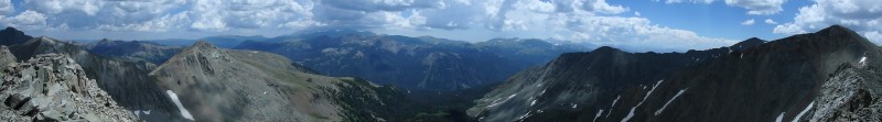
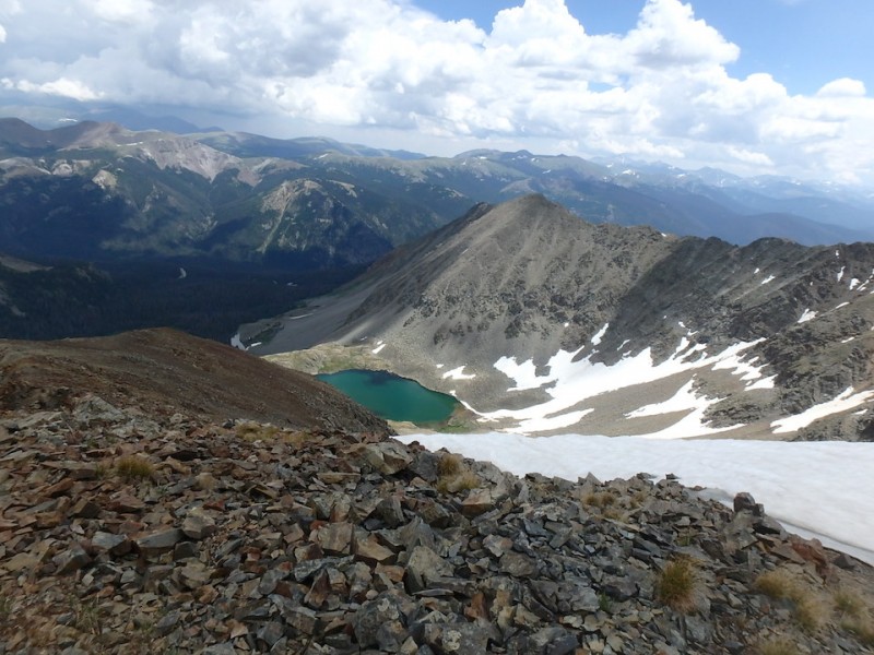
Summit views of the basin and surrounding peaks were great. We're going over there?
Lake of the Clouds Iron Mountain and other peaks to the north
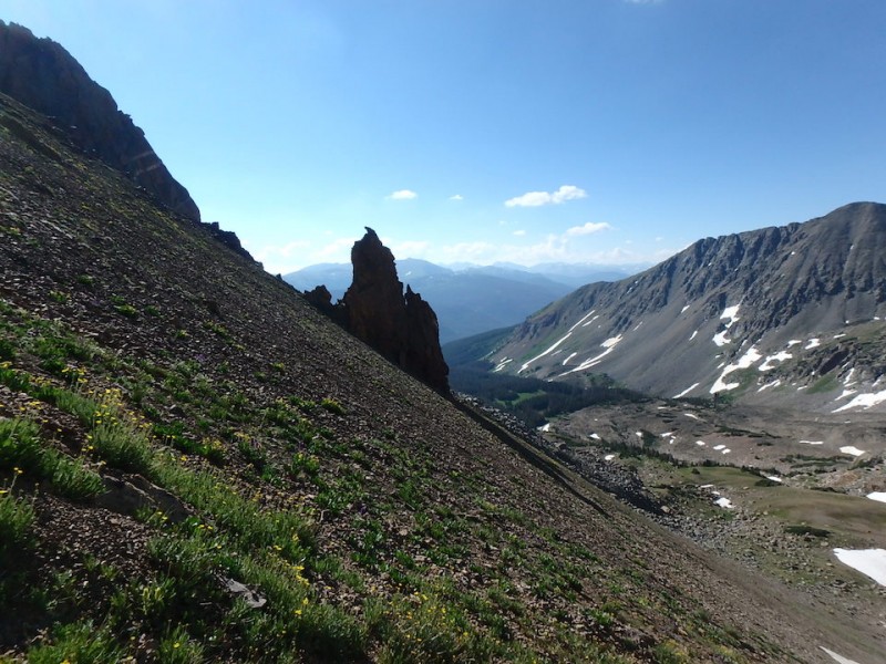
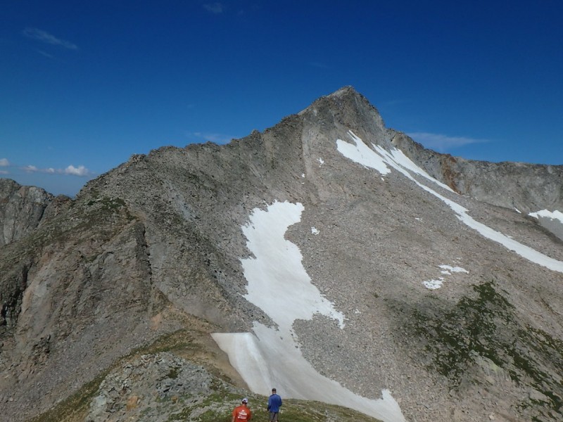
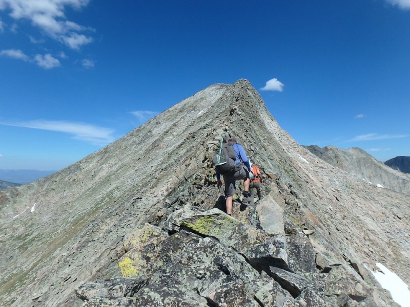
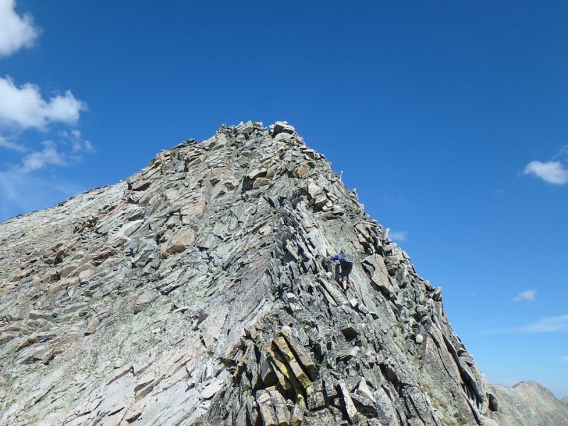
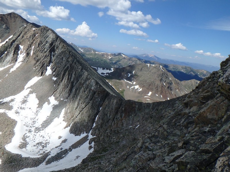
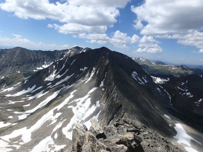
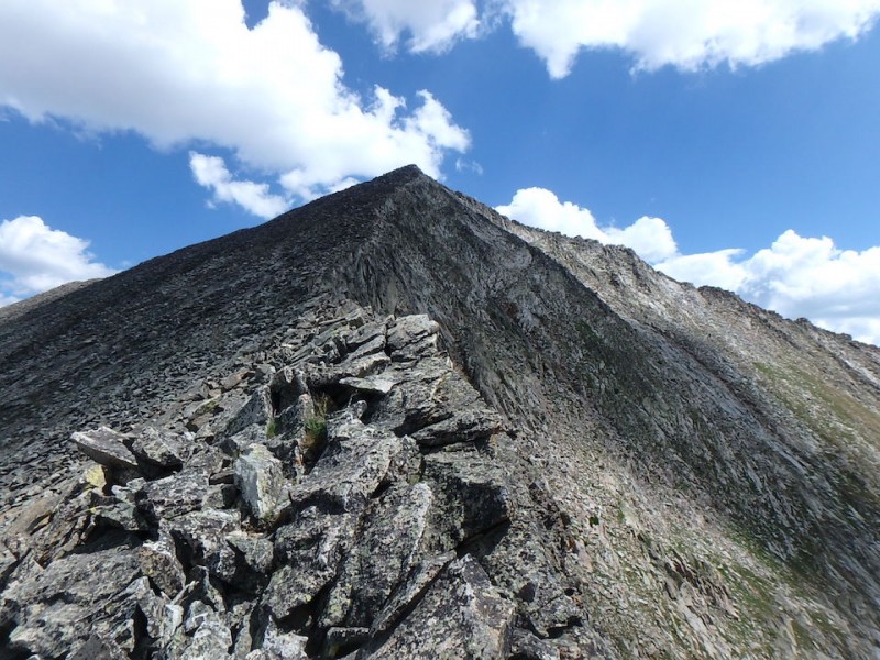
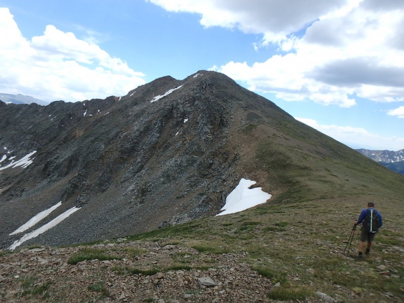
We descended back to the saddle and towards Lead Mountain's east ridge, the highlight of the day.
Lead Mountain's east ridge
I'd recommend gaining this saddle as a snow climb from Skeleton Gulch to the north instead. Here's a pic of that ramp from the top - it holds snow into at least late July. Mt Ricthofen is prominent to the north.
snow ramp on north side of saddle
A look back at Never Summer Peak. looking back at Never Summer Peak
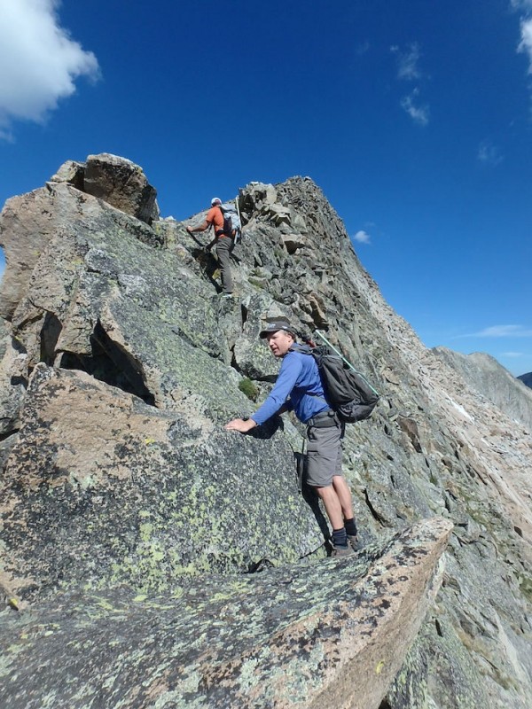
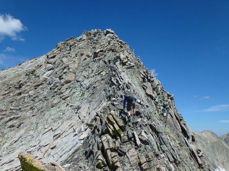
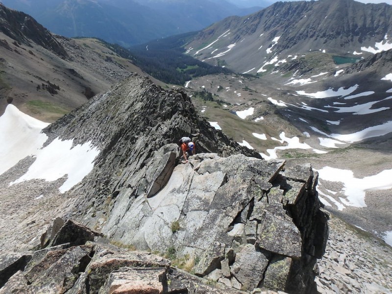
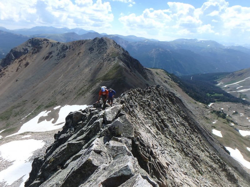
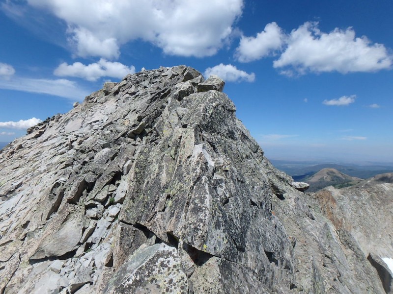
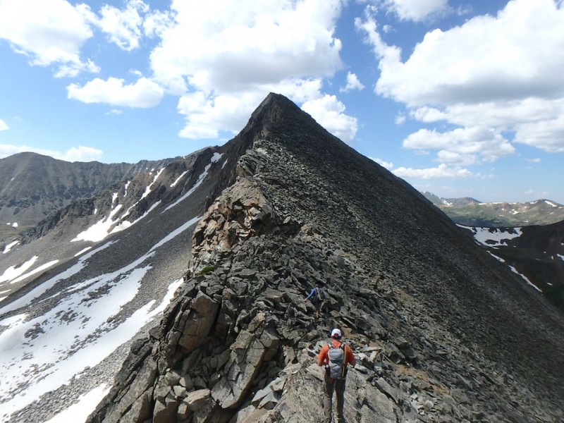
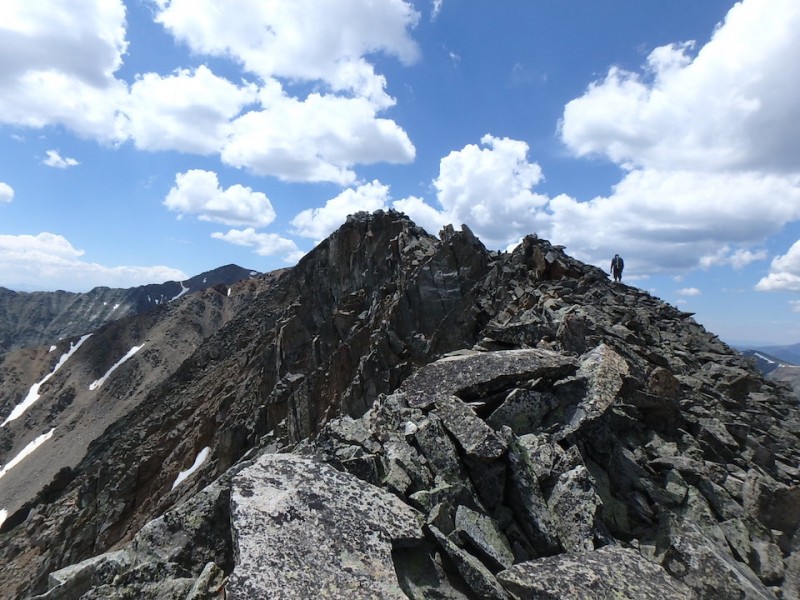
Ascending Lead Mountain's class 3 east ridge. The introduction is over. Most solid rock and most fun of the day. The holds were plentiful, but the climbing is sustained class 3 with each move across 1/4 mile. It took an hour.
fun class 3
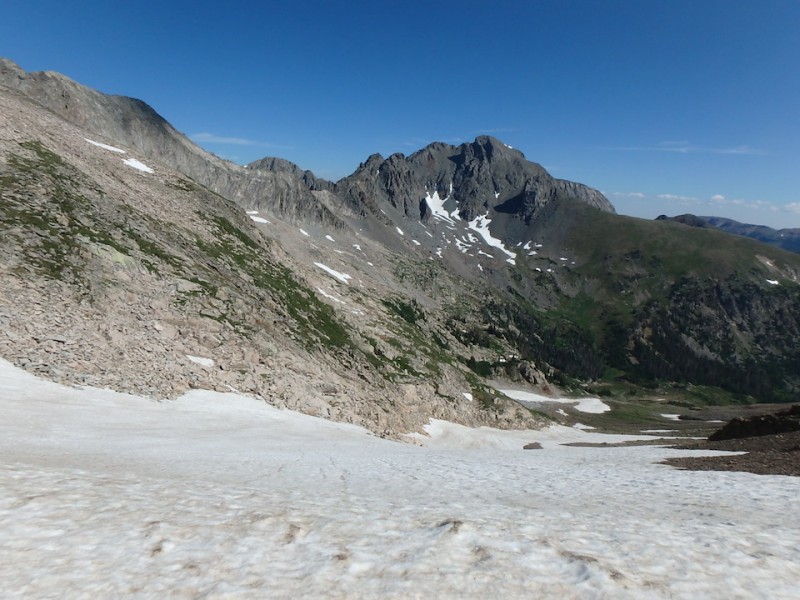
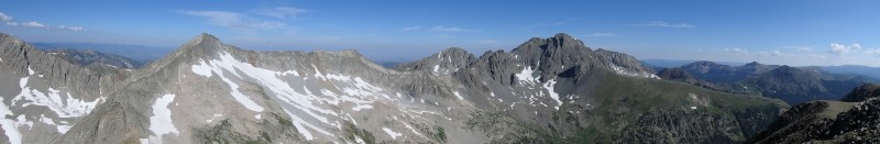
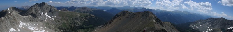
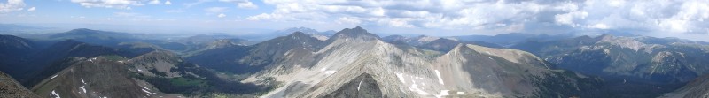
Some surrounding views:
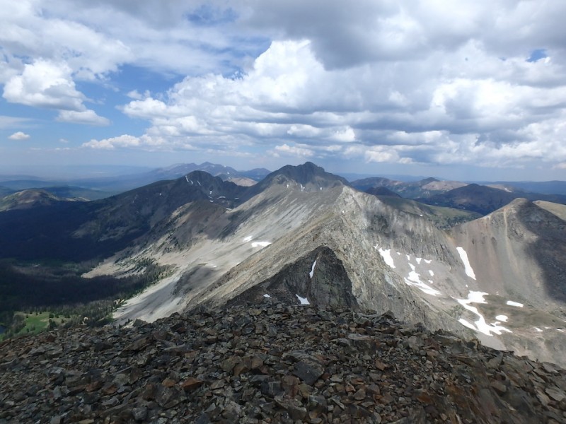
The class 4 ridge between Lead Mountain, Tepee, and Ricthofen
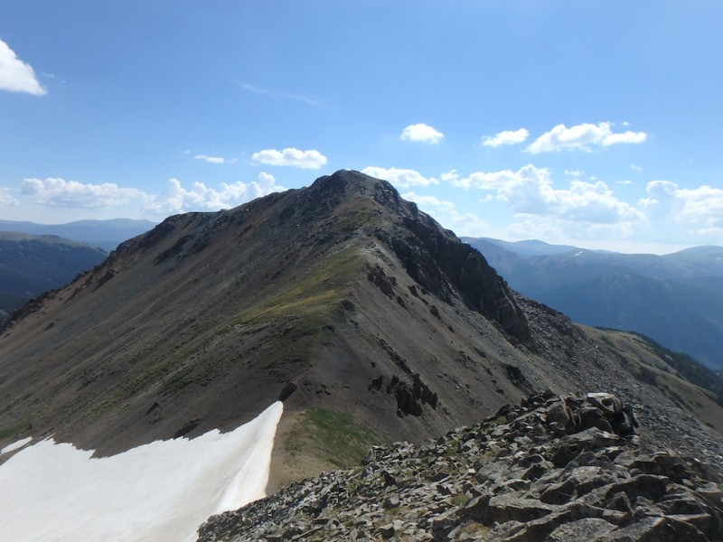
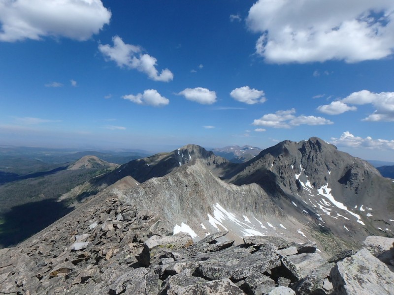
Hart Ridge: Hart Ridge
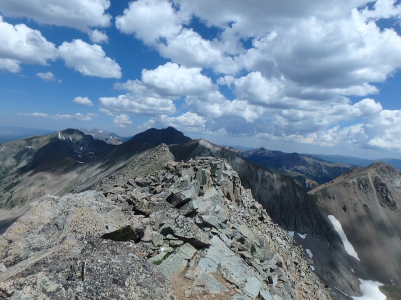
Lead Mountain's summit: Summit of Lead Mountain
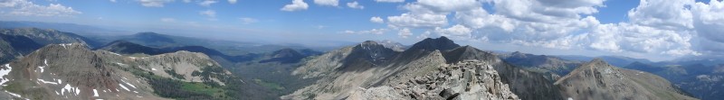
some surrounding views :
On to Hart Ridge. Wobbly uneven talus but nowhere near as bad as what would come later.
Hart Ridge
A look back at the descent off Lead Mtn:
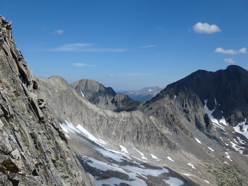
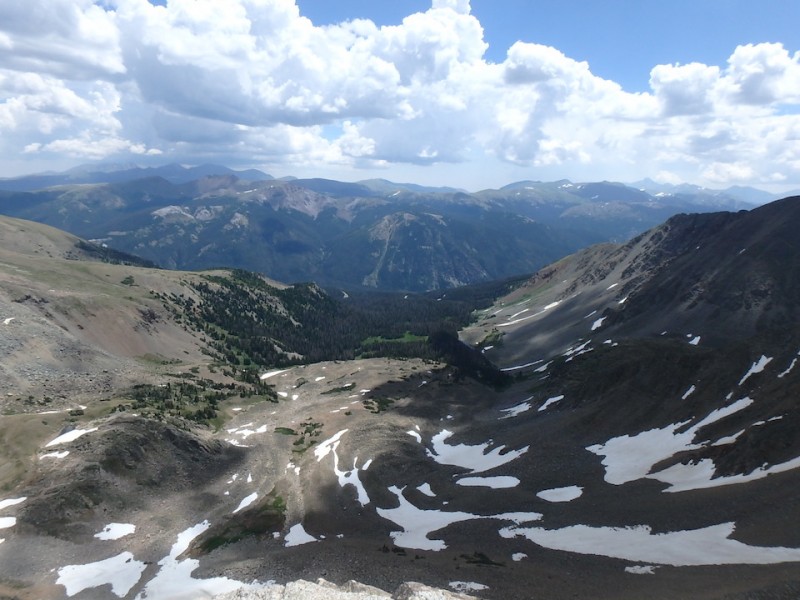
Lake of the Clouds basin: basin
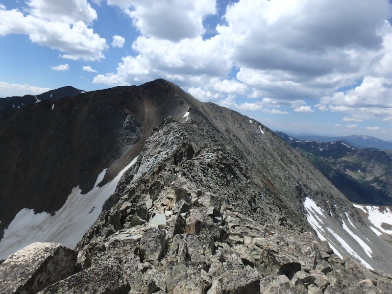
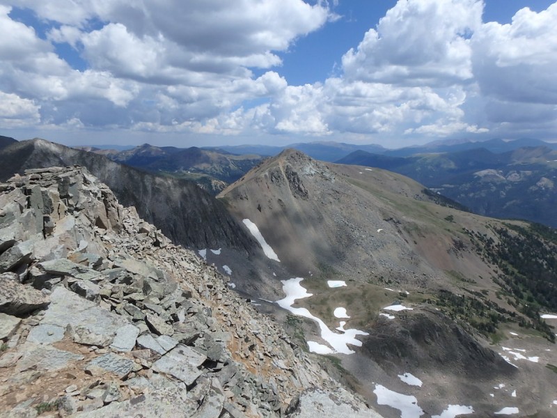
Hart Ridge and Mt Cirrus
Topping out on unranked but still impressive Hart Ridge. top of Hart Ridge
From here you can see the scree saddle we ascended between Lead and Never Summer, looks brutal from this angle. Maybe ascending the slope on the right would be better.
ascent saddle
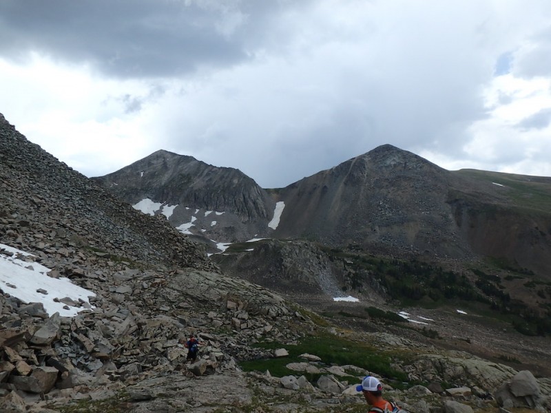
Next up was Mt. Cirrus, more scree but not nearly as bad as gaining the saddle earlier.
Mt Cirrus
By the time we summited Mt Cirrus, it had taken a lot longer than expected, we were beat, and clouds were building. Although Mt Howard looked relatively easy from here, compared to everything else, we orphaned it, content enough with all the scrambling and knowing it was a long way back.
Mt Howard
The descent from the saddle between Cirrus and Howard was really nasty. Tons of large loose rocks, no way to keep things from rolling. The herd of bighorns nearby didn't seem to care. There's a wall of snow on the rim, vertical more than a cornice. We had to spread out and pick different lines down.
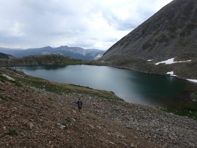
Eventually making it down to Lake of the Clouds.
Usually when you get down off the peaks to a lake, it's a mellow hike out. Not so with Lake of the Clouds. Despite being the 'most visited destination in the Never Summers' (at least in RMNP), it's a rough scramble across a bunch of loose talus and moraines, and snowfields. Unsuspecting hikers can easily get lost up there, as I did my first time. We had to cross a hard snowfield that fed into the lake.
So the trek below the lake took its time as well.
Lead Mtn and Never Summer Peak from Lake of the Clouds Lake of the Clouds
Eventually we got back to treeline and easier ground, and the slog out on the road, past the start of the Colorado River. 12.5 hrs on foot, and 2 hr drive time each way. We had left town at 3am and got back after 8pm.
Essentials for any time of year in this area : helmet, ice axe, really sturdy footwear, trekking poles. The area is very scenic, but taxing to hike in. It definitely lives up to its reputation. Lead Mountain's east ridge is a fantastic scramble, albeit with a long approach riddled with scree.
Thumbnails for uploaded photos (click to open slideshow):
Yes, the brief taste I had of the Never Summer Mts with you guys a few years ago was delicious! Super area! Those ridges DID look like a blast! Great job in getting those in, and thanks for sharing it! :D
Great TR & photos.
LOL - your Yelp rating went down. Great way to describe some wicked scree.
As Doug mentioned above, I enjoyed a sample of the Never Summers a few yrs ago with you 3.
I notice several of your pics feature Dave J's back. Mine too, except when I hike with him, he's usually a much smaller dot in my hiking photos! :lol:
Thanks for sharing!
Cheers! :D
Except for the descent off of Cirrus/Howard saddle. The looseness of that freaked me out a bit. Hoping for more adventures in the Never Summers this summer.
Caution: The information contained in this report may not be accurate and should not be the only resource used in preparation for your climb. Failure to have the necessary experience, physical conditioning, supplies or equipment can result in injury or death. 14ers.com and the author(s) of this report provide no warranties, either express or implied, that the information provided is accurate or reliable. By using the information provided, you agree to indemnify and hold harmless 14ers.com and the report author(s) with respect to any claims and demands against them, including any attorney fees and expenses. Please read the 14ers.com Safety and Disclaimer pages for more information.
Please respect private property: 14ers.com supports the rights of private landowners to determine how and by whom their land will be used. In Colorado, it is your responsibility to determine if land is private and to obtain the appropriate permission before entering the property.