Download Agreement, Release, and Acknowledgement of Risk:
You (the person requesting this file download) fully understand mountain climbing ("Activity") involves risks and dangers of serious bodily injury, including permanent disability, paralysis, and death ("Risks") and you fully accept and assume all such risks and all responsibility for losses, costs, and damages you incur as a result of your participation in this Activity.
You acknowledge that information in the file you have chosen to download may not be accurate and may contain errors. You agree to assume all risks when using this information and agree to release and discharge 14ers.com, 14ers Inc. and the author(s) of such information (collectively, the "Released Parties").
You hereby discharge the Released Parties from all damages, actions, claims and liabilities of any nature, specifically including, but not limited to, damages, actions, claims and liabilities arising from or related to the negligence of the Released Parties. You further agree to indemnify, hold harmless and defend 14ers.com, 14ers Inc. and each of the other Released Parties from and against any loss, damage, liability and expense, including costs and attorney fees, incurred by 14ers.com, 14ers Inc. or any of the other Released Parties as a result of you using information provided on the 14ers.com or 14ers Inc. websites.
You have read this agreement, fully understand its terms and intend it to be a complete and unconditional release of all liability to the greatest extent allowed by law and agree that if any portion of this agreement is held to be invalid the balance, notwithstanding, shall continue in full force and effect.
By clicking "OK" you agree to these terms. If you DO NOT agree, click "Cancel"...
These days I work a seasonal job and am off work from Dec 15 to March 15, give or take a few days. I work as a Guide at Gateway Canyons Resort in western Colorado. I guide rock climbing, mtn biking, hiking, Jeep, and UTV/ATV trips. Beautiful area of CO, great guests at the Resort, outside all day long, winters off.....good stuff. Way better than a real job.
For my months off this winter I decided to do some long distance solo hiking. I knew about the Arizona Trail (AZT) from having lived in AZ so I got serious about logistics and gear and put together my plan.
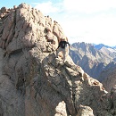
Overview of the AZT
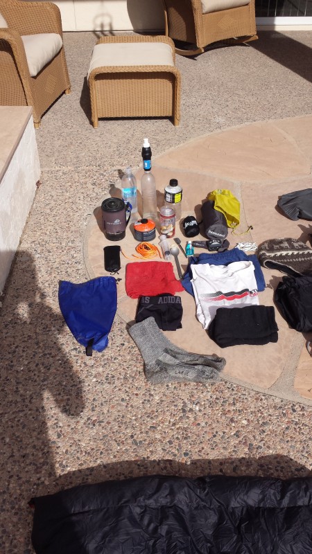
I planned on doing 300 miles of the trail. I would start at the Mexico border and go to Superior, AZ. I didn't really have "lightweight" gear so a few items were bought..new pack, (Osprey Exos 48) 0 degreee down quilt, (from Enlightened Equipment) new tent (Sierra Designs 1FL) and a new sleeping pad, (Neoair Xlite). Those were the major items. My most important piece of gear....my Sawyer Squeeze water filter. Screws right on top of Smart water bottles. I carried 3 liters capacity, all Smart water bottles. Used my REI dividend, got some Amazon gift cards for Xmas from my sisters (THX!) and got my gear squared away. My "base weight" (all gear and pack minus food, water, fuel) was 12.5 lbs. My planned date "on trail" was Jan 2.
Gear
Gear
The trail itself is 800 miles long, goes from the southern border with Mexico all the way to the Utah border in the north. 90+% of the trail is on trail, not on road, and quite remote. I went NoBo, which means I was travelling northbound. This time of year the northern sections are cold, snowy, and tough, so most thru-hikers don't leave the southern border until around early-ish March to be up north without too much troubles. I did have a guy named Taz that passed me by Oracle, AZ about mile 200 and he was going all the way!
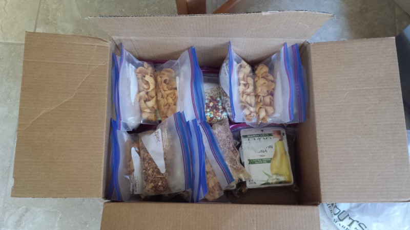
My time off, Xmas is in there too, and my month long ski trip in Feb meant I had about 25 days or so to go hiking. I planned on 15 miles a day average, so I needed about 20 days. So far, so good. Got my gear squared away so now food, food drops, possible water caches, and a zero day somewhere towards the middle of the 300 mile hike. Before I left CO I had made up menus, looking at calories/day, weight per calorie, how many meals, packaging of meals...lots of stuff. I ordered some food off Amazon, got some local. Basically I aimed for 3000 calories/day but didn't quite make that, food in the range of 125 calories/oz and higher, only hot water food but not prepackaged dehydro meals (too salty, don't like) and easy to consume, on the trail lunches. My breakfast and dinners were hot water poured into a freezer Ziplok bag meals along with good instant coffee. I had made the choice to go with a stove vs. stove-less. These long hikes can be done stove-less but I took my Jetboil. Next time, I will change my stove system.
Putting food bags together
Food
My menu was:
Breakfast - quick oats, powdered milk, protein powder, brn sugar, dehydro strawberries or peaches. I had option #2 which was same thing but cream of wheat instead of oats. Had a nice cup of Starbuck's Via instant coffee each morning too....key! This meal, and the coffee, would require about 2 1/2 to 3 cups of water to make. 670 calories
Lunch - 1 Clif bar, 2 Justin's almond honey butter, 1 Snicker's, about 1 cup of peanut M&M's, and a nice blueberry type "fig" bar from Sprout's. around 800 calories
Dinner - 2 packs of Ramen, tuna in olive oil, dehydro veggies or second choice was dehydro refried beans, (Mexicali Rose, off of Amazon..very good) instant rice, a bit of taco seasoning added, some pizza pepper flakes and small amount of Frito's to toss in. The Frito's are clutch! The rice/beans meal was my favorite. The Ramen meal needed about 3 to 4 cups of water and the rice/beans about 2 cups. Both these meals were in the 600 to 800 calorie range.
I left Grand Junction on Dec 21st and headed to my parents house in the Phoenix area. They had gone to the Minneapolis area for the holidays so I had the place to myself. I had all my gear, all the food still in bulk, lots of Ziplok bags, and a plan! I also brought along a kitchen scale as everything had to be weighed and bagged. I took my mtn bike, my road bike, some climbing gear with me also. I did get in 2 nice mtn bike rides at South Mtn Park, went climbing with my friend Ryan out by Queen Creek (the Pond area) and did 3 road bike rides.
I spent the next few days weighing, measuring, and bagging all my meals. Each day essentially had 3 bags...breakfast, lunch, dinner. I worked out the logistics and miles for my food drops next. Each day was right around 1.5 to 1.7 lbs of food per day. There are trail towns, where the trail goes right through or very near a town, so I mapped those out, looked at mileage between them, and came up with 3 food drops......Patagonia, AZ, Colossal Mtn Cave State Park, (Tucson area) and Oracle, AZ. Of course I started with meals in my pack to get me to the first food drop. First food drop was at mile 52.8, second was at mile 118.8, and final was at mile 206.6. I was ending my hike at mile 300.5. The final food drop and miles after the food drop was longer but the trial got a bit "easier" and I felt I could carry some extra and move quicker. In actuality I had planned for 6.6 days of food for the last almost 100 miles but cut it to 5 days of food, which was perfect.
Day after Xmas I drove around AZ to drop my food at businesses. The trail towns are super hiker friendly and will hold boxes for hikers. My Patagonia food box was dropped at Wild Horse Hotel, my second at the gift shop at Colossal Mtn Cave State Park, and my third at Chalet Village Motel in Oracle. I had decided to do a "zero" day in Oracle to do laundry, shower, grab a day of zero miles, and stay at the motel. This ended up being on Day 14. I also identified a few areas where water might be a concern so I dropped a few gallons of water at some locations. I drove 4wd roads to get to locations where the trail crosses roads and stashed water. More on water later.
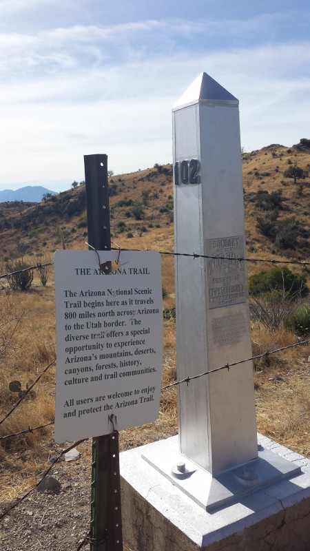
Done, let's go! My folks got back from MN and on Jan 2nd they drove me down to the border. The trail starts in Coronado National Memorial, just a bit west and south of Sierra Vista, AZ. You park and I had to walk 1.7 miles SOUTH (the wrong way) to get to the actual border, then turned around and returned to the parking lot. The border monument Mile Zero First Passage Leaving the parking lot, heading out
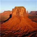
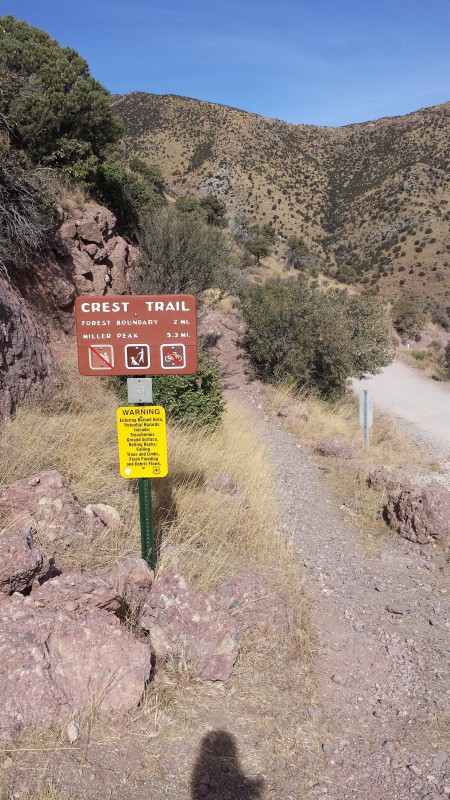
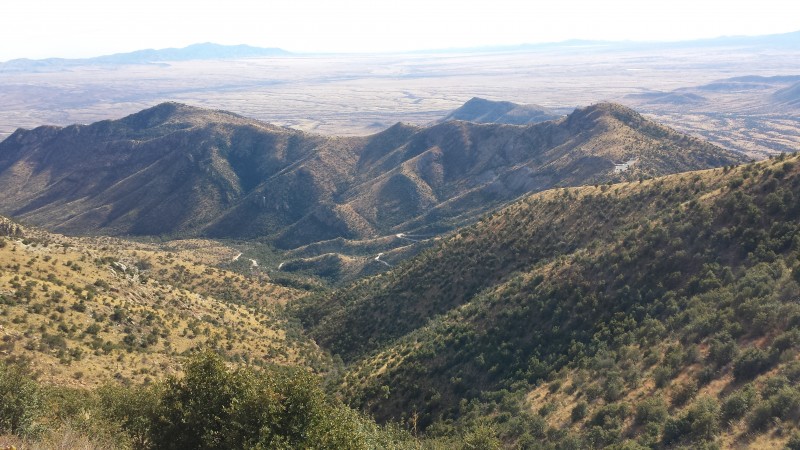
My folks waited for me to return, then I was off and we said our goodbye's. The elevation profile of the AZT is big...up, down, up down.....I had 4 mtn ranges to go up and over within the first 200 miles. I had the Huachuca's, the Santa Rita's, the Rincon's and the Santa Catalina's. The trail starts at 6600 ft. The section from the Rincons and Oracle, AZ were the toughest. I went from 3300 ft, up to 8000 ft, right back down to 3600 ft, and then right back up to 8600 ft. Not CO type elevations but tough nonetheless. Bathtub Springs The Huachuca mtn's Looking back south towards Mexico Early morning light
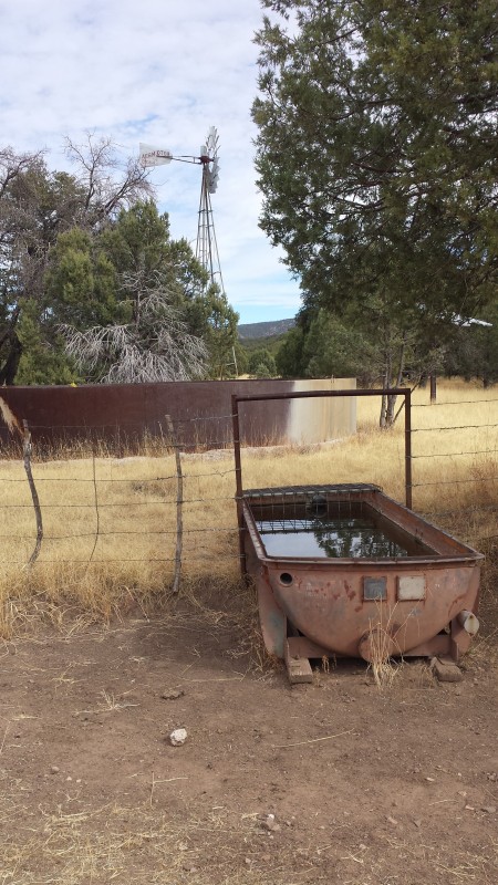
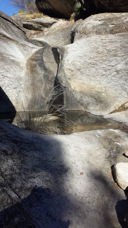
Long story short.....I walked. I found water, I found solitude big time...out there solitude. Beautiful camps, beautiful country, great weather, white tail deer, a few javelina's, lots and lots and lots of cows, good water, not so good water, and really ugly water. But it's the only water out there so you drink it. My longest carry was 19 miles between water sources. The strategy of water management was key and as time on trail went on, I got better at it. Several times I had to "camel"...I was at a water source, I had many, many miles to go to my next water source, so I would drink 2 liters straight up, then load 3 liters onto my pack. So that's 4 lbs of water in my belly, 6 lbs on the back. Water had to be used to cook and drink. Some nights I had a water source right by my tent so those were easier.....water for dinner/breakfast without having to carry much. The water sources were springs, flowing streams, (very, very few) cow tanks, cow ponds, one big-ish river (Gila River) and a few water cache boxes at key locations that Trail Angels keep stocked. Freeman Rd trailhead was one such cache box that is super important. It had 18 gals of water in it when I got there. If you get to this location and there is no water in the cache box, your hike is done.
One of the only flowing streams..Parker Canyon Water source...open the valve and beautiful water came out small spring water source
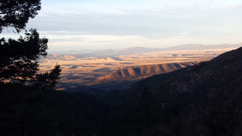
I averaged 16.5 miles/day over the 18 days it took me. I had some tough days where I only made 8 to 12 miles (up and down the Rincon's) and after Oracle I made 20+ miles a day easy. I was hiking by 7:30 ish most days and looking for or making camp by 5:00 ish each night. 2 days of light rain, ran into snow up high in the Rincon's and Santa Catalina's. Nice cool days, nice cool to colder nights. All good.
Out of the Huachuca mtn's, heading for Patagonia and the Santa Rita mtns camp just outside Patagonia
Next winter I will return to start where I left off (Picketpost trailhead by Superior, AZ) and go further. I might even push it and go all the way to Utah border and fight through the snows of northern AZ. I loved it and found many things I used and learned from this that I will incorporate into my 14er and mtn hiking. I am now a down quilt convert (no more sleeping bags) the Sawyer squeeze is awesome (with all the nasty ass water sources I had I never crapped myself!) and the "light or lightweight" gear makes a difference. I know the dangers of high mtn's and the "what if" mentality that we need to bring into our adventures. This hike brought me some clarity to that which I need, I want, I must have, and I can leave at home. I lost 8 lbs but didn't really ever feel "hungry". I had no major cravings but next time will take more "salty" stuff and more protein. I also took 800 photo's, used my cell phone in airplane mode (lasted 2 days) I carried a spare 20,000 ma battery by Anker, and used an app to help navigate and get updates on water sources.
(img281> Heading up the Santa Rita mtns Water! Water...but didn't need it.... Kentucky Camp, a restored gold mining camp heading out of the Santa Rita's...going downhill! Water Arizona skies..... flattening out, almost to the Tucson area. Rincon's and Santa Catalina's ahead La Sevilla picnic area. Deserted but had water so I had a cooked lunch as next water was a long way. Rincon mtns dead ahead. Camped just outside boundary of Saguaro Nat Park - east unit. Lots of these inactive, old, abandoned water wells out in the desert Water. It had been raining this day and I had to use the bottom cup of my Jetboil to scoop up water from the small puddles an The clearing storm Manning Camp, top of the Rincon mtns. The rain had been snow up high and the winds coated the needles and trees Heading down the Rincon's and the Santa Catalina's are next, dead ahead. Hutch's Pool. Last water for 19 miles. Beautiful place. Going to get water. I had to break the thin ice crust on top.
I will be glad to share more details with anyone interested..just PM me.
Thumbnails for uploaded photos (click to open slideshow):
I have looked to find "official" numbers but my guess would be for the 300 miles I did were in the range of 100,000 ft gain/loss, possibly more. Rare to have flat ground. My low was about 1800 ish ft at the Gila River and about 8600 ft was my high.
because I got the feeling seeing some of those, um, cloudy water sources that you used yours to backflush your filter quite a bit. :lol: After the AZT, any plans for the CO trail, CDT, PCT, or AT?
I brought my backflush syringe with me but only used it once...in Oracle. At the really nasty cow tanks, i would use my bandana to pre filter the floaties out, then put the water in my bottles...worked good. The CT for sure...the PCT and AT don't interest me. The Hayduke trail has my interest too. I would like to finish the AZT next winter.
This is very cool Mike. The AZT really piqued my interest last year and its interesting to read the PCT and AT don't interest you. I'm gonna go out on a limb and say its because they are too popular and/or crowded now? Could be wrong.
So is there a specific reason that you wanted to hike it vs ride it? Just curious because you brought up mtn biking in the report. I'd also imagine if biked, the water issue may be less of one.
Anyways, cool read and I enjoyed the minutiae as that is the real meat of a trip like this. Good luck on finishing it up! Is there a trail through Utah.....? Thats probably way hard to hike I'm thinkin.
You nailed it! Both the "big trails" are too busy. I'm more interested in an off the beaten trail...trail. The AZT was that. I never considered mtn biking the section of the AZT I hiked. First, there are wilderness sections where bikes aren't allowed. Also, when I was at Kentucky Camp I met a guy that had biked almost all of it and he said he averages 3 mph when biking it, so not all that faster. I do know this....there would be lots and lots of hike-a-bike if you rode it. Lots of unrideable sections. The trail in Utah that is next on my list is the Hayduke trail...super rad!!
I spent 38 years in AZ and this was a nice reminder of old times. Your next leg thru the Superstition Mountains is my old playground and the Mazatzals are amazing. Enjoy.
I really enjoyed reading your report and love the pictures. I am planning on solo hiking the Colorado Trail next summer so your advice and recommendations on gear, food, etc. are helpful. One question I have is - what was your footwear setup and how did it work for you?
I wore Altura Lone Peak 2.0 running shoes. I'm a huge fan of Altura shoes. They were perfect. I had zero foot issues. I wore a "heavier" wool blend sock. Thought about Darn Tough but I had the others. I took 2 pairs of socks and switched each day. Hung "yesterday's" socks off the back of my pack to air out and dry.
Best to you on the Colorado Trail...on my list too.
Hey, This trip report is awesome and we are totally interested in the AZT in the future! Do you live in Grand Junction? We do, and would love to meet up & hear more about it!!
Between this trip and your signature line there seems to be a "western" theme going on. :D Hope to meet you out there someday. Loved your TR on the Cap/Snowmass ridge some time ago!
Caution: The information contained in this report may not be accurate and should not be the only resource used in preparation for your climb. Failure to have the necessary experience, physical conditioning, supplies or equipment can result in injury or death. 14ers.com and the author(s) of this report provide no warranties, either express or implied, that the information provided is accurate or reliable. By using the information provided, you agree to indemnify and hold harmless 14ers.com and the report author(s) with respect to any claims and demands against them, including any attorney fees and expenses. Please read the 14ers.com Safety and Disclaimer pages for more information.
Please respect private property: 14ers.com supports the rights of private landowners to determine how and by whom their land will be used. In Colorado, it is your responsibility to determine if land is private and to obtain the appropriate permission before entering the property.


 Overview of the AZT")
 Gear")
 Gear")
 Putting food bags together")
 Food")
 The border monument")
 Mile Zero")
 First Passage")
 Leaving the parking lot, heading out")
 Bathtub Springs")
 The Huachuca mtn's")
 Looking back south towards Mexico")
 Early morning light")
")
 One of the only flowing streams..Parker Canyon")
 Water source...open the valve and beautiful water came out")
 small spring")
 water source")
 Out of the Huachuca mtn's, heading for Patagonia and the Santa Rita mtns")
")
 camp just outside Patagonia")
")
")
 Getting to my food drop in Patagonia")
 Heading up the Santa Rita mtns")
 Water!")
 Water...but didn't need it....")
 Kentucky Camp, a restored gold mining camp")
 heading out of the Santa Rita's...going downhill!")
 Water")
 Arizona skies.....")
 flattening out, almost to the Tucson area. Rincon's and Santa Catalina's ahead")
 La Sevilla picnic area. Deserted but had water so I had a cooked lunch as next water was a long way.")
 Rincon mtns dead ahead. Camped just outside boundary of Saguaro Nat Park - east unit.")
 Lots of these inactive, old, abandoned water wells out in the desert")
 Water. It had been raining this day and I had to use the bottom cup of my Jetboil to scoop up water from the small puddles an")
 The clearing storm")
 Manning Camp, top of the Rincon mtns.")
 The rain had been snow up high and the winds coated the needles and trees")
 Heading down the Rincon's and the Santa Catalina's are next, dead ahead.")
")
 Hutch's Pool. Last water for 19 miles. Beautiful place.")
 Going to get water. I had to break the thin ice crust on top.")
")
")