| Report Type | Full |
| Peak(s) |
Missouri Mountain - 14,071 feet Huron Peak - 14,006 feet |
| Date Posted | 01/21/2018 |
| Date Climbed | 12/21/2017 |
| Author | bmcqueen |
| Additional Members | JQDivide, globreal, 14erAddict, ScreeSurfer |
| Kicking off Winter 2017-18 Deep in the Sawatch |
|---|
|
Kicking off Winter 2017-18 Deep in the Sawatch Day 1 - Missouri Mountain Date: December 21, 2017 Peak: Missouri Mountain Start Time: 9:29 AM MST (solstice 9:28 AM MST) Route: Missouri Gulch summer route for the most part Vertical: 4,500 feet Ascent Party: bmcqueen & ScreeSurfer Time: 4:57 up; 8:02 roundtrip In January 2017, I climbed Belford and Oxford from the winter closure on Chaffee County Road 390 four miles before the Missouri Gulch trailhead. I was utterly spent at the end of that day and began to wonder whether I would have it in me to do that again someday to climb Missouri and Huron. As winter 2017-18 approached with precious little snow, I began to wonder if we might not sneak in Missouri and Huron with access to the Missouri Gulch trailhead or maybe even Winfield if the stars really aligned! Things looked good until right before it was time to go. Early-December was dry as could be and people were easily getting all the way to Winfield. The forecast for December 20, 2017 was snow in the evening (many potential partners opted out despite the tantalizing 9:28 AM earliest start time), continuing all through the Winter Solstice on December 21st. With the solstice not being until 9:28 AM MST, we couldn't get a very early start and still count it as winter, so we just hoped that we'd still be able to drive to at least Missouri Gulch the morning of the 21st. I picked up John Balciar (ScreeSurfer) at the Highway 285 park-n-ride and we drove up the snowy, icy roads towards Buena Vista. Around the Buffalo Peaks area, the snow stopped and the road was pretty dry all the way into BV. We turned off onto Chaffee County 390 and saw low clouds to the west - time to drive into the storm. We easily made it to the Missouri Gulch TH in my Highlander and celebrated that we wouldn't have to start as low as we did last year for Belford & Oxford. We geared up and started walking 1-minute into the 2017-18 winter. 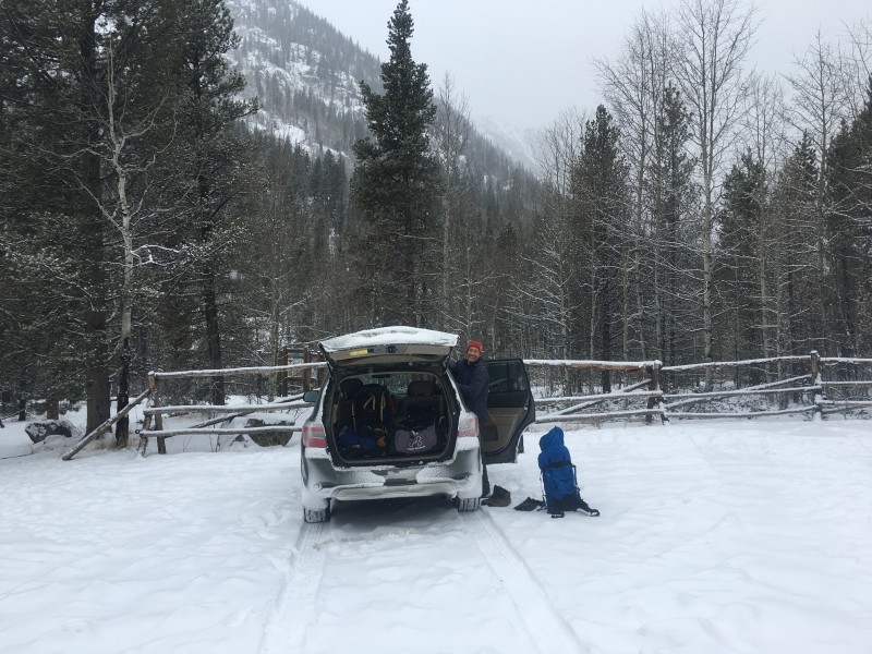 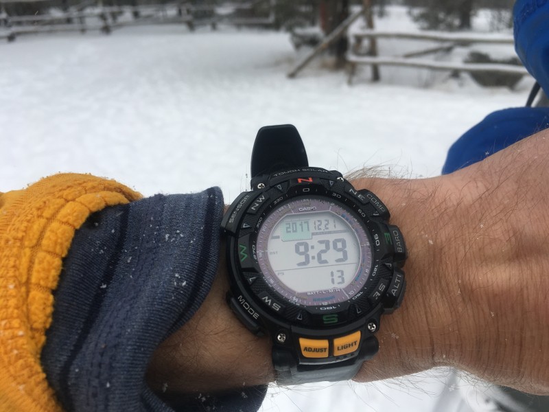 Note that we chose to go up Missouri's summer route because of the utter lack of snowfall to this point in the season. This is not normally a safe winter route - the west ridge has much less avalanche danger and should be used for Missouri most winters. 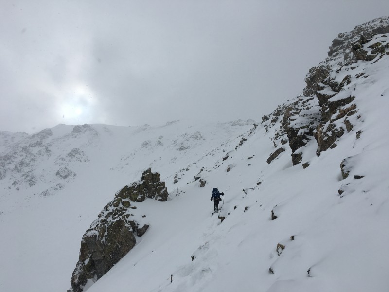 We went ahead and carried our snowshoes just in case, finally putting them on above treeline. John spotted a few ptarmigan in the basin. 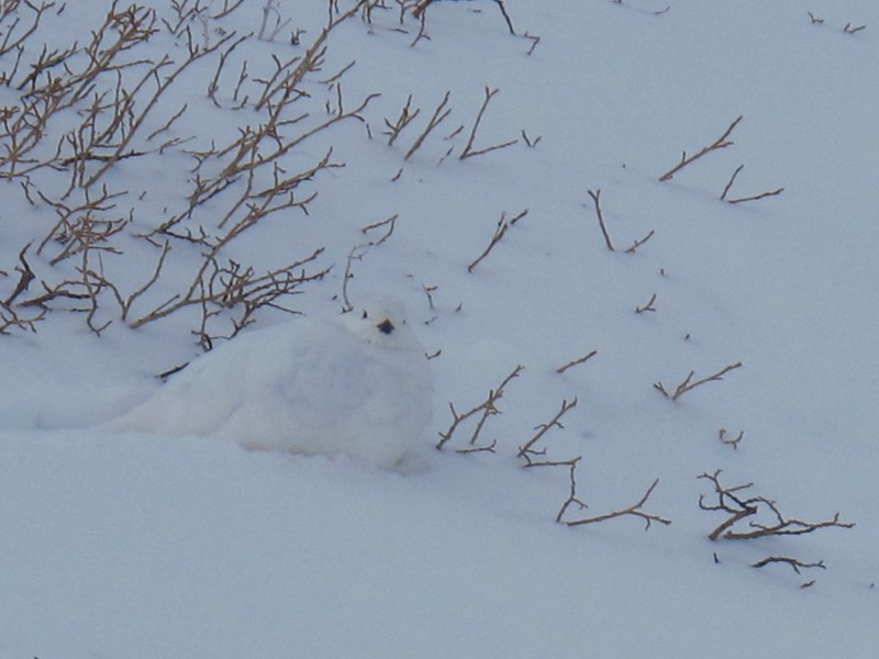 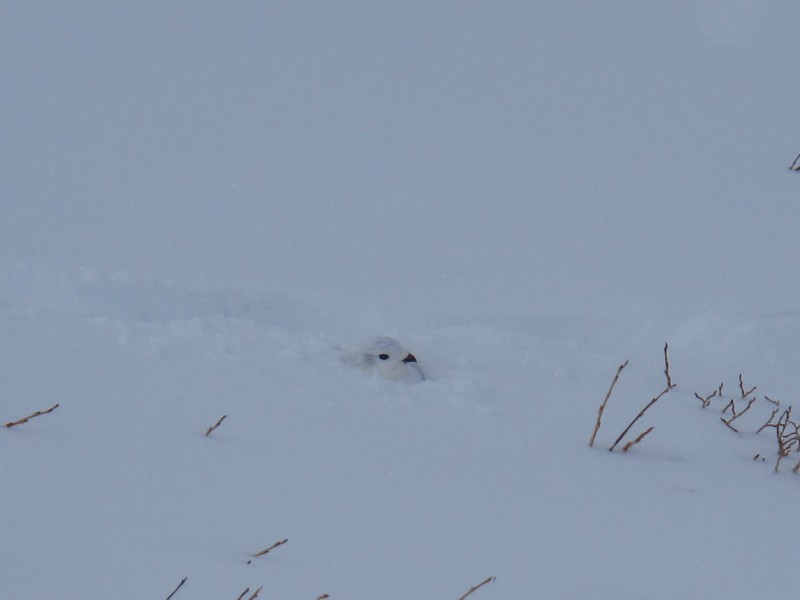 We were fairly socked in all day, but really the weather could have been so much worse given the forecast. I chased John up the mountain and we topped out in just under five hours. 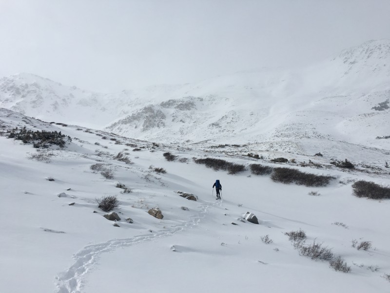 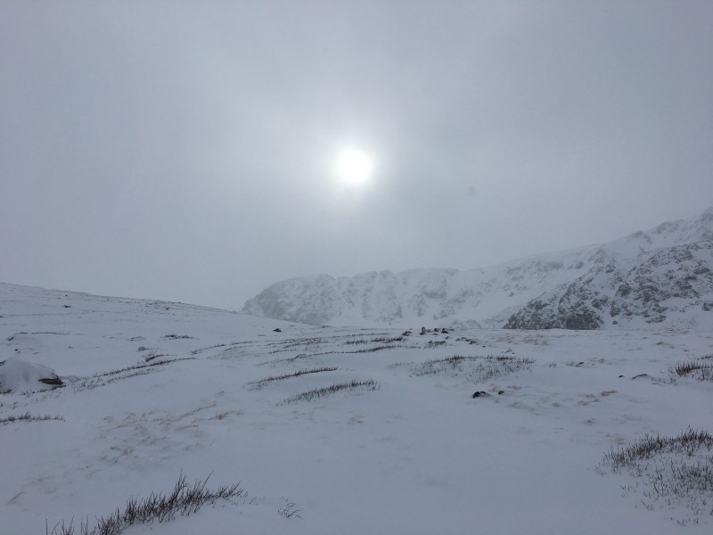 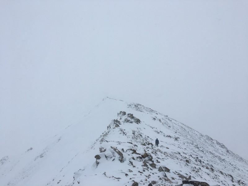 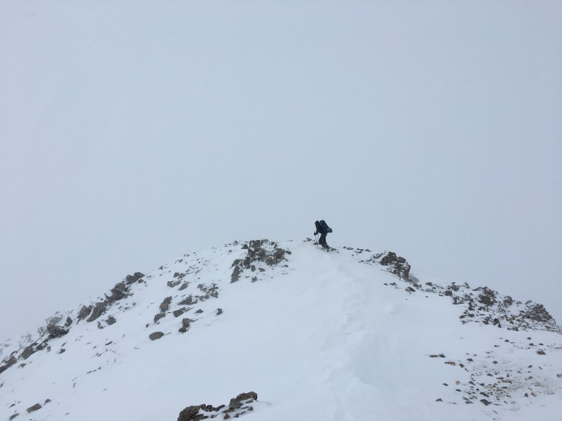 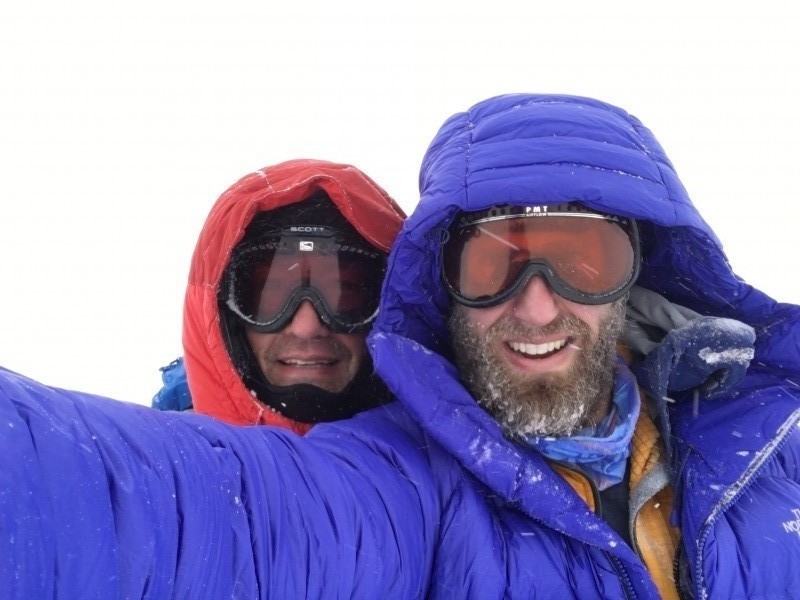 John had crampons whereas I had only brought my spikes. That ruled out the steeper couloirs near the summit for the descent. He led us down a gully near where we had previously reached the ridge. Most of it was good plunge stepping, but occasionally we would hit an icy spot underneath the fresh snow. We were close enough to being down as it was getting dark that we didn't bother with headlamps on the descent. 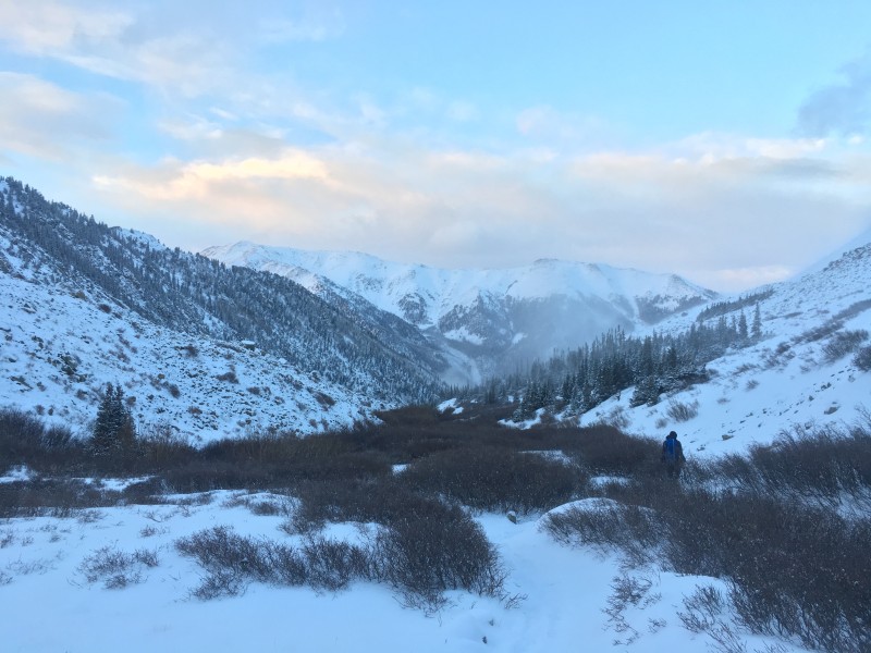 Just about back to the trailhead, we saw car headlights go by, figuring it was probably Joel Q coming up to meet us for Huron the next morning. Since we didn't have headlamps on, Joel didn't see us or my car in the Missouri Gulch TH parking lot, so he drove right past. I had joked with John that maybe Joel had brought us dinner. We fantasized about what that might be - I told John I was only half joking and that Joel was actually just the kind of guy who might do something nice like that. We hopped in my car and with some trepidation, drove towards Winfield, just hoping that we could stay in Joel's tracks and not get my car stuck - thankfully no issues. At Winfield, we saw headlights and drove to the lower summer TH to say hi to Joel. Turned out it wasn't Joel. It was Dad Mike, surprised to find anyone else out here, preparing to go to sleep in his Jeep for his early morning attempt at Frozen Centennials Ice and North Apostle. We wished him well and went back up to the Winfield town turn-off to set up our tents for the cold night out. As we were finishing up, Joel showed up and told us that he was another 100 feet up the road around the corner. He had indeed brought dinner for us - cheese tortellini with meat sauce and fresh bread! Needless to say, we were pretty stoked. Thanks Joel! Shortly after dinner, we crawled into our tents while Joel bundled up for the cold night sleeping in his Jeep. Day 2 - Huron Peak Date: December 22, 2017 Peak: Huron Peak Start Time: 6 something, but who cares - it's winter now! Route: Lulu Gulch up and over Browns Peak; Northwest Slopes standard summer route down Vertical: 3,980 feet Ascent Party: bmcqueen, ScreeSurfer, globreal, 14erAddict, JQDivide Time: 5:58 up; 9:39 roundtrip We were expecting Nicole Leonard (14erAddict) and Britt Jones (globreal) to join us around 6:00 on Friday morning for Huron. They braved the icy roads and had no trouble getting to Winfield to join us. Temps on our various cars that morning were in the minus 11 to minus 18 range. Cold! But it was clear and looking to be a nice day for our attempt on Huron. 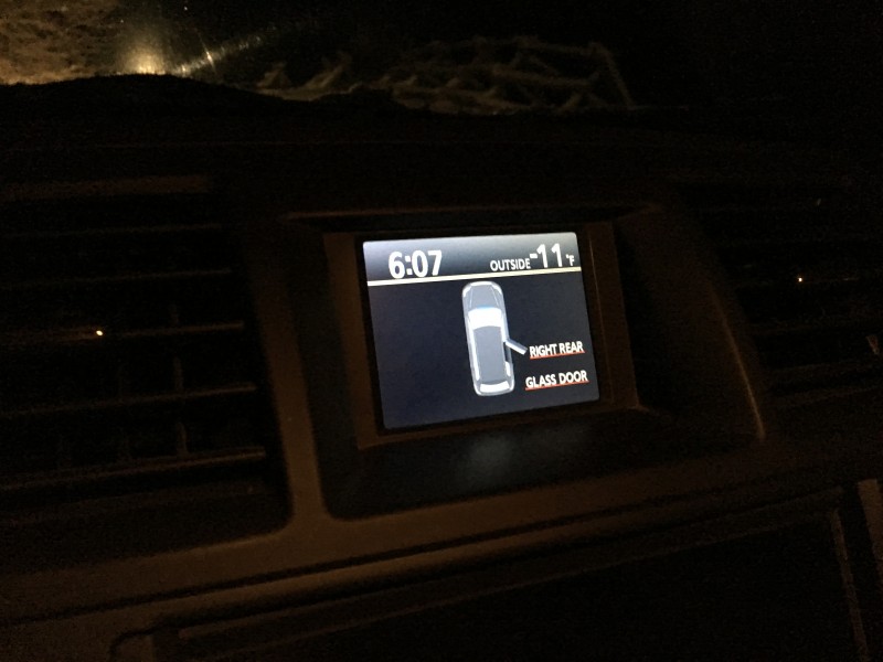 We headed up towards Lulu Gulch, crossing the avalanche prone slope at treeline one at a time now that we had a few inches of snow from the day before. 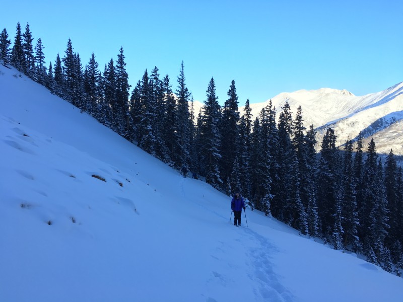 Slowly, but steadily, we ascended to reach the ridge leading to Browns Peak. 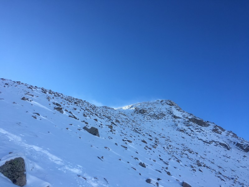 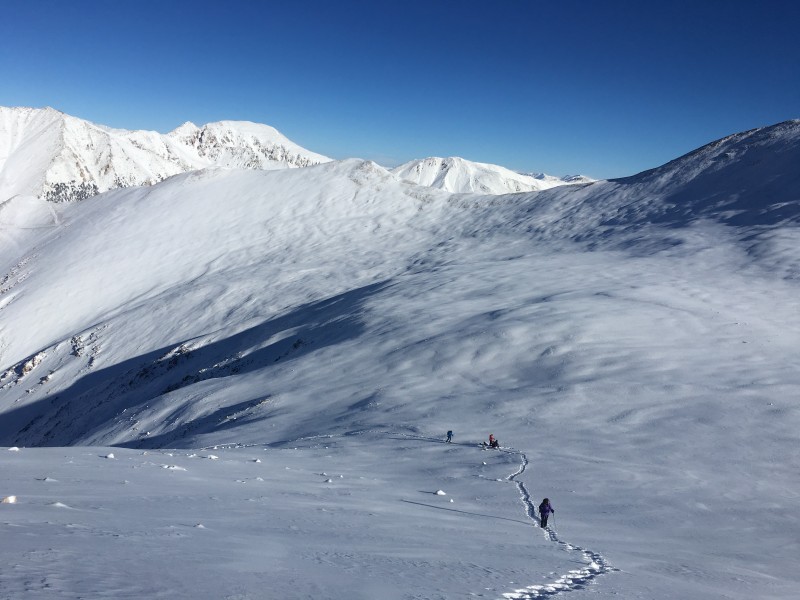 We regrouped on Browns, switched over to microspikes and decided to go ahead and carry our snowshoes over towards Huron to give ourselves options for the descent. 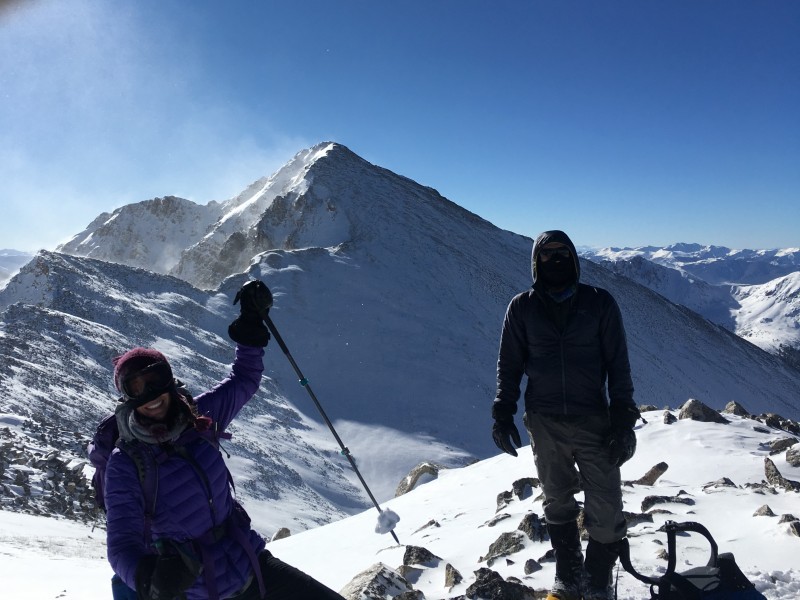 The talus between Browns and Huron was painful to traverse. I stepped on what I thought was snow or rock and went into a trapdoor, banging my kneecap on a rock. Ouch! 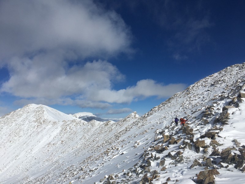 John zipped right up to the summit after telling me that his goal for 2018 was to "get in shape". Good grief. Lord help us if all this time ScreeSurfer hasn't been in shape! Nicole (nicknamed on this day "The Purple Prancer" for her many, many, many pieces of purple gear and clothing - just in case it sticks, I want a record of where the name came from!) and I followed next with Britt and Joel minutes behind. I was thrilled that all five of us summited this winter peak on a cold day.  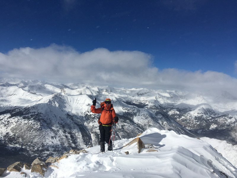 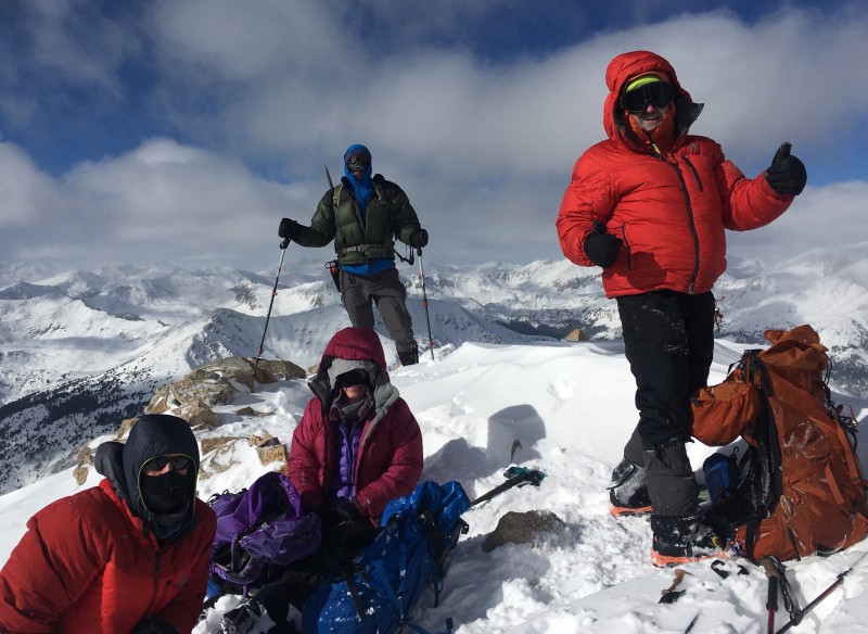 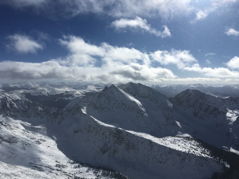 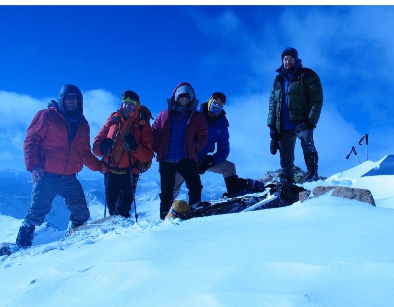 Given the relative lack of snow on the Northwest Slopes route, we opted to plunge step down that way rather than re-doing the talus traverse and re-climb of Browns Peak. A long walk on the road led us back to our cars at Winfield, all tired, but happy to have another new winter ascent under our belts. 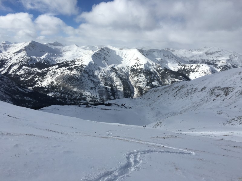 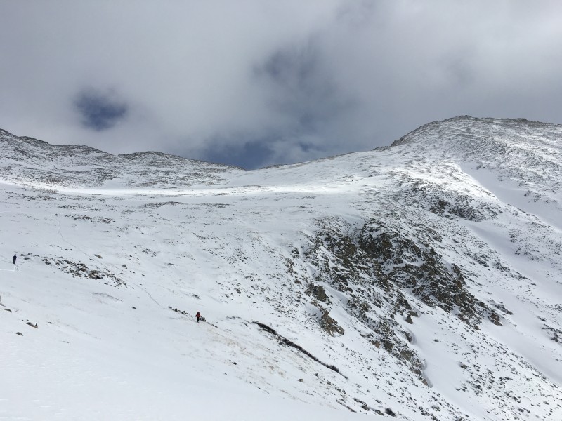 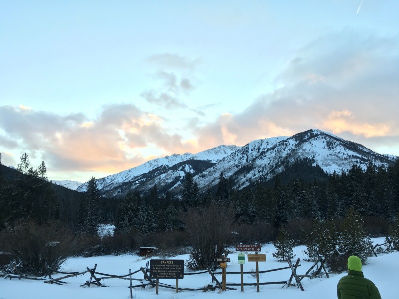 Thumbnails for uploaded photos (click to open slideshow):
|
| Comments or Questions | ||||||
|---|---|---|---|---|---|---|
|
Caution: The information contained in this report may not be accurate and should not be the only resource used in preparation for your climb. Failure to have the necessary experience, physical conditioning, supplies or equipment can result in injury or death. 14ers.com and the author(s) of this report provide no warranties, either express or implied, that the information provided is accurate or reliable. By using the information provided, you agree to indemnify and hold harmless 14ers.com and the report author(s) with respect to any claims and demands against them, including any attorney fees and expenses. Please read the 14ers.com Safety and Disclaimer pages for more information.
Please respect private property: 14ers.com supports the rights of private landowners to determine how and by whom their land will be used. In Colorado, it is your responsibility to determine if land is private and to obtain the appropriate permission before entering the property.


