Download Agreement, Release, and Acknowledgement of Risk:
You (the person requesting this file download) fully understand mountain climbing ("Activity") involves risks and dangers of serious bodily injury, including permanent disability, paralysis, and death ("Risks") and you fully accept and assume all such risks and all responsibility for losses, costs, and damages you incur as a result of your participation in this Activity.
You acknowledge that information in the file you have chosen to download may not be accurate and may contain errors. You agree to assume all risks when using this information and agree to release and discharge 14ers.com, 14ers Inc. and the author(s) of such information (collectively, the "Released Parties").
You hereby discharge the Released Parties from all damages, actions, claims and liabilities of any nature, specifically including, but not limited to, damages, actions, claims and liabilities arising from or related to the negligence of the Released Parties. You further agree to indemnify, hold harmless and defend 14ers.com, 14ers Inc. and each of the other Released Parties from and against any loss, damage, liability and expense, including costs and attorney fees, incurred by 14ers.com, 14ers Inc. or any of the other Released Parties as a result of you using information provided on the 14ers.com or 14ers Inc. websites.
You have read this agreement, fully understand its terms and intend it to be a complete and unconditional release of all liability to the greatest extent allowed by law and agree that if any portion of this agreement is held to be invalid the balance, notwithstanding, shall continue in full force and effect.
By clicking "OK" you agree to these terms. If you DO NOT agree, click "Cancel"...
Greetings, everyone. I do love Colorado, and travel there as often as possible, but when I found myself in Taos last August, I made an executive decision to climb to the top of the highest point in New Mexico via the standard route.
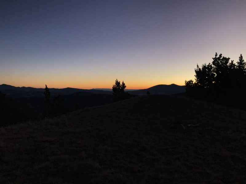
The day began at about 3:30 AM, and after a 40 minute drive I was on Trail 90, or the 'Bull of the Woods Trail,' at 5:10. This route is about 14.5 miles round-trip, and features 4,550' of elevation gain. It begins in the parking lot of the Taos Ski Valley, heads Northeast through a valley, then swings Southward along a ridge, towards the summit. The temperature was a balmy 18 degrees F, and a thin coating of patchy ice was present upon on the trail, but I felt no need for traction aids. The trail begins on a 4wd road, and eventually narrows to singletrack. I was all alone in a forest of 40' tall spruce trees, with a universe of stars burning so brightly that I could have managed without a head lamp. After about two hours of hiking, the sun began to rise.
Mountain sunrises are my favorite kind, and alpensky was present in full force.
I caught a bit of alpenglow on Gold Hill (12,711') as I passed the ski area on the other side of the valley. At this point, I was well above the treeline, and making excellent progress.
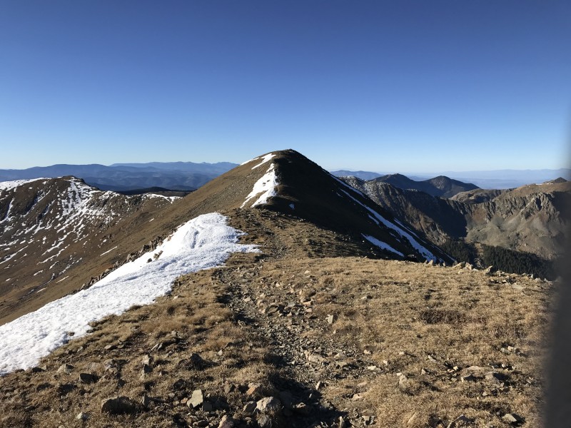
The path zig-zagged across grassy slopes, eventually descended back into the tress, across a frozen stream, then up a sizable bowl to the top of the ridge.
Mt. Walter is but a nub on the ridge to Wheeler Peak.
Wheeler Peak, as seen from Mt. Walter.
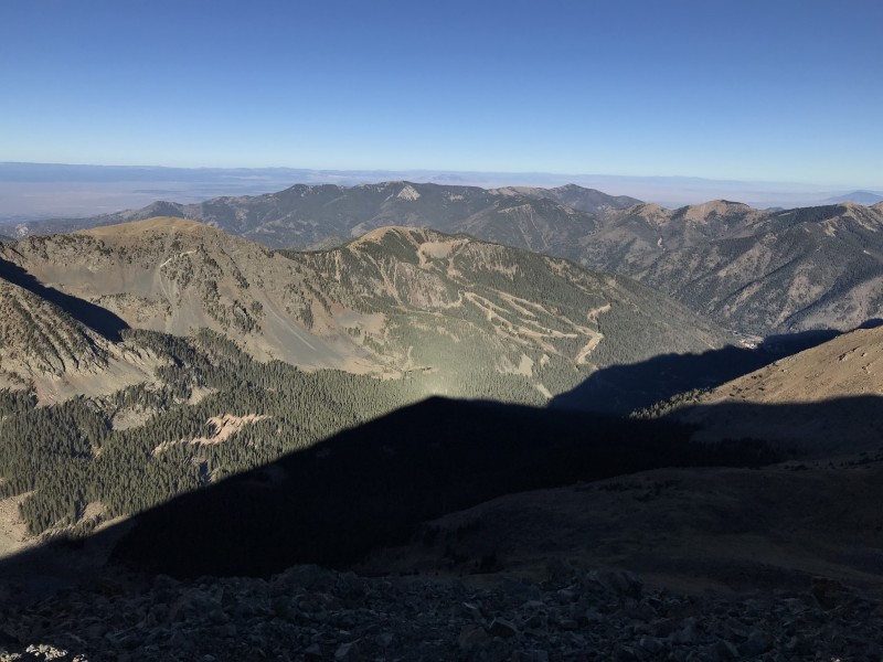
I arrived at the summit just before 9:00 AM, and signed the register. My phone had three bars of service, so I sent a few texts and relaxed a bit before heading down. Looking back along the route, one can see Culebra Peak.
The obligatory USGS marker shot.
Angel Fire is this way.
Taos is behind Old Mike Peak (13,113') and Simpson Peak (12, 978'), from left to right.
The shadow of Wheeler Peak. If you look to the middle-right, you can see the Taos Ski Valley village. The chairlift to Kachina Peak looks so small from up here.
I returned to my car at about 12:40 PM. It is of note that I saw no other humans until the last half mile of the return trip, and the solitude was appreciated. I would gladly hike this trail again. In all, I believe it was a respectable effort for a human who lives at about 500' above sea level. Cheers!
Thumbnails for uploaded photos (click to open slideshow):
Comments or Questions
Caution: The information contained in this report may not be accurate and should not be the only resource used in preparation for your climb. Failure to have the necessary experience, physical conditioning, supplies or equipment can result in injury or death. 14ers.com and the author(s) of this report provide no warranties, either express or implied, that the information provided is accurate or reliable. By using the information provided, you agree to indemnify and hold harmless 14ers.com and the report author(s) with respect to any claims and demands against them, including any attorney fees and expenses. Please read the 14ers.com Safety and Disclaimer pages for more information.
Please respect private property: 14ers.com supports the rights of private landowners to determine how and by whom their land will be used. In Colorado, it is your responsibility to determine if land is private and to obtain the appropriate permission before entering the property.


")
")
")
")
")
")
")
")
")
")
")
")
")
")
")
")


