Download Agreement, Release, and Acknowledgement of Risk:
You (the person requesting this file download) fully understand mountain climbing ("Activity") involves risks and dangers of serious bodily injury, including permanent disability, paralysis, and death ("Risks") and you fully accept and assume all such risks and all responsibility for losses, costs, and damages you incur as a result of your participation in this Activity.
You acknowledge that information in the file you have chosen to download may not be accurate and may contain errors. You agree to assume all risks when using this information and agree to release and discharge 14ers.com, 14ers Inc. and the author(s) of such information (collectively, the "Released Parties").
You hereby discharge the Released Parties from all damages, actions, claims and liabilities of any nature, specifically including, but not limited to, damages, actions, claims and liabilities arising from or related to the negligence of the Released Parties. You further agree to indemnify, hold harmless and defend 14ers.com, 14ers Inc. and each of the other Released Parties from and against any loss, damage, liability and expense, including costs and attorney fees, incurred by 14ers.com, 14ers Inc. or any of the other Released Parties as a result of you using information provided on the 14ers.com or 14ers Inc. websites.
You have read this agreement, fully understand its terms and intend it to be a complete and unconditional release of all liability to the greatest extent allowed by law and agree that if any portion of this agreement is held to be invalid the balance, notwithstanding, shall continue in full force and effect.
By clicking "OK" you agree to these terms. If you DO NOT agree, click "Cancel"...
After getting Wheeler Peak a few days prior, I had the opportunity to also grab the high point of Oklahoma - Black Mesa - as I traveled from Albuequerque, NM to El Paso, TX. Black Mesa would be a bit out of the way - about 8 hours out of the way. But, my schedule allowed, so I decided to go ahead and make it a long day.
I left the hotel in ABQ around 5 am, and started the 5 hour drive to Black Mesa. The drive was uneventful, but it was very interesting getting to see the extents of the state of New Mexico. A few stops, combined with a time change, I ended up getting started at the trail head just before noon, Oklahoma time. I wanted to get Black Mesa quickly for a few reasons: 1) I wanted to get to El Paso before it got too late, and I still had an 8+ hour drive ahead of me. 2) It was a bit chilly (around 41 degress F and windy) and I was determined to do this thing in shorts. 3) I was paranoid about leaving my rental car in the trail head parking lot for very long with my luggage and laptop in the trunk. So, I started from the trail head at a moderate paced run.
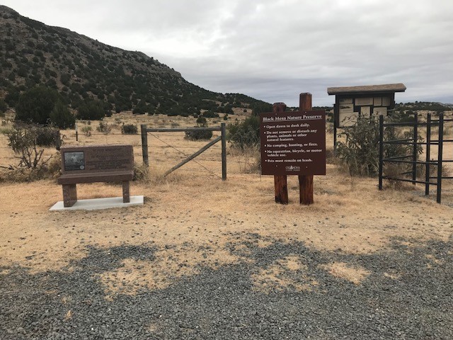
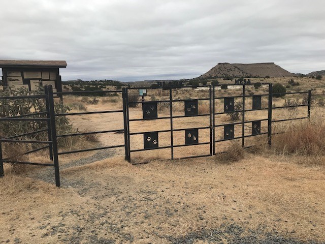
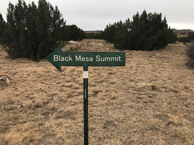
Black Mesa Trail head Trail head entrance
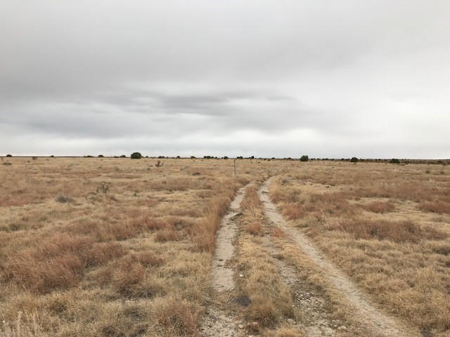
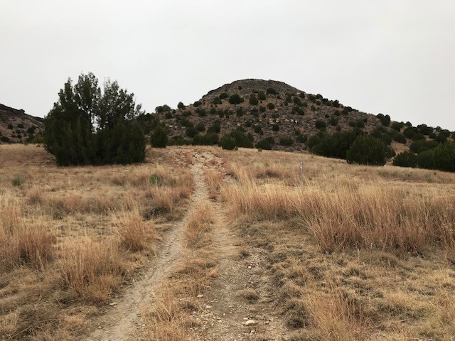
The lower sections of the trail are very flat and the terrain is mixed dirt, sand and some rocks. It was very runnable, when the wind wasn't pounding you in the face. The trail basically goes like this: about 2.5 miles of flat, about a mile of gradual up climb, then about another mile of flat, at the top of the mesa. The elevation gain occurs almost all during the 2.5-3.5 mile section. The overall gain is around 682 feet. At about mile 2.5, the trail goes left around a hill. The trail cuts right, towards the hill, and circumnavigates the perimeter of the hill, counterclockwise, spiraling up in elevation, until it lands onto the mesa. From the top of the mesa, it is still not clear which point, or which direction is the high point. Luckily, there is a clear trail to follow.
Lower trail Hill climb where almost all of the elevation gain occurs One of the many trail markers
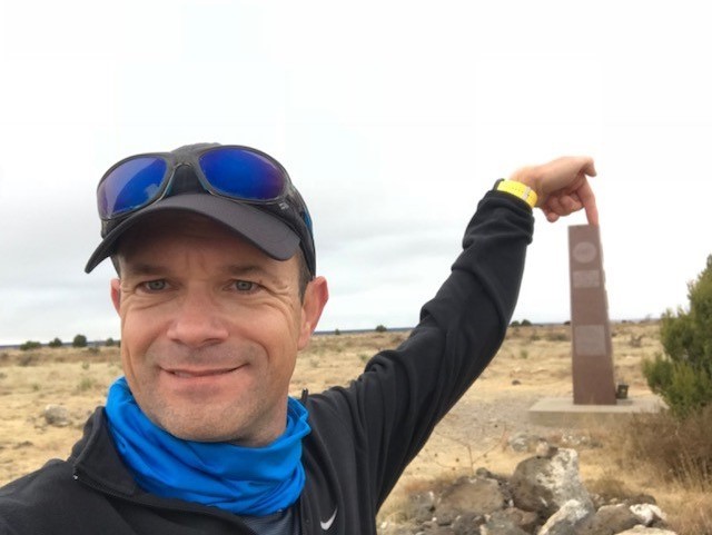
About a quarter mile away from the true high point, the marker finally becomes visible. I made the high point is just over 45 minutes. The high point for the state of Oklahoma is really not the high point for the whole mesa. The highest point is actually located in Colorado. And, there is actually a point higher than the Oklahoma point, located in New Mexico. The highest point that is located within the state of Oklahoma is located very close to the Oklahoma, New Mexico border. At the high point, there is a visitor's log and a granite obelisk.
Selfie at the summit Another selfie at the summit
I only spent about 5 minutes at the high point. Then, I started running back across the mesa. I reached the down climb, spiraled down the hill, and continued running the lower flat section. I ended up wiping out once, when my foot snagged on a rock. This happened within a half mile of the trail head, which kind of sucked. I brushed myself off and continue running back to the trail head. I reached the trail head from the summit in about 40 minutes. Total round trip was around 1 hour 30 minutes; total mileage 8.5 miles, elevation gain, 682 ft. 37th state high point complete. Only 13 more to go.
My GPS Tracks on Google Maps (made from a .GPX file upload):
I did it 4 weeks after having my baby. For anyone interested, there is a couple there that has a guest house near by- the only thing near by, they are really nice and cook you a great breakfast!
Wow. I've been there twice (once to wait for ChrisinAZ to hike it) and had no idea. That'd beat sleeping in the car and eating leftover Subway from the Love's in Clayton, NM for breakfast.
For the geeks--all Oklahoma's 4ers are right there in the same quad. We were on a long highpointing trip and had Mt. Sunflower on our minds, but could easily have cleaned all of them up in a short time, but did only one.
Congrats on another state highpoint! I'm at 48 and holding now (Denali...someday...).
Matt: fond memories of that trip, hiking the mesa entirely by moonlight. Miss those crazy adventures...if you ever get the chance to get out again, the other 3 ranked peaks in the quad, and the one ranked peak in Baca County are a blast, private property issues notwithstanding. Absolutely love this little corner of Oklahoma.
Caution: The information contained in this report may not be accurate and should not be the only resource used in preparation for your climb. Failure to have the necessary experience, physical conditioning, supplies or equipment can result in injury or death. 14ers.com and the author(s) of this report provide no warranties, either express or implied, that the information provided is accurate or reliable. By using the information provided, you agree to indemnify and hold harmless 14ers.com and the report author(s) with respect to any claims and demands against them, including any attorney fees and expenses. Please read the 14ers.com Safety and Disclaimer pages for more information.
Please respect private property: 14ers.com supports the rights of private landowners to determine how and by whom their land will be used. In Colorado, it is your responsibility to determine if land is private and to obtain the appropriate permission before entering the property.